
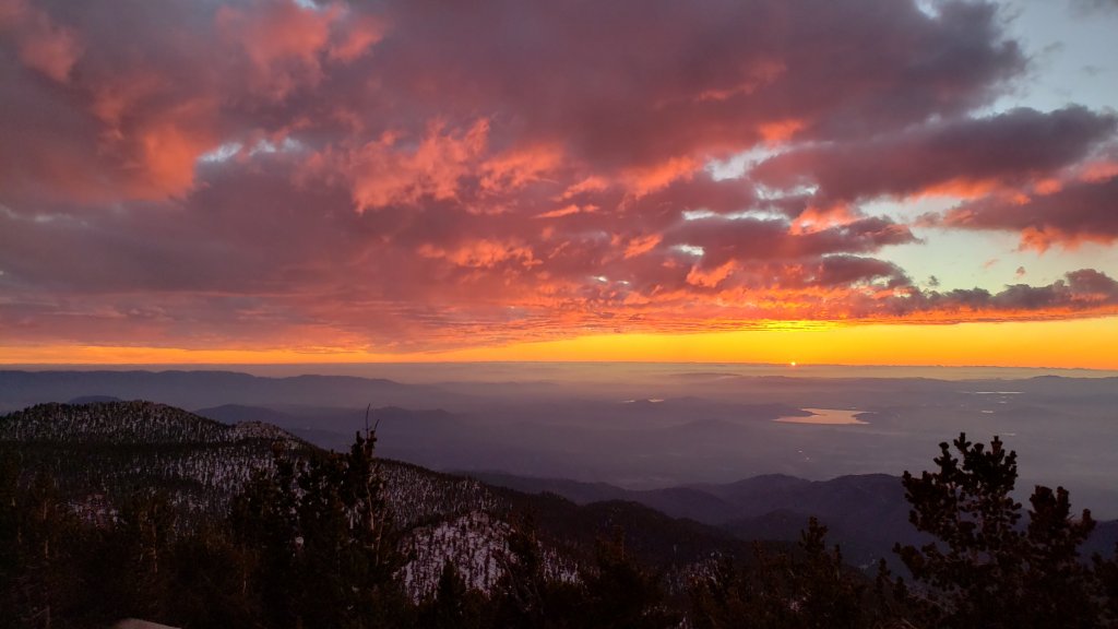
[UPDATE 31st December 2020: I was unable to resist one last ascent of San Jacinto Peak in the year. Strong Santa Ana winds on the night of 29th had largely eliminated my tracks above 9000ft, so I broke trail again. Remarkably a brief storm blew in around noon, with 0.5 inch of snow settling above 10,000ft. Wild accompanying winds again partially removed my tracks with spindrift. Strong Santa Ana winds overnight into 1st January will fill trails with spindrift making for challenging hiking and navigation for the first days of 2021. Snowshoes are strongly recommended above 8000ft.]
This is a summary of conditions following the third, and most substantial (so far), snow storm of winter 2020/21, with all of the snow falling yesterday, Monday 28th December. As is increasingly the trend with a changed climate in recent years, there was little difference in snowfall between the mid and upper elevations, with 15.5 inches measured in Idyllwild (at 5550ft) through to 17 inches at San Jacinto Peak (10,810ft). The storm system was colder than forecast at lower elevations, with a dusting of snow below 4000ft in many ranges, and even down to 4800ft on Skyline Trail, a desert-facing slope.
Currently very few no major trails have been traveled and most are obscured by significant snowfall. On my descent late this morning I was again surprised to see no tracks up to Saddle Junction. The significance of this is that there are currently no tracks on Willow Creek Trail, to Chinquapin Flat or Tahquitz Peak, or around the meadows. Beyond Saddle Junction, at the time of writing my snowshoe tracks to San Jacinto Peak are the only traveled high country trail. Cautious navigation is strongly recommended everywhere. Snow depths measured today are listed at the foot of this posting, but note that due to drifting, snow is sometimes deeper in the trails themselves.
Snow depths are currently ideal for snowshoeing everywhere above about 6000‘, potentially lower on less exposed trails that will melt slowly (e.g., the Ernie Maxwell Trail). Elsewhere (and in addition), spikes are recommended for the foreseeable future as established trails become consolidated by hiker traffic and undergo freeze-thaw cycles.
Hikers should be prepared for temperatures below freezing in the high country, and far below freezing when considering wind chill effects (see below for recent temperatures at San Jacinto Peak today).
For details regarding coronavirus closures, hiking permits, camping restrictions, ranger station access, and the Tramway, please see this earlier report, or contact the State Park or Forest Service as indicated on their websites.
The USFS gate at Humber Park was (unexpectedly) open when I drove out around noon today. The parking area is an rink of compacted icy snow and is treacherous for most vehicles.

WEATHER Temperatures are forecast to remain below seasonal averages into the first week of January, with freezing conditions every night above about 5000ft. Snow melt will generally be slow, and conditions will be icy. Minor storm systems are possible around 6th-8th January.
At San Jacinto Peak (10,810ft/3295m) yesterday, Monday 28th December 2020 at 1330 the air temperature was 11.4°F (-11°C), with a windchill temperature of -16.8°F (-27°C), 93% relative humidity, and a wild SW wind sustained at 26 mph gusting to 39.0 mph.
At the Peak on Friday 25th December 2020 at 1125 the air temperature was 27.7°F (-2°C), with a windchill temperature of 15.3°F (-9°C), 69% relative humidity, and a sharp WSW wind sustained at 9 mph gusting to 14.1 mph.

TRAIL CONDITIONS
All trails above about 4500′ are snow-covered. By this afternoon, melting was already underway below 5000′. Reliable tracks are currently only known to be in place for Devil’s Slide Trail through to San Jacinto Peak via Wellman Divide. The closure of the Tram will result in extremely light hiker traffic to the highest peaks via the Peak Trail, and very limited traffic on the Long and Round Valley trails.
Tahquitz Peak trail from Chinquapin Flat/PCT Mile 178 has no steps to follow through the steeply angled icy snow. These icy slopes are treacherous. Currently crampons (with an ice axe) are strongly recommended. Snowshoes are not advised due to the angle of the icy snow.
Devil’s Slide Trail has a well-traveled track to follow.
The Ernie Maxwell Trail has a firm and well-defined 18″ wide snowshoe track to follow along its entire length [updated 30th December].
SNOW DEPTHS measured on 29th December 2020, are as follows. Note that average depth is given; due to strong winds there is extensive drifting, especially in the trails. Altitudes are approximate.
San Jacinto Peak (10810′): 17 inches
Wellman Divide (9700′): 15 inches
Annie’s Junction/approx. PCT Mile 181.8 (9070′): 15 inches
Saddle Junction/approx. PCT Mile 179.9 (8070′): 16 inches
Devil’s Slide Trail at Humber Park (6550′): 14 inches (at noon, melting already underway)
Idyllwild (at 5550′): 15.5 inches, melting slowly this afternoon.
San Jacinto Trail Report: available for everyone, funded by readers. While all labor and time is volunteered, this Report completely depends on small private donations to cover its costs. In an especially challenging year, and with a busy winter already well underway, every contribution is invaluable. If you have found this Report useful, please consider visiting the Donate page. Thank you.
