[UPDATE 1st May 2019: we hiked Marion Mountain Trail to San Jacinto Peak this morning. Rapid melting has led to some marked changes to trails and snow depths, which are all updated in the text below.]
Today we hiked to and from San Jacinto Peak via Devil’s Slide Trail and Wellman Divide. Other trails hiked in recent days include Fuller Ridge Trail and upper Deer Springs Trail, Tahquitz Peak via South Ridge and from the PCT, and around Skunk Cabbage and Tahquitz meadows. I recorded a vlog just after 0900 this morning at San Jacinto Peak, available here on YouTube.
In that vlog I mention the ice axe training video that Second Chance Hiker and I just uploaded, which is linked here.
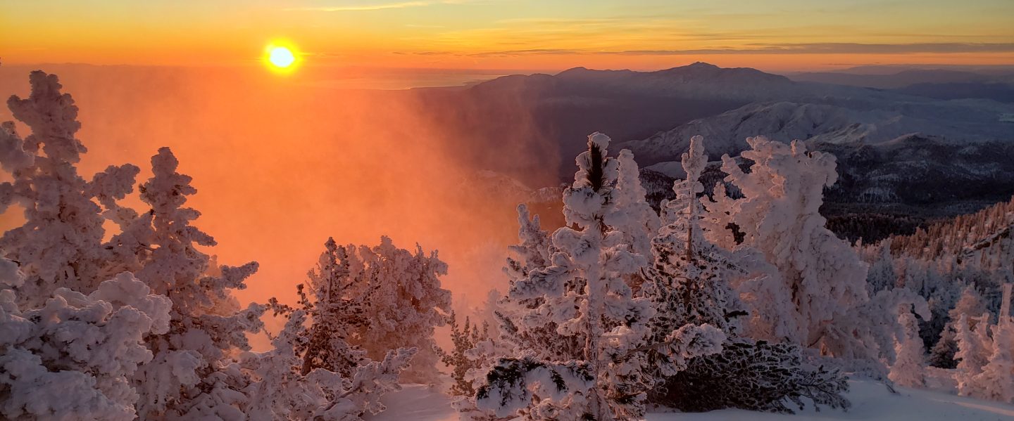
On our ascent there was evidence of a very brief snow storm overnight, with a little graupel remaining above 9000′ to the Peak (see photo below). As we descended this morning, we encountered drizzle around 9000′ and again between 7000′-6000′. As has been the case with other recent precipitation events during the day, the high country has remained largely above the clouds, with some spectacular views as a result. Indeed today it was much colder at 9000′ late morning than at the Peak (10,810′) an hour earlier. It continued drizzling periodically in Idyllwild this afternoon, adding up to 0.28″.
Despite cooler conditions today (and tomorrow morning) melting has been very rapid in the past week – with overall snow coverage much more reminiscent of late May than late April – and with bare patches present and expanding rapidly at all elevations.
This has created new navigation hazards. The five PCT hikers (in three separate groups) I met on the Wellman Trail as I descended this morning had all intended to stay on the PCT but had missed the turning at Annie’s Junction (approx PCT Mile 181.5). The mix of snow and bare patches seems to have obscured the tracks, and hikers had just followed the more heavily-traveled trail straight ahead. As always, snow travel requires cautious navigation.
Microspikes in combination with hiking poles continue to be recommended throughout the high country above about 8800′ (and lower in some areas e.g., north end of Fuller Ridge). Microspikes are sufficient traction to hike the PCT throughout the San Jacinto mountains.

WEATHER After tomorrow morning, warm stable weather will return, and the first few days of May are forecast to have pleasant seasonal temperatures with no precipitation. However the second week of May will be cooler, cloudy, with the possibility of light precipitation on several days.
At San Jacinto Peak (10,810ft/3295m) today, 29th April 2019, at 0910 the air temperature was 33°F (1°C), with a windchill temperature of 26.9°F (-3°C), 46% relative humidity, and a light but chilly WSW breeze at 3 mph gusting to 5 mph.
At the Peak on 25th April 2019, at 1015 the air temperature was 47.6°F (8°C), with a windchill temperature of 45°F (7°C), 46% relative humidity, and a very light SSE breeze at 1 mph gusting to 4.4 mph.

TRAIL CONDITIONS
Many trails above about 8800′ remain largely or partly snow-covered, although this is changing rapidly. Details for specific routes are below. Hikers should be prepared for temperatures near or below freezing in the high country (even colder when considering windchill effects).
Major trails are now well traveled, and have obvious tracks. Routefinding can be challenging in places for those not familiar with the area due to wandering, inaccurate tracks which often do not match the established trail routes, so use caution.
Pacific Crest Trail The trail is clear of snow from Highway 74 (Mile 151) to about Mile 174 (Red Tahquitz) after which the trail is about 70% snow-covered to about Mile 178, but with more snow-free areas opening up every day. Note that navigation through the snow has reported to be a problem around Miles 174-177. Miles 179-181 and 182-185 are clear of snow. Multiple hikers are missing the hard left uphill turning at Annie’s Junction (approx. Mile 181.5) in the patchy snow.
Fuller Ridge Trail (approx. PCT Miles 185.5-190.5) is best traversed carrying microspikes used in conjunction with hiking poles. Snow patches are frequent enough to use microspikes for some of the five mile length of the Fuller Ridge Trail, specifically Miles 185.5-186, 187.2-187.7, and 188.5-190.4. Particularly on the northernmost two miles, the track does not follow the trail in many places, and there are a couple of steep challenging descents where hikers have clearly fallen. Please use caution. PCT hikers not comfortable with angled snow/ice travel should continue to consider the Black Mountain Road alternative. Fuller Ridge campground is clear of snow.
San Jacinto Peak trails On the eastern side, the Wellman Trail from Annie’s Junction (PCT turning near Mile 181.5) to Wellman Divide (9700′) is largely clear of snow, but microspikes are useful on those areas where stubborn icy snow patches remain. The Peak Trail from Wellman Divide to the Peak is now only partly snow-covered and the track now largely follows the trail route, but microspikes remain recommended. On the western side, the upper Deer Springs Trail [UPDATED 1st May] from Little Round Valley to the Peak remains about 90% snow-covered, and note that the consolidated tracks are steep and do not closely follow the trail route. Microspikes are recommended.
Black Mountain Road is clear of snow to the PCT. No microspikes are required to hike to the PCT. Just before the Fuller Ridge campground turning, the road is partly snow-covered at up to 2 feet deep, which continues in patches north of Fuller Ridge down to about 7200′ elevation. For vehicular access, Black Mountain Road has been cleared, repaired, and partially graded to the turning to Boulder Basin, and cleared and repaired to the PCT crossing.
Skyline Trail is clear. C2C hikers have not been encountering snow until past Long Valley Ranger Station.
Devil’s Slide Trail is now completely clear of snow to Saddle Junction.
Deer Springs Trail [UPDATED 1st May] is clear of snow to Strawberry Junction (8100′) and largely clear to the Seven Pines Trail junction. There is about 70% snow cover from there to the Fuller Ridge Trail junction, and microspikes are useful. The track above the Fuller Ridge junction now more closely follows the trail and there is only about 50% snow cover to Little Round Valley. Through and above Little Round Valley the tracks largely do not approximate to the true trail, and are steep and postholey in places, with about 90% snow cover (microspikes useful again, especially for descending).
Marion Mountain Trail [UPDATED 1st May] is clear of snow, with just a couple of tiny patches very near the PCT. Microspikes are not required.
Tahquitz Peak trail from Chinquapin Flat There are reasonable steps to follow through the snow. Microspikes in conjunction with hiking poles (or ideally an ice axe if you know how to use it) are strongly recommended for this perilous trail until it is completely clear of snow.
South Ridge Trail is clear of snow to Tahquitz Peak. South Ridge Road is clear of snow, but is impassable to vehicles near the top due to severe storm damage.

SNOW DEPTHS measured on various dates (as indicated) are as follows. Current average depth is given; drifts can be much deeper than the average in places. Altitudes are approximate.
San Jacinto Peak (10,810′): 20″ (on 1st May; was 75″ on 22nd March)
Little Round Valley (9800′): 20″ (on 1st May)
Wellman Divide (9700′): 0″ (but with drifted patches nearby)
Pacific Crest Trail at south end of Fuller Ridge Trail (8950′): 4″ (on 1st May)
Annie’s Junction (PCT Mile 181.5 at State Park boundary) (9050′): 6″
Long Valley (8500′): 0″
Strawberry Junction (8100′): 0″
Saddle Junction (8070′): 0″ (was 20″ on 22nd March)


