[UPDATE Wednesday 13th February: We are bracing ourselves for a major “pineapple express” storm system. Currently much lighter rainfall than forecast, with barely 0.1″ in the past five hours since it started raining at 1300 this afternoon in Idyllwild. As much as 5″ (125mm) of rain has been forecast for elevations below about 8000′, with about two feet of snow possible at the high peaks. Flooding and landslides are possible on mountain roads, with voluntary evacuations in/near areas affected by the July 2018 Cranston Fire.]
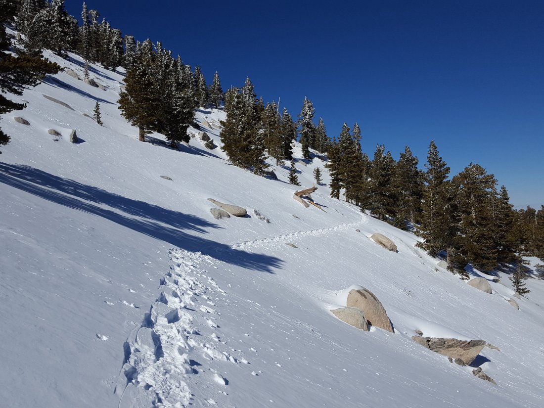
Following a minor two-day storm over the weekend, today I snowshoed to San Jacinto Peak from Humber Park via Saddle Junction and Wellman Divide, descending the same way. For the second time in a few days I was breaking trail all the way to the Peak. Snowfall yesterday evening plus windy, drifting conditions, meant that again there was not a single track anywhere to be seen on the mountain. Very unusually, when I returned to Saddle Junction this afternoon the only tracks visible for the day were those from my early morning ascent. I recorded the following vlog at San Jacinto Peak just after noon today.
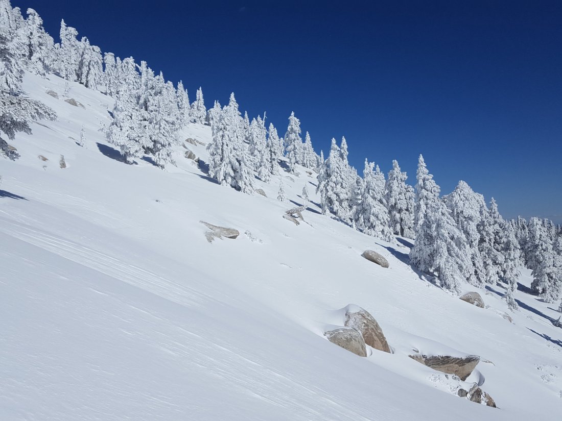
The weekend storm occurred in two phases, some very light snow throughout the mountain on Saturday (mainly in the morning) and a somewhat heavier snowfall on Sunday that was confined to the western side of the mountain below 9000′ (the top of the mountain was above the cloud). Saturday snowfall was about one inch at all elevations. The Sunday snow produced an additional 2.5″ at 5550′ in Idyllwild, 3″ at Humber Park (6500′), 5″ at Saddle Junction (8100′), and 6″ at Annie’s Junction (9050′). There was no clear sign of significant fresh snowfall above about 9000′. Otherwise conditions looked very similar to those following last week’s major storm described in detail here. With cold conditions for the last week, signs of melting were minimal.
Snow depths measured today are as follows. Average current depth is given (known new accumulations are described above). Locations not surveyed since last week are estimated based on the depth six days ago and their elevation. Strong winds have led to major drifting, again even as low as 7500′ on Devil’s Slide Trail. Drifts can be double the average depth in places. Altitudes are approximate.
San Jacinto Peak (10,810′): 50″ (with drifts averaging 5-6 feet)
Little Round Valley (9800′): 45″ [estimated]
Wellman Divide (9700′): 37″
Fuller Ridge Trail/PCT at junction with Deer Springs Trail (8950′): 38″ [estimated]
Annie’s Junction (State Park boundary north of Saddle Junction) (9050′): 31″
Marion Mountain Trail at junction with PCT/Deer Springs Trail (8800′): 27″ [estimated]
Saddle Junction (8100′): 26″
Strawberry Junction (8100′): 20″ [estimated]
Devil’s Slide trailhead at Humber Park (6500′): 7″ (some significant recent melting)
WEATHER In keeping with the theme of this winter, a mild multi-day storm system is forecast from the afternoon of Wednesday 13th through to early morning Friday 15th. At San Jacinto Peak, about 1-1.5′ of snow is predicted across the period, although air temperatures even there will be only just below freezing. Most precipitation is forecast to fall as rain, potentially as high as 8500′, with the likelihood of a mix of rain, freezing rain, and snow above about 8000′. At all elevations below 8000′, at least three inches of rain are forecast in only a 30 hour period. Obviously this may lead to substantial loss of snow volume at mid and lower elevations.
At San Jacinto Peak today, Monday 11th February 2019, at 1220 the air temperature was 22°F (-5.5°C), with a windchill temperature of 3.6°F (-16°C), 28% relative humidity, and a cool 9 mph WNW wind gusting to 18 mph.
At the Peak on Wednesday 6th February 2019, at 1150 the air temperature was 4.9°F (-15°C), with a windchill temperature of -31.7°F (-35°C), 71% relative humidity, and a savage 21 mph WNW wind gusting to 48.8 mph.
TRAIL CONDITIONS
All trails above about 5000′ are completely snow-covered at this time (measured average snow depths are listed above). This includes almost the entire PCT from Highway 74 near Paradise Corner to below the Black Mountain Truck Trail (roughly PCT miles 150-195).
Hikers should be prepared for temperatures below freezing in the high country (>8000′) and well below freezing above 10,000′ (with potential for even more severe cold when considering windchill effects).
Snowshoes are currently strongly recommended everywhere above 6500′. Crampons or microspikes may soon be useful (following rain/freezing rain later this week) on almost all trails above about 7000′.
Waterproof footwear is recommended on the approach trails (below about 8200′) due to multiple stream crossings and water flowing in the trails. This will become quite extreme with the change in the weather in the next few days.
Routefinding will be challenging for those not familiar with the area. Almost all signage above about 9000′ is currently completely snow-covered. Many PCT marker posts and some other signs at lower elevations are also completely obscured. Few if any trails will be meaningfully broken prior to further precipitation this week.
Tahquitz Peak trail from Chinquapin Flat remains extremely treacherous. It has not been traversed since the latest snowfall. Crampons in conjunction with an ice axe, and knowledge of how to use both, are essential.