[UPDATE Sunday 10th February: it has snowed gently on/off in Idyllwild (5550′) since 0900 this morning, adding about 2.0″ to the existing snow depth. It is clear and sunny higher on the mountain (>8000′) and on the eastern side, with no new snow accumulation today.]
[UPDATE Saturday 9th February: it snowed lightly in Idyllwild (5550′) this morning between 0800-1230, adding about 1.2″ to the existing snow. At the same time it was snowing higher on the mountain, also adding about an inch at higher elevations.]
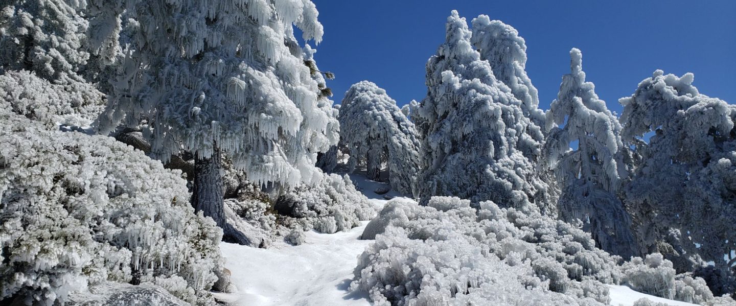
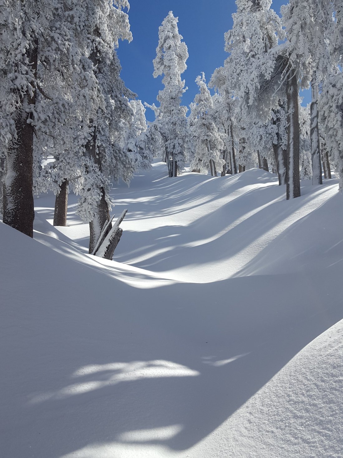
Following another multi-day storm, today I snowshoed to San Jacinto Peak from Humber Park via Saddle Junction and Wellman Divide, descending Deer Springs Trail to the Suicide Rock Trail, then back to Humber via the Suicide Climbers Trail. I was breaking trail from pre-dawn to dusk, with not a single track anywhere to be seen on the mountain. I recorded the following vlog in spectacular, wild spindrift conditions just before noon (please excuse the ice in my moustache, it was chilly up there!).
What was effectively a four-day storm (at least at mid-elevations) started on Saturday with the heaviest snowfall at the highest elevations, as described in the previous update. A second significant snowfall occurred on Monday into Tuesday. At 5550′ elevation in Idyllwild, we ended up with an impressive 3.74″ of rain (early on) plus 6.25″ snow (towards the end of the storm). Snow level was at about 4000′ on both the east (below Mountain Center) and west (Pinyon) sides of the mountain.

Looking west from San Jacinto Peak towards Black Mountain, 6th February 2019.
Snow depths measured today are as follows. Only average depth is given, due to the complexity of past storms. Extremely strong winds have led to major drifting, even as low as 7500′ (on Devil’s Slide Trail, see photo below). Drifts can be double the average depth in places. Altitudes are approximate.
San Jacinto Peak (10,810′): 50″ (with drifts averaging 5-6 feet)
Little Round Valley (9800′): 38″
Wellman Divide (9700′): 36″
Fuller Ridge Trail/PCT at junction with Deer Springs Trail (8950′): 32″
Annie’s Junction (State Park boundary north of Saddle Junction) (9050′): 25″
Marion Mountain Trail at junction with PCT/Deer Springs Trail (8800′): 22″
Saddle Junction (8100′): 20″
Strawberry Junction (8100′): 15″
Devil’s Slide trailhead at Humber Park (6500′): 10″

Tahquitz Peak and Tahquitz Rock as seen from the Suicide Rock Trail this afternoon, 6th February 2019.
WEATHER For the first time this winter, it will remain cold post-storm. Overnight low temperatures will remain below freezing everywhere above 5000′ for the foreseeable future, so melting of snow and ice will be very slow. Some light precipitation (snow in the high country, mixed below 6500′) is forecast for Saturday morning and Sunday evening, with another possible multi-day storm later next week.
At San Jacinto Peak today, Wednesday 6th February 2019, at 1150 the air temperature was 4.9°F (-15°C), with a windchill temperature of -31.7°F (-35°C), 71% relative humidity, and a savage 21 mph WNW wind gusting to 48.8 mph.
At San Jacinto Peak on Sunday 3rd February 2019, at 0635 the air temperature was 13°F (-11°C), with a windchill temperature of -5°F (-21°C), 100% relative humidity, and a bitter 18 mph SW wind gusting to 25 mph.
TRAIL CONDITIONS
All trails above about 4000′ are completely snow-covered at this time. Measured average snow depths are listed above.
For at least the next ten days hikers should be prepared for temperatures below freezing in the high country (>8000′) and well below freezing above 10,000′ (with potential for even more severe cold when considering windchill effects).
Snowshoes are very strongly recommended everywhere above 6500′. Crampons or microspikes will soon be useful (once heavily used trails are consolidated) on almost all trails above about 7000′.
Waterproof footwear is recommended on the approach trails (below 8200′) due to multiple stream crossings and water flowing in the trails.
Routefinding will be challenging for those not familiar with the area. Almost all signage above about 9000′ is currently completely snow-covered. Mamy PCT marker posts at lower elevations are also completely obscured. No trails had been broken whatsoever on my circuit of the mountain today. My snowshoe tracks on the east side ascent were quickly invisible due to strong winds and severe drifting. My tracks on the Deer Springs Trail will be more obvious as it was less windy lower down this afternoon, however I was off-trail for some of the descent and I would not recommend trying to ascend some of my route, even where it is visible.
Tahquitz Peak trail from Chinquapin Flat will be extremely treacherous. Crampons in conjunction with an ice axe, and knowledge of how to use both, are essential.
The Ernie Maxwell Trail is completely snow-covered, but is passable without snowshoes. [Thanks to Anne and Anabel King for this update from today.]


Although it looks like a heavy snowfall, the Tahquitz Peak and Tahquitz Rock look beautiful!
LikeLike
Thanks for the update. Do you have an Instagram where you post your photos?
On Wed, Feb 6, 2019, 8:15 PM San Jacinto Trail Report sanjacjon posted: “Following yet another multi-day storm, today I > snowshoed to San Jacinto Peak from Humber Park via Saddle Junction and > Wellman Divide, descending Deer Springs Trail to the Suicide Rock Trail, > then back to Humber via the Suicide Climbers Trail. I was breaki” >
LikeLike
Hi Michael, I don’t at present, thanks for asking.
LikeLike