The streak ends today at 33. Having ascended San Jacinto Peak every day in June and for the first three days of July, it is time for sanity to prevail. It has been a remarkably enjoyable month-plus, and a challenge, mentally as much as physically. I talk much more (too much, sorry) about the streak in a video I recorded at the Peak early this morning.
In other news, the snow has gone from the trail network. Trail, road, and water source news is all outlined below.
Be bear aware. At least one of the two bears we have had in the San Jacinto mountains since 2017 has put in a reappearance. One was seen and photographed on Sylvan Way in Pine Cove on 20th June, and one of my neighbors off South Circle Drive in Idyllwild had one in their yard a few days later. Then on Saturday 29th June, hikers saw a bear on Devil’s Slide Trail at about 0900. Black Bears have been harmless to humans up here in recent history.
For those interested in obscure history factoids, 3rd July is the feast day for Hyacinth of Caesarea. A Christian boy living some 1900 years ago, he was martyred by the Romans, becoming Saint Hyacinth (the first of at least three Saint Hyacinths). San Jacinto is Spanish for Saint Hyacinth, hence many locations around here are named for him, including the mountains and the Peak.
Hikers should always be prepared for rapidly changing weather conditions in the high country in summer. Thunderstorms with lightning and precipitation can occur at or near the high peaks even when such storms are not forecast for lower elevations.

WEATHER The relatively cool conditions that characterized June 2019 look set to continue until about 10th July, when true midsummer temperatures are forecast to take hold. Wednesday 12th June remains the warmest day of the year so far in the high country. On average it was the coolest June in Idyllwild and in the high country for nearly a decade (and I could not have been more fortunate with the weather for my ascent record month). No precipitation is in the forecast.
At San Jacinto Peak (10,810’/3295m) today 3rd July 2019 at 0745, the air temperature was 49.1°F (10°C), with a windchill temperature of 42.4°F (6°C), 21% relative humidity, and a light due West wind at 6 mph gusting to 9 mph.
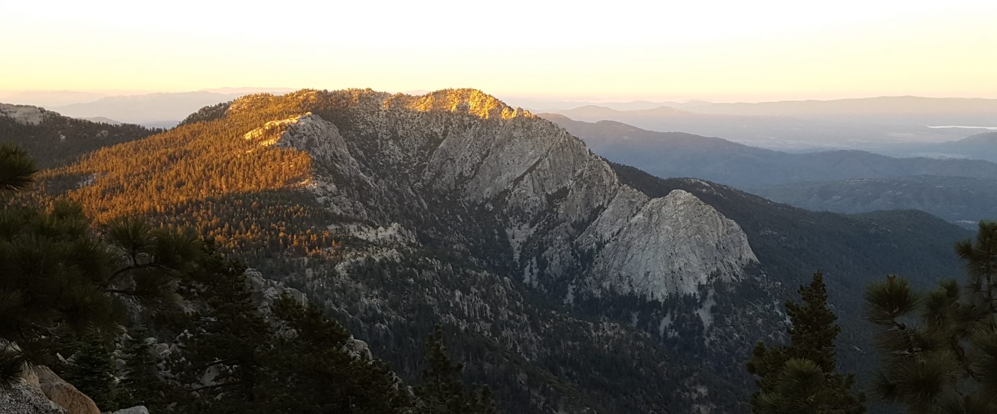
The last two days of June were the coolest for a week, with spectacular cloud cover in the early mornings (photos above and below), and Anne and I even got lightly rained on in Little Round Valley and at the Peak on Saturday 29th.
For example, at San Jacinto Peak on Sunday 30th June 2019 at 0730 the air temperature was 46°F (8°C), with a windchill temperature of 35.9°F (2°C), 46% relative humidity, and a chilly SW wind sustained at 19 mph gusting to 22.7 mph.

TRAIL CONDITIONS
All trails, including the entire Pacific Crest Trail throughout the San Jacinto mountains, are free of snow.
East Ridge Trail from near Miller Peak to San Jacinto Peak has only six tiny patches remaining on the trail, which can literally be stepped over.
The Pacific Crest Trail remains open at the rockslide near Antsell Rock (Mile 172.5). The video report from late May (available here) may be useful for deciding whether to try to hike around the rockslide.
Dark Canyon Road remains closed for the foreseeable future. Dark Canyon campground is therefore also closed, and there is no vehicular access to Seven Pines trailhead (although the road is hikeable of course).
The Boulder Basin and Black Mountain Group campgrounds remain closed until at least late July. They have a revised tentative reopening date of 25th July.
The rehabilitation of Apache Spring Trail has been completed by an ACE (American Conservation Experience) crew. This is great news as this side trail off the PCT had been indistinct since the 2013 Mountain Fire.
Another ACE crew recently completed six days work on Devil’s Slide Trail, smoothing out some of the rocky sections with dirt. It will be interesting to see how their work holds up in the next serious rainfall.
Willow Creek Trail had 18 trees down on the trail between Willow Creek and Hidden Divide yesterday, 2nd July (nine each on USFS and State land). The USFS volunteer tree have been working hard (thanks Steve and Jana!), and another team will be dealing with the State Park side on 7th July.
Seven Pines Trail was surveyed in mid June and has 35 trees down, almost all above 7500′ elevation. This trail has been very lightly traveled for many months, and is indistinct in places. Hikers without considerable prior experience of this trail should take great care with routefinding.
The Caramba Trail from near Reeds Meadow through Laws Camp to Caramba, and the Cedar Trail from Willow Creek Trail to Laws, are not maintained. New signage to this effect has just been mounted. When USFS reopened these routes in November 2018 they made it clear they would not be maintained for the foreseeable future (and the trails had been closed since the Mountain Fire in July 2013). Both are indistinct in places, and hikers without considerable prior experience of this area should exercise very cautious navigation.

WATER STATUS: Eastern slope
The Round Valley pipe is flowing well (once you turn the tap on). Flow rate on 2nd July was just over 2.0 gpm, which is as strong as it gets. [UPDATE 12th July 2019: the new tap has been removed! Water is back to gushing from the pipe uncontrollably. Thanks to Florian Boyd for this information.]

Both the northern and southern springs at Wellman’s Cienega are flowing well, but flow rates have dropped considerably in the last two weeks. These are the sources for Willow Creek, which is flowing very well where it crosses the Willow Creek Trail.

Tahquitz Valley is just still flowing.
Tahquitz Creek is flowing well at the northern end of Little Tahquitz Meadow. It is also flowing well further upstream at its source (known locally as Grethe Spring) where it crosses the PCT (approx. PCT Mile 177).
Skunk Cabbage Creek – that flows through Skunk Cabbage Meadow and then crosses the Caramba Trail near Reeds Meadow – is currently flowing well.
WATER STATUS: Western slope
The North Fork of the San Jacinto River is flowing very well where it crosses the Deer Springs Trail and even better where it crosses the Fuller Ridge Trail on the PCT (approx. PCT Mile 186.2).
O’Sullivan Creek (PCT Mile 186.4) on Fuller Ridge Trail is flowing well.
The creek in Little Round Valley is flowing the strongest I have seen in at least six years, but flow rate has halved in the past week.
Shooting Star Spring (below Little Round Valley but above the North Fork of the San Jacinto River crossing) is flowing well.
The Deer Springs stream crossing at the PCT (approx. PCT mile 185.6) is flowing strongly, as are several nearby seasonal tributaries.
Switchback Spring (about 0.4 miles north of Strawberry Junction) is flowing well, but there is little depth in which to filter water.

The little creek at Strawberry Cienega is flowing well.
On Devil’s Slide Trail, Middle Spring is flowing well, but flow rate is only a few percent compared to less than a month ago. In 2018, this spring had dried up by 1st July. Powderbox and Jolley springs, and the several unnamed ephemeral creeks on this trail, have now dried up.
On the Ernie Maxwell Trail, the crossing of Chinquapin Creek just below Humber Park continues to flow very well (an important source of water for the many dogs walked on this trail).
WATER STATUS: Desert Divide
Live Oak Spring (N 33 37 21, W 116 33 24) Flowing well. The most reliable water source on the Desert Divide.
Cedar Spring (N 33 40 36, W 116 34 35) Flowing well. Easiest access is the trough just upstream from the trail to the campsite.
Apache Spring (N 33 43 11, W 116 37 13) Flowing fairly well. See comments above regarding the greatly improved trail to this spring.
Spitler Peak Trail Descending the trail there are five water crossings. The first two, at 0.9 and 0.95 miles down, cross a tiny side creek which is largely dry and should be ignored. The next crossing, at 1.1 miles down, is Spitler Creek and is the best source of water (currently flowing well). The next two crossings are the same creek, but for obvious reasons it is best to fill up at the highest of the three crossings.
Antsell Rock Creek (N 33 41 52, W 116 39 08) Right by the Spitler Peak Trail trailhead on Apple Canyon Road, Antsell Rock Creek is flowing very well. Just on the upstream side of the road there is excellent access to the creek. Useful if hikers are descending the Spitler Peak Trail.
ACCESS CLOSURES The Valentine’s Day flood events continue to make access to the San Jacinto mountains challenging. Highway 243 between Banning and Idyllwild is closed from Skyland Ranch (north of Bay Tree Spring) to just north of Lake Fulmor. The remaining closed section may reopen this autumn, winter, or even not until 2020 (see this excellent article in the Press Enterprise). Highway 74 between Mountain Center and Hemet is currently open with a pilot car and restricted hours (0400-0800, 1800-0000) on weekdays, and broader hours (0400-0000) on weekends and holidays. It will not reopen without restrictions in late July as had been hoped. Instead it is expected to open round-the-clock but with a flagman and partial single lane traffic, perhaps sometime next month.

Quite a hiking streak, Jon. It must be a record for consecutive ascents to the top of San Jac! Still sharing your blog entries on FB to the delight of many.
LikeLike