
[UPDATE Wednesday 20th February: it started snowing again gently at 1230, with about one inch accumulating in three hours. After two days of torrential rain last week it has snowed on five of the subsequent six days (so far!). I plan a more detailed update on the snow conditions in the high country for Friday.]
[UPDATE Tuesday 19th February: Following major road damage in the Valentine’s Day rains, CalTrans have announced Highway 243 between Banning and Lake Fulmor will be closed for at least two months, and Highway 74 between Valle Vista and Mountain Center will be closed for at least one month.]
[UPDATE Monday 18th February: in Idyllwild we received 5.75″ more fresh snow overnight, and then two more inches this afternoon, for a total of about 10″ around town. The high country received only a few additional inches. It even snowed an inch in Garner Valley (4100′). Highway 74 is currently open at Lake Hemet to all traffic.]
[UPDATE Sunday 17th February: It started snowing in Idyllwild at 1200 today, and is accumulating at 0.5″ per hour (at least thru 1900). The Highway 74 access issue remains unpredictable. This morning it was open to all traffic at Lake Hemet, as it was yesterday. By early afternoon, CHP was allowing only residents, homeowners, and employees uphill, as was the case on Friday. Visitors should be aware that if they try to come up to Idyllwild by the one and only open route, they risk getting turned around depending on the day or the weather.]
[UPDATE II Saturday 16th February: Highway 74 from Garner Valley to Mountain Center and Highway 243 from Mountain Center to Idyllwild are open to all traffic (not just residents). When descending from Idyllwild, use the Saunders Meadow Road diversion (i.e. past the transfer station) as Hwy 243 is single lane for uphill traffic only. All other road closures remain in effect.]
[UPDATE I Saturday 16th February: Just back from a hike from home up South Ridge Trail to Old Lookout Flat. About 3.5″ fresh snow at top of South Ridge Road (6500′) and the same depth at Old Lookout Flat (7800′). Bitter conditions high up with 30-40 mph winds. Idyllwild (at 5550′) had 2.25″ of snow overnight, but melting is now very rapid at town elevation. South Ridge Road has a huge boulder in the road at 0.4 miles up, and was severely damaged by washouts from 0.7 miles to the top. Do not attempt vehicular access. At Long Valley (8600′) there was little more than an inch of fresh snowfall.]
Following the unprecedented rainfall and flooding event yesterday, discussed in detail in the posting linked here, today I hiked to San Jacinto Peak from Humber Park via Saddle Junction and Wellman Divide, descending Deer Springs Trail to the Suicide Rock Trail, then back to Humber via the Suicide Climbers Trail. There was not a single track anywhere to be seen on the mountain.
I recorded a rambling and overly long (sorry) vlog at about 0945 at San Jacinto Peak this morning, available on YouTube at this link.
For the second time this year, it rained all the way to San Jacinto Peak, and consequently snowfall in the upper elevations was far below what had been forecast, with barely 5″ at San Jacinto Peak, and only 1-2″ above 10,000′. Even that snowfall seemed to have been accompanied by freezing rain, so there was barely any powder on top of very icy snow.
Relatively mild and heavy rain, accompanied by strong winds, has smoothed the existing snow at all elevations, so there is very little evidence of the trails, especially above 8500′. This also makes even fairly low angle exposed slopes (like those on the Peak Trail above Wellman Divide) quite challenging to traverse in anything other than crampons. Considerable caution is required with both route-finding and traversing slopes.
Currently, there is no change to the timetable for road closures that I outlined yesterday. However, the Palm Springs Aerial Tramway will be closed indefinitely due to flood damage to the access road to Valley Station. Check their website for updates.
Snow depths measured today are as follows. Only average depth is given, due to the complexity of past storms. Strong winds have led to major drifting; drifts can be much greater than the average depth in places. Altitudes are approximate.
San Jacinto Peak (10,810′): 55″ [was c.50″ on Monday 11th]
Little Round Valley (9800′): 40″
Wellman Divide (9700′): 30″
Fuller Ridge Trail/PCT at junction with Deer Springs Trail (8950′): 36″
Annie’s Junction (State Park boundary north of Saddle Junction) (9050′): 24″
Marion Mountain Trail at junction with PCT/Deer Springs Trail (8800′): 22″
Saddle Junction (8100′): 16″ [was 26″ on Monday 11th]
Strawberry Junction (8100′): 11″
Devil’s Slide trailhead at Humber Park (6500′): 3″ [was 7″ on Monday 11th]
WEATHER Well, it can’t be as crazy as it was on Valentine’s Day! However, in the El Niño-driven winter we are having, it seems that conditions will remain highly variable and unpredictable. Minor storms with snowfall down as low as 5000′ are forecast for tonight and Sunday 17th. Snowfall at all elevations may be just a few inches at most, with about 2-3″ forecast for the Peak on Sunday. Then a potentially more substantial storm is currently predicted around Thursday 21st, with greater snowfall possible (4-9″ at the Peak}. Temperatures will remain well below average for the foreseeable future, with consequently little or no melting of snow and ice above 6500′.
At San Jacinto Peak today, Friday 15th February 2019, at 0945 the air temperature was 19.5°F (-7°C), with a windchill temperature of -2.4°F (-19°C), 31% relative humidity, and a harsh 18 mph WSW wind gusting to 27.8 mph.
At the Peak on Monday 11th February 2019, at 1225 the air temperature was 22°F (-6°C), with a windchill temperature of 3.6°F (-16°C), 28% relative humidity, and a moderate 9 mph WNW wind gusting to 18.3 mph.
TRAIL CONDITIONS
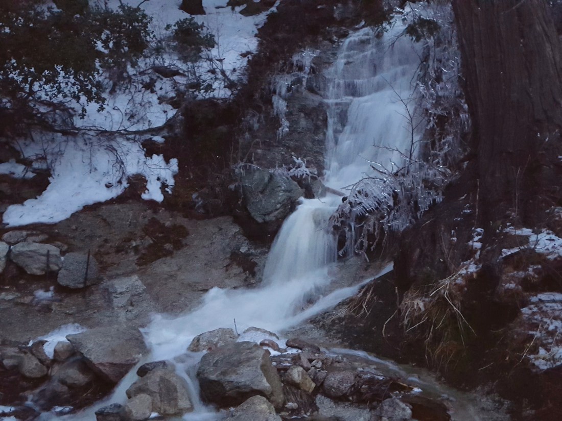
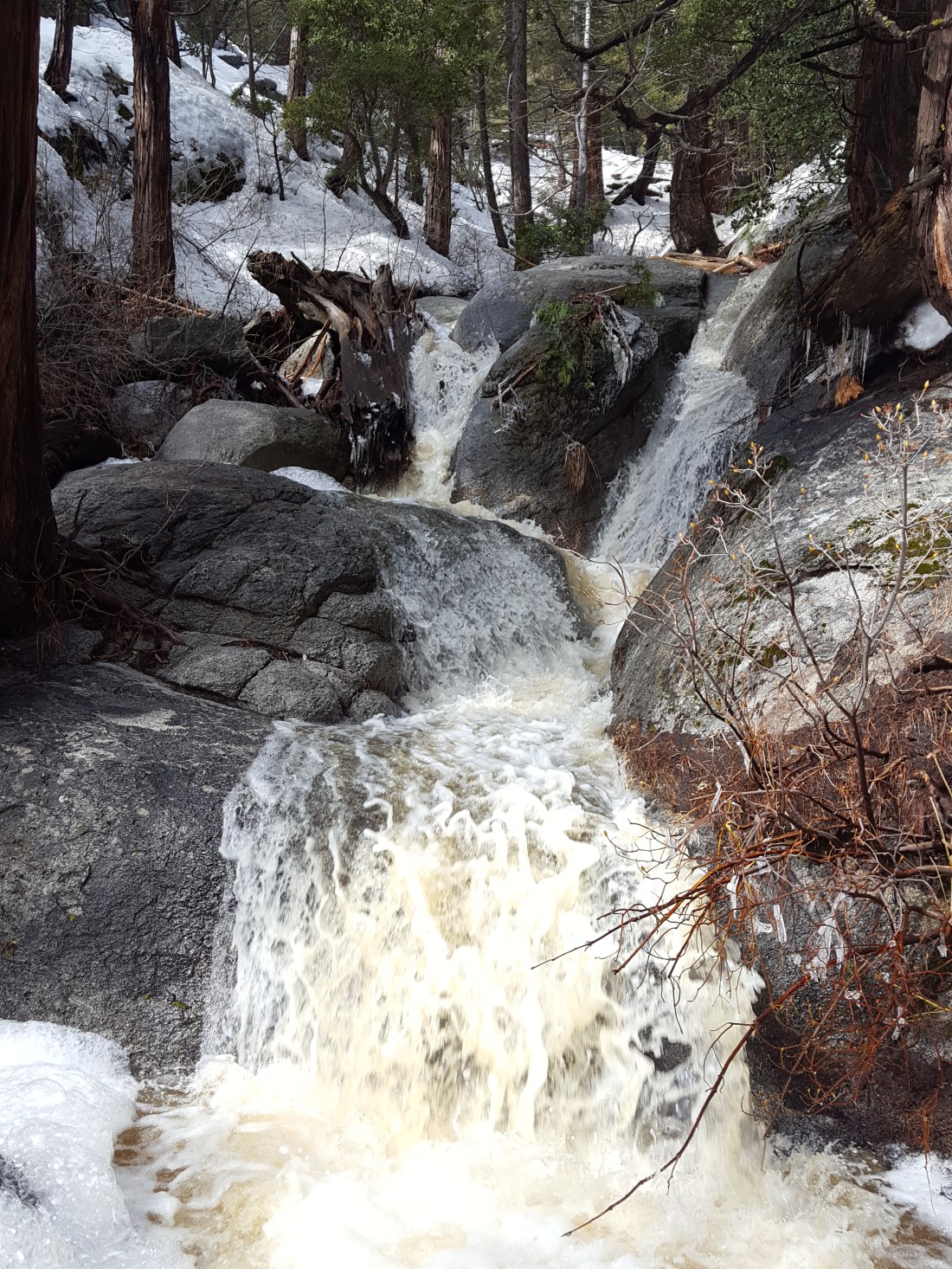
All trails above about 6000′ remain snow-covered at this time, despite considerable snow loss at lower elevations due to rainfall. Measured average snow depths are listed above. Trail damage from the rain event yesterday was less than feared. Although many washouts occurred in areas where streams cross trails, none were so severe as to be impassable. In fact, it was delightful to see so many ephemeral creeks flowing that had had little or no flow for much of the past six years.
For at least the next ten days hikers should be prepared for temperatures below freezing in the high country (>6000′) and well below freezing above 10,000′ (with potential for severe cold when considering windchill effects).
Microspikes (or even better crampons with an ice axe) are currently essential on all trails above 6500′, especially in the morning. Snowshoes may soon be useful depending on the depth of fresh snowfalls, and/or during afternoon melting on exposed and lower elevation trails.
Waterproof footwear is strongly recommended on the approach trails (below 8200′) due to multiple stream crossings and considerable water flowing in the trails.
Routefinding will be challenging for those not familiar with the area. Almost all signage above about 9000′ is currently completely snow-covered. Many PCT marker posts at lower elevations are also completely obscured. No trails had been broken whatsoever on my circuit of the mountain today. The snow is so icy from the rainfall yesterday that I did not posthole at all until the early afternoon descent of lower Deer Springs Trail. Consequently there are no tracks anywhere on the trail system above 8000′. Below about 8900′ there were subtle signs of the trails from traffic earlier in the week, but these may disappear in the next day or so with forecast fresh snowfalls.
Tahquitz Peak trail from Chinquapin Flat will be extremely treacherous. Crampons in conjunction with an ice axe, and knowledge of how to use both, are essential.
The Ernie Maxwell Trail is almost completely snow-covered with about 1-2″ snow, but is passable without additional traction. [Thanks to Anne and Anabel King for this update from today.]

One thought on “Snow and trail update 15th February 2019”