This afternoon I snowshoed to the top of Angel’s Glide at 9000′ on the PCT north of Saddle Junction. Since the unprecedented rainfall/flooding event on Valentine’s Day last week (discussed in detail in the posting linked here), the mountain has received some snowfall on six of the subsequent seven days. Although none of the snowfall events in isolation have been dramatic, the cumulative effect has been substantial.
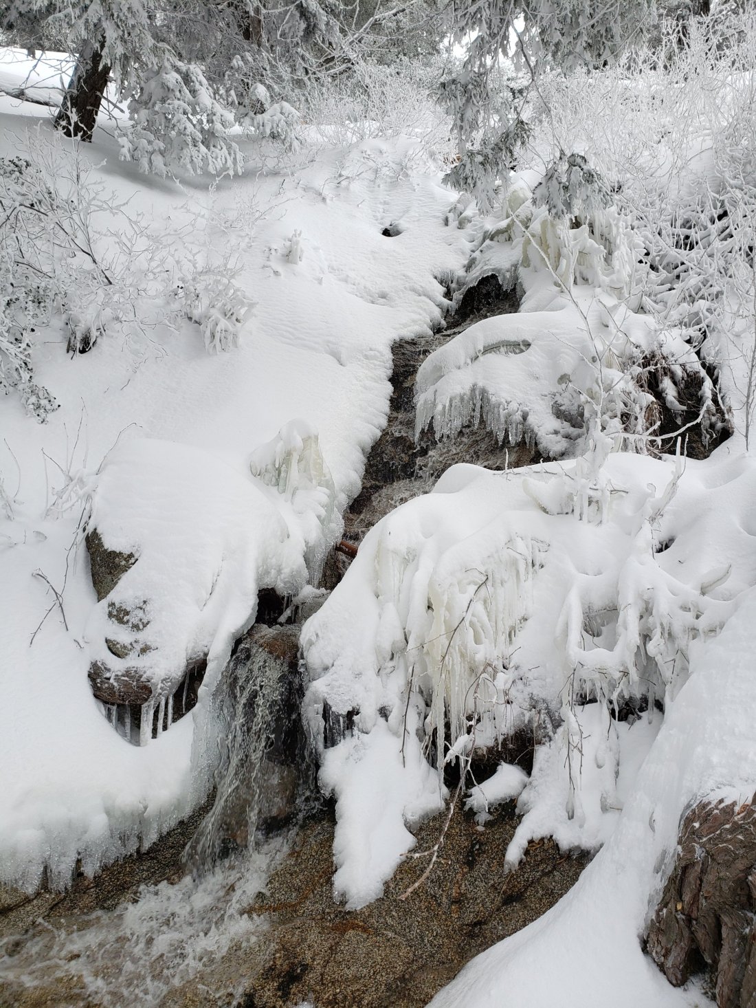
The snow conditions that I described the day after the Valentine’s Day rains (described in the previous posting here) have changed beyond all recognition. There is now thick powder everywhere above 5000′. with shallower snow down below 4000′. See more detailed discussion in Trail conditions section below.
Access closures The Valentine’s Day floods have made access to the San Jacinto mountains extremely challenging for non-residents. Palm Springs Aerial Tramway remains closed indefinitely due to damage to the access road to Valley Station. It seems likely to be weeks rather than days before the tram can safely reopen. Check their website for updates. Highway 243 between Banning and Idyllwild is closed at Bay Tree Spring (4 miles north of Lake Fulmor) for at least two months. Highway 74 between Mountain Center and Valle Vista is closed for as much as one month. In addition, periodic closures for maintenance of varying durations are happening on the only route to Idyllwild (Highway 74 from Garner Valley then Highway 243 up from Mountain Center).
Snow depths measured today are as follows. Only average depth is given, due to the complexity of past storms. Strong winds have led to major drifting and drifts are much deeper than the average depth in places. Altitudes are approximate.
Annie’s Junction (State Park boundary north of Saddle Junction) (9050′): 46″
Saddle Junction (8100′): 34″ [added 18″ since 15th February]
Devil’s Slide trailhead at Humber Park (6500′): 17″ [added 14″ since 15th February]
Idyllwild (at 5550′): 15″ [all new snow since 14th February]
WEATHER It was prescient when I wrote six days ago that in the El Niño-driven winter we are having, it seems that conditions will remain highly variable and unpredictable. It is currently snowing again heavily in Idyllwild (Thursday evening). Then over the next week we will experience a very rapid warming trend, with temperatures forecast to be above seasonal by late next week. By the middle of next week, temperatures may well be just above freezing at San Jacinto Peak. This is proving to be quite the winter for wildly variable weather.
At San Jacinto Peak on Friday 15th February 2019, at 0945 the air temperature was 19.5°F (-7°C), with a windchill temperature of -2.4°F (-19°C), 31% relative humidity, and a harsh 18 mph WSW wind gusting to 27.8 mph.
TRAIL CONDITIONS All trails above about 3000′ are snow-covered at this time. With extremely rapid warming forecast over the next week, there will be considerable snow loss at lower elevations due to melting (<6000′). However snow depths are such that it will take considerable time for melting to have any significant impact at higher elevations. Measured average snow depths are listed above.
For the next few days hikers should be prepared for temperatures near or below freezing in the high country (>8000′) and below freezing above 10,000′.
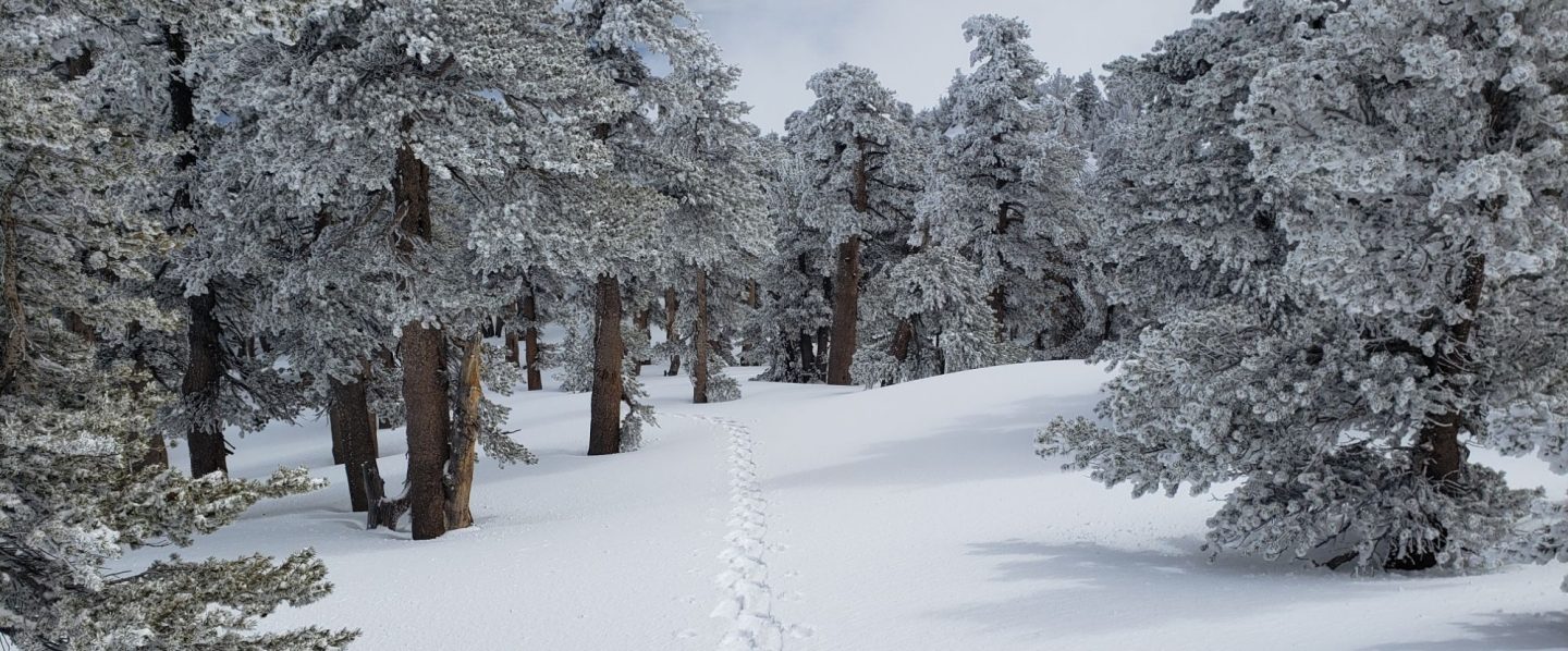
Snowshoes are currently essential on all trails above 5000′. Microspikes may become useful on lower elevation trails during the course of the coming week. Waterproof footwear is strongly recommended on the approach trails (<8200′) due to considerable water flowing in the trails.
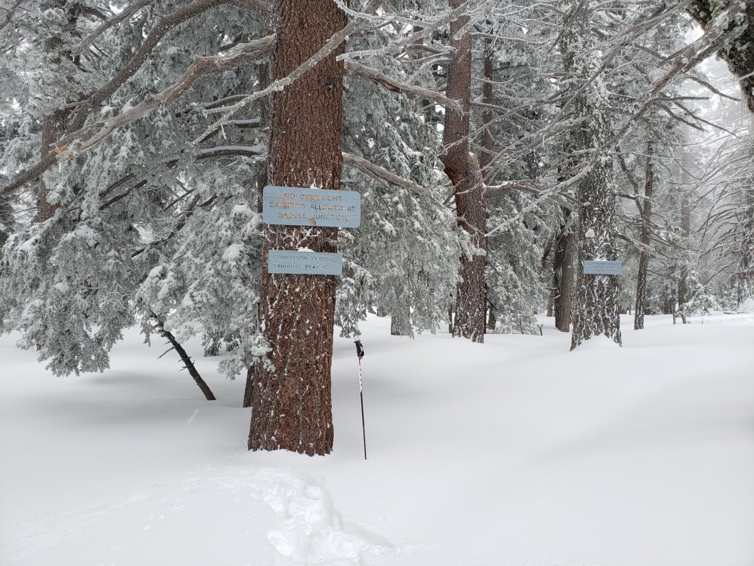
Routefinding is currently extremely challenging for those hikers who are not very familiar with the area, with areas above 8000′ largely just featureless snow slopes with no hint of trails whatsoever. Almost all signage above about 8500′ is currently completely snow-covered and almost all PCT marker posts and some other signage above about 7500′ is also obscured. No trails have been broken and snow is so deep that travel is slow and arduous, even with snowshoes.
Crampons in conjunction with an ice axe, and good knowledge of how to use both, are essential for moderate angle terrain, such as the Tahquitz Peak trail from Chinquapin Flat, sections of Fuller Ridge Trail, and any off-trail travel on the north faces of San Jacinto Peak and Tahquitz Peak.
There is an increased risk of avalanche conditions at the highest elevations. With considerable fresh snowfall on top of the icy Valentine’s Day frozen rain layer at all elevations, accompanied by strong SW-W winds at higher elevations, wind slab and storm slab conditions are possible, especially on easterly and northerly slopes. Upper Snow Creek drainage is infamously vulnerable, but the exposed easterly slopes above about 9800′ e.g., between Wellman Divide and Miller and San Jacinto peaks, could be unstable too. Cautious routefinding and conservative decision-making are recommended in any areas that display signs of possible instability (shooting cracks, whumphing, large cracks perpendicular to slope).