[ACCESS UPDATE: Caltrans has announced that starting Saturday 21st April there will be limited access on Highway 74 between Mountain Center and Hemet, in two time windows 0500-0800 and 1800-0000.]
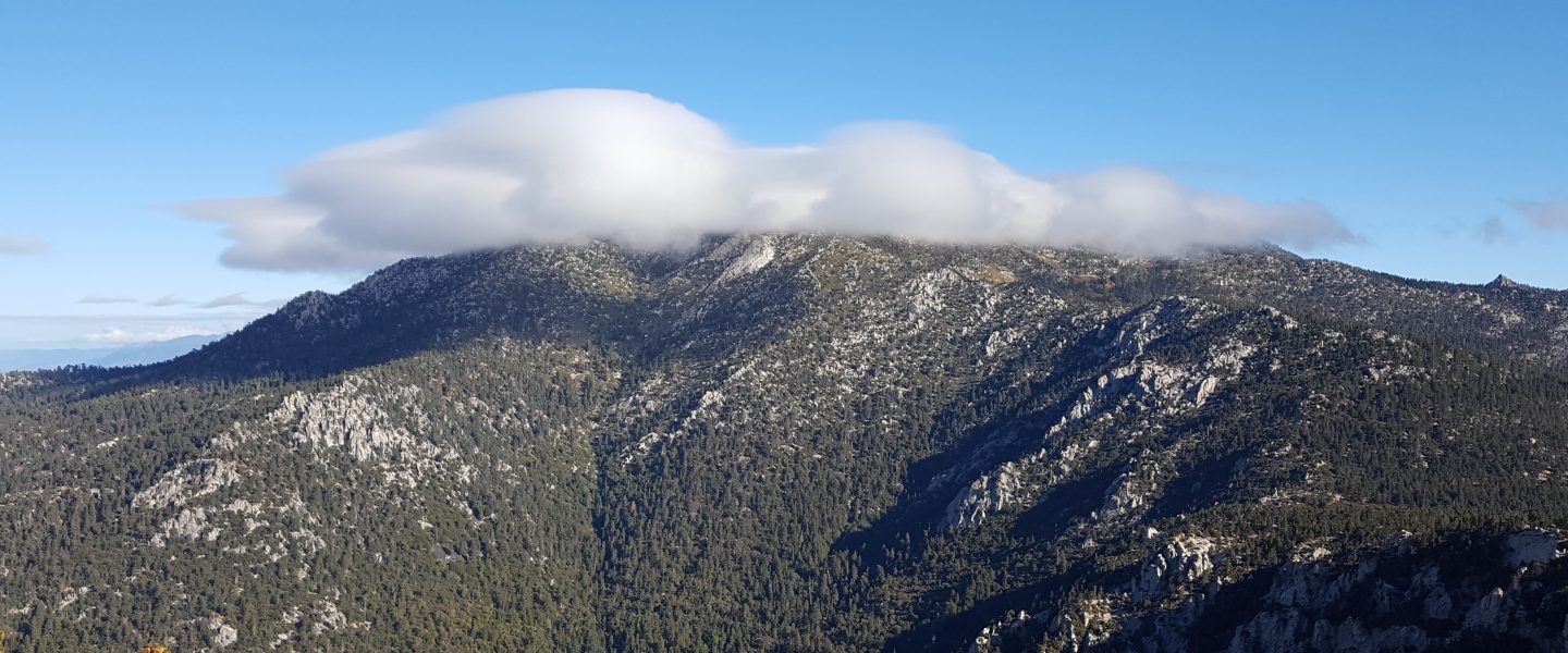
This morning we hiked Marion Mountain and Deer Springs trails to San Jacinto Peak. Two days earlier we hiked to and from San Jacinto Peak via Devil’s Slide Trail and Wellman Divide, in damp, cloudy, windy conditions.
Road access issues and the status of various water sources were updated last week (linked here) and will only be revised when there are noteworthy changes to report.
I recorded the following video on 16th April at San Jacinto Peak.
Shortly after I recorded the video, we were very briefly snowed on as we descended through 10,000′, just some tiny rounded grains that completely failed to accumulate. In Idyllwild we received barely 0.02″ of drizzle, mainly in the afternoon, when the high country was above the cloud. Trail and snow conditions are largely unchanged from last week, other than some continued melting.
Microspikes in combination with hiking poles continue to be recommended throughout the high country above 8500′ (and lower in some areas, e.g., Fuller Ridge). Microspikes are sufficient to hike all of the PCT in the San Jacinto mountains at present.
WEATHER After a very brief reminder of winter on 16th, summer returned the next day. Temperatures will be above (or well above) average for the foreseeable future, with very rapid snow melt continuing at all elevations. There is no notable precipitation in the forecast.
At San Jacinto Peak (10,810ft/3295m) today, 18th April 2019, at 0900 the air temperature was 41°F (5°C), with a windchill temperature of 31°F (-1°C), 38% relative humidity, and a cool NE wind at 11 mph gusting to 14 mph.
At the Peak on 16th April 2019 at 0855, the air temperature was 25.5°F (-4°C), with a windchill temperature of 7.7°F (-14°C), 100% relative humidity, and a bitter due West wind at 10 mph gusting to 26 mph.
At the Peak on Friday 12th April 2019 at 0910, the air temperature was 22°F (-6°C), with a windchill temperature of 3.8°F (-16°C), 55% relative humidity, and a moderate due North wind at 8 mph gusting to 18 mph.
TRAIL CONDITIONS
Many trails above about 8700′ remain largely snow-covered, although this is changing rapidly. Details for specific routes are below. Despite warmer weather overall, hikers should be prepared for temperatures at or near freezing in the high country (and colder when considering windchill effects).
Waterproof footwear is useful on approach trails (e.g., Devil’s Slide, lower Deer Springs) due to multiple stream crossings and considerable water flowing in the trails. It will also be invaluable for the next few weeks in soft melting snow.
Many major trails are now well traveled, and have obvious, consolidated tracks. Routefinding is challenging in places for those not familiar with the area due to wandering, inaccurate tracks however, so use caution. Some PCT marker posts above 8500′ remain snow-covered.
Pacific Crest Trail The trail is clear of snow from Highway 74 (Mile 151) to about Mile 173, except for the challenging area at Apache Peak, Mile 169.5. Most hikers will find microspikes useful for that area, although it is now passable without spikes for those experienced on angled snow travel in appropriate footwear. Between about Mile 174 and Mile 191, much of the trail averages about 80% snow-covered, but with more snow-free areas opening up every day. Miles 179-181 and 182-184.5 are largely free of snow.
Fuller Ridge Trail is best traversed with microspikes and at least hiking poles. The short sections that face south and on top of the ridge are now largely snow-free, but the majority of the trail remains snow-covered and challenging. PCT hikers not comfortable with angled snow/ice travel should continue to consider the Black Mountain Road alternative.
Black Mountain Road is clear of snow until about 7000′ (5 miles up). From the Boulder Basin junction to the PCT/Fuller Ridge campground (miles 5 to 8) there is only about 10% snow cover. No microspikes are required to hike to the PCT. Note that Black Mountain Road is currently accessible to vehicles to about 4.5 miles up from Highway 243. Beyond the Fuller Ridge campground turning, the road is continuously snow-covered at 1-3 feet deep down to about 7000′ elevation. Black Mountain Road is being graded over the next ten days, and should be passable to vehicles (at least to Fuller Ridge) by about 25th April.
Skyline Trail is clear of snow to 7200′. Microspikes and hiking poles are sufficient above that elevation, although an ice axe (if you know how to use it) could be useful on the traverse chutes. There is an obvious track to follow through the snow-covered section.
Devil’s Slide Trail is clear of snow, with short icy snow patches near Saddle Junction.
Deer Springs Trail is clear of snow to Strawberry Junction (8100′). Snow is limited to patches for the next mile north, before becoming continuous near the Marion Mountain Trail junction. The track above the Fuller Ridge junction up to San Jacinto Peak largely does not approximate to the true trail, and is steep and postholey in places.
Marion Mountain Trail is clear of snow to the viewpoint at 7500′. Above that there is only patchy snow at about 20% coverage all the way to the PCT at 8700′ elevation. Microspikes are not required for the ascent, but are useful for descending the uppermost 0.5 mile.
Tahquitz Peak trail from Chinquapin Flat remains very treacherous. There are no tracks or steps to follow. Crampons in conjunction with an ice axe are very strongly recommended for this section. It is possible to pass between the PCT and Tahquitz Peak along the top of Tahquitz Ridge with caution.
South Ridge Trail is almost completely clear of snow to Tahquitz Peak. Above Old Lookout Flat (7800′) there are occasional snow patches, mainly near the Peak, but with very well-defined steps. Microspikes are not required. South Ridge Road is clear of snow, but is impassable near the top due to severe storm damage.
SNOW DEPTHS measured on 16th and 18th April are as follows. Current average depth is given; drifts can be much greater than the average depth. Altitudes are approximate.
San Jacinto Peak (10,810′): 28″ (75″ on 22nd March)
Little Round Valley (9800′): 24″
Wellman Divide (9700′): 16″ (43″ on 22nd March)
Pacific Crest Trail at south end of Fuller Ridge Trail (8950′): 20″
Pacific Crest Trail at top of Marion Mountain Trail (8700′): 17″
Annie’s Junction (PCT at State Park boundary north of Saddle Junction) (9050′): 14″ (34″ on 22nd March)
Long Valley (8500′): 0.5″
Strawberry Junction (8100′): 1″
Saddle Junction (8070′): 2″ (20″ on 22nd March)


