[UPDATE 25th May 2019: as anticipated in the text below, snow melt has been extremely rapid. For example Long Valley (8500′) almost completely cleared of snow yesterday. However, precipitation is now very likely on Sunday 26th May at all elevations, with light snow forecast for the high country above about 6000′.]
Today we had a superb hike with Jenn Murdock to San Jacinto Peak ascending on the east side via Devil’s Slide Trail and Wellman Divide, returning the same way. Tim Dailey joined us early and helped break trail to 8500′.
Two days after we got our May snowstorm (described here) we got another one! Slightly less snowfall yesterday than on Sunday, but the combined effect has been quite dramatic, especially for late May.
The entire mountain from 5000′ to the Peak was in the cloud all day, with light fine drizzle on the ascent and descent of Devil’s Slide Trail, and a fine damp fog everywhere else, with visibility occasionally under 50 yards. The sun tried but failed to break through a couple of times when we were at San Jacinto Peak.
I recorded a short video at about 1055 this morning at San Jacinto Peak, available on YouTube here.
Microspikes are currently recommended at all elevations above about 7000′. Melting is expected to b very rapid, and the elevation at which spikes are useful may rise rapidly. Snow depths were great for snowshoeing above about 9000′ elevation (and I even wore them down to 8100′ on the descent) but that situation will also change soon with the rapid melting likely in the next few days.
Waterproof footwear is strongly recommended on approach trails at least (e.g., Devil’s Slide, lower Deer Springs) due to considerable water flowing in the trails and slushy melting snow everywhere. It will also be invaluable for at least the next few days elsewhere in soft melting snow.
Due to the time of year (high sun angle) and the warmth of the ground before the snow fell this week, melting will be unusually rapid during the warming trend over the next week or so. Conditions will therefore change rapidly. I do not anticipate updating the Trail Report for at least 3-4 days, so do not be surprised to find somewhat less snow over this weekend (and definitely next week) than currently described here.
WEATHER Overall a significant warming trend will commence tomorrow, which will be especially pronounced next week. However May 26th and 27th will be cool and overcast with the possibility of light precipitation on Sunday 26th (perhaps a few inches of snow in the high country) . Hikers should be prepared for temperatures near or below freezing in the high country, and potentially well below freezing with windchill on some days.
At San Jacinto Peak (10,810ft/3295m) today, 23rd May 2019, at 1055 the air temperature was 24.4°F (-4°C), with a windchill temperature of 9.5°F (-12.5°C), 100% relative humidity, and a brisk West wind at 10 mph gusting to 15.5 mph.
At the Peak on 20th May 2019 at 1050 the air temperature was 19°F (-7°C), with a windchill temperature of -2°F (-19°C), 88% relative humidity, and an icy NW wind at 14 mph gusting to 25 mph.
TRAIL CONDITIONS
All trails above 6000′ were completely snow-covered this morning, but by this afternoon some melting meant that most areas below 7000′ were already becoming very wet and slushy.
All trails above 8000′, including much of the PCT in the San Jacinto mountains, are currently under continuous snow cover 4-15″ deep (deeper in areas that retained snow since the winter, see data below).
Reasonable tracks to follow are already in place for the PCT at least from Saddle Junction (approx PCT Mile 179.7) all the way through Fuller Ridge.
Reliable, well-traveled tracks are also in place for Devil’s Slide Trail, and the Wellman and Peak trails on the east side. Good friend of the Trail Report Kyle Eubanks also broke reliable trail from Wellman Divide through Round and Long valleys to the Tram last night.
Upper Deer Springs Trail from the Peak down to the Fuller Ridge Trail junction has NOT had any traffic and currently has no tracks to follow. Marion Mountain and Seven Pines trails have not been hiked since the fresh snowfall.
Pacific Crest Trail Snow cover is likely thin and patchy from about Mile 158 to 163, and then continuous thereafter, and at least several inches deep, through to at least Mile 194. PCT hikers not comfortable with angled snow/ice travel should consider the Black Mountain Road alternative to Fuller Ridge, at least for the next week or so.
SNOW DEPTHS measured today 23rd May are as follows (for those areas that still had snow remaining from the winter, the combined total is indicated in parentheses). Locations that were measured on 20th May are shown as [estimated] based on likely additional accumulation from yesterday’s storm at that elevation. Average depth is given, drifts may be significantly deeper than the average in places. Altitudes are approximate.
San Jacinto Peak (10,810′): 15″ (total 23″)
Peak Trail (at and above 10,000′): 13″
Little Round Valley (9800′): 13″ (total 28″) [estimated]
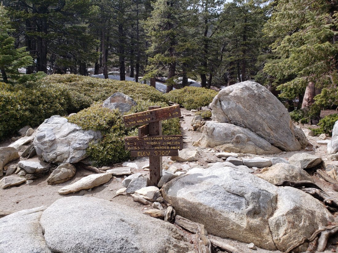
Wellman Divide (9700′): 10″
Pacific Crest Trail at south end of Fuller Ridge Trail (8950′): 9″ [estimated]
Annie’s Junction (PCT Mile 181.5 at State Park boundary) (9050′): 9″
Long Valley (8500′): 3″
Strawberry Junction (8100′): 4″ [estimated]
Saddle Junction (8070′): 5″
Devil’s Slide Trail at Humber Park (6550′): 3″ (at 0600 this morning, now largely melted)
Idyllwild (at 5550′): 1.75″ (last night, now completely melted)