[UPDATE 3rd January 2019: Yesterday we hiked South Ridge Trail, then this morning I hiked to San Jacinto Peak via Devil’s Slide Trail. I have incorporated new info from those hikes into the report below. The swing in temperatures has been astounding, with San Jacinto Peak already above freezing early this morning (36°F). Consequently, melting has been very rapid, with many trails below 8000′ clearing fast. Only a handful of hikers have made it to San Jacinto Peak in recent days via all routes, with extremely few tracks visible in the high country, so trails remain a little slow-going in heavily drifted areas. Next full update will be after the snowstorm (fingers crossed) on Sunday.]
If today was a sign of things to come, 2019 will be an exciting year in the San Jacinto mountains! Early this morning I hiked to San Jacinto Peak via Devil’s Slide Trail and Wellman Divide, descending via Deer Springs Trail. Conditions at all elevations were very cold, with a howling northerly gale, and spindrift snow flying in all directions. I observed yet another record low windchill temperature at San Jacinto Peak, as discussed in the video.
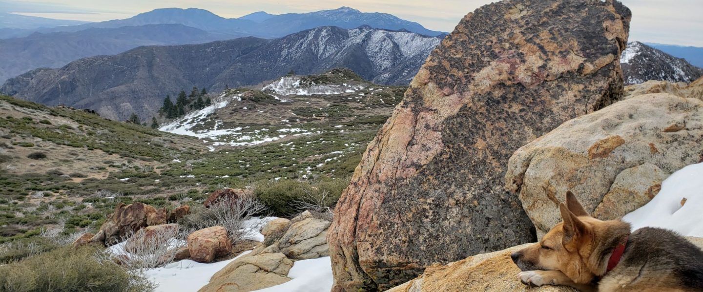
I briefly described the snow that fell yesterday in the final update of 2018. All trails above about 6700′ are snow-covered, with patchy thin snow to 5700′ (discussed in detail below). With such strong winds, drifting has been very widespread, making tracks disappear within minutes, and route-finding complicated at times for those unfamiliar with the area.
Despite the cold conditions in the past week, a remarkable amount of melting had occurred in the days prior to the light snow yesterday. The 1-2″ of snow that fell yesterday may melt quickly on exposed slopes in the warmer temperatures expected for the rest of this week (see Weather below).
Microspikes are useful, but are not essential, on most trails above about 7800′ at this time (see details below). They are most valuable in the early morning when snow is icier, and for descending. Snowshoes are useful for travel off-trail and in some areas of the high country above about 9800′.
In general, hikers should be prepared for temperatures at or near freezing in the high country (>8000′ elevation), and well below freezing at the highest peaks (with potential for severe cold when considering windchill effects).
Note that during the federal government shutdown, the U.S. Forest Service Idyllwild Ranger Station is closed. Adventure passes and wilderness permits are not required (or at least unenforceable) until the shutdown ends.
Weather The next few days may be a microcosm of the highly erratic weather we have experienced so far this winter. The severe cold of the last few days will be replaced by relatively warm weather (with likely extensive melting) for the rest of this week, which may then end abruptly with a snow storm at the weekend. The latter was originally forecast to be comparable to the notable storm of early December 2018, but more recent forecasts have greatly reduced the predicted snow volumes.
At San Jacinto Peak today, Tuesday 1st January 2019, at 0900 the air temperature was 0.7°F (-17°C), with a windchill temperature of -33.4°F (-36°C), 58% relative humidity, and a bitter 25 mph due North wind gusting to 49.7 mph.
At the Peak yesterday, Monday 31st December 2018, at 0930 the air temperature was 16.5°F (-9°C), with a windchill temperature of 0.7°F (-17°C), 100% relative humidity, and a cool 6 mph WSW wind gusting to 12 mph.
TRAIL CONDITIONS
Tahquitz Peak trail from Chinquapin Flat is challenging, and the conditions are described in detail in this earlier report. I have not re-checked this trail since then, but with an inch or so of fresh snow, plus extreme wind-blown drifting, it is certain that conditions will be no less difficult. Crampons (or microspikes if you are very comfortable with their use), in conjunction with hiking poles or preferably an ice axe, are recommended. [I would discourage carrying an ice axe if you aren’t familiar with how to use it.]
South Ridge Trail has barely 1″ depth of patchy snow from the top of South Ridge Road to Old Lookout Flat (the plateau at 7800′). From 7800′ the trail is largely snow-covered at 1-2″ deep, with 3-5″ near Tahquitz Peak. There are some deeper drifts on the upper switchbacks. Due to the nature of the snow, microspikes are not essential, but some hikers will find them useful especially for descending the uppermost switchbacks. [Note that South Ridge Road is very icy, and challenging for both 2WD vehicles and hikers.]
Eastern slope trails The major trails had been well traveled and were fairly well consolidated until 30th December. However minimal hiker traffic and heavy drifting from strong winds since then has made the trails harder to follow. This includes the main Long Valley and Round Valley trails. The East Ridge Trail on San Jacinto Peak, the Sid Davis Trail, and the Old Tamarack Trail, have received no visible traffic, and require caution and snowshoes.
Deer Springs Trail has been lightly traveled since the snow on Christmas Day. Snow depth is at about 8-10″ in Little Round Valley, with deeper drifts nearer San Jacinto Peak. There is no consolidated trail between Little Round Valley and San Jacinto Peak, with tracks of just a few people, and these only approximate to the route of the trail.
Deer Springs Trail below Little Round Valley has continuous snow to Strawberry Junction. At the latter, snow depth is only 1″. Below Strawberry Junction there is very shallow patchy snow, and microspikes are not required in this section.
Marion Mountain Trail has been well traveled today. Thin snow starts at the trailhead, increasing to about 5″ at the junction with the PCT/Deer Springs Trail. Areas that had cleared following the earlier December snows, below about 7800′, are already starting to clear in patches.
Fuller Ridge Trail and Seven Pines Trail show no signs of recent use, so route finding will be very challenging for those not completely familiar with these trails.
Devil’s Slide Trail is largely clear of snow below 7600′. Snow cover is more-or-less continuous above that elevation, but very shallow and not too icy. Snow depth at Saddle Junction averages 2″. Most hikers will find microspikes are not required for the majority of this trail. There is a small but very treacherous patch of black ice at Middle Spring, about 1.4 trail miles above Humber Park.
Ernie Maxwell Trail has only patchy snow at no more than 1″ depth. Microspikes are not required. [Many thanks to Anne and Anabel King for this information.]
Skyline Trail has light patchy snow above about 6000′, which is then more continuous from the Traverse upwards (>7200′) at about 2-4″ deep. The trail is consolidated and fairly obvious. Some hikers are carrying microspikes and poles or ice axes, but report not needing to use them. [Many thanks to various correspondents for this information.]
Pacific Crest Trail north from Saddle Junction currently has only patchy snow to near 9000′. Microspikes are of limited use up to that elevation, but are then helpful from there to Annie’s Junction (the State Park boundary).
Pacific Crest Trail south from Saddle Junction has continuous snow cover (at only 2-4″ deep) to 8300′, and then about 3-6″ deep, but with a clear consolidated track, to 8400′ at Chinquapin Flat. There has been no recent foot traffic on the PCT south from Chinquapin Flat.

Finally, a huge thank you to all those supporters and donors who helped make 2018 such a remarkably successful year for the San Jacinto Trail Report, far, far beyond my most optimistic expectations for the project. All those supporters are listed here. If you found the Report to be useful to you in the past year, please consider visiting the Donate page. Many thanks. Happy New Year and safe hiking.
