[UPDATE Wednesday 18th December: I have updated trail conditions below for either side of Tahquitz Peak based on our hike this morning from home ascending from the north (via Saddle Junction) and descending South Ridge.]
We spent this morning ascending San Jacinto Peak via the east side (Devil’s Slide to East Ridge Trail) and descending the west side (Deer Springs Trail), affording a thorough survey of the snow and trail conditions around the mountain.
Pleasantly frigid conditions – 26°F in Idyllwild and much colder in the high country – were ideal for hiking this morning on compacted icy snow, and I ascended to San Jacinto Peak with zero postholing and in a time typical of dry summer trail conditions. Microspikes were useful above 9000′, and especially for the descent down to about 8500′. These conditions should remain largely unchanged this week (at least in the mornings) with cold temperatures forecast at all elevations. Trail conditions are discussed in a short video recorded this morning at San Jacinto Peak. Overall snow conditions on the trails were more reminiscent of April than of late December.
Snow depths measured today are listed at the foot of this posting. In summary, all elevations above 6500′ have lost many inches of snow depth in the past week (depending on sun exposure of the location), with all trails below about 8000′ now largely snow-free.
Microspikes are recommended for all trails above about 8500′. Snow depths are marginally adequate for snowshoeing off-trail above about 8800′ elevation. Established tracks are too compacted for comfortable snowshoeing.
Hikers should be prepared for temperatures at or below freezing in the high country, and well below freezing when considering windchill effects.
WEATHER Cool temperatures below seasonal continue for the next couple of days, before returning to above seasonal on 19th-22nd December. The fifth storm system of this winter is currently forecast to arrive overnight on Sunday 22nd, with cold temperatures and precipitation possible for the entire Christmas week.
At San Jacinto Peak (10,810ft/3295m) today, Monday 16th December 2019 at 0940 the air temperature was 14.7°F (-10°C), with a windchill temperature of -5.1°F (-21°C), 18% relative humidity, and a cool due North wind sustained at 12 mph gusting to 18.2 mph.
By contrast, at the Peak on Thursday 12th December 2019 at 0940 the air temperature was 40.2°F (5°C), with a windchill temperature of 27.7°F (-3°C), 71% relative humidity, and a brisk NW wind sustained at 16 mph gusting to 25.7 mph.
TRAIL CONDITIONS
All trails above about 7800′ are at least partly snow-covered, with depth depending on elevation (see below).
Tahquitz Peak trail from Chinquapin Flat/PCT Mile 178 [updated 18th December 2019] There are no steps to follow through the angled icy snow for about 0.25 miles of this trail section. We crossed early this morning and found it quite challenging. Do not attempt to cross these ice slopes without additional traction. Microspikes (at a minimum) are essential, ideally in conjunction with an ice axe (if you know how to use it), for this treacherous trail.
The Peak Trail above 10,300′ has not been completely traversed since before the late November storms. The only defined trail is the steeper option up the East Ridge (although the current track does not follow the normal trail route).
Round Valley Trail from the Tram through to Wellman Divide has been well-traveled and a good track through the snow is easy to follow.
Devil’s Slide Trail is free of snow to 7800′, with only patchy compacted snow cover thereafter to Saddle Junction.
Ernie Maxwell Trail is completely clear of snow.
South Ridge Trail [updated 18th December] is completely clear of snow to Old Lookout Flat (7800′), with limited icy snow patches from there to Tahquitz Peak, mainly above about 8400′. Microspikes are useful (but not essential), especially for descending when the snow is firm i.e. on cold mornings.
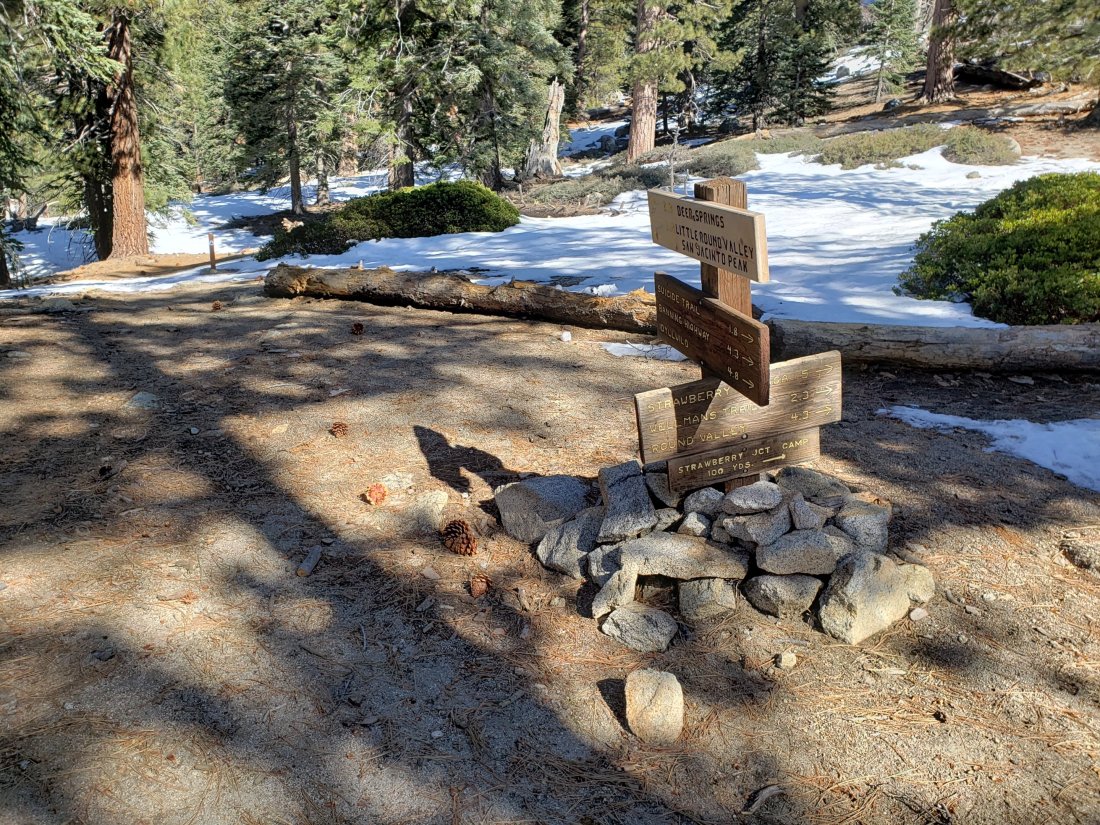
Deer Springs Trail is basically clear of snow below 8100′, with just a few patches near Strawberry Junction. Snow cover is patchy from there to about 8500′ (no traction required), and thereafter is continuous. An excellent track is now in place through to Little Round Valley. From there to San Jacinto Peak, the visible route does not follow the usual trail course and is steep.
Marion Mountain Trail has been well traveled and has a good track to follow. It is largely clear below 8000′.
Seven Pines Trail and Fuller Ridge Trail (PCT Miles 185.5-190.5) have no visible signs of hiker traffic since the recent storms, and no tracks or trail to follow. Indeed Seven Pines Trail has only been hiked a handful of times since November 2018. Extremely cautious navigation is recommended for those who are not very familiar with hiking these trails in snow.
The Forest Service closure of Dark Canyon Road will remain in place into 2020, hence there is no vehicular access to Seven Pines trailhead.
SNOW DEPTHS measured today are as follows. Please note that average depth is given; drifts are much deeper than the average in places. Altitudes are approximate.
San Jacinto Peak (10810′): 26″ (36″ on 4th December)
Little Round Valley (9800′): 20″ (25″ on 9th December)
Wellman Divide (9700′): 7″ (previously 16″ on 4th December)
Annie’s Junction (9070′): 11″ (previously 18″ on 4th December)
Fuller Ridge Trail south end (8980′): 12″
Marion Mountain Trail junction with PCT (8800′): 10″
Long Valley (8600′): 2″
Strawberry Junction (8100′): <1″ (5-6″ on 9th December)
Saddle Junction (8070′): 2″ (previously 13″ on 4th December)