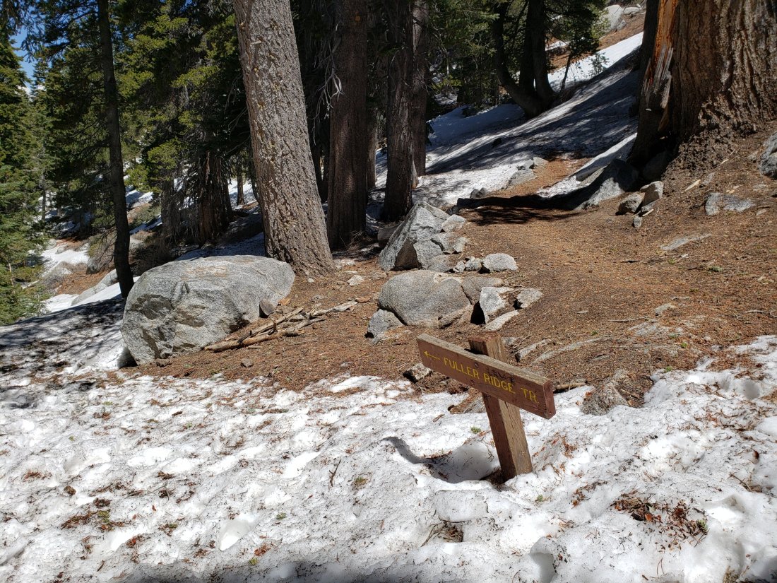
As nonsensical as it seems, I have continued to ascend San Jacinto Peak every morning this month, by as many diverse routes as possible. For example on Monday I descended via Fuller Ridge Trail (having ascended from Saddle Junction), hiking part way – and getting a ride back to Idyllwild – with Florian Boyd who had manned Black Mountain fire lookout the previous day. On Tuesday we took a long circuitous route to the Peak via Willow Creek Trail, Hidden Divide, and Round Valley. Today, a quick up-and-down from Humber Park.
The snow has (virtually) gone from the trail network. A few tiny patches remain on the East Ridge Trail only.
The Pacific Crest Trail remains open at the rockslide near Antsell Rock (Mile 172.5). The video report from late May (available here) may be useful for deciding whether to try to scramble around the rockslide.
The rehabilitation of Apache Spring Trail has been completed by an ACE (American Conservation Experience) crew. This is great news as this side trail off the PCT had been indistinct since the 2013 Mountain Fire.
Another ACE crew has just completed six days work on Devil’s Slide Trail, smoothing out some of the rocky sections with dirt. It will be interesting to see how their work holds up in the next serious rainfall.
Dark Canyon Road remains closed for the foreseeable future. Dark Canyon campground is therefore also closed, and there is no vehicular access to Seven Pines trailhead (although the road is hikeable of course).
The Boulder Basin and Black Mountain Group campgrounds remain closed until at least late July. They have a revised tentative reopening date of 25th July.
The status of various water sources is updated below. Also updated at the foot of this posting are the highway conditions (bad news for most readers).
Hikers should always be prepared for rapidly changing conditions in the high country in summer. Thunderstorms with lightning and precipitation can occur at or near the high peaks even when such storms are not forecast for lower elevations.
WEATHER Delightfully cool June temperatures continue for the rest of the month (and into the first few days of July)! Wednesday 12th June remains the warmest day of the year so far in the high country. On average this has been the coolest June in Idyllwild and in the high country for nearly a decade. No precipitation is in the forecast.
At San Jacinto Peak (10,810’/3295m) today 26th June 2019 at 0845, the air temperature was 49°F (10°C), with a windchill temperature of 41.8°F (6°C), 19% relative humidity, and a light SSW wind at 7 mph gusting to 13.7 mph.
The coolest day at the Peak since 9th June was on Saturday 22nd June, when at 0750 the air temperature was 37.4°F (3°C), with a windchill temperature of 23.9°F (-5°C), 48% relative humidity, and a stiff NE wind of 14 mph gusting to 24.5 mph.
TRAIL CONDITIONS
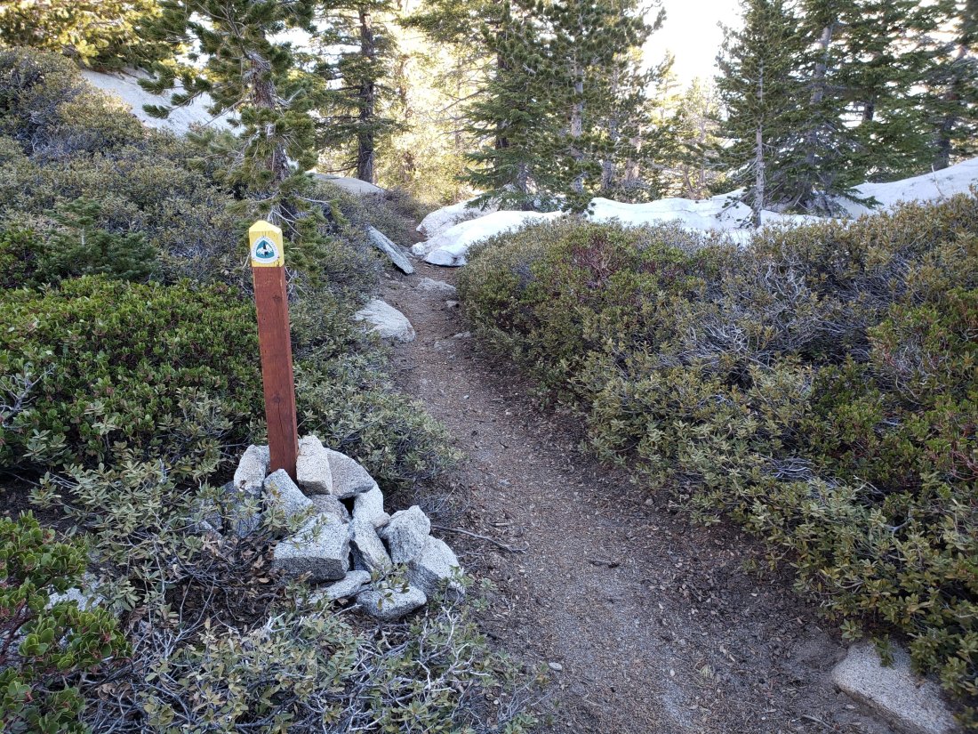
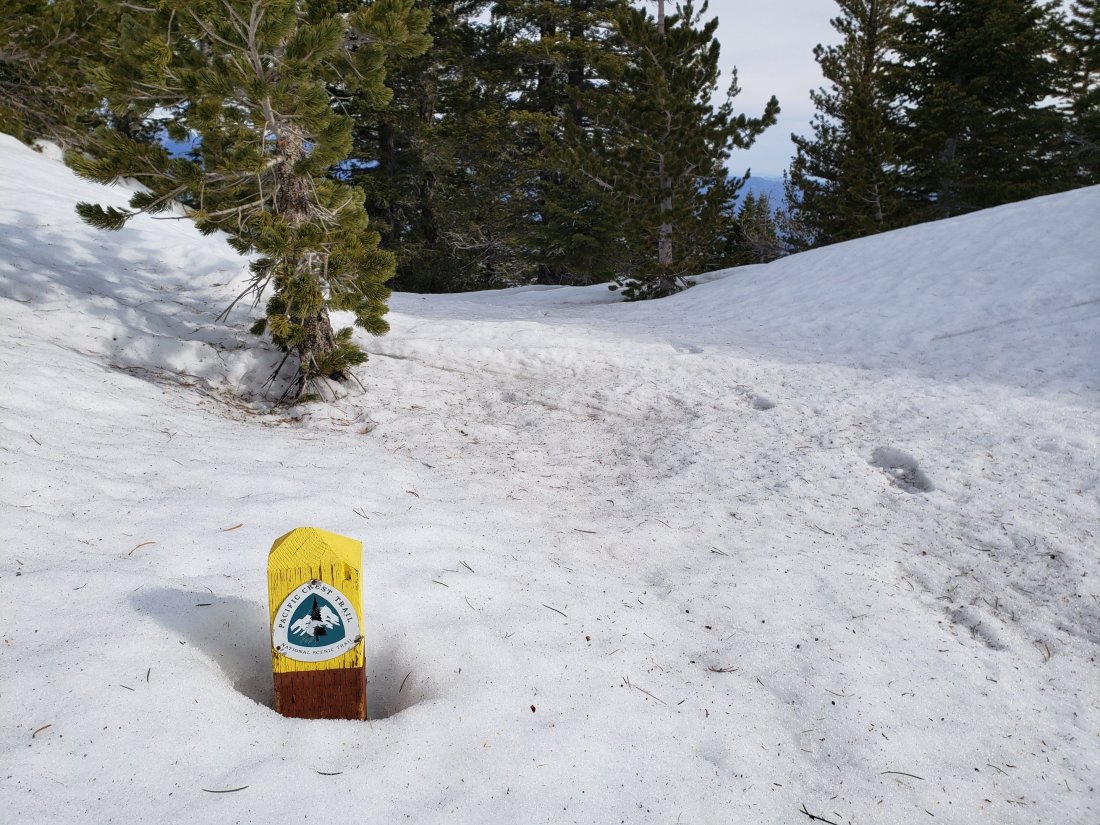
All trails, including the entire Pacific Crest Trail throughout the San Jacinto mountains, are free of snow, with a couple of very minor exceptions.
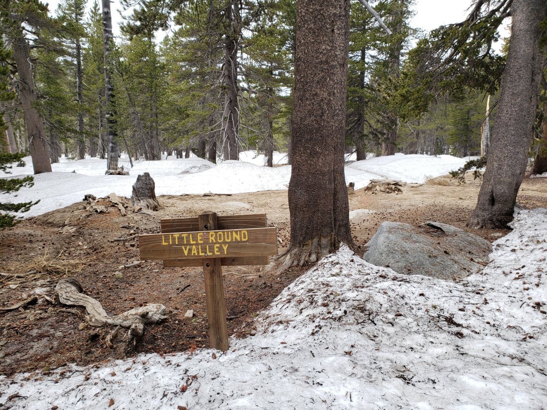
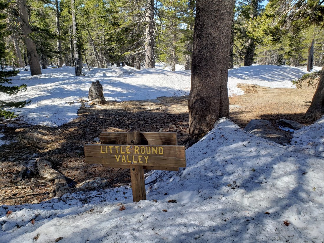
Deer Springs Trail There are a few tiny snow patches through Little Round Valley but it is snow-free from there to San Jacinto Peak. The campsites in LRV are snow-free.
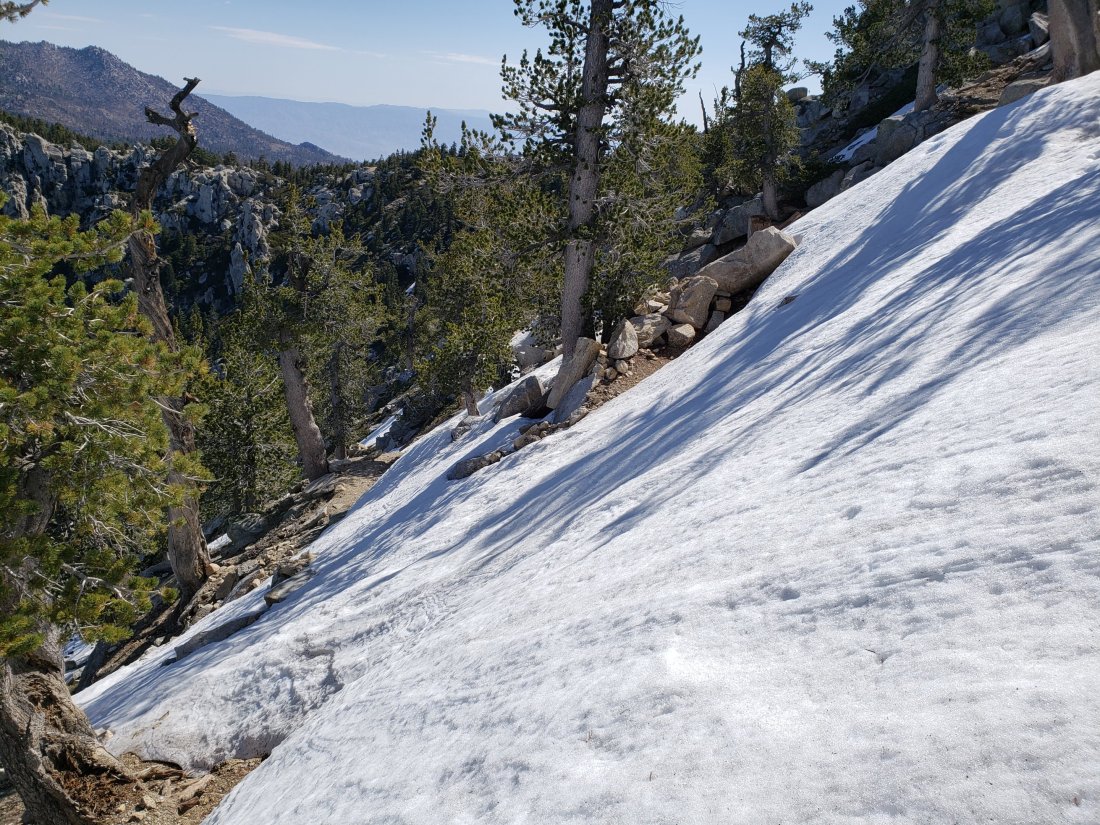
East Ridge Trail from near Miller Peak to San Jacinto Peak remains 10% snow-covered, with some drifted areas still 1-2 feet deep, but it is possible to follow almost the entire trail route without crossing drifts.
Note that as of my survey on 25th June, Willow Creek Trail has 26 trees down on the trail between Willow Creek and Hidden Divide. However this morning I passed to the USFS volunteer tree crew (Steve and Jana) who were going to start work on the 18 on the USFS side. Another team will apparently be working on the eight on the State Park side very soon.
I surveyed Seven Pines Trail on behalf of the State Park two weeks ago, and it has 35 trees down, almost all above 7500′ elevation. This trail has been very lightly traveled for many months, and is indistinct in places. Hikers without considerable prior experience of this trail should take great care with routefinding.
Black Mountain Road is easily passable, albeit a little bumpy in places, through to at least Fuller Ridge campground.
A reminder that the Caramba Trail from near Reeds Meadow through Laws Camp to Caramba is not maintained. When USFS reopened the trail in November 2018 they made it clear that it would not be maintained for the foreseeable future (and it had been closed since the Mountain Fire in July 2013). The trail is indistinct in places, and hikers without considerable prior experience of this trail should exercise very cautious navigation.
WATER STATUS: Eastern slope
The Round Valley pipe is flowing well. It was fitted with a new tap on 13th June (please turn it off after use). Flow rate yesterday (25th June) was about 2.0 gpm, which is as strong as it gets.
Both the northern and southern springs at Wellman’s Cienega are flowing well, but flow rates have dropped considerably in the last two weeks. These are the sources for Willow Creek, which is flowing very well where it crosses the Willow Creek Trail.
Tahquitz Valley is flowing.
Tahquitz Creek is flowing well at the northern end of Little Tahquitz Meadow. It is also flowing well further upstream at its source (known locally as Grethe Spring) where it crosses the PCT (approx. PCT Mile 177).
Skunk Cabbage Creek – that flows through Skunk Cabbage Meadow and then crosses the Caramba Trail near Reeds Meadow – is currently flowing well.
WATER STATUS: Western slope
The North Fork of the San Jacinto River is flowing very well where it crosses the Deer Springs Trail and even better where it crosses the Fuller Ridge Trail on the PCT (approx. PCT Mile 186.2).
O’Sullivan Creek (PCT Mile 186.4) on Fuller Ridge Trail is flowing well.
The creek in Little Round Valley is flowing the strongest I have seen in at least six years.
Shooting Star Spring (below Little Round Valley but above the North Fork of the San Jacinto River crossing) is flowing well.
The Deer Springs stream crossing at the PCT (approx. PCT mile 185.6) is flowing very strongly, as are several nearby seasonal tributaries.
Switchback Spring at PCT Mile 183.5 (about 0.4 miles north of Strawberry Junction) is flowing well, but there is little depth in which to filter water.
The little creek at Strawberry Cienega (PCT mile 183.0) is flowing well.
On Devil’s Slide Trail, Middle Spring is flowing well, but flow rate is only 10% compared to less than a month ago. Powderbox and Jolley springs, and the several unnamed ephemeral creeks on this trail, have functionally dried up.
On the Ernie Maxwell Trail, the crossing of Chinquapin Creek just below Humber Park continues to flow very well (an important source of water for the many dogs walked on this trail).
WATER STATUS: Desert Divide
Live Oak Spring (N 33 37 21, W 116 33 24) Flowing well. The most reliable water source on the Desert Divide.
Cedar Spring (N 33 40 36, W 116 34 35) Flowing well. Easiest access is the trough just upstream from the trail to the campsite.
Apache Spring (N 33 43 11, W 116 37 13) Flowing fairly well. See comments above regarding the greatly improved trail to this spring.
Spitler Peak Trail Descending the trail there are five water crossings. The first two, at 0.9 and 0.95 miles down, cross a tiny side creek which is largely dry and should be ignored. The next crossing, at 1.1 miles down, is Spitler Creek and is the best source of water (currently flowing well). The next two crossings are the same creek, but for obvious reasons it is best to fill up at the highest of the three crossings.
Antsell Rock Creek (N 33 41 52, W 116 39 08) Right by the Spitler Peak Trail trailhead on Apple Canyon Road, Antsell Rock Creek is flowing very well. Just on the upstream side of the road there is excellent access to the creek. Useful if hikers are descending the Spitler Peak Trail.
ACCESS CLOSURES The Valentine’s Day flood events continue to make access to the San Jacinto mountains challenging. Highway 243 between Banning and Idyllwild is closed from Skyland Ranch (north of Bay Tree Spring) to just north of Lake Fulmor. The remaining closed section may reopen this autumn, winter, or even not until 2020 (see this excellent article in the Press Enterprise). Highway 74 between Mountain Center and Hemet is currently open with a pilot car and restricted hours (0400-0800, 1800-0000) on weekdays, and broader hours (0400-0000) on weekends. It will not reopen without restrictions in late July as had been hoped. Instead it is expected to open round-the-clock but with a flagman and partial single lane traffic, perhaps sometime next month.