Snow storm update 27th May 2019

[UPDATE 29th May 2019: U.S. Forest Service has confirmed that the trail is NOT closed at the rock slide near PCT Mile 172.5. An official assessment will be made in the next few days. A closure notice would then take several more days to come into effect. Hence the trail will remain open at least into next week. Any signs to the contrary on the trail are not official and not accurate.]

[UPDATE 28th May 2019: we hiked to the PCT via South Ridge and Tahquitz Peak this morning, mainly to assess the challenging snow slope on the north side of Tahquitz, updated in the text below, with photo.]

This morning I had my last true snow hike of a memorable season, to San Jacinto Peak via Devil’s Slide Trail and Wellman Divide, descending the same way. Our third snow storm in the last eight days! It was still snowing very finely on me as I hiked up Devil’s Slide Trail past Saddle Junction until about 8600′, when I broke out into spectacular sunshine for the rest of the morning.

A light snowfall coated the entire mountain down to about 5500′, with five fresh inches at San Jacinto Peak. On top of the two storms last week, the Peak has had 20″ of snowfall in late May this year! Last night’s snow was an extremely fine grain powder, reminiscent of sand, and was so light that it was heavily drifting in the strong wind. It was delightful to hike in, with minimal postholing, and I didn’t use microspikes all the way to San Jacinto Peak (although I did use them on the uppermost descent).

Yesterday and overnight in Idyllwild we had drizzle and rain (0.53″ at 5550′), which briefly turned to snow early this morning (0.25″).

Exceptionally rapid melting was already well underway during my descent. It felt like it was raining coming through the wooded sections with so much snow melt falling from the trees. Devil’s Slide Trail below 7000′ was already completely clear of snow by noon today, when just five or so hours earlier I had hiked up in a continuous couple of inches of lovely fresh powder. There was no sign that Humber Park or Idyllwild had even received any overnight snow by early this afternoon.

I recorded an unneccessarily long and rambling video (sorry!) just after 0900 this morning at San Jacinto Peak, available on YouTube here.

Melting is so rapid, and with a very strong warming trend forecast, that equipment recommendations may change daily. Currently, I suggest microspikes will be useful for some trails above about 7000′, especially early tomorrow morning, and likely for a few more days at the highest elevations, especially for descending San Jacinto Peak. The PCT will largely clear in the next day or two, at least below 8000′.

Waterproof or water resistant footwear is strongly recommended on approach trails at least (e.g., Devil’s Slide, lower Deer Springs) due to considerable water flowing in the trails and slushy melting snow everywhere. It will also be invaluable for at least the next few days elsewhere in soft melting snow.

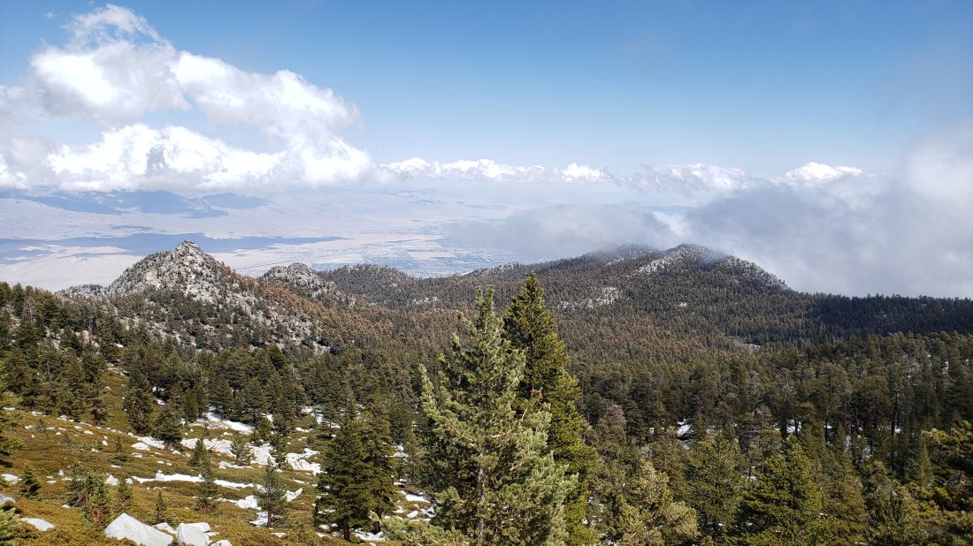
Tahquitz Peak and Tahquitz Rock emerging from the cloud at around noon today, 27th May 2019.

WEATHER Other than what I recorded at the Peak this morning (see below), the weather will be warm the rest of this week, hot next week. A very significant warming trend will commence tomorrow, leading to almost complete melting everywhere by or in the first week of June. There is a slim chance of brief afternoon thunderstorms tomorrow and Wednesday, May 28th and 29th. For the rest of May hikers should still be prepared for temperatures near freezing in the high country, and potentially below freezing with windchill on some days.

At San Jacinto Peak (10,810ft/3295m) today, 27th May 2019, at 0855 the air temperature was 25°F (-4°C), with a windchill temperature of 5.5°F (-14°C), 52% relative humidity, and a very sharp WNW wind at 12 mph gusting to 28.6 mph.

At the Peak on 23rd May 2019 at 1055 the air temperature was 24.4°F (-4°C), with a windchill temperature of 9.5°F (-12.5°C), 100% relative humidity, and a brisk West wind at 10 mph gusting to 15.5 mph.

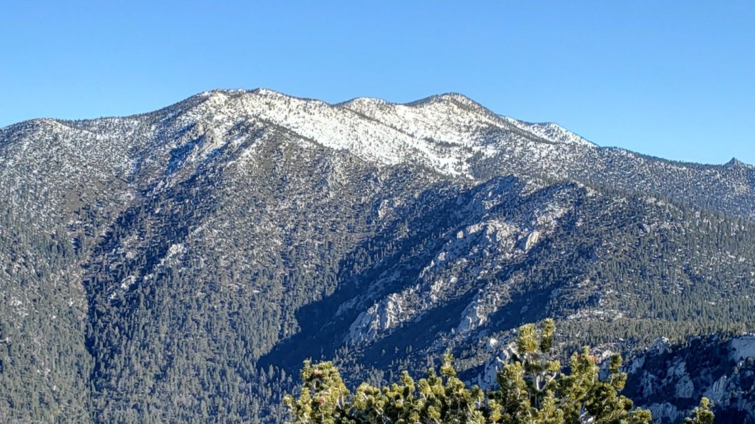
Jean Peak (10,670′) early this morning, 27th May 2019, from the Peak Trail.

TRAIL CONDITIONS

All trails above 6000′ were completely covered with 1-5″ of fresh snow this morning, but by this afternoon very rapid melting meant that most areas below 8000′ were already becoming very wet and slushy, or were already clear (<7000′).

All trails above 9000′ are currently under continuous snow cover roughly 4-20″ deep but this situation will change dramatically with melting in the next few days.

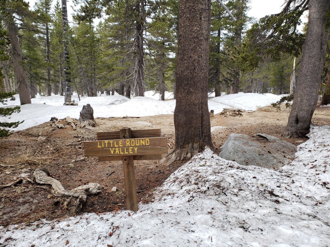
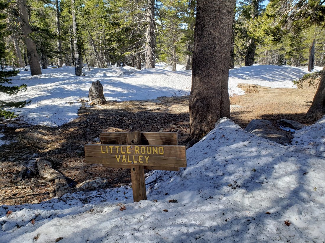
Reasonable tracks to follow are already in place for the PCT throughout the San Jacinto mountains. Reliable, well-traveled tracks are also in place for Devil’s Slide Trail, and the Wellman and Peak trails on the east side, and through Round and Long valleys to the Tram. It is likely that Deer Springs and Marion Mountain trails will be hiked today given the holiday and the traffic I witnessed on the lower trails on my descent.

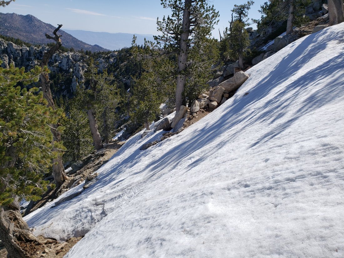
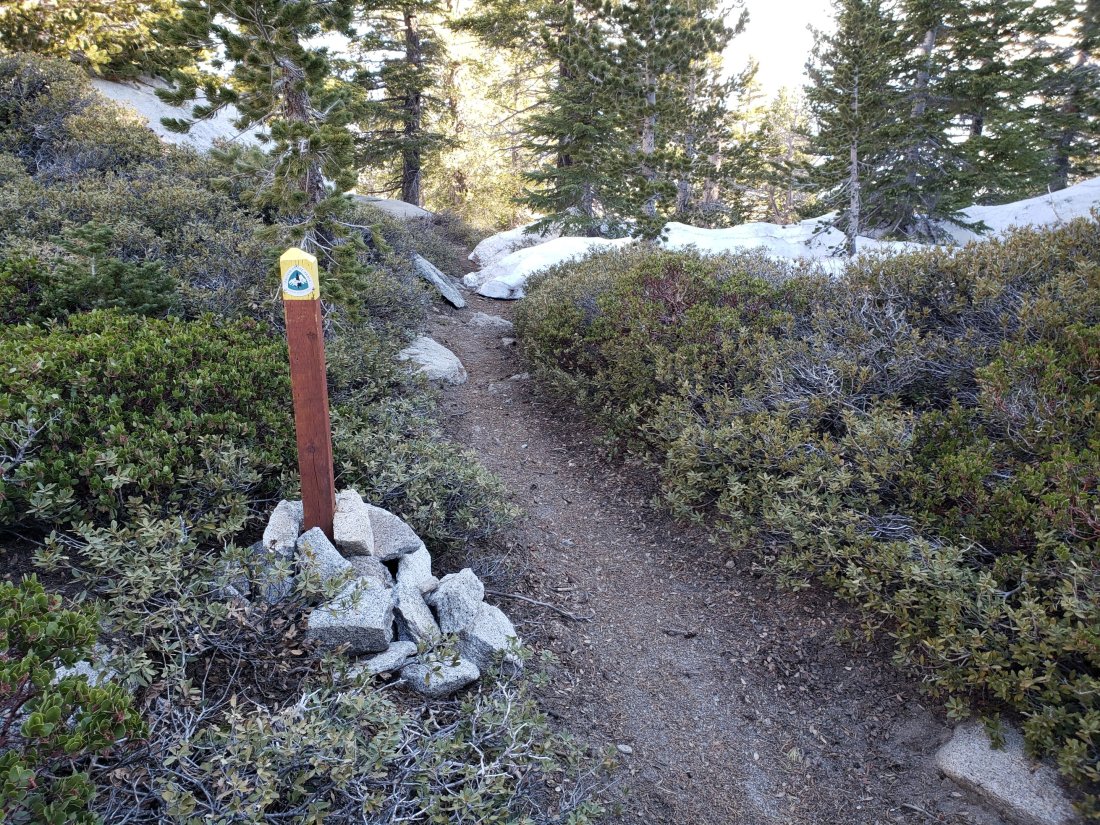
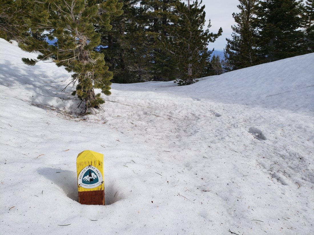
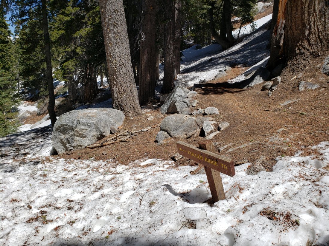
Pacific Crest Trail Early this morning snow cover was thin and patchy from about Mile 158 to 163, and then continuous thereafter, and at least a couple of inches deep, through to at least Mile 194. See however the comments above regarding melting. Microspikes are unlikely to be needed anywhere on the PCT by about Thursday 30th May.

Note that the much-reported rockfall at about Mile 172.5 (Antsell-South Peak) is basically one huge rock and is passable with some minor scrambling (thanks to multiple PCT hikers for confirming this information). The area was assessed today by the PCTA Trail crew. USFS will make a determination as to any possible closure shortly and I will update as necessary.

Tahquitz Peak trail from the PCT/ Chinquapin Flat is tricky again with the recent snowfalls. Microspikes (in conjunction with an ice axe, if you are familiar with its use) and considerable caution are recommended for this section. There are reasonable steps to follow in the softening snow, but with a couple of short steep icy patches. The situation is improving rapidly with considerable melting.

The steepest section of trail on the north side of Tahquitz Peak, mid-morning of 28th May 2019

SNOW DEPTHS measured on 27th May are as follows (for those areas that had snow remaining from the winter, plus snow from last week’s stroms, the combined average total is indicated in parentheses). For locations that were measured on 20th May and then [estimated] on 23rd May, see those data in the previous report (I have not re-estimated those locations due to the rapid nature of recent melting). Average depth is given, drifts may be significantly deeper than the average in places. Altitudes are approximate.

San Jacinto Peak (10,810′): 5″ (total 20″)

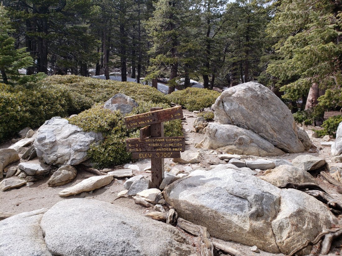
Wellman Divide (9700′): 4″ (total 10″)

Annie’s Junction (PCT Mile 181.5 at State Park boundary) (9050′): 3″ (total 6″)

Long Valley (8500′): 2″ (almost completely melted by the time of writing)

Saddle Junction (8070′): 2″ (total 3″, largely melted by this afternoon)

Devil’s Slide Trail at Humber Park (6550′): 0.5″ (now all melted)

Idyllwild (at 5550′): 0.25″ (now completely melted)

Trail sign at Annie’s Junction (9050′) today 27th May 2019 (above) and just eleven days earlier on 16th May 2019 (below).

Snow storm update 23rd May 2019

[UPDATE 25th May 2019: as anticipated in the text below, snow melt has been extremely rapid. For example Long Valley (8500′) almost completely cleared of snow yesterday. However, precipitation is now very likely on Sunday 26th May at all elevations, with light snow forecast for the high country above about 6000′.]

Today we had a superb hike with Jenn Murdock to San Jacinto Peak ascending on the east side via Devil’s Slide Trail and Wellman Divide, returning the same way. Tim Dailey joined us early and helped break trail to 8500′.

Two days after we got our May snowstorm (described here) we got another one! Slightly less snowfall yesterday than on Sunday, but the combined effect has been quite dramatic, especially for late May.

The entire mountain from 5000′ to the Peak was in the cloud all day, with light fine drizzle on the ascent and descent of Devil’s Slide Trail, and a fine damp fog everywhere else, with visibility occasionally under 50 yards. The sun tried but failed to break through a couple of times when we were at San Jacinto Peak.

I recorded a short video at about 1055 this morning at San Jacinto Peak, available on YouTube here.

Microspikes are currently recommended at all elevations above about 7000′. Melting is expected to b very rapid, and the elevation at which spikes are useful may rise rapidly. Snow depths were great for snowshoeing above about 9000′ elevation (and I even wore them down to 8100′ on the descent) but that situation will also change soon with the rapid melting likely in the next few days.

Waterproof footwear is strongly recommended on approach trails at least (e.g., Devil’s Slide, lower Deer Springs) due to considerable water flowing in the trails and slushy melting snow everywhere. It will also be invaluable for at least the next few days elsewhere in soft melting snow.

Due to the time of year (high sun angle) and the warmth of the ground before the snow fell this week, melting will be unusually rapid during the warming trend over the next week or so. Conditions will therefore change rapidly. I do not anticipate updating the Trail Report for at least 3-4 days, so do not be surprised to find somewhat less snow over this weekend (and definitely next week) than currently described here.

WEATHER Overall a significant warming trend will commence tomorrow, which will be especially pronounced next week. However May 26th and 27th will be cool and overcast with the possibility of light precipitation on Sunday 26th (perhaps a few inches of snow in the high country) . Hikers should be prepared for temperatures near or below freezing in the high country, and potentially well below freezing with windchill on some days.

At San Jacinto Peak (10,810ft/3295m) today, 23rd May 2019, at 1055 the air temperature was 24.4°F (-4°C), with a windchill temperature of 9.5°F (-12.5°C), 100% relative humidity, and a brisk West wind at 10 mph gusting to 15.5 mph.

At the Peak on 20th May 2019 at 1050 the air temperature was 19°F (-7°C), with a windchill temperature of -2°F (-19°C), 88% relative humidity, and an icy NW wind at 14 mph gusting to 25 mph.

TRAIL CONDITIONS

All trails above 6000′ were completely snow-covered this morning, but by this afternoon some melting meant that most areas below 7000′ were already becoming very wet and slushy.

All trails above 8000′, including much of the PCT in the San Jacinto mountains, are currently under continuous snow cover 4-15″ deep (deeper in areas that retained snow since the winter, see data below).

Reasonable tracks to follow are already in place for the PCT at least from Saddle Junction (approx PCT Mile 179.7) all the way through Fuller Ridge.

Reliable, well-traveled tracks are also in place for Devil’s Slide Trail, and the Wellman and Peak trails on the east side. Good friend of the Trail Report Kyle Eubanks also broke reliable trail from Wellman Divide through Round and Long valleys to the Tram last night.

Upper Deer Springs Trail from the Peak down to the Fuller Ridge Trail junction has NOT had any traffic and currently has no tracks to follow. Marion Mountain and Seven Pines trails have not been hiked since the fresh snowfall.

Pacific Crest Trail Snow cover is likely thin and patchy from about Mile 158 to 163, and then continuous thereafter, and at least several inches deep, through to at least Mile 194. PCT hikers not comfortable with angled snow/ice travel should consider the Black Mountain Road alternative to Fuller Ridge, at least for the next week or so.

SNOW DEPTHS measured today 23rd May are as follows (for those areas that still had snow remaining from the winter, the combined total is indicated in parentheses). Locations that were measured on 20th May are shown as [estimated] based on likely additional accumulation from yesterday’s storm at that elevation. Average depth is given, drifts may be significantly deeper than the average in places. Altitudes are approximate.

San Jacinto Peak (10,810′): 15″ (total 23″)

Peak Trail (at and above 10,000′): 13″

Little Round Valley (9800′): 13″ (total 28″) [estimated]

Wellman Divide (9700′): 10″

Pacific Crest Trail at south end of Fuller Ridge Trail (8950′): 9″ [estimated]

Annie’s Junction (PCT Mile 181.5 at State Park boundary) (9050′): 9″

Long Valley (8500′): 3″

Strawberry Junction (8100′): 4″ [estimated]

Saddle Junction (8070′): 5″

Devil’s Slide Trail at Humber Park (6550′): 3″ (at 0600 this morning, now largely melted)

Idyllwild (at 5550′): 1.75″ (last night, now completely melted)

Wellman Divide on 23rd May 2019 (above) and on 16th May 2019 for comparison (below).

Junction sign at south end of Fuller Ridge Trail (8940′) on 20th May 2019 (above), and ten days earlier on 10th May 2019 for comparison (below)

Brief snow update 22nd May 2019

[UPDATE 22nd May at 2020: contrary to what was generally forecast, heavy snowfall accumulated rapidly at all elevations above 5000′ in mid-afternoon today. In Idyllwild we had 1.75″ in about two hours, with 3-4″ reported in Pine Cove, and 2-3″ in Long Valley. An additional 4″ fell at Wellman Divide (for a total this week of 10″) and 6″ fell above 10,000′ (for a total of 14″). The snow stopped and the mountain partly cleared at about 1700 this evening, with melting already underway in Idyllwild at dusk. I hope to do a comprehensive update of conditions tomorrow afternoon.][Many thanks to Kyle Eubanks for snow data from the Tram side of San Jacinto Peak.]

We hiked this morning to Tahquitz Peak (8836′) via South Ridge Trail, also checking the trail from Tahquitz through to Chinquapin Flat. For a more detailed review of the trails since the snow storm on 20th May, see the previous report. I recorded the following video at Tahquitz at about 1100 this morning.

After recording that video, there has been more snowfall in the high country, with for example 1-2″ fresh snow at Long Valley (8500′) since 0800 this morning. We hiked through some very light snowfall (graupel) on South Ridge on our descent also. The highest peaks (>10,000′) were above the cloud for most of the morning at least.

Melting has removed most snow below 8000′ (and almost all snow below 7000′). However freeze-thaw cycles have turned remaining snow icy, so microspikes are recommended everywhere above 8000′ at present, and may be useful at lower elevations in some places. This advice will remain valid throughout the Memorial Day weekend.

Tahquitz Peak trail to Chinquapin Flat is readily passable with microspikes for those comfortable with basic snow hiking, as the trail has no significant angled icy patches and only 1-3″ snow on the trail (see photo below).

The steepest section of the Chinquapin Flat to Tahquitz Peak trail this morning, 22nd May 2019.

WEATHER More light precipitation is forecast at all elevations for this afternoon and tonight (at least 2-4″ snow above 8000′), and then again in the middle of the day tomorrow, 23rd May. A warming trend – with steady melting of snow – will slowly take hold commencing Friday 24th.

Above and below, spectacular rime ice patterns on the rocks at Tahquitz Peak ths morning, 22nd May 2019.

Snow storm update 20th May 2019

Today we hiked to San Jacinto Peak ascending on the east side via Devil’s Slide Trail and Wellman Divide, then descending the west side down Deer Springs Trail. This included two short sections of the PCT (roughly Miles 180-182 and 184-186). I broke trail through fresh snowfall almost all of the ascent and then back down to the south end of Fuller Ridge.

Well we got our May snowstorm! Seemingly without fail – even in very dry years – we get at least one snow event in May. Credit to NOAA/National Weather Service, who typically wildly overestimate their snowfall predictions, they got this one almost exactly right, with 9″ of fresh snow at San Jacinto Peak (measured snow depths today are listed below). It looks like we may quickly follow up with a second snow storm on Wednesday 22nd. In Idyllwild at 5550′ we received 1.29″ of rainfall, and <0.25″ of snow, in the past 24 hours.

I was pleased to see that many of the PCT hikers that I had spoken to yesterday at Nomad Ventures in Idyllwild had taken advice to get back on the trail today, taking advantage of a decent weather window. Even on the short sections of the trail I did, I encountered close to 30 thru hikers heading north. One of them, Don Kreitz, accompanied me to the Peak, and was treated to a spectacular (if chilly) morning up there.

I recorded a video at about 1045 this morning at San Jacinto Peak in a strong and frigid NW wind, available on YouTube here.

At present the PCT in the San Jacinto mountains is passable for most hikers without microspikes. Depending on confidence and experience on angled icy snow, some PCT hikers will prefer to use microspikes, especially on Fuller Ridge. However this situation may change rapidly as freeze-thaw cycles, and the possibility of additional snowfall, make the snow increasingly icy and treacherous. IF IN DOUBT, CARRY MCROSPIKES.

Microspikes remain recommended for ascending and descending from San Jacinto Peak, at least. Snow depths were marginal for snowshoeing, but it would be possible above about 9000′ elevation.

WEATHER Rain is possible again tomorrow, Tuesday 21st, especially overnight into Wednesday 22nd. Further rain is likely in the middle of the day Wednesday, including the possibility of light snowfall down to 6000′. Snow is forecast throughout the mountain that day, with several inches likely in the high country. Drier and slightly warmer weather is likely starting Thursday 23rd May.

Hikers must be prepared for temperatures below seasonal averages everywhere, below freezing in the high country, and well below freezing with windchill.

At San Jacinto Peak (10,810ft/3295m) today, 20th May 2019, at 1050 the air temperature was 19°F (-7°C), with a windchill temperature of -2.0°F (-19°C), 88% relative humidity, and an icy NW wind at 14 mph gusting to 25 mph.

At the Peak on 16th May 2019, at 1345 the air temperature was 27°F (-3°C), with a windchill temperature of 8.4°F (-13°C), 100% relative humidity, and a sharp SW wind at 15 mph gusting to 24 mph.

San Gorgonio as seen from San Jacinto Peak this morning, 20th May 2019, with cloud pouring through the pass at about 9000′ elevation.

TRAIL CONDITIONS

All trails above 6000′ were completely snow-covered this morning, but by this afternoon some rapid melting meant that most areas below 7000′ were already clear of snow, trails below 8000′ were melting fast, and there was partial melting of exposed sections of trail below 9000′.

Almost all trails above 7500′, including much of the PCT in the San Jacinto mountains, are currently under continuous light snow cover 2-9″ deep.

Reliable tracks to follow are already in place for the PCT at least from Saddle Junction (approx PCT Mile 179.7) all the way through Fuller Ridge.

Reliable tracks are also in place for Devil’s Slide Trail, the Wellman and Peak trails on the east side, and the entire Deer Springs Trail on the west side. Good friend of the Trail Report Kyle Eubanks also broke reliable trail from Wellman Divide through Round and Long valleys to the Tram this morning.

Marion Mountain and Seven Pines trails have not been hiked since the fresh snowfall.

Pacific Crest Trail Snow cover is likely thin and patchy from about Mile 158 to 163, and then increasingly continuous thereafter, through to about Mile 194.

Deer Springs Trail was rapidly clearing of snow below Strawberry Junction (8100′) this afternoon, although much of the trail was through wet slushy snow, or was a meltwater creek, so waterproof footwear is recommended.

SNOW DEPTHS measured today 20th May are as follows (for those areas that still had snow remaining from the winter, the combined total is indicated in parentheses). Average depth is given, drifts may be significantly deeper than the average in places. Altitudes are approximate.

San Jacinto Peak (10,810′): 9″ (total 17″)

Peak Trail (at and above 10,000′): 8″

Little Round Valley (9800′): 7″ (total 22″)

Wellman Divide (9700′): 6″

Pacific Crest Trail at south end of Fuller Ridge Trail (8950′): 6″

Annie’s Junction (PCT Mile 181.5 at State Park boundary) (9050′): 5″

Long Valley (8500′): 2″

Strawberry Junction (8100′): 3″

Saddle Junction (8070′): 4″

Devil’s Slide Trail at Humber Park (6550′): 1.5″ (at 0600 this morning, now largely melted)

Wellman Divide on 20th May 2019 (above) and on 16th May 2019 for comparison (below).

Junction sign at south end of Fuller Ridge Trail (8940′) on 20th May 2019 (above), and ten days earlier on 10th May 2019 for comparison (below)

Storm update 19th May 2019

I have spent the day hearing stories from PCT hikers in Idyllwild of challenging weather overnight, with probably all hikers bailing off the mountain at some point this morning (some even packing up camp in the early hours to descend).

Wind gusts were especially severe in the night. First hand reports of tents being literally destroyed by very strong winds came from Fobes saddle, between Spitler and Apache peaks, and near Red Tahquitz.

Snowfall totals were all in the range of 1-3″, with 2-3″ at San Jacinto Peak, about 2″ at Strawberry Junction (8100′) and on the north side of Red Tahquitz (8300′), 1-2″ at about 6500′ in upper Pine Cove, 1″ at Long Valley (8500′), and <1″ at Black Mountain (7700′). This depth of snow should not significantly impact route finding on the trail system. In many locations, slightly warmer conditions later in the morning turned the precipitation to rain, and there was no evidence of the snow by later in the day (e.g., at Long Valley).

Rainfall in Idyllwild (at 5550′) in the last 24 hours has been 0.84″, and 0.25″ at Long Valley. By this afternoon the rainfall had become very patchy, and the upper mountain was above the cloud in largely blue sky conditions.

WEATHER Further precipitation is forecast for tonight, mainly at lower to mid-elevations, with less than one inch of snow forecast for San Jacinto Peak, but potentially half-an-inch of rain, or even 1-2″ snow, at the elevation of Idyllwild (5000-6000′). Severe winds are again forecast for Tuesday 21st, and heavier precipitation (perhaps several inches of snow in the high country) for Wednesday 22nd.

There will be a full update on trail, snow, and weather conditions tomorrow afternoon (Monday 20th May).

Storm and trail update 17th May 2019

[UPDATE 19th May 2019, 1150: Rainfall so far today has been 0.68″ in Idyllwild. It snowed barely an inch over 6000′ overnight, with 2″ (5cm) snow at San Jacinto Peak. Much snow has already melted this morning at the elevation of Long Valley (8500′). After some rainfall, it is now sleeting again in the high country. Extreme winds have been reported, especially along the Desert Divide (approx PCT Miles 157-175).]

[WEATHER UPDATE 18th May 2019: A winter weather warning has been issued for the next two days available here. Although these tend to overestimate snowfall in the San Jacinto mountains, some precipitation is likely and it will be very cold. Temperatures well below freezing (10-30 degrees below freezing with windchill) are expected for much of the next six days, 19th-24th May, in the San Jacinto high country.]

Yesterday we hiked to San Jacinto Peak in the rain, hoping for some snow up high. After a few hours around the Peak we descended via Wellman Divide and Devil’s Slide Trail in clearer conditions. The rain started and ended a couple of hours earlier than forecast, between about 0700-1300, and the system was milder than expected with no snowfall even at the Peak. In Idyllwild at 5550′ we received 0.20″ rain, but rainfall was significantly heavier than that between about 8000-10,000′ elevation.

I recorded the following short video at San Jacinto Peak on 16th May.

At about 1400 as we descended, the high country cleared (see photo below) but Idyllwild and the mountain below about 9000′ largely remained in the cloud until dusk.

Details of trail conditions are below. I am no longer updating snow depths as most areas below 10,000′ are largely clear (albeit with some persistent drifts around). Currently I am not updating water conditions. Due to rainfall and rapid snow melt all established water sources are flowing well, and many ephemeral sources are flowing also.

With this mild system and rainfall, melting has continued rapidly. The PCT in the San Jacinto mountains is now safely passable for hikers without microspikes. Depending on confidence and experience on icy snow, some PCT hikers may still prefer to use microspikes, especially on the north end of Fuller Ridge (aroud Mile 190).

Microspikes remain useful (but not essential) above 9700′ in some areas, especially descending from San Jacinto Peak, in particular on the western (Deer Springs Trail) route.

The high country after the rain. Looking east down on Round and Long valleys, with Cornell Peak to the left, at about 1430 on 16th May 2019.

WEATHER Following a couple of milder days, there is the chance of light precipitation on most days from Sunday 19th to Thursday 23rd May. Temperatures will be below seasonal averages, and at or below freezing in the high country (well below freezing with windchill). Light snowfall at the highest elevations is a possibility on several days in the next week.

At San Jacinto Peak (10,810ft/3295m) yesterday, 16th May 2019, at 1345 the air temperature was 27°F (-3°C), with a windchill temperature of 8.4°F (-13°C), 100% relative humidity, and a sharp SW wind at 15 mph gusting to 24 mph.

At San Jacinto Peak on 11th May 2019, at 1530 the air temperature was 30°F (-1°C), with a windchill temperature of 15°F (-9°C), 97% relative humidity, and a fresh NE wind at 12 mph gusting to 20 mph.

TRAIL CONDITIONS

Trails above about 8700′ remain partly snow-covered. All main trails are now well traveled, and have good tracks to follow which largely align with the established trail system.

Pacific Crest Trail The trail is clear of snow from Highway 74 (Mile 151) to about Mile 174 (Red Tahquitz) after which the trail has a few snow patches to about Mile 179. There is a short section with about 80% snow cover near Mile 181. There is patchy snow on Miles 185-186 at about 30% coverage.

Fuller Ridge Trail (approx. PCT Miles 185.5-190.5) can be traversed without microspikes, although they are useful for those less experienced on angled icy snow. Snow patches are frequent enough to use microspikes for parts of the five mile length of the Fuller Ridge Trail, briefly around Miles 187.5-188, and then more continuously on Miles 188.5-190. Particularly at the northernmost end, the track does not follow the trail in places, and there are a couple of steeper descents.

San Jacinto Peak trails On the eastern side, the Wellman Trail from Annie’s Junction (PCT turning near Mile 181.5) to Wellman Divide (9700′) is clear of snow. The Peak Trail from Wellman Divide to the Peak averages less than 20% snow-covered and the track now largely follows the trail route, but microspikes remain useful, especially for descending those areas where stubborn icy snow patches remain. The East Ridge Trail remains almost completely under snow. On the western side, the upper Deer Springs Trail from Little Round Valley is about 60% snow-covered through the Valley, 50% covered on the ascent to the Peak, and about 50% snow-covered at San Jacinto Peak itself. The tracks through the snow patches now largely follow the route of the Deer Springs Trail. Microspikes are recommended in places, especially for descending from the Peak to about 9600′.

Tahquitz Peak trail from Chinquapin Flat was updated in detail earlier this week. Microspikes are no longer required for the steps through the very short remaining sections of icy snow.

Black Mountain Road is clear of snow. No microspikes are required to hike to the PCT. The road has been cleared, repaired, and partially graded to the turning to Boulder Basin, and cleared and repaired to the Fuller Ridge campground.

Skyline Trail is clear. C2C hikers have not been encountering snow until well past Long Valley Ranger Station.

Devil’s Slide Trail is clear of snow.

Tahquitz meadows trails are clear of snow with only occasional small patches to cross. No microspikes required.

Deer Springs Trail is clear of snow to Strawberry Junction (8100′) and almost completely clear to the Seven Pines Trail junction. There is about 20% snow cover from there to the Fuller Ridge Trail junction, but microspikes are no longer required. The track above the Fuller Ridge junction now follows the trail and there is only about 20% snow cover as the trail nears Little Round Valley. For the section through and beyond Little Round Valley, see “San Jacinto Peak trails” above.

Marion Mountain Trail is clear of snow.

Tahquitz trail update 14th May 2019

We hiked up South Ridge to Tahquitz Peak and across to Chinquapin Flat this morning. With a couple of recent warm days, the notoriously stubborn icy snow on the north side of Tahquitz Peak is now sufficiently melted for that trail to be safely passable without additional traction (such as microspikes). The hardest section of that trail is shown in a short video available on YouTube.

Otherwise trail conditions are not substantially different from the previous report of three days ago, linked here. The necessity for microspikes continues to diminish with continued rapid melting everywhere until Thursday, as I describe in the video.

WEATHER Cooler conditions arrive tomorrow, with the possibility of light snow (<2″) in the high country on Thursday 16th, and rain at lower elevations. Temperatures will be below (or well below) freezing on 16th and 17th. Below seasonal temperatures are forecast to continue well into next week, with several further chances for very light precipitation.

San Jacinto high country as seen from Tahquitz Peak today 14th May 2019 (above) and the same view six weeks earlier on 30th March 2019 (below).

Weather and trail update 11th May 2019

This afternoon I hiked to and from San Jacinto Peak via Devil’s Slide Trail and Wellman Divide, having done the same via Marion Mountain and upper Deer Springs trails on 10th May. On 8th May we hiked to Tahquitz Peak from home, checking trails all around that mountain. I recorded a video at 0920 on 10th May in the cloud at San Jacinto Peak available on YouTube at this link.

Today I wanted to see if there was any chance of snow in the high country as had been forecast. While the trees above 10,300′ were plastered with thick rime, alas no snow.

Idyllwild was in the cloud all morning on 10th and it was trying to drizzle in Pine Cove (6300′) at first light. On our ascent of Marion Mountain Trail we quickly emerged from the cloud, only to find another layer 3000′ higher enshrouding the high peaks. The lower cloud was a classic marine layer (“May grey”) coming from the west, while the upper layer was moving in the opposite direction driven by high elevation easterly winds. Where both levels were visible, the effect was spectacular.

Black Mountain (to the left) and Fuller Ridge as seen from Marion Mountain Trail, early morning of 10th May 2019.

Despite recent cooler weather, snowmelt has continued rapidly, with many areas below about 9500′ now clear or largely clear of snow, and sun-exposed slopes from San Jacinto Peak down now partly or largely clear too. The PCT in the San Jacinto mountains is now safely passable for most hikers without microspikes. Depending on confidence and experience on icy snow, some PCT hikers will still prefer to use microspikes, especially on the north end of Fuller Ridge (about Miles 189-191).

Microspikes remain recommended above 9700′ in some areas, especially descending from San Jacinto Peak, and in particular on the western (Deer Springs Trail) route.

WEATHER There will be yet another rapid warming trend over the next couple of days. Light rain is possible on 12th May at all elevations.

At San Jacinto Peak (10,810ft/3295m) today, 11th May 2019, at 1530 the air temperature was 30°F (-1°C), with a windchill temperature of 15°F (-9°C), 97% relative humidity, and a fresh NE wind at 12 mph gusting to 20 mph.

At the Peak on 10th May 2019, at 0915 the air temperature was 29°F (-2°C), with a windchill temperature of 15°F (-9°C), 100% relative humidity, and a cool ENE wind at 5 mph gusting to 15 mph.

TRAIL CONDITIONS

Many trails above about 9000′ remain partly snow-covered. Details for specific routes are below. Hikers should be prepared for temperatures near freezing in the high country for several days this week (below freezing when considering windchill effects). All main trails are now well traveled, and have good tracks to follow which largely align with the established trail system.

Pacific Crest Trail The trail is clear of snow from Highway 74 (Mile 151) to about Mile 174 (Red Tahquitz) after which the trail is only patchily 10% snow-covered to about Mile 179. There is a short section with about 90% snow cover near Mile 181. Many nobo PCT hikers have been missing the hard left uphill turning at Annie’s Junction (approx. Mile 181.5) in the patchy snow. There is patchy snow on Miles 185-186 at about 30% coverage.

Fuller Ridge Trail (approx. PCT Miles 186-191) can be traversed without microspikes, although they are useful for those less experienced on angled icy snow. Snow patches are frequent enough to use microspikes for parts of the five mile length of the Fuller Ridge Trail, briefly around Miles 187.5-188, and then more continuously on Miles 189-191. Particularly on the northernmost two miles, the track does not follow the trail in places, and there are a couple of steeper descents.

San Jacinto Peak trails On the eastern side, the Wellman Trail from Annie’s Junction (PCT turning near Mile 181.5) to Wellman Divide (9700′) is clear of snow. The Peak Trail from Wellman Divide to the Peak averages less than 40% snow-covered and the track now largely follows the trail route, but microspikes remain useful, especially for descending those areas where stubborn icy snow patches remain. The East Ridge Trail remains completely under snow. On the western side, the upper Deer Springs Trail from Little Round Valley is about 70% snow-covered through the Valley, 60% covered on the ascent to the Peak, and about 50% snow-covered at San Jacinto Peak itself. The tracks through the snow patches now largely follow the route of the Deer Springs Trail. Microspikes are recommended in places, especially for descending from the Peak to about 9600′.

Black Mountain Road is clear of snow. No microspikes are required to hike to the PCT. Beyond the Fuller Ridge campground turning there are some very limited snow patches down to about 7300′ elevation. For vehicular access, Black Mountain Road has been cleared, repaired, and partially graded to the turning to Boulder Basin, and cleared and repaired to the Fuller Ridge campground.

Skyline Trail is clear. C2C hikers have not been encountering snow until well past Long Valley Ranger Station.

Devil’s Slide Trail is clear of snow.

Tahquitz meadows trails are functionally clear of snow with only occasional patches to cross. No microspikes required.

Deer Springs Trail is clear of snow to Strawberry Junction (8100′) and almost completely clear to the Seven Pines Trail junction. There is about 20% snow cover from there to the Fuller Ridge Trail junction, but microspikes are no longer required. The track above the Fuller Ridge junction now follows the trail and there is only about 20% snow cover as the trail nears Little Round Valley. For the section through and beyond Little Round Valley, see “San Jacinto Peak trails” above.

Marion Mountain Trail is clear of snow.

Tahquitz Peak trail from Chinquapin Flat There are some steps to follow through the short (but steep) remaining sections of icy snow. Microspikes in conjunction with hiking poles (or ideally an ice axe if you know how to use it) remain strongly recommended for this challenging trail until it is clear of snow (likely one to two more weeks).

Short but challenging section of trail from Tahquitz Peak to Chinquapin Flat, 8th May 2019.

South Ridge Trail is clear of snow to Tahquitz Peak. South Ridge Road was repaired and graded on 7th May and is passable to the trailhead to all vehicle types.

SNOW DEPTHS measured on 10th May (or on various recent dates as indicated in parentheses) are as follows. Current average depth is given; drifts can be much deeper than the average in places. Altitudes are approximate.

San Jacinto Peak (10,810′): 10″ (was 75″ on 22nd March)

Little Round Valley (9800′): 15″ (with drifts 2-3 feet in places)

Wellman Divide (9700′): 0″ (but with drifted patches nearby)

Pacific Crest Trail at south end of Fuller Ridge Trail (8950′): 1″

Annie’s Junction (PCT Mile 181.5 at State Park boundary) (9050′): 4″ (on 6th May)

Long Valley (8500′): 0″

Strawberry Junction (8100′): 0″

Saddle Junction (8070′): 0″ (was 20″ on 22nd March)

Sign at upper end of Little Round Valley (9850′) on 10th May 2019 (above), and 1st May 2019 for comparison (below).

Junction sign at south end of Fuller Ridge Trail (8940′) on 10th May 2019 (above), and about three weeks earlier on 18th April 2019 for comparison (below)

Trail update 6th May 2019

[UPDATE 8th May: we hiked South Ridge to Tahquitz Peak this morning. South Ridge Road was repaired and fully graded yesterday. I have updated the status of the challenging Tahquitz Peak to Chinquapin Flat trail also.]

This morning we briskly hiked to and from San Jacinto Peak via Devil’s Slide Trail and Wellman Divide. Other trails surveyed in recent days were outlined in the previous update three days ago. I recorded a short video at about 0900 this morning just below Miller Peak, available on YouTube. There was some very light rain in Idyllwild this afternoon, totaling 0.26″ at 5550′ elevation, but yet again the high country was above the cloud.

Snowmelt has continued rapidly, with many areas below about 9000′ now clear or largely clear of snow, and sun-exposed slopes below 10,400′ largely clear too. The PCT in the San Jacinto mountains is now safely passable for most hikers without microspikes. Depending on confidence and experience on icy snow, some PCT hikers will still prefer to use microspikes, especially on the north end of Fuller Ridge (about Miles 189-191).

Microspikes are still recommended above 9500′ in many areas, especially descending from San Jacinto Peak, and in particular on the western (Deer Springs Trail) route. We hiked the traverse from Chinquapin Flat (about PCT Mile 178) to Tahquitz Peak on 3rd May and found that it remains challenging even in microspikes.

WEATHER Temperatures this week will be below average for early May, with considerable cloudiness and light precipitation possible on several days, at least at mid-elevations (San Jacinto Peak has been above the cloud for four of the five most recent storms). Light rain at mid elevations and light snow in the high country are most likely on Friday and Saturday (10-11 May) with a few inches of snow possible, mainly above about 8500′.

At San Jacinto Peak (10,810ft/3295m) today, 6th May 2019, at 0830 the air temperature was 29°F (-2°C), with a windchill temperature of 20°F (-7°C), 54% relative humidity, and a very light SSW breeze at 3 mph gusting to 6 mph.

At the Peak on Wednesday 1st May 2019, at 0845 the air temperature was 34°F (1°C), with a windchill temperature of 23.6°F (-5°C), 14% relative humidity, and a brisk West breeze at 12 mph gusting to 17 mph.

TRAIL CONDITIONS

Many trails above about 9000′ remain at least partly snow-covered. Details for specific routes are below. Hikers should be prepared for temperatures at or below freezing in the high country this week (well below freezing when considering windchill effects). All main trails are now well traveled, and have good tracks to follow.

Pacific Crest Trail The trail is clear of snow from Highway 74 (Mile 151) to about Mile 174 (Red Tahquitz) after which the trail is only patchily 20% snow-covered to about Mile 179. There is almost continuous snow either side of Mile 181. Many nobo PCT hikers are missing the hard left uphill turning at Annie’s Junction (approx. Mile 181.5) in the patchy snow.

Fuller Ridge Trail (approx. PCT Miles 186-191) can be traversed without microspikes, although they are useful for those less experienced on angled icy snow. Snow patches are frequent enough to use microspikes for parts of the five mile length of the Fuller Ridge Trail, specifically approx. Miles 187.5-188, and 189-191. Particularly on the northernmost two miles, the track does not follow the trail in places, and there are a couple of steeper descents. PCT hikers not comfortable with angled snow/ice travel could still consider the Black Mountain Road alternative. Fuller Ridge campground (Mile 191) is clear of snow.

San Jacinto Peak trails On the eastern side, the Wellman Trail from Annie’s Junction (PCT turning near Mile 181.5) to Wellman Divide (9700′) is largely clear of snow, but microspikes are useful for descending those areas where stubborn icy snow patches remain. The Peak Trail from Wellman Divide to the Peak is only partly snow-covered and the track now largely follows the trail route, but microspikes remain useful, especially for descending. On the western side, the upper Deer Springs Trail from Little Round Valley to the Peak remains about 80% snow-covered, and note that the consolidated tracks are steep and do not closely follow the trail route. Microspikes are recommended, especially for descending.

Black Mountain Road is clear of snow to the PCT. No microspikes are required to hike to the PCT. Beyond the Fuller Ridge campground turning there are some small snow patches down to about 7300′ elevation. For vehicular access, Black Mountain Road has been cleared, repaired, and partially graded to the turning to Boulder Basin, and cleared and repaired to the Fuller Ridge campground.

Skyline Trail is clear. C2C hikers have not been encountering snow until well past Long Valley Ranger Station.

Devil’s Slide Trail is clear of snow.

Tahquitz meadows trails are largely clear of snow with only occasional patches to cross. No microspikes required.

Deer Springs Trail is clear of snow to Strawberry Junction (8100′) and largely clear to the Seven Pines Trail junction. There is about 70% snow cover from there to the Fuller Ridge Trail junction, and microspikes are useful. The track above the Fuller Ridge junction now more closely follows the trail and there is only about 50% snow cover to Little Round Valley. Through and above Little Round Valley the tracks largely do not approximate to the true trail, and are steep and postholey in places, with about 90% snow cover (microspikes useful again, especially for descending).

Marion Mountain Trail is clear of snow, with just a couple of tiny patches very near the PCT. Microspikes not required.

Tahquitz Peak trail from Chinquapin Flat [UPDATED 8th May] There are some steps to follow through the short (but steep) remaining sections of snow. Microspikes in conjunction with hiking poles (or ideally an ice axe if you know how to use it) remain strongly recommended for this challenging trail until it is clear of snow (likely one to two more weeks).

South Ridge Trail is clear of snow to Tahquitz Peak. South Ridge Road [UPDATED 8th May] was repaired and graded yesterday and is passable to he top to all vehicles.

Peak Trail looking north at 9800′ just above Wellman Divide today 6th May 2019 (above) and the same view two weeks earlier on 22nd April (below).

SNOW DEPTHS measured on various recent dates (as indicated in parentheses) are as follows. Current average depth is given; drifts can be much deeper than the average in places. Altitudes are approximate.

San Jacinto Peak (10,810′): 19″ (on 6th May; was 75″ on 22nd March)

Little Round Valley (9800′): 20″ (on 1st May)

Wellman Divide (9700′): 0″ (but with drifted patches nearby)

Pacific Crest Trail at south end of Fuller Ridge Trail (8950′): 4″ (on 1st May)

Annie’s Junction (PCT Mile 181.5 at State Park boundary) (9050′): 4″ (on 6th May)

Long Valley (8500′): 0″

Strawberry Junction (8100′): 0″

Saddle Junction (8070′): 0″ (was 20″ on 22nd March)

Trail junction sign at south end of Fuller Ridge Trail (8940′) on 1st May 2019 (above) and two weeks earlier on 18th April 2019 for comparison (below)

Snow and trail update 3rd May 2019

Today we hiked to Red Tahquitz (above PCT Mile 174) from home, ascending via Devil’s Slide Trail and the Tahquitz meadows, then returning via Tahquitz Peak and South Ridge. This allowed an assessment of PCT Miles 174-179, an area that traditionally holds stubborn late icy snow patches. Other trails hiked in recent days include San Jacinto Peak via Fuller Ridge Trail and both east and west sides, upper Deer Springs Trail, and Marion Mountain Trail. I recorded a short vlog at about 0900 this morning at Red Tahquitz, available here on YouTube.

Snowmelt has continued rapidly, with almost all areas below about 9000′ now clear or largely clear of snow. The PCT in the San Jacinto mountains is now safely passable for most hikers without microspikes. Depending on confidence and experience on icy snow, some PCT hikers will still prefer to use microspikes, especially on the north end of Fuller Ridge (about Miles 189-191).

Microspikes are still recommended above 9000′ in many areas, especially descending from San Jacinto Peak, in particular on the western (Deer Springs Trail) route. We hiked the traverse from Chinquapin Flat (about PCT Mile 178.5) to Tahquitz Peak this morning and found that it remains challenging even in microspikes. Although this is melting fast, an ice axe and extreme care remain advisable for the next few days at least.

As reported in the previous update, the mix of snow and bare patches seems to have obscured tracks in several places, and I have witnessed and heard stories of folks losing the trail in recent days. As always, snow travel requires cautious navigation.

WEATHER After another warm weekend, the following week (6th-12th May) will have below average temperatures, with considerable cloud and chances of light precipitation on several days, at least at mid-elevations (San Jacinto Peak has been above the cloud for three of the four most recent storms).

At San Jacinto Peak (10,810ft/3295m) on 1st May 2019, at 0845 the air temperature was 34°F (1°C), with a windchill temperature of 23.6°F (-5°C), 14% relative humidity, and a brisk West breeze at 12 mph gusting to 17.4 mph.

At the Peak on 29th April 2019, at 0910 the air temperature was 33°F (1°C), with a windchill temperature of 26.9°F (-3°C), 46% relative humidity, and a light but chilly WSW breeze at 3 mph gusting to 5 mph.

TRAIL CONDITIONS

Many trails above about 9000′ remain largely or partly snow-covered, although this is changing rapidly. Details for specific routes are below. Hikers should be prepared for temperatures at or below freezing in the high country (well below freezing when considering windchill effects). All main trails are now well traveled, and have good tracks.

Pacific Crest Trail The trail is clear of snow from Highway 74 (Mile 151) to about Mile 174 (Red Tahquitz) after which the trail is only 20% snow-covered to about Mile 178. Miles 179-181 and 182-186 are clear of snow. Many nobo PCT hikers are missing the hard left uphill turning at Annie’s Junction (approx. Mile 181.8) in the patchy snow.

Fuller Ridge Trail (approx. PCT Miles 186-191) can be traversed without microspikes, although they are useful for those less experienced on angled icy snow. Snow patches are frequent enough to use microspikes for parts of the five mile length of the Fuller Ridge Trail, specifically Miles 187.5-188, and 189-191. Particularly on the northernmost two miles, the track does not follow the trail in many places, and there are a couple of steep challenging descents. Use caution. PCT hikers not comfortable with angled snow/ice travel could consider the Black Mountain Road alternative. Fuller Ridge campground is clear of snow.

San Jacinto Peak trails On the eastern side, the Wellman Trail from Annie’s Junction (PCT turning near Mile 181.8) to Wellman Divide (9700′) is largely clear of snow, but microspikes are useful on those areas where stubborn icy snow patches remain. The Peak Trail from Wellman Divide to the Peak is now only partly snow-covered and the track now largely follows the trail route, but microspikes remain useful, especially for descending. On the western side, the upper Deer Springs Trail from Little Round Valley to the Peak remains about 90% snow-covered, and note that the consolidated tracks are steep and do not closely follow the trail route. Microspikes are recommended.

Black Mountain Road is clear of snow to the PCT. No microspikes are required to hike to the PCT. Beyond the Fuller Ridge campground turning there are some small snow patches down to about 7200′ elevation. For vehicular access, Black Mountain Road has been cleared, repaired, and partially graded to the turning to Boulder Basin, and cleared and repaired to the Fuller Ridge campground.

Skyline Trail is clear. C2C hikers have not been encountering snow until well past Long Valley Ranger Station.

Devil’s Slide Trail is now completely clear of snow to Saddle Junction.

Tahquitz meadows trails are largely clear of snow with only occasional patches to cross. No microspikes required.

Deer Springs Trail is clear of snow to Strawberry Junction (8100′) and largely clear to the Seven Pines Trail junction. There is about 70% snow cover from there to the Fuller Ridge Trail junction, and microspikes are useful. The track above the Fuller Ridge junction now more closely follows the trail and there is only about 50% snow cover to Little Round Valley. Through and above Little Round Valley the tracks largely do not approximate to the true trail, and are steep and postholey in places, with about 90% snow cover (microspikes useful again, especially for descending).

Marion Mountain Trail is clear of snow, with just a couple of tiny patches very near the PCT. Microspikes are not required.

Tahquitz Peak trail from Chinquapin Flat There are some steps to follow through the snow. Microspikes in conjunction with hiking poles (or ideally an ice axe if you know how to use it) are strongly recommended for this perilous trail until it is completely clear of snow.

South Ridge Trail is clear of snow to Tahquitz Peak. South Ridge Road is clear of snow, but is impassable to vehicles near the top due to severe storm damage.

SNOW DEPTHS measured on various recent dates (as indicated in parentheses) are as follows. Current average depth is given; drifts can be much deeper than the average in places. Altitudes are approximate.

San Jacinto Peak (10,810′): 20″ (on 1st May; was 75″ on 22nd March)

Little Round Valley (9800′): 20″ (on 1st May)

Wellman Divide (9700′): 0″ (but with drifted patches nearby)

Pacific Crest Trail at south end of Fuller Ridge Trail (8950′): 4″ (on 1st May)

Annie’s Junction (PCT Mile 181.5 at State Park boundary) (9050′): 6″

Long Valley (8500′): 0″

Strawberry Junction (8100′): 0″

Saddle Junction (8070′): 0″ (was 20″ on 22nd March)

Trail junction sign at south end of Fuller Ridge Trail (8940′) on 1st May 2019 (above) and two weeks earlier on 18th April 2019 for comparison (below)

Minor storm 29th April 2019

[UPDATE 1st May 2019: we hiked Marion Mountain Trail to San Jacinto Peak this morning. Rapid melting has led to some marked changes to trails and snow depths, which are all updated in the text below.]

Today we hiked to and from San Jacinto Peak via Devil’s Slide Trail and Wellman Divide. Other trails hiked in recent days include Fuller Ridge Trail and upper Deer Springs Trail, Tahquitz Peak via South Ridge and from the PCT, and around Skunk Cabbage and Tahquitz meadows. I recorded a vlog just after 0900 this morning at San Jacinto Peak, available here on YouTube.

In that vlog I mention the ice axe training video that Second Chance Hiker and I just uploaded, which is linked here.

On our ascent there was evidence of a very brief snow storm overnight, with a little graupel remaining above 9000′ to the Peak (see photo below). As we descended this morning, we encountered drizzle around 9000′ and again between 7000′-6000′. As has been the case with other recent precipitation events during the day, the high country has remained largely above the clouds, with some spectacular views as a result. Indeed today it was much colder at 9000′ late morning than at the Peak (10,810′) an hour earlier. It continued drizzling periodically in Idyllwild this afternoon, adding up to 0.28″.

Despite cooler conditions today (and tomorrow morning) melting has been very rapid in the past week – with overall snow coverage much more reminiscent of late May than late April – and with bare patches present and expanding rapidly at all elevations.

This has created new navigation hazards. The five PCT hikers (in three separate groups) I met on the Wellman Trail as I descended this morning had all intended to stay on the PCT but had missed the turning at Annie’s Junction (approx PCT Mile 181.5). The mix of snow and bare patches seems to have obscured the tracks, and hikers had just followed the more heavily-traveled trail straight ahead. As always, snow travel requires cautious navigation.

Microspikes in combination with hiking poles continue to be recommended throughout the high country above about 8800′ (and lower in some areas e.g., north end of Fuller Ridge). Microspikes are sufficient traction to hike the PCT throughout the San Jacinto mountains.

Pre-dawn clouds over Tahquitz Rock and Tahquitz Peak, 28th April 2019.

WEATHER After tomorrow morning, warm stable weather will return, and the first few days of May are forecast to have pleasant seasonal temperatures with no precipitation. However the second week of May will be cooler, cloudy, with the possibility of light precipitation on several days.

At San Jacinto Peak (10,810ft/3295m) today, 29th April 2019, at 0910 the air temperature was 33°F (1°C), with a windchill temperature of 26.9°F (-3°C), 46% relative humidity, and a light but chilly WSW breeze at 3 mph gusting to 5 mph.

At the Peak on 25th April 2019, at 1015 the air temperature was 47.6°F (8°C), with a windchill temperature of 45°F (7°C), 46% relative humidity, and a very light SSE breeze at 1 mph gusting to 4.4 mph.

Remains of a very brief graupel storm overnight in the San Jacinto high country. Where these tiny (1-4mm) snow balls had fallen on bare ground they had already melted, but they remained on top of old March snow, as shown here accumulated in a footprint.

TRAIL CONDITIONS

Many trails above about 8800′ remain largely or partly snow-covered, although this is changing rapidly. Details for specific routes are below. Hikers should be prepared for temperatures near or below freezing in the high country (even colder when considering windchill effects).

Major trails are now well traveled, and have obvious tracks. Routefinding can be challenging in places for those not familiar with the area due to wandering, inaccurate tracks which often do not match the established trail routes, so use caution.

Pacific Crest Trail The trail is clear of snow from Highway 74 (Mile 151) to about Mile 174 (Red Tahquitz) after which the trail is about 70% snow-covered to about Mile 178, but with more snow-free areas opening up every day. Note that navigation through the snow has reported to be a problem around Miles 174-177. Miles 179-181 and 182-185 are clear of snow. Multiple hikers are missing the hard left uphill turning at Annie’s Junction (approx. Mile 181.5) in the patchy snow.

Fuller Ridge Trail (approx. PCT Miles 185.5-190.5) is best traversed carrying microspikes used in conjunction with hiking poles. Snow patches are frequent enough to use microspikes for some of the five mile length of the Fuller Ridge Trail, specifically Miles 185.5-186, 187.2-187.7, and 188.5-190.4. Particularly on the northernmost two miles, the track does not follow the trail in many places, and there are a couple of steep challenging descents where hikers have clearly fallen. Please use caution. PCT hikers not comfortable with angled snow/ice travel should continue to consider the Black Mountain Road alternative. Fuller Ridge campground is clear of snow.

San Jacinto Peak trails On the eastern side, the Wellman Trail from Annie’s Junction (PCT turning near Mile 181.5) to Wellman Divide (9700′) is largely clear of snow, but microspikes are useful on those areas where stubborn icy snow patches remain. The Peak Trail from Wellman Divide to the Peak is now only partly snow-covered and the track now largely follows the trail route, but microspikes remain recommended. On the western side, the upper Deer Springs Trail [UPDATED 1st May] from Little Round Valley to the Peak remains about 90% snow-covered, and note that the consolidated tracks are steep and do not closely follow the trail route. Microspikes are recommended.

Black Mountain Road is clear of snow to the PCT. No microspikes are required to hike to the PCT. Just before the Fuller Ridge campground turning, the road is partly snow-covered at up to 2 feet deep, which continues in patches north of Fuller Ridge down to about 7200′ elevation. For vehicular access, Black Mountain Road has been cleared, repaired, and partially graded to the turning to Boulder Basin, and cleared and repaired to the PCT crossing.

Skyline Trail is clear. C2C hikers have not been encountering snow until past Long Valley Ranger Station.

Devil’s Slide Trail is now completely clear of snow to Saddle Junction.

Deer Springs Trail [UPDATED 1st May] is clear of snow to Strawberry Junction (8100′) and largely clear to the Seven Pines Trail junction. There is about 70% snow cover from there to the Fuller Ridge Trail junction, and microspikes are useful. The track above the Fuller Ridge junction now more closely follows the trail and there is only about 50% snow cover to Little Round Valley. Through and above Little Round Valley the tracks largely do not approximate to the true trail, and are steep and postholey in places, with about 90% snow cover (microspikes useful again, especially for descending).

Marion Mountain Trail [UPDATED 1st May] is clear of snow, with just a couple of tiny patches very near the PCT. Microspikes are not required.

Tahquitz Peak trail from Chinquapin Flat There are reasonable steps to follow through the snow. Microspikes in conjunction with hiking poles (or ideally an ice axe if you know how to use it) are strongly recommended for this perilous trail until it is completely clear of snow.

South Ridge Trail is clear of snow to Tahquitz Peak. South Ridge Road is clear of snow, but is impassable to vehicles near the top due to severe storm damage.

Early morning cloud pouring east over the Desert Divide, from the Peak Trail, 29th April 2019.

SNOW DEPTHS measured on various dates (as indicated) are as follows. Current average depth is given; drifts can be much deeper than the average in places. Altitudes are approximate.

San Jacinto Peak (10,810′): 20″ (on 1st May; was 75″ on 22nd March)

Little Round Valley (9800′): 20″ (on 1st May)

Wellman Divide (9700′): 0″ (but with drifted patches nearby)

Pacific Crest Trail at south end of Fuller Ridge Trail (8950′): 4″ (on 1st May)

Annie’s Junction (PCT Mile 181.5 at State Park boundary) (9050′): 6″

Long Valley (8500′): 0″

Strawberry Junction (8100′): 0″

Saddle Junction (8070′): 0″ (was 20″ on 22nd March)

The Peak Trail at 9800′ just above Wellman Divide, on 29th April 2019 (above) and 17 days earlier on 12th April (below).

Trail junction sign at south end of Fuller Ridge Trail (8940′) on 1st May 2019 (above) and two weeks earlier on 18th April 2019 for comparison (below)

Snow and trail update 25th April 2019

Today I hiked to and from San Jacinto Peak via Fuller Ridge Trail and upper Deer Springs Trail. Other trails hiked in the last few days include San Jacinto Peak from Humber Park and Tahquitz Peak via South Ridge, plus a run to and around the Tahquitz area meadows yesterday.

I recorded a vlog at about 1100 this morning at San Jacinto Peak, available here on YouTube.

Snow conditions underfoot were frankly pretty ugly today. Even before sunrise, snow on Fuller Ridge was not icy hard, and by the afternoon descent it was downright soft and sloppy. Even “waterproof” boots with gaiters struggled to stay dry. Melting has been very rapid in the past week – with overall coverage more reminiscent of late May than late April – and bare patches are present and expanding at all elevations.

Microspikes in combination with hiking poles continue to be recommended throughout the high country above about 8700′ (and lower in some areas e.g., north end of Fuller Ridge). Microspikes are sufficient traction to hike the PCT throughout the San Jacinto mountains.

WEATHER Temperatures at all elevations will be above average for the next three days, with very rapid snow melt continuing. There is cooler weather forecast for early next week, with a chance of light precipitation on Monday 29th April. The first few days of May are forecast to have pleasant seasonal temperatures with no precipitation.

At San Jacinto Peak (10,810ft/3295m) today, 25th April 2019, at 1015 the air temperature was 47.6°F (8°C), with a windchill temperature of 45°F (7°C), 46% relative humidity, and a very light SSE breeze at 1 mph gusting to 4.4 mph.

At the Peak on 22nd April 2019, at 0900 the air temperature was 29°F (-2°C), with a windchill temperature of 11.8°F (-11°C), 55% relative humidity, and a brisk due North wind at 11 mph gusting to 17 mph.

The top of Fuller Ridge has lost more than four feet of snow in less than a month. PCT post on 25th April 2019 (above) and the same post on 27th March (below).

TRAIL CONDITIONS

Many trails above about 8800′ remain largely or partly snow-covered, although this is changing rapidly. Details for specific routes are below. Despite warmer weather overall, hikers should be prepared for temperatures at or below freezing in the high country (and colder when considering windchill effects), especially next week.

Major trails are now well traveled, and have obvious tracks. Routefinding is challenging in places for those not familiar with the area due to wandering, inaccurate tracks which often do not match the established trail routes, so use caution.

Pacific Crest Trail The trail is clear of snow from Highway 74 (Mile 151) to about Mile 174, except for tiny icy patches at Apache Peak, Mile 169.5. Between about Mile 174 and Mile 178, the trail is largely snow-covered, but with more snow-free areas opening up every day. Miles 179-181 and 182-184.5 are clear of snow.

Fuller Ridge Trail (approx. PCT Miles 185.5-190.5) is best traversed carrying microspikes used in conjunction with hiking poles. Snow patches are frequent enough to use microspikes for about half the five mile length of the Fuller Ridge Trail, specifically Miles 185.5-186, 187.2-187.7, and 188.5-190.4. Particularly on the northernmost two miles, the track does not follow the trail in many places, and there are a couple of steep challenging descents where hikers have clearly fallen. Please use caution. PCT hikers not comfortable with angled snow/ice travel should continue to consider the Black Mountain Road alternative. Fuller Ridge campground is clear of snow.

San Jacinto Peak trails On the eastern side, the Wellman Trail from Annie’s Junction (PCT turning at Mile 181.6) to Wellman Divide (9700′) is largely clear of snow, but microspikes are useful on those areas where stubborn icy snow patches remain. The Peak Trail from Wellman Divide to the Peak remains completely snow-covered and microspikes are recommended. There are multiple meandering tracks, most of which do not closely follow the trail route, so some caution with navigation is required. On the western side, the upper Deer Springs Trail from Little Round Valley to the Peak remains almost completely snow-covered, and note that the consolidated tracks are steep and do not closely follow the trail route. Microspikes are strongly recommended.

Black Mountain Road is clear of snow to the PCT. No microspikes are required to hike to the PCT. Just before the Fuller Ridge campground turning, the road is partly snow-covered at up to 2 feet deep, which continues in patches north of Fuller Ridge down to about 7200′ elevation. For vehicular access, Black Mountain Road has been cleared, repaired, and partially graded to the turning to Boulder Basin, and cleared and repaired to the PCT crossing.

Skyline Trail is clear. C2C hikers have not been encountering snow until past Long Valley Ranger Station.

Devil’s Slide Trail is clear of snow, with a couple of tiny icy patches near Saddle Junction.

Deer Springs Trail is clear of snow to Strawberry Junction (8100′). Snow is limited to small patches for the next mile north, before becoming largely continuous near the Marion Mountain Trail junction. The track above the Fuller Ridge junction up to San Jacinto Peak largely does not approximate to the true trail, and is steep and postholey in places.

Marion Mountain Trail is clear of snow to the viewpoint at 7500′. Above that there is only limited patchy snow at about 10% coverage all the way to the PCT at 8700′ elevation. Microspikes are not required for the ascent, but some hikers may find them useful for descending the uppermost 0.5 mile.

Tahquitz Peak trail from Chinquapin Flat [UPDATED Saturday 27th April] There are reasonable steps to follow through the snow. Microspikes in conjunction with hiking poles (or ideally an ice axe if you know how to use it) are strongly recommended for this perilous trail until it is completely clear of snow.

South Ridge Trail is clear of snow to Tahquitz Peak. There are a few tiny snow patches near the Peak, but with very well-defined steps. Microspikes are not required. South Ridge Road is clear of snow, but is impassable to vehicles near the top due to severe storm damage.

Trail junction sign at south end of Fuller Ridge Trail (8940′) on 25th April 2019 (above) and a week earlier on 18th April 2019 for comparison (below)

SNOW DEPTHS measured today (and on earlier dates as indicated) are as follows. Current average depth is given; drifts can be much deeper than the average in places. Altitudes are approximate.

San Jacinto Peak (10,810′): 25″ (75″ on 22nd March)

Little Round Valley (9800′): 22″

Wellman Divide (9700′): 12″ (on 22nd April)

Pacific Crest Trail at south end of Fuller Ridge Trail (8950′): 10″

Pacific Crest Trail at top of Marion Mountain Trail (8700′): 17″ (on 18th April)

Annie’s Junction (PCT at State Park boundary north of Saddle Junction) (9050′): 10″ (on 22nd April)

Long Valley (8500′): 0″

Strawberry Junction (8100′): 0″ but with drifted patches

Saddle Junction (8070′): 0″ but with some drifted patches (20″ on 22nd March)

Trail junction sign at Wellman Divide (9700′) on 22nd April 2019 (above) and on 1st April for comparison (below)

Snow and trail update 22nd April 2019

This morning we hiked to and from San Jacinto Peak via Devil’s Slide Trail and Wellman Divide. In recent days I have hiked South Ridge Trail to Tahquitz Peak, Deer Springs Trail, Marion Mountain Trail, and the southern end of Fuller Ridge Trail. The status of various water sources is largely unchanged from an earlier report (linked here). I recorded the following video at 0910 this morning at San Jacinto Peak.

Just like last Tuesday 16th, there was some brief precipitation later in the day after I recorded the video. In Idyllwild we received 0.1″ of rain in the afternoon, but again the high country was largely above the cloud. Other than continued rapid melting of snow, trail conditions are not substantially changed from last week.

Microspikes in combination with hiking poles continue to be recommended throughout the high country above 8700′ (and lower in some areas e.g., Fuller Ridge). Microspikes are sufficient traction to hike the PCT throughout the San Jacinto mountains.

WEATHER Despite cooler conditions today, temperatures will be at or above average for the foreseeable future, with very rapid snow melt continuing at all elevations. There is no notable precipitation in the forecast before May.

At San Jacinto Peak (10,810ft/3295m) today, 22nd April 2019, at 0900 the air temperature was 29°F (-2°C), with a windchill temperature of 11.8°F (-11°C), 55% relative humidity, and a brisk due North wind at 11 mph gusting to 17 mph.

At the Peak on 18th April 2019, at 0900 the air temperature was 41°F (5°C), with a windchill temperature of 31°F (-1°C), 38% relative humidity, and a cool NE wind at 11 mph gusting to 14 mph.

At the Peak on 16th April 2019 at 0855, the air temperature was 25.5°F (-4°C), with a windchill temperature of 7.7°F (-14°C), 100% relative humidity, and a bitter due West wind at 10 mph gusting to 26 mph.

TRAIL CONDITIONS

Many trails above about 8700′ remain largely or partly snow-covered, although this is changing rapidly. Details for specific routes are below. Despite warmer weather overall, hikers should be prepared for temperatures at or near freezing in the high country (and colder when considering windchill effects).

Many major trails are now well traveled, and have obvious, consolidated tracks. Routefinding is challenging in places for those not familiar with the area due to wandering, inaccurate tracks which often do not match the established trail routes, so use caution.

Pacific Crest Trail The trail is clear of snow from Highway 74 (Mile 151) to about Mile 174, except for some small icy snow patches at Apache Peak, Mile 169.5. Some hikers will find microspikes useful for that area, although it is now passable without spikes for those experienced on angled snow travel in appropriate footwear. Between about Mile 174 and Mile 178, the trail averages about 90% snow-covered, but with more snow-free areas opening up every day. Miles 179-181 and 182-184.5 are largely free of snow.

Fuller Ridge Trail (PCT Miles 185.5-190.5) is best traversed with microspikes and at least hiking poles. The short sections that face south and on top of the ridge are now largely snow-free, but the majority of the trail remains snow-covered and is challenging in places. PCT hikers not comfortable with angled snow/ice travel should continue to consider the Black Mountain Road alternative.

San Jacinto Peak trails On the eastern side, the Wellman Trail from Annie’s Junction (PCT turning at Mile 181.6) to Wellman Divide (9700′) is largely clear of snow, but microspikes are useful on those areas where stubborn icy snow patches remain. The Peak Trail from Wellman Divide to the Peak remains completely snow-covered and microspikes are recommended. There are multiple meandering tracks, most of which do not closely follow the trail route, so some caution with navigation is required. On the western side, the upper Deer Springs Trail from Little Round Valley to the Peak remains almost completely snow-covered, and note that the consolidated tracks are steep and do not closely follow the trail route. Microspikes are strongly recommended.

Black Mountain Road is clear of snow to the PCT/Fuller Ridge campground. No microspikes are required to hike to the PCT. Beyond the Fuller Ridge campground turning, the road is partly snow-covered at up to 2 feet deep down to about 7200′ elevation. Black Mountain Road has been graded and is now passable to vehicles to the PCT crossing near Fuller Ridge campground.

Skyline Trail is clear of snow to about 7200′. Microspikes are useful but not essential above that elevation. There is an obvious track to follow through the short snow-covered patches.

Devil’s Slide Trail is clear of snow, with a couple of tiny icy patches near the top.

Deer Springs Trail is clear of snow to Strawberry Junction (8100′). Snow is limited to small patches for the next mile north, before becoming largely continuous near the Marion Mountain Trail junction. The track above the Fuller Ridge junction up to San Jacinto Peak largely does not approximate to the true trail, and is steep and postholey in places.

Marion Mountain Trail is clear of snow to the viewpoint at 7500′. Above that there is only patchy snow at about 20% coverage all the way to the PCT at 8700′ elevation. Microspikes are not required for the ascent, but are useful for descending the uppermost 0.5 mile.

Tahquitz Peak trail from Chinquapin Flat remains very treacherous. There are no tracks or steps to follow. Crampons in conjunction with an ice axe are strongly recommended for this section. It is possible to pass between the PCT and Tahquitz Peak along the top of Tahquitz Ridge with caution.

South Ridge Trail is clear of snow to Tahquitz Peak. There are a few small snow patches near the Peak, but with very well-defined steps. Microspikes are not required. South Ridge Road is clear of snow, but is impassable near the top due to severe storm damage.

SNOW DEPTHS measured today (and on 18th April as indicated) are as follows. Current average depth is given; drifts can be much greater than the average depth. Altitudes are approximate.

San Jacinto Peak (10,810′): 25″ (75″ on 22nd March)

Little Round Valley (9800′): 24″ (on 18th April)

Wellman Divide (9700′): 12″ (43″ on 22nd March)

Pacific Crest Trail at south end of Fuller Ridge Trail (8950′): 20″ (on 18th April)

Pacific Crest Trail at top of Marion Mountain Trail (8700′): 17″ (on 18th April)

Annie’s Junction (PCT at State Park boundary north of Saddle Junction) (9050′): 10″ (34″ on 22nd March)

Long Valley (8500′): 0″

Strawberry Junction (8100′): 1″ (on 18th April)

Saddle Junction (8070′): 0″ but with some drifted patches (20″ on 22nd March)

Trail junction sign at Wellman Divide (9700′) on 22nd April 2019 (above) and on 1st April for comparison (below)

Snow and trail update 18th April 2019

[ACCESS UPDATE: Caltrans has announced that starting Saturday 21st April there will be limited access on Highway 74 between Mountain Center and Hemet, in two time windows 0500-0800 and 1800-0000.]

This morning we hiked Marion Mountain and Deer Springs trails to San Jacinto Peak. Two days earlier we hiked to and from San Jacinto Peak via Devil’s Slide Trail and Wellman Divide, in damp, cloudy, windy conditions.

Road access issues and the status of various water sources were updated last week (linked here) and will only be revised when there are noteworthy changes to report.

I recorded the following video on 16th April at San Jacinto Peak.

Shortly after I recorded the video, we were very briefly snowed on as we descended through 10,000′, just some tiny rounded grains that completely failed to accumulate. In Idyllwild we received barely 0.02″ of drizzle, mainly in the afternoon, when the high country was above the cloud. Trail and snow conditions are largely unchanged from last week, other than some continued melting.

Microspikes in combination with hiking poles continue to be recommended throughout the high country above 8500′ (and lower in some areas, e.g., Fuller Ridge). Microspikes are sufficient to hike all of the PCT in the San Jacinto mountains at present.

WEATHER After a very brief reminder of winter on 16th, summer returned the next day. Temperatures will be above (or well above) average for the foreseeable future, with very rapid snow melt continuing at all elevations. There is no notable precipitation in the forecast.

At San Jacinto Peak (10,810ft/3295m) today, 18th April 2019, at 0900 the air temperature was 41°F (5°C), with a windchill temperature of 31°F (-1°C), 38% relative humidity, and a cool NE wind at 11 mph gusting to 14 mph.

At the Peak on 16th April 2019 at 0855, the air temperature was 25.5°F (-4°C), with a windchill temperature of 7.7°F (-14°C), 100% relative humidity, and a bitter due West wind at 10 mph gusting to 26 mph.

At the Peak on Friday 12th April 2019 at 0910, the air temperature was 22°F (-6°C), with a windchill temperature of 3.8°F (-16°C), 55% relative humidity, and a moderate due North wind at 8 mph gusting to 18 mph.

TRAIL CONDITIONS

Many trails above about 8700′ remain largely snow-covered, although this is changing rapidly. Details for specific routes are below. Despite warmer weather overall, hikers should be prepared for temperatures at or near freezing in the high country (and colder when considering windchill effects).

Waterproof footwear is useful on approach trails (e.g., Devil’s Slide, lower Deer Springs) due to multiple stream crossings and considerable water flowing in the trails. It will also be invaluable for the next few weeks in soft melting snow.

Many major trails are now well traveled, and have obvious, consolidated tracks. Routefinding is challenging in places for those not familiar with the area due to wandering, inaccurate tracks however, so use caution. Some PCT marker posts above 8500′ remain snow-covered.

Pacific Crest Trail The trail is clear of snow from Highway 74 (Mile 151) to about Mile 173, except for the challenging area at Apache Peak, Mile 169.5. Most hikers will find microspikes useful for that area, although it is now passable without spikes for those experienced on angled snow travel in appropriate footwear. Between about Mile 174 and Mile 191, much of the trail averages about 80% snow-covered, but with more snow-free areas opening up every day. Miles 179-181 and 182-184.5 are largely free of snow.

Fuller Ridge Trail is best traversed with microspikes and at least hiking poles. The short sections that face south and on top of the ridge are now largely snow-free, but the majority of the trail remains snow-covered and challenging. PCT hikers not comfortable with angled snow/ice travel should continue to consider the Black Mountain Road alternative.

Black Mountain Road is clear of snow until about 7000′ (5 miles up). From the Boulder Basin junction to the PCT/Fuller Ridge campground (miles 5 to 8) there is only about 10% snow cover. No microspikes are required to hike to the PCT. Note that Black Mountain Road is currently accessible to vehicles to about 4.5 miles up from Highway 243. Beyond the Fuller Ridge campground turning, the road is continuously snow-covered at 1-3 feet deep down to about 7000′ elevation. Black Mountain Road is being graded over the next ten days, and should be passable to vehicles (at least to Fuller Ridge) by about 25th April.

Skyline Trail is clear of snow to 7200′. Microspikes and hiking poles are sufficient above that elevation, although an ice axe (if you know how to use it) could be useful on the traverse chutes. There is an obvious track to follow through the snow-covered section.

Devil’s Slide Trail is clear of snow, with short icy snow patches near Saddle Junction.

Deer Springs Trail is clear of snow to Strawberry Junction (8100′). Snow is limited to patches for the next mile north, before becoming continuous near the Marion Mountain Trail junction. The track above the Fuller Ridge junction up to San Jacinto Peak largely does not approximate to the true trail, and is steep and postholey in places.

Marion Mountain Trail is clear of snow to the viewpoint at 7500′. Above that there is only patchy snow at about 20% coverage all the way to the PCT at 8700′ elevation. Microspikes are not required for the ascent, but are useful for descending the uppermost 0.5 mile.

Tahquitz Peak trail from Chinquapin Flat remains very treacherous. There are no tracks or steps to follow. Crampons in conjunction with an ice axe are very strongly recommended for this section. It is possible to pass between the PCT and Tahquitz Peak along the top of Tahquitz Ridge with caution.

South Ridge Trail is almost completely clear of snow to Tahquitz Peak. Above Old Lookout Flat (7800′) there are occasional snow patches, mainly near the Peak, but with very well-defined steps. Microspikes are not required. South Ridge Road is clear of snow, but is impassable near the top due to severe storm damage.

SNOW DEPTHS measured on 16th and 18th April are as follows. Current average depth is given; drifts can be much greater than the average depth. Altitudes are approximate.

San Jacinto Peak (10,810′): 28″ (75″ on 22nd March)

Little Round Valley (9800′): 24″

Wellman Divide (9700′): 16″ (43″ on 22nd March)

Pacific Crest Trail at south end of Fuller Ridge Trail (8950′): 20″

Pacific Crest Trail at top of Marion Mountain Trail (8700′): 17″

Annie’s Junction (PCT at State Park boundary north of Saddle Junction) (9050′): 14″ (34″ on 22nd March)

Long Valley (8500′): 0.5″

Strawberry Junction (8100′): 1″

Saddle Junction (8070′): 2″ (20″ on 22nd March)

Trail junction sign at Wellman Divide (9700′) on 16th April 2019 (above) and on 1st April (below)

Trail update 12th April 2019

This morning we hiked to San Jacinto Peak via Devil’s Slide Trail and Wellman Divide, descending the same way. The past few days have included hikes on the north and south ends of Fuller Ridge, Black Mountain Road, Deer Springs Trail, and Spitler and Apache peaks.

Detailed trail conditions are discussed below, with measured snow depths at the foot of this post. Road access issues and the status of various water sources were updated earlier this week (linked here) and for the foreseeable future will only be revised when there are noteworthy changes to report.

I recorded the following vlog this morning at San Jacinto Peak.

Microspikes in combination with hiking poles (or in some situations an ice axe if you know how to use it) continue to be recommended throughout the high country. Microspikes are sufficient to hike all of the PCT in the San Jacinto mountains at present.

WEATHER Temperatures will be at or above average for the foreseeable fuure, with extensive snow melt continuing at all elevations. There is no notable precipitation in the forecast.

At San Jacinto Peak (10,810ft/3295m) today 12th April 2019 at 0910, the air temperature was 22°F (-6°C), with a windchill temperature of 3.8°F (-16°C), 55% relative humidity, and a due North wind at 8 mph gusting to 18 mph.

At the Peak on Monday 8th April at 0905 the air temperature was 49°F (9°C), with a windchill temperature of 48°F (9°C), 19% relative humidity, and a barely discernible West breeze at 2 mph gusting to 4 mph.

California Milkmaids (Cardamine californica) of a pink flowered form, Spitler Peak Trail, 9th April 2019.

TRAIL CONDITIONS

Most trails above about 8500′ remain largely snow-covered. Trail conditions will continue to change rapidly with more melting. Details for specific routes are below. Despite warmer weather overall, hikers should still be prepared for temperatures near freezing in the high country (and colder when considering windchill effects).

Waterproof footwear is useful on approach trails (e.g., Devil’s Slide, lower Deer Springs) due to multiple stream crossings and considerable water flowing in the trails. It is also invaluable in the soft melting snow in many areas, especially after mid-morning.

Many major trails have been well traveled in the past week, so they have obvious, well consolidated tracks. Routefinding is challenging in places for those not familiar with the area due to wandering, inaccurate tracks however, so use caution. Some signage above about 8500′ remains snow-covered, including PCT marker posts.

Pacific Crest Trail The trail is clear of snow from Highway 74 (Mile 151) to about Mile 173, except for the challenging section at Mile 169.5, discussed in detail a few days ago. Between about Mile 174 and Mile 191, much of the trail averages 90% snow-covered, but with more snow-free areas opening up every day. Miles 180-181 and 182-184 are now largely free of snow.

Fuller Ridge Trail should not be attempted without microspikes and at least hiking poles. Significant sections remain challenging. PCT hikers not familiar with angled snow/ice travel should consider the Black Mountain Road alternative to Fuller Ridge, at least for the next few days.

Black Mountain Road is clear of snow until about 7000′ (5 miles up). From the Boulder Basin junction to the PCT/Fuller Ridge campground (miles 5 to 8) there is only about 10% snow cover. No microspikes are required to hike to the PCT. Note that Black Mountain Road is currently accessible to vehicles to about 4.5 miles up from Highway 243. Beyond the Fuller Ridge campground turning, the road is continuously snow-covered at 1-3 feet deep down to about 7000′ elevation.

Skyline Trail is clear of snow to 7200′. Microspikes and hiking poles are sufficient above that elevation, although an ice axe (if you know how to use it) could be useful on the traverse chutes. There is an obvious track to follow through the snow-covered section.

Devil’s Slide Trail is clear of snow, with a short icy snow section near Saddle Junction.

Deer Springs Trail is clear of snow to Strawberry Junction (8100′), except for a few tiny patches near the Junction. Snow is limited to patches for the next mile north, before becoming continuous near the Marion Mountain Trail junction. The track above the Fuller Ridge junction up to San Jacinto Peak does not approximate to the true trail, and is steep and postholey in places.

Marion Mountain Trail has been hiked and has a reasonable track to follow. Snow is patchy above about 7600′ and is nearly continuous above about 8300′.

Tahquitz Peak trail from Chinquapin Flat remains very treacherous. Last week I made the first traverse of this trail for several weeks. There are no tracks or steps to follow. Crampons in conjunction with an ice axe are very strongly recommended for this section. It is possible to pass between the PCT and Tahquitz Peak along the top of Tahquitz Ridge with caution.

Ernie Maxwell Trail is clear of snow.

South Ridge Trail is almost completely clear of snow to Tahquitz Peak. Above Old Lookout Flat (7800′) there are occasional snow patches, mainly near the Peak, but with very well-defined steps. Microspikes are not required. South Ridge Road is clear of snow, but is impassable near the top due to severe storm damage.

SNOW DEPTHS measured today are as follows, with additional data from 8th April included. Total depth is given. Drifts can be much greater than the average depth. Altitudes are approximate.

San Jacinto Peak (10,810′): 35″ (75″ on 22nd March)

Little Round Valley (9800′): 34″ on 8th April

Wellman Divide (9700′): 19″ (43″ on 22nd March)

Pacific Crest Trail at south end of Fuller Ridge Trail (8950′): 30″ on 8th April

Pacific Crest Trail at top of Marion Mountain Trail (8700′): 25″ on 8th April

Annie’s Junction (PCT at State Park boundary north of Saddle Junction) (9050′): 15″ (34″ on 22nd March)

Strawberry Junction (8100′): 2″ on 8th April

Saddle Junction (8070′): 3″ (20″ on 22nd March)

Peak Trail at 9800′ above Wellman Divide today 12th April 2019 (above) and on 1st April (below).

Apache ice update 9th April 2019

Anabel and I hiked back-and-forth across the snow on the north-east flank of Apache Peak (PCT Mile 169.5) early this morning. Conditions are much improved, and it is fairly easy to cross with care and microspikes. I met a few hikers who were making the wise decision (for their comfort level) of using the Spitler Peak Trail alternate to avoid this section. I recorded the following video on site (in a wild wind storm, sorry).

[If you have any trouble viewing this video, it is also available at this link on YouTube.]

All other trail and snow info is in yesterday’s full update.

Snow, trail and water update 8th April 2019

This morning I hiked to San Jacinto Peak up the eastern side from Devil’s Slide Trail via Wellman Divide, descending the western side down Deer Springs Trail. The past week has included hikes on half-a-dozen local parts of the PCT, plus Spitler Peak Trail, Cedar Springs Trail, Tahquitz Peak and the Tahquitz area meadows.

Detailed trail conditions are discussed below, and measured snow depths and current access problems are described near the foot of this posting. Access to Black Mountain Road from Idyllwild became possible this afternoon due to a short section of Highway 243 reopening.

I have also added the status of various water sources, mainly for the benefit of thru-hikers. Some sources in the high country are still inaccessible under snow, while I have noticed some minor ephemeral streams are already drying up. Of course snow is available for melting in the high country also.

The most challenging PCT hiking problem continues to be around Apache Peak. I talked to many thru-hikers on Sunday about their experiences in this area, and I plan to check it again tomorrow.

I recorded the following vlog this morning at San Jacinto Peak.

In the blog I describe fairly good snow conditions for my ascent this morning. The descent was softer with more postholing, especially through Little Round Valley. Overall snow conditions are more reminiscent of mid May than early April. Temperatures above seasonal have resulted in substantial snow melt at all elevations. Melting has also made snow conditions more uniform (and hence easier underfoot when cold and hard) and consolidated trails are good for fairly easy hiking. However, soft snow from mid morning onwards can result in some postholing and sliding later in the day.

Microspikes, in combination with hiking poles or, in some situations, an ice axe (if you know how to use it) are recommended throughout the high country. Microspikes are sufficient to hike all of the PCT in the San Jacinto mountains at present. Crampons (always with an ice axe) may be useful for those hikers who are less confident on angled snow and ice. Snowshoes continue to have some use for off-trail travel only, in flatter terrain, and especially in softer afternoon snow. I saw tracks of folks hiking the Peak and PCT without spikes, but also much evidence of them slipping and sliding.

The PCT at Chinquapin Flat (approx Mile 178) on 4th April 2019, with the San Jacinto high country in the distance.

WEATHER Temperatures will be below seasonal for the next few days, resulting in excellent snow hiking conditions, then above average thereafter, with extensive snow melt resuming at all elevations.

At San Jacinto Peak (10,810’/3295m) today 8th April 2019 at 0905, the air temperature was 49°F (9°C), with a windchill temperature of 48°F (9°C), 19% relative humidity, and a barely discernible West breeze at 2 mph gusting to 4 mph.

Weather at the Peak on 1st April 2019 was almost identical to today. At 0930 the air temperature was 49°F (9°C), with a windchill temperature of 48°F (9°C), 17% relative humidity, and largely calm conditions with an occasional West breeze to 2 mph.

Pit toilet in Little Round Valley today. Not a good option if you need a restroom urgently.

TRAIL CONDITIONS

Most trails above about 8200′ remain largely snow-covered. Trail conditions will continue to change rapidly with more melting. Details for specific routes are below. Despite warmer weather overall, hikers should be prepared for temperatures below freezing in the high country (>8,000’/2300m elevation) over the next few days, and even colder when considering windchill effects.

Waterproof footwear is useful on approach trails (e.g., Devil’s Slide, lower Deer Springs) due to multiple stream crossings and considerable water flowing in the trails. It is also invaluable in the soft melting snow in many areas, especially after mid-morning.

Many major trails have been well traveled in the past week, so they have obvious, well consolidated tracks. Routefinding is challenging in places for those not familiar with the area due to wandering, inaccurate tracks however, so use caution. Some signage above about 8500′ remains snow-covered, including many PCT marker posts.

Pacific Crest Trail The trail is clear of snow from Highway 74 (Mile 151) to about Mile 173, except for the challenging section at Mile 169.5. Between about Mile 173 and Mile 191, the trail averages 90% snow-covered, but with more snow-free areas opening up every day. Miles 182 to 184 are now largely free of snow.

Fuller Ridge Trail should not be attempted without microspikes, ideally with an ice axe (if you know how to use one), or at least hiking poles. Significant sections remain challenging. PCT hikers not familiar with angled snow/ice travel should consider the Black Mountain Road alternative to Fuller Ridge, at least for the next few days.

Black Mountain Road is clear of snow until about 7000′ (5 miles up). From the Boulder Basin junction to the PCT/Fuller Ridge campground (miles 5 to 8) snow cover is patchy. Note that Black Mountain Road is now accessible due to the reopening of a short section of Highway 243.

Skyline Trail is clear of snow to 7200′. Microspikes and hiking poles are sufficient above that elevation, although an ice axe (if you know how to use it) could be useful on the traverse chutes. There is an obvious track to follow through the snow-covered section. [Thanks to Chris Dow and others for this update.]

Devil’s Slide Trail is largely clear of snow, with a few icy snow patches near Saddle Junction. Some hikers will find microspikes useful, especially for descending.

Deer Springs Trail is clear of snow to Strawberry Junction (8100′), except for a few tiny patches near the Junction. Snow is limited to patches for the next mile north, before becoming continuous near the Marion Mountain Trail junction. The track above the Fuller Ridge junction up to San Jacinto Peak does not approximate to the true trail, and is steep and postholey in places.

Marion Mountain Trail has been hiked and has a reasonable track to follow. Snow is patchy above about 7500′ and is nearly continuous above about 8200′.

Tahquitz Peak trail from Chinquapin Flat remains very treacherous. Last week I made the first traverse of this trail for several weeks. Crampons in conjunction with an ice axe are very strongly recommended for this section. It is possible to pass between the PCT and Tahquitz Peak along the top of Tahquitz Ridge with caution.

Ernie Maxwell Trail is clear of snow.

South Ridge Road is clear of snow, but is impassable near the top due to severe storm damage. South Ridge Trail is largely clear of snow to Tahquitz Peak. Above Old Lookout Flat (7800′) there is about 30% patchy snow coverage. Microspikes are valuable for descending – and can be useful for ascending – the switchbacks above 8500′, especially when icy in the early morning.

SNOW DEPTHS measured today are as follows. Current total depth is given. Drifts can be much greater than the average depth. Altitudes are approximate.

San Jacinto Peak (10,810′): 38″ (75″ on 22nd March) (online reports of 6-8 feet at the Peak are wildly inaccurate!)

Little Round Valley (9800′): 34″

Wellman Divide (9700′): 23″ (43″ on 22nd March)

Annie’s Junction (PCT at State Park boundary north of Saddle Junction) (9050′): 20″ (33″ on 12th March)

Pacific Crest Trail at south end of Fuller Ridge Trail (8950′): 30″

Pacific Crest Trail at top of Marion Mountain Trail (8700′): 25″

Annie’s Junction (PCT at State Park boundary north of Saddle Junction) (9050′): 16″ (34″ on 22nd March)

Long Valley (8500′): 2″ (per State Park)

Strawberry Junction (8100′): 2″

Saddle Junction (8070′): 6″ (20″ on 22nd March)

Wellman’s Cienega North Spring today, 8th April 2019.

WATER STATUS: Eastern slope

The Round Valley faucet is not flowing (per Mount San Jacinto State Park).

Both the northern and southern springs at Wellman’s Cienega are flowing well. These are the sources for Willow Creek, which is flowing well where it crosses the Willow Creek Trail.

Tahquitz Valley is flowing.

Tahquitz Creek is flowing well at the northern end of Little Tahquitz Meadow. It is also flowing well further upstream at its source (known locally as Grethe Spring) where it crosses the PCT (approx. PCT Mile 177).

Skunk Cabbage Creek – that flows through Skunk Cabbage Meadow and then crosses the Caramba Trail near Reeds Meadow – is currently flowing well.

WATER STATUS: Western slope

The North Fork of the San Jacinto River is not accessible under snow where it crosses the Deer Springs Trail above Fuller Ridge. It is accessible where it crosses the Fuller Ridge Trail on the PCT (approx. PCT Mile 186.2).

O’Sullivan Creek (PCT Mile 186.4) on Fuller Ridge Trail is flowing well.

The spring in the creek in Little Round Valley is wholly under snow but is close to being snow-free.

Shooting Star Spring (below Little Round Valley but above the North Fork of the San Jacinto River crossing) is currently hidden under snow.

The Deer Springs stream crossing at the PCT (approx. PCT mile 185.6) is wholly snow-covered. [PCT hikers note: almost all PCT guides and apps confuse the Deer Springs crossing with the North Fork of the San Jacinto River. The latter is another 0.5 miles further north on the Fuller Ridge Trail, see above.]

Switchback Spring at PCT Mile 183.5 (about 0.4 miles north of Strawberry Junction) is flowing well.

The little creek at Strawberry Cienega (PCT mile 183.0) is flowing well.

On Devil’s Slide Trail, Jolley, Middle, and Powderbox springs are all flowing strongly, as are several unnamed ephemeral creeks.

On the Ernie Maxwell Trail, the crossing of Chinquapin Creek just below Humber Park continues to flow very well, as do several other creeks that cross the trail.

WATER STATUS: Desert Divide

Highway 74 There is a water cache where the PCT crosses Highway 74, on the south side of the highway. This appears to be reliably maintained, but never assume water caches will definitely be there.

Pool 3.5 miles north of Highway 74 is flowing.

Live Oak Spring (N 33 37 21, W 116 33 24) Flowing well. The most reliable water source on the Desert Divide.

Cedar Spring (N 33 40 36, W 116 34 35) Flowing well. Easiest access is the trough just upstream from the trail to the campsite.

Apache Spring (N 33 43 11, W 116 37 13) Flowing fairly well, but the access tail off the PCT is unclear. Easier to get water from Spitler Creek described below.

Spitler Peak Trail Descending the trail there are five water crossings. The first two, at 0.9 and 0.95 miles down, cross a tiny side creek which is already drying up and should be ignored. The next crossing, at 1.1 miles down, is Spitler Creek and is the best source of water (currently flowing well). The next two crossings are the same creek, but for obvious reasons it is best to fill up at the highest of the three crossings.

Antsell Rock Creek (N 33 41 52, W 116 39 08) Right by the Spitler Peak Trail trailhead on Apple Canyon Road, Antsell Rock Creek is flowing very well. Just on the upstream side of the road there is excellent access to the creek.

ACCESS CLOSURES The Valentine’s Day flood events continue to make access to the San Jacinto mountains challenging. Highway 243 between Banning and Idyllwild is closed from north of Bay Tree Spring to just north of Lake Fulmor. The remaining closed section may not reopen until July or later. Highway 74 between Mountain Center and Hemet may partially reopen – with a pilot car and restricted hours – by May. Whitewater Preserve (PCT Mile 218.5) recently announced that they will not be able to accommodate day use or overnight PCT hikers this year, due to severe damage to Whitewater Canyons roads and trails. Currently the trail from the PCT to Whitewater is non-existent and requires a wide water crossing with quickly flowing water.

Trail sign at Wellman Divide (9700′) today 8th April 2019 (above), last week on 1st April (below), and 17 days ago on 22nd March (bottom).

Snow and trail update 1st April 2019

This morning we hiked briskly to San Jacinto Peak from Devil’s Slide Trail via Wellman Divide, descending the same way. On Saturday we hiked to Tahquitz Peak via South Ridge. Detailed trail conditions are discussed below and both measured snow depths and current access problems are described near the foot of this posting.

Currently the most challenging PCT problem is around Apache Peak. I talked to many thru-hikers on Sunday about their experiences in this area, and I will be checking it again tomorrow. I recorded the following vlog this morning at San Jacinto Peak.

Error
This video doesn’t exist

Sadly, snow conditions are more reminiscent of 1st May than of 1st April. Temperatures above seasonal norms have resulted in significant snow melt at all elevations. San Jacinto Peak has lost 15″ to 35″ of snow in the past 20 days, depending on specifc location, due to melting and consolidation. Melting has also made snow conditions more uniform (and hence easier underfoot in the mornings) and consolidated trails are currently virtually perfect for fast easy hiking. However, soft snow from late morning onwards can result in some postholing and sliding later in the day.

Microspikes, in combination with hiking poles or, in some situations, an ice axe (if you know how to use it) are recommended throughout the high country. With prior experience on angled snow, and considerable care, microspikes are sufficient to hike all of the PCT in the San Jacinto mountains at present. Crampons (always with an ice axe) will be useful for those hikers who are less confident on angled snow and ice, especially around Apache Peak for the next couple of days. Snowshoes continue to have some use for off-trail travel in flatter terrain, especially in softer afternoon snow.

Be Bear Aware. One of several fairly fresh prints at Annie’s Junction (9050′) today, 1st April 2019 (the lip balm for size reference is 2.5″ long).

WEATHER Temperatures will be seasonal for the next few days, then well above average thereafter, with extensive snow melt at all elevations. Highs may reach near-summer temperatures next week. There is a possibility of light precipitation overnight on 4th-5th April, with a light dusting of snow in the high country.

At San Jacinto Peak (10,810’/3295m) today 1st April 2019, at 0930 the air temperature was 49°F (9°C), with a windchill temperature of 48°F (9°C), 17% relative humidity, and largely calm conditions with an occasional West breeze gusting to 2 mph.

In contrast, at the Peak on Thursday 28th March 2019, at 0935 the air temperature was 28°F (-2°C), with a windchill temperature of 9.9°F (-12°C), 15% relative humidity, and a sharp 15 mph West wind gusting to 27 mph.

TRAIL CONDITIONS

Almost all trails above about 8000′ remain snow-covered. With melting, trail conditions will continue to change rapidly. Details for specific routes are below. Despite warmer weather overall, hikers should be prepared for temperatures at or below freezing around the highest peaks (>10,000’/3000m elevation), and even colder when considering windchill effects.

Waterproof footwear is useful on approach trails (e.g., Devil’s Slide, lower Deer Springs) due to multiple stream crossings and considerable water flowing in the trails. It is also advisable due to the somewhat slushy quality of melting snow in many areas, especially after mid-morning.

Many major trails have been well traveled in the past week, so they have obvious, well consolidated tracks. Routefinding is challenging in places for those not familiar with the area due to wandering, inaccurate tracks however, so use caution. Some signage above about 9000′ remains snow-covered, including many PCT marker posts.

Pacific Crest Trail The trail is basically clear of snow from Highway 74 to about Mile 173, except for the challenging section at Mile 169.5. Between about Mile 173 and Mile 192, the trail is largely snow-covered, depths in places up to two feet, but with more snow-free areas opening up every day. Based on my own assessment, and in discussion with PCT hikers who have completed both areas, the icy snow at Apache Peak (Mile 169.5) is currently more treacherous than Fuller Ridge.

Fuller Ridge Trail should not be attempted without a minimum of microspikes, ideally with an ice axe (if you know how to use one), or at least hiking poles. Significant sections remain an icy snow slope. PCT hikers not familiar with angled snow/ice travel should consider the Black Mountain Road alternative to Fuller Ridge, at least for the next few days.

Black Mountain Road is clear of snow until about 7000′ (5 miles up). From the Boulder Basin junction to the PCT/Fuller Ridge campground (miles 5 to 8) snow cover is patchy. [Note that Black Mountain Road is not currently accessible to private vehicles due to the closures on Highway 243.]

Devil’s Slide Trail is largely clear of snow, with a few extended icy snow patches near Saddle Junction. Some hikers will find microspikes useful, especially for descending in the morning.

Deer Springs Trail is largely clear of snow to Strawberry Junction (8100′). There are confusing multiple tracks through the snow from near Marion Mountain Trail junction through to Fuller Ridge (roughly PCT Miles 184-186). Careful navigation is required. The track above the Fuller Ridge junction up to San Jacinto Peak does not closely approximate to the true trail, so again navigation is tricky.

Marion Mountain Trail has been hiked and has a reasonable track to follow. Snow is patchy above about 7000′ and is nearly continuous above about 7900′.

Tahquitz Peak trail from Chinquapin Flat remains very treacherous even as the snow softens. [UPDATE 4th April] After the first 0.1 mile, there are no tracks to follow and no sign of any attempt to traverse this trail for several weeks. Crampons in conjunction with an ice axe are very strongly recommended for this section. It is possible to pass between the PCT and Tahquitz Peak along the top of Tahquitz Ridge with caution.

Ernie Maxwell Trail is clear of snow.

South Ridge Road is clear of snow, but is impassable near the top due to severe storm damage. South Ridge Trail is largely clear of snow below Old Lookout Flat (7800′), but is about 50% snow-covered above it. Microspikes are valuable for descending – and can be useful for ascending – the switchbacks above 8500′, especially when icy in the early morning.

SNOW DEPTHS measured today are as follows. Current total depth is given. Drifts can be much greater than the average depth. Altitudes are approximate. For some snow depths on the western side trails last week, see the previous report linked here.

San Jacinto Peak (10,810′): 52″ (75″ on 22nd March)

Wellman Divide (9700′): 28″ (43″ on 22nd March)

Annie’s Junction (PCT at State Park boundary north of Saddle Junction) (9050′): 22″ (34″ on 22nd March)

Saddle Junction (8070′): 9″ (20″ on 22nd March)

Devil’s Slide trailhead at Humber Park (6500′): 0″ (5″ on 22nd March)

ACCESS CLOSURES The Valentine’s Day flood events continue to make access to the San Jacinto mountains challenging. Highway 243 between Banning and Idyllwild is closed from north of Bay Tree Spring to just north of Alandale. The section from near Alandale to Lake Fulmor will reopen in late April – allowing access to Black Mountain Road – but the remainder may not reopen until July or even later. Highway 74 between Mountain Center and Hemet will partially reopen – with a pilot car and restricted hours – by May. Whitewater Preserve (PCT Mile 218.5) recently announced that they will not be able to accommodate day use or overnight PCT hikers this year, due to severe damage to Whitewater Canyons roads and trails. Currently the trail from the PCT to Whitewater is non-existent and requires a wide water crossing with quickly flowing water.

Trail sign at Wellman Divide (9700′) today 1st April 2019 (above), and ten days earlier on 22nd March (below).

Snow and trail update 28th March 2019

[UPDATE 30th March: we hiked South Ridge to Tahquitz Peak this morning, and Ernie Maxwell Trail yesterday, and I have amended the text below accordingly.]

This morning (28th March) I hiked with Jenn Murdock to San Jacinto Peak from Devil’s Slide Trail via Wellman Divide, descending the same way. Yesterday I hiked Deer Springs and Fuller Ridge trails for search-and-rescue reasons, on 26th I hiked Spitler Peak Trail and the PCT north around Apache Peak, and on 25th up Black Mountain Road to the north end of Fuller Ridge. Many thanks to Tim Dailey and Jenn for supplementary information on the trails around Tahquitz Peak from their hike on 26th.

Detailed trail conditions are discussed below and both measured snow depths and current access problems are described near the foot of this posting. Currently the most challenging PCT problem is around Apache Peak, which I discuss in detail in a posting from two days ago. I recorded the following vlog this morning at San Jacinto Peak.

Error
This video doesn’t exist

Temperatures above seasonal norms have resulted in significant snow melt at all elevations. San Jacinto Peak has lost 12″ to 30″ of snow in the past 16 days, depending on specifc location, due to melting and consolidation. Melting has also made snow conditions more uniform (and hence easier underfoot in the mornings) by reducing the dangerous ice layer just under the surface snow. Snow conditions yesterday and today were virtually perfect on the consolidated trails for fast easy hiking. However, soft snow from late morning onwards does result in moderate postholing later in the day.

Microspikes, in combination with hiking poles or, in some situations, an ice axe (if you know how to use it) are strongly recommended throughout the high country. With prior experience on angled snow, and considerable care, microspikes are sufficient to hike all of the PCT in the San Jacinto mountains at present. Crampons (always with an ice axe) will be useful for those hikers who are less confident on angled snow and ice, especially around Apache Peak for the next few days. Snowshoes continue to be useful for off-trail travel in flatter terrain, especially in softer afternoon snow.

WEATHER Temperatures will continue to be at or above average into early April, with extensive snow melt at all elevations, especially on sunny aspects and below 9000′. Highs may reach as high as 70°F (21°C) in Idyllwild on 1st April, and 90°F (32°C) in the desert. There is no notable precipitation in the forecast.

At San Jacinto Peak (10,810’/3295m) today, Thursday 28th March 2019, at 0935 the air temperature was 28°F (-2°C), with a windchill temperature of 9.9°F (-12°C), 15% relative humidity, and a sharp 15 mph West wind gusting to 27 mph.

At the Peak on Friday 22nd March 2019, at 1230 the air temperature was 29°F (-2°C), with a windchill temperature of 16.3°F (-9°C), 29% relative humidity, and a light 7 mph NW wind gusting to 11 mph.

Fuller Ridge Trail at about PCT Mile 186, on 27th March 2019. A fairly average example of the “trail” conditions. If that doesn’t look like fun to you, an alternative route might be a good idea.

TRAIL CONDITIONS

Almost all trails above about 7700′ remain snow-covered. With rapid melting, trail conditions will continue to change rapidly. Details for specific routes are below. Despite warmer weather overall, hikers should nevertheless be prepared for temperatures around freezing around the highest peaks (>10,000’/3000m elevation), and colder when considering windchill effects.

Waterproof footwear is useful on approach trails (e.g., Devil’s Slide, lower Deer Springs) due to multiple stream crossings and considerable water flowing in the trails. It is also advisable due to the somewhat slushy quality of melting snow in many areas, especially after mid-morning.

Many major trails have been well traveled in the past week, so they have obvious, well consolidated tracks. Routefinding is challenging in places for those not familiar with the area due to wandering, inaccurate tracks however, so use caution. Much signage above about 8500′ remains snow-covered, including many PCT marker posts.

Pacific Crest Trail The trail is essentially clear of snow from Highway 74 to about Mile 169. Between about Mile 174 and Mile 192, the trail is largely snow-covered, depths ranging from an inch to two feet. Based on my own assessment, and in discussion with PCT hikers who have completed the San Jacinto mountain section, the icy snow at Apache Peak (Mile 169.5) is currently more treacherous than Fuller Ridge.

Fuller Ridge Trail should not be attempted without a minimum of microspikes, ideally with an ice axe (if you know how to use one), or at least hiking poles. Significant sections remain largely a featureless icy snow slope. Crampons and ice axe remain recommended for those less comfortable on snow. PCT hikers not familiar with angled snow/ice travel should consider the Black Mountain Road alternative to Fuller Ridge.

Black Mountain Road is largely clear of snow for its lower four miles. Up to 7000′ (5 miles up) there is shallow patchy snow. From the Boulder Basin junction to the PCT/Fuller Ridge campground (miles 5 to 8) snow cover is extensive, from a few inches to two feet deep. At yellow post campsites 4 & 5, there is a large area clear of snow good for camping. Snow is largely soft and postholing is inevitable without snowshoes. Beyond Fuller Ridge, snow is largely 1-2′ deep, with deeper drifts, down to near Camp Lackey. [Note that vehicle access is currently not possible beyond 2.5 miles due to downed trees and snow. Black Mountain Road is not currently accessible to private vehicles due to the closures on Highway 243.]

Devil’s Slide Trail has only patchy snow to 7900′, but some patches are icy. The trail has been heavily traveled, is obvious, and some hikers will find microspikes ideal, especially for descending in the morning.

Deer Springs Trail is clear of snow to the Suicide Rock turning, and largely clear of snow from there to about 7800′. From there to Strawberry Junction (8100′) there is extensive soft snow cover, with a few hazardous sections of water flowing under snow bridges or on the trail route.

There are confusing multiple tracks through the snow from near Marion Mountain Trail junction through to Fuller Ridge (roughly PCT Miles 184-186). Careful navigation is required. The track above the Fuller Ridge junction up to San Jacinto Peak does not closely approximate to the true trail, so again navigation is tricky.

Marion Mountain Trail has been hiked and has a reasonable track to follow. Snow is patchy above about 7000′ and is nearly continuous above about 7600′.

Tahquitz Peak trail from Chinquapin Flat remains very treacherous even as the snow softens. There are no tracks to follow and no sign of any attempt to traverse this trail in the past couple of weeks. Crampons in conjunction with an ice axe are strongly recommended for this section. It is possible to pass from Tahquitz Peak to the PCT along the top of Tahquitz Ridge with extreme caution.

Ernie Maxwell Trail is clear of snow. [UPDATED 29th March]

[UPDATED 30th March] South Ridge Road is clear of snow, but is impassable near the top due to severe storm damage. South Ridge Trail is largely clear of snow below Old Lookout Flat (7800′), but is about 50% snow-covered above it. Microspikes are valuable for descending, and can be useful for ascending, the switchbacks above 8500′, especially when icy in the early morning.

PCT marker emerging from the snow on top of Fuller Ridge at about Mile 187.5, on 27th March 2019.

SNOW DEPTHS measured yesterday and today are as follows. Current total depth is given. Drifts can be much greater than the average depth. Altitudes are approximate.

San Jacinto Peak (10,810′): 55″ (75″ on 22nd March)

Wellman Divide (9700′): 35″ (43″ on 22nd March)

Annie’s Junction (PCT at State Park boundary north of Saddle Junction) (9050′): 27″ (34″ on 22nd March)

Fuller Ridge Trail south end (8950′): 35″

Strawberry Junction (8100′): 7″ (but ranging from 0-15″)

Saddle Junction (8070′): 11″ (20″ on 22nd March)

Devil’s Slide trailhead at Humber Park (6500′): 0″ (5″ on 22nd March)

ACCESS CLOSURES The parking area at Humber Park has reopened, as has the trailhead access for Marion Mountain Trail. The Valentine’s Day flood events continue to make access to the San Jacinto mountains challenging. Palm Springs Aerial Tramway remains closed until 1st April (according to their website). Highway 243 between Banning and Idyllwild is closed from north of Bay Tree Spring to just north of Alandale. The section from near Alandale to Lake Fulmor may reopen in April – allowing access to Black Mountain Road – but the remainder may not reopen until July or even later. Highway 74 between Mountain Center and Hemet will partially reopen – with a pilot car and restricted hours – by May. Several minor roads around Idyllwild-Pine Cove remain partly closed or damaged. Apple Canyon Road (access for the Spitler Peak trailhead) is still flooded at Hurkey Creek and is recommended only for 4WD/high clearance vehicles. Whitewater Preserve (PCT Mile 218.5) recently announced that they will not be able to accommodate day use or overnight PCT hikers this year, due to severe damage to Whitewater Canyons roads and trails. Currently the trail from the PCT to Whitewater is non-existent and requires a wide water crossing with quickly flowing water.

Wellman Divide (9700′) sign on 28th March 2019 (above), and six days earlier on 22nd March (below)