Anabel and I hiked back-and-forth across the snow on the north-east flank of Apache Peak (PCT Mile 169.5) early this morning. Conditions are much improved, and it is fairly easy to cross with care and microspikes. I met a few hikers who were making the wise decision (for their comfort level) of using the Spitler Peak Trail alternate to avoid this section. I recorded the following video on site (in a wild wind storm, sorry).
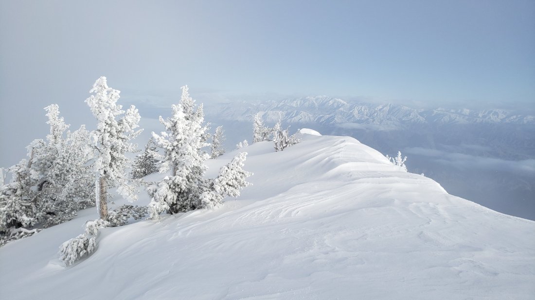
This morning I hiked to San Jacinto Peak up the eastern side from Devil’s Slide Trail via Wellman Divide, descending the western side down Deer Springs Trail. The past week has included hikes on half-a-dozen local parts of the PCT, plus Spitler Peak Trail, Cedar Springs Trail, Tahquitz Peak and the Tahquitz area meadows.
Detailed trail conditions are discussed below, and measured snow depths and current access problems are described near the foot of this posting. Access to Black Mountain Road from Idyllwild became possible this afternoon due to a short section of Highway 243 reopening.
I have also added the status of various water sources, mainly for the benefit of thru-hikers. Some sources in the high country are still inaccessible under snow, while I have noticed some minor ephemeral streams are already drying up. Of course snow is available for melting in the high country also.
The most challenging PCT hiking problem continues to be around Apache Peak. I talked to many thru-hikers on Sunday about their experiences in this area, and I plan to check it again tomorrow.
I recorded the following vlog this morning at San Jacinto Peak.
In the blog I describe fairly good snow conditions for my ascent this morning. The descent was softer with more postholing, especially through Little Round Valley. Overall snow conditions are more reminiscent of mid May than early April. Temperatures above seasonal have resulted in substantial snow melt at all elevations. Melting has also made snow conditions more uniform (and hence easier underfoot when cold and hard) and consolidated trails are good for fairly easy hiking. However, soft snow from mid morning onwards can result in some postholing and sliding later in the day.
Microspikes, in combination with hiking poles or, in some situations, an ice axe (if you know how to use it) are recommended throughout the high country. Microspikes are sufficient to hike all of the PCT in the San Jacinto mountains at present. Crampons (always with an ice axe) may be useful for those hikers who are less confident on angled snow and ice. Snowshoes continue to have some use for off-trail travel only, in flatter terrain, and especially in softer afternoon snow. I saw tracks of folks hiking the Peak and PCT without spikes, but also much evidence of them slipping and sliding.
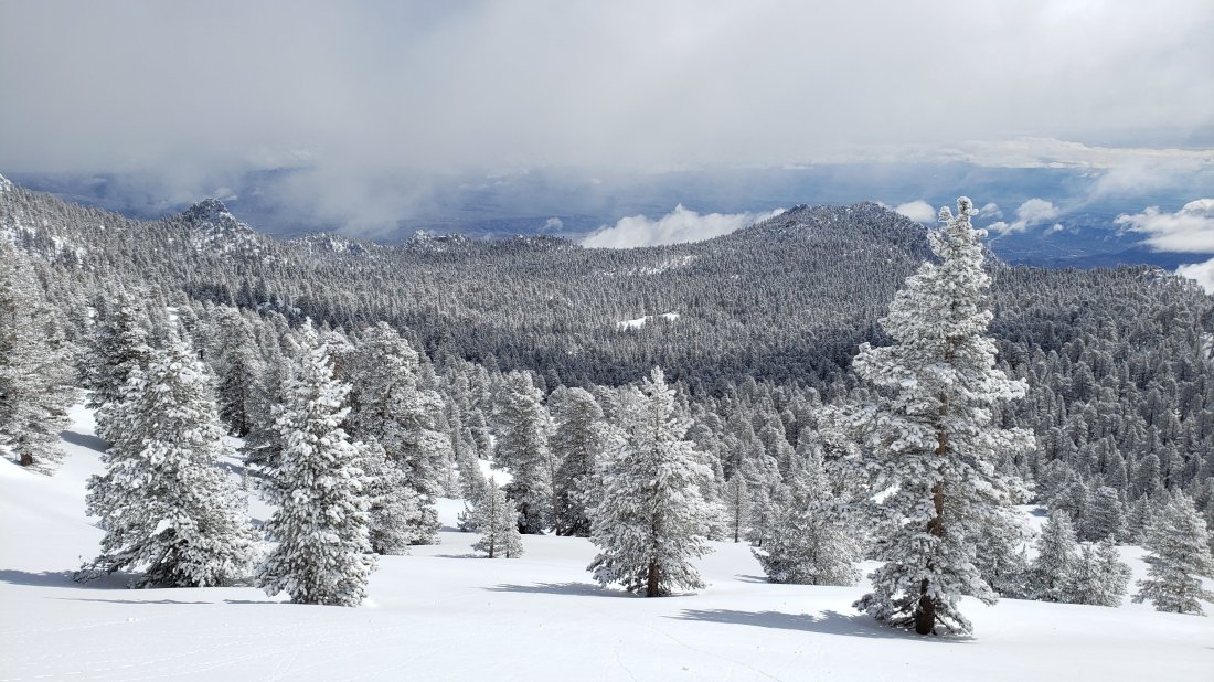
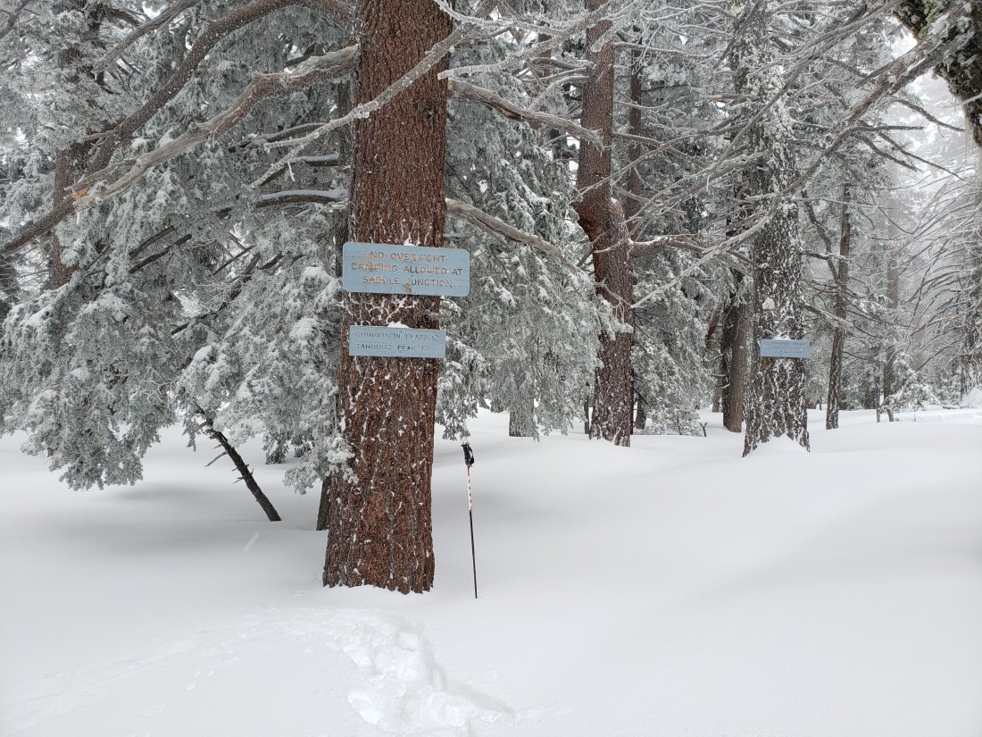
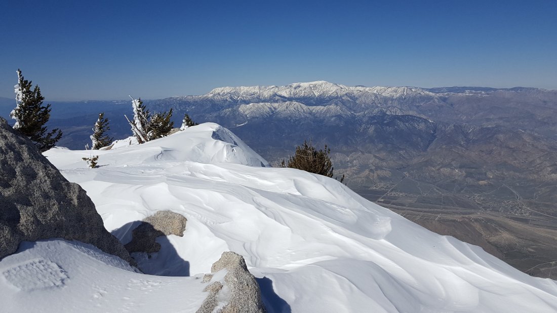
The PCT at Chinquapin Flat (approx Mile 178) on 4th April 2019, with the San Jacinto high country in the distance.
WEATHER Temperatures will be below seasonal for the next few days, resulting in excellent snow hiking conditions, then above average thereafter, with extensive snow melt resuming at all elevations.
At San Jacinto Peak (10,810’/3295m) today 8th April 2019 at 0905, the air temperature was 49°F (9°C), with a windchill temperature of 48°F (9°C), 19% relative humidity, and a barely discernible West breeze at 2 mph gusting to 4 mph.
Weather at the Peak on 1st April 2019 was almost identical to today. At 0930 the air temperature was 49°F (9°C), with a windchill temperature of 48°F (9°C), 17% relative humidity, and largely calm conditions with an occasional West breeze to 2 mph.
Pit toilet in Little Round Valley today. Not a good option if you need a restroom urgently.
TRAIL CONDITIONS
Most trails above about 8200′ remain largely snow-covered. Trail conditions will continue to change rapidly with more melting. Details for specific routes are below. Despite warmer weather overall, hikers should be prepared for temperatures below freezing in the high country (>8,000’/2300m elevation) over the next few days, and even colder when considering windchill effects.
Waterproof footwear is useful on approach trails (e.g., Devil’s Slide, lower Deer Springs) due to multiple stream crossings and considerable water flowing in the trails. It is also invaluable in the soft melting snow in many areas, especially after mid-morning.
Many major trails have been well traveled in the past week, so they have obvious, well consolidated tracks. Routefinding is challenging in places for those not familiar with the area due to wandering, inaccurate tracks however, so use caution. Some signage above about 8500′ remains snow-covered, including many PCT marker posts.
Pacific Crest Trail The trail is clear of snow from Highway 74 (Mile 151) to about Mile 173, except for the challenging section at Mile 169.5. Between about Mile 173 and Mile 191, the trail averages 90% snow-covered, but with more snow-free areas opening up every day. Miles 182 to 184 are now largely free of snow.
Fuller Ridge Trail should not be attempted without microspikes, ideally with an ice axe (if you know how to use one), or at least hiking poles. Significant sections remain challenging.PCT hikers not familiar with angled snow/ice travel should consider the Black Mountain Road alternative to Fuller Ridge, at least for the next few days.
Black Mountain Road is clear of snow until about 7000′ (5 miles up). From the Boulder Basin junction to the PCT/Fuller Ridge campground (miles 5 to 8) snow cover is patchy. Note that Black Mountain Road is now accessible due to the reopening of a short section of Highway 243.
Skyline Trail is clear of snow to 7200′. Microspikes and hiking poles are sufficient above that elevation, although an ice axe (if you know how to use it) could be useful on the traverse chutes. There is an obvious track to follow through the snow-covered section. [Thanks to Chris Dow and others for this update.]
Devil’s Slide Trail is largely clear of snow, with a few icy snow patches near Saddle Junction. Some hikers will find microspikes useful, especially for descending.
Deer Springs Trail is clear of snow to Strawberry Junction (8100′), except for a few tiny patches near the Junction. Snow is limited to patches for the next mile north, before becoming continuous near the Marion Mountain Trail junction. The track above the Fuller Ridge junction up to San Jacinto Peak does not approximate to the true trail, and is steep and postholey in places.
Marion Mountain Trail has been hiked and has a reasonable track to follow. Snow is patchy above about 7500′ and is nearly continuous above about 8200′.
Tahquitz Peak trail from Chinquapin Flat remains very treacherous. Last week I made the first traverse of this trail for several weeks. Crampons in conjunction with an ice axe are very strongly recommended for this section. It is possible to pass between the PCT and Tahquitz Peak along the top of Tahquitz Ridge with caution.
Ernie Maxwell Trail is clear of snow.
South Ridge Road is clear of snow, but is impassable near the top due to severe storm damage. South Ridge Trail is largely clear of snow to Tahquitz Peak. Above Old Lookout Flat (7800′) there is about 30% patchy snow coverage. Microspikes are valuable for descending – and can be useful for ascending – the switchbacks above 8500′, especially when icy in the early morning.
SNOW DEPTHS measured today are as follows. Current total depth is given. Drifts can be much greater than the average depth. Altitudes are approximate.
San Jacinto Peak (10,810′): 38″ (75″ on 22nd March) (online reports of 6-8 feet at the Peak are wildly inaccurate!)
Little Round Valley (9800′): 34″
Wellman Divide (9700′): 23″ (43″ on 22nd March)
Annie’s Junction (PCT at State Park boundary north of Saddle Junction) (9050′): 20″ (33″ on 12th March)
Pacific Crest Trail at south end of Fuller Ridge Trail (8950′): 30″
Pacific Crest Trail at top of Marion Mountain Trail (8700′): 25″
Annie’s Junction (PCT at State Park boundary north of Saddle Junction) (9050′): 16″ (34″ on 22nd March)
Long Valley (8500′): 2″ (per State Park)
Strawberry Junction (8100′): 2″
Saddle Junction (8070′): 6″ (20″ on 22nd March)
Wellman’s Cienega North Spring today, 8th April 2019.
WATER STATUS: Eastern slope
The Round Valley faucet is not flowing (per Mount San Jacinto State Park).
Both the northern and southern springs at Wellman’s Cienega are flowing well. These are the sources for Willow Creek, which is flowing well where it crosses the Willow Creek Trail.
Tahquitz Valley is flowing.
Tahquitz Creek is flowing well at the northern end of Little Tahquitz Meadow. It is also flowing well further upstream at its source (known locally as Grethe Spring) where it crosses the PCT (approx. PCT Mile 177).
Skunk Cabbage Creek – that flows through Skunk Cabbage Meadow and then crosses the Caramba Trail near Reeds Meadow – is currently flowing well.
WATER STATUS: Western slope
The North Fork of the San Jacinto River is not accessible under snow where it crosses the Deer Springs Trail above Fuller Ridge. It is accessible where it crosses the Fuller Ridge Trail on the PCT (approx. PCT Mile 186.2).
O’Sullivan Creek (PCT Mile 186.4) on Fuller Ridge Trail is flowing well.
The spring in the creek in Little Round Valley is wholly under snow but is close to being snow-free.
Shooting Star Spring (below Little Round Valley but above the North Fork of the San Jacinto River crossing) is currently hidden under snow.
The Deer Springs stream crossing at the PCT (approx. PCT mile 185.6) is wholly snow-covered. [PCT hikers note: almost all PCT guides and apps confuse the Deer Springs crossing with the North Fork of the San Jacinto River. The latter is another 0.5 miles further north on the Fuller Ridge Trail, see above.]
Switchback Spring at PCT Mile 183.5 (about 0.4 miles north of Strawberry Junction) is flowing well.
The little creek at Strawberry Cienega (PCT mile 183.0) is flowing well.
On Devil’s Slide Trail, Jolley, Middle, and Powderbox springs are all flowing strongly, as are several unnamed ephemeral creeks.
On the Ernie Maxwell Trail, the crossing of Chinquapin Creek just below Humber Park continues to flow very well, as do several other creeks that cross the trail.
WATER STATUS: Desert Divide
Highway 74 There is a water cache where the PCT crosses Highway 74, on the south side of the highway. This appears to be reliably maintained, but never assume water caches will definitely be there.
Pool 3.5 miles north of Highway 74 is flowing.
Live Oak Spring (N 33 37 21, W 116 33 24) Flowing well. The most reliable water source on the Desert Divide.
Cedar Spring (N 33 40 36, W 116 34 35) Flowing well. Easiest access is the trough just upstream from the trail to the campsite.
Apache Spring (N 33 43 11, W 116 37 13) Flowing fairly well, but the access tail off the PCT is unclear. Easier to get water from Spitler Creek described below.
Spitler Peak Trail Descending the trail there are five water crossings. The first two, at 0.9 and 0.95 miles down, cross a tiny side creek which is already drying up and should be ignored. The next crossing, at 1.1 miles down, is Spitler Creek and is the best source of water (currently flowing well). The next two crossings are the same creek, but for obvious reasons it is best to fill up at the highest of the three crossings.
Antsell Rock Creek (N 33 41 52, W 116 39 08) Right by the Spitler Peak Trail trailhead on Apple Canyon Road, Antsell Rock Creek is flowing very well. Just on the upstream side of the road there is excellent access to the creek.
ACCESS CLOSURES The Valentine’s Day flood events continue to make access to the San Jacinto mountains challenging. Highway 243 between Banning and Idyllwild is closed from north of Bay Tree Spring to just north of Lake Fulmor. The remaining closed section may not reopen until July or later. Highway 74 between Mountain Center and Hemet may partially reopen – with a pilot car and restricted hours – by May. Whitewater Preserve (PCT Mile 218.5) recently announced that they will not be able to accommodate day use or overnight PCT hikers this year, due to severe damage to Whitewater Canyons roads and trails. Currently the trail from the PCT to Whitewater is non-existent and requires a wide water crossing with quickly flowing water.
Trail sign at Wellman Divide (9700′) today 8th April 2019 (above), last week on 1st April (below), and 17 days ago on 22nd March (bottom).
Anne, Anabel and I hiked to the challenging icy snow traverse around Apache Peak (approx PCT Mile 169.5) this morning. I recorded the following video at about 0950. With care, this section will now be readily passable for most folks with microspikes. All other trail info was updated yesterday in the report linked here.
This morning we hiked briskly to San Jacinto Peak from Devil’s Slide Trail via Wellman Divide, descending the same way. On Saturday we hiked to Tahquitz Peak via South Ridge. Detailed trail conditions are discussed below and both measured snow depths and current access problems are described near the foot of this posting.
Currently the most challenging PCT problem is around Apache Peak. I talked to many thru-hikers on Sunday about their experiences in this area, and I will be checking it again tomorrow. I recorded the following vlog this morning at San Jacinto Peak.
Error
This video doesn’t exist
Sadly, snow conditions are more reminiscent of 1st May than of 1st April. Temperatures above seasonal norms have resulted in significant snow melt at all elevations. San Jacinto Peak has lost 15″ to 35″ of snow in the past 20 days, depending on specifc location, due to melting and consolidation. Melting has also made snow conditions more uniform (and hence easier underfoot in the mornings) and consolidated trails are currently virtually perfect for fast easy hiking. However, soft snow from late morning onwards can result in some postholing and sliding later in the day.
Microspikes, in combination with hiking poles or, in some situations, an ice axe (if you know how to use it) are recommended throughout the high country. With prior experience on angled snow, and considerable care, microspikes are sufficient to hike all of the PCT in the San Jacinto mountains at present. Crampons (always with an ice axe) will be useful for those hikers who are less confident on angled snow and ice, especially around Apache Peak for the next couple of days. Snowshoes continue to have some use for off-trail travel in flatter terrain, especially in softer afternoon snow.
Be Bear Aware. One of several fairly fresh prints at Annie’s Junction (9050′) today, 1st April 2019 (the lip balm for size reference is 2.5″ long).
WEATHER Temperatures will be seasonal for the next few days, then well above average thereafter, with extensive snow melt at all elevations. Highs may reach near-summer temperatures next week. There is a possibility of light precipitation overnight on 4th-5th April, with a light dusting of snow in the high country.
At San Jacinto Peak (10,810’/3295m) today 1st April 2019, at 0930 the air temperature was 49°F (9°C), with a windchill temperature of 48°F (9°C), 17% relative humidity, and largely calm conditions with an occasional West breeze gusting to 2 mph.
In contrast, at the Peak on Thursday 28th March 2019, at 0935 the air temperature was 28°F (-2°C), with a windchill temperature of 9.9°F (-12°C), 15% relative humidity, and a sharp 15 mph West wind gusting to 27 mph.
TRAIL CONDITIONS
Almost all trails above about 8000′ remain snow-covered. With melting, trail conditions will continue to change rapidly. Details for specific routes are below. Despite warmer weather overall, hikers should be prepared for temperatures at or below freezing around the highest peaks (>10,000’/3000m elevation), and even colder when considering windchill effects.
Waterproof footwear is useful on approach trails (e.g., Devil’s Slide, lower Deer Springs) due to multiple stream crossings and considerable water flowing in the trails. It is also advisable due to the somewhat slushy quality of melting snow in many areas, especially after mid-morning.
Many major trails have been well traveled in the past week, so they have obvious, well consolidated tracks. Routefinding is challenging in places for those not familiar with the area due to wandering, inaccurate tracks however, so use caution. Some signage above about 9000′ remains snow-covered, including many PCT marker posts.
Pacific Crest Trail The trail is basically clear of snow from Highway 74 to about Mile 173, except for the challenging section at Mile 169.5. Between about Mile 173 and Mile 192, the trail is largely snow-covered, depths in places up to two feet, but with more snow-free areas opening up every day. Based on my own assessment, and in discussion with PCT hikers who have completed both areas, the icy snow at Apache Peak (Mile 169.5) is currently more treacherous than Fuller Ridge.
Fuller Ridge Trail should not be attempted without a minimum of microspikes, ideally with an ice axe (if you know how to use one), or at least hiking poles. Significant sections remain an icy snow slope. PCT hikers not familiar with angled snow/ice travel should consider the Black Mountain Road alternative to Fuller Ridge, at least for the next few days.
Black Mountain Road is clear of snow until about 7000′ (5 miles up). From the Boulder Basin junction to the PCT/Fuller Ridge campground (miles 5 to 8) snow cover is patchy. [Note that Black Mountain Road is not currently accessible to private vehicles due to the closures on Highway 243.]
Devil’s Slide Trail is largely clear of snow, with a few extended icy snow patches near Saddle Junction. Some hikers will find microspikes useful, especially for descending in the morning.
Deer Springs Trail is largely clear of snow to Strawberry Junction (8100′). There are confusing multiple tracks through the snow from near Marion Mountain Trail junction through to Fuller Ridge (roughly PCT Miles 184-186). Careful navigation is required. The track above the Fuller Ridge junction up to San Jacinto Peak does not closely approximate to the true trail, so again navigation is tricky.
Marion Mountain Trail has been hiked and has a reasonable track to follow. Snow is patchy above about 7000′ and is nearly continuous above about 7900′.
Tahquitz Peak trail from Chinquapin Flat remains very treacherous even as the snow softens. [UPDATE 4th April] After the first 0.1 mile, there are no tracks to follow and no sign of any attempt to traverse this trail for several weeks. Crampons in conjunction with an ice axe are very strongly recommended for this section. It is possible to pass between the PCT and Tahquitz Peak along the top of Tahquitz Ridge with caution.
Ernie Maxwell Trail is clear of snow.
South Ridge Road is clear of snow, but is impassable near the top due to severe storm damage. South Ridge Trail is largely clear of snow below Old Lookout Flat (7800′), but is about 50% snow-covered above it. Microspikes are valuable for descending – and can be useful for ascending – the switchbacks above 8500′, especially when icy in the early morning.
SNOW DEPTHS measured today are as follows. Current total depth is given. Drifts can be much greater than the average depth. Altitudes are approximate. For some snow depths on the western side trails last week, see the previous report linked here.
San Jacinto Peak (10,810′): 52″ (75″ on 22nd March)
Wellman Divide (9700′): 28″ (43″ on 22nd March)
Annie’s Junction (PCT at State Park boundary north of Saddle Junction) (9050′): 22″ (34″ on 22nd March)
Saddle Junction (8070′): 9″ (20″ on 22nd March)
Devil’s Slide trailhead at Humber Park (6500′): 0″ (5″ on 22nd March)
ACCESS CLOSURES The Valentine’s Day flood events continue to make access to the San Jacinto mountains challenging. Highway 243 between Banning and Idyllwild is closed from north of Bay Tree Spring to just north of Alandale. The section from near Alandale to Lake Fulmor will reopen in late April – allowing access to Black Mountain Road – but the remainder may not reopen until July or even later. Highway 74 between Mountain Center and Hemet will partially reopen – with a pilot car and restricted hours – by May. Whitewater Preserve (PCT Mile 218.5) recently announced that they will not be able to accommodate day use or overnight PCT hikers this year, due to severe damage to Whitewater Canyons roads and trails. Currently the trail from the PCT to Whitewater is non-existent and requires a wide water crossing with quickly flowing water.
Trail sign at Wellman Divide (9700′) today 1st April 2019 (above), and ten days earlier on 22nd March (below).
[UPDATE 30th March: we hiked South Ridge to Tahquitz Peak this morning, and Ernie Maxwell Trail yesterday, and I have amended the text below accordingly.]
This morning (28th March) I hiked with Jenn Murdock to San Jacinto Peak from Devil’s Slide Trail via Wellman Divide, descending the same way. Yesterday I hiked Deer Springs and Fuller Ridge trails for search-and-rescue reasons, on 26th I hiked Spitler Peak Trail and the PCT north around Apache Peak, and on 25th up Black Mountain Road to the north end of Fuller Ridge. Many thanks to Tim Dailey and Jenn for supplementary information on the trails around Tahquitz Peak from their hike on 26th.
Detailed trail conditions are discussed below and both measured snow depths and current access problems are described near the foot of this posting. Currently the most challenging PCT problem is around Apache Peak, which I discuss in detail in a posting from two days ago. I recorded the following vlog this morning at San Jacinto Peak.
Error
This video doesn’t exist
Temperatures above seasonal norms have resulted in significant snow melt at all elevations. San Jacinto Peak has lost 12″ to 30″ of snow in the past 16 days, depending on specifc location, due to melting and consolidation. Melting has also made snow conditions more uniform (and hence easier underfoot in the mornings) by reducing the dangerous ice layer just under the surface snow. Snow conditions yesterday and today were virtually perfect on the consolidated trails for fast easy hiking. However, soft snow from late morning onwards does result in moderate postholing later in the day.
Microspikes, in combination with hiking poles or, in some situations, an ice axe (if you know how to use it) are strongly recommended throughout the high country. With prior experience on angled snow, and considerable care, microspikes are sufficient to hike all of the PCT in the San Jacinto mountains at present. Crampons (always with an ice axe) will be useful for those hikers who are less confident on angled snow and ice, especially around Apache Peak for the next few days. Snowshoes continue to be useful for off-trail travel in flatter terrain, especially in softer afternoon snow.
WEATHER Temperatures will continue to be at or above average into early April, with extensive snow melt at all elevations, especially on sunny aspects and below 9000′. Highs may reach as high as 70°F (21°C) in Idyllwild on 1st April, and 90°F (32°C) in the desert. There is no notable precipitation in the forecast.
At San Jacinto Peak (10,810’/3295m) today, Thursday 28th March 2019, at 0935 the air temperature was 28°F (-2°C), with a windchill temperature of 9.9°F (-12°C), 15% relative humidity, and a sharp 15 mph West wind gusting to 27 mph.
At the Peak on Friday 22nd March 2019, at 1230 the air temperature was 29°F (-2°C), with a windchill temperature of 16.3°F (-9°C), 29% relative humidity, and a light 7 mph NW wind gusting to 11 mph.
Fuller Ridge Trail at about PCT Mile 186, on 27th March 2019. A fairly average example of the “trail” conditions. If that doesn’t look like fun to you, an alternative route might be a good idea.
TRAIL CONDITIONS
Almost all trails above about 7700′ remain snow-covered. With rapid melting, trail conditions will continue to change rapidly. Details for specific routes are below. Despite warmer weather overall, hikers should nevertheless be prepared for temperatures around freezing around the highest peaks (>10,000’/3000m elevation), and colder when considering windchill effects.
Waterproof footwear is useful on approach trails (e.g., Devil’s Slide, lower Deer Springs) due to multiple stream crossings and considerable water flowing in the trails. It is also advisable due to the somewhat slushy quality of melting snow in many areas, especially after mid-morning.
Many major trails have been well traveled in the past week, so they have obvious, well consolidated tracks. Routefinding is challenging in places for those not familiar with the area due to wandering, inaccurate tracks however, so use caution. Much signage above about 8500′ remains snow-covered, including many PCT marker posts.
Pacific Crest Trail The trail is essentially clear of snow from Highway 74 to about Mile 169. Between about Mile 174 and Mile 192, the trail is largely snow-covered, depths ranging from an inch to two feet. Based on my own assessment, and in discussion with PCT hikers who have completed the San Jacinto mountain section, the icy snow at Apache Peak (Mile 169.5) is currently more treacherous than Fuller Ridge.
Fuller Ridge Trail should not be attempted without a minimum of microspikes, ideally with an ice axe (if you know how to use one), or at least hiking poles. Significant sections remain largely a featureless icy snow slope. Crampons and ice axe remain recommended for those less comfortable on snow. PCT hikers not familiar with angled snow/ice travel should consider the Black Mountain Road alternative to Fuller Ridge.
Black Mountain Road is largely clear of snow for its lower four miles. Up to 7000′ (5 miles up) there is shallow patchy snow. From the Boulder Basin junction to the PCT/Fuller Ridge campground (miles 5 to 8) snow cover is extensive, from a few inches to two feet deep. At yellow post campsites 4 & 5, there is a large area clear of snow good for camping. Snow is largely soft and postholing is inevitable without snowshoes. Beyond Fuller Ridge, snow is largely 1-2′ deep, with deeper drifts, down to near Camp Lackey. [Note that vehicle access is currently not possible beyond 2.5 miles due to downed trees and snow. Black Mountain Road is not currently accessible to private vehicles due to the closures on Highway 243.]
Devil’s Slide Trail has only patchy snow to 7900′, but some patches are icy. The trail has been heavily traveled, is obvious, and some hikers will find microspikes ideal, especially for descending in the morning.
Deer Springs Trail is clear of snow to the Suicide Rock turning, and largely clear of snow from there to about 7800′. From there to Strawberry Junction (8100′) there is extensive soft snow cover, with a few hazardous sections of water flowing under snow bridges or on the trail route.
There are confusing multiple tracks through the snow from near Marion Mountain Trail junction through to Fuller Ridge (roughly PCT Miles 184-186). Careful navigation is required. The track above the Fuller Ridge junction up to San Jacinto Peak does not closely approximate to the true trail, so again navigation is tricky.
Marion Mountain Trail has been hiked and has a reasonable track to follow. Snow is patchy above about 7000′ and is nearly continuous above about 7600′.
Tahquitz Peak trail from Chinquapin Flat remains very treacherous even as the snow softens. There are no tracks to follow and no sign of any attempt to traverse this trail in the past couple of weeks. Crampons in conjunction with an ice axe are strongly recommended for this section. It is possible to pass from Tahquitz Peak to the PCT along the top of Tahquitz Ridge with extreme caution.
Ernie Maxwell Trail is clear of snow. [UPDATED 29th March]
[UPDATED 30th March] South Ridge Road is clear of snow, but is impassable near the top due to severe storm damage. South Ridge Trail is largely clear of snow below Old Lookout Flat (7800′), but is about 50% snow-covered above it. Microspikes are valuable for descending, and can be useful for ascending, the switchbacks above 8500′, especially when icy in the early morning.
PCT marker emerging from the snow on top of Fuller Ridge at about Mile 187.5, on 27th March 2019.
SNOW DEPTHS measured yesterday and today are as follows. Current total depth is given. Drifts can be much greater than the average depth. Altitudes are approximate.
San Jacinto Peak (10,810′): 55″ (75″ on 22nd March)
Wellman Divide (9700′): 35″ (43″ on 22nd March)
Annie’s Junction (PCT at State Park boundary north of Saddle Junction) (9050′): 27″ (34″ on 22nd March)
Fuller Ridge Trail south end (8950′): 35″
Strawberry Junction (8100′): 7″ (but ranging from 0-15″)
Saddle Junction (8070′): 11″ (20″ on 22nd March)
Devil’s Slide trailhead at Humber Park (6500′): 0″ (5″ on 22nd March)
ACCESS CLOSURES The parking area at Humber Park has reopened, as has the trailhead access for Marion Mountain Trail. The Valentine’s Day flood events continue to make access to the San Jacinto mountains challenging. Palm Springs Aerial Tramway remains closed until 1st April (according to their website). Highway 243 between Banning and Idyllwild is closed from north of Bay Tree Spring to just north of Alandale. The section from near Alandale to Lake Fulmor may reopen in April – allowing access to Black Mountain Road – but the remainder may not reopen until July or even later. Highway 74 between Mountain Center and Hemet will partially reopen – with a pilot car and restricted hours – by May. Several minor roads around Idyllwild-Pine Cove remain partly closed or damaged. Apple Canyon Road (access for the Spitler Peak trailhead) is still flooded at Hurkey Creek and is recommended only for 4WD/high clearance vehicles. Whitewater Preserve (PCT Mile 218.5) recently announced that they will not be able to accommodate day use or overnight PCT hikers this year, due to severe damage to Whitewater Canyons roads and trails. Currently the trail from the PCT to Whitewater is non-existent and requires a wide water crossing with quickly flowing water.
Wellman Divide (9700′) sign on 28th March 2019 (above), and six days earlier on 22nd March (below)
Just a quick vlog update on the challenging situation around PCT mile 169.5, on the north-east flank of Apache Peak. I was up there this morning, and at the north end of Fuller Ridge yesterday.
Error
This video doesn’t exist
Otherwise conditions remain largely unchanged from the previous Report linked here. I will be on Fuller Ridge tomorrow, and will do a complete update on 28th March after hiking San Jacinto Peak.
[UPDATE 24th March 2019: Whitewater Preserve (PCT Mile 218.5) issued this statement today. “It is with heavy hearts that we have decided that due to the severe damage to Whitewater Canyons roads and trails that Whitewater Preserve will not be able to accommodate day use or overnight PCT hikers this year. There would be no phones available (landline or otherwise), no restrooms, no wifi, and no road access to be picked up or dropped off. Also as of right now the trail from the PCT to Whitewater is non-existent and requires a wide water crossing with quickly flowing water.”]
Today (22nd March) I hiked to San Jacinto Peak from Devil’s Slide Trail via Wellman Divide, descending the same way. On 21st we hiked the Spitler Peak Trail to the PCT between Apache and Spitler peaks, and on 20th to Tahquitz Peak via South Ridge. I recorded the following video at San Jacinto Peak at about 1230 today.
Error
This video doesn’t exist
Detailed trail conditions are below and measured snow depths are at the foot of this posting.
In classic San Jacinto mountains style, the snow conditions today were very different from just four days ago. We had a couple of inches of fresh snow overnight on 20th, and slightly more during the day on 21st. As the underlying snow was very icy due to recent cold days, the new snow created a challenging loose powder layer that was giving way on even moderate slopes. Above 8000′ I used snowshoes to break trail but with considerable slippage. Crampons would be a good option, but with heavy postholing in unbroken areas. Microspikes were useful below 8000′.
Carrying snowshoes (with poles), crampons (with ice axe), and microspikes, is the unfortunate but ideal combination at present, such is the variability of snow conditions due to altitude, aspect, and time of day.
Current road and trailhead access issues have changed and are discussed at the bottom of this post.
Spitler Peak in the cloud, 21st March 2019.
WEATHER Temperatures will be at or above average for the remainder of March, with extensive snow melt at all elevations, especially below 8000′. There is no notable precipitation in the forecast.
At San Jacinto Peak (10,810’/3295m) today, Friday 22nd March 2019, at 1230 the air temperature was 29°F (-2°C), with a windchill temperature of 16.3°F (-9°C), 29% relative humidity, and a light 7 mph NW wind gusting to 11 mph.
At the Peak on Monday 18th March 2019, at 0935 the air temperature was 30°F (-1°C), with a windchill temperature of 17.1°F (-8°C), 44% relative humidity, and a light 9 mph SSE wind gusting to 12.2 mph.
Tahquitz Ridge as seen from the PCT, 22nd March 2019.
TRAIL CONDITIONS
All trails above about 6500′ were snow-covered today. As I descended today, very rapid melting was already underway below 7500′. This will continue for the foreseeable future, so trail conditions will once again change rapidly. Details for specific routes are below.
Despite warmer weather overall, hikers should nevertheless be prepared for temperatures at or below freezing in the high country (and colder when considering windchill effects).
Microspikes are recommended everywhere especially once trails have been broken and become consolidated, in particular for descending. Crampons with an ice axe (and knowledge of how to use both) are currently useful in many areas above 8000′, and they are strongly recommended for moderate angle slopes (PCT Miles 169-174, Fuller Ridge, TahquitzPeak) at least until underlying snow conditions soften over the next few days. Snowshoes are recommended off-trail above about 7800′, for breaking trail everywhere at present, and may also be useful on-trail in soft afternoon snow on warmer days.
Waterproof footwear is useful on approach trails (e.g., Devil’s Slide, lower Deer Springs) due to multiple stream crossings and considerable water flowing in the trails. It is also advisable due to the slushy quality of melting snow in many areas, especially after mid-morning.
The limited number of trails that had obvious tracks over the past ten days have now been completely covered with fresh snow. As a result routefinding is challenging for those not familiar with the area. Most signage above about 8500′ is snow-covered. Most PCT marker posts are also completely obscured. Currently no trails have been broken other than my route today (and I would not recommend following that above 10,000′ as I took a very direct ascent route from the base of Miller Peak).
Pacific Crest Trail Shallow snow will quickly clear from Highway 74 to about Mile 165. Between Mile 169 and Mile 193, snow depths average 1-3 feet. See my video above for the specific problem around Apache Peak (Mile 169.5).
Fuller Ridge Trail has been traversed by very few hikers, carrying crampons/ice axe, however it remains a largely a featureless ice slope along almost all its five mile length. Crampons and ice axe remain very strongly recommended. The majority of PCT hikers (those who are not familiar with angled snow/ice travel) should consider the Black Mountain Road alternative to Fuller Ridge.
Black Mountain Road will quickly clear of snow for its lower 2.5 miles. Up to 7000′ (5 miles up) there is shallow patchy snow. From the Boulder Basin junction to the PCT/Fuller Ridge campground (miles 5 to 8) snow cover is continuous at 1-2′ deep. Snow is largely soft and extensive postholing is inevitable without snowshoes. Beyond Fuller Ridge, snow is largely 1-2′ deep, with deeper drifts, almost to Camp Lackey. [Note that vehicle access is not possible beyond 2.5 miles due to downed trees and snow. Black Mountain Road is not currently accessible to private vehicles due to the closures on Highway 243.]
Devil’s Slide Trail now has patchy snow to 7500′, but is completely under snow thereafter. The trail has been heavily traveled, is obvious, and microspikes are ideal especially for descending.
Deer Springs Trail is melting rapidly to about 7500′. From there to Strawberry Junction (8100′) there is almost continuous soft snow cover, with some hazardous sections of water flowing under or on the trail route.
Tahquitz Peak trail from Chinquapin Flat [updated 20th March] remains very treacherous even as the snow softens. There are no tracks to follow and no sign of any attempt to traverse this trail in the past ten days. Crampons in conjunction with an ice axe are strongly recommended for this section, but it may be passable for those very confident with the use of microspikes.
Ernie Maxwell Trail will quickly clear of snow for most of its length, with shallow snow patches more frequent near Humber Park.
South Ridge Road is largely clear of snow, but is impassable near the top due to severe road damage. South Ridge Trail will quicklyclear of snow below Old Lookout Flat (7800′), but is almost completely snow-covered above it. Microspikes are very valuable for descending, and can be useful for ascending the final switchbacks close to Tahquitz Peak. An ice axe would be a good idea on the uppermost switchbacks.
SNOW DEPTHS measured today are as follows, with new snow accumulation given first and total in parentheses. Strong winds have led to major drifting and drifts can be much greater than the average depth. Altitudes are approximate.
San Jacinto Peak (10,810′): 7″ (75″)
Wellman Divide (9700′): 6.5″ (43″)
Annie’s Junction (PCT at State Park boundary north of Saddle Junction) (9050′): 6.5″ (34″)
Saddle Junction (8100′): 6″ (20″)
Devil’s Slide trailhead at Humber Park (6500′): 4.5″ (5″) (but largely melted)
ACCESS CLOSURES The parking area at Humber Park has reopened, as has the trailhead access for Marion Mountain Trail. The Valentine’s Day flood events continue to make access to the San Jacinto mountains challenging. Palm Springs Aerial Tramway remains closed until 1st April (according to their website). Highway 243 between Banning and Idyllwild is closed from north of Bay Tree Spring to just north of Alandale until approximately July. Highway 74 between Mountain Center and Valle Vista (Hemet) will partially reopen by May. Several minor roads around Idyllwild-Pine Cove remain partly closed or damaged. Apple Canyon Road (access for the Spitler Peak trailhead) is still flooded at Hurkey Creek and is recommended only for 4WD/high clearance vehicles.
[UPDATE 20th March 2019: multiple hikers (wearing microspikes) turned back at PCT Mile 169.5 today due to steep ice on the NE flank of Apache Peak. This slope had probably been easier on recent warmer days when the snow was softer. Also tonight it is currently snowing in Idyllwild (about one inch so far).]
[UPDATE 20th March 2019: Snow conditions are basically unchanged from the report below, microspikes are ideal on traveled consolidated trails. At Tahquitz Peak (8836′) this morning it briefly snowed on us, but with no accumulation. It felt very cold, with high humidity and a windchill temperature of 19°F (-7°C) despite only a fairly light 11mph wind. I have updated the Tahquitz area trails in the text below.]
Today (18th March) I hiked to San Jacinto Peak from Devil’s Slide Trail via Wellman Divide on the eastern side, descending the western side via Deer Springs Trail, including some of Fuller Ridge, a route which incorporated a few miles of the PCT. On Saturday we hiked part of the PCT north of Highway 74 to assess conditions at lower elevation, and on Friday I hiked Black Mountain Road at the north end of Fuller Ridge. I recorded the following vlog from San Jacinto Peak at about 0935 this morning.
Error
This video doesn’t exist
Detailed trail conditions are below and measured snow depths from my circuit today are at the foot of this posting. At elevations below 8000′ there is little sign of the fresh snow that fell on 11th/12th March (described in the previous report). There has been considerable melting at lower elevations, but proportionately less high up. Increased trail traffic and consolidation of the main trails makes hiking much easier than just a few days ago. However many slopes and traverses are still challenging. Of the two PCT hikers I passed today (neither wearing even microspikes) one had just fallen about ten yards below the trail in one of the low angle sections near Deer Spring.
Current road and trailhead access issues are discussed at the bottom of this post.
WEATHER A strong warming trend has been in evidence in recent days, accompanied by extensive snow melt at lower elevations (<8000′). After another spring-like day tomorrow, it will cool considerably on 20th and 21st, with windchill temperatures at the highest elevations close to 0°F (-18°C). On those days, light rain or snow is possible depending on elevation. From the 22nd, mild, cloudy, and somewhat unsettled weather is forecast and continued melting will resume at all elevations.
At San Jacinto Peak (10,810’/3295m) today, Monday 18th March 2019, at 0935 the air temperature was 30°F (-1°C), with a windchill temperature of 17.1°F (-8°C), 44% relative humidity, and a light 9 mph SSE wind gusting to 12.2 mph.
In contrast, at the Peak on Tuesday 12th March 2019, at 0755 the air temperature was 16°F (-9°C), with a windchill temperature of -4.7°F (-20°C), 100% relative humidity, and a bitter 15 mph due North wind gusting to 22.4 mph.
TRAIL CONDITIONS
All trails above about 7500′ remain completely snow-covered, despite rapid melting in the past few days. Details for specific routes are below.
Hikers should be prepared for temperatures at or near freezing in the high country, below freezing above 10,000′, and well below freezing on 20th and 21st March (especially when considering windchill effects).
Microspikes are recommended everywhere on well consolidated trails, in particular for descending. Crampons with an ice axe (and knowledge of how to use both) are strongly recommended for moderate angle slopes (at least Fuller Ridge and TahquitzPeak) as the snow continues to consolidate with freeze-thaw cycles, at least in the morning, or all day in colder temperatures. Snowshoes are recommended off-trail above about 7800′, and may be useful even on- trail in the afternoon on warmer days.
Waterproof footwear is useful on approach trails (e.g., Devil’s Slide, lower Deer Springs) due to multiple stream crossings and considerable water flowing in the trails. It is also advisable currently due to the slushy quality of the snow in many areas, especially after mid-morning.
With increased foot traffic on the trails, navigation is not as tricky as it has been for the previous month, however routefinding through snow remains challenging for those not familiar with the area. Do not assume that the hikers who put down tracks ahead of you knew where they were going (based on what I saw today, they often didn’t)! Most signage above about 8500′ continues to be snow-covered. Many PCT marker posts are obscured.
Pacific Crest Trail Clear of snow from Highway 74 to about Palm View Peak. Patchy snow starts at about Mile 165. Between Mile 175 and Mile 195, snow depths are 1-3 feet. Fuller Ridge Trail has been traversed by a few hikers carrying crampons/ice axe, however it remains a largely a featureless ice slope along almost all its five mile length. Crampons and ice axe remain very strongly recommended. The majority of PCT hikers (those who are not familiar with angled snow/ice travel) should consider the Black Mountain Road alternative to Fuller Ridge.
Black Mountain Road is largely clear of snow for its lower 2.5 miles. Up to 7000′ (5 miles up) there is shallow patchy snow. From the Boulder Basin junction to the PCT/Fuller Ridge campground (miles 5 to 8) snow cover is continuous at 1-2′ deep. Snow is largely soft and extensive postholing is inevitable without snowshoes. Beyond Fuller Ridge, snow is largely 1-2′ deep, with deeper drifts, almost to Camp Lackey. [Note that vehicle access is not possible beyond 2.5 miles due to downed trees and snow. Black Mountain Road is not currently accessible to private vehicles due to the closures on Highway 243.]
Devil’s Slide Trail has patchy snow to 7500′, but is completely under snow thereafter. The trail has been heavily traveled, is obvious, and microspikes are ideal especially for descending.
Deer Springs Trail is largely clear to about 7500′. From there to Strawberry Junction (8100′) there is about 80% soft snow cover, with some hazardous sections of water flowing under or on the trail route.
Tahquitz Peak trail from Chinquapin Flat [updated 20th March] remains very treacherous even as the snow softens. There are no tracks to follow and no sign of any attempt to traverse this trail since the fresh snow last week. Crampons in conjunction with an ice axe are strongly recommended for this section, but it may be passable for those very confident with the use of microspikes.
Ernie Maxwell Trail is largely clear of snow for most of its length, with shallow snow patches more frequent near Humber Park.
South Ridge Road is clear of snow, but is impassable near the top due to severe road damage. South Ridge Trail [updated 20th March] is largely clear of snow below Old Lookout Flat (7800′), but almost completely snow-covered above it. Microspikes are very valuable for descending, and can be useful for ascending the final switchbacks close to Tahquitz Peak. An ice axe would be a good idea on the uppermost switchbacks.
SNOW DEPTHS measured today are as follows. Strong winds have led to major drifting and drifts can be much greater than the average depth. Altitudes are approximate.
San Jacinto Peak (10,810′): 69″ (75″ on 12th March)
Little Round Valley (9800′): 40″
Wellman Divide (9700′): 41″ (47″ on 12th March)
Annie’s Junction (PCT at State Park boundary north of Saddle Junction) (9050′): 29″ (33″ on 12th March)
Pacific Crest Trail at south end of Fuller Ridge Trail (8950′): 35″
Pacific Crest Trail at top of Marion Mountain Trail (8700′): 30″
Strawberry Junction (8100′): 11″
Saddle Junction (8100′): 17″ (26″ on 12th March)
Devil’s Slide trailhead at Humber Park (6500′): 1″ (6″ on 12th March)
Idyllwild (at 5550′): 0″ (2.5″ on 12th March)
ACCESS CLOSURES The parking area at Humber Park has now reopened, as has the trailhead access for Marion Mountain Trail. The Valentine’s Day flood events continue to make access to the San Jacinto mountains challenging. Palm Springs Aerial Tramway remains closed until approximately 15th April (according to local media). Highway 243 between Banning and Idyllwild is closed from north of Bay Tree Spring to just north of Alandale until at least June. Highway 74 between Mountain Center and Valle Vista (Hemet) is closed until June. Several minor roads around Idyllwild-Pine Cove remain partly closed or damaged. Apple Canyon Road (access for the Spitler Peak trailhead) is still flooded by Hurkey Creek and was closed to non-residents.
The Peak Trail at 9800′ above Wellman Divide (above) today 18th March 2019, (below) six days earlier on 12th March.
The sign at Annie’s Junction, the high point of the PCT in the San Jacinto mountains at 9070′ (above) today 18th March 2019, (below) on 12th March 2019.
[UPDATE 16th March 2019: I was in the Black Mountain/Fuller Ridge area yesterday. Melting has continued steadily mainly below 7000′. General snow conditions are little changed from the report below, although snow is soft on warm afternoons. There are now tracks on the PCT through Fuller Ridge but crampons/ice axe are required. Two sets of prints far off-trail showed that PCTers were having great trouble navigating safely in the Fuller Ridge area.]
In anticipation of the forecast storm, yesterday I ascended San Jacinto Peak up Devil’s Slide Trail, a short section of the PCT, then via Wellman Divide. From the latter I took the “scenic route” via Jean Peak (I guess I needed a little more exercise). This morning I descended roughly following the trail system to Humber Park, but with plenty of off-trail travel through thick snow. As forecast the storm produced about a foot of fresh powder throughout the high country (measured snow depths detailed below) on top of the existing few feet. I recorded the following vlog at San Jacinto Peak at about 0800 this morning.
Error
This video doesn’t exist
Conditions were considerably more wild at San Jacinto Peak yesterday evening, as shown in this short video clip.
Error
This video doesn’t exist
As described in the posting from last week (available here), the basal conditions are very firm and icy. This meant that the ascent yesterday in microspikes (to 9000′) and then crampons was solid, but technical at higher elevation. This morning I descended in snowshoes in the glorious fluffy powder, but where I postholed through to the ice beneath (especially as the new snow grew shallower) it became very treacherous. I kept sliding downslope and had to switch to crampons for one traverse, and then descended the lower elevations in microspikes.
Carrying snowshoes (with poles), crampons (with ice axe), and microspikes, is the unfortunate but ideal combination at present, such is the variability of snow conditions due to altitude, aspect, and time of day.
WEATHER A strong warming trend was already in evidence this afternoon, with most snow in Idyllwild already rapidly melting. Since I recorded the vlog above, forecasts have somewhat moderated the high temperatures expected, but they will nevertheless be at or above average for the next week or so.
At San Jacinto Peak today, Tuesday 12th March 2019, at 0755 the air temperature was 16°F (-9°C), with a windchill temperature of -4.7°F (-20°C), 100% relative humidity, and a sharp 15 mph due North wind gusting to 22.4 mph.
At the Peak on Monday 11th March 2019, at 1805 the air temperature was 17.5°F (-8°C) with a windchill temperature of -7.1°F (-22°C), 100% relative humidity, and a brutal 32 mph NE wind gusting to 40.1 mph.
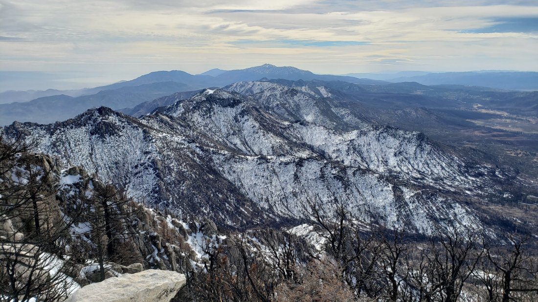
San Gorgonio mountain from San Jacinto Peak early this morning, 12th March 2019.
TRAIL CONDITIONS
All trails above about 6000′ are again completely snow-covered, although rapid melting is anticipated in the coming days, at least below about 9000′. The very limited number of tracks that were present on some parts of the PCT in the San Jacinto mountains have now been completely covered by fresh snow. Please see this posting about the specific challenges of Fuller Ridge just two days ago.
Hikers should be prepared for temperatures at or below freezing in the high country, and below freezing above 10,000′ (considerably colder when considering windchill effects).
Snowshoes are currently recommended everywhere above about 7500′. Microspikes may become useful mainly in the colder early mornings as the most popular trails become consolidated (e.g. Devil’s Slide, lower Deer Springs). Crampons with an ice axe (and knowledge of how to use both) are useful at higher elevations, as the icy snow underlying the fresh snowfall is treacherous. Their usefulness will increase with the strong freeze-thaw cycle expected in the next week. Crampons and ice axe are currently essential on Fuller Ridge, as discussed here.
Waterproof footwear is strongly recommended on the approach trails (e.g., Devil’s Slide, lower Deer Springs) due to multiple stream crossings and considerable water flowing in the trails. It is also advisable due to the slushy quality of the snow due to thawing.
Routefinding remains very challenging for those not familiar with the area. Almost all signage above about 8500′ is snow-covered. Most PCT marker posts are also completely obscured. Currently no trails have been broken whatsoever, other than my descent route today, and those tracks may be obscured quickly due to melting of surface snow and spindrift.
Please note that Tahquitz Peak trail from the PCT at Chinquapin Flat is extremely treacherous. With the fresh snowfall there will not even be a hint of “trail” to follow whatsoever. Crampons in conjunction with an ice axe, and excellent knowledge of how to use both, are critical.
Snow depths measured today are as follows. The first number is fresh snowfall overnight, followed by the total depth in parentheses (based on pre-storm measurements as I ascended yesterday). Very strong overnight winds have led to major drifting; drifts can be much greater than the average depth, especially at the exposed peaks. Altitudes are approximate.
San Jacinto Peak (10,810′): 13″ (75″)
Wellman Divide (9700′): 11″ (47″)
Annie’s Junction (PCT at State Park boundary north of Saddle Junction) (9050′): 7″ (33″)
Saddle Junction (8100′): 6.5″ (26″)
Devil’s Slide trailhead at Humber Park (6500′): 5″ (6″)
Idyllwild (at 5550′): 2.5″ (2.5″, but largely melted already)
Round Valley and Long Valley from the Peak “trail”, 12th March 2019.
Yesterday I hiked to Castle Rocks on Fuller Ridge. With our continuing road closures, this involved a lengthy hike each way, along a closed section of Highway 243, then up a snowy Black Mountain Road, before using crampons and ice axe to ascend Fuller Ridge. Most of the week was spent hiking trails nearer Idyllwild to check conditions. I recorded the following video from Castle Rocks at about 1140 in the morning yesterday.
Snow conditions are largely unchanged since the previous report on Monday (see that report for detailed snow depth data). Despite very cold conditions, there has been some slow melting at lower elevations, with no significant net change in snow depths. Two days ago it snowed lightly overnight, with an inch in Idyllwild at 5550′, two inches up to 7000′, and three inches above that. This lovely fine powder was sitting on top of very firm, icy snow, a combination which made for easy snow hiking with the right equipment (microspikes to about 8000′, crampons with ice axe higher).
Carrying snowshoes (with poles), crampons (with ice axe), and microspikes, is the unfortunate but ideal gear combination at present, such is the variability of snow conditions due to altitude, aspect, and time of day. PCT hikers may prefer not to carry the weight of snowshoes, accepting that this will result in some serious postholing on warmer days and in the afternoons.
One of the gentler sections of Fuller Ridge “Trail” just north of Castle Rocks, 9th March 2019.
WEATHER After several more days of cold weather including snowfall forecast for tomorrow (with severe cold in the high country), a major shift to settled, sunny weather and above-average temperatures later in the week will result in rapid melting at all elevations.
At Castle Rocks (8600′) on Fuller Ridge yesterday, Saturday 9th March 2019, at 1130 the air temperature was 23°F (-5°C), with a windchill temperature of 7.9°F (-13°C), 80% relative humidity, and an icy 15 mph NW wind gusting to 21 mph.
At San Jacinto Peak (10,810′) on Monday 4th March 2019 at 1025 the air temperature was 34°F (1°C), with a windchill temperature of 17°F (-8°C), 18% relative humidity, and a biting 24 mph WNW wind gusting to 33 mph.
PCT junction sign at Black Mountain Road crossing, 9th March 2019.
TRAIL CONDITIONS
All trails above about 7500′ remain completely snow-covered, despite rapid melting in the past few days. Details for specific routes are below.
Hikers should be prepared for temperatures below freezing in the high country, and well below freezing above 10,000′ (especially when considering windchill effects).
Microspikes are currently useful mainly in the morning and on well consolidated trails (e.g. Devil’s Slide, lower Deer Springs). Crampons with an ice axe (and solid knowledge of how to use both) are recommended forhigher elevations and on moderate angle slopes (e.g. Fuller Ridge, Tahquitz Peak) as the snow consolidates with freeze-thaw cycles, at least in the morning, or all day in colder temperatures. Snowshoes are recommended off-trail above about 8000′, and everywhere at mid elevations after mid-morning on milder days.
Waterproof footwear is useful at least on approach trails (e.g., Devil’s Slide, lower Deer Springs) due to multiple stream crossings and considerable water flowing in the trails. It is also advisable currently due to the slushy quality of the snow on sun-exposed slopes after mid-morning.
Routefinding remains very challenging for those not familiar with the area. Almost all signage above about 8500′ is snow-covered. Many PCT marker posts are obscured. Very few trails have been broken whatsoever, and tracks from will be at least partly obscured by forecast snow tomorrow.
Pacific Crest Trail Most ofthe PCTthrough the San Jacinto mountains has been traversed by only a handful of hikers (or not at all) for weeks, so caution is required for route finding. Patchy snow starts at about Mile 155. By Mile 164, snow depths in places are 1-2 feet. Fuller Ridge Trail is largely a featureless ice slope along almost all its five mile length. Crampons and ice axe are essential. Most PCT hikers should consider the Black Mountain Road alternative.
Black Mountain Road was largely clear of snow by yesterday afternoon for its lower three miles. Up to 7000′ (5 miles up) there was shallow patchy snow. From the Lookout junction to the PCT/Fuller Ridge campground (miles 5 to 8) snow cover is continuous at about 20″ deep. Snow is currently firm and easy to traverse, with or without microspikes.
Devil’s Slide Trail is largely snow-covered to 7500′, then completely under snow thereafter. The trail has been heavily traveled, is obvious, and microspikes are ideal for the consolidated icy snow.
Deer Springs Trail is largely clear to the Suicide Rock trail junction (6900′). From there to Strawberry Junction (8100′) there is about 90% soft snow cover, with many hazardous sections of water flowing under or on the trail route.
Tahquitz Peak trail from Chinquapin Flat is extremely treacherous. Crampons in conjunction with an ice axe, and excellent knowledge of how to use both, are critical.
Ernie Maxwell Trail has about 10% snow cover (1-2″ deep) for most of its length, increasing to about 40% near Humber Park.
South Ridge Road is largely clear of snow in its lower half, but is impassable near the trailhead due to severe road damage. South Ridge Trail is continuously snow-covered ranging from a few inches deep below Old Lookout Flat, to 1-3 feet deep above it. Crampons are very useful on the final approach to Tahquitz Peak (above about 8500′).
Access closures The Valentine’s Day floods continue to make access to the San Jacinto mountains challenging. Palm Springs Aerial Tramway remains closed until approximately 1st April. Highway 243 between Banning and Idyllwild is closed from north of Bay Tree Spring to just north of Alandale until at least April. Highway 74 between Mountain Center and Valle Vista (Hemet) is closed until sometime in March or April. Many minor roads around Idyllwild-Pine Cove remain partly closed or damaged. Apple Canyon Road (access for the Spitler Peak trailhead) is still flooded at Hurkey Creek and closed to non-residents.
[UPDATE 8th March 2019: a minor snowfall overnight produced barely one inch in Idyllwild, and only a couple of inches up to about 9000′, with the upper mountain above the cloud. Very cold temperatures are forecast for the next five days, with potential for significant new snowfall on Monday at all elevations.]
[UPDATE 7th March 2019: yesterday Idyllwild received an additional 0.69″ of rainfall. There was a very light dusting of snow in the mid elevations (the upper mountain was above the cloud). Highway 243 remains closed to traffic either side of the Black Mountain Road, but on my hike today I found that both the highway and lower BMR are now clear of snow, so this is now an option for PCT hikers wishing to avoid Fuller Ridge.]
Today I ascended San Jacinto Peak up Devil’s Slide Trail, a short section of the PCT, then via Wellman Divide. I descended through Little Round Valley, the PCT/Deer Springs Trail southbound from the south end of Fuller Ridge to Strawberry Junction, and then descended lower Deer Springs Trail. Other than my own from last week, there were no tracks anywhere above 8100′, and none anywhere on the PCT north of Saddle Junction. Yesterday we ran the Pacific Crest Trail just south of Highway 74, to assess trail conditions at lower elevation. I recorded the following video at San Jacinto Peak at about 1030 this morning.
Error
This video doesn’t exist
Snow conditions have changed dramatically compared to last week. Two days ago it rained most of the day, with a total of 1.56″ in Idyllwild at 5550′. Despite forecasts for light snow at higher elevations, I discovered today that it rained all the way to San Jacinto Peak, for at least the third time this winter. This helped consolidate snow at all elevations, augmented melting, and glazed the upper elevations with a crust of freezing rain.
As a consequence of the firm icy snow, in the early morning I was able to ascend to 9700′ with just microspikes, before changing to crampons for the final climb to the Peak. Crampons were also essential for the direct descent to Little Round Valley. By late morning, the snow was becoming soft, and at the Deer Springs-Fuller Ridge trail junction, I had to put on snowshoes to minimize postholing.
Carrying snowshoes (with poles), crampons (with ice axe), and microspikes, is the unfortunate but ideal combination at present, such is the variability of snow conditions due to altitude, aspect, and time of day.
Mild weather (and rainfall) led to significant melting in the previous few days, mainly below 9000′. Lower elevations that received the most rain lost a great deal of snow in just a few days (12″ at Saddle Junction, 15+” at Humber Park, c.20″ in Idyllwild). Conversely, the highest elevations experienced minimal melting, despite relatively mild temperatures. Snow depth measurements are listed near the foot of this posting.
My ice axe at the location of the sign (buried in the snow) for the southern end of Fuller Ridge “trail”, today 4th March 2019.
WEATHER Unsettled and uncertain are the best words to describe the weather for the San Jacintos over the next ten days. After another warm day tomorrow, temperatures will fall below average, and remain there for about a week. At mid-elevations, precipitation is possible on several days between 6th-12th March, but whether it falls as rain or light snow depends on the day and altitude. Above about 9000′ should be above the rainfall, but may also be largely above the cloud, and fresh snowfall is forecast to be little more than an inch or two for the high country all week.
At San Jacinto Peak today, Monday 4th March 2019, at 1025 the air temperature was 34°F (1°C), with a windchill temperature of 17°F (-8°C), 18% relative humidity, and a biting 24 mph WNW wind gusting to 33 mph.
At the Peak on Monday 25th February 2019, at 1145 the air temperature was 27°F (-3°C), with a windchill temperature of 12.5°F (-11°C), 57% relative humidity, and a fresh 7 mph NW wind gusting to 15 mph.
From the very top of the Snow Creek drainage, 4th March 2019. San Jacinto Peak summit to the left, San Gorgonio in the distance to the right.
TRAIL CONDITIONS
All trails above about 7500′ remain completely snow-covered, despite rapid melting in the past few days. Details for specific trails are below.
Hikers should be prepared for temperatures at or below freezing in the high country, and well below freezing above 10,000′ (especially when considering windchill effects).
Snowshoes are strongly recommended on all trails and off-trail areas above about 8000′, especially after mid-morning on warm days. Microspikes are currently useful mainly in the colder early mornings on well consolidated trails (e.g. Devil’s Slide, lower Deer Springs). Crampons with an ice axe (and knowledge of how to use both) are becoming increasingly useful at higher elevations and on moderate angle slopes (e.g. Fuller Ridge, Tahquitz Peak) as the snow consolidates with freeze-thaw cycles, at least in the morning, or all day in colder temperatures.
Waterproof footwear is strongly recommended on the approach trails (e.g., Devil’s Slide, lower Deer Springs) due to multiple stream crossings and considerable water flowing in the trails. It is also advisable currently due to the slushy quality of the snow, especially after mid-morning.
Routefinding remains very challenging for those not familiar with the area. Almost all signage above about 8500′ is snow-covered. Many PCT marker posts are also completely obscured. Very few trails have been broken whatsoever, and my tracks from today will be obscured quickly due to melting of surface snow and forecast light snwfall. Much of the PCT through the San Jacinto mountains high country has hardly been traversed for weeks (or in the case of Fuller Ridge, not at all since November).
Devil’s Slide Trail is about 90% snow-covered to 7500′, then completely under snow thereafter. The trail has been heavily traveled, is obvious, and microspikes are ideal for the consolidated icy snow.
Deer Springs Trail has patchy snow up to the Suicide Rock trail junction (6900′). From there to Strawberry Junction (8100′) there is about 90% soft snow cover, with many hazardous sections of water flowing under or on the trail route.
Tahquitz Peak trail from Chinquapin Flat is extremely treacherous. There is no evidence of it having been traversed since early February, so there is not even a hint of “trail” to follow whatsoever. Crampons in conjunction with an ice axe, and excellent knowledge of how to use both, are critical.
Ernie Maxwell Trail [updated 6th March] has about 10% snow cover (1-2″ deep) for most of its length, increasing to about 40% near Humber Park. Microspikes are useful in the early morning in the upper half of the trail, and on colder frozen days, but are generally not essential later in the day.
South Ridge Road [updated 5th March] is largely clear of snow, but is impassable near the trailhead due to severe road damage. South Ridge Trail is essentially continuously snow-covered (about 90% below 7000′), ranging from a few inches deep below Old Lookout Flat, to 1-3 feet deep above it. Crampons are very useful on the final approach to Tahquitz Peak (above about 8500′) where there is no trail as such and the entire peak is a largely featureless, consolidated snow dome.
Snow depths measured today are as follows. Measurements noted from 1st March will have dropped slightly due to melting, but likely only by a few inches, and mainly at the lower elevations. Only average depth is given, due to the complexity of past storms. Strong winds have led to major drifting; drifts can be much greater than the average depth, especially at the exposed peaks. Altitudes are approximate.
San Jacinto Peak (10,810′): 55″ [60″ on 25th February]
Little Round Valley (9800′): 48″
Wellman Divide (9700′): 40″ [45″ on 25th February]
Annie’s Junction (PCT at State Park boundary north of Saddle Junction) (9050′): 29″ [40″ on 25th February]
PCT at south end of Fuller Ridge Trail (8950′): 35″
Tahquitz Peak (8836′): 36″ measured on 1st March, with massive drifting ranging from 0″ to seven feet.
Marion Mountain Trail junction with PCT/Deer Springs Trail (8800′): 28″
Strawberry Junction (8100′): 16″
Saddle Junction (8100′): 23″ [35″ on 25th February]
Old Lookout Flat on South Ridge Trail (7800′): 14″ measured on 1st March, very heavily drifted
Devil’s Slide trailhead at Humber Park (6500′): 3″ but patchy [18″ on 25th February]
South Ridge Road junction with South Ridge Trail (6500′): 4″ measured on 1st March
PCT at crossing of Highway 74 (4700′): 0″ [2″ on 27th February]
Nature note Spring is in the air! I had my first returning spring migrant bird today, with several Violet-green Swallows flying around over Saddle Junction and Angel’s Glide (8100-8500′). Early March is when I typically record the first swallows up here.
Annie’s Junction (9070′), the high point of the PCT in the San Jacinto mountains, (above) today 4th March, (below) one week earlier on 25th February.
Access closures The Valentine’s Day floods continue to make access to the San Jacinto mountains challenging. Palm Springs Aerial Tramway remains closed until approximately 1st April. Highway 243 between Banning and Idyllwild is closed from north of Bay Tree Spring to just north of Alandale until at least April. Highway 74 between Mountain Center and Valle Vista (Hemet) is closed until sometime in March or April. The status of some of the trailhead access roads was updated in an earlier posting linked here. Many minor roads around Idyllwild-Pine Cove remain partly closed or damaged. Apple Canyon Road (access for the Spitler Peak trailhead) is still flooded and completely closed.
The older of the two pit toilets in Little Round Valley, 4th March 2019. Currently somewhat challenging to access.
[UPDATE Saturday 2nd March: it started raining at 0400 in Idyllwild, with 1.56″ recorded by late evening. As has often been the case this winter, it has rained to a higher elevation on the mountain than forecast, with more than an inch of rain so far at Long Valley (8600′). For much of the storm the highest elevations have been above the cloud.]
For a change of scenery today we hiked from home in Idyllwild to Tahquitz Peak via South Ridge Road and South Ridge Trail. This also allowed assessment of the snow situation on one of the most sun-exposed (and therefore rapidly melting) trails in the entire region. There was no evidence of any ascent of Tahquitz Peak since the 14th February flooding/rain event. The previous two days we had hiked/run trails in the Desert Divide area, including the Pacific Crest Trail just north of Highway 74, to assess the snow situation on the lower elevations of the PCT.
Mild weather has led to significant melting this week, but mainly below 7000′, and extensive snow still covers almost all elevations above about 6000′. Snow is largely rotten and was terrible underfoot today below about 7500′, making snowshoes essential (and postholing a nightmare). Even at higher elevations, a thin refrozen crust masked softer snow beneath, making for challenging snowshoeing. Only above 8500′, at which point spikes or crampons were better anyway (at least in the early morning), was the going somewhat easier. Carrying snowshoes, crampons (with ice axe), and microspikes, is the unfortunate but ideal combination at present, such is the variability of snow conditions due to altitude, aspect, and time of day.
Snow depths measured today and earlier this week are as follows. Measurements from prior days will have dropped slightly due to melting, but likely only by a few inches, and mainly at the lower elevations. Only average depth is given, due to the complexity of past storms. Strong winds have led to major drifting; drifts can be much greater than the average depth, especially at the exposed peaks. Altitudes are approximate.
San Jacinto Peak (10,810′): 60″ [measured on 25th February]
Wellman Divide (9700′): 45″ [measured on 25th February]
Annie’s Junction (State Park boundary north of Saddle Junction) (9050′): 40″ [measured on 25th February]
Tahquitz Peak (8836′): 36″, but with massive drifting ranging from 0″ to seven feet.
Saddle Junction (8100′): 35″ [measured on 25th February]
Old Lookout Flat on South Ridge Trail (7800′): 14″, very heavily drifted
Devil’s Slide trailhead at Humber Park (6500′): 18″ [measured on 25th February]
South Ridge Road junction with South Ridge Trail (6500′): 4″
PCT at crossing of Highway 74 (4700′): 2″ [measured on 27th February]
Access closures The Valentine’s Day floods continue to make access to the San Jacinto mountains challenging. Palm Springs Aerial Tramway remains closed until approximately 1st April. Highway 243 between Banning and Idyllwild is closed from north of Bay Tree Spring to just north of Alandale until at least April. Highway 74 between Mountain Center and Valle Vista (Hemet) is closed until sometime in March. The status of some of the trailhead access roads was updated in an earlier posting linked here. Many minor roads around Idyllwild-Pine Cove remain partly closed or damaged.
Looking SSE from Tahquitz Peak across the Desert Divide (PCT route) to Toro Peak and the Santa Rosa range, 1st March 2019.
WEATHER Temperatures will remain at or above average for the next week, with continued melting of snow at all elevations, especially on sun-exposed slopes. Significant rainfall is forecast for tomorrow, Saturday 2nd March, with about one inch possible at the elevation of Idyllwild, which will accelerate snow melt below c.7000′. A light dusting of snow (just a couple of inches) is likely in the high country. Further rain is forecast on/off for Tuesday to Friday next week, 5th-7th March, perhaps totaling another half-inch at mid elevations, but with more snow (2-5″ depending on altitude) above about 7000′.
At Tahquitz Peak today, Friday 1st March 2019, at 0950 the air temperature was 37°F (3°C), with a windchill temperature of 24.8°F (-4°C), 51% relative humidity, and a bitter 11 mph NW wind gusting to 17 mph.
At San Jacinto Peak on Monday 12th February 2019, at 1145 the air temperature was 27°F (-3°C), with a windchill temperature of 12.5°F (-11°C), 57% relative humidity, and a fresh 7 mph NW wind gusting to 15 mph.
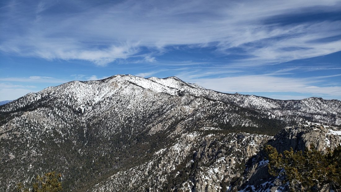
The high country of the San Jacinto mountains as seen from Tahquitz Peak, 1st March 2019.
TRAIL CONDITIONS
All trails above about 6000′ remain snow-covered at this time, despite rapid melting in the past few days. The Pacific Crest Trail north of Highway 74 is largely free of snow (up to 5000′ elevation) on exposed sections, but thereafter has continuous snow cover (for an idea of depths depending on elevation, see measurements above).
Hikers should be prepared for temperatures near freezing in the high country and at or below freezing above 10,000′, especially when considering windchill effects.
Snowshoes are currently very strongly recommended on all trails and off-trail areas above about 7000′, especially after mid-morning, and at lower elevations in some areas and on warm afternoons in soft snow. Microspikes are currently useful only in the colder early mornings on well consolidated trails (e.g. Devil’s Slide, lower Deer Springs). Crampons (with an ice axe) are becoming increasingly useful at higher elevations as the snow consolidates with freeze-thaw cycles, at least in the morning prior to about 0930.
Waterproof footwear is strongly recommended on the approach trails (e.g., Devil’s Slide, lower Deer Springs) due to multiple stream crossings and considerable water flowing in the trails. It is also advisable everywhere else due to the soft and slushy quality of the snow, especially after mid-morning.
Routefinding remains very challenging for those not familiar with the area. Almost all signage above about 8500′ is snow-covered. Many PCT marker posts at lower elevations are also completely obscured. Very few trails have been broken whatsoever, and even my snowshoe tracks from early this morning were becoming indistinct within an hour due to melting of surface snow. Much of the PCT through the San Jacinto mountains has not been traversed for weeks (or in the case of Fuller Ridge, for months).
Tahquitz Peak trail from Chinquapin Flat is extremely treacherous. There is no evidence of it having been traversed since early February, so there is not even a hint of “trail” to follow whatsoever. Crampons in conjunction with an ice axe, and excellent knowledge of how to use both, are critical.
South Ridge Road continues to be largely snow-covered (c.70%) at 1-4″ deep. South Ridge Trail is essentially continuously snow-covered (a few bare patches below 7000′), ranging from a few inches deep below Old Lookout Flat, to 1-3 feet deep above it. Crampons were very useful on the final approach to Tahquitz Peak (above about 8500′) this morning, where there is no trail as such and the entire peak is a largely featureless, consolidated snow dome.
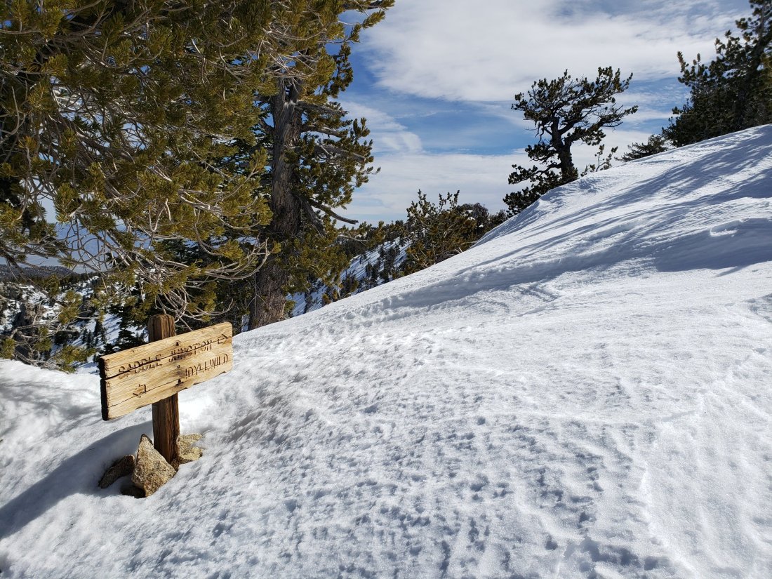
The trail junction sign just below Tahquitz Peak, today 1st March 2019. The only evidence that a trail system exists near Tahquitz right now.
Today I hiked to San Jacinto Peak from Humber Park via Saddle Junction and Wellman Divide, descending the same way (in order to try to consolidate a reasonable trail). Above Saddle Junction, the only (vague) tracks to be seen anywhere on the mountain were my own from last week’s report. Early in the morning I was able to use microspikes to ascend to Saddle Junction in firm icy snow, but the rest of the hike was in snowshoes. The early afternoon descent below 9000′ felt a bit like wading through soft serve ice cream, as the snow melted in the warm sun.
I recorded the following vlog just after 1145 at San Jacinto Peak this morning. (After I recorded this video the Tram gave an updated reopening date of 1st April.)
Error
This video doesn’t exist
The only additional snowfall has been 3-5″ in the afternoon just after my last trail report on 21st. However it was obvious from the state of the trees that the upper mountain (>9000′) was above that precipitation. Strong winds at higher elevations have smoothed the existing snow so there is little or no evidence of the trail system. Considerable caution is required with both route-finding and traversing slopes.
Snow depths measured today are as follows. Only average depth is given, due to the complexity of past storms. Strong winds have led to major drifting; drifts can be much greater than the average depth in places. Altitudes are approximate.
San Jacinto Peak (10,810′): 60″
Wellman Divide (9700′): 45″
Annie’s Junction (State Park boundary north of Saddle Junction) (9050′): 40″
Saddle Junction (8100′): 35″
Devil’s Slide trailhead at Humber Park (6500′): 18″
Access closures The Valentine’s Day floods continue to make access to the San Jacinto mountains challenging. Palm Springs Aerial Tramway remains closed until about 1st April. Check their website for updates. Highway 243 between Banning and Idyllwild is closed from north of Bay Tree Spring to just north of Alandale until at least April. Highway 74 between Mountain Center and Valle Vista (Hemet) is closed until sometime in March. The status of some of the trailhead access roads was updated in my posting yesterday. Many minor roads around Idyllwild-Pine Cove are also closed or damaged.
San Jacinto Peak summit hut today, 25th February 2019, under four feet of snow (plus drifting)
WEATHER Temperatures will remain above average through at least the first week of March, with steady melting of snow at all elevations, especially on sun-exposed slopes (which at this time of year is almost everything except the north faces). Light precipitation is forecast as a possibility for Saturday 2nd March, with very light rain to at least 8000′, and a dusting of snow (maybe an inch) above that.
At San Jacinto Peak today, Monday 25th February 2019, at 1145 the air temperature was 27°F (-3°C), with a windchill temperature of 12.5°F (-11°C), 57% relative humidity, and a fresh 7 mph NW wind gusting to 15 mph.
At the Peak on Friday 15th February 2019, at 0945 the air temperature was 19.5°F (-7°C), with a windchill temperature of -2.4°F (-19°C), 31% relative humidity, and a harsh 18 mph WSW wind gusting to 27.8 mph.
San Jacinto Peak, 25th February 2019.
TRAIL CONDITIONS
All trails above about 4000′ remain snow-covered at this time, despite rapid melting in the past couple of days, especially below 7000′. Measured average snow depths are listed above. It continues to be delightful to see so many ephemeral creeks flowing that had had little or no flow for much of the past six years.
Hikers should be prepared for temperatures near freezing in the high country and below freezing above 10,000′, especially when considering windchill effects.
Snowshoes are currently essential on all “trails” above 7000′, especially after mid-morning, and anywhere in the backcountry (and at lower elevations on warm afternoons in soft snow). Microspikes are currently useful only in the early mornings on well consolidated trails (e.g. Devil’s Slide, lower Deer Springs). Crampons (with an ice axe) may become increasingly useful at the highest elevations if the snow consolidates with freeze-thaw cycles, at least in the mornings.
Waterproof footwear is strongly recommended on the approach trails (e.g., Devil’s Slide, lower Deer Springs) due to multiple stream crossings and considerable water flowing in the trails.
Routefinding will be very challenging for those not familiar with the area. Almost all signage above about 8500′ is completely snow-covered. Most PCT marker posts at lower elevations are also completely obscured. Very few trails have been broken whatsoever, and even my snowshoe tracks from early this morning were becoming vague by my descent a few hours later due to melting of surface snow.
Tahquitz Peak trail from Chinquapin Flat will be extremely treacherous. Crampons in conjunction with an ice axe, and knowledge of how to use both, are essential.
Wellman Divide (9700′) with the sign completely buried today 25th February 2019 (above) and a similar view ten days ago, with sign just visible, on 15th February (below)
With so much poor and inaccurate information floating around since the Valentine’s Day flood event and subsequent heavy snowfalls, I checked on some trailhead access issues today.
Black Mountain Road (4S01) is completely inaccessible by vehicle. Highway 243 is closed both north and south of the start of the road. To the south, the highway is closed – a hard closure with concrete barriers – just north of Alandale, more than two miles before the Black Mountain Road junction. The highway hasn’t even been ploughed north of the closure. Snow is currently about two feet deep there. This closure greatly impacts access to Black Mountain, Fuller Ridge campground and the Pacific Crest Trail at the north end of Fuller Ridge.
Azalea Drive has been narrowly ploughed. This is the access for Marion Mountain Trail, Seven Pines Trail, and associated campgrounds. The ploughed road still requires 4WD/AWD or chains, and has almost no pullout or turn-around opportunities. It has been ploughed only as far as the junction of the Dark Canyon (4S02) and Marion Mountain campground (4S71) roads. Therefore it requires 0.6 mile of snowshoeing to reach the trailhead for Marion Mountain Trail. Snow was about two feet deep there today.
Inexplicably South Ridge Road (5S11) remains open. This is the access for South Ridge Trail and associated yellow post campsites. Although currently covered in deep snow, the upper section of this road was severely damaged on Valentine’s Day, and is both impassable to vehicles and very dangerous.
This afternoon I snowshoed to the top of Angel’s Glide at 9000′ on the PCT north of Saddle Junction. Since the unprecedented rainfall/flooding event on Valentine’s Day last week (discussed in detail in the posting linked here), the mountain has received some snowfall on six of the subsequent seven days. Although none of the snowfall events in isolation have been dramatic, the cumulative effect has been substantial.
The snow conditions that I described the day after the Valentine’s Day rains (described in the previous posting here) have changed beyond all recognition. There is now thick powder everywhere above 5000′. with shallower snow down below 4000′. See more detailed discussion in Trail conditions section below.
Access closures The Valentine’s Day floods have made access to the San Jacinto mountains extremely challenging for non-residents. Palm Springs Aerial Tramway remains closed indefinitely due to damage to the access road to Valley Station. It seems likely to be weeks rather than days before the tram can safely reopen. Check their website for updates. Highway 243 between Banning and Idyllwild is closed at Bay Tree Spring (4 miles north of Lake Fulmor) for at least two months. Highway 74 between Mountain Center and Valle Vista is closed for as much as one month. In addition, periodic closures for maintenance of varying durations are happening on the only route to Idyllwild (Highway 74 from Garner Valley then Highway 243 up from Mountain Center).
Snow depths measured today are as follows. Only average depth is given, due to the complexity of past storms. Strong winds have led to major drifting and drifts are much deeper than the average depth in places. Altitudes are approximate.
Annie’s Junction (State Park boundary north of Saddle Junction) (9050′): 46″
Saddle Junction (8100′): 34″ [added 18″ since 15th February]
Devil’s Slide trailhead at Humber Park (6500′): 17″ [added 14″ since 15th February]
Idyllwild (at 5550′): 15″ [all new snow since 14th February]
Saddle Junction signage, today Thursday 21st February 2019. My ski pole gives a reference. Usually these signs are 10 feet above the trail but are now nearly at eye level.
WEATHER It was prescient when I wrote six days ago that in the El Niño-driven winter we are having, it seems that conditions will remain highly variable and unpredictable. It is currently snowing again heavily in Idyllwild (Thursday evening). Then over the next week we will experience a very rapid warming trend, with temperatures forecast to be above seasonal by late next week. By the middle of next week, temperatures may well be just above freezing at San Jacinto Peak. This is proving to be quite the winter for wildly variable weather.
At San Jacinto Peak on Friday 15th February 2019, at 0945 the air temperature was 19.5°F (-7°C), with a windchill temperature of -2.4°F (-19°C), 31% relative humidity, and a harsh 18 mph WSW wind gusting to 27.8 mph.
TRAIL CONDITIONS All trails above about 3000′ are snow-covered at this time. With extremely rapid warming forecast over the next week, there will be considerable snow loss at lower elevations due to melting (<6000′). However snow depths are such that it will take considerable time for melting to have any significant impact at higher elevations. Measured average snow depths are listed above.
For the next few days hikers should be prepared for temperatures near or below freezing in the high country (>8000′) and below freezing above 10,000′.
Snowshoes are currently essential on all trails above 5000′. Microspikes may become useful on lower elevation trails during the course of the coming week. Waterproof footwear is strongly recommended on the approach trails (<8200′) due to considerable water flowing in the trails.
Routefinding is currently extremely challenging for those hikers who are not very familiar with the area, with areas above 8000′ largely just featureless snow slopes with no hint of trails whatsoever. Almost all signage above about 8500′ is currently completely snow-covered and almost all PCT marker posts and some other signage above about 7500′ is also obscured. No trails have been broken and snow is so deep that travel is slow and arduous, even with snowshoes.
Crampons in conjunction with an ice axe, and good knowledge of how to use both, are essential for moderate angle terrain, such as the Tahquitz Peak trail from Chinquapin Flat, sections of Fuller Ridge Trail, and any off-trail travel on the north faces of San Jacinto Peak and Tahquitz Peak.
There is an increased risk of avalanche conditions at the highest elevations. With considerable fresh snowfall on top of the icy Valentine’s Day frozen rain layer at all elevations, accompanied by strong SW-W winds at higher elevations, wind slab and storm slab conditions are possible, especially on easterly and northerly slopes. Upper Snow Creek drainage is infamously vulnerable, but the exposed easterly slopes above about 9800′ e.g., between Wellman Divide and Miller and San Jacinto peaks, could be unstable too. Cautious routefinding and conservative decision-making are recommended in any areas that display signs of possible instability (shooting cracks, whumphing, large cracks perpendicular to slope).
The waterfall that is currently Middle Spring on Devil’s Slide Trail, today Thursday 21st February 2019.
[UPDATE Wednesday 20th February: it started snowing again gently at 1230, with about one inch accumulating in three hours. After two days of torrential rain last week it has snowed on five of the subsequent six days (so far!). I plan a more detailed update on the snow conditions in the high country for Friday.]
[UPDATE Tuesday 19th February: Following major road damage in the Valentine’s Day rains, CalTrans have announced Highway 243 between Banning and Lake Fulmor will be closed for at least two months, and Highway 74 between Valle Vista and Mountain Center will be closed for at least one month.]
[UPDATE Monday 18th February: in Idyllwild we received 5.75″ more fresh snow overnight, and then two more inches this afternoon, for a total of about 10″ around town. The high country received only a few additional inches. It even snowed an inch in Garner Valley (4100′). Highway 74 is currently open at Lake Hemet to all traffic.]
[UPDATE Sunday 17th February: It started snowing in Idyllwild at 1200 today, and is accumulating at 0.5″ per hour (at least thru 1900). The Highway 74 access issue remains unpredictable. This morning it was open to all traffic at Lake Hemet, as it was yesterday. By early afternoon, CHP was allowing only residents, homeowners, and employees uphill, as was the case on Friday. Visitors should be aware that if they try to come up to Idyllwild by the one and only open route, they risk getting turned around depending on the day or the weather.]
[UPDATE II Saturday 16th February: Highway 74 from Garner Valley to Mountain Center and Highway 243 from Mountain Center to Idyllwild are open to all traffic (not just residents). When descending from Idyllwild, use the Saunders Meadow Road diversion (i.e. past the transfer station) as Hwy 243 is single lane for uphill traffic only. All other road closures remain in effect.]
[UPDATE I Saturday 16th February: Just back from a hike from home up South Ridge Trail to Old Lookout Flat. About 3.5″ fresh snow at top of South Ridge Road (6500′) and the same depth at Old Lookout Flat (7800′). Bitter conditions high up with 30-40 mph winds. Idyllwild (at 5550′) had 2.25″ of snow overnight, but melting is now very rapid at town elevation. South Ridge Road has a huge boulder in the road at 0.4 miles up, and was severely damaged by washouts from 0.7 miles to the top. Do not attempt vehicular access. At Long Valley (8600′) there was little more than an inch of fresh snowfall.]
Following the unprecedented rainfall and flooding event yesterday, discussed in detail in the posting linked here, today I hiked to San Jacinto Peak from Humber Park via Saddle Junction and Wellman Divide, descending Deer Springs Trail to the Suicide Rock Trail, then back to Humber via the Suicide Climbers Trail. There was not a single track anywhere to be seen on the mountain.
I recorded a rambling and overly long (sorry) vlog at about 0945 at San Jacinto Peak this morning, available on YouTube at this link.
For the second time this year, it rained all the way to San Jacinto Peak, and consequently snowfall in the upper elevations was far below what had been forecast, with barely 5″ at San Jacinto Peak, and only 1-2″ above 10,000′. Even that snowfall seemed to have been accompanied by freezing rain, so there was barely any powder on top of very icy snow.
Relatively mild and heavy rain, accompanied by strong winds, has smoothed the existing snow at all elevations, so there is very little evidence of the trails, especially above 8500′. This also makes even fairly low angle exposed slopes (like those on the Peak Trail above Wellman Divide) quite challenging to traverse in anything other than crampons. Considerable caution is required with both route-finding and traversing slopes.
Currently, there is no change to the timetable for road closures that I outlined yesterday. However, the Palm Springs Aerial Tramway will be closed indefinitely due to flood damage to the access road to Valley Station. Check their website for updates.
Snow depths measured today are as follows. Only average depth is given, due to the complexity of past storms. Strong winds have led to major drifting; drifts can be much greater than the average depth in places. Altitudes are approximate.
San Jacinto Peak (10,810′): 55″ [was c.50″ on Monday 11th]
Little Round Valley (9800′): 40″
Wellman Divide (9700′): 30″
Fuller Ridge Trail/PCT at junction with Deer Springs Trail (8950′): 36″
Annie’s Junction (State Park boundary north of Saddle Junction) (9050′): 24″
Marion Mountain Trail at junction with PCT/Deer Springs Trail (8800′): 22″
Saddle Junction (8100′): 16″ [was 26″ on Monday 11th]
Strawberry Junction (8100′): 11″
Devil’s Slide trailhead at Humber Park (6500′): 3″ [was 7″ on Monday 11th]
WEATHER Well, it can’t be as crazy as it was on Valentine’s Day! However, in the El Niño-driven winter we are having, it seems that conditions will remain highly variable and unpredictable. Minor storms with snowfall down as low as 5000′ are forecast for tonight and Sunday 17th. Snowfall at all elevations may be just a few inches at most, with about 2-3″ forecast for the Peak on Sunday. Then a potentially more substantial storm is currently predicted around Thursday 21st, with greater snowfall possible (4-9″ at the Peak}. Temperatures will remain well below average for the foreseeable future, with consequently little or no melting of snow and ice above 6500′.
At San Jacinto Peak today, Friday 15th February 2019, at 0945 the air temperature was 19.5°F (-7°C), with a windchill temperature of -2.4°F (-19°C), 31% relative humidity, and a harsh 18 mph WSW wind gusting to 27.8 mph.
At the Peak on Monday 11th February 2019, at 1225 the air temperature was 22°F (-6°C), with a windchill temperature of 3.6°F (-16°C), 28% relative humidity, and a moderate 9 mph WNW wind gusting to 18.3 mph.
Middle Spring well before dawn this morning, 15th February 2019. It looked more like Falls Creek than Devil’s Slide Trail (with only a hint of hyperbole)!
TRAIL CONDITIONS
All trails above about 6000′ remain snow-covered at this time, despite considerable snow loss at lower elevations due to rainfall. Measured average snow depths are listed above. Trail damage from the rain event yesterday was less than feared. Although many washouts occurred in areas where streams cross trails, none were so severe as to be impassable. In fact, it was delightful to see so many ephemeral creeks flowing that had had little or no flow for much of the past six years.
For at least the next ten days hikers should be prepared for temperatures below freezing in the high country (>6000′) and well below freezing above 10,000′ (with potential for severe cold when considering windchill effects).
Microspikes (or even better crampons with an ice axe) are currently essential on all trails above 6500′, especially in the morning. Snowshoes may soon be useful depending on the depth of fresh snowfalls, and/or during afternoon melting on exposed and lower elevation trails.
Waterproof footwear is strongly recommended on the approach trails (below 8200′) due to multiple stream crossings and considerable water flowing in the trails.
Routefinding will be challenging for those not familiar with the area. Almost all signage above about 9000′ is currently completely snow-covered. Many PCT marker posts at lower elevations are also completely obscured. No trails had been broken whatsoever on my circuit of the mountain today. The snow is so icy from the rainfall yesterday that I did not posthole at all until the early afternoon descent of lower Deer Springs Trail. Consequently there are no tracks anywhere on the trail system above 8000′. Below about 8900′ there were subtle signs of the trails from traffic earlier in the week, but these may disappear in the next day or so with forecast fresh snowfalls.
Tahquitz Peak trail from Chinquapin Flat will be extremely treacherous. Crampons in conjunction with an ice axe, and knowledge of how to use both, are essential.
The Ernie Maxwell Trail is almost completely snow-covered with about 1-2″ snow, but is passable without additional traction. [Thanks to Anne and Anabel King for this update from today.]
Marion Creek crossing the Suicide Rock Trail, this afternoon, 15th February 2019.
Today Idyllwild and neighbouring communities in the San Jacinto mountains experienced a once-in-a-generation rainfall and flooding event. Many minor roads remain flooded, severely damaged, and/or impassable. There is currently no road access to Idyllwild. Unless under an evacuation order, please do not attempt to move around or visit the region. Highway 74 is closed at Lake Hemet and Valle Vista (both with an estimated reopening on 16th February).
In about 24 hours we had an astonishing 7.77″ of rain in Idyllwild. By 0700 this morning, we had had 3.66″ of rain at home in Idyllwild (5550′) since yesterday. It finally stopped raining at about 1745 by which time we’d had an additional 4.11″.
With air temperatures above 45°F for much of the day, and so much mild rain, melting of existing snow was prodigious. Huge snow loss – basically all of the 6″ we had in town – massively increased the flood water volumes.
Long Valley (8600′) received a remarkable 9.1″ of rain in the same period. It then started snowing after about 1415 on top of the rain-saturated pre-existing snow. So far there has been only about an inch of fresh snowfall. The Palm Springs Aerial Tramway has been closed all day, and will not reopen until Saturday 16th February.
I will start assessment of trail conditions tomorrow. There may be washouts, trees down, and even landslides, in addition to horrible slushy snow conditions, that may make hiking anywhere in the region challenging for the foreseeable future.
My video below shows where upper Fern Valley Road – access for Humber Park – is impassable as Chinquapin Creek has flooded the road (with floodwater 2-3 feet deep).
Strawberry Creek where it flows under Village Center Drive near Idyllwild Post Office at about 0900.
I took this video of Strawberry Creek – between River Drive and Tahquitz Drive – at about 0800 this morning. Nowadays it is rarely more than a gentle trickle at best. Not today.
Tahquitz Drive just down from the Episcopal Church turned into a river, a foot deep in places, with the snow berms functioning as river banks.
[UPDATE Wednesday 13th February: We are bracing ourselves for a major “pineapple express” storm system. Currently much lighter rainfall than forecast, with barely 0.1″ in the past five hours since it started raining at 1300 this afternoon in Idyllwild. As much as 5″ (125mm) of rain has been forecast for elevations below about 8000′, with about two feet of snow possible at the high peaks. Flooding and landslides are possible on mountain roads, with voluntary evacuations in/near areas affected by the July 2018 Cranston Fire.]
Following a minor two-day storm over the weekend, today I snowshoed to San Jacinto Peak from Humber Park via Saddle Junction and Wellman Divide, descending the same way. For the second time in a few days I was breaking trail all the way to the Peak. Snowfall yesterday evening plus windy, drifting conditions, meant that again there was not a single track anywhere to be seen on the mountain. Very unusually, when I returned to Saddle Junction this afternoon the only tracks visible for the day were those from my early morning ascent. I recorded the following vlog at San Jacinto Peak just after noon today.
Error
This video doesn’t exist
The weekend storm occurred in two phases, some very light snow throughout the mountain on Saturday (mainly in the morning) and a somewhat heavier snowfall on Sunday that was confined to the western side of the mountain below 9000′ (the top of the mountain was above the cloud). Saturday snowfall was about one inch at all elevations. The Sunday snow produced an additional 2.5″ at 5550′ in Idyllwild, 3″ at Humber Park (6500′), 5″ at Saddle Junction (8100′), and 6″ at Annie’s Junction (9050′). There was no clear sign of significant fresh snowfall above about 9000′. Otherwise conditions looked very similar to those following last week’s major storm described in detail here. With cold conditions for the last week, signs of melting were minimal.
Snow depths measured today are as follows. Average current depth is given (known new accumulations are described above). Locations not surveyed since last week are estimated based on the depth six days ago and their elevation. Strong winds have led to major drifting, again even as low as 7500′ on Devil’s Slide Trail. Drifts can be double the average depth in places. Altitudes are approximate.
San Jacinto Peak (10,810′): 50″ (with drifts averaging 5-6 feet)
Little Round Valley (9800′): 45″ [estimated]
Wellman Divide (9700′): 37″
Fuller Ridge Trail/PCT at junction with Deer Springs Trail (8950′): 38″ [estimated]
Annie’s Junction (State Park boundary north of Saddle Junction) (9050′): 31″
Marion Mountain Trail at junction with PCT/Deer Springs Trail (8800′): 27″ [estimated]
Saddle Junction (8100′): 26″
Strawberry Junction (8100′): 20″ [estimated]
Devil’s Slide trailhead at Humber Park (6500′): 7″ (some significant recent melting)
San Gorgonio from San Jacinto Peak, today 11th February 2019.
WEATHER In keeping with the theme of this winter, a mild multi-day storm system is forecast from the afternoon of Wednesday 13th through to early morning Friday 15th. At San Jacinto Peak, about 1-1.5′ of snow is predicted across the period, although air temperatures even there will be only just below freezing. Most precipitation is forecast to fall as rain, potentially as high as 8500′, with the likelihood of a mix of rain, freezing rain, and snow above about 8000′. At all elevations below 8000′, at least three inches of rain are forecast in only a 30 hour period. Obviously this may lead to substantial loss of snow volume at mid and lower elevations.
At San Jacinto Peak today, Monday 11th February 2019, at 1220 the air temperature was 22°F (-5.5°C), with a windchill temperature of 3.6°F (-16°C), 28% relative humidity, and a cool 9 mph WNW wind gusting to 18 mph.
At the Peak on Wednesday 6th February 2019, at 1150 the air temperature was 4.9°F (-15°C), with a windchill temperature of -31.7°F (-35°C), 71% relative humidity, and a savage 21 mph WNW wind gusting to 48.8 mph.
TRAIL CONDITIONS
All trails above about 5000′ are completely snow-covered at this time (measured average snow depths are listed above). This includes almost the entire PCT from Highway 74 near Paradise Corner to below the Black Mountain Truck Trail (roughly PCT miles 150-195).
Hikers should be prepared for temperatures below freezing in the high country (>8000′) and well below freezing above 10,000′ (with potential for even more severe cold when considering windchill effects).
Snowshoes are currently strongly recommended everywhere above 6500′. Crampons or microspikes may soon be useful (following rain/freezing rain later this week) on almost all trails above about 7000′.
Waterproof footwear is recommended on the approach trails (below about 8200′) due to multiple stream crossings and water flowing in the trails. This will become quite extreme with the change in the weather in the next few days.
Routefinding will be challenging for those not familiar with the area. Almost all signage above about 9000′ is currently completely snow-covered. Many PCT marker posts and some other signs at lower elevations are also completely obscured. Few if any trails will be meaningfully broken prior to further precipitation this week.
Tahquitz Peak trail from Chinquapin Flat remains extremely treacherous. It has not been traversed since the latest snowfall. Crampons in conjunction with an ice axe, and knowledge of how to use both, are essential.
The Peak “Trail” at about 9800′ just above Wellman Divide, (above) today 11th February, and (below) Wednesday 6th February.
[UPDATE Sunday 10th February: it has snowed gently on/off in Idyllwild (5550′) since 0900 this morning, adding about 2.0″ to the existing snow depth. It is clear and sunny higher on the mountain (>8000′) and on the eastern side, with no new snow accumulation today.]
[UPDATE Saturday 9th February: it snowed lightly in Idyllwild (5550′) this morning between 0800-1230, adding about 1.2″ to the existing snow. At the same time it was snowing higher on the mountain, also adding about an inch at higher elevations.]
Following another multi-day storm, today I snowshoed to San Jacinto Peak from Humber Park via Saddle Junction and Wellman Divide, descending Deer Springs Trail to the Suicide Rock Trail, then back to Humber via the Suicide Climbers Trail. I was breaking trail from pre-dawn to dusk, with not a single track anywhere to be seen on the mountain. I recorded the following vlog in spectacular, wild spindrift conditions just before noon (please excuse the ice in my moustache, it was chilly up there!).
Error
This video doesn’t exist
What was effectively a four-day storm (at least at mid-elevations) started on Saturday with the heaviest snowfall at the highest elevations, as described in the previous update. A second significant snowfall occurred on Monday into Tuesday. At 5550′ elevation in Idyllwild, we ended up with an impressive 3.74″ of rain (early on) plus 6.25″ snow (towards the end of the storm). Snow level was at about 4000′ on both the east (below Mountain Center) and west (Pinyon) sides of the mountain.
Looking west from San Jacinto Peak towards Black Mountain, 6th February 2019.
Snow depths measured today are as follows. Only average depth is given, due to the complexity of past storms. Extremely strong winds have led to major drifting, even as low as 7500′ (on Devil’s Slide Trail, see photo below). Drifts can be double the average depth in places. Altitudes are approximate.
San Jacinto Peak (10,810′): 50″ (with drifts averaging 5-6 feet)
Little Round Valley (9800′): 38″
Wellman Divide (9700′): 36″
Fuller Ridge Trail/PCT at junction with Deer Springs Trail (8950′): 32″
Annie’s Junction (State Park boundary north of Saddle Junction) (9050′): 25″
Marion Mountain Trail at junction with PCT/Deer Springs Trail (8800′): 22″
Saddle Junction (8100′): 20″
Strawberry Junction (8100′): 15″
Devil’s Slide trailhead at Humber Park (6500′): 10″
Tahquitz Peak and Tahquitz Rock as seen from the Suicide Rock Trail this afternoon, 6th February 2019.
WEATHER For the first time this winter, it will remain cold post-storm. Overnight low temperatures will remain below freezing everywhere above 5000′ for the foreseeable future, so melting of snow and ice will be very slow. Some light precipitation (snow in the high country, mixed below 6500′) is forecast for Saturday morning and Sunday evening, with another possible multi-day storm later next week.
At San Jacinto Peak today, Wednesday 6th February 2019, at 1150 the air temperature was 4.9°F (-15°C), with a windchill temperature of -31.7°F (-35°C), 71% relative humidity, and a savage 21 mph WNW wind gusting to 48.8 mph.
At San Jacinto Peak on Sunday 3rd February 2019, at 0635 the air temperature was 13°F (-11°C), with a windchill temperature of -5°F (-21°C), 100% relative humidity, and a bitter 18 mph SW wind gusting to 25 mph.
TRAIL CONDITIONS
All trails above about 4000′ are completely snow-covered at this time. Measured average snow depths are listed above.
For at least the next ten days hikers should be prepared for temperatures below freezing in the high country (>8000′) and well below freezing above 10,000′ (with potential for even more severe cold when considering windchill effects).
Snowshoes are very strongly recommended everywhere above 6500′. Crampons or microspikes will soon be useful (once heavily used trails are consolidated) on almost all trails above about 7000′.
Waterproof footwear is recommended on the approach trails (below 8200′) due to multiple stream crossings and water flowing in the trails.
Routefinding will be challenging for those not familiar with the area. Almost all signage above about 9000′ is currently completely snow-covered. Mamy PCT marker posts at lower elevations are also completely obscured. No trails had been broken whatsoever on my circuit of the mountain today. My snowshoe tracks on the east side ascent were quickly invisible due to strong winds and severe drifting. My tracks on the Deer Springs Trail will be more obvious as it was less windy lower down this afternoon, however I was off-trail for some of the descent and I would not recommend trying to ascend some of my route, even where it is visible.
Tahquitz Peak trail from Chinquapin Flat will be extremely treacherous. Crampons in conjunction with an ice axe, and knowledge of how to use both, are essential.
The Ernie Maxwell Trail is completely snow-covered, but is passable without snowshoes. [Thanks to Anne and Anabel King for this update from today.]
Unusually heavy drifting for Devil’s Slide “Trail”, very early this morning at about 7800′ elevation.The trail junction sign at Wellman Divide (9700′) this morning, 6th February 2019.North Fork of the San Jacinto River at Deer Springs Trail, today 6th February 2019. All water sources above 8500′ are currently frozen and snow-covered.Good luck trying to use the pit toilet in Little Round Valley anytime soon!
[UPDATE Tuesday 5th February: For the first time this winter, Idyllwild awoke to a reasonable blanket of snow, 2.5″ depth at 5550′ elevation. It has continued to snow gently all day, with an additional 2″ accumulation. Since Friday, Idyllwild has had 3.74″ rain and 5.0″ snow. Long Valley (8500′) added another 3-4″ of snow overnight, but the upper mountain has often been above the cloud today.]
[UPDATE Monday 4th February: it has rained – and tried but largely failed to snow – in Idyllwild continuously since yesterday evening. At Humber Park this morning there was an additional one inch of snow at 6500′, but it was also occasionally drizzling. By this evening another 1″ of snow had accumulated. I happened to be there when U. S. Forest Service was closing the Humber Park gate, reducing legal parking spaces from 100+ to 10. It has been snowing on/off at Long Valley (8500′), with an additional 3-5″ accumulating, but for at least part of the day the upper mountain was above the cloud.]
I spent the previous three days on the mountain, descending this morning from San Jacinto Peak via Wellman Divide to Humber Park. On Friday I was assessing the snow from the minor storm we had on Thursday, and then observed the continuous snowfall we had on Saturday. Snow conditions were perfect for snowshoeing today everywhere above 8000′, with a few inches of soft powder on top of firmer deep snow, with occasional deep drifts.
The minor storm on Thursday produced a very even snowfall across the mountain, with 2.5″ at Saddle Junction (8100′), and 3″ from Long Valley (8500′) all the way to San Jacinto Peak (10,810′), with just a fraction of an inch down to 6400′ in Idyllwild.
Yesterday’s storm was more typical in terms of the snow distribution, but failed to produce the major snowfall of 2-3 feet that had been forecast for the high country. As has been the case all winter, the system was very mild, with much of the precipitation falling as rainfall (up to 8500′) until late on Saturday. Although there was a brief dusting to lower elevations, sticking snow level was down to about 6000′, with 1″ of fresh snowfall at Humber Park, 1.5″ at Saddle Junction, 4″ at 9000′, and about 13″ at San Jacinto Peak. Strong winds have caused extensive drifting, especially into the trails, and quickly eliminate any sign of prior tracks, so route-finding is challenging.
In Idyllwild (at 5550′ elevation) we had 1.72″ rain plus 0.25″ snow yesterday.
I recorded the following vlog at San Jacinto Peak at sunrise today.
Error
This video doesn’t exist
All trails above about 6500′ are completely snow-covered at this time (some individual trail conditions are discussed below). Microspikes are useful but not essential up to about8000′, especially for descending. Snowshoes are currently invaluable above about 9000′. Crampons may be a useful alternative to above about 9,000′ (and on the north side of Tahquitz Peak) as the snow continues to firm up. Some revised snow depths are at the foot of this posting.
For at least the next ten days hikers should be prepared for temperatures below freezing in the high country (>8000′) and well below freezing above 10,000′ (with potential for even more severe cold when considering windchill effects).
Sunrise just east of the Salton Sea, from San Jacinto Peak, today 3rd February 2019.
Weather February is currently forecast be a cold month at all elevations. Further light snow is forecast this evening, tomorrow, and Tuesday, with a possibility of a little more again next weekend. As temperatures will remain low all week, snow conditions should remain excellent for snowshoeing in the high country.
At San Jacinto Peak today, Sunday 3rd February 2019, at 0635 the air temperature was 13°F (-11°C), with a windchill temperature of -5°F (-21°C), 100% relative humidity, and a bitter 18 mph SW wind gusting to 25 mph.
At the Peak yesterday, Saturday 2nd February 2019, at 1210 the air temperature was a relatively mild 26.9°F (-3°C), with a windchill temperature of 9.8°F (-12°C), 100% relative humidity, and a howling 19 mph SW wind gusting to 40.3 mph.
San Gorgonio from San Jacinto Peak, today 3rd February, at sunrise.
TRAIL CONDITIONS
The Pacific Crest Trail is continuously snow-covered from south of Red Tahquitz (approx. PCT Mile 175) through to at least Mile 192. Fuller Ridge Trail section has not been traveled since November, there is no trail to follow, and it will be very treacherous in places. Itwill likely be impassable without ice axe, crampons, and good knowledge of how to use both.
Devil’s Slide Trail has a continuous snow cover of a couple of inches. Currently microspikes are not required in the soft snow for either descending or ascending, but they may become useful soon due to compaction and overnight freezing.
Tahquitz Peak trail from Chinquapin Flat remains very treacherous. Crampons (or microspikes if you are very comfortable with their use), an ice axe, and knowledge of how to use both, are essential.
The Ernie Maxwell Trail is largely clear of snow in its lower half, and the snow is very thin and soft in the upper section (nearer Humber Park).
South Ridge Road is open, and is readily passable with 4WD/AWD.
Measured snow depths from today (including all recent and past storms) are as follows. Only the average depth is given, due to the complexity of past storms, recent melting, and windblown drifts. Much deeper drifts and patches may be encountered. Altitudes are approximate.
San Jacinto Peak (10810′): 3.5-4.0 feet (very heavily drifted on east slope)
Wellman Divide (9700′): 30″ (but very heavily drifted here)
Annie’s Junction (State Park boundary north of Saddle Junction) (9050′): 13″
Long Valley (8500′): 7″
Saddle Junction (8100′): 5″
Humber Park (6500′): 1″
The Peak Trail just above Wellman Divide this morning, 3rd February (above), and the same view two days earlier on Friday 1st February (below).