Cranston Fire: trail update

The following is a review of the status of access and trail conditions in the San Jacinto mountains high country following the Cranston Fire. Following a review of the current state of access, there is a trail-by-trail breakdown of the fire’s impacts. The latter section is likely of interest mainly to local and hardcore hikers very familiar with the trail system. The trail details could not have been completed without information and photos from a completely reliable (anonymous) source on the ground.

Access overview: Forest Service lands

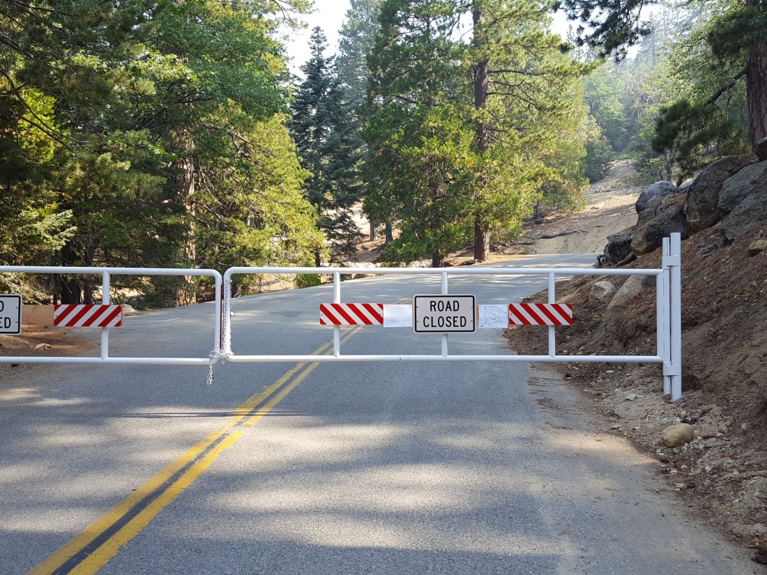
All trails in the USFS San Jacinto Ranger District remain closed. The U.S. Forest Service issued an official forest closure order on the evening of 27th July, details of which are available at this link. This measure initially closes the entire San Jacinto Ranger District trail system until 31st August 2018.

Good news however. USFS informed me yesterday that because most trails received little or no damage from the fire (as discussed in detail below), a new forest closure order has already been drafted and is in the review process (i.e. head office and legal team). We should hear about this revised order as soon as Friday, 3rd August. It is therefore likely that many trails in the forest will reopen sooner than initially feared.

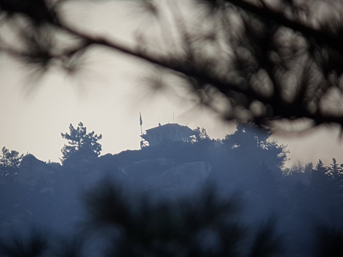
More good news. Black Mountain fire lookout reopened 1st August. Access will initially be for fire lookout volunteers only. However it is further evidence that the trail and access conditions are returning to normal rather quickly.

Access overview: Mount San Jacinto State Park

The Palm Springs Aerial Tramway reopened 30th July, along with the Desert View and Nature trails in Long Valley. A message on the homepage of the State Park website (linked here) indicates that the Idyllwild and Stone Creek developed campgrounds reopened today, 31st July. All other State Park camping and trails in the wilderness remain closed.

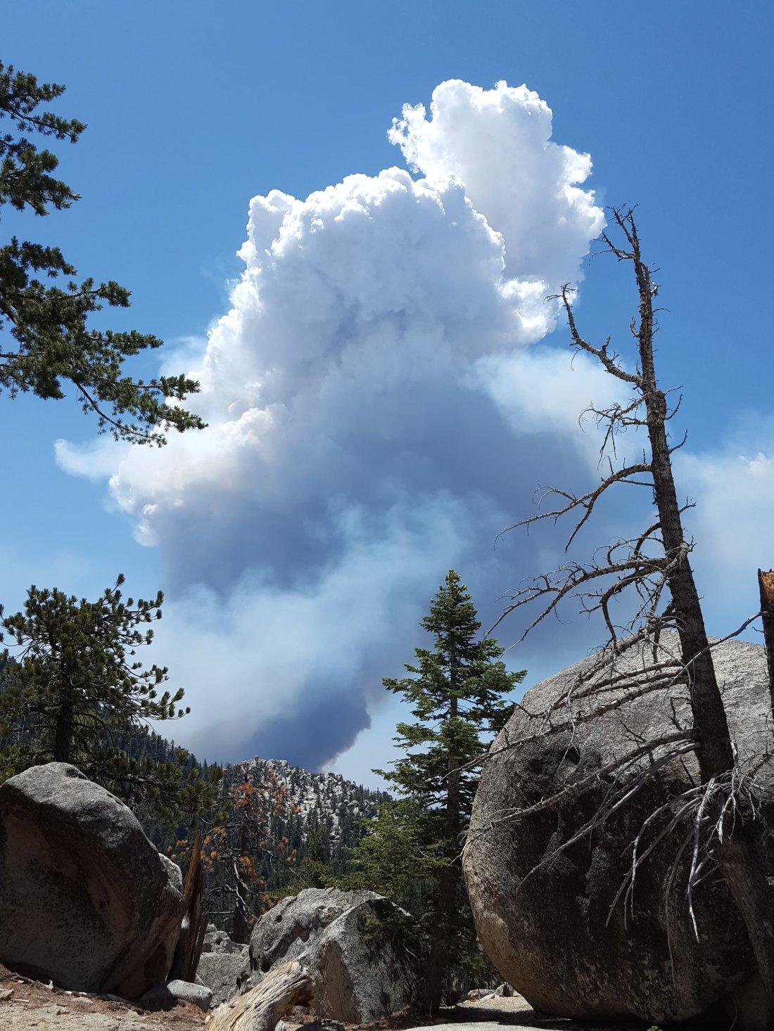
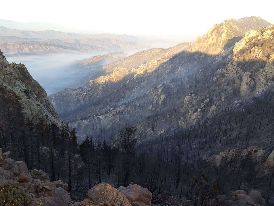
Pacific Crest Trail Fears that the PCT on the Desert Divide would once again be badly damaged (as it was in the Mountain Fire) were thankfully not realised. The Cranston Fire burned up the ridges from May Valley to the western and north-west flanks of Antsell Rock, and to the peaks of South Peak and Red Tahquitz. This section of the PCT remained closed from the 2013 Mountain Fire, but rehabilitation work had just been completed and the PCT was likely to reopen later this year. Fortunately, the Cranston Fire could not burn over to the east side of the Desert Divide due to the lack of fuels. In this area, the PCT largely runs along the eastern flank of the Desert Divide. Only at the saddle between Red Tahquitz and South Peak did the Cranston Fire reach the PCT, but in this relatively rocky area there was no significant damage to the trail.

Although the Cranston Fire did burn a short way north between Red Tahquitz and Grey Tahquitz (Peak 8792), it did not reach the PCT here. The fire did however reach north to the PCT at Chinquapin Flat, having burned completely around Anabel Peak (Peak 8860), the high point of the ridge just east of Tahquitz Peak proper. The fire jumped the PCT by only a few yards just downslope from the sign at Chinquapin Flat.

In summary, the PCT is virtually unchanged from its post-Mountain Fire status. Hopefully plans to reopen this section soon will be unaffected. This will be especially important given that the PCT Alternate through Hurkey Creek campground and May Valley has been completely destroyed by the Cranston Fire.

The PCT at Chinquapin Flat looking towards Tahquitz Peak, July 2018.
View from Red Tahquitz looking WSW (Tahquitz Peak on far right), July 2018

Fobes Trail The Cranston Fire did not reach this far south in Garner Valley. However the Fobes Ranch Road area remains closed until further notice.

Spitler Peak Trail Although there were some spot fires ahead of the main fire front in the semi-desert area south of Apple Canyon Road, the Spitler Peak Trail itself was apparently unaffected. However, it may be some time before Apple Canyon Road – the access for the Spitler Peak trailhead – is open to non-residents. [I don’t have reliable information on the status of the informal Zen Center Trail at this time.]

South Ridge Trail This is the higher elevation (>6000′) trail most impacted by the Cranston Fire. Most of the trail was not directly burned, but many areas were heavily covered with phos-chek retardant. Between Chinquapin Flat and Tahquitz Peak, some vegetation burned right around Tahquitz Peak. [Unless you have been slavishly following highly irresponsible individuals online or by email, you know by now that the Tahquitz Peak fire lookout did NOT burn down.]

South from Tahquitz Peak to Old Lookout Flat, the trail is well below the ridgeline on the western flank. As the fire was held at or near the ridgeline in most places, this section of trail is unaffected. From Old Lookout Flat south to the trailhead at the top of South Ridge Road, the trail was heavily hit with phos-chek retardant. In addition, the fire broke through in a few minor spots here. While the surrounding vegetation is burned, the fire was not notably hot through these areas and the trail itself is undamaged.

Phos-chek retardant on the Tahquitz Peak to Chinquapin Flat trail, 26 July 2018.

South Ridge Trail (from South Ridge Road to May Valley Road) This multi-use trail, a popular mountain bike trail, was completely burned over.

May Valley Road (and adjacent bike trails) This dirt road very popular with locals for biking, hiking, running, and dog walking, was completely burned over from its crest just beyond Cowbell Alley all the way down to its junction with Bonita Vista Road.

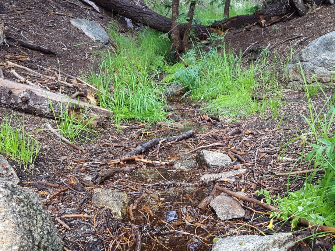
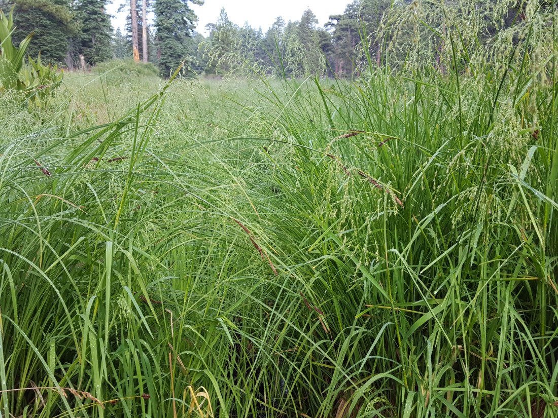
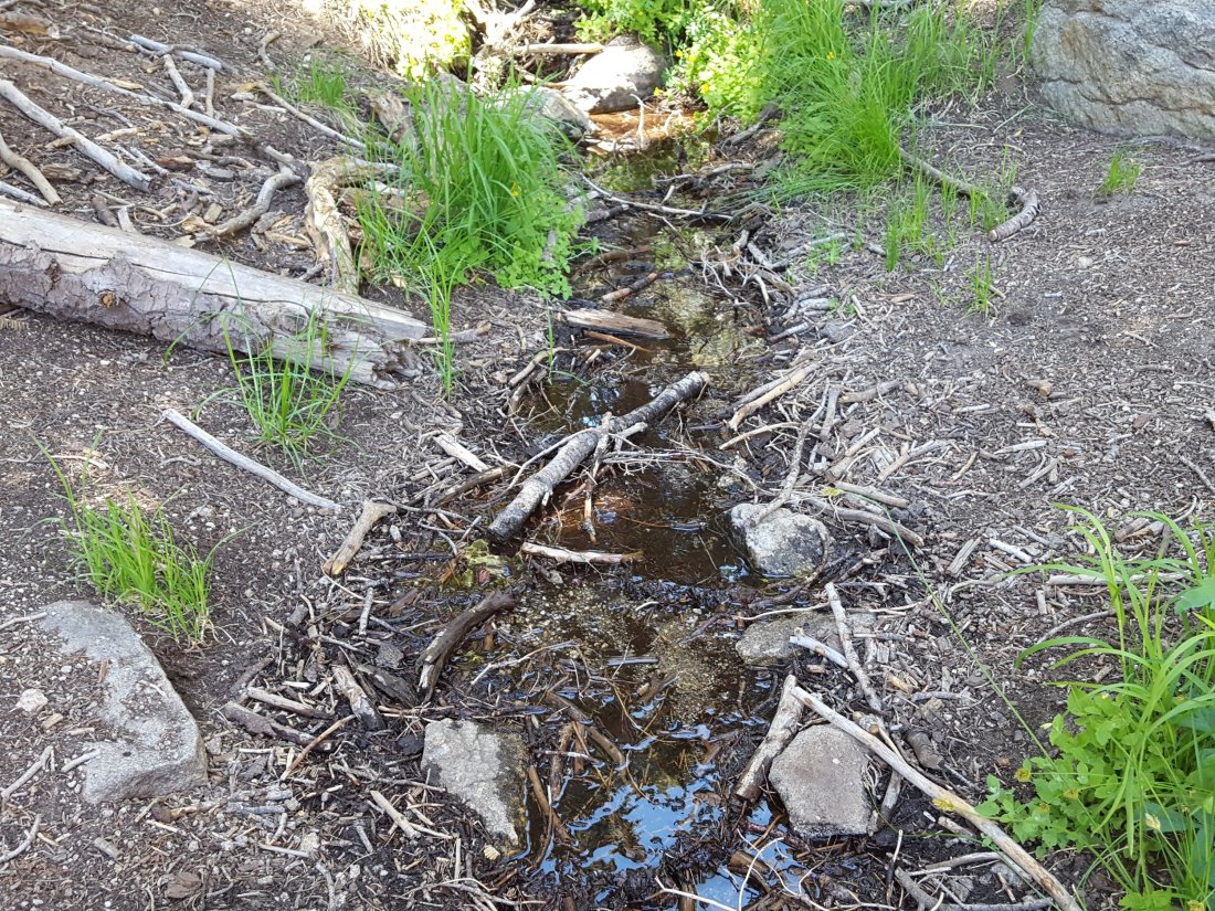
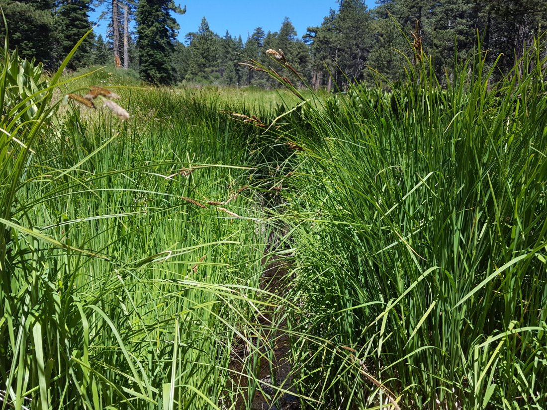
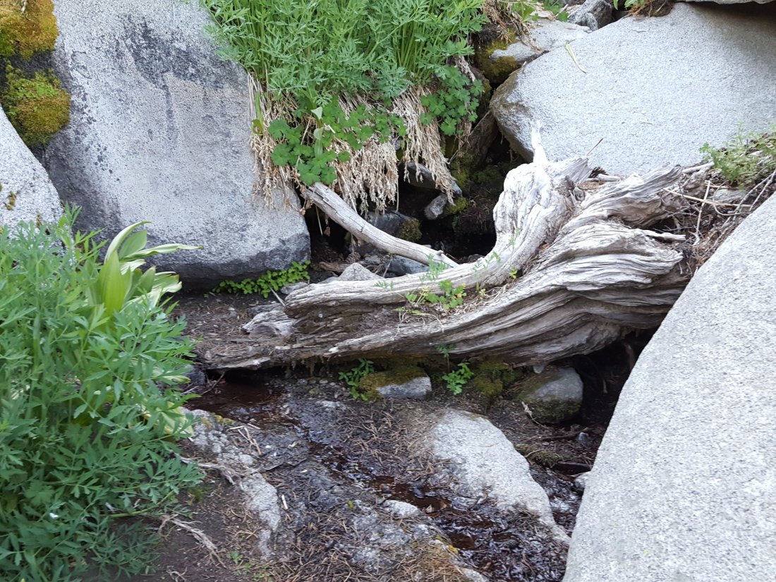
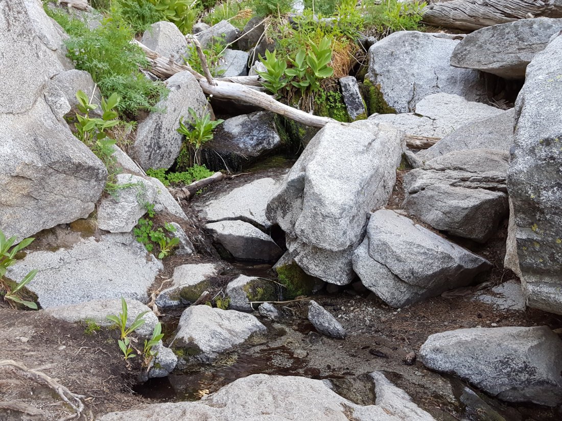
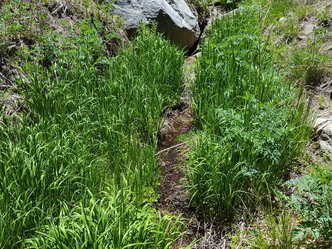
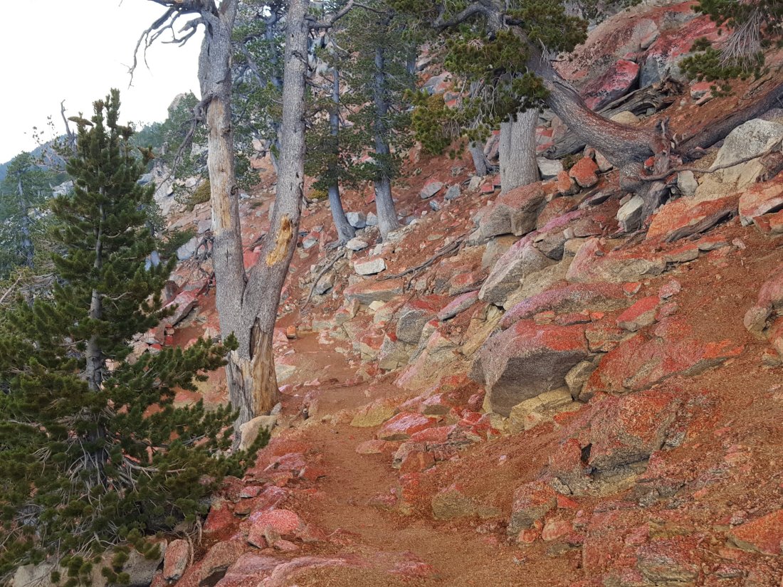
All other high country trails were not directly affected by the Cranston Fire. This includes all the trails around the Tahquitz area meadows, Devils Slide, Ernie Maxwell Trail, Willow Creek Trail, Ramona Trail, etc. It is however amazing (and frankly disconcerting) to see black ash flakes throughout all the trails of the mountain, even all the way to San Jacinto Peak. That there were not more spot fires scattered around the high country is very fortunate. It is to be hoped that all these other trails can be reopened promptly once all necessary fire suppression activities have been completed.

Cranston Fire

UPDATE Monday 30th July 2018 at 1430

The San Jacinto Trail Report will steadily transition back to its primary objective (trail information) over the next couple of days. However a handful of quick pieces of fire-related news follow.

Helicopters continue to move back-and-forth across Idyllwild making water drops in the South Ridge area, but at greatly reduced intensity compared to recent days. Barely any smoke was visible up there at dawn this morning, and town was almost smoke-free.

Ground crews were deployed in the high country yesterday, primarily in the north-east area of the fire front (e.g., Red Tahquitz). The main visible smoke this morning was on the north-west side of Red Tahquitz, where the fire had marginally slopped over the east-west Tahquitz ridge into areas largely burned by the Mountain Fire in 2013.

Some residents returned yesterday with the evacuation order lifted for Idyllwild-Pine Cove, including almost all our immediate neighbours. Many part-time residents continued to stay off the hill however, allowing for a more gentle transition into “normal” town life. The Post Office, USFS Idyllwild Ranger Station, and some businesses and restaurants are reopening today. The Mount San Jacinto State Park headquarters remains closed.

The only road into Idyllwild remains Highway 243 from Banning. The original plan was to restrict access today to only residents plus commercial traffic, but non-residents are now being allowed access via Hwy 243 also.

Highway 74 on both sides of Mountain Center, and Highway 243 from Mountain Center to Idyllwild, remain closed. Highway 74 to Hemet will apparently remain closed for a minimum of another week (per CalTrans), after which traffic will be subject to flag and flow controls for at least two months. In the burn areas along Highway 74, Southern California Edison has to replace over 120 power poles, including more than 90 using aerial lifts by helicopter. I’m hearing anything between a minimum of two to four weeks to complete that work. In summary, the three road routes out of Mountain Center will be subject to continuing significant disruption for weeks or probably months.

Finally, many thanks to the dozens of people who contacted the San Jacinto Trail Report in recent days to say thank you for our accurate and detailed coverage of developments during the Cranston Fire. We did the best we could in challenging circumstances. Special thanks to Steven Morris and Martha Ludlum, and to Chrissy King, for their generous donations in recent days to help maintain this website. Donations are always accepted at this page! A full list of website supporters is always maintained here.

Thanks to all, and safe hiking. Jon.

Cranston Fire

UPDATE Sunday 29th July 2018 at 1315

Highway 74 south from Lake Hemet (to Highway 371/Paradise café) is now open. It will remain closed from Lake Hemet to Mountain Center for the foreseeable future.

UPDATE Sunday 29th July 2018 at 1015

The evacuation order for Idyllwild-Pine Cove has been lifted in the last hour. Access is for residents with identification only, and only via Highway 243 from Banning.

This morning Idyllwild was much less smoke-filled than the previous two days, with an encouraging rise in humidity. There are still a couple of hotspots smoldering on the Idyllwild side of South Ridge just south of Tahquitz Peak, but nothing that is apparently cause for alarm. The Cranston Fire is at 13,130 acres and is 29% contained, according to InciWeb.

After an early morning hike, I checked around the fringes of town a little. Good news is that despite the fire burning around and through it, the transfer station is open already. I’m guessing it will fill up fast with the contents of fridges that were without power for a few days. Note that the transfer station is currently only accessible from above via Saunders Meadow Road, not via the shorter route from Hwy 243 (which is still closed just after Marian View Drive).

The persistent hotspots at the southern end of South Ridge – where May Valley Road comes off from Cowbell Alley – have been contained and there was no sign of smoke there.

The situation for hikers and recreation remains largely unchanged and is described at this link. The Palm Springs Aerial Tramway and Long Valley hiking trails will reopen tomorrow, Monday 30th July, at 10am, according to the facebook page of the Tram.

Cranston Fire

UPDATE Saturday 28th July at 1930

The helicopters finally fell silent at about 1600, a telltale sign that the hotspots on South Ridge were under control, at least for another evening. The ridge looks beautiful tonight, clear and smoke-free, but then it did last night too.

Highway 243 from Banning will apparently reopen tomorrow for those with confirmed identification as residents of Idyllwild-Pine Cove. Unfortunately Highway 74 has much greater challenges on both sides of Mountain Center, and it remains very unclear how long it will be before that highway can reopen to anything other than emergency traffic. It’s possible we may have to deal with only one route in and out of town for several weeks.

Details of trail and recreation closures are discussed at this link.

Cranston Fire: trail update

All trails in the USFS San Jacinto Ranger District and the Mount San Jacinto State Park, including those served by the Palm Springs Aerial Tramway, are currently closed. The full recreation closures for both agencies are listed here.

The U.S. Forest Service issued an official forest closure order on the evening of 27th July, details of which are available at this link. This draconian measure initially closes the entire San Jacinto Ranger District trail system until 31st August 2018.

Hopefully common sense will prevail, and trails that are completely unaffected by (and literally miles away from) the Cranston Fire, such as Fuller Ridge Trail, Black Mountain Trail, Seven Pines Trail, and Marion Mountain Trail, among others, will be considered for reopening as soon as possible. Obviously these are functionally closed anyway at this time, given the combination of road closures (for non-residents), and the closure of the State Park at their higher elevations. Once those measures are lifted however, there is no logical reason to keep the aforementioned trails closed.

Bear in mind that this closure order applies only through August 31st. Some trails will remain closed long after that. Almost exactly five years on from the Mountain Fire, some trails are still closed from that fire (Caramba Trail, PCT from Spitler Peak Trail to Grethe Spring).

Fortunately, damage to high country trails by the Cranston Fire has been much more limited than by the Mountain Fire, but for example it is highly likely that the PCT south from Saddle Junction to Grethe Spring, the trail to Tahquitz Peak, and South Ridge Trail, will be closed well beyond August 31st. [I will be posting detailed information on trails impacted by this fire by the end of July.]

Exactly what the State Park does (and when) remains to be seen. It is not directly affected by the Cranston Fire at all, so hopefully it will reopen relatively soon. Of course many of the trails accessing the State Park initially pass through USFS land, complicating access (other than by the Tram) unless the agencies coordinate their approach.

Humber Park is closed. The closure order is posted on the gate. (By chance, installation of this new gate was only completed a few weeks ago!)
Closure at the upper end of the Ernie Maxwell Trail.

Cranston Fire

UPDATE Saturday 28th July at 1245

Sorry if this pattern is starting to sound familiar, but as with the previous two days, the major aerial water bombing campaign has been effective, and the hotspots I described earlier today seem to be under control. Regrettably, the weather has been less cooperative than anticipated, with a slightly cooler day not materializing, and its already 92 degrees F in Fern Valley. There was also a moderate south-west wind in the high country early this morning which is not helping (although winds have been far less dangerous than they could have been throughout this whole incident).

UPDATE Saturday 28th July at 1030

Cranston Fire slopping over South Ridge just south of Tahquitz Peak, 28th July at 1015. Note the helicopter dumping water above the left hand smoke column.

Although the overall spread of the fire has greatly diminished, for the first time it broke through the line along the top of South Ridge in several places overnight. I was up hours before first light, and could see trees and bushes burning on the Idyllwild side of the ridge in at least three places, which was both dramatic to see, and somewhat disconcerting. With binoculars I could see that one of the spot fires was a bush right next to Tahquitz Peak fire lookout, but by first light it had burned itself out and was just smoldering.

Fire crews had a well deserved rest first thing, and aerial activity didn’t commence until 0800. Since then the helicopters have been working incessantly to douse the hotspots.

These continuing challenges with the fire may – I emphasize may – have delayed any prospect of the evacuation order being lifted imminently. Incidentally, rumours that the power in town is intermittent (or even off again) are untrue.

Cranston Fire

UPDATE Friday 27th July at 2010

Contrary to remarkably stubborn and ill-informed rumours, apparently spread by folks nowhere near Idyllwild, Tahquitz Peak fire lookout has not burned and is still standing strong as of 8pm this evening.

Tahquitz Peak fire lookout digiscoped from my house at 8pm on 27th July 2018

South Ridge looks as smoke-free as it has since Tuesday. However persistent hotspots evidently remain and some aerial suppression continues as I write. Barring some dramatic, unforseen change in the wind, I think its fair to say that the situation is looking at its most optimistic since this all began on Wednesday.

UPDATE Friday 27th July at 1700

Power seems to be restored to all of Idyllwild and Pine Cove. Current estimates are that it may be several weeks before power is restored to Mountain Center and Apple Canyon.

Although there is still significant helicopter activity putting water on hotspots on the east side of South Ridge, the smoke looking east from Idyllwild is the least threatening it’s been since Wednesday.

UPDATE Friday 27th July at 1450

Power starting to return to Idyllwild neighbourhoods, one of my neighbors WiFi signals just showed up on my ‘phone.

Also, Pine Cove residents with proof of a physical address north of Marion Ridge Drive are being allowed to return home by CHP via Hwy 243 from Banning.

UPDATE Friday 27th July at 1410

Power is back on in the centre of Idyllwild. Hasn’t come back in most residential neighborhoods yet, but we’re obviously heading in the right direction.

UPDATE Friday 27th July at 1330

All remains well in town. A nasty flare-up on the east side of South Ridge just over from the top of South Ridge Road has led to an amazing procession of helicopters over our house in the ladt hour, ferrying water from Dutch Flats to the blaze.

The flag at Tahquitz Peak shows a gusty south-west wind up high. It’s obviously not helping the suppression effort that the wind is shifting from day-to-day, but at least it’s not strong.

I just checked Tahquitz Peak and was dismayed to see the chapparal immediately on the south side of the Tower smouldering, literally within 100 yards of the structure. But fingers crossed, the old girl will hang in there.

Spirits in town remain high. I have a friend with a cache of a dozen bags of ice, so as long as we have enough gas to keep the generators running, there’s no reason to be drinking warm gin-and-tonics.

Cranston Fire

Sun rising through smoke over Tahquitz Peak at 0750 this morning, 27th July, from Chipmunk Drive.

UPDATE Friday 27th July at 1045.

Idyllwild-Pine Cove remain safe and secure. There has been a flare-up on the east side of South Ridge to the south of Tahquitz Peak, and a huge smoke column is rising from there now that was absent just an hour ago. The DC-10s are back making circuits over town again.

As planned, the fire burned up the east side of South Ridge and very close to Tahquitz Peak. Although it “slopped over” in a couple of spots, the South Ridge line, that I watched being laid down yesterday morning, apparently held remarkably well.

Yesterday afternoon the fire took a turn for the worse in Garner Valley. The northerly wind caused some south and south-east movement along Apple Canyon and towards Lake Hemet. The fire jumped Hwy 74 at Hurkey Creek, at least partly damaging both the county campground and the Ronald McDonald camp to its east.

Crews launched a major operation to defend properties at the head of Apple Canyon (e.g. Pine Springs Ranch). They allowed the fire to burn on by these properties, but structures themselves were largely saved. News in the Bonita Vista area was not so good, and I have reliable reports that some structures in that area, burned in the 2013 Mountain Fire, and the Fleming Ranch area were lost.

I don’t have reliable information as to the status of facilities and structures around Lake Hemet.

Edison trucks have started to appear around town for the first time since the fire started. Whether that means anything regarding the restoration of power, it’s hard to say. The word around town is that the evacuation order is unlikely to be lifted for a few more days. Although that’s pure speculation, it seems like a good guess as long as flare-ups continue relatively close to town.

UPDATE Friday 27th July at 0800.

All is well in Idyllwild. The fire did not break South Ridge at all yesterday, and for now, Idyllwild and Pine Cove remain safe. Lots of smouldering apparent along the east and south-east sides of South Ridge suggest that the fire burned extensively in the canyon on the the east flank of Tahquitz Peak.

Despite grossly irresponsible rumors from off the hill, Tahquitz Peak fire lookout is intact, with flag still flying. See photos below. (The flag was left up when my colleague Darla had to leave in haste on Wednesday, understandably. It is proving useful to me as I can see the wind direction at 8800′ by observing the flag through binoculars.)

The news for our beloved wilderness in the high country may be more mixed. It appears that the apparent containment plan I described yesterday (below) may have partly failed yesterday evening. From about 1730 to dark last night there was a massive increase in helicopter activity, transporting water drops to areas north-east of Tahquitz Peak. Impossible to say from here exactly what happened, but it’s possible the fire broke through in the areas north of Red Tahquitz and Chinquapin Flat. Hopefully I’ll learn more today.

Tahquitz Peak fire lookout, photographed through my spotting scope, at sunset on 26th July 2018.
Tahquitz Peak this morning at 0630. The flag shows winds are calm.

UPDATE Thursday 26th July at 1640.

Palm Springs Aerial Tramway is now CLOSED. All trails >5000′ elevation in the San Jacinto mountains are now CLOSED.

Also, another fire started just west of Pinyon at about 1015, the Ribbon Fire. Currently 100 acres, 0% contained.

UPDATE Thursday 26th July at 1300. For latest photos see below.

The fire was smouldering gently early this morning,, but a moderate NW wind picked up about 0930. Although this is taking the fire largely away from Idyllwild, it gave it significant energy. It started a major run east and north-east up the parallel ridges from May Valley to both South Peak and Antsell Rock. It is also burning heavily in the canyon immediately below Tahquitz Peak.

Looks like the decision has been made to let it burn these areas. The retardant tankers were doing a superb job of establishing South Ridge as a firm boundary. It was great to see them making a deliberate effort to protect Tahquitz Peak fire lookout, laying down three layers of Phos-Chek on the east side right next to the tower.

With its current path, the fire will largely run up to the Desert Divide and into areas that burned in the 2013 Mountain Fire. Most of those areas have very little fuel, and I imagine the hope is the fire will struggle to maintain itself. All this assumes no significant change in wind direction or strength (there is none forecast).

Ironically, this would mean the fire may burn into the area of the Pacific Crest Trail that is still currently closed from 2013. Restoration work on this section was just nearing completion, and the hope was it would reopen later this year.

The ridge from May Valley to South Peak. The fire was making a run to the east at 1045 today, producing all the dark smoke visible this morning.
Closer than I intended to be to a phos-chek dump! Tahquitz Peak at 1045.
Laying down the retardant line on South Ridge this morning at about 1015.

All Idyllwild area trails are currently closed (Ernie Maxwell, Devils Slide, South Ridge, Deer Springs, PCT, etc).

The Palm Springs Aerial Tramway remains open for now, but with no camping or hiking permitted beyond Long Valley.

Idyllwild is under mandatory evacuation (although many residents have stayed) and all roads to the Idyllwild area are closed.

The Cranston Fire, which has currently burned over 7500 acres, started at about 1200 on Wednesday 25th July to the west of Idyllwild. It burned just South of Idyllwild and north of Mountain Center, from west to east.

It continues to burn on the south slope of South Ridge and east toward Antsell Rock and South Peak.

Just topped the ridge between Tahquitz Peak and May Valley, 26th July at 1020
Burning heavily due south of Tahquitz Peak, 26th July at 0955
South Ridge looking south-west from Tahquitz Peak, 0900 on 26th July
South Ridge from Idyllwild near dusk on Wednesday 25th July.

Remarkably, when the fire started I was on a search-and-rescue mission for two lost hikers off the Seven Pines Trail. When I found them, I took the photo below. It was only during our complicated descent (when it started raining ash on us) that the gravity of the situation became clear. Then, and when I was trying to turn to head south toward Idyllwild at about 1700 and could barely make the left due to the constant stream of vehicles heading north on Hwy 243 evacuating town.

Huge pyrocumulus and smoke cloud at the start of the Cranston Fire, from below Fuller Ridge Trail, 25th July 2018, at 1235.

Water conditions 20 July 2018

Today I hiked from Devil’s Slide Trail to San Jacinto Peak on the Pacific Crest Trail via Strawberry Junction, plus an out-and-back on a short section of Fuller Ridge Trail, and up through Little Round Valley, then descending via Wellman Divide. On Monday 16th, I hiked to San Jacinto Peak up and down via Wellman Divide in the early morning, then spent the rest of the day in the Tahquitz area meadows botanizing. On Wednesday 18th I also hiked to Tahquitz Peak.

Weather At San Jacinto Peak at 1100 this morning the air temperature was 55°F (13°C), with a pleasantly cool windchill temperature of 48°F (9°C), a high 75% relative humidity (increasing to 90% when the Peak was enveloped in cloud), and a strong SE breeze gusting to 12 mph. On Monday 16th the temperature at the Peak by 0815 was already a sticky 59°F (15°C), with relative humidity of 63% and no discernable wind.

Regrettably no more rain since last week. Most of next week (starting 23rd) is forecast to be well above typical July temperatures for the mountain. Although the likelihood of thunderstorms may be diminished for the next week or so, hikers should always be prepared for rapidly changing weather conditions in the high country in summer. Thunderstorms with lightning can occur at or near the high peaks even when such storms are not forecast for lower elevations.

Trail overview Flow rates at all water sources have dropped again from the brief increase after last weeks rain, and overall flow rates remain far below seasonal norms. There is no snow anywhere on the mountain (all trails have been completely clear since early May).

Bear sightings No new ones to report, see previous post for last known observations.

EASTERN SLOPE WATER FEATURES

The Round Valley faucet flow rate today was at 0.20 gallons per minute, the same rate as on Tuesday 17th. This was a rapid drop from the post-rain increase to 0.35 gallons per minute on 13th July. Flow rate on 6th July had fallen as low as 0.10 gallons per minute. [Many thanks to Florian Boyd for these data from Round Valley.]

Both the northern and southern springs at Wellman’s Cienega are flowing gently. At the northern Cienega, flow rate today was roughly half that of last week, back to the low flow rate of early July. These springs are the sources for Willow Creek, which continues to flow fairly well where it crosses the Willow Creek Trail.

Wellman’s Cienega North spring, 13 July 2018

Tahquitz Valley is completely dry.

Tahquitz Creek continues to flow well at the northern (lower) end of Little Tahquitz Meadow.

Tahquitz Creek at the north end of Little Tahquitz Meadow, 12 July 2018

Despite some rain last week, it is only flowing weakly further upstream at its source (known locally as Grethe Spring) where it crosses the PCT at the northern end of the fire closure (approx. PCT Mile 177). Just after crossing the PCT, the creek dries up and disappears subsurface.

Skunk Cabbage Creek has now dried up where the trail crosses Skunk Cabbage Meadow at the small wooden bridge.

WESTERN SLOPE WATER FEATURES

The North Fork of the San Jacinto River continues to flow reliably both where it crosses the Deer Springs Trail, and where it crosses the Fuller Ridge Trail on the PCT (approx. PCT Mile 186.2). About 100′ downstream from the river crossing on Fuller Ridge Trail, the flow rate was 1.2 gallons per minute today.

North Fork of the San Jacinto River on Deer Springs Trail, 20 July 2018
North Fork of the San Jacinto River on Fuller Ridge Trail, 20 July 2018

O’Sullivan Creek (PCT Mile 186.4) on Fuller Ridge Trail is completely dry.

The spring in the creek in Little Round Valley has been completely dry since early June.

Shooting Star Spring – 0.28 trail miles below Little Round Valley – is now flowing weakly. For hikers it is possible to filter water from the source at the base of the obvious huge rock, but a better option is to descend to the North Fork crossing mentioned above.

The minor creek crossing (sometimes known as Rock Spring) on Deer Springs Trail midway between the North Fork of the San Jacinto River crossing and Shooting Star Spring is close to drying completely, and is now dry across and below the trail.

The Deer Springs stream crossing at the PCT (approx. PCT mile 185.6) is dry, and the pools just upstream (and downstream) of the trail are also dry. The Deer Springs camp just downslope has been occupied by a crew from the California Conservation Corps (CCC) since late May.

Switchback Spring – the small spring just below the eight switchbacks on Deer Springs Trail about 0.4 miles north of Strawberry Junction – continues to flow quite well. There is a tiny pool on the upslope side of the trail where water can be filtered.

Switchback Spring crossing the PCT, 20 July 2018

The little spring in the rock crack at Strawberry Cienega (PCT mile 183.0) continues to flow quite well. For filtering, there is a tiny pool among the rocks (now heavily obscured by plants), and a permanently placed tent stake makes a clean accessible trickle out of the mud. At the tent stake, the flow rate today was 0.07 gallons per minute.

Strawberry Cienega, 20 July 2018. Note the tent stake in the lower right. The main pool is among the plants between the large rocks.

On Devil’s Slide Trail, Middle Spring is now just a trickle in the morning (barely enough for a dog to get a little water), but by afternoon it is basically dry. Insufficient flow for a hiker to get any water at all.

On the Ernie Maxwell Trail, Chinquapin Creek just below Humber Park is – since 1st July – periodically diverted by Fern Valley Water District to their storage tanks, drying the creek where it crosses the trail. However, even when the creek flow is diverted, good pools remain immediately upstream from the trail. This is a very important water source for the many dogs walked on this trail.

Water conditions 13 July 2018

This report is a compilation of several hikes in the last three days. Today we hiked from Devil’s Slide Trail to San Jacinto Peak via Wellman’s Cienega, repeating the same route we hiked on 11th. Yesterday (12th July) I hiked to my fire lookout shift at Tahquitz Peak checking all the meadows to the east of Saddle Junction, descending via South Ridge Trail. On 9th July, Anne and I hiked up Marion Mountain Trail to San Jacinto Peak via the PCT and Deer Springs Trail, repeating the route I hiked with Deb Nelson on 6th July. Also included are observations from Anne’s run on the Maxwell Trail yesterday, and from Florian Boyd’s hike to Round Valley today.

Weather At San Jacinto Peak at 0810 this morning the air temperature was 52°F (11°C), with a high 80% relative humidity and a very light SSE breeze. On Wednesday 11th July, temperature at the Peak at 0745 was 51°F (10.6°C), with a pleasantly cool windchill temperature of 43°F (6°C), very high relative humidity of 87%, and a stiff ENE wind gusting to 13mph.

We finally got some rain! Combined rainfall at 5550′ elevation in Idyllwild for Tuesday-Thursday was 0.44″. It rained all over the mountain, including parts of all three days at both San Jacinto and Tahquitz peaks. As is typical with thunderstorms, rainfall was highly variable depending on location. For example, on Wednesday evening (11th July), our home in Idyllwild received 0.25″, parts of the nearby Maxwell Trail remained completely dry, while Palm Springs got 1.0″ from the same storm.

Hikers should always be prepared for rapidly changing weather conditions in the high country in summer. Thunderstorms with lightning can occur at or near the high peaks even when such storms are not forecast for lower elevations.

Trail overview Flow rates at all water sources increased significantly in the last couple of days following the rains, but this improvement is temporary, and overall flow rates remain far below seasonal norms. There is no snow anywhere on the mountain (all trails have been completely clear since early May).

Bear sightings No new ones to report, see previous post for recent observations.

EASTERN SLOPE WATER FEATURES

The Round Valley faucet flow rate tripled in the last couple of days, to 0.35 gallons per minute today. [UPDATE 17 July: flow rate has already fallen to 0.2 gallons per minute.] Flow rate on 6th July was 0.10 gallons per minute (down from 0.28 gallons per minute on 15th June). [Many thanks to Florian Boyd for these data from Round Valley.]

Both the northern and southern springs at Wellman’s Cienega are flowing well. At the northern Cienega, flow rate today was roughly double that of last week. These springs are the sources for Willow Creek, which continues to flow fairly well where it crosses the Willow Creek Trail.

Wellman’s Cienega North spring, 13 July 2018
Wellman’s Cienega South spring, 13 July 2018

Tahquitz Valley is completely dry.

Tahquitz Creek continues to flow well at the northern (lower) end of Little Tahquitz Meadow.

Tahquitz Creek at the north end of Little Tahquitz Meadow, 12 July 2018

Despite some rain, it is only flowing weakly further upstream at its source (known locally as Grethe Spring) where it crosses the PCT at the northern end of the fire closure (approx. PCT Mile 177). Just after crossing the PCT, the creek dries up and disappears subsurface.

Tahquitz Creek crossing the PCT immediately below Grethe Spring (visible in the background), 12 July 2018

Skunk Cabbage Creek where it flows through Skunk Cabbage Meadow has now dried up, at least where the trail crosses the meadow. There are a few wet patches, but nothing that can be filtered.

Skunk Cabbage Creek at the trail crossing in Skunk Cabbage Meadow, 12 July 2018

WESTERN SLOPE WATER FEATURES

The North Fork of the San Jacinto River continues to flow reliably both where it crosses the Deer Springs Trail above Fuller Ridge, and where it crosses the Fuller Ridge Trail on the PCT (approx. PCT Mile 186.2).

North Fork of the San Jacinto River at Deer Springs Trail, 8th July 2018

O’Sullivan Creek (PCT Mile 186.4) on Fuller Ridge Trail is completely dry.

The spring in the creek in Little Round Valley has been completely dry since early June.

Shooting Star Spring – 0.28 trail miles below Little Round Valley – is currently flowing weakly but reliably. For hikers it is possible to filter water from the source at the base of the obvious huge rock. Otherwise the spring is largely just muddy across a short section of trail.

The minor creek crossing on Deer Springs Trail midway between the North Fork of the San Jacinto River crossing and Shooting Star Spring (sometimes known as Rock Spring) is close to drying completely, and is now dry across and below the trail.

The Deer Springs stream crossing at the PCT (approx. PCT mile 185.6) is dry, and the pools just upstream (and downstream) of the trail are also dry. The Deer Springs camp just downslope has been occupied by a crew from the California Conservation Corps (CCC) since late May.

Switchback Spring – the small spring just below the eight switchbacks on Deer Springs Trail about 0.4 miles north of Strawberry Junction – continues to flow well. There is a tiny pool on the upslope side of the trail where water can be filtered.

The little spring in the rock crack at Strawberry Cienega (PCT mile 183.0) continues to flow quite well. For filtering, there is a tiny pool among the rocks, and a carefully placed tent stake makes a clean accessible trickle out of the mud.

On Devil’s Slide Trail, Middle Spring is now just a trickle in the morning (just about enough for a dog to get a little water), but by afternoon it is often dry. Even after the recent rain, insufficient flow for a hiker to get any water at all.

On the Ernie Maxwell Trail, Chinquapin Creek just below Humber Park has now been diverted again by Fern Valley Water District to their tanks, drying the creek where it crosses the trail. However, even when the creek flow is diverted, good pools remain just upstream from the trail. This is an important water source for the many dogs walked on this trail.

Water conditions 9 July 2018

Yesterday Anne and I hiked up Marion Mountain Trail to San Jacinto Peak via the PCT and Deer Springs Trail, repeating the route I hiked with Deb Nelson on 6th July. Also included are observations from a run on the Maxwell Trail on 7th July, a hike up the east side trails to San Jacinto Peak on Sunday 1st July, and to Tahquitz Peak on 4th July.

Weather At San Jacinto Peak at 0845 yesterday morning the air temperature was a mild 61°F (16°C), with a high 53% relative humidity and a very light south-east breeze, under clear skies. By late morning, there was heavy cloud cover and the occasional rumble of thunder from the high country. No recorded rain in Idyllwild yet in July.

The chance of thunderstorms is forecast for the next few days at least. Any precipitation would be very welcome, but hikers should be aware of rapidly changing weather conditions in the high country, and the probability of lightning at/near the high peaks.

Trail overview Following a couple of questions I have had in recent days, I should reiterate that there is no snow anywhere on the mountain (all trails have been completely clear since early May). Flow rates at all water sources continue to drop every week, and are far below seasonal norms.

Bear sightings I spoke to local homeowners on 4th July who saw two bears together in their upper Fern Valley yard at night in late June. One of these was videoed by an automatic camera at another residence in upper Fern Valley just before midnight on Sunday 24th June. This individual appears to be one of the bears seen all over the mountain in 2017, different from the one we videoed on our property in Idyllwild on 15th May this year, linked to in the San Jacinto Trail Report for 31 May.

EASTERN SLOPE WATER FEATURES

The Round Valley faucet is now flowing very weakly. Flow rate on 6th July was 0.10 gallons per minute (down from 0.28 gallons per minute on 15th June). [Many thanks to Florian Boyd for this update from Round Valley.]

Both the northern and southern springs at Wellman’s Cienega are flowing. Flow rates continue to decline rapidly, and the northern spring continues to be weaker every time I pass by. Without fresh precipitation soon, this spring will be dry by August, which would be unprecedented in the known human history of Wellman’s Cienega. (The northern cienega dried for the first time in recorded history in 2015, and then again in 2016, but not until September-October.)

These springs are the sources for Willow Creek, which is still flowing fairly well where it crosses the Willow Creek Trail.

Tahquitz Valley is completely dry.

Tahquitz Creek continues to flow fairly well at the northern (lower) end of Little Tahquitz Meadow. It is now flowing weakly further upstream at its source (known locally as Grethe Spring) where it crosses the PCT at the northern end of the fire closure (approx. PCT Mile 177). Just after crossing the PCT, the creek dries up and disappears subsurface.

Tahquitz Creek crossing the PCT immediately below Grethe Spring, 29 June 2018

Skunk Cabbage Creek where it flows through Skunk Cabbage Meadow is currently flowing weakly. The water level has not changed markedly in the last couple of weeks.

Skunk Cabbage Creek in Skunk Cabbage Meadow, 29 June 2018

WESTERN SLOPE WATER FEATURES

The North Fork of the San Jacinto River continues to flow gently but reliably both where it crosses the Deer Springs Trail above Fuller Ridge, and where it crosses the Fuller Ridge Trail on the PCT (approx. PCT Mile 186.2).

North Fork of the San Jacinto River at Deer Springs Trail, 8th July 2018

O’Sullivan Creek (PCT Mile 186.4) on Fuller Ridge Trail is completely dry.

The spring in the creek in Little Round Valley has been completely dry since early June.

Shooting Star Spring – 0.28 trail miles below Little Round Valley – is currently flowing weakly but reliably. For hikers it is possible to filter water from the source at the base of the obvious huge rock. Otherwise the spring is largely just muddy across a short section of trail.

The minor creek crossing on Deer Springs Trail midway between the North Fork of the San Jacinto River crossing and Shooting Star Spring (sometimes known as Rock Spring) may be close to drying completely, and is now dry across and below the trail.

Rock Spring just above Deer Springs Trail, 8th July 2018

The Deer Springs stream crossing at the PCT (approx. PCT mile 185.6) is dry, and the pools just upstream (and downstream) of the trail are also dry. The Deer Springs camp just downslope has been occupied by a crew from the California Conservation Corps (CCC) since late May.

Switchback Spring – the small spring just below the eight switchbacks on Deer Springs Trail about 0.4 miles north of Strawberry Junction – continues to flow well. There is a tiny pool on the upslope side of the trail where water can be filtered.

Switchback Spring crossing Deer Springs Trail, 29 June 2018

The little spring in the rock crack at Strawberry Cienega (PCT mile 183.0) continues to flow quite well. For filtering, there is a tiny pool among the rocks, and a carefully placed tent stake makes a clean accessible trickle out of the mud.

The spring at Strawberry Cienega, 29 June 2018

On Devil’s Slide Trail, Middle Spring is now just a useless trickle in the early morning (barely even enough for a small dog to get a little water), but by afternoon it is dry. This is now the typical daily pattern. Insufficient flow for a hiker to get any water at all.

On the Ernie Maxwell Trail, the crossing of Chinquapin Creek just below Humber Park is now flowing again across the trail. Fern Valley Water District had briefly – between about 1st and 6th July – diverted water to their tanks, drying the creek where it crosses the trail. Usually the FVWD diversion is in place for several weeks or months every summer, and it is likely it will happen again soon. However, even when the creek flow is diverted, good pools remain just upstream from the trail. This is a very important water source for the many dogs walked on this trail.

Water conditions 6 July 2018

Yesterday I surveyed several water sources during a botanical hike with my friend Deb Nelson up Marion Mountain Trail to San Jacinto Peak via the PCT and Deer Springs Trail. Also included are observations from a hike up the east side trails to San Jacinto Peak on Sunday 1st July, and in the Tahquitz Peak area on 4th July.

At San Jacinto Peak at 1130 yesterday morning the air temperature was a very warm 67°F (19.4°C), with only 16% relative humidity and virtually no breeze.

Overview Following a couple of questions I have had in recent days, I should reiterate that there is no snow anywhere on the mountain (all trails have been completely clear since early May). Flow rates at all water sources continue to drop every week.

The chance of thunderstorms is forecast almost daily for the next week or so. Any precipitation would be very welcome, but beware of rapidly changing weather conditions in the high country, and the possibility of lightning at/near the high peaks.

Bear sightings I spoke to local homeowners on 4th July who saw two bears together in their upper Fern Valley yard at night in late June. One of these was videoed by an automatic camera at another residence in upper Fern Valley just before midnight on Sunday 24th June. This individual appears to be one of the bears seen all over the mountain in 2017, different from the one we videoed on our property in Idyllwild on 15th May this year, linked to in the San Jacinto Trail Report for 31 May.

EASTERN SLOPE WATER FEATURES

The Round Valley faucet is now flowing very weakly. Flow rate today, 6th July, was 0.10 gallons per minute (down from 0.28 gallons per minute on 15th June). Many thanks to Florian Boyd for this update from Round Valley.

Both the northern and southern springs at Wellman’s Cienega are flowing. Flow rates continue to decline rapidly, and the northern spring continues to be weaker every time I pass by. Without fresh precipitation soon, this spring will be dry by August, which would be unprecedented in the known human history of Wellman’s Cienega. (The northern cienega dried for the first time in recorded history in 2015, and then again in 2016, but not until September-October.)

These springs are the sources for Willow Creek, which is still flowing fairly well where it crosses the Willow Creek Trail.

Tahquitz Valley is completely dry.

Tahquitz Creek continues to flow fairly well at the northern (lower) end of Little Tahquitz Meadow. It is now flowing rather weakly further upstream at its source (known locally as Grethe Spring) where it crosses the PCT at the northern end of the fire closure (approx. PCT Mile 177). Just after crossing the PCT, the creek dries up and disappears subsurface.

Tahquitz Creek crossing the PCT immediately below Grethe Spring, 29 June 2018

Skunk Cabbage Creek where it flows through Skunk Cabbage Meadow is currently flowing weakly. The water level has not changed markedly in the last couple of weeks.

Skunk Cabbage Creek in Skunk Cabbage Meadow, 29 June 2018

WESTERN SLOPE WATER FEATURES

The North Fork of the San Jacinto River continues to flow gently both where it crosses the Deer Springs Trail above Fuller Ridge, and where it crosses the Fuller Ridge Trail on the PCT (approx. PCT Mile 186.2).

North Fork of the San Jacinto River at Deer Springs Trail, 29 June 2018

O’Sullivan Creek (PCT Mile 186.4) on Fuller Ridge Trail is completely dry.

The spring in the creek in Little Round Valley has been completely dry since early June.

Shooting Star Spring – 0.28 trail miles below Little Round Valley – is currently flowing weakly but reliably.

The minor creek crossing on Deer Springs Trail midway between the North Fork of the San Jacinto River crossing and Shooting Star Spring (sometimes known as Rock Spring) may be close to drying completely, and is now dry across and below the trail.

Rock Spring just above Deer Springs Trail, 29 June 2018

The Deer Springs stream crossing at the PCT (approx. PCT mile 185.6) is dry, and the pools just upstream (and downstream) of the trail are also dry. The Deer Springs camp just downslope has been occupied by a crew from the California Conservation Corps (CCC) since late May.

Switchback Spring – the small spring just below the eight switchbacks on Deer Springs Trail about 0.4 miles north of Strawberry Junction – continues to flow well.

Switchback Spring crossing Deer Springs Trail, 29 June 2018

The little spring in the rock crack at Strawberry Cienega (PCT mile 183.0) continues to flow quite well.

The spring at Strawberry Cienega, 29 June 2018

On Devil’s Slide Trail, Middle Spring is nothing more than a pathetic trickle in the early morning (barely enough for a dog to get a little water), but by afternoon it is dry. This is now the typical daily pattern. Either way, insufficient flow for a hiker to get any water at all.

On the Ernie Maxwell Trail, the crossing of Chinquapin Creek just below Humber Park is now dry across and below the trail (this is an important water source especially for dogs being walked on this trail). On or about 2nd July, Fern Valley Water District started their annual diversion of this creek to their water tanks. However, there is good flowing water just a few yards upstream from the trail, with several small pools for filtering or for dogs to drink. [UPDATE 7 July: on our run up the Maxwell Trail early this morning we were very surprised to find the creek flowing again across the trail. Apparently FVWD have suspended their diversion, so for the time being water is again available right on the trail.]

Mountain Footwear supports the San Jacinto Trail Report

Many thanks indeed to Mountain Footwear in Idyllwild, who this week became the first business sponsor of the San Jacinto Trail Report. Special thanks to Tony Vernon (owner) and Phyllis Lancaster (manager) for making this arrangement happen. Suppliers of great hiking boots such as Keen and Merrell, among many other things, Mountain Footwear is located on the ground floor of “The Fort” in the center of Idyllwild. Their support for the concept of the Trail Report is greatly appreciated.

The latest trail report, from yesterday 29th June, is posted at this link.

Water conditions 29 June 2018

A minor milestone on my hike this morning was my 50th ascent of San Jacinto Peak so far this year. I surveyed many water sources today, starting from Devils Slide Trail and hiking the PCT northbound from Saddle Junction to Fuller Ridge, then up to San Jacinto Peak and down via Wellman Divide back to the Tahquitz area meadows, before doing my shift at Tahquitz Peak Fire Lookout. Also included are observations from a hike to San Jacinto Peak on Monday 25th June.

At San Jacinto Peak early this morning the air temperature was a cool 50°F (10°C), and with a stiff south-west wind the windchill temperature was 44°F (6.7°C).

Overview I say it every week, but yet again flow rates at all water sources are visibly lower than just a week ago. Those very familiar with the Deer Springs Trail/PCT will be interested to find a short new section has just opened immediately before the Deer Springs crossing, where the CCC crew has been working for several years to take the PCT upslope and away from the streamside vegetation.

Bear sightings One was videoed by an automatic camera at a residence in upper Fern Valley (Idyllwild) just before midnight on Sunday 24th June. This individual appears to be one of the bears seen all over the mountain in 2017, different from the one we videoed on our property in Idyllwild on 15th May, linked to in the San Jacinto Trail Report for 31 May.

EASTERN SLOPE WATER FEATURES

The Round Valley faucet is flowing weakly but steadily. Flow rate on 15th June was about 0.28 gallons per minute.

Both the northern and southern springs at Wellman’s Cienega are flowing. Flow rates continue to decline rapidly, and the northern spring was much weaker today even than last week. Without fresh precipitation soon, this spring will be dry by August, which would be unprecedented in the known human history of Wellman’s Cienega. (The northern cienega dried for the first time in recorded history in 2015, and then again in 2016, but not until September-October.)

These springs are the sources for Willow Creek, which is still flowing fairly well where it crosses the Willow Creek Trail.

Tahquitz Valley is completely dry.

Tahquitz Creek continues to flow fairly well at the northern (lower) end of Little Tahquitz Meadow. It is now flowing rather weakly further upstream at its source (known locally as Grethe Spring) where it crosses the PCT at the northern end of the fire closure (approx. PCT Mile 177). Just after crossing the PCT, the creek dries up and disappears subsurface.

Tahquitz Creek crossing the PCT immediately below Grethe Spring, 29 June 2018

Skunk Cabbage Creek where it flows through Skunk Cabbage Meadow is currently flowing weakly. The water level today appeared to be similar to last week.

Skunk Cabbage Creek in Skunk Cabbage Meadow, 29 June 2018

WESTERN SLOPE WATER FEATURES

The North Fork of the San Jacinto River continues to flow gently both where it crosses the Deer Springs Trail above Fuller Ridge, and where it crosses the Fuller Ridge Trail on the PCT (approx. PCT Mile 186.2).

North Fork of the San Jacinto River at Deer Springs Trail, 29 June 2018

O’Sullivan Creek (PCT Mile 186.4) on Fuller Ridge Trail is completely dry.

The spring in the creek in Little Round Valley has been completely dry since early June.

Shooting Star Spring – 0.28 trail miles below Little Round Valley – is currently flowing weakly but reliably.

The minor creek crossing on Deer Springs Trail midway between the North Fork of the San Jacinto River crossing and Shooting Star Spring (sometimes known as Rock Spring) is flowing very poorly, and is now dry across and below the trail.

Rock Spring just above Deer Springs Trail, 29 June 2018

The Deer Springs stream crossing at the PCT (approx. PCT mile 185.6) is dry, and the pools just upstream (and downstream) of the trail are also dry. The Deer Springs camp just downslope has been occupied by a crew from the California Conservation Corps (CCC) for about a month.

Switchback Spring – the small spring just below the eight switchbacks on Deer Springs Trail about 0.4 miles north of Strawberry Junction – continues to flow remarkably well.

Switchback Spring crossing Deer Springs Trail, 29 June 2018

The little spring in the rock crack at Strawberry Cienega (PCT mile 183.0) continues to flow surprisingly well.

The spring at Strawberry Cienega, 29 June 2018

On Devil’s Slide Trail, Middle Spring was a pathetic trickle very early this morning(barely enough for a dog to get a little water), but by late afternoon it was dry. This is now the typical daily pattern. Either way, not enough water for a hiker to get any water at all.

On the Ernie Maxwell Trail, the crossing of Chinquapin Creek just below Humber Park continues to flow well (an important water source especially for dogs being walked on this trail). [UPDATE 2nd July – Fern Valley Water District started it’s annual diversion of the creek to its water tanks, meaning the creek is now dry across the trail. However, there is good flowing water just a few yards upstream from the trail, with pools for filtering or for dogs to drink.]

Water conditions 20 June 2018

After two days of hiking around lava-strewn desert on a SAR mission in the Amboy area, I couldn’t wait to do a long cool forest hike back in the mountains. Today I surveyed many water sources, starting from Devils Slide Trail and hiking the PCT northbound from Saddle Junction to Fuller Ridge, then up to San Jacinto Peak and down via Wellman Divide back to Humber Park. Also included is information from a check of the Tahquitz area meadows on our botany hike on Saturday 16th. Many thanks to Florian Boyd for updating the status of the Round Valley faucet on 15th, and to Anne King for checking Chinquapin Creek on the Maxwell Trail while I was away.

At San Jacinto Peak at 0900 this morning the air temperature was a balmy 61°F (16°C), and with a light north breeze the windchill temperature was 59.5°F (15°C).

Overview Apologies for sounding like a broken record, but water resources everywhere are flowing poorly for the time of year, and yet again flow rates are visibly lower than just a week or two ago.

Bear sightings I had a reliable report of the small yearling Black Bear near the North Rim campsites on the Willow Creek Trail (i.e. only about 0.6 miles from Saddle Junction) on about 18th/19th June. This is likely the same individual we videoed at home in Idyllwild on 15th May that was linked to in the San Jacinto Trail Report for 31 May.

EASTERN SLOPE WATER FEATURES

The Round Valley faucet is currently flowing weakly but consistently, at a flow rate of about 0.28 gallons per minute. [Thanks to Florian Boyd for this update, from 15th June.]

Both the northern and southern springs at Wellman’s Cienega are flowing. Flow rates continue to decline rapidly, and the northern spring in particular is now much weaker than two weeks ago. At this rate, this spring may be dry by August, which would be unprecedented in the history of Wellman’s Cienega. (The northern cienega dried for the first time in recorded history in 2015, and then again in 2016, but not until September-October.)

These springs are the sources for Willow Creek, which is still flowing fairly well where it crosses the Willow Creek Trail.

Tahquitz Valley is completely dry.

Tahquitz Creek continues to flow fairly well at the northern (lower) end of Little Tahquitz Meadow. It is now flowing rather weakly further upstream at its source (known locally as Grethe Spring) where it crosses the PCT at the northern end of the fire closure (approx. PCT Mile 177). Just after crossing the PCT, the creek dries up and disappears subsurface.

Skunk Cabbage Creek where it flows through Skunk Cabbage Meadow is currently flowing weakly. The water level has dropped significantly compared to two weeks ago.

Skunk Cabbage Meadow, 16 June 2018

WESTERN SLOPE WATER FEATURES

The North Fork of the San Jacinto River is flowing relatively well both where it crosses the Deer Springs Trail above Fuller Ridge, and where it crosses the Fuller Ridge Trail on the PCT (approx. PCT Mile 186.2).

North Fork of the San Jacinto River on Deer Springs Trail, 20 June 2018

O’Sullivan Creek (PCT Mile 186.4) on Fuller Ridge Trail is completely dry.

The spring in the creek in Little Round Valley has been completely dry since early June.

Shooting Star Spring – 0.28 trail miles below Little Round Valley – is currently flowing weakly but reliably. Note that its namesake plants, Alpine Shooting Star Dodecatheon alpinum, are currently flowering spectacularly all around the spring.

The minor creek crossing on Deer Springs Trail midway between the North Fork of the San Jacinto River crossing and Shooting Star Spring (sometimes known as Rock Spring) is flowing very poorly, and is largely dry below the trail.

Rock Spring just above Deer Springs Trail, 20 June 2018

The Deer Springs stream crossing at the PCT (approx. PCT mile 185.6) is dry, and the pools just upstream (and downstream) of the trail are also dry. The Deer Springs camp just downslope is now occupied by a crew from the California Conservation Corps (CCC) for the season.

Switchback Spring – the small spring just below the eight switchbacks on Deer Springs Trail about 0.4 miles north of Strawberry Junction – continues to flow well.

Switchback Spring, 20 June 2018

The little spring in the rock crack at Strawberry Cienega (PCT mile 183.0) continues to flow surprisingly well.

Strawberry Cienega, 20 June 2018

On Devil’s Slide Trail, Middle Spring is a weak trickle in the mornings (barely enough for a dog to get a little water).

On the Ernie Maxwell Trail, the crossing of Chinquapin Creek just below Humber Park continued to flow well as of at least 19th June.

Water conditions 7 June 2018

This morning we hiked to San Jacinto Peak via Marion Mountain Trail, checking springs on the western side of the mountain. Yesterday following my fire lookout shift at Tahquitz Peak, I checked the Tahquitz area meadows, and on Tuesday 5th our hike to San Jacinto and Cienega peaks from Humber Park included a side trip to check the Round Valley faucet.

At San Jacinto Peak at 0750 this morning the air temperature was 48°F (9°C), and with a light south-west wind the windchill temperature was a pleasant 44°F (7°C).

Overview Water resources everywhere are flowing poorly for the time of year, and yet again flow rates were often visibly lower than just 10 days ago. Water conditions for the PCT south of Idyllwild (from Highway 74 to the Spitler area) were last updated on 21 May. No new reports on bear sightings at the time of writing.

EASTERN SLOPE WATER FEATURES

The Round Valley faucet is currently flowing weakly but consistently.

Faucet flowing at Round Valley trail junction, 5th June 2018

Both the northern and southern springs at Wellman’s Cienega are flowing fine, but flow rates continue to decline rapidly. These are the sources for Willow Creek, which is flowing fairly well where it crosses the Willow Creek Trail.

Tahquitz Valley is completely dry.

Tahquitz Creek continues to flow fairly well at the northern (lower) end of Little Tahquitz Meadow. It is now flowing rather weakly further upstream at its source (known locally as Grethe Spring) where it crosses the PCT at the northern end of the fire closure (approx. PCT Mile 177). Just after crossing the PCT, the creek dries up and disappears subsurface.

Tahquitz Creek at Grethe Spring, 6th June 2018

Skunk Cabbage Creek where it flows through Skunk Cabbage Meadow is currently flowing, but rather weakly for June.

Skunk Cabbage Meadow bridge, 6th June 2018

WESTERN SLOPE WATER FEATURES

The North Fork of the San Jacinto River is flowing relatively well both where it crosses the Deer Springs Trail above Fuller Ridge, and where it crosses the Fuller Ridge Trail on the PCT (approx. PCT Mile 186.2). [For northbound thru-hikers, the latter is the crucial refill point before a section of 22.5 miles with no water.]

O’Sullivan Creek (PCT Mile 186.4) on Fuller Ridge Trail is completely dry.

The spring in the creek in Little Round Valley is now completely dry.

Shooting Star Spring – 0.28 trail miles below Little Round Valley – is currently flowing weakly but reliably.

Alpine Shooting Star (Dodecatheon alpinum) at their namesake spring, 7th June 2018

The minor creek crossing on Deer Springs Trail midway between the North Fork of the San Jacinto River crossing and Shooting Star Spring is flowing very weakly, and is starting to dry up below the trail.

The Deer Springs stream crossing at the PCT (approx. PCT mile 185.6) is dry, and the pools just upstream (and downstream) of the trail are also dry. The Deer Springs camp just downslope is now occupied by a crew from the California Conservation Corps (CCC) for the season. [PCT thru hikers note: almost all PCT guides and apps confuse the Deer Springs crossing with the North Fork of the San Jacinto River. The latter is another 0.5 miles further north on the Fuller Ridge Trail, see above.]

The small spring at PCT Mile 183.5 (about 0.4 miles north of Strawberry Junction) continues to flow.

The little spring in the rock crack at Strawberry Cienega (PCT mile 183.0) continues to flow fairly well. [Thanks to Florian Boyd for this update from 1st June.]

On Devil’s Slide Trail, Middle Spring is barely a trickle (just about enough for a dog to get a little water).

On the Ernie Maxwell Trail, the crossing of Chinquapin Creek just below Humber Park continues to flow well.

Water (and bear!) conditions 31 May 2018

This update is a compilation of surveys, including this morning when we hiked to San Jacinto Peak from Humber Park via Wellman Divide, yesterday when I hiked up South Ridge to Tahquitz Peak and back via Devil’s Slide Trail as part of my first fire lookout shift of the season, and multiple other hikes in the last week to both San Jacinto and Tahquitz peaks.

At San Jacinto Peak at 0800 this morning the air temperature was 36.5°F (2.5°C), but with a steady west wind the windchill temperature was as low as 24.4°F (-4.2°C). All month a thick marine cloud layer has covered the lowlands to the west almost every morning at about 4000-5000′ elevation, usually (but not always) dispersing around 0900-1100.

Overview Water resources everywhere are flowing poorly for the time of year, and yet again flow rates everywhere were visibly lower than just 10 days ago. Water conditions for the PCT south of Idyllwild (from Highway 74 to the Spitler area) were last updated in my previous posting.

Be bear aware The San Jacinto Mountains do not ordinarily hold Black Bear. However in 2017, for the first time in 20 years, there were at least two seen in the summer months, everywhere from Garner Valley to Idyllwild to Long Valley and Black Mountain. Well at least one has made a reappearance this summer. On 28th May 2018, one large bear was reliably reported at the Black Mountain Group Campground. What may have been a different individual walked by our house in Idyllwild on 15th May 2018, and fortunately the wildlife cam on our property caught it on video. All hikers and campers in the area should therefore act as if they are in typical bear country and take necessary precautions.

And be snake aware Southern Pacific Rattlesnakes are now out in abundance, to at least 9000′ elevation. Reports I received yesterday from visitors to Tahquitz Peak ranged from 2-4 individuals on the trails between Humber Park and Tahquitz Peak, between mid morning to mid afternoon.

EASTERN SLOPE WATER FEATURES

The Round Valley faucet is currently flowing weakly but consistently.

Both the northern and southern springs at Wellman’s Cienega are flowing fine, but flow rates are very low for May. These are the sources for Willow Creek, which is flowing well where it crosses the Willow Creek Trail.

Tahquitz Valley is completely dry.

Tahquitz Creek is flowing fairly well at the northern (lower) end of Little Tahquitz Meadow. It is also flowing well further upstream at its source (known locally as Grethe Spring) where it crosses the PCT at the northern end of the fire closure (approx. PCT Mile 177).

Skunk Cabbage Creek – that flows through Skunk Cabbage Meadow and then crosses the Caramba Trail near Reeds Meadow – is currently flowing, but poorly.

WESTERN SLOPE WATER FEATURES

The North Fork of the San Jacinto River is flowing well both where it crosses the Deer Springs Trail above Fuller Ridge, and where it crosses the Fuller Ridge Trail on the PCT (approx. PCT Mile 186.2). [For northbound thru-hikers, the latter is the crucial refill point before a section of 22.5 miles with no water.]

O’Sullivan Creek (PCT Mile 186.4) on Fuller Ridge Trail is completely dry.

The spring in the creek in Little Round Valley is only a trickle for a few feet – half of what it was ten days ago – just above the crossing for Campsite 2 (Owls Hootch). There is no longer sufficient to filter, and it will dry completely in June.

Both the spring and small creek just below Little Round Valley (but above the North Fork of the San Jacinto River crossing) are currently flowing.

The Deer Springs stream crossing at the PCT (approx. PCT mile 185.6) is dry, and the pools just upstream (and downstream) of the trail are also dry. [PCT thru hikers note: almost all PCT guides and apps confuse the Deer Springs crossing with the North Fork of the San Jacinto River. The latter is another 0.5 miles further north on the Fuller Ridge Trail, see above.]

The small spring at PCT Mile 183.5 (about 0.4 miles north of Strawberry Junction) continues to flow.

The little spring in the rock crack at Strawberry Cienega (PCT mile 183.0) continues to flow fairly well.

On Devil’s Slide Trail Middle Spring is down to a trickle (just about enough for a dog to get a little water).

On the Ernie Maxwell Trail, the crossing of Chinquapin Creek just below Humber Park continues to flow well.

Water conditions 21 May 2018

This update is a compilation of surveys, including this morning when we hiked to San Jacinto Peak from Humber Park via Wellman Divide, returning via the Deer Springs Trail/PCT, and hikes last week along the Desert Divide south of Idyllwild and to the Tahquitz Peak and meadows areas.

At San Jacinto Peak at 0815 this morning the air temperature was 33.5°F (1°C), but with a light west wind the windchill temperature was as low as 21.8°F (-6°C).

Overview All trails have been completely clear of snow for nearly three weeks. Water resources everywhere are flowing relatively poorly for the time of year, and flow rates everywhere are visibly lower than just 10 days ago. Water conditions for the PCT south of Idyllwild (from Highway 74 to the Spitler area) are discussed at the foot of this posting.

EASTERN SLOPE WATER FEATURES

The Round Valley faucet is flowing weakly but consistently (it was dry from January 2014 to December 2016).

Both the northern and southern springs at Wellman’s Cienega are flowing well, but flow rates are low for May. These are the sources for Willow Creek, which is flowing well where it crosses the Willow Creek Trail.

Tahquitz Valley is completely dry.

Tahquitz Creek is flowing fairly well at the northern end of Little Tahquitz Meadow. It is also flowing well further upstream at its source (known locally as Grethe Spring) where it crosses the PCT at the northern end of the fire closure (approx. PCT Mile 177).

Skunk Cabbage Creek – that flows through Skunk Cabbage Meadow and then crosses the Caramba Trail near Reeds Meadow – is currently flowing fairly well.

WESTERN SLOPE WATER FEATURES

The North Fork of the San Jacinto River is flowing well both where it crosses the Deer Springs Trail above Fuller Ridge, and where it crosses the Fuller Ridge Trail on the PCT (approx. PCT Mile 186.2). [For northbound thru-hikers, the latter is the crucial refill point before a section of 22.5 miles with no water.]

O’Sullivan Creek (PCT Mile 186.4) on Fuller Ridge Trail is completely dry.

The spring in the creek in Little Round Valley is only a trickle for fewer than 15 feet – half of what it was ten days ago – just above the crossing for Campsite 2 (Owls Hootch). There is currently just about enough to filter, but it will likely be dry in the next couple of weeks.

Both the spring and small creek just below Little Round Valley (but above the North Fork of the San Jacinto River crossing) are currently flowing fairly well.

The Deer Springs stream crossing at the PCT (approx. PCT mile 185.6) is dry, and the pools just upstream (and downstream) of the trail are now also dry. [PCT thru hikers note: almost all PCT guides and apps confuse the Deer Springs crossing with the North Fork of the San Jacinto River. The latter is another 0.5 miles further north on the Fuller Ridge Trail, see above.]

The small spring at PCT Mile 183.5 (about 0.4 miles north of Strawberry Junction) continues to flow quite well.

The little spring in the rock crack at Strawberry Cienega (PCT mile 183.0) continues to flow fairly well.

On Devil’s Slide Trail, Jolley Spring is completely dry, and Middle Spring is down to a trickle (just enough for a dog to get a little water).

On the Ernie Maxwell Trail, the crossing of Chinquapin Creek just below Humber Park continues to flow very well.

DESERT DIVIDE (HWY 74 TO SPITLER AREA) WATER FEATURES

Highway 74 There is a water cache where the PCT crosses Highway 74, on the south side of the highway. In addition, there is a much smaller cache behind the Andy Elam memorial on the north side of the highway. These appear to be reliably maintained, but never assume water caches will definitely be there.

Pool 3.5 miles north of Highway 74 is now dry.

Live Oak Spring (N 33 37 21, W 116 33 24) Flowing well. The most reliable water source on the Desert Divide.

Cedar Spring (N 33 40 36, W 116 34 35) Flowing well. Easiest access is the trough just upstream from the trail to the campsite.

Apache Spring (N 33 43 11, W 116 37 13) Technically this is beyond the current closure boundary, but Apache Spring as a possible emergency water source. Flowing fairly well.

Spitler Peak Trail Descending the diversion trail, there are five water crossings. The first two, at 0.9 and 0.95 miles down, cross a tiny side creek which is now drying up and should be ignored. The next crossing, at 1.1 miles down, is Spitler Creek and is the best source of water (currently flowing fairly well). The next two crossings are the same creek, but for obvious reasons it is best to fill up at the highest of the three crossings.

Antsell Rock Creek (N 33 41 52, W 116 39 08) Right by the Spitler Peak Trail trailhead on Apple Canyon Road, Antsell Rock Creek is flowing well. Just on the upstream side of the road there is excellent access to the creek.

Water conditions 12 May 2018

This update is a compilation of surveys, including this morning when Anne and I hiked to San Jacinto Peak from Humber Park via Wellman Divide, yesterday when I hiked Marion Mountain Trail to San Jacinto Peak, returning via the Willow Creek drainage to Devils Slide Trail, and hikes to the Tahquitz Peak and meadows areas on 9th May and last week.

Overview All trails have been completely clear of snow for nearly 10 days. Water resources everywhere (including along the PCT) are flowing relatively poorly. The flow rates of many of the “perennial” springs are reminiscent of late summer.

EASTERN SLOPE WATER FEATURES

The Round Valley faucet is flowing weakly (it was dry from January 2014 to December 2016).

Bothe the northern and southern springs at Wellman’s Cienega are flowing well, but flow rates are low for May. These are the sources for Willow Creek, which is flowing well where it crosses the Willow Creek Trail.

Tahquitz Valley is completely dry.

Tahquitz Creek is flowing well at the northern (lower) end of Little Tahquitz Meadow. It is also flowing well further upstream at its source (known locally as Grethe Spring) where it crosses the PCT at the northern end of the fire closure (approx. PCT Mile 177).

Skunk Cabbage Creek – that flows through Skunk Cabbage Meadow and then crosses the Caramba Trail near Reeds Meadow – is currently flowing well.

WESTERN SLOPE WATER FEATURES

The North Fork of the San Jacinto River is flowing well both where it crosses the Deer Springs Trail above Fuller Ridge, and where it crosses the Fuller Ridge Trail on the PCT (approx. PCT Mile 186.2). [For northbound thru-hikers, the latter is the crucial refill point before a section of 22.5 miles with no water.]

O’Sullivan Creek (PCT Mile 186.4) on Fuller Ridge Trail is completely dry.

The spring in the creek in Little Round Valley is only a trickle for fewer than 30 feet just above the crossing for Campsite 2 (Owls Hootch).

Both the spring and small creek below Little Round Valley (but above the North Fork of the San Jacinto River crossing) are currently flowing quite well.

The Deer Springs stream crossing at the PCT (approx. PCT mile 185.6) is now dry, and even the tiny pools just upstream (and downstream) of the trail are drying rapidly. [PCT thru hikers note: almost all PCT guides and apps confuse the Deer Springs crossing with the North Fork of the San Jacinto River. The latter is another 0.5 miles further north on the Fuller Ridge Trail, see above.]

The little spring in the rock crack at Strawberry Cienega (PCT mile 183.0) continues to flow well.

On Devil’s Slide Trail, Jolley Spring is completely dry (there were still small pools last week), and Middle Spring is down to a trickle (just enough for a dog to get a little water).

On the Ernie Maxwell Trail, the crossing of Chinquapin Creek just below Humber Park is currently flowing well.