
The PCT and all major high country trails were clear of snow by 30th April. No traction devices have been required anywhere on the trail system in the San Jacinto mountains since late April.
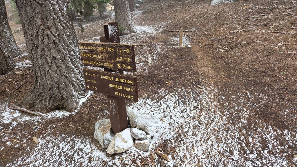
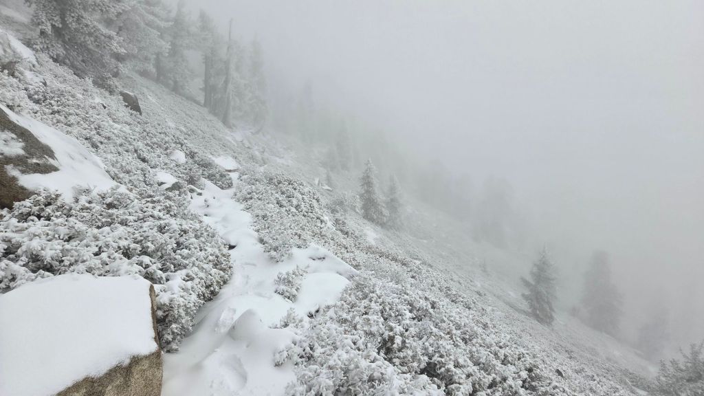
Very light precipitation on the morning of 5th May included 0.22 inch of rain in Idyllwild (at 5550 ft), but nothing more than a hint of a dusting of snow everywhere above about 7500 ft (photo below). By mid morning, elevations above 9100 ft were above the cloud, with the emerging sunshine immediately melting any localized dustings of snow. High pressure returned to the region starting 7th May, with very warm and dry summer-like weather expected until 12th May, and above seasonal temperatures forecast to persist into late May.
At this time main springs and creeks are flowing and water availability is not a significant issue for campers or long distance hikers. It is disconcerting however to see most ephemeral and some “perennial” water sources already at low flow rates, and the four very minor precipitation events in April-May have not improved medium- and long-term water conditions.
Fire lookouts at Tahquitz Peak and Black Mountain reopen for the season on Sunday 17th May and Saturday 23rd May, respectively, having been functionally closed throughout 2025 for maintenance reasons. Note that the steps and railings at Tahquitz Peak lookout are in urgent need of major repair work, and should not be considered safe at this time. The State Park Stone Creek campground reopened this week.
The gate 1.7 miles up from Highway 243 on Black Mountain Road (4S01) remains closed, but will reopen mid month. Following superficial grading late in 2025 the road is in better condition than last summer, but remains far rougher than in June 2020, the last time it was comprehensively graded. Picnic benches at many of the yellow post sites were replaced with new, immovable models in March.
Be rattlesnake aware. This year rattlesnakes became active 1-2 months earlier than normal at both mid and upper elevations. Above about 5000 ft elevation, the venom of Southern Pacific Rattlesnakes (Crotalus oreganus helleri) in the San Jacinto mountains is predominantly neurotoxic, almost always fatal for dogs and sometimes for humans (see my long read article linked here for further information describing our dogs’ survival after a July 2020 neurotoxic bite). Devil’s Slide Trail, lower Deer Springs and lower Marion Mountain trails, Suicide Rock, near Strawberry Cienega, and trails around Tahquitz Peak are frequent higher elevation locations for sightings, but rattlesnakes have been recorded up to 9350 ft.
Be bear aware. Although rarely reported, 4-5 individually identifiable Black Bears have been observed in the San Jacinto mountains since 2017, and I have personally seen at least one annually for the past six years. One large, dark chestnut-colored adult with a right ear tag was seen at least six times in multiple locations in Fern Valley and the Willow Creek drainage in July-September 2025 (see my video from 14th September available here, and images from late August in a prior Report linked here). My brief videos from Devil’s Slide Trail in September 2021 (linked here) and one walking through our property in Idyllwild in 2018 (linked here) show two other individuals. There have been no reports of negative interactions with humans in the high country, at or near campsites, or on trails.
Daily survey hikes by the Trail Report year-round in the San Jacinto mountains include multiple routes to the highest peaks including San Jacinto Peak typically 2-3 times per week (but almost daily during and following storm conditions), Tahquitz Peak and area at least once per week, plus a wide variety of other trails on intervening days.
WEATHER
High pressure returns to the region this week, with temperatures consequently rising rapidly to above seasonal, and will be far above seasonal for May on 10th-12th, before dropping somewhat late next week (but remaining above seasonal). There is, predictably, no significant precipitation in the forecasts.
The last notable low pressure system impacted the region starting 25th April. Light precipitation fell primarily on the evening of 25th continuing into the early morning of 26th. A consistent accumulation of one inch of snow fell everywhere above 8000 ft elevation, with a dusting as low as 6400 ft. Rainfall in Idyllwild was an impressive 0.83 inch. Despite only modest warming, all snow from that storm had melted within a few days.
At San Jacinto Peak (10,810 ft/3295 m) on Thursday 14th May 2026 at 1730 the air temperature was 49.2°F (10°C), with a windchill temperature of 41.9°F (5°C), 41% relative humidity, and a light NNE wind sustained at 4 mph gusting to 9.1 mph.
At the Peak on Monday 11th May 2026 at 0810 the air temperature was 52.6°F (11°C), with a windchill temperature of 43.9°F (6°C), 21% relative humidity, and a gusty SSW wind sustained at 9 mph gusting to 15.6 mph.
At the Peak on Thursday 7th May 2026 at 0635 the air temperature was 37.4°F (3°C), with a windchill temperature of 25.2°F (-4°C), 50% relative humidity, and a steady NE wind sustained at 15 mph gusting to 19.7 mph.
TRAIL CONDITIONS
The Pacific Crest Trail and all major high country trails are clear of snow. This includes the often-treacherous 0.4 mile section of South Ridge Trail from Chinquapin Flat to Tahquitz Peak [surveyed 10th May] which is completely clear of snow and ice.
The East Ridge Trail [surveyed 11th May] route from near Miller Peak to San Jacinto Peak has only 10% cover of drifted snow persisting from much earlier in the season. Nevertheless in places the old trail is partly obscured by snow drifts, and cautious navigation is recommended.
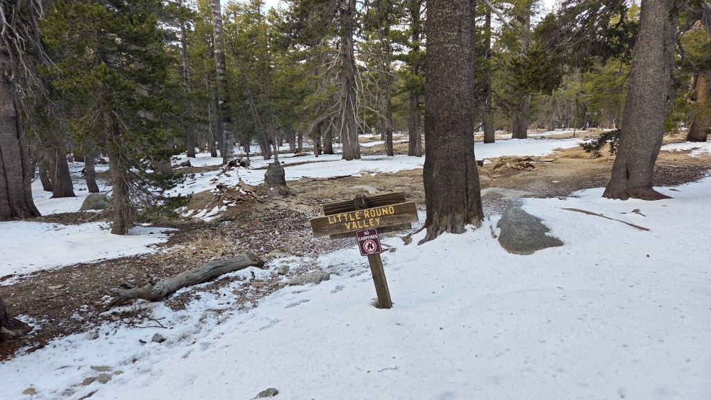
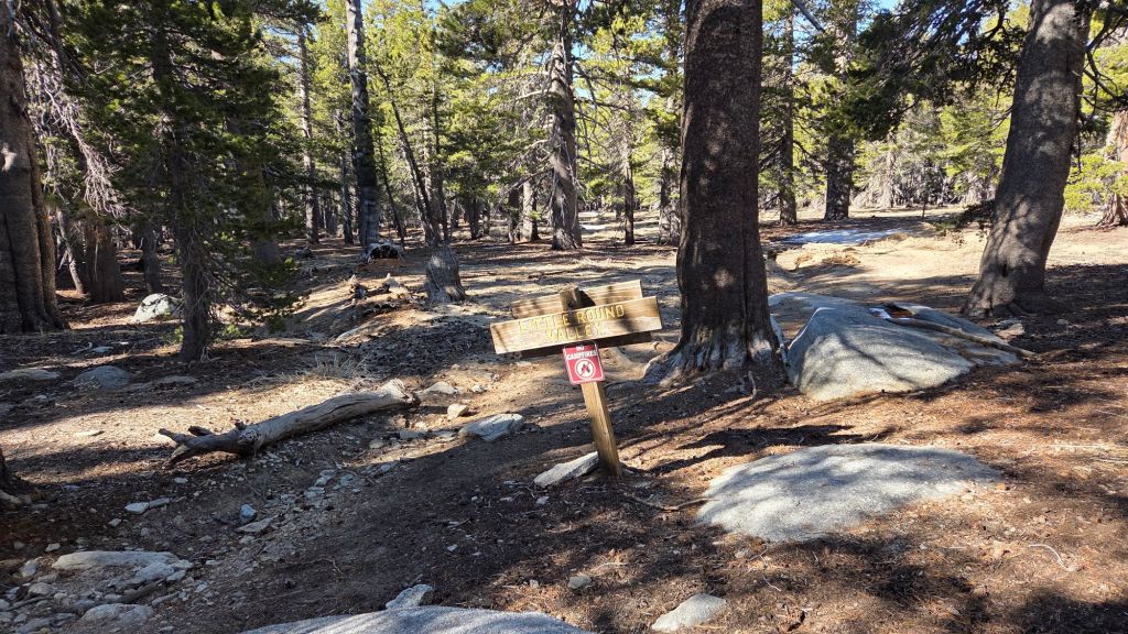
Deer Springs Trail [surveyed 1st and 7th May] is clear of snow to San Jacinto Peak. Even in Little Round Valley, no significant snow remained by the beginning of May (photo below).
Spitler Peak Trail is clear of treefall hazards, despite having been decimated by about 65 new blowdowns in strong winds that accompanied mid February storms. In February-March the Trail Report cut almost all of these, bringing to 235 the number of trees we have removed from this trail in the past seven years. The remaining four large cedars were removed by Forest Service at the end of March.
The Caramba Trail from near Reeds Meadow through Laws Camp and on to Caramba, and the Cedar Trail from Willow Creek Trail to Laws, are euphemistically (and arguably dangerously) described by the Forest Service as “not maintained”. In reality both trails have been abandoned for more than a decade and no longer exist. They are so heavily overgrown, largely with dense whitethorn which obscures dozens of downed trees, that hikers should not attempt to follow them (regardless of how much you may trust any particular app).
An informal use trail to Laws is much more direct, generally well maintained, and avoids the bushwhacking of the abandoned trails (some local Idyllwild hikers dubbed it the “King Trail” when I established the route in 2019). It leaves Willow Creek Trail exactly 1.0 mile from Saddle Junction, 0.46 mile from the Skunk Cabbage turning (trailhead at N 33.7796, W 116.6590). The route descends following former deer trails for 1.2 miles, meeting Willow Creek about 0.15 mile upstream from the site of the historic Laws Camp (the remains of which were destroyed by the 2013 Mountain Fire and subsequent flood and treefall damage). Blowdowns from this winter have already been removed by the Trail Report, and the huge pine tree that fell in late 2024 was kindly removed by Forest Service volunteers in May 2026. There is some optimism that work to rehabilitate the Caramba Trail may start in 2026, so if you see any flagging in this area please leave it in place.
The San Jacinto Trail Report celebrates ten years of operation in 2026. The Report has helped tens of thousands of hikers, and saved multiple lives, both directly and indirectly. Since the Report became established online, snow/ice rescues in the San Jacinto Mountains have dropped 82%, with an additional benefit of saving Riverside County hundreds of thousands of dollars. While all time is volunteered, the Report uses small private donations to help cover operating costs. Donations keep the Report available to all, free from advertising or paywalls, and independent from agencies. If you have found this Report useful, please consider using this link to the Donate page. Thank you very much for your support.


Thanks Jon! I haven’t donated in a while so wanted to chip in generously. These reports are invaluable as I hike in Idyllwild. Stay safe! Hope Anabel is doing well.
Linda Briggs and Sam the Dog
LikeLike