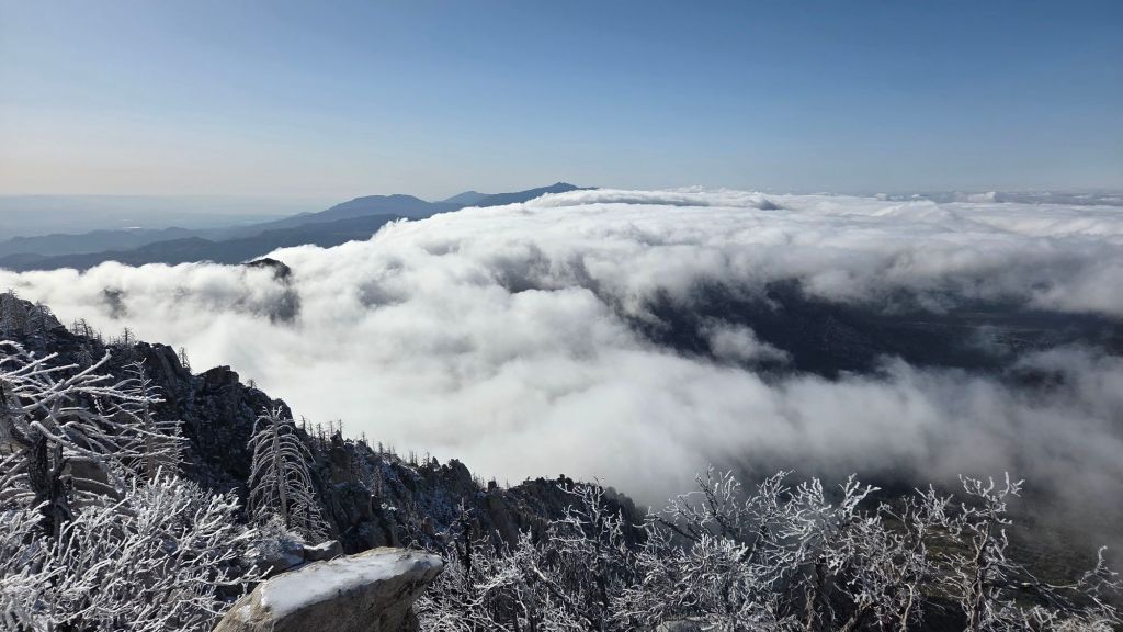
UPDATE Tuesday 5th May 2026: light and localized precipitation this morning included 0.21 inch of rain in Idyllwild (largely between 0630-1130). Although we found it snowing very gently everywhere above about 7500 ft on our hike to San Jacinto Peak, there was no measurable accumulation at any elevation. By mid morning, elevations above 9100 ft were above the cloud, melting the few localized dustings of snow. No further precipitation is forecast for the afternoon, and temperatures rise rapidly over the remainder of the week.
The PCT and all major high country trails were clear of snow by 30th April. No traction devices are required anywhere on the trail system. Hikers heading off trail to 10,000+ ft peaks other than San Jacinto Peak may find that spikes are useful in places as significant drifts persist on the north slopes of Jean and Shirley peaks, and Marion Mountain.
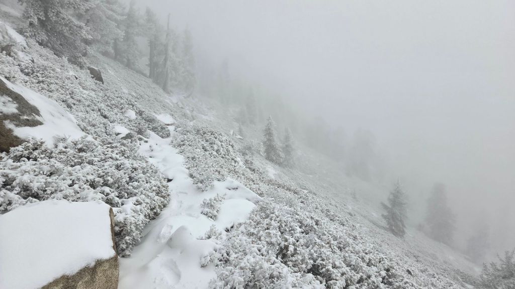
The third very minor storm of April impacted the San Jacinto mountains overnight on Saturday 25th, with light precipitation persisting into mid morning on Sunday 26th. I surveyed from Idyllwild to the highest peaks that morning, ascending in light rain to 7700 ft, and then through intermittent light snow for the remainder of the morning. Snow was largely limited to about one inch depth from 8000 ft to San Jacinto Peak, but locally averaging 1.5 inches deep between 9000-10,000 ft, indicating that the highest peaks were probably above the cloud for part of the storm. Snow dusted as low as 6400 ft in Fern Valley.
Following a brief cooling on 4th-5th, persistent high pressure is forecast to return to the region starting 7th May, with warm and dry summer-like weather consequently expected.
The gate 1.7 miles up from Highway 243 on Black Mountain Road (4S01) remains closed. Following superficial grading late in 2025 the road is in better condition than last summer, but remains far rougher than in June 2020, the last time it was thoroughly graded. Picnic benches at many of the yellow post sites were replaced with new, modern, immovable models in March.
Be rattlesnake aware. This year rattlesnakes became active 1-2 months earlier than normal at both mid and upper elevations. Above about 5000 ft elevation, the venom of Southern Pacific Rattlesnakes (Crotalus oreganus helleri) in the San Jacinto mountains is predominantly neurotoxic, almost always fatal for dogs and sometimes for humans (see my long read article linked here for further information describing our dogs’ survival after a July 2020 neurotoxic bite). Devil’s Slide Trail, lower Deer Springs and lower Marion Mountain trails, Suicide Rock, near Strawberry Cienega, and trails around Tahquitz Peak are frequent higher elevation locations for sightings, but rattlesnakes have been recorded up to 9350 ft.
Daily survey hikes by the Trail Report year-round in the San Jacinto mountains include multiple routes to the highest peaks including San Jacinto Peak typically 2-3 times per week (but almost daily during and following storm conditions), Tahquitz Peak and area at least once per week, plus a wide variety of other trails on intervening days.
WEATHER
A very weak low pressure system impacted the region starting 25th April. Light precipitation fell primarily on the evening of 25th continuing into the early morning of 26th April. A very consistent accumulation of just one inch of snow fell everywhere above 8000 ft elevation, with a dusting as low as 6400 ft. Snowfall reached a maximum of 1.5 inches at 8900-10,100 ft on the east slope. Snowfall was slightly lower at the highest elevations, as the peaks were above the cloud for large parts of the stormy weather. Rainfall in Idyllwild was an impressive 0.83 inch, almost all of which fell prior to 0700 on 26th.
Steady warming was a feature of the last few days of April, with temperatures peaking slightly above seasonal on 1st-2nd May. Temperatures then drop again rapidly as another minor low pressure system passes over the region on 4th-5th May, although at this time there is no significant further precipitation in the forecasts. High pressure is provisionally forecast to return by the second week of May, with the end of the “April showers” and temperatures returning to above seasonal.
At San Jacinto Peak (10,810 ft/3295 m) on Friday 1st May 2026 at 0815 the air temperature was 38.1°F (3°C), with a windchill temperature of 28.6°F (-2°C), 52% relative humidity, and a gentle NNE wind sustained at 4 mph gusting to 8.4 mph.
At the Peak on Tuesday 28th April 2026 at 0810 the air temperature was 34.5°F (1°C), with a windchill temperature of 23.2°F (-5°C), 17% relative humidity, and a light WSW wind sustained at 6 mph gusting to 10.8 mph.
At the Peak on Sunday 26th April 2026 at 0920 the air temperature was 19.9°F (-7°C), with a windchill temperature of 0.1°F (-18°C), 100% relative humidity, and a stiff due West wind sustained at 19 mph gusting to 25.8 mph.
TRAIL CONDITIONS
Trails below 8000 ft elevation are now functionally clear of snow (trails above 7000 ft were entirely under light snow cover as of the morning of 26th April, although nowhere was the average depth greater than 1.5 inches). Patchy, very thin, icy snow covers only about 10% of trails above that elevation, with rapid melting continuing over the next 2-3 days.
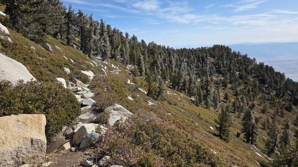
Spikes are not required anywhere on the PCT or high country trail system at this time.
The Pacific Crest Trail [surveyed 1st May] is now functionally clear of snow throughout the San Jacinto mountains. Snow cover is <10% between Miles 175-178. The remainder of the PCT is functionally clear of snow, including the Fuller Ridge Trail section (Miles 185.5 to 191.5).
The often-treacherous 0.4 mile section of South Ridge Trail from Chinquapin Flat to Tahquitz Peak [surveyed 2nd May] is now functionally clear of snow and ice.
South Ridge Trail [surveyed 2nd May] is completely clear of snow from the South Ridge Road trailhead to Tahquitz Peak.
Devil’s Slide Trail [surveyed 1st May] is clear of snow and ice.
The Wellman Trail [surveyed 1st May] is clear of snow.
The Peak Trail [surveyed 1st May] is functionally clear of snow, with just a handful of tiny patches in the forested section at 9900-10,100 ft.
The East Ridge Trail [surveyed 1st May] route above Miller Peak has only 40% cover of drifted snow persisting from earlier in the season (generally only a few inches deep).
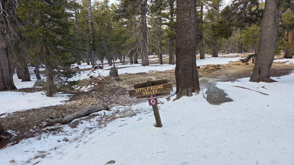
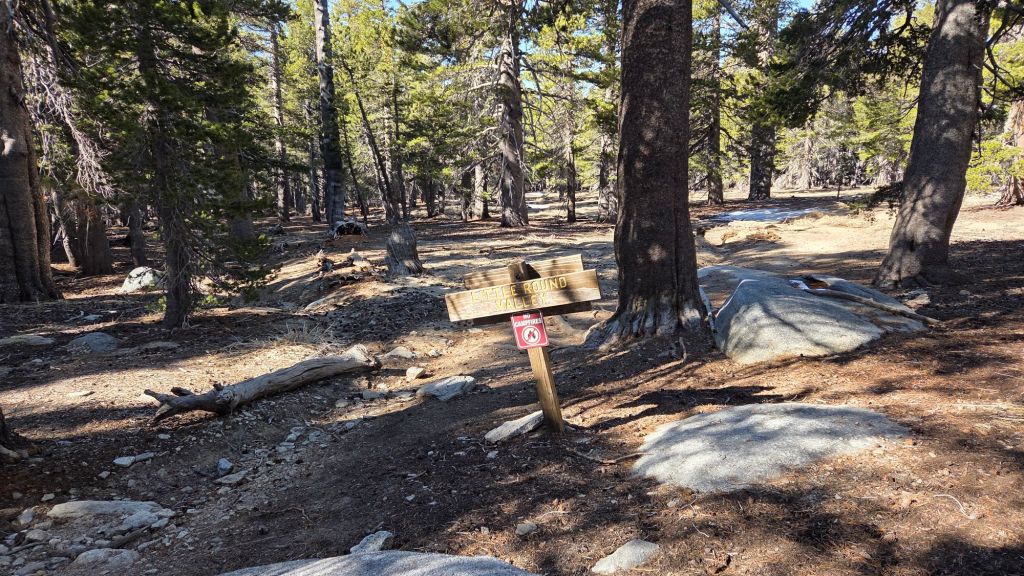
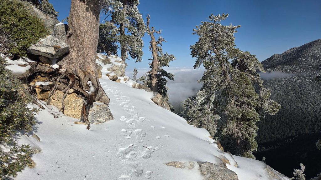
Deer Springs Trail [surveyed 1st May] is clear of snow to San Jacinto Peak. Even in Little Round Valley, remarkably no significant snow remains (photo below).
Marion Mountain and Seven Pines trails [surveyed 1st May] are clear of snow.
The San Jacinto Trail Report celebrates ten years of operation in 2026. The Report has helped tens of thousands of hikers, and saved multiple lives, both directly and indirectly. Since the Report became established online, snow/ice rescues in the San Jacinto Mountains have dropped 82%, with an additional benefit of saving Riverside County hundreds of thousands of dollars. While all time is volunteered, the Report uses small private donations to help cover operating costs. Donations keep the Report available to all, free from advertising or paywalls, and independent from agencies. If you have found this Report useful, please consider using this link to the Donate page. Thank you very much for your support.