PCT and Peak trails 28 Feb 2018

Today I surveyed from Humber Park to San Jacinto Peak via Wellman Divide, then back via Little Round Valley, the south end of Fuller Ridge Trail, and Deer Springs Trail. See yesterday’s update for details of the South Ridge Trail, the PCT south of Saddle Junction, Devil’s Slide Trail and the Ernie Maxwell Trail. The next trail update will be 7-8 March 2018.

Overview A good snowfall in the early hours of yesterday morning, and some flurries during yesterday, produced a remarkably consistent 4.5-5.5″ (approx. 13cm) of snow at almost all elevations above about 5000′. Strong winds have resulted in some drifting, in many places 6-8″ in trails. Although traction aids (e.g., microspikes) are not strictly essential, they will be useful in many areas, especially for descending, and in the morning when still icy. Very rapid melting started this afternoon below 8000′ at least, and will likely continue on/off for the next week. See the report for 23 Feb regarding the hazards of cold, water availability, and route finding. These issues will improve with higher temperatures over the next few days, but remain challenging. At San Jacinto Peak this morning the air temperature was 20.5° F (-6° C) with a windchill down to 8° F (-13° C), almost tropical compared to last week! At the time of writing, only my tracks were present on every trail surveyed today and yesterday, and these may soon be obscured by drifting snow and melting.

Pacific Crest Trail The entire PCT above 5500′ through the San Jacinto Mountains, including Fuller Ridge, is currently covered with about 3-5″ of fresh snow, with deeper drifts, making it slow going. Fuller Ridge does not have fresh tracks to follow. Snow depth at Saddle Junction was 5″, but only 3-4″ from Strawberry Junction to the Marion Mountain Trail junction. At the south end of Fuller Ridge, snow depth was 5.5″. Most water resources along the PCT above 8300′ are frozen solid and heavily obscured by snow.

San Jacinto Peak trails On the west side, the Upper Deer Springs Trail from Fuller Ridge Junction to San Jacinto Peak has continuous fresh snow cover of 4.5-5.5″ (significantly deeper in areas of drifting and in Little Round Valley where old snow remained). The fresh and drifted snow masks ice from previous storms, and at the various creek and spring crossings, so microspikes are very useful, especially when descending.

On the east side, snow depth at Annie’s Junction (the State Park boundary) was 5″, but only 3-4″ from Wellman’s Cienega through Wellman Divide, thereafter about 5″ to the Peak (but heavily drifted from 9900-10,100′). At San Jacinto Peak itself, fresh snow depth was about 5-6″, but in places overlaying icy snow from January, and heavily drifted.

Deer Springs Trail Snow depth at Strawberry Junction was only 3″, and from 7000-8000′ was 1-3″ with deeper drifts but also some rapidly melting clear areas. Below the Suicide Rock junction, largely clear with small snow patches melting quickly. (See above for sections north from Strawberry Junction.)

Tahquitz trails 27 Feb 2018

Anabel and I hiked through the fresh overnight snow from home via South Ridge Trail to Tahquitz Peak this morning, returning via the PCT from Chinquapin Flat to Saddle Junction, then down Devils Slide and Ernie Maxwell trails.

I would currently recommend using (or at least carrying) microspikes on all these trails. Although the powder currently provides good traction, in places (especially drifts) it masks ice from past storms underneath. Also, generally milder conditions starting tomorrow (but especially after next weekend) will result in freeze-thaw cycles that will turn more of this powder into ice. There is not yet sufficient depth and consistency of snow cover for snowshoeing.

South Ridge Trail (to Tahquitz Peak) received similar snowfall as Idyllwild (about 5″) for almost all of its length, but slightly more (5.5″) at the Peak. There has been significant drifting, especially above 7600′, and the trail sometimes alternates from almost bare to drifts up to 12″ deep. For PCT hikers the South Ridge Trail through to Saddle Junction can be an important route for those skipping Idyllwild, and/or for those doing continuous steps from the PCT Alternate at May Valley Road.

South Ridge Trail (from Tahquitz Peak to the PCT) has deep, drifted powder, from 6-18″, especially nearer the Peak. The deepest drift I crossed was about 27″ (70cm) deep. Although traction is relatively easy in the soft powder, the drifts hide dangerous ice from January storms, and spikes and hiking poles (or an ice axe if you prefer) are very useful. This short section of trail is notoriously treacherous, please use considerable caution.

PCT from Chinquapin Flat to Saddle Junction unusually received slightly less snow than South Ridge Trail, and has continuous snow cover from 4-5″ deep, with some shallower and deeper patches depending on drifting.

Devils Slide Trail has continuous snow cover averaging about 5″ at both Humber Park (6500′) and at Saddle Junction (8100′).

Ernie Maxwell Trail has continuous snow cover, with (oddly) slightly less snow at its upper end at Humber Park (about 4.5″) than at its lower end at Tahquitz View Drive (5″).

Trail from Tahquitz Peak to Chinquapin Flat 27 Feb 2018
The PCT at Chinquapin Flat (mile 178.5) 27 Feb 2018

Trails 23 Feb 2018

Yesterday evening I surveyed South Ridge Trail past Tahquitz Peak to the PCT at Chinquapin Flat, and today hiked from Humber Park to San Jacinto Peak then back via Little Round Valley, the south end of Fuller Ridge Trail, and Deer Springs Trail.

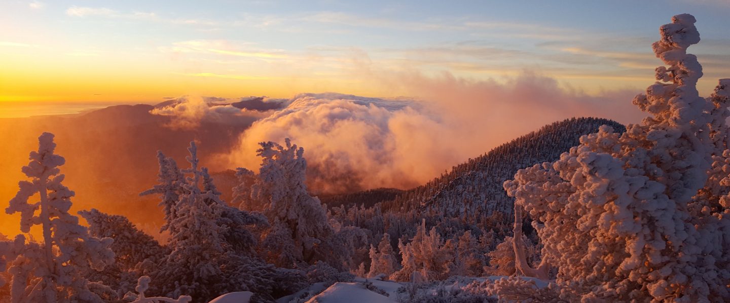
Overview We have had three light dustings of snow this week, on Monday (discussed in previous post), yesterday, and briefly this morning. Combined these have produced a fairly consistent maximum of 2″ (5cm) of snow across the mountain above about 8000′, and above 6500′ about 1″ or even less. However very strong winds have resulted in extensive drifting, especially accumulating in trails. The uppermost parts of the mountain were above most of the cloud, and have also only received about 2″ of fresh snow, although here drifting has been extreme, especially on the east side of San Jacinto Peak. Although traction aids (e.g., microspikes) are not currently essential, I would now recommend them in a couple of specific areas (discussed below), and as always, hikers unfamiliar with snow/ice travel may find microspikes useful in many areas. Three notable hazards at present are discussed first.

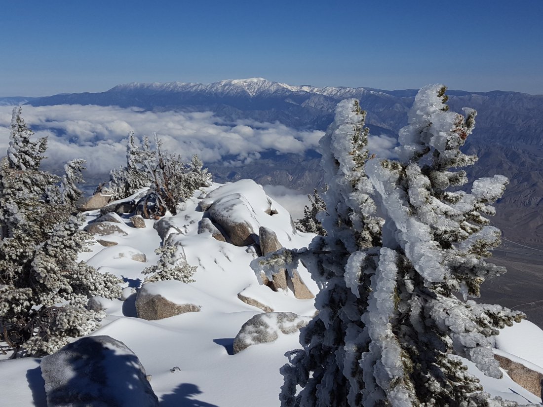
Severe cold Last night at Tahquitz Peak, the windchill temperature was -1° F. At San Jacinto Peak today the air temperature (in the sun!) was only 4° F (-15.5° C) and I recorded a windchill temperature of -25.1° F (-32° C)! Everywhere above 9000′ (2700m) today was below 0° F (-18° C) when including windchill. Temperatures will warm very slightly this weekend, but at higher elevations (>8000′) they will remain below freezing day and night for the foreseeable future. These forecast temperatures do not include additional treacherous windchill effects. I advise against venturing into the highest elevations without the very best equipment suitable for such conditions.

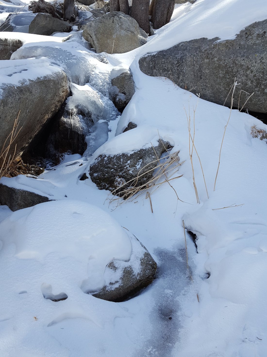
Water This is only really an issue for thru hikers. Most sources above 8000′ are frozen solid and covered with inches of ice (that is a challenge to remove even with an ice axe!). This may remain a problem for at least the next couple of weeks. Of course there is plenty of snow to melt, but that is not very efficient with stove fuel.

Routefinding Many trails have received very little traffic this week, so there are few tracks to follow. On the less traveled trails on the western side of the mountain, in many cases there are one or two sets of tracks at most, but with strong winds and light powdery snow, tracks are disappearing within hours (or even minutes). The East Ridge Trail that was obvious on Monday had completely disappeared by Friday morning under drifts up to 12″ (30cm) deep.

Pacific Crest Trail Basically the entire PCT above 7500′ through the San Jacinto Mountains, including Fuller Ridge, is currently covered with at least 1-2″ of snow. However the route has tracks and is relatively easy to follow. The section north from Saddle Junction to Annie’s Junction (PCT miles 180-182) has some of the worst drifting, up to 4-6″ in places, and is consequently slow going.

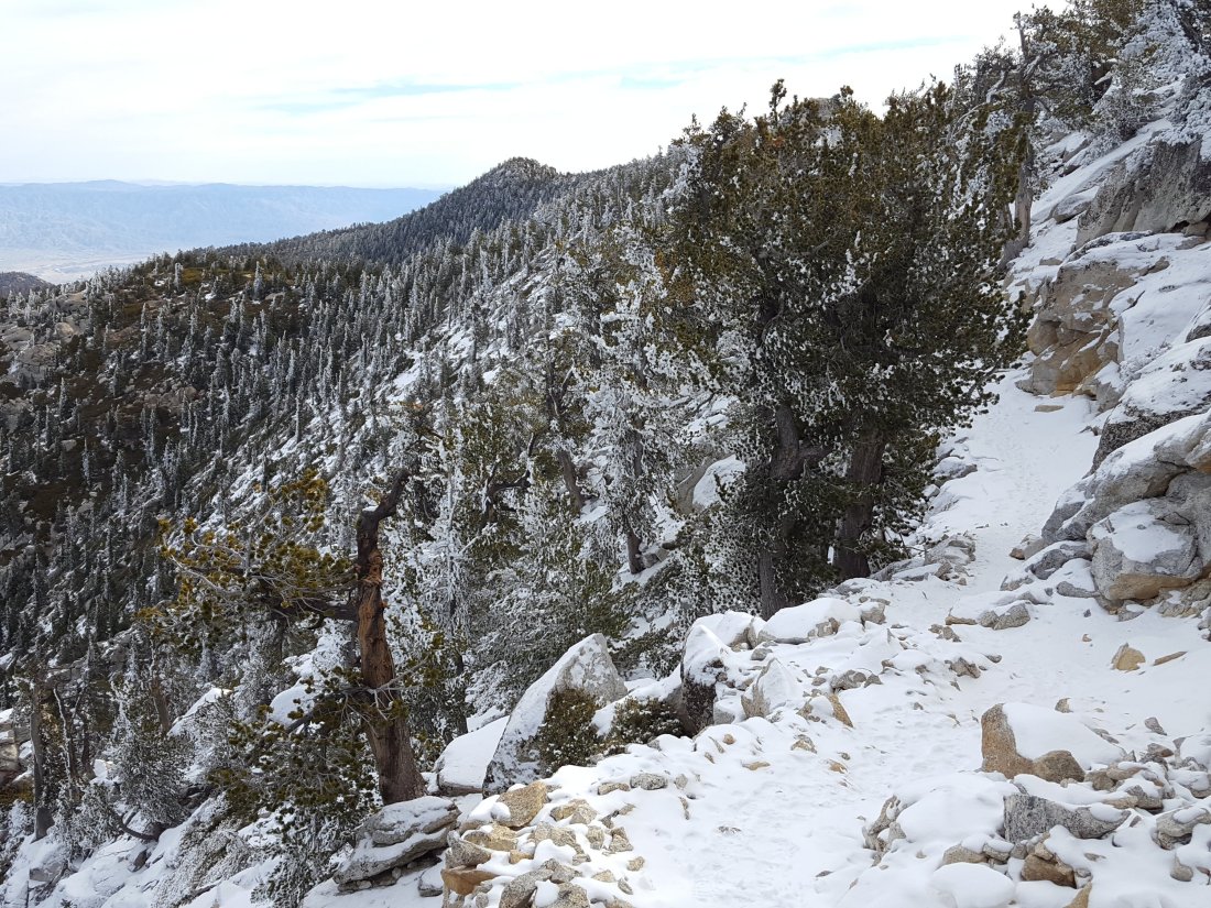
Tahquitz Peak to Chinquapin Flat/PCT This is the most hazardous section of trail at present. Last night I waded through powder drifts at least 12″ deep, especially near the Tahquitz Peak end (at Chinquapin Flat there is less than 2″ of snow). By the time I headed back, just 10 minutes later, my tracks were already disappearing. I would recommend hiking poles and microspikes for most hikers on this section. If you do not know the route and there are no good tracks to follow, I do not recommend attempting this trail. Once these drifts become icy (perhaps as early as this weekend), this is an intimidating crossing.

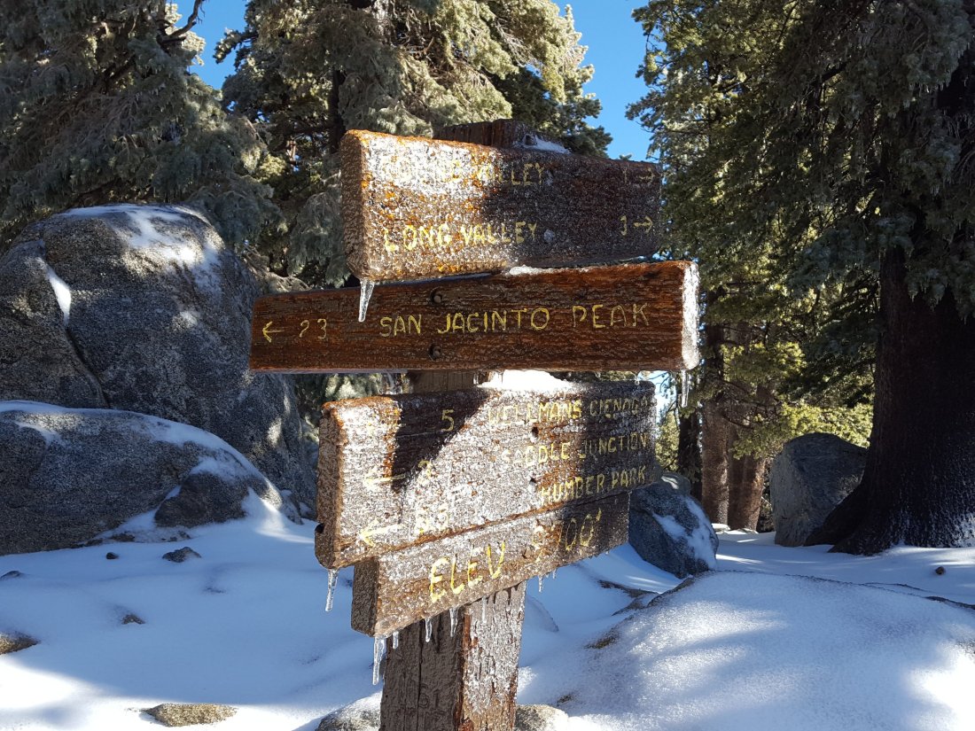
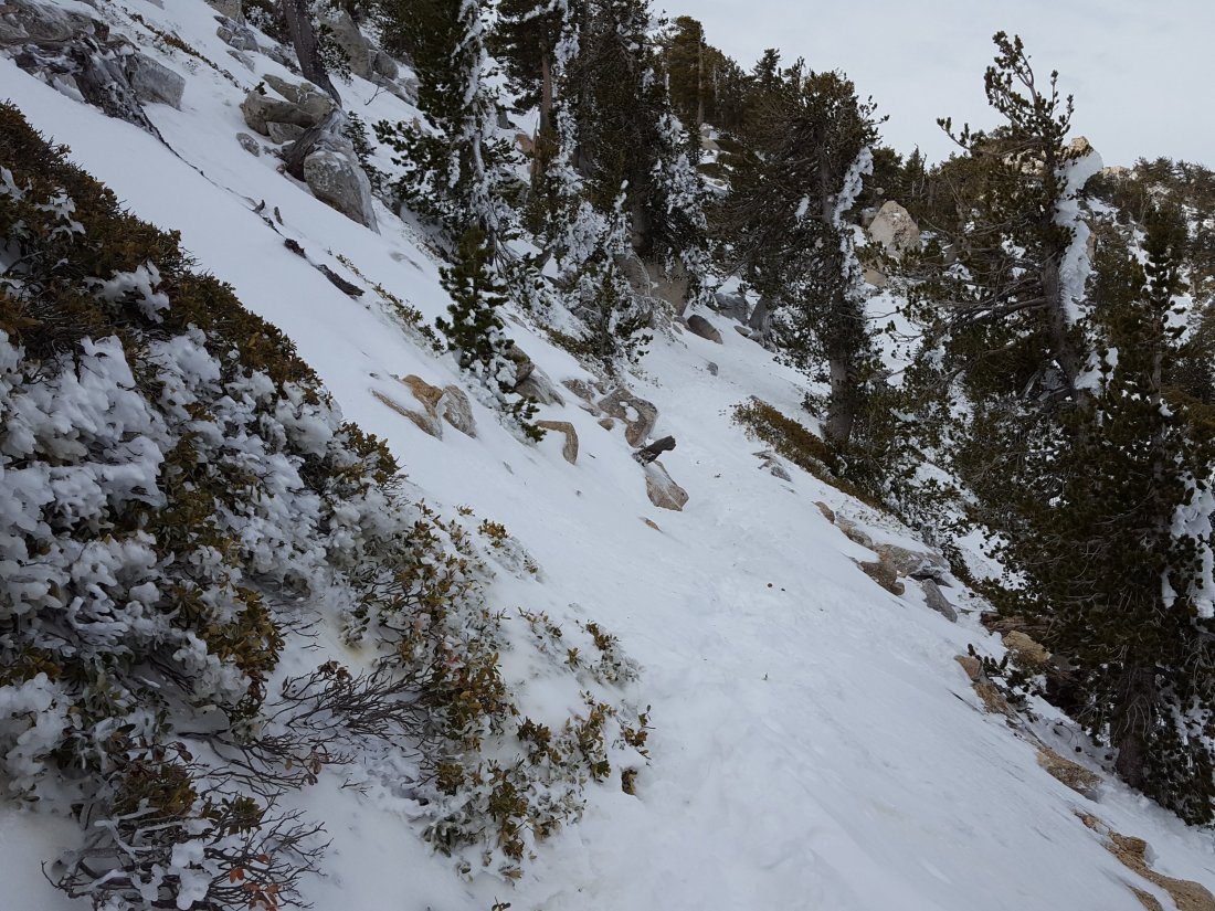
San Jacinto Peak trails On the west side, the Upper Deer Springs Trail (from Fuller Ridge Junction to San Jacinto Peak) is lightly snow-covered (generally 2″ but significantly deeper in areas of drifting). However the drifted snow masks ice from previous storms, and microspikes are very useful here, especially when descending. The crossings of the various springs below Little Round Valley are frozen solid and form treacherous ice sheets. From Little Round Valley to the Peak the trail appears to have had only one set of tracks (which have probably now disappeared) in recent days.

On the east side, the trail from Wellman Divide to the Peak is clear for long stretches (<0.25″ snow depth), except from about 9900-10,100′, where drifted powder is overlaying icy snow from January, and varies from 2-8″ deep.

From Annie’s Junction (where the PCT turns sharply west at the State Park boundary) to Wellman Divide, the trail is initially under several inches of drifted snow, but then relatively clear (<1″ snow depth) to Wellman Divide.

Deer Springs Trail up to Strawberry Junction (see above for sections beyond Strawberry Junction) A patchwork of clear sections and areas of drifted powder to 2″ deep. Below the Suicide Rock turning, largely clear and small snow patches melting quickly.

Devils Slide Trail Below 7500′, a very light covering of snow (about 1″), increasing to 2″ by Saddle Junction (8100′). Currently, none of this is icy requiring microspikes, however this may change after weekend hiker traffic compacts the snow.

South Ridge Trail A light covering of snow (about 1″) as far as Old Lookout Flat (7800′) then at least 2″ deep to Tahquitz Peak, but with deeper drifts in places. Again, none of this is icy requiring microspikes yet, but this will change if weekend hiker traffic compacts the snow.

Trail update 19 Feb 2018

I started today hiking from San Jacinto Peak to the PCT via Little Round Valley, then surveyed almost all the PCT above 8000′ (Fuller Ridge southbound to Saddle Junction), and finished with Devils Slide Trail. At San Jacinto Peak it started snowing at 0630, and continued lightly until 0930.

Overview Last night most trails and many exposed aspects were snow-free. However, the entire mountain above about 5500′ received a light dusting of snow today. It is fair to assume that almost all major trails on the mountain currently have a light covering of snow. I measured about 1.0″ (2.5cm) at San Jacinto Peak and Annie’s Junction, 0.75″ in Little Round Valley, and 0.5″ at Strawberry Junction and Saddle Junction. The snowfall was largely graupel, a powdery hail-like snow that actually makes traction very easy on trails when it is fresh. Although traction aids (e.g., microspikes) are not currently essential, this may change as the current snow goes through freeze-thaw cycles and starts to become icy, especially where it is compacted by hiker traffic. Conditions may also change further as it is snowing again lightly this evening (at least in Idyllwild at 5550′), and further snow is forecast for the whole mountain later this week.

Severe cold This is the biggest hazard at present. Early this morning at San Jacinto Peak I recorded a temperature (including windchill effect) of -24.7° F (-31.5° C)! (See video below.) While this is extreme, temperatures are forecast to remain well below freezing at night above 6000′ (1800m), and at higher elevations below freezing all day, for at least the next 10 days. These forecast temperatures do not include additional dangerous windchill effects. Unless you are certain that you have the very best equipment suitable for such conditions, camping above 8000′ (2400m) for at least the next 10 days could be life-threatening.

Water The only concern with water right now is that most sources above 8500′ are frozen solid. This will remain a problem, especially in the mornings, for at least the next several days. For example at the crossing of the North Fork of the San Jacinto River on Fuller Ridge today at noon, I was unable to kick through several inches of solid ice with a hiking boot heel to reach the flowing trickle underneath (see photo below).

Pacific Crest Trail While much of the PCT through the San Jacinto Mountains is currently covered with a little snow (<1″), the route is relatively easy to follow. By this afternoon, the snow from the morning was already starting to melt on some sections on exposed southerly aspects (e.g., near Strawberry Cienega). Hikers very unfamiliar with snow/ice travel will find microspikes useful in some areas. Please also see comments above regarding severe cold, water problems, and additional forecast snow.

Upper Deer Springs Trail (from Fuller Ridge Junction to San Jacinto Peak) Lightly snow-covered (generally <1″ but 2-3″ in areas of drifting). In Little Round Valley about 90% snow cover of a few inches from January storms persists (under the fresh snowfall), but the trail is still fairly clear.

Devils Slide Trail Largely clear below 7000′, a very light covering of snow above 7000′.

Error
This video doesn’t exist
Frozen North Fork of San Jacinto River on Fuller Ridge (PCT mile 187) on 19 Feb 2018
Pacific Crest Trail just north of Saddle Junction (PCT mile 180) on 19 Feb 2018

Tahquitz 16 Feb 2018

Anabel and I ran from home via the South Ridge Trail to Tahquitz Peak this morning, returning via Chinquapin Flat, the PCT to Saddle Junction, Devils Slide Trail, and the Ernie Maxwell Trail. The north side of Tahquitz Peak, from the Peak to the PCT, is always one of the most treacherous trail sections in the San Jacinto Mountains, and one of the very last to melt in spring. For PCT hikers the South Ridge Trail through to Saddle Junction is an important alternate for those skipping Idyllwild, and for those doing continuous steps from the PCT Alternate at May Valley Road.

Unusually for this time of year, the trails both north and south of Tahquitz Peak do not require microspikes. South Ridge Trail has only a few tiny ice patches. Although the trail between the Peak and the PCT is completely snow-covered, the light dusting of about 1″ of snow it received earlier this week actually improved traction significantly. I was able to run through this section comfortably in road running shoes with no spikes. However, hikers uncomfortable on snow/ice may prefer to use spikes for this section.

Trail from Tahquitz Peak to Chinquapin Flat/PCT on 16 Feb 2018

The PCT from Chinquapin Flat to Saddle Junction has some lengthy sections with snow cover (<2″ deep), but again this is actually much better for traction than ice. Devils Slide Trail is completely clear below about 7800′ (and no spikes are required higher up).

Snow 14 Feb 2018

We have had three minor snow storms in the past three days. However they have produced so little snow that there is currently no change to the trail conditions from the 9 Feb update. In fact the highest elevations have been largely above the cloud, so there has been more melting than accumulation. For example today I was easily able to ascend and descend San Jacinto Peak without using microspikes. Nevertheless, those unfamiliar with snow/ice travel may continue to find spikes useful in places (as discussed in the 9 Feb update). Further precipitation is forecast for 18-19 Feb, and overnight temperatures are forecast to be well below freezing at higher elevations in the mountains for at least the next 10 days.

In the early hours of Monday 12 Feb there was light snow at higher elevations with the snowline at 6400′. That morning I visited Tahquitz Peak (8836′, 2700m) where there was only about 0.5″ (1.2cm) of fresh snow. By the time I was descending in mid-morning, most was already melting below 7700′.

Trail from Tahquitz Peak to Chinquapin Flat on morning of 12 Feb 2018

Overnight on 12/13 February, there was much more widespread snow, with a dusting down as low as Garner Valley (4100′, 1250m). However, snow volume was very light and uniform, with only 0.6″ in Idyllwild (5550′, 1700m), and about the same at higher elevations.

Finally, most of today, Wednesday 14 Feb, was cloudy. I hiked to San Jacinto Peak from Humber Park in the early morning, and passed through extremely light snowfall both on the ascent and descent. The snowfall only settled to less than 0.5″ between about 7800′-9300′ elevation (2400-2800m). The top of the cloud was at about 10,200′, and the Peak was clear. The air temperature at the Peak was 22° F (-6° C), but with a steady wind the windchill temperature was 6° F (-14° C).

View across to Wellman’s Cienega (9300′) in very light snow on 14 Feb 2018
San Jacinto Peak above the cloud at 0900 on morning of 14 Feb 2018

Trail update 9 Feb 2018

In anticipation of the first wave of February northbound (nobo) PCT hikers, I surveyed the PCT from near Tahquitz Peak north through Fuller Ridge, plus all the main access trails to the high country, and San Jacinto Peak daily from 5-9 Feb.

Overview With near-record-low snowfall so far this winter, many trails are largely clear of snow (in stark contrast to this time in 2017). Nevertheless, in some places hikers may find microspikes useful for traversing areas of compacted snow. This is especially true when descending slopes. The main problem this season may prove to be water. Although currently not a problem, some springs are already drying up, and even with precipitation forecast next week, other springs will dry during the course of the nobo PCT season

Pacific Crest Trail The PCT is largely clear of snow throughout the San Jacinto Mountains. There are some easily traversed extended areas of compacted snow and ice either side of Annie’s Junction (the State Park boundary north of Saddle Junction, where the PCT turns sharply west to Strawberry Cienega), and then again along the 0.5 mile section just south of the Fuller Ridge Trail junction. Fuller Ridge Trail is largely clear. Where there are occasional small remnants of snow there are obvious tracks to follow with well-dug steps. Small snow patches are most extensive between 3.1-4.7 miles along Fuller Ridge (measured from the south end of the trail), but the trail is easy to follow and the snow is melting quickly. Note that there is excellent flowing water (under the ice) at the North Fork of the San Jacinto River (0.48 miles north from the S end of Fuller Ridge Trail)

San Jacinto Peak trails The trail north from Saddle Junction to San Jacinto Peak is mostly clear of snow. The only extended area of snow patches is north of Wellman’s Divide, between 9900’-10100’, but the trail is obvious. The Deer Springs Trail above the Fuller Ridge Trail has large ice/compacted snow patches, especially >9300′. Spikes are not required for ascending, but can be useful for descending for those unfamiliar with snow/ice travel. In Little Round Valley there continues to be about 90% snow cover under the trees, but the trail is obvious.

At San Jacinto Peak itself, there remains only 60% snow cover above 10,500’. The East Ridge (Ranger) Trail remains fully snow covered, with some drifts 6-10″ deep, but the trail is obvious (microspikes recommended for descending at least).

Deer Springs Trail Clear to Strawberry Junction (see above for details beyond Fuller Ridge).

PCT south from Saddle Junction to Mountain Fire closure Largely clear, small snow patches near Chinquapin Flat.

South Ridge Trail Clear from South Ridge Road trailhead to Tahquitz Peak, then passable with care to PCT (Chinquapin Flat). Between Tahquitz Peak and Chinquapin Flat there is continuous coverage of compacted snow that requires some care to traverse (microspikes are useful but not essential when heading north from Tahquitz Peak).

Devils Slide Trail Clear, a few tiny ice patches near Saddle Junction

Marion Mountain Trail  Clear to State Park boundary. Some small ice patches in State Park section to Deer Springs Trail/PCT, but spikes not required.