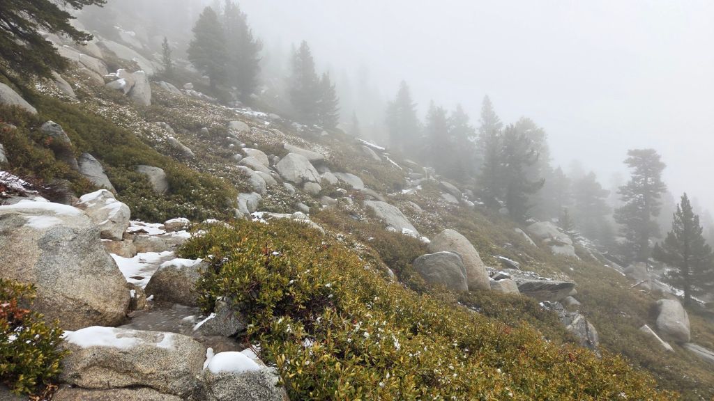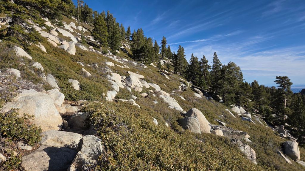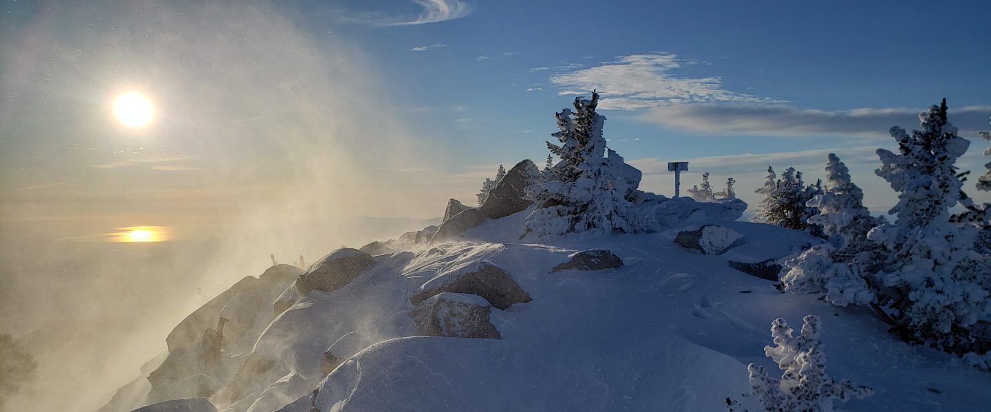
The third snow-producing storm of this winter season impacted the San Jacinto mountains late on Saturday 31st October, with light rain and drizzle continuing into Sunday 1st November. With a warm subtropical air mass driving the storm, the freeze level was predictably high, snow dusting only down to 9650 ft, with two inches above 10,000 ft and 2.5 inches at San Jacinto Peak falling late on 31st. By the morning of 1st November, it was already drizzling as high as San Jacinto Peak, and large sections of the Peak Trail were already more slush than snow. I recorded a YouTube short from the Peak just after 0900 on 1st to give a feel for conditions (linked here).
Mid elevations throughout the San Jacinto mountains received at least half-an-inch of rain, with many closer to one inch. The most rain recorded locally was 1.46 inches at Vista Grande (4700 ft, NWS data), with 1.22 inches at Wellman’s Cienega (9300 ft) and 0.76 inch in Idyllwild (at 5550 ft).
With temperatures rising steadily during and following the storm, and even the highest elevation snow so wet on settling, melting has been rapid. Most trails are already functionally clear of snow, with only a few minor persistent sections remaining above 10,000 ft on the Peak Trail, East Ridge Trail, and uppermost Deer Springs Trail. Few, if any, hikers will find that spikes are necessary, although caution is required especially on the rocks around the highest peaks.
Multiple precipitation events in September and October have had a positive impact on the water situation at all elevations. Consequently I do not anticipate detailing water availability and flow rates for springs, creeks and pipes for the remainder of the year.
Be bear aware. Although rarely reported, up to six individually identifiable Black Bears have been observed in the San Jacinto mountains in the past decade. Of these, one with an ear tag has been here since 2017 and was seen repeatedly in 2025 (see, for example, my video from 14th September 2025 linked here). Another individual was fitted with a satellite collar in April 2026, and has ranged widely in the San Jacinto and northern Santa Rosa mountains (per CDFW). Most recently this individual was in the Dark Canyon area. There have been no reports of negative interactions with humans in the high country, at or near wilderness campsites, or on trails.
Dark Canyon campground did not reopen in 2026 due to staffing/budget issues, although Dark Canyon Road (the access to Seven Pines trailhead) has remained open all year. Following superficial grading late last year, Black Mountain Road (4S01) is in slightly better condition than in 2025, but remains far rougher than in June 2020, the last time it was comprehensively graded. South Ridge Road is in poor condition (although not as bad as 2019) and generally requires a high clearance and/or AWD/4WD vehicle to reach the South Ridge trailhead at the top of the road.
Daily survey hikes by the Trail Report year-round in the San Jacinto mountains include multiple routes to the highest peaks including San Jacinto Peak typically 2-3 times per week (but almost daily during and following storm conditions), Tahquitz Peak and area at least once per week, plus a wide variety of other trails on intervening days.
WEATHER
Tropical Storm (formerly Hurricane) Rachel passed across Southern California on 10th-11th October, with remnant precipitation persisting into 12th. Cumulative storm totals included 3.31 inches of rain at San Jacinto Peak (plus 0.25 inch of snow), 4.02 inches at Wellman’s Cienega (9300 ft), and 3.77 inches in Idyllwild (at 5500 ft). Snow dusted down to 9400 ft, and 0.25 inch of snow above 9900 ft, the bulk of which had melted by 13th.
A low pressure system moving steadily eastwards across California drew additional tropical moisture northwards (including remnants of Tropical Storm Trudy) on 21st-23rd October. Light rain fell on 21st-22nd (totaling 0.25 inch in Idyllwild at 5500 ft), which then turned to light snow on the afternoon of 22nd at higher elevations. Snow dusted down to 6400 ft on Marion Mountain Trail visible early on 23rd and a consistent one inch depth everywhere above about 9000 ft. Snow was much more sparse on the sun-exposed eastern and southern slopes, with the dusting only down to 8400 ft. By the late afternoon of 23rd, the movement of the low pressure system across the state resulted in further storm cells, this time originating from the north rather than south-west. A dusting of 0.25 inch of snow was evident in the early morning of 24th down to about 9800 ft, with a scant 0.5 inch above 10,500 ft.
The storm system on 31st October to 1st November is described in detail in the introduction above. With an additional 2.5 inches of snow at San Jacinto Peak on 31st, the Peak received a total of 4.25 inches of snow in October 2026, the most in the month of October for at least the past decade (the previous high was 1.5 inches in October 2025).
The first jet stream-driven storm system is tentatively forecast for our region in mid November. Details remain unclear at this time, but moderate precipitation is possible on one or more days from 12th November onwards. This may include snow down to a much lower elevation than has been recorded so far this winter, potentially even below 8000 ft. This section will be updated daily as forecasts improve over the next ten days or so.
At San Jacinto Peak (10,809 ft/3295 m) on Tuesday 3rd November 2026 at 0840 the air temperature was 44.9°F (7°C), with a windchill temperature of 37.1°F (3°C), 33% relative humidity, and a steady due West wind sustained at 8 mph gusting to 11.6 mph.
At the Peak on Sunday 1st November 2026 at 0910 the air temperature was 30.8°F (-1°C), with a windchill temperature of 17.1°F (-8°C), 100% relative humidity, and a strengthening WNW wind sustained at 10 mph gusting to 17.0 mph.
At the Peak on Thursday 29th October 2026 at 0900 the air temperature was 44.6°F (7°C), with a windchill temperature of 34.9°F (2°C), 11% relative humidity, and a light SSW wind sustained at 6 mph gusting to 10.7 mph.
TRAIL CONDITIONS
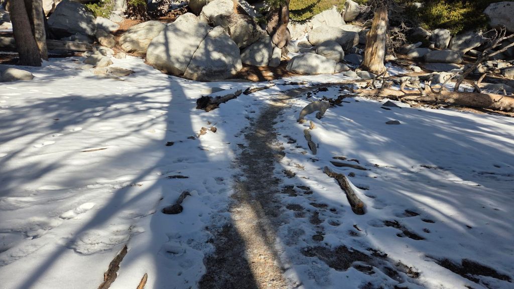
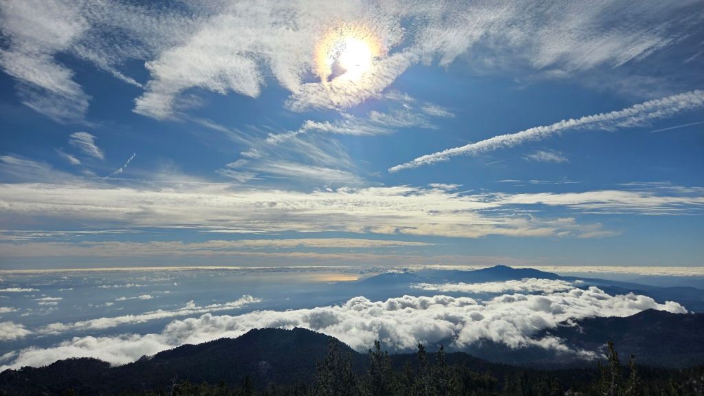
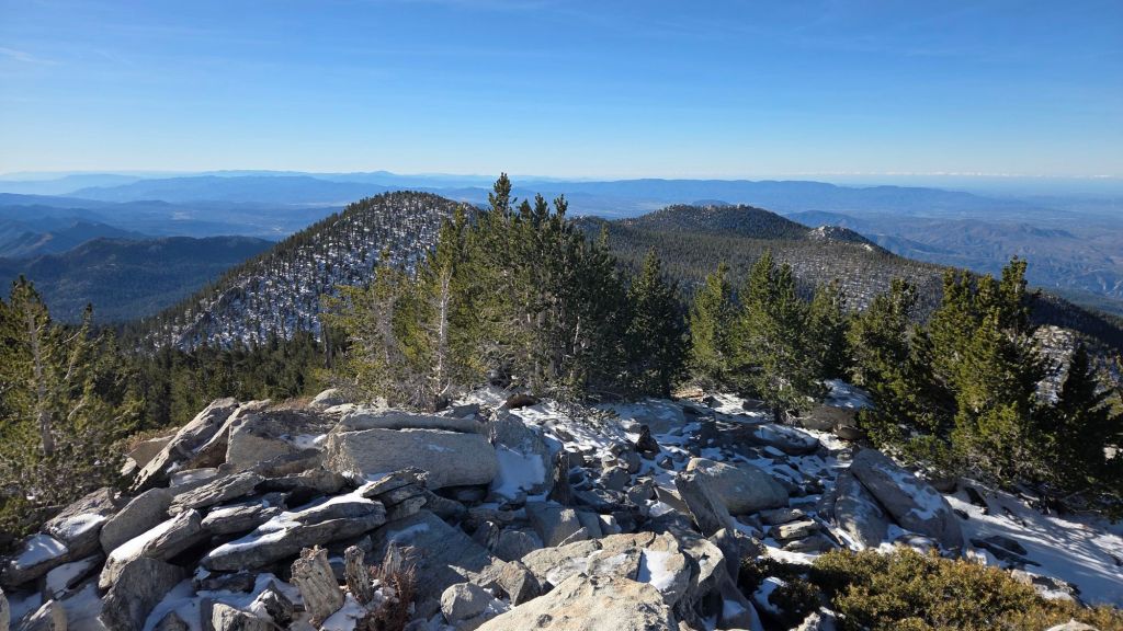
Trails have largely cleared of the light snowfall that had accumulated on 31st October. All trails below 9800 ft are clear, and the eastern side high country routes (e.g., Wellman and Peak trails) were functionally melted by Tuesday 3rd November, other than the lightly traveled East Ridge route to San Jacinto Peak which retained 70% snow cover. Only upper Deer Springs Trail, which is more heavily forested and less sun-exposed, retains limited, thin, snow patches, but nowhere are any traction devices required at this time (although hikers unfamiliar with icy snow travel may choose to carry them if venturing above 10,000 ft).
As discussed in the introduction, established springs and pipes are flowing steadily at this time, and hence flow rates and availability are not currently described. Note that most ephemeral sources remain dry however.
Significant sections of the Pacific Crest Trail in the San Jacinto mountains, although largely clear of blowdowns, remain in urgent need of brushing despite repeated reporting to USFS and PCTA. This includes Miles 155-157, 169-170 (Apache Peak area), 171-173, 179-183 (Saddle Junction to Strawberry Junction), and 185.5-190 (Fuller Ridge).
The first comprehensive trail trimming in decades is being undertaken by the Trail Report this year on the upper Peak Trail. After five months of work, almost the entire 0.5 mile section of trail between 10,000 ft and the Miller Peak switchback has been widened to 2-4 feet by early November. Unmanaged chinquapin overgrowth had narrowed the trail to just 10-15 inches wide in many places, which was problematic year-round, but especially in winter conditions and for pole users (example before-and-after photos in several prior reports since June).
Trail maintenance work by USFS and State Park volunteers earlier this year cleared Willow Creek Trail of blowdowns from last winter. Brush trimming work was undertaken on both the USFS and State Park sections of the trail in late July, although it was much more limited on the State Park section, and the upper switchbacks closer to Hidden Divide remain badly overgrown in places.
Deer Springs Trail from the trailhead to Little Round Valley was cleared of the handful of blowdowns from last winter by the Trail Report.
The Caramba Trail from near Reeds Meadow through Laws Camp and on to Caramba, and the Cedar Trail from Willow Creek Trail to Laws, are euphemistically (and perhaps dangerously) described by the Forest Service as “not maintained”. In reality both trails have been abandoned for more than a decade and no longer exist. They are so heavily overgrown, largely with dense whitethorn which obscures several hundred downed trees, that hikers should not attempt to follow them (regardless of how much you may trust any particular app).
An informal use trail to Laws is much more direct, generally well maintained, and avoids the bushwhacking of the abandoned trails (some local Idyllwild hikers dubbed it the “King Trail” when I established the route in 2019). It leaves Willow Creek Trail exactly 1.0 mile from Saddle Junction, 0.46 mile from the Skunk Cabbage turning (trailhead at N 33.7796, W 116.6590). The route is marked with cairns (and subtle flagging to aid USFS work crews) and descends following former deer trails for 1.2 miles, meeting Willow Creek about 0.15 mile upstream from the site of the historic Laws Camp (the remains of which were destroyed by the 2013 Mountain Fire and subsequent flood and treefall damage). Blowdowns from this winter have already been removed by the Trail Report, and the huge pine tree that fell in late 2024 was kindly removed by Forest Service volunteers in May 2026.
East from Laws the old Caramba Trail is initially heavily obscured by blowdowns and thick regrowth, but the easternmost 1.5 miles closest to Caramba camp is often well marked with cairns placed by myself and others. Much of the old trail rock work is visible in places. The first mile east of Laws is currently marked largely along the former trail route with orange flagging (for use by USFS work crews), although it is not recommended to follow this in some areas as it goes directly through blowdowns and obstructive vegetation, not around them.
Work to rehabilitate the original Caramba Trail started in June this year – combining the Trail Report, other volunteers, and Forest Service employees – almost exactly 13 years after it burned in the Mountain Fire. Unsurprisingly it is proving to be a very slow process and it is possible that 2-3 years of work may be required to fully rehabilitate the old trail routes. Please do not remove, move, or (as described above) attempt to follow, flagging in this area which has been placed to guide USFS work crews.
The Trail Report “adopted” Seven Pines Trail as a priority for maintenance work due to a disproportionate number of lost hiker rescues (with the agencies evidently no longer maintaining the route). In the past seven years we have removed 101 downed trees and the trail is largely trimmed and cleared annually. Thankfully only two large blowdowns affected the trail this past winter, and both now have very easy workarounds. Although our work has restored this delightful trail to its best condition in decades, Seven Pines remains a genuine wilderness trail very unlike the wider, bare, obvious routes of, for example, Devil’s Slide or Marion Mountain trails. Cautious navigation remains invaluable for those without extensive experience of hiking this trail.
The San Jacinto Trail Report celebrates ten years of operation in 2026. The Report has helped tens of thousands of hikers, and saved multiple lives, both directly and indirectly. Since the Report became established online, snow/ice rescues in the San Jacinto Mountains have dropped 82%, with an additional benefit of saving Riverside County hundreds of thousands of dollars. While all time is volunteered, the Report uses small private donations to help cover operating costs. Donations keep the Report available to all, free from advertising or paywalls, and independent from agencies. If you have found this Report useful, please consider using this link to the Donate page. Thank you very much for your support.