Temperatures on 10th-16th June were more typical of midsummer, and above average for the month. Although cooler, seasonal temperatures are forecast for 18th-21st, hikers should generally be prepared for hot weather, especially from 22nd June onwards. Please give considerable extra thought to route choice, start times, clothing, sun protection, and hydration requirements (the latter only if your planned route does not intersect with known water sources).
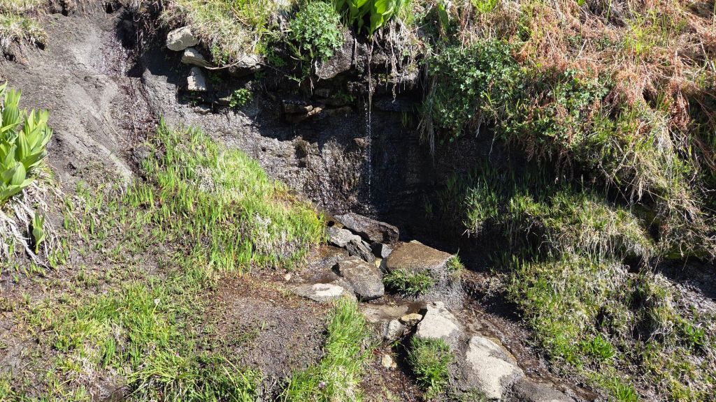
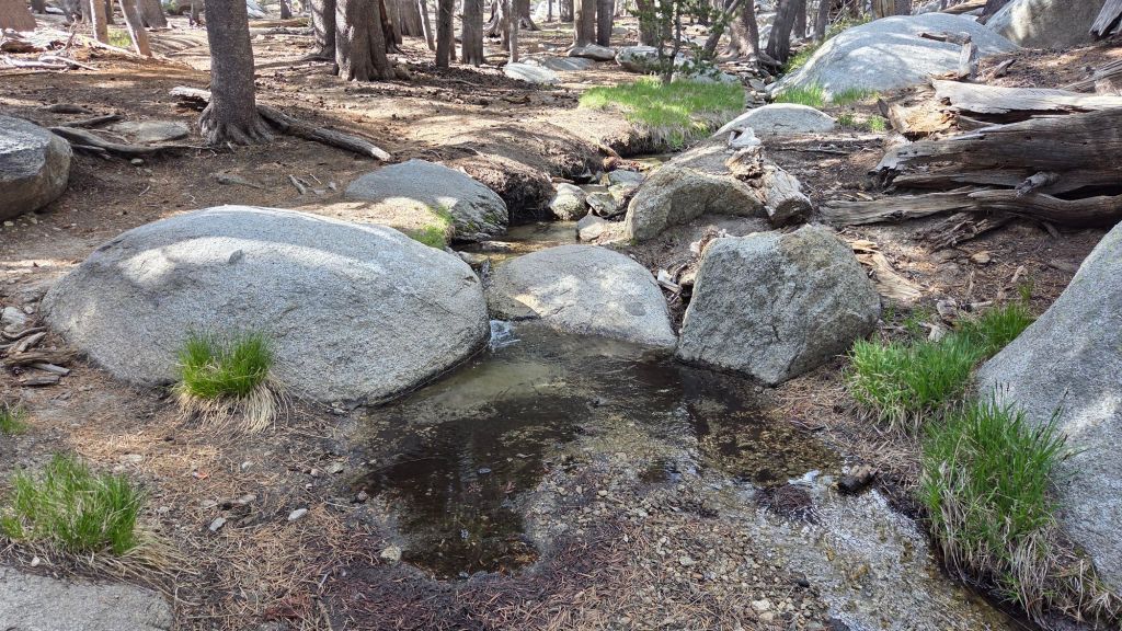
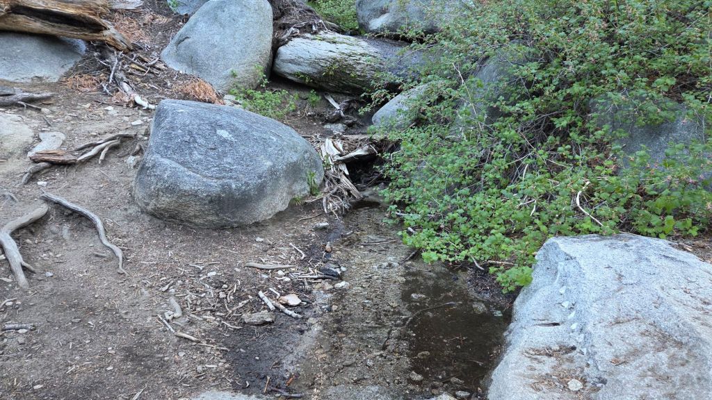
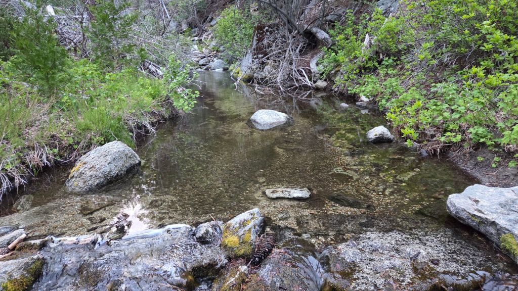
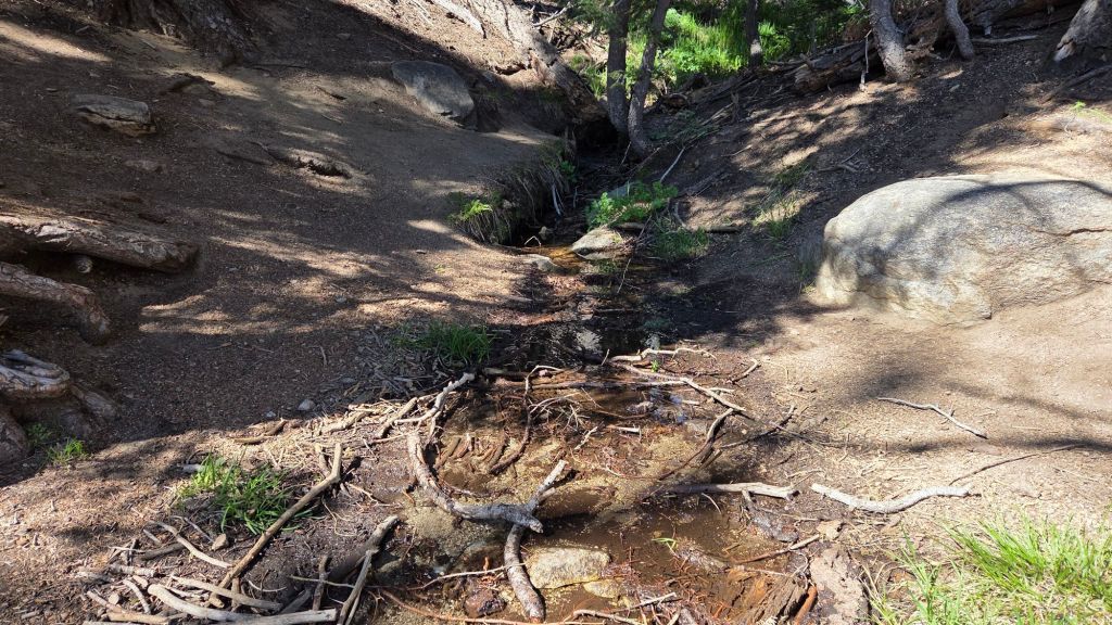
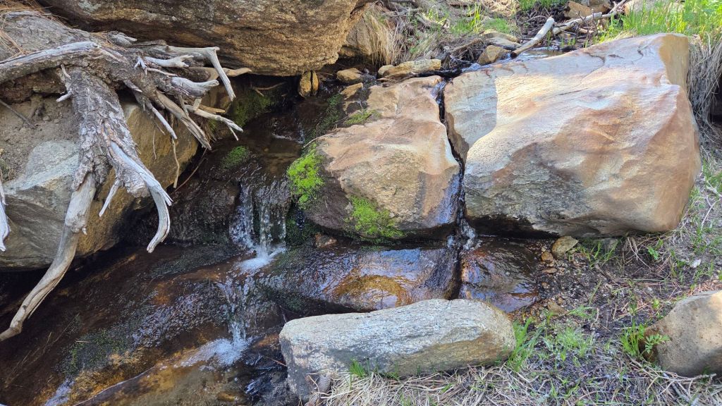
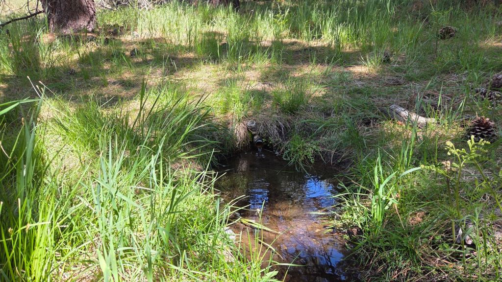
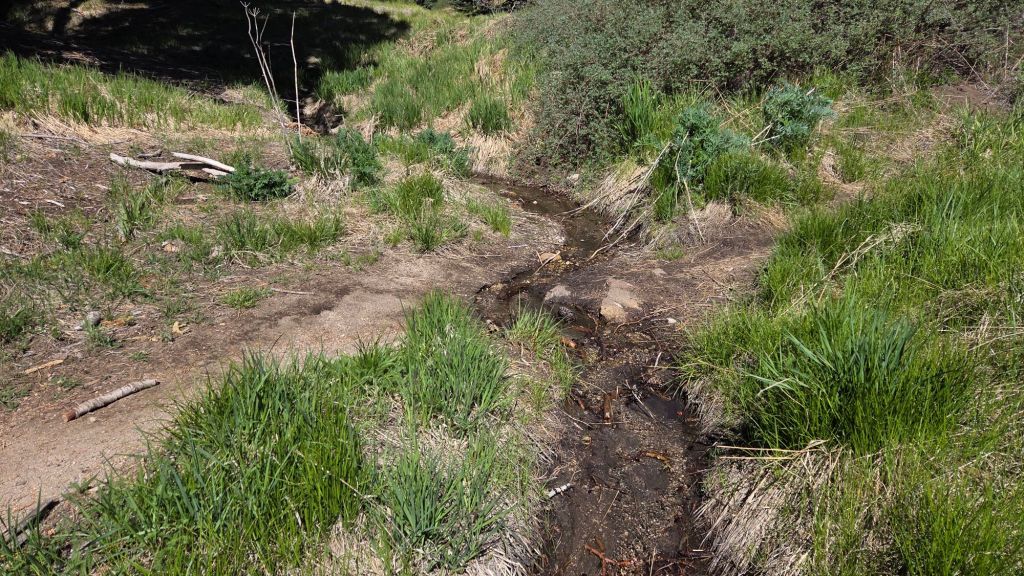
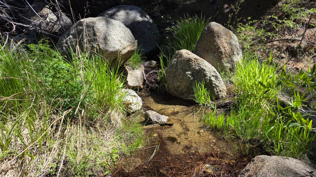
At this time main springs and creeks continue to flow and water availability is not generally a significant issue for campers or hikers (multiple example photos below). Many ephemeral sources are already dry however, and many “perennial” water sources are at low flow rates. The four very minor precipitation events since early March had no impact on medium- and long-term water conditions.
Be rattlesnake aware. Above about 5000 ft elevation, the venom of Southern Pacific Rattlesnakes (Crotalus oreganus helleri) in the San Jacinto mountains is predominantly neurotoxic, almost always fatal for dogs and sometimes for humans (see my long read article linked here for further information describing our dogs’ survival after a July 2020 neurotoxic bite). Devil’s Slide Trail, lower Deer Springs and lower Marion Mountain trails, Suicide Rock, near Strawberry Cienega, and trails around Tahquitz Peak are frequent higher elevation locations for sightings, but rattlesnakes have been recorded up to 9350 ft.
Be bear aware. Although rarely reported, 5-6 individually identifiable Black Bears have been observed in the San Jacinto mountains since 2017, and I have seen at least one annually for the past seven years. One 10+ year-old dark chestnut-colored adult with a right ear tag was seen multiple times between Fern Valley and the Willow Creek drainage in July-September 2025 (see my video from 14th September available here, and images from late August in a prior Report linked here). This individual was relocated to the San Jacintos from Indio in May 2017. A smaller, paler, six-year-old individual was trapped at the State Park Stone Creek campground in April 2026 and fitted with a satellite collar plus colored tags in both ears. In May it ranged remarkably widely from 8500 ft on the north side of San Jacinto Peak to south of Highway 74 into the northernmost Santa Rosa Mountains (thank you to CDFW for this information). My brief videos from Devil’s Slide Trail in September 2021 (linked here) and one walking through our property in Idyllwild in 2018 (linked here) likely show other individuals. There have been no reports of negative interactions with humans in the high country, at or near wilderness campsites, or on trails.
Dark Canyon campground is not expected to reopen this year due to staffing/budget issues, although Dark Canyon Road (the access to Seven Pines trailhead) remains open.
The gate 1.7 miles up from Highway 243 on Black Mountain Road (4S01) reopened on Wednesday 20th May. Following superficial grading late in 2025 the road is in better condition than last summer, but remains far rougher than in June 2020, the last time it was comprehensively graded. Picnic benches at many of the yellow post sites were replaced with new, immovable models in March.
Daily survey hikes by the Trail Report year-round in the San Jacinto mountains include multiple routes to the highest peaks including San Jacinto Peak typically 2-3 times per week (but almost daily during and following storm conditions), Tahquitz Peak and area at least once per week, plus a wide variety of other trails on intervening days.
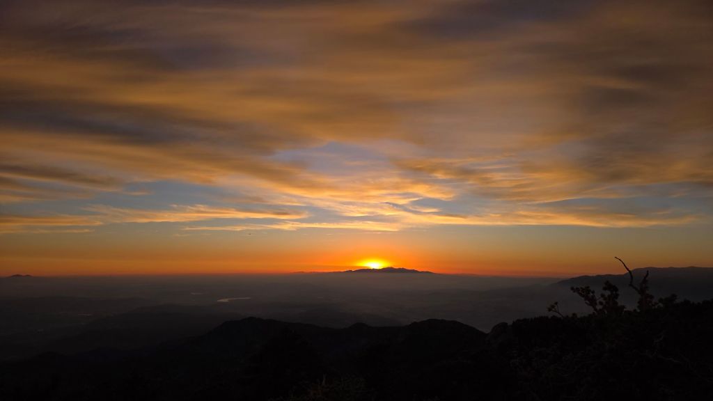
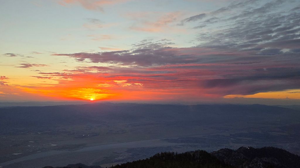
WEATHER
With multiple waves of low pressure during May, that month was often pleasantly cool, with temperatures frequently somewhat below seasonal. Since the beginning of June, temperatures have been largely near or above seasonal, and temperatures are forecast to warm further for the next week (to at least 16th) to well above seasonal, with overnight low temperatures at mid elevations in particular well above seasonal for mid June. There is, unsurprisingly, no significant new precipitation in the forecasts.
At San Jacinto Peak (10,810 ft/3295 m) on Tuesday 16th June 2026 at 0745 the air temperature was 54.1°F (12°C), with a “windchill” temperature of 48.2°F (9°C), 59% relative humidity, and a pleasantly cool SSW wind sustained at 8 mph gusting to 13.2 mph.
At the Peak on Friday 12th June 2026 at 0610 the air temperature was 51.6°F (11°C), with a “windchill” temperature of 47.1°F (8°C), 56% relative humidity, and a light SSE wind sustained at 5 mph gusting to 8.4 mph.
At the Peak on Tuesday 9th June 2026 at 0915 the air temperature was 50.1°F (10°C), with a windchill temperature of 43.5°F (6°C), 57% relative humidity, and a steady WNW wind sustained at 6 mph gusting to 11.4 mph.
TRAIL CONDITIONS
The Pacific Crest Trail and all high country trails were functionally clear of snow by late April.
Deer Springs Trail from the trailhead to Little Round Valley has already been cleared of the handful of blowdowns from this past winter by the Trail Report.
Trail maintenance work by USFS and State Park volunteers this spring has Willow Creek Trail clear of blowdowns from this past winter.
The Caramba Trail from near Reeds Meadow through Laws Camp and on to Caramba, and the Cedar Trail from Willow Creek Trail to Laws, are euphemistically (and perhaps dangerously) described by the Forest Service as “not maintained”. In reality both trails have been abandoned for more than a decade and no longer exist. They are so heavily overgrown, largely with dense whitethorn which obscures several hundred downed trees, that hikers should not attempt to follow them (regardless of how much you may trust any particular app).
An informal use trail to Laws is much more direct, generally well maintained, and avoids the bushwhacking of the abandoned trails (some local Idyllwild hikers dubbed it the “King Trail” when I established the route in 2019). It leaves Willow Creek Trail exactly 1.0 mile from Saddle Junction, 0.46 mile from the Skunk Cabbage turning (trailhead at N 33.7796, W 116.6590). The route is marked with cairns (and subtle flagging to aid USFS work crews) and descends following former deer trails for 1.2 miles, meeting Willow Creek about 0.15 mile upstream from the site of the historic Laws Camp (the remains of which were destroyed by the 2013 Mountain Fire and subsequent flood and treefall damage). Blowdowns from this winter have already been removed by the Trail Report, and the huge pine tree that fell in late 2024 was kindly removed by Forest Service volunteers in May 2026.
East from Laws the old Caramba Trail is initially heavily obscured by blowdowns and thick regrowth, but the easternmost 1.5 miles closest to Caramba camp is often well marked with cairns placed by myself and others. Much of the old trail rock work is visible in places. The first mile east of Laws is currently marked largely along the former trail route with orange flagging, although it is not recommended to follow this in some areas as it goes directly through blowdowns and obstructive vegetation (not around them).
Work to rehabilitate the original Caramba Trail starts this month – combining the Trail Report, other volunteers, and Forest Service employees – almost exactly 13 years after it burned in the Mountain Fire. Two years of work may be required to fully rehabilitate the old trail route. Please do not remove, move, or (as described above) attempt to follow, any flagging in this area which is critical for USFS work crews.
The Trail Report “adopted” Seven Pines Trail as a priority for maintenance work due to a disproportionate number of lost hiker rescues (with the agencies evidently no longer maintaining the route). In the past seven years we have removed 101 downed trees and the trail is largely trimmed and cleared annually. Thankfully only two large blowdowns affected the trail this past winter, and both now have very easy workarounds. Although our work has restored this delightful trail to its best condition in well over 20 years, Seven Pines remains a genuine wilderness trail very unlike the wider, bare, obvious routes of, for example, Devil’s Slide or Marion Mountain trails. Cautious navigation remains invaluable for those without extensive experience of hiking this trail.
Spitler Peak Trail is clear of treefall hazards, despite having been decimated by about 65 new blowdowns in mid February storms. In February-March the Trail Report cut almost all of these, bringing to 235 the number of trees we have removed from this trail in the past seven years. The remaining four large cedars were removed by Forest Service at the end of March.
The San Jacinto Trail Report celebrates ten years of operation in 2026. The Report has helped tens of thousands of hikers, and saved multiple lives, both directly and indirectly. Since the Report became established online, snow/ice rescues in the San Jacinto Mountains have dropped 82%, with an additional benefit of saving Riverside County hundreds of thousands of dollars. While all time is volunteered, the Report uses small private donations to help cover operating costs. Donations keep the Report available to all, free from advertising or paywalls, and independent from agencies. If you have found this Report useful, please consider using this link to the Donate page. Thank you very much for your support.