UPDATE Saturday 16th March 2024: This morning I broke trail to San Jacinto Peak from Devil’s Slide Trail. Snow depths are impressive, with 10.5 inches at Saddle Junction, 12 inches at Wellman Divide, and nine inches at the Peak. The light powder makes for great snowshoeing, but there is hard icy snow underneath. I hope to fully update the Report this evening.

UPDATE Friday 15th March 2024: A “surprise” snowstorm hit the San Jacinto mountains overnight, coming in, unusually, from the north-east. Idyllwild had 5.25 inches of fresh powder this morning, with about 7 inches in Long Valley (8400 ft), and a dusting of snow as low as 4000 ft near Anza. We hiked lower Devil’s Slide Trail early this morning, where there were 7 inches at Humber Park (6500 ft) and 8-9 inches at 7000 ft. Another check this afternoon found that two more inches had accumulated at Humber. It is some of the lightest powder I have ever experienced in these mountains, with an extremely low water content. To be fair the storm wasn’t a complete surprise, but the forecasts changed dramatically late yesterday, and even then percentage probabilities of precipitation remained low. Further light snow is likely this afternoon and evening. Snow depths are sufficient to have eliminated pre-existing tracks above 6000 ft. While snowshoes are now useful above about 6000 ft, underlying old snow remains very icy and crampons will be preferable in most areas. Humber Park closed again this morning to vehicle traffic.
———————————
The most recent storm – remarkably our 21st of this winter, although almost all have been minor – was on 6th-7th March. A colder system than most this season, it distributed light snow quite evenly everywhere above about 5000 ft, with an inch in Idyllwild (which melted within a day) increasing to just three inches at San Jacinto Peak. Although tracks below 9000 ft remained largely visible, even such a thin covering of powder greatly complicated snow conditions underfoot by obscuring very hard, icy layers underneath (originating from widespread freezing rain in a prior storm a few days earlier). In gorgeous post-storm conditions on Thursday 7th March I recorded a short video discussion of the conditions at that time from San Jacinto Peak (available here).
Tracks remain dangerously icy in places under the thin fresh powder. On Monday 11th I saw widespread evidence of significant hiker falls from the previous day (example photos below). For at least the next week – until thawing is expected to be well underway – spikes at a minimum (preferably crampons in many locations) are strongly recommended everywhere above 7500 ft. Even well-known mid elevation trails can be tricky, for example some of the upper switchbacks on Devil’s Slide Trail (at 7700-7900 ft) had obvious signs of significant hiker falls from 8th-9th March.
Daily survey hikes in the San Jacinto mountains include various routes to San Jacinto Peak multiple times per week (most recently on 4th, 7th, 10th, and 11th March), Tahquitz Peak and area at least once per week (most recently on 12th March), Apache Peak area at least weekly (during PCT season), plus a wide variety of other trails on intervening days.
Snow conditions have become more predictable with cooler weather this week, especially above 7500 ft, in contrast to the soft snow of prior weeks. However hard, icy snow requires considerably more caution plus specialist equipment (and different physical and mental skillsets) than soft, postholing snow. Snow quality should remain largely stable at higher elevations this week with temperatures remaining cool on most days until about Sunday 17th March when a potent warming trend is forecast to start.
Details of recommended traction devices are given below under Trail Conditions. In summary, carrying spikes is recommended everywhere above about 6500 ft, even if using other traction devices as well. Crampons (in combination with an ice axe) are currently very useful everywhere in the high country above about 7500 ft over the next week as described above. Crampons are required on the north side of Tahquitz Peak (details below) and on Fuller Ridge. Snowshoes are generally not recommended for use on the established, compacted, icy tracks this week. They will become more useful above about 8000 ft elevation on warmer, sunnier days from late morning onwards as snow softens on sun-exposed slopes (i.e. from about 18th March onwards). They remain valuable for any off-trail travel above 8000 ft once snow softens, increasingly so in the warm weeks ahead (this week such areas generally require crampons).
Details of snow depths measured at various locations on the trail system are given at the foot of this posting. Note however that snow depth itself is very rarely indicative of the difficulty (or ease) of hiking a particular track or trail. For example a well-traveled and defined track across snow several feet deep is often much easier hiking than a lightly traveled track across just a few inches depth of angled icy snow. Many high country trails currently pose much greater risks this year (due to underlying ice) than they did at the same time in 2023 when snow depths were at least triple those of 2024.
Hikers should be prepared for temperatures below freezing at higher elevations, and well below freezing when considering wind chill effects. See Weather section below for some of my recent meteorological observations from San Jacinto Peak.
Black Mountain Road is closed to vehicle traffic due to winter conditions at the gate 1.7 miles up from Highway 243. The road is clear of snow until the turning to Boulder Basin five miles from the highway [surveyed 14th March]. Snow cover on the road averages about 70% from there for the next three miles to the PCT crossing/Fuller Ridge campground.
Humber Park reopened in Saturday 9th March having been closed since 31st January. South Ridge Road is closed due to winter conditions. Azalea Drive – access to Marion Mountain trailhead – is clear of snow. Dark Canyon Road has been closed almost continuously for the past five years.

WEATHER
The next few days will remain relatively cool at mid elevations, with chances for light precipitation especially on the western (marine) slope of the mountains every day, most likely on 15th-16th. The pattern in the high country may be more complex, generally above the “lifted marine layer” cloud with lower risk of precipitation (although a dusting of snow is forecast on both 15th and 16th). From 17th March onwards, all elevations are expected to experience a warming trend, although light drizzle remains a possibility at mid elevations every afternoon throughout next week.
At San Jacinto Peak (3295m/10,810ft) on Monday 11th March 2024 at 0850 the air temperature was 23.6°F (-5°C), with a windchill temperature of 4.8°F (-15°C), 55% relative humidity, and a stiff due West wind sustained at 19 mph gusting to 23.7 mph.
At the Peak on Sunday 10th March 2024 at 0905 the air temperature was 31.1°F (-0.5°C), with a windchill temperature of 18.1°F (-8°C), 10% relative humidity, and a steady SW wind sustained at 12 mph gusting to 15.5 mph.
At the Peak on Thursday 7th March 2024 at 1020 the air temperature was 17.8°F (-8°C), with a windchill temperature of 1.4°F (-17°C), 89% relative humidity, and a steady due North wind sustained at 9 mph gusting to 14.5 mph.
TRAIL CONDITIONS
There is increasingly patchy thin icy snow cover on all trails between 6400-7000 ft, becoming largely continuous above about 6800 ft (except on the most sun-exposed trails such as lower Deer Springs). Some of the warmest and most sun-exposed areas and trails as high as 8700 ft (e.g., Long Valley) are steadily clearing of snow, but the snow that remains tends to be very icy due to hiker compaction and freeze-thaw cycles.
Compacted tracks are now in place for some of the major trails (details below) however these are less distinct than last week due to drifting light powder in the minor storm last week. Snow depths measured at specific locations are given below.
Carrying spikes is strongly recommended everywhere above about 6500 ft. Icy compacted snow on the well-traveled trails is largely ideal for spikes at this time, although crampons are an excellent option until next week at least, especially above about 9000 ft.
Crampons are essential if attempting Fuller Ridge and the north side of Tahquitz Peak (discussed below) and are very useful everywhere in the high country especially for the relatively cool next week above 9000 ft (lower in shaded areas that will melt slowly, if at all, this week).
Snowshoes can be valuable everywhere above about 8000 ft elevation on warm days (most likely after about 17th March) and later in the day on sunny slopes. They are currently less useful on the established tracks which are well compacted. On the Peak Trail on 10th March I saw clear evidence of hikers struggling in snowshoes across the angled icy traverses (for which spikes or crampons were ideal). Snowshoes are recommended for any significant off-trail travel only away from the defined tracks in the high country, other than on cold mornings when all high elevation snow is currently very firm.
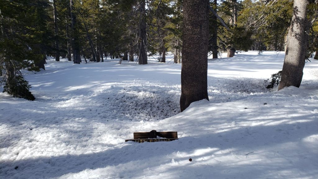
Some major tracks have been broken through the snow at this time including South Ridge Trail to Tahquitz Peak on the south side of the peak, Devil’s Slide Trail, onward via the PCT, Wellman and Peak trails to San Jacinto Peak, from Long and Round valleys up to Wellman Divide, Deer Springs Trail to Little Round Valley, and Marion Mountain Trail.
There are currently no tracks to follow on Fuller Ridge Trail and Seven Pines Trail.
Despite limited snow this season and being readily passable with the appropriate skills and equipment for angled icy snow (currently crampons plus ice axe recommended), the State Park closed the uppermost section of Skyline Trail in their jurisdiction (above about 5600 ft) starting 21st February due to perceived unsafe conditions.
Devil’s Slide Trail is largely clear of snow up to 6800 ft (switchback 3). Thereafter snow cover is largely continuous to 7500 ft, becoming continuous thereafter. The track is well-defined and compacted to about 7700 ft, at which point very icy conditions are treacherous around switchbacks 6-8 (for those who are very familiar with this trail). Spikes are ideal for this trail, some hikers will prefer crampons above 7700 ft. The Trail Report undertook extensive trail maintenance work on 15th February to remove many damaged tree limbs in and over the trail resulting from an early February ice storm.
Ernie Maxwell Trail [surveyed 11th March by Anne] is functionally clear of snow.
There are very lightly traveled tracks around the Tahquitz area meadows, but not generally accurately following the established trail routes. These have become somewhat obscured in the recent fresh snow. As of late February, a lightly-traveled mixed posthole/snowshoe track is in place on Willow Creek Trail as far as the “King Trail”, continuing from there down to Laws.
The Peak Trail track that I broke on 7th March has been heavily traveled and now quite accurately follows the true trail route. However near Miller Peak at about 10,400 ft the track ascends directly up the East Ridge route, rather than following the Peak Trail switchback, as is traditional in snow conditions.
Deer Springs Trail is functionally clear of snow up to the Suicide Rock junction (near 7000 ft), and then is largely clear of snow through to Strawberry Junction (8100 ft), with snow patches increasing in size and frequency near the junction. North from Strawberry Junction snow cover is largely continuous, with a few cleared patches starting to develop, and the PCT has a moderately traveled track through to the top of Marion Mountain Trail (8700 ft). Above Marion Mountain Trail, the boot track largely follows the PCT to the Fuller Ridge junction, but there are multiple meandering tracks in places.
Above the Fuller Ridge junction, there are multiple boot tracks, only occasionally and vaguely following the Deer Springs Trail route up to Little Round Valley, but they will get you there. There is a reasonable track to follow through Little Round Valley, but on the ascent above the valley to San Jacinto Peak the handful of boot tracks going directly upslope are obscure and none even remotely follow the trail. Following any given route is made much harder by the large volume of ice chunks on the slope that have fallen from trees, often obscuring tracks.
Marion Mountain Trail has a compacted track to follow up to Deer Springs Trail, ideal for spikes. Snow is becoming very patchy in the first mile up to about 7000 ft, but is largely continuous thereafter. Although the track does not accurately follow the trail route in a few minor places, it gets you up to the Deer Springs Trail junction directly.
The 0.4 mile section of South Ridge Trail between Chinquapin Flat/PCT MIle 177 and Tahquitz Peak has no track to follow at this time through 2-5 feet of heavily drifted and angled ice and icy snow. This ice slope is notoriously treacherous. Neither snowshoes nor spikes are helpful at this time, due to the angled slope and structure of the snow, respectively. Crampons with an ice axe are essential on this section at this time, along with the necessary skills and experience to use that equipment in icy, angled terrain.
South Ridge Trail above South Ridge Road is almost clear of snow to Old Lookout Flat at 7600 ft, with just a handful of small icy patches remaining (no spikes required to that point). Unfortunately three new treefall hazards are down on that section. Snow cover averages 80% thereafter to Tahquitz Peak, becoming continuous in the upper switchbacks. The angled snow is very icy above 8300 ft with a very poorly defined track, requiring an ice axe with spikes (for the most experienced) or crampons (recommended for most hikers).
Spitler Peak Trail is clear of snow, however it suffered badly during the ice storms in early February, and I found 34 new treefall hazards down during my surveys in late February, almost all in the upper half. Most are relatively small and readily passable, but a few are larger, and the combined effect is to make for a slower and scrappier hike.
Fobes Trail is clear of snow. There is one major stump down and half-a-dozen new minor treefall hazards, but none are significant obstructions for hikers.
PACIFIC CREST TRAIL
Current snow cover on the PCT is minimal from Miles 151 (Highway 74) to about 163. Snow is then thin and patchy, largely confined to north- and east-facing slopes, until about Mile 174. Note that many of these patches are icy and require considerable caution. See comments below regarding specific conditions around Apache Peak (Mile 169.5). Snow cover is then functionally continuous between Miles 174-194. There are currently no reliable tracks to follow on Fuller Ridge (Miles 185.5-191) and traversing this section requires crampons, an ice axe, and appropriate snow skills.
At this time, nobo hikers should consider taking alternates at either Fobes Trail (Mile 166) or Spitler Peak Trail (Mile 168.5) to avoid the worst of the icy snow slopes from Miles 169-175. This situation will continue to change over the coming days and weeks with steady (or even rapid) melting expected into late March (at least).
It is recommended that hikers use the Black Mountain Road alternate to avoid Fuller Ridge until the ice conditions improve (likely in the next week or two). Black Mountain Road is open to hikers but not to vehicle traffic at this time. Spikes are useful (but not essential) on the upper three miles of Black Mountain Road.
A significant icy snow slope remains on the north-east side of Apache Peak (photo in prior Report linked here). At this time spikes at a minimum, but preferably crampons, plus an ice axe, and crucially the skills and experience to use this equipment on angled icy snow, are required to traverse this section. While one option for nobo hikers is to go up and over the saddle between the double peaks of Apache to avoid this traverse, there are further very icy chutes and slopes in the next few miles, especially at present around Red Tahquitz (Miles 174-175.5), some of which have proven to be equally problematic in past seasons. Alternates at Miles 166 and 168.5 are recommended, as mentioned above.
PCT hikers should not attempt to use South Ridge Trail from the PCT at Chinquapin Flat (roughly Mile 177.7) to Idyllwild via Tahquitz Peak, even though this looks temptingly simple on apps and maps. There are no steps to follow through a lengthy section of steeply angled (and notoriously treacherous) ice slopes. Crampons, always with an ice axe, and expert knowledge of how to use this equipment on high angle terrain, are critical. Even in low snow years like 2024 these slopes always take many weeks longer to clear of ice than adjacent areas, and they will remain challenging into April this year.

SNOW DEPTHS measured on 10th and 11th March 2024 are as follows. The first number gives current average total depth. The number in parentheses gives new snow from the storm on 6th-7th March (measured on 7th), while the number in brackets is the greatest depth at that location this winter (where known). Note that averages are given; due to strong winds during and after most storms there has been considerable drifting, plus often uneven melting. Altitudes and PCT mileages are approximate.
San Jacinto Peak (10810 ft): 36-38 inches (3.0 inches new snow 6th-7th March)[55-60 inches on 8th February]
Little Round Valley (9800 ft): 32-36 inches
Wellman Divide (9700 ft): 26 inches (2.5 inches new 6th-7th March) [41-43 inches on 8th February]
Annie’s Junction/approx. PCT Mile 181.8 (9070 ft): 36 inches (4.0 inches new on 6th-7th March)[48-50 inches on 8th February]
Long Valley (8400 ft): 2-5 inches, ranging from 0-10 (1.0 inch new 6th-7th March)[24 inches on 8th February]
Strawberry Junction/PCT Mile 183 (8100 ft): 4 inches, ranging from 0-10 (2 inches new 6th-7th March)
Saddle Junction/PCT Mile 179.9 (8070 ft): 11 inches (1.5 inches new on 6th-7th March)[31 inches on 8th February]
Devil’s Slide Trail at Humber Park (6550 ft): 0-1 inch (1.5 inches new on 6th-7th March)[15 inches on 8th February]
Idyllwild (at 5550 ft): 0 inch (1.0 inch new on 6th-7th March)[9 inches on 8th February]
Mountain Center (4400 ft): 0 inch (no new snow 6th-7th March)[3 inches on 9th February]

While all time and labor is volunteered, the San Jacinto Trail Report uses small private donations to help cover operating costs. Every year seems to have its unique challenges, and it is already clear that 2024 will be no exception. Your contribution keeps the Report available to all, free from advertising or paywalls, and independent from agencies. If you have found this Report useful, please consider using this link to the Donate page. Thank you very much for your support.


Do you think the fuller ridge trail head parking lot is accessible? Was thinking of hiking the PCT north from there (mile 190.5) which would be downhill
LikeLike
Hi Geoff, Fuller Ridge trailhead is only accessible for hikers, not vehicles. The gate on Black Mountain Road 1.7 miles up from Hwy 243 is closed for the season, plus snow is more-or-less continuous from the Boulder Basin turning as far as Fuller Ridge campground (c.3 miles). I was up there today and the snow is relatively thin and firm, so it is easy going in spikes. Safe hiking, Jon.
LikeLike