UPDATE Tuesday 20th February 2024 at 1610: steady light rain overnight totaled 0.45 inch in Idyllwild by 0700, with another 0.3 inch added by 1000, after which it largely stopped raining. It rained to at least 9000 ft overnight, with drizzle totaling just 0.08 inch in Long Valley (8600 ft) until 0930, when it turned to light snowfall, but with no significant settling by late afternoon. Our road run to Humber Park this morning was wet but warm, and the parking area is being slowly clearing of snow due to the mild rain.
UPDATE Monday 19th February 2024: The 18th and 19th storm systems of this winter are on the way. The first of these arrives in the early hours of tomorrow morning, Tuesday 20th, continuing into Wednesday 21st February. A mild storm, the freeze level is not expected to drop significantly below 7000 ft, with 0.5-1.0 inch of rain forecast for mid elevations with the possibility of a dusting of snow, and 6-8 inches of snow at the highest elevations of the San Jacinto mountains. The subsequent storm is nearly a week away, tentatively forecast for 25th-26th February. It may have similar snowfall in the high country (i.e. 6-12 inches) but is expected to be a colder system, with a lower freeze level and consequently a higher likelihood of 1-2 inches of snow at mid elevations in addition to light-to-moderate rainfall. The next comprehensive Report update is not expected before Wednesday 21st February, although I plan to post brief storm updates here on Tuesday 20th.
_________________________
The 16th and 17th storms of winter 2023/24 impacted the San Jacinto mountains on 4th-9th February, the vast majority of the precipitation coming from the first of these, a very slow-moving system spread across 4th-8th February (described in detail in the previous Report available here). Although ultimately the snow quantities in the high country were at the lower end of the range of forecasts, the impact of 2-3 feet of snow on the trail system was of course significant, and freezing rain as high as San Jacinto Peak at the start of the storm sequence has medium-term implications for snow quality.
On 12th and 14th February we hiked to San Jacinto Peak from Humber Park via Devil’s Slide, Wellman, Peak, and East Ridge trails to assess changes in the snow and trails since my multiple stormy hikes the previous week. With an Alpine start on both days I was able to bareboot to 9000 ft north of Saddle Junction on very firm icy snow before switching to snowshoes on 12th, but with a better track all the way to San Jacinto Peak on 14th. On both days snowshoes became especially useful on the descent as snow was softening rapidly by late morning. On 12th I ultimately wore snowshoes all the way back down to Humber Park, and most of the way down Devil’s Slide Trail on 14th.
I recorded a short(ish) video report at San Jacinto Peak late morning on Monday 12th February (available here) that discusses conditions up there at that time.
The next storm system is already on its way, tentatively forecast for 19th-21st February. Snow estimates for the high country have literally ranged across an order of magnitude, from three to 50 inches. At this time, the low end of that range seems most likely, but as has been the case throughout this winter forecasts probably won’t improve in accuracy until the storm is only 24-48 hours away. Moderate rainfall is expected at mid elevations as the storm is forecast to be relatively warm, with freeze levels likely near or even above 7000 ft.
Snowshoes are now valuable everywhere above about 6500 ft elevation, especially above 8000 ft and in late morning and afternoons as snow softens in the warm weather (see also photos below for sample conditions). Carrying spikes is recommended everywhere above about 5000 ft. Crampons are required on the north side of Tahquitz Peak, as discussed below, and will become increasingly useful everywhere in the high country above roughly 9700 ft (possibly lower) over the next few days and weeks as the expected deep snow firms up following freeze-thaw cycles and compaction.
At present snow depths are too shallow for any avalanche risk anywhere in the vicinity of the established trail system, and snow in the Snow Creek drainage/north face of San Jacinto Peak has now consolidated sufficiently to have no significant avy risk.
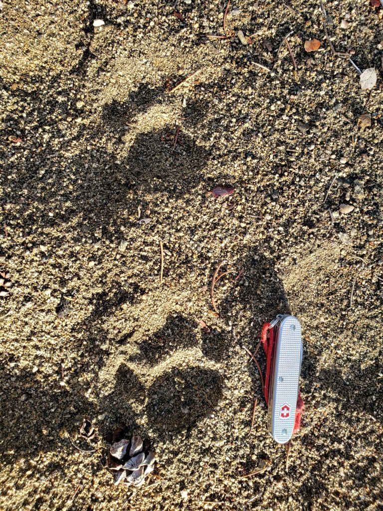
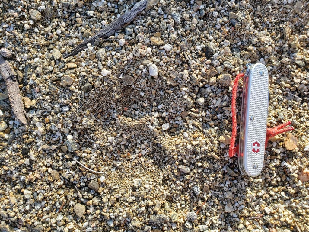
Be bear aware. Although rarely reported, up to three Black Bears have been in the San Jacinto mountains since 2017. I crossed bear tracks at 9100 ft on the PCT on 12th February 2024 (photo below, one of many I took). While Southern California studies have found that hibernation is integral to gestation for pregnant female bears, adult males and younger bears of both sexes generally don’t hibernate this far south. I have seen at least one bear annually for six years, most recently in September 2023 on Marion Mountain Trail, and on Devil’s Slide Trail in July 2022 and September 2021 (a poor quality video from the latter observation is available here). I saw a different “blond” individual on Devil’s Slide Trail in August 2020 and had previously filmed that same bear walking past our house in Idyllwild in 2018 (video here).
Humber Park closed on 31st January, has not yet been plowed, and remained closed as of Saturday 17th. Even when closed, there are nine legal parking spaces just below the gate (Adventure Pass or equivalent still required). South Ridge Road is closed due to winter conditions. Azalea Drive – access to Marion Mountain trailhead – has been periodically plowed by USFS.
Palm Springs Aerial Tramway closed 12th-14th February for repairs on the flood-damaged access road to Valley Station. It is scheduled to reopen on Thursday 15th, but check their website (available here). (The tram previously closed twice earlier this month due to the same problem.)

WEATHER
Temperatures are rising to well above seasonal this week, up to and including Saturday 17th, with steady melting of snow at all elevations, especially on sun-exposed slopes. Temperatures on 15th-16th will be especially warm, including above freezing as high as San Jacinto Peak (very rare for mid February at that elevation).
Another storm system is expected around 19th-21st February, although not now expected to be a major system to impact the San Jacinto mountains. Forecasts remain in flux, and as we saw with the previous storm event, can change at short notice. Nevertheless, the storm is initially expected to be relatively warm, with freeze levels above 7000 ft, and consequently with 0.5-2 inches of rain (rather than snow) at mid elevations. Freeze levels may drop to 5000 ft by 20th-21st February, at which point mid elevations (e.g., Idyllwild) could experience a mix of rain and snow. Snowfall in the high country may be concentrated on 21st, and as mentioned in the introduction forecasts have recently ranged from several inches to several feet for possible snowfall accumulations across the multiple storm days. At this time, somewhere under 12 inches seems most probable for the high country.
After the passage of that storm, another spell of rapid warming to well-above-average temperatures is tentatively forecast.
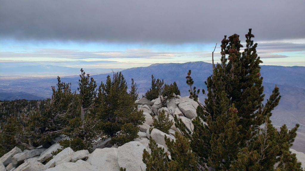
At San Jacinto Peak (3295m/10,810ft) on Wednesday 14th February 2024 at 0910 the air temperature was 25.9°F (-3°C), with a windchill temperature of 12.0°F (-11°C), 62% relative humidity, and a steady due West wind sustained at 9 mph occasionally gusting to 13.6 mph.
At the Peak on Monday 12th February 2024 at 0955 the air temperature was 30.3°F (-1°C), with a “windchill” temperature of 23.9°F (-4.5°C), 41% relative humidity, and a barely discernable NE breeze sustained at 4 mph occasionally gusting to 5.0 mph.
At the Peak on Thursday 8th February 2024 at 0815 the air temperature was 6.9°F (-14°C), with a windchill temperature of -18.4°F (-28°C), 100% relative humidity, and a bitter WNW wind sustained at 11 mph gusting to 24.9 mph.

TRAIL CONDITIONS
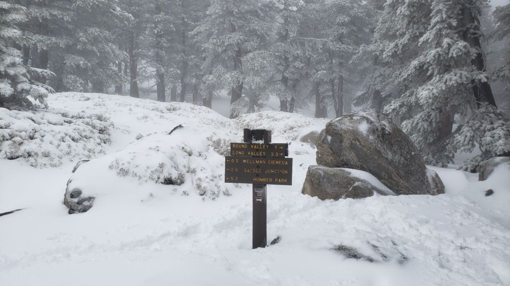
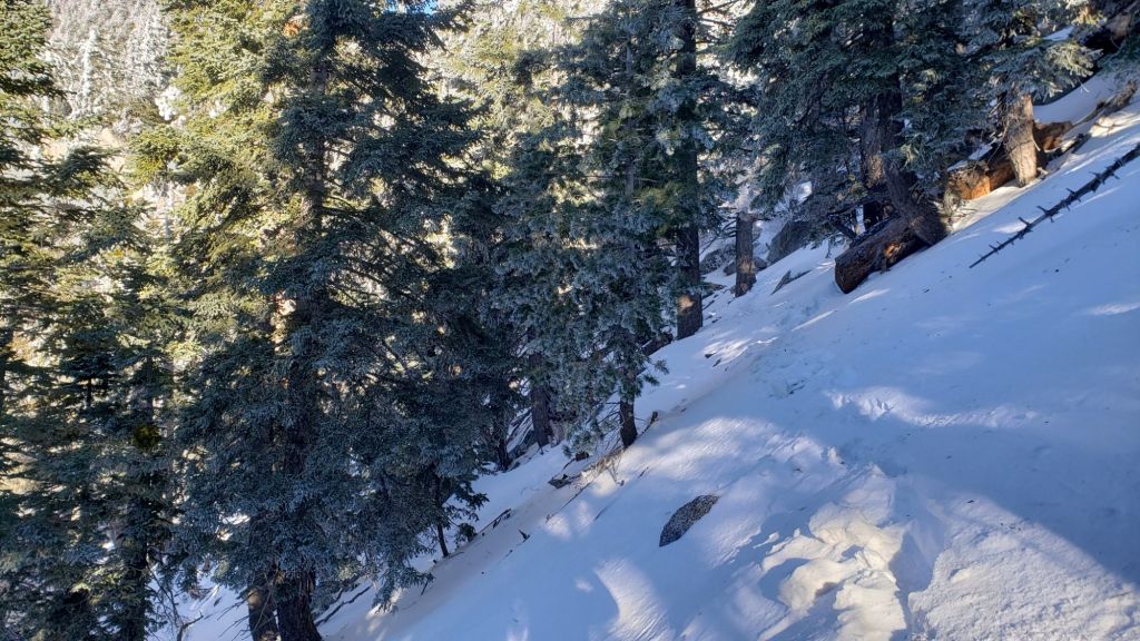
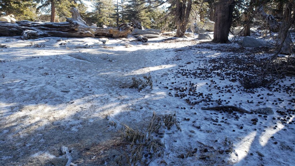
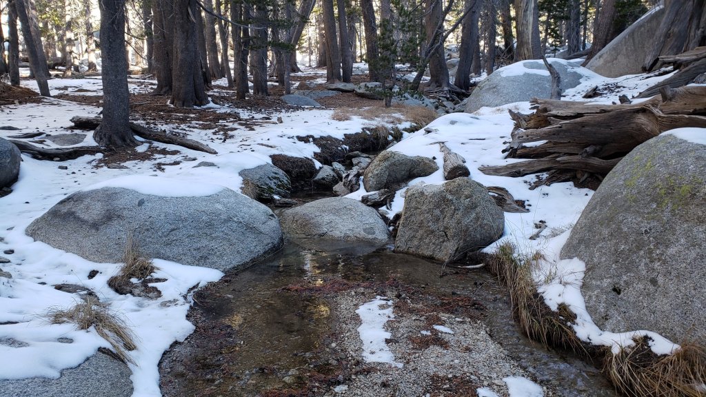
There is largely continuous light snow cover on all trails above about 5500 ft, becoming continuous above 6500 ft and heavy (>20 inches) above about 7500 ft. Patchy thin snow is locally present to 4500 ft. Snow depths measured at specific locations are given below.
Snowshoes are now valuable everywhere above about 7000 ft elevation, although less so only heavily traveled trails that are now well compacted. Carrying spikes is recommended everywhere above about 5500 ft. Crampons are required on the north side of Tahquitz Peak, as discussed below, and will become increasingly useful everywhere in the high country over the next few days and weeks as the expected deep snow undergoes freeze-thaw cycles and compaction.
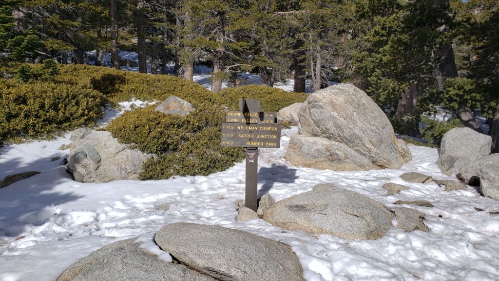
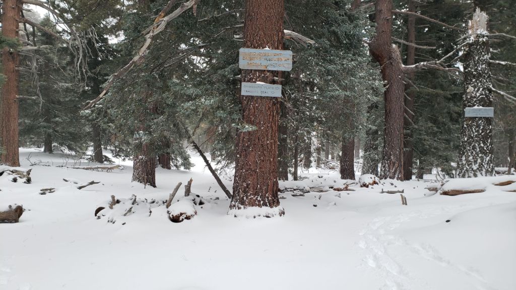
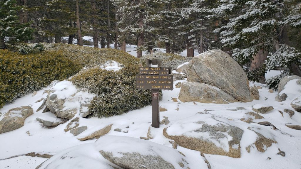
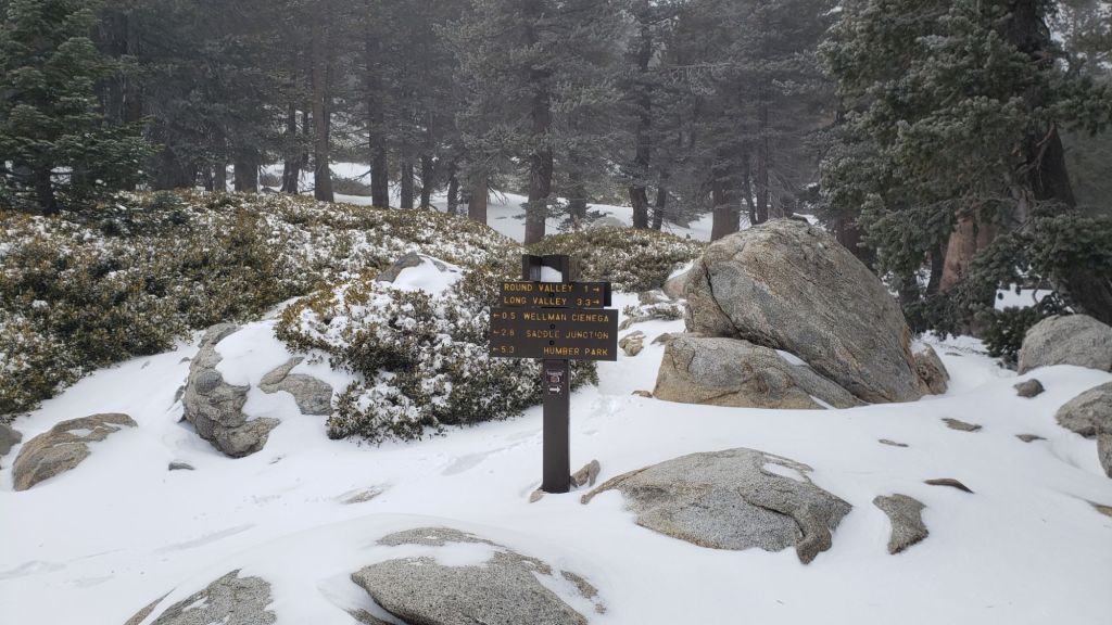
Tracks known to be broken through the snow at this time are the Ernie Maxwell Trail, South Ridge Trail to Tahquitz Peak on the south side of the peak, Devil’s Slide Trail, onward via the PCT, Wellman and Peak trails to San Jacinto Peak, from Long and Round valleys up to Wellman Divide and more directly up from Tamarack Valley joining the Peak Trail at about 10,000 ft and also at 10,350 ft just below the Miller Peak area. There is also evidence of a track approximately following the Deer Springs Trail route up from Little Round Valley to San Jacinto Peak.
Devil’s Slide Trail has continuous snow cover, has been well-traveled and is suitable for snowshoes (especially later in the day as snow softens) despite some significant postholes, or for spikes all day. A few snow-free patches were starting to develop by 15th below 6800 ft. The Trail Report undertook extensive trail maintenance work on 15th February to remove the many damaged tree limbs in and over the trail resulting from the early February ice storm.
Ernie Maxwell Trail has a well-traveled and compacted track through continuous light snow along its entire length. Spikes are useful.
There are very lightly traveled snowshoe tracks around the Tahquitz area meadows, but not generally accurately following the established trail routes.
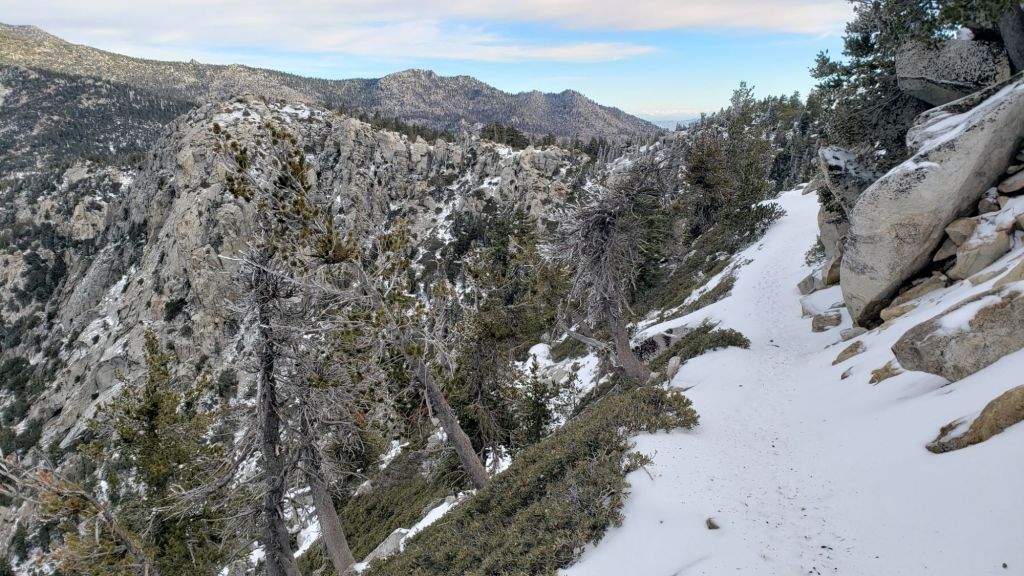
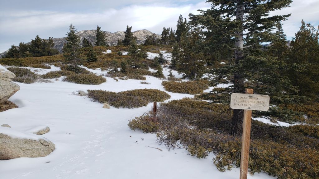
The track following the PCT north of Saddle Junction to Annie’s Junction, and then beyond on the Wellman Trail, accurately follows those trails. Unfortunately the tracks(s) north from Wellman Divide put in over the weekend by tram traffic are a mess across the open slopes and only roughly follow the established trail routes at best. But they will get you to San Jacinto Peak with patience. The very well-defined snowshoe track above 10,350 ft does not follow the Peak Trail route, but follows the East Ridge directly up to the Peak.
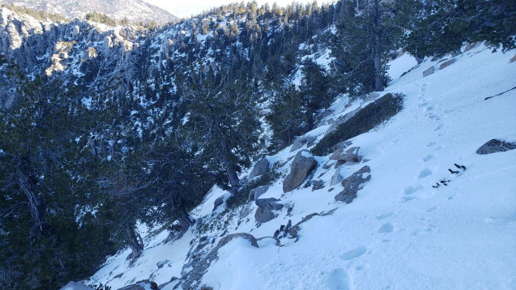
The 0.4 mile section of South Ridge Trail between Chinquapin Flat/PCT and Tahquitz Peak has no track to follow at this time through 23-5 feet of heavily drifted and angled ice and icy snow. Neither snowshoes nor spikes are especially helpful at this time, due to the angled slope and structure of the snow, respectively. Crampons (always with an ice axe) are recommended on this section at this time, along with the necessary skills and experience to use that equipment in icy, angled terrain.
Current snow cover on the PCT is minimal from Miles 151 (Highway 74) to about 156. Snow is then thin and patchy, largely confined to north-facing slopes, until about Mile 165. Snow cover is then continuous and moderately deep between Miles 165-194. Based on my survey hike on 16th February, there are currently no tracks through snow on the PCT north of Fobes Saddle (Mile 166) until about Mile 177. There are currently no tracks on Fuller Ridge (Miles 185.5-191). At this time, nobo hikers should consider taking alternates at either Fobes Trail (Mile 166) or Spitler Peak Trail (Mile 168.5) to avoid the worst of the icy snow slopes from Miles 169-175. This situation will change over the coming days with another minor storm next week, likely followed by rapid melting into early March.

SNOW DEPTHS measured on 12th February 2024 are as follows. The first number gives current average total depth. Reductions in totals since the last Report are due to melting. The numbers in parentheses gives the new snow from the double storm sequence on 4th-9th February. Note that average depth is given; due to strong winds there has been considerable drifting, often especially accumulating in trails. Altitudes and PCT mileages are approximate.
San Jacinto Peak (10810 ft): 55 inches (28-30 inches new on 4th-8th February)
Wellman Divide (9700 ft): 38 inches (24 inches new on 4th-8th February)
Annie’s Junction/approx. PCT Mile 181.8 (9070 ft): 46 inches (24-25 inches new on 4th-8th February)
Long Valley (8600 ft): 20 inches (16 inches new on 5th-8th February)
Saddle Junction/approx. PCT Mile 179.9 (8070 ft): 26 inches (17 inches new on 5th-8th February)
Devil’s Slide Trail at Humber Park (6550 ft): 8-10 inches (13 inches new on 5th-8th February)
Idyllwild (at 5550 ft): 4 inches (8 inches new on 5th-8th February)
Mountain Center (4400 ft): 0 inch (2-3 inches from 7th-9th February now melted)
While all time and labor is volunteered, the San Jacinto Trail Report uses small private donations to help cover operating costs. Every year seems to have its unique challenges, and it is already clear that 2024 will be no exception. Your contribution keeps the Report available to all, free from advertising or paywalls, and independent from agencies. If you have found this Report useful, please consider using this link to the Donate page. Thank you very much for your support.