Weather and water update 28th July 2021

[UPDATE Friday 30th July: major monsoonal thunderstorms this afternoon have produced up to two inches of rain (plus large hail) across the San Jacinto mountains. Obviously the water conditions reported below are not currently relevant. When runoff has subsided, likely within a few days, conditions should revert to “normal”. The next full update to the Report will likely be 3rd August.]

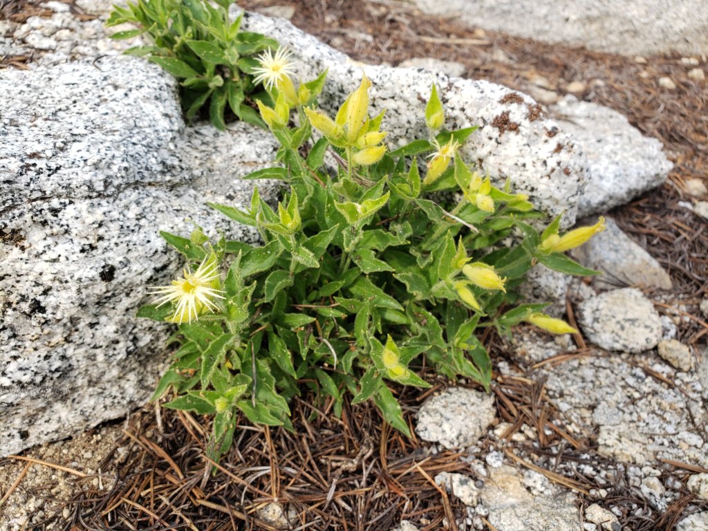
With the monsoons having failed here in the San Jacinto mountains for the past 3-4 years, it is so encouraging to be writing about summer rainstorms for the second week in a row. While the storm cells on Sunday 18th produced only about 0.17in (4mm), the monsoonal system that came through in the morning of Monday 26th July, more than doubled that with 0.42in (10mm) at 5550ft in Idyllwild. While this volume of rain will not change the water conditions on the mountain, and only offers a brief respite from fire risk, we’ll take anything at this point! We had a pleasantly cool, if humid, hike in light drizzle early Monday morning via Devil’s Slide Trail, reaching San Jacinto Peak just as the cloud was breaking up, then descending Deer Springs Trail. Water sources were of course flowing a little better following the rain, but this will likely last only a day or two. As last week, it was delightful to have the dust dampened down and to smell a wet forest.

Daily survey hikes continue to include San Jacinto Peak multiple times per week, plus Tahquitz Peak weekly, both by a variety of routes facilitating regular checks of water sources. Recent trail maintenance work (alongside Forest Service volunteer Bill Rhoads) has focused on the PCT just north of Saddle Junction.

Hikers should be prepared for rapidly changing weather conditions in the high country in summer. Monsoon conditions, ordinarily most common in the afternoon, are a possibility most days for the remainder of July at least. Thunderstorms with lightning, precipitation, and rapid temperature drops can occur in the high country even when such storms are not forecast for lower elevations.

Full fire restrictions on Forest Service lands began on 23rd June, as described here. All campfires anywhere in the San Jacinto mountains, including at all USFS campgrounds and yellow post sites, are now prohibited.

Water conditions in the high country are very poor and deteriorating, despite recent showers. The current status of many key springs and creeks is described below. Notably creeks in Little Round Valley and Skunk Cabbage Meadow are now dry.

Be bear aware. Observations have been infrequent in the past two years, but 1-3 individuals remain active in the San Jacinto mountains. One was seen just east of Saddle Junction in early July, and fresh tracks were on lower Seven Pines Trail on 22nd May.

The U.S. Forest Service ranger station in Idyllwild remains closed due to USFS coronavirus protocols. Apparently it may not reopen until October. Hiking and camping permits are nevertheless required for USFS lands, and should be available at the kiosk outside the ranger station. The State Park ranger station reopened many months ago.

WEATHER The brief cooling of the past couple of days will not last, and daytime high temperatures will be at or above seasonal averages for the remainder of July, before another heating trend in the first week of August. Overnight low temperatures continue to be up to ten degrees above seasonal every day. There is no significant precipitation in the forecast (although minor monsoonal rains are a possibility as discussed above). Fire risk remains severe.

At San Jacinto Peak (10,810ft/3295m) on Monday 26th July 2021 at 1040 the air temperature was 45.9°F (8°C), with a windchill temperature of 37.2°F (3°C), 94% relative humidity, and a moderate SSW wind sustained at 8 mph gusting to 14.3 mph.

At the Peak on Saturday 24th July 2021 at 0715 the air temperature was 51.8°F (11°C), with a windchill temperature of 47.6°F (9°C), 75% relative humidity, and a light SSE wind sustained at 3 mph gusting to 7.6 mph.

At the Peak on Monday 12th July 2021 at 0810 the air temperature was 67.6°F (19.8°C), with a “windchill” temperature of 67.2°F (19.6°C), 38% relative humidity, and a very light NNE breeze sustained at 2 mph gusting to 7.2 mph. This the highest air temperature ever reliably recorded at San Jacinto Peak, shattering the previous record temperature of 62.3°F (16.8°C) observed at 0745 on 19th August 2020.

Parish’s Catchfly (Silene parishii) at 10,700ft elevation on San Jacinto Peak. This species, endemic to the mountains of Southern California, is flowering about two months earlier at this elevation than in 2019.

TRAIL CONDITIONS

Trails throughout the San Jacinto high country cleared of snow by early May. Water conditions are a major concern, with many springs and creeks already having dried up or having very low flows for the time of year, as discussed in detail below.

The rockslide at PCT Mile 172.5, just north of Antsell Rock, was removed on Monday 14th June. My “before, during, and after” video is available here. This section of the PCT is now safer and is readily passable with care by hikers (but still not by stock).

Many trails have accumulated treefall hazards from the past two winters, passable with care by hikers but not for stock. Some are described below, others include the PCT between Strawberry Cienega and Deer Springs camp (PCT Miles 182-185, about 12 trees down), and Fuller Ridge Trail near its northern end (PCT Miles 189.1-190.2, three trees). Spitler Peak Trail was cleared of multiple tree hazards by the Trail Report in early July. Many treefall hazards from Red Tahquitz to Antsell Rock (PCT Miles 172.5-175) were cleared in June. Nevertheless about 20 remain, including at least six major obstructions for hikers. Tahquitz Creek to Red Tahquitz (PCT Miles 175-177) is now clear.

Willow Creek Trail has 33 downed trees between Skunk Cabbage Junction and Hidden Divide. Of these 22 are on the Forest Service section (16 between Willow Creek and the Park boundary), with 11 in the State Park. Most are readily passable by hikers with care. Despite so much work last year, the whitethorn has grown back rapidly, especially on the State Park section, but remains less challenging than in 2019.

The Caramba Trail from near Reeds Meadow through Laws Camp and on to Caramba, and the Cedar Trail from Willow Creek Trail to Laws (which both nominally reopened in late 2018) are optimistically described by the Forest Service as “not maintained”. In reality parts of these trails no longer exist with significant sections of both so heavily overgrown that I strongly advise hikers do not attempt to follow them. Multiple experienced hikers have reported getting lost in this area since summer 2019. An informal use trail to the Laws Camp area is much more direct and completely avoids all of the challenging bush-whacking of the unmaintained trails (other hikers kindly nicknamed it the “King Trail”). It leaves Willow Creek Trail exactly 1.0 mile from Saddle Junction, 0.45 mile from the Skunk Cabbage turning (trailhead at N33°46’46”, W116°39’32”, WGS84). The cairned (but subtle) trail descends largely on established deer tracks for 0.9 mile, reaching Willow Creek just upstream of the former site of Laws Camp. From Laws east to Caramba the route of the old Caramba Trail has become increasingly tricky to follow, especially for the first 1.2 miles east of Laws where there are dozens of trees down. Closer to Caramba the trail is relatively obvious (for those familiar with the route prior to the 2013 Mountain Fire). Very cautious navigation is recommended throughout this area.

Seven Pines Trail has had limited hiker traffic since November 2018. There are 35 treefall hazards on the trail, four large ones on the short Forest Service section, and the remainder in the State Park, based on my most recent 2021 survey. Cautious navigation is recommended for those who are not familiar with hiking this trail. Dark Canyon Road has been closed since early 2019, and there is currently no vehicular access to Seven Pines trailhead. USFS apparently does not expect Dark Canyon Road to reopen this year.

Multi-layer clouds just after rain, looking south-south-easr from San Jacinto Peak, 26th July 2021. Jean Peak is to the right.

WATER STATUS: Eastern slope

The Round Valley pipe is flowing weakly (at about 0.5L/min). This source may not be reliable throughout the summer. Creeks in Round Valley and Tamarack Valley were dry in May (in 2020 neither dried until August).

Hidden Lake dried up completely in June.

Both the northern and southern springs at Wellman’s Cienega are flowing very gently (but adequately to filter). These are the sources for Willow Creek, which is flowing where it crosses the Willow Creek Trail (on 12th July the flow was good for filtering, but was the lowest I have ever seen this creek).

Tahquitz Creek is flowing gently at the northern end of Little Tahquitz Meadow. It is also flowing, but very gently, further upstream at its source (known locally as Grethe Spring) where it crosses the PCT at approx. Mile 177.

The small creek in Tahquitz Valley dried in May, some four months earlier than in 2020.

Candy’s Creek – that flows through Skunk Cabbage Meadow and then crosses the remaining visible section of Caramba Trail near Reeds Meadow – dried up in early July.

WATER STATUS: Western slope

The North Fork of the San Jacinto River continues to flow steadily where it crosses the Deer Springs Trail and also downstream – but much more weakly – where it crosses the Fuller Ridge Trail on the PCT (approx. PCT Mile 186.2).

The creek in Little Round Valley completely dried up in early July, reminiscent of the extremely dry years of 2014-16. The same creek dried up where it crosses Fuller Ridge Trail (PCT Mile 186.4) in April.

Shooting Star Spring (not far below Little Round Valley but above the North Fork of the San Jacinto River crossing) is flowing weakly and is very poor for filtering.

The Deer Springs stream crossing is dry at the PCT/Deer Springs Trail (approx. PCT mile 185.6). (Despite some online mapping to the contrary, this is NOT the source for the North Fork of the San Jacinto River.)

The tiny but perennial spring about 0.4 miles north of Strawberry Junction (known colloquially as Switchback Spring) continues to flow well. I rework the tiny pool every week and there is just about adequate depth from which to filter water.

The little creek at Strawberry Cienega (PCT mile 183.0) is functionally dry. The tiny pool, just a few inches in diameter, is not adequate for filtering (I nearly drained it dry trying to filter 0.25L in late June).

On Devil’s Slide Trail, Middle Spring is now dry. All other springs on this trail have been dry for months.

On the Ernie Maxwell Trail, the crossing of Chinquapin Creek just below Humber Park is dry where it crosses the trail. However, there are small but invaluable fresh pools just upslope from the trail (this creek is an especially useful source of water for the many dogs walked on this trail).

The faucet at Cinco Poses Spring about 4.5 miles up Black Mountain Road continues to flow.

WATER STATUS: Desert Divide

Live Oak Spring (N 33 37 21, W 116 33 24) Flowing. The most reliable water source on the Desert Divide.

Cedar Spring (N 33 40 36, W 116 34 35) Flowing. Easiest access is the trough about 60 yards upstream from the trail to the campsite.

Apache Spring (N 33 43 11, W 116 37 13) Barely trickling, not now reliable.

Spitler Peak Trail Descending the trail from the PCT there are five water crossings. The first two, at 0.9 and 0.95 miles down, cross a tiny side creek which is largely dry and should be ignored. The next crossing, at 1.1 miles down, is Spitler Creek and is the best source of water (currently flowing very gently, but can be filtered). The next two crossings are the same creek, also flowing adequately for filtering.

Antsell Rock Creek (N 33 41 52, W 116 39 08) Right by the Spitler Peak Trail trailhead on Apple Canyon Road, Antsell Rock Creek is now dry. Even in the very dry years of 2015 and 2016, this source did not dry until the autumn.

Thank you hikers for taking the time to read this. While all labor and time is volunteered, the San Jacinto Trail Report completely depends on small private donations to cover operating costs. Every year seems to be challenging and 2021 has been no exception, so every contribution, no matter how small, is truly valuable. If you have found this Report useful, please consider visiting the Donate page. Thank you.

Tahquitz Peak (in the cloud to the left) looking south from the PCT, early morning on 26th July 2021. The cloudbase at about 8700ft lifted to 11,000ft within two hours.

Water and weather update 21st July 2021

Daily survey hikes have included San Jacinto Peak multiple times per week, plus Tahquitz Peak weekly, both by a variety of routes facilitating regular checks of water sources. Recent trail maintenance work (alongside Forest Service volunteer Bill Rhoads) has focused on the PCT just north of Saddle Junction.

Impressive early morning thunderstorms passed over us on Sunday 18th, largely to the south then west of Idyllwild. We had only 0.10in of rain in Idyllwild (at 5550ft) in that storm and from the condition of trails in the high country on 19th it was clear that there had been similarly little rain up there. We had a delightful early morning hike up South Ridge to Tahquitz Peak on 18th, initially in the warm rain, and it was so pleasant to have the dust dampened down and to smell a wet forest for the first time in months.

Hikers should be prepared for rapidly changing weather conditions in the high country in summer. Monsoon conditions, most often in the afternoons, are a possibility most days for the foreseeable future, especially 25th-26th July. Thunderstorms with lightning, precipitation, and rapid temperature drops can occur in the high country even when such storms are not forecast for lower elevations.

Full fire restrictions on Forest Service lands began on 23rd June, as described here. All campfires anywhere in the San Jacinto mountains, including at all USFS campgrounds and yellow post sites, are now prohibited. USFS enforcement has been effective, with multiple substantial fines apparently issued last week to violators along South Ridge Road.

Water conditions in the high country are very poor and deteriorating. The current status of many key springs and creeks is described below. Notably creeks in Little Round Valley and Skunk Cabbage Meadow are now dry.

Be bear aware. Observations have been infrequent in the past two years, but 1-3 individuals remain active in the San Jacinto mountains. One was seen just east of Saddle Junction in early July, and fresh tracks were on lower Seven Pines Trail on 22nd May.

The U.S. Forest Service ranger station in Idyllwild remains closed due to USFS coronavirus protocols. Apparently it may not reopen until October. Hiking and camping permits are required for USFS lands, and should be available at the kiosk outside the ranger station. The State Park ranger station reopened many months ago.

An early morning thunderstorm passing to the north-west of Pine Cove, as seen from South Ridge Trail just below Tahquitz Peak, 18th July 2021.

WEATHER Daytime high temperatures will fluctuate around seasonal averages for the next week, but with overnight lows continuing to be some several degrees above seasonal. There is a chance of light rainfall associated with thunderstorms at all elevations on 26th July. Fire risk remains severe.

At San Jacinto Peak (10,810ft/3295m) on Monday 19th July 2021 at 0755 the air temperature was 53.2°F (12°C), with a windchill temperature of 49.7°F (10°C), 86% relative humidity, and a very light ESE breeze sustained at 1 mph gusting to 6.7 mph.

At the Peak on Friday 16th July 2021 at 0750 the air temperature was 56.6°F (14°C), with a windchill temperature of 53.6°F (12°C), 53% relative humidity, and a very light SSE breeze sustained at 1 mph gusting to 6.8 mph.

At the Peak on Monday 12th July 2021 at 0810 the air temperature was 67.6°F (19.8°C), with a “windchill” temperature of 67.2°F (19.6°C), 38% relative humidity, and a very light NNE breeze sustained at 2 mph gusting to 7.2 mph. This the highest air temperature recorded at San Jacinto Peak, shattering the previous record temperature of 62.3°F (16.8°C) observed at 0745 on 19th August 2020.

It was a rare sticky summer morning at San Jacinto Peak on 19th July with relative humidity close to 90%. The cumulus cloudbase was at 11,000ft. The view looking WNW with Black Mountain on the far left.

TRAIL CONDITIONS

Trails throughout the San Jacinto high country cleared of snow by early May. Water conditions are a major concern, with many springs and creeks already having dried up or having very low flows for the time of year, as discussed in detail below.

The rockslide at PCT Mile 172.5, just north of Antsell Rock, was removed on Monday 14th June. My “before, during, and after” video is available here. This section of the PCT is now safer and is readily passable with care by hikers (but still not by stock).

Many trails have accumulated treefall hazards from the past two winters, passable with care by hikers but not for stock. Some are described below, others include the PCT between Strawberry Cienega and Deer Springs camp (PCT Miles 182-185, about 12 trees down), and Fuller Ridge Trail near its northern end (PCT Miles 189.1-190.2, three trees). Spitler Peak Trail was cleared of multiple tree hazards by the Trail Report in early July. Many treefall hazards from Red Tahquitz to Antsell Rock (PCT Miles 172.5-175) were cleared in June. Nevertheless about 20 remain, including at least six major obstructions for hikers. Tahquitz Creek to Red Tahquitz (PCT Miles 175-177) is now clear.

Willow Creek Trail has 33 downed trees between Skunk Cabbage Junction and Hidden Divide. Of these 22 are on the Forest Service section (16 between Willow Creek and the Park boundary), with 11 in the State Park. Most are readily passable by hikers with care. Despite so much work last year, the whitethorn has grown back rapidly, especially on the State Park section, but remains less challenging than in 2019.

The Caramba Trail from near Reeds Meadow through Laws Camp and on to Caramba, and the Cedar Trail from Willow Creek Trail to Laws (which both nominally reopened in late 2018) are optimistically described by the Forest Service as “not maintained”. In reality parts of these trails no longer exist with significant sections of both so heavily overgrown that I strongly advise hikers do not attempt to follow them. Multiple experienced hikers have reported getting lost in this area since summer 2019. An informal use trail to the Laws Camp area is much more direct and completely avoids all of the challenging bush-whacking of the unmaintained trails (some other local hikers have kindly nicknamed it the “King Trail”). It leaves Willow Creek Trail exactly 1.0 mile from Saddle Junction, 0.45 mile from the Skunk Cabbage turning (trailhead at N33°46’46”, W116°39’32”, WGS84). The cairned (but subtle) trail descends largely on established deer tracks for 0.9 mile, reaching Willow Creek just upstream of the former site of Laws Camp. From Laws east to Caramba the route of the old Caramba Trail has become increasingly tricky to follow, especially for the first 1.2 miles east of Laws where there are dozens of trees down. Closer to Caramba the trail is relatively obvious (for those familiar with the route prior to the 2013 Mountain Fire). Very cautious navigation is recommended throughout this area.

Seven Pines Trail has had limited hiker traffic since November 2018. There are 35 treefall hazards on the trail, four large ones on the short Forest Service section, and the remainder in the State Park, based on my recent survey. Cautious navigation is recommended for those who are not familiar with hiking this trail. Dark Canyon Road has been closed since early 2019, and there is currently no vehicular access to Seven Pines trailhead.

WATER STATUS: Eastern slope

The Round Valley pipe is flowing weakly (at about 0.5L/min). This source may not be reliable throughout the summer. Creeks in Round Valley and Tamarack Valley were dry in May (in 2020 neither dried until August).

Round Valley pipe flowing gently, 12th July 2021.

Hidden Lake dried up completely in June.

Both the northern and southern springs at Wellman’s Cienega are flowing very gently (but adequately to filter). These are the sources for Willow Creek, which is flowing where it crosses the Willow Creek Trail (on 12th July the flow was good for filtering, but was the lowest I have ever seen this creek).

Tahquitz Creek is flowing steadily at the northern end of Little Tahquitz Meadow. It is also flowing, but very gently, further upstream at its source (known locally as Grethe Spring) where it crosses the PCT at approx. Mile 177.

The small creek in Tahquitz Valley dried in May, some four months earlier than in 2020.

Candy’s Creek – that flows through Skunk Cabbage Meadow and then crosses the remaining visible section of Caramba Trail near Reeds Meadow – dried up in early July.

WATER STATUS: Western slope

The North Fork of the San Jacinto River is flowing steadily where it crosses the Deer Springs Trail and also downstream – but much more weakly – where it crosses the Fuller Ridge Trail on the PCT (approx. PCT Mile 186.2).

The creek in Little Round Valley completely dried up in early July, reminiscent of the extremely dry years of 2014-16. The same creek dried up where it crosses Fuller Ridge Trail (PCT Mile 186.4) in April.

Recently dried creekbed in Little Round Valley, 19th July 2021.

Shooting Star Spring (not far below Little Round Valley but above the North Fork of the San Jacinto River crossing) is flowing extremely weakly and is very poor for filtering.

The Deer Springs stream crossing is dry at the PCT/Deer Springs Trail (approx. PCT mile 185.6). (Despite some online mapping to the contrary, this is NOT the source for the North Fork of the San Jacinto River.)

The tiny but perennial spring about 0.4 miles north of Strawberry Junction (known colloquially as Switchback Spring) is flowing. I rework the tiny pool every week and there is just about adequate depth from which to filter water.

The little creek at Strawberry Cienega (PCT mile 183.0) is functionally dry. The tiny pool, just a few inches in diameter, is not adequate for filtering (I nearly drained it dry trying to filter 0.25L in late June).

On Devil’s Slide Trail, Middle Spring is now functionally dry. All other springs on this trail are dry.

On the Ernie Maxwell Trail, the crossing of Chinquapin Creek just below Humber Park is dry where it crosses the trail. However, there are small but invaluable fresh pools just upslope from the trail (this creek is an especially useful source of water for the many dogs walked on this trail).

The faucet at Cinco Poses Spring about 4.5 miles up Black Mountain Road continues to flow.

WATER STATUS: Desert Divide

Live Oak Spring (N 33 37 21, W 116 33 24) Flowing. The most reliable water source on the Desert Divide.

Cedar Spring (N 33 40 36, W 116 34 35) Flowing. Easiest access is the trough about 60 yards upstream from the trail to the campsite.

Apache Spring (N 33 43 11, W 116 37 13) Barely trickling, not now reliable.

Spitler Peak Trail Descending the trail from the PCT there are five water crossings. The first two, at 0.9 and 0.95 miles down, cross a tiny side creek which is largely dry and should be ignored. The next crossing, at 1.1 miles down, is Spitler Creek and is the best source of water (currently flowing very gently, but can be filtered). The next two crossings are the same creek, also flowing adequately for filtering.

Antsell Rock Creek (N 33 41 52, W 116 39 08) Right by the Spitler Peak Trail trailhead on Apple Canyon Road, Antsell Rock Creek is now dry. Even in the very dry years of 2015 and 2016, this source did not dry until the autumn.

Thank you hikers for taking the time to read this. While all labor and time is volunteered, the San Jacinto Trail Report completely depends on small private donations to cover operating costs. Every year seems to be challenging and 2021 has been no exception, so every contribution, no matter how small, is truly valuable. If you have found this Report useful, please consider visiting the Donate page. Thank you.

Lemon Lily (Lilium parryi) flowering in a San Jacinto mountains meadow, 16th July 2021.

Water and weather update 14th July 2021

Daily survey hikes have included San Jacinto Peak multiple times per week, allowing for regular checks of water sources, for example on 12th descending via Round Valley, the High Trail, and Willow Creek Trail.

The astonishing air temperature I recorded at San Jacinto Peak on Monday 12th July, 67.6°F (19.8°C) at 0810, shattered the previous record Peak temperature of 62.3°F (16.8°C) observed at 0745 on 19th August 2020. I have rarely recorded high temperatures at or just above 60°F at the Peak (three times in summer 2018, but not once in 2019), but now 70 degrees seems to be a possibility. In over 500 early morning ascents of Devil’s Slide Trail, I have never known it to be so warm as on 12th, close to 80°F at Humber Park pre-dawn at 0515.

While temperatures will drop for the next few days, they will remain at or above seasonal averages (overnight lows especially tending to be high), so plan your hiking accordingly for hot, very dry conditions. There have been multiple heat-related rescues on Skyline Trail in recent weeks, and only hikers who are extremely familiar with that trail in these conditions should even be considering attempting it in summer.

Hikers should also be prepared for rapidly changing weather conditions in the high country in summer. Monsoon conditions, usually in the afternoons, are a possibility for the foreseeable future, especially 18th-23rd July. Thunderstorms with lightning, precipitation, and rapid temperature drops can occur in the high country even when such storms are not forecast for lower elevations.

Full fire restrictions on Forest Service lands began on 23rd June, as described here. All campfires at USFS campgrounds and yellow post sites in the San Jacinto mountains are now prohibited.

Water conditions in the high country are poor and deteriorating. The current status of many key springs and creeks is described below. The creek in Little Round Valley is now functionally dry. Even the relatively major Antsell Rock Creek has dried up at Apple Canyon Road adjacent to the Spitler Peak trailhead.

Be bear aware. Observations have been infrequent in the past two years, but 1-3 individuals remain active in the San Jacinto mountains. One was seen just east of Saddle Junction last week, and very fresh tracks were on lower Seven Pines Trail on 22nd May.

The U.S. Forest Service ranger station in Idyllwild remains closed due to USFS coronavirus protocols. It may reopen later this month. Hiking and camping permits are nevertheless required for USFS lands, and should be available at the kiosk outside the ranger station. The State Park ranger station reopened months ago.

WEATHER Daytime high temperatures will drop to near seasonal averages on 14th-18th, although with overnight lows tending to remain as much as 10°F above seasonal. Temperatures are forecast to again be above average next week. There is no significant widespread precipitation in the forecast. Fire risk remains severe.

At San Jacinto Peak (10,810ft/3295m) on Monday 12th July 2021 at 0810 the air temperature was 67.6°F (19.8°C), with a “windchill” temperature of 67.2°F (19.6°C), 38% relative humidity, and a very light NNE breeze sustained at 2 mph gusting to 7.2 mph, with visibility very limited by haze/smoke.

At the Peak on Tuesday 6th July 2021 at 0825 the air temperature was 56.5°F (14°C), with a windchill temperature of 49.9°F (10°C), 31% relative humidity, and a stiff due East wind sustained at 10 mph gusting to 17.4 mph.

TRAIL CONDITIONS

Trails throughout the San Jacinto high country cleared of snow by early May. Water conditions are a major concern, with most springs and creeks already having flows more typical of late autumn, as discussed in detail below.

The rockslide at PCT Mile 172.5, just north of Antsell Rock, was removed on Monday 14th June. My “before, during, and after” video is available here. This section of the PCT is now safer and is readily passable with care by hikers (but still not by stock).

Black Mountain Road reopened on 23rd April, and the Black Mountain Fire Lookout on 23rd May. Boulder Basin campground reopened on 22nd May along with other USFS seasonal campgrounds. Tahquitz Peak Fire Lookout reopened for the season on Sunday 30th May.

Many trails have accumulated treefall hazards from the past two winters, passable with care by hikers but not for stock. Some are described below, others include: PCT between Strawberry Cienega and Deer Springs camp (PCT Miles 182-185, about 12 trees down), Fuller Ridge Trail near its northern end (PCT Miles 189.1-190.2, three trees). Spitler Peak Trail was cleared of multiple tree hazards in early July.

Many treefall hazards from Red Tahquitz to Antsell Rock (PCT Miles 172.5-175) were cleared in June. Nevertheless about 20 remain, including at least six major obstructions for hikers. Tahquitz Creek to Red Tahquitz (PCT Miles 175-177) has been completely cleared.

Willow Creek Trail has 33 downed trees between Skunk Cabbage Junction and Hidden Divide. Of these 22 are on the Forest Service section (16 between Willow Creek and the Park boundary), with 11 in the State Park. Most are readily passable by hikers with care. Despite so much work last year, the whitethorn has grown back rapidly, especially on the State Park section, but nevertheless remains much less challenging than in 2019.

The Caramba Trail from near Reeds Meadow through Laws Camp and on to Caramba, and the Cedar Trail from Willow Creek Trail to Laws (which both nominally reopened in late 2018) are optimistically described by the Forest Service as “not maintained”. In reality parts of these trails no longer exist with significant sections of both so heavily overgrown that I strongly advise hikers do not attempt to follow them. Multiple experienced hikers have reported getting lost in this area since summer 2019. An informal use trail to the Laws area is much more direct and completely avoids all of the challenging bush-whacking of the unmaintained trails (local hikers have kindly nicknamed it the “King Trail“). It leaves Willow Creek Trail exactly 1.0 mile from Saddle Junction, 0.45 mile from the Skunk Cabbage turning (trailhead at N33°46’46”, W116°39’32”, WGS84). The cairned (but subtle) trail descends largely on established deer tracks for 0.9 mile, reaching Willow Creek just upstream of the former site of Laws Camp. From Laws east to Caramba the route of the old Caramba Trail has become increasingly tricky to follow, especially for the first 1.2 miles east of Laws where there are dozens of trees down. Closer to Caramba the trail is relatively obvious (for those familiar with the route prior to the 2013 Mountain Fire). Very cautious navigation is recommended throughout this area.

Seven Pines Trail has had limited hiker traffic since November 2018. There are 35 treefall hazards on the trail, four large ones on the short Forest Service section, and the remainder in the State Park, based on my recent survey. Cautious navigation is recommended for those who are not familiar with hiking this trail. Dark Canyon Road has been closed since early 2019, and there is currently no vehicular access to Seven Pines trailhead.

WATER STATUS: Eastern slope

The Round Valley pipe is flowing weakly (at about 0.5L/min). This source may not be reliable throughout the summer. Creeks in Round Valley and Tamarack Valley were dry in May (in 2020 neither dried until August).

Round Valley pipe flowing gently, 12th July 2021.

Hidden Lake dried completely in June.

Both the northern and southern springs at Wellman’s Cienega are flowing very gently (but adequately to filter). These are the sources for Willow Creek, which is flowing, but very weakly, where it crosses the Willow Creek Trail.

Willow Creek, where it crosses the trail of the same name, 12th July 2021. This is the lowest flow I have ever seen in Willow Creek, but it remains invaluable for filtering.

Tahquitz Creek is flowing steadily at the northern end of Little Tahquitz Meadow. It is also flowing further upstream at its source (known locally as Grethe Spring) where it crosses the PCT at approx. Mile 177.

The small creek in Tahquitz Valley dried in May, some four months earlier than in 2020.

Candy’s Creek – that flows through Skunk Cabbage Meadow and then crosses the remaining visible section of Caramba Trail near Reeds Meadow – is currently flowing very gently in both locations.

WATER STATUS: Western slope

The North Fork of the San Jacinto River is flowing steadily where it crosses the Deer Springs Trail and again downstream where it crosses the Fuller Ridge Trail on the PCT (approx. PCT Mile 186.2).

The creek in Little Round Valley has stopped flowing, there are tiny pools for about 20 feet, and it dries up long before leaving the Valley. It is currently very marginal for filtering at best. The same creek dried up where it crosses Fuller Ridge Trail (at about PCT Mile 186.4) in April.

Shooting Star Spring (below Little Round Valley but above the North Fork of the San Jacinto River crossing) is flowing weakly and is very poor for filtering.

The Deer Springs stream crossing is dry at the PCT/Deer Springs Trail (approx. PCT mile 185.6). (Despite some online mapping to the contrary, this is NOT the source for the North Fork of the San Jacinto River.)

The tiny but perennial spring about 0.4 miles north of Strawberry Junction (known colloquially as Switchback Spring) is flowing. I rework the tiny pool every week and there is just about adequate depth from which to filter water.

The little creek at Strawberry Cienega (PCT mile 183.0) is almost dry. The tiny pool, just a few inches in diameter, is not adequate for filtering (I nearly drained it dry trying to filter 0.25L in late June).

On Devil’s Slide Trail, Middle Spring is now functionally dry. Other springs on this trail are dry.

On the Ernie Maxwell Trail, the crossing of Chinquapin Creek just below Humber Park is dry where it crosses the trail. However, there are tiny fresh pools just upslope from the trail (this creek is a critical source of water for the many dogs walked on this trail.

The faucet at Cinco Poses Spring about 4.5 miles up Black Mountain Road continues to flow.

WATER STATUS: Desert Divide

Live Oak Spring (N 33 37 21, W 116 33 24) Flowing. The most reliable water source on the Desert Divide.

Cedar Spring (N 33 40 36, W 116 34 35) Flowing. Easiest access is the trough about 60 yards upstream from the trail to the campsite.

Apache Spring (N 33 43 11, W 116 37 13) Barely trickling, not now reliable.

Spitler Peak Trail Descending the trail from the PCT there are five water crossings. The first two, at 0.9 and 0.95 miles down, cross a tiny side creek which is largely dry and should be ignored. The next crossing, at 1.1 miles down, is Spitler Creek and is the best source of water (currently flowing very gently, but can be filtered). The next two crossings are the same creek, also flowing adequately for filtering.

Spitler Creek continues to flow gently in the upper switchbacks of Spitler Peak Trail, 5th July 2021.

Antsell Rock Creek (N 33 41 52, W 116 39 08) Right by the Spitler Peak Trail trailhead on Apple Canyon Road, Antsell Rock Creek is now dry. Even in the very dry years of 2015 and 2016, this source did not dry until the autumn.

Southern Mountain Yellow-legged Frogs (Rana muscosa), 8th July 2021. These individuals, photographed after their release into the wild, are part of a reintroduction project in the San Jacinto mountains managed by San Diego Zoo, with which I was kindly invited to assist. Note how individuals can adjust their coloration to match the substrate.

Thank you hikers for taking the time to read this. While all labor and time is volunteered, the San Jacinto Trail Report completely depends on small private donations to cover operating costs. Every year seems to be challenging and 2021 has been no exception, so every contribution, no matter how small, is truly valuable. If you have found this Report useful, please consider visiting the Donate page. Thank you.

Water and trail update 7th July 2021

Daily survey hikes have included San Jacinto Peak multiple times per week, plus in recent days Spitler Peak Trail, South Ridge Trail (several times), Laws/Caramba area, South Fork Wilderness Trail, and the Tahquitz/Skunk Cabbage meadow trail complex. Recent trail maintenance has focused on several of the trails mentioned above.

Full fire restrictions began on Wednesday 23rd June on Forest Service lands, as described here. All campfires at USFS campgrounds and yellow post sites in the San Jacinto mountains are now prohibited.

Temperatures for the foreseeable future will be largely well above seasonal averages, so plan your hiking accordingly for very hot, very dry conditions.

Hikers should also be prepared for rapidly changing weather conditions in the high country in summer. Monsoon conditions, usually in the afternoons, are a slim possibility for the foreseeable future. Thunderstorms with lightning, precipitation, and rapid temperature drops, can occur in the high country even when such storms are not forecast for lower elevations.

Water conditions in the high country are poor and deteriorating. Hot, dry weather for many weeks has not helped the situation. The current status of many key springs and creeks is described in detail below. The creek in Little Round Valley was almost dry on 6th July. On 5th July I was surprised to find that Antsell Rock Creek has dried up at Apple Canyon Road adjacent to the Spitler Peak trailhead.

Be bear aware. Although sightings have been infrequent in the past two years, one was reported on Willow Creek Trail at 0745 on 3rd July just east of Saddle Junction (per David English). The size and colour reported suggest this may be a third individual, different from the “Rite Aid” bear and “Blondie” who both appeared in 2017 (see my video of the latter in Idyllwild in 2018). The Trail Report last reported very fresh tracks on lower Seven Pines Trail on 22nd May (see this earlier Report for photo).

Mountain Lions are thankfully always common and widespread locally. One of my camera traps in the San Jacinto mountains near Idyllwild obtained great daylight video of an adult female on 24th June.

The rockslide at PCT Mile 172.5, just north of Antsell Rock, was removed on Monday 14th June. My “before, during, and after” video is available here. This section of the PCT is now safer and is readily passable with care by hikers (but still not by stock).

The U.S. Forest Service ranger station in Idyllwild remains closed due to USFS coronavirus protocols. It may reopen later this month. Hiking and camping permits are nevertheless required for USFS lands, and are usually available at the kiosk outside the ranger station. The State Park ranger station reopened months ago.

WEATHER Temperatures overall will be above seasonal averages for the foreseeable future, with overnight lows in particular tending to be far above seasonal. There is no significant precipitation in the forecast. Fire risk remains severe.

At San Jacinto Peak (10,810ft/3295m) on Tuesday 6th July 2021 at 0825 the air temperature was 56.5°F (14°C), with a windchill temperature of 49.9°F (10°C), 31% relative humidity, and a stiff due East wind sustained at 10 mph gusting to 17.4 mph.

At the Peak on Thursday 1st July 2021 at 0805 the air temperature was 52.3°F (11°C), with a windchill temperature of 47.6°F (9°C), 48% relative humidity, and a light due West wind sustained at 5 mph gusting to 9.0 mph.

TRAIL CONDITIONS

Trails throughout the San Jacinto high country cleared of snow by early May. Water conditions are a major concern, with most springs and creeks already having flows more typical of late autumn, as discussed in detail below.

Black Mountain Road reopened on 23rd April, and the Black Mountain Fire Lookout on 23rd May. Boulder Basin campground reopened on 22nd May along with other USFS seasonal campgrounds. Tahquitz Peak Fire Lookout reopened for the season on Sunday 30th May.

Many trails have accumulated treefall hazards from the past two winters, passable with care by hikers but not for stock. Some are described below, others include: PCT between Strawberry Cienega and Deer Springs camp (PCT Miles 182-185, about 12 trees down), Fuller Ridge Trail near its northern end (PCT Miles 189.1-190.2, three trees). Spitler Peak Trail was cleared of multiple tree hazards in early July.

Many treefall hazards from Red Tahquitz to Antsell Rock (PCT Miles 172.5-175) were cleared in June. Nevertheless about 20 remain, including at least six major obstructions for hikers. Tahquitz Creek to Red Tahquitz ( PCT Miles 175-177) has been completely cleared.

Willow Creek Trail has 14 downed trees on its Forest Service section (including a couple of new ones in high winds in June), with a couple of large, heavily-branched trees that are somewhat challenging to pass. This was reported to USFS in April. There are half-a-dozen additional trees down on the State Park section of the same trail.

The Caramba Trail from near Reeds Meadow through Laws Camp and on to Caramba, and the Cedar Trail from Willow Creek Trail to Laws (which both nominally reopened in late 2018) are optimistically described by the Forest Service as “not maintained”. In reality parts of these trails no longer exist with significant sections of both so heavily overgrown that I strongly advise hikers do not attempt to follow them. Multiple experienced hikers have reported getting lost in this area since summer 2019. An informal use trail to the Laws area is much more direct and completely avoids all of the challenging bush-whacking of the unmaintained trails (local hikers have kindly nicknamed it the “King Trail“). It leaves Willow Creek Trail exactly 1.0 mile from Saddle Junction, 0.45 mile from the Skunk Cabbage turning (trailhead at N33°46’46”, W116°39’32”, WGS84). The cairned (but subtle) trail descends largely on established deer tracks for 0.9 mile, reaching Willow Creek just upstream of the former site of Laws Camp. From Laws east to Caramba the route of the old Caramba Trail has become increasingly tricky to follow, especially for the first 1.2 miles east of Laws where there are dozens of trees down. Closer to Caramba the trail is relatively obvious (for those familiar with the route prior to the 2013 Mountain Fire). Very cautious navigation is recommended throughout this area.

Seven Pines Trail has had limited hiker traffic since November 2018. There are 35 treefall hazards on the trail, four large ones on the short Forest Service section, and the remainder in the State Park, based on my recent survey. Cautious navigation is recommended for those who are not familiar with hiking this trail. Dark Canyon Road has been closed since early 2019, and there is currently no vehicular access to Seven Pines trailhead.

The creek in Little Round Valley, sadly reduced to a few feet of tiny pools, 6th July 2021. It will be completely dry within a couple of weeks.

WATER STATUS: Eastern slope

The Round Valley pipe is flowing weakly (at about 0.5L/min on 28th June). This source may not be reliable throughout the summer. Creeks in Round Valley and Tamarack Valley were dry in May (in 2020 neither dried until August).

Both the northern and southern springs at Wellman’s Cienega are flowing very gently (but adequately to filter). These are the sources for Willow Creek, which is flowing, but relatively weakly, where it crosses the Willow Creek Trail.

Tahquitz Creek is flowing steadily at the northern end of Little Tahquitz Meadow. It is also flowing further upstream at its source (known locally as Grethe Spring) where it crosses the PCT at approx. Mile 177.

The small creek in Tahquitz Valley dried some four months earlier than in 2020.

Candy’s Creek – that flows through Skunk Cabbage Meadow and then crosses the remaining visible section of Caramba Trail near Reeds Meadow – is currently flowing gently in both locations.

WATER STATUS: Western slope

The North Fork of the San Jacinto River is flowing steadily where it crosses the Deer Springs Trail and again downstream where it crosses the Fuller Ridge Trail on the PCT (approx. PCT Mile 186.2).

The creek in Little Round Valley has stopped flowing, there are tiny pools for about 20 feet, and it dries up long before leaving the Valley (see photo above). It is currently very marginal for filtering, and will completely dry in July. The same creek dried up where it crosses Fuller Ridge Trail (at about PCT Mile 186.4) in April.

Shooting Star Spring (below Little Round Valley but above the North Fork of the San Jacinto River crossing) is flowing weakly and is very poor for filtering.

The Deer Springs stream crossing is dry at the PCT/Deer Springs Trail (approx. PCT mile 185.6). (Despite some online mapping to the contrary, this is NOT the source for the North Fork of the San Jacinto River.)

The tiny but perennial spring about 0.4 miles north of Strawberry Junction (known colloquially as Switchback Spring) is flowing. I rework the tiny pool every week and there is just adequate depth from which to filter water.

The little creek at Strawberry Cienega (PCT mile 183.0) is almost dry. The tiny pool is barely sufficient for filtering (I nearly drained it dry trying to filter 0.25L in late June).

Strawberry Cienega, 24th June 2021. The tiny pool (lower left) was barely two inches deep, and about six inches across, and should not be relied upon for filtering.

On Devil’s Slide Trail, Middle Spring is now almost dry. Other springs on this trail are dry.

On the Ernie Maxwell Trail, the crossing of Chinquapin Creek just below Humber Park is dry where it crosses the trail. However, there are tiny fresh pools just upslope from the trail (this creek is an important source of water for the many dogs walked on this trail.

The faucet at Cinco Poses Spring, about 4.5 miles up Black Mountain Road, continues to flow well.

WATER STATUS: Desert Divide

Live Oak Spring (N 33 37 21, W 116 33 24) Flowing. The most reliable water source on the Desert Divide.

Cedar Spring (N 33 40 36, W 116 34 35) Flowing. Easiest access is the trough about 60 yards upstream from the trail to the campsite.

Apache Spring (N 33 43 11, W 116 37 13) Barely trickling, not now reliable.

Spitler Peak Trail Descending the trail from the PCT there are five water crossings. The first two, at 0.9 and 0.95 miles down, cross a tiny side creek which is largely dry and should be ignored. The next crossing, at 1.1 miles down, is Spitler Creek and is the best source of water (currently flowing very gently, but can be filtered). The next two crossings are the same creek, also flowing adequately for filtering.

Spitler Creek continues to flow gently in the upper switchbacks of Spitler Peak Trail, 5th July 2021.

Antsell Rock Creek (N 33 41 52, W 116 39 08) Right by the Spitler Peak Trail trailhead on Apple Canyon Road, Antsell Rock Creek is now dry. Even in the very dry years of 2015 and 2016, this source did not dry until the autumn.

Spectacular cumulus and altocumulus clouds as seen from Old Lookout Flat (7600ft) on South Ridge Trail, early morning 29th June 2021. Looking east (above), and west (below).

Thank you hikers for taking the time to read this. While all labor and time is volunteered, the San Jacinto Trail Report completely depends on small private donations to cover operating costs. Every year seems to be challenging and 2021 has been no exception, so every contribution, no matter how small, is truly valuable. If you have found this Report useful, please consider visiting the Donate page. Thank you.