UPDATED 6th April 2021: a thorough new video survey of Fuller Ridge (PCT Miles 185.5-191) was undertaken today. Spikes are generally recommended for parts of this section, other than for hikers who are very comfortable on angled snow/ice.
UPDATED 2nd April 2021: The PCT through the Snow Fire closure area (approx. Miles 191-207) will reopen on Saturday 3rd April. Only the tread of the Trail has reopened, meaning no camping is permitted along the 16+ mile section.
[Please note that information specific to the Pacific Crest Trail is included at the foot of this Report. However much of the main Report is also applicable to PCT hikers. Important PCT note: We surveyed the challenging north-east flank of Apache Peak (PCT Mile 169.5) on 29th March, as summarised in this video.]
Almost all of our recent daily hikes have focused on parts of the PCT and/or its side trails. We had a swift ascent of San Jacinto Peak this morning via Marion Mountain and Deer Springs trails, and on Sunday 28th via the east side (Devil’s Slide, Wellman, and Peak trails). Spikes were required almost the entire way today, but hardly at all on Sunday.
The weather recorded at San Jacinto Peak this morning is, regrettably, not an April Fool’s joke (details below). With even the “windchill” above freezing, and a relative humidity of only 16%, conditions were more reminiscent of June than of 1st April. The omens for this year’s fire season are not good at all.
We had unusual “thundersnow” events in the San Jacinto mountains on both 21st and 23rd March, then a more conventional dusting mainly in the early morning of 26th. All three events produced just 0.25-1.0 inch of snow, depending on elevation, which promptly largely melted off within hours.
More significantly, we have a major warming spell for the next week (it is 71°F in Idyllwild as I write this). Temperatures will be well above seasonal averages at all elevations. This will be especially pronounced at the highest elevations with air temperatures (even at night) expected to remain at or above freezing at San Jacinto Peak for almost all of the first half of April.
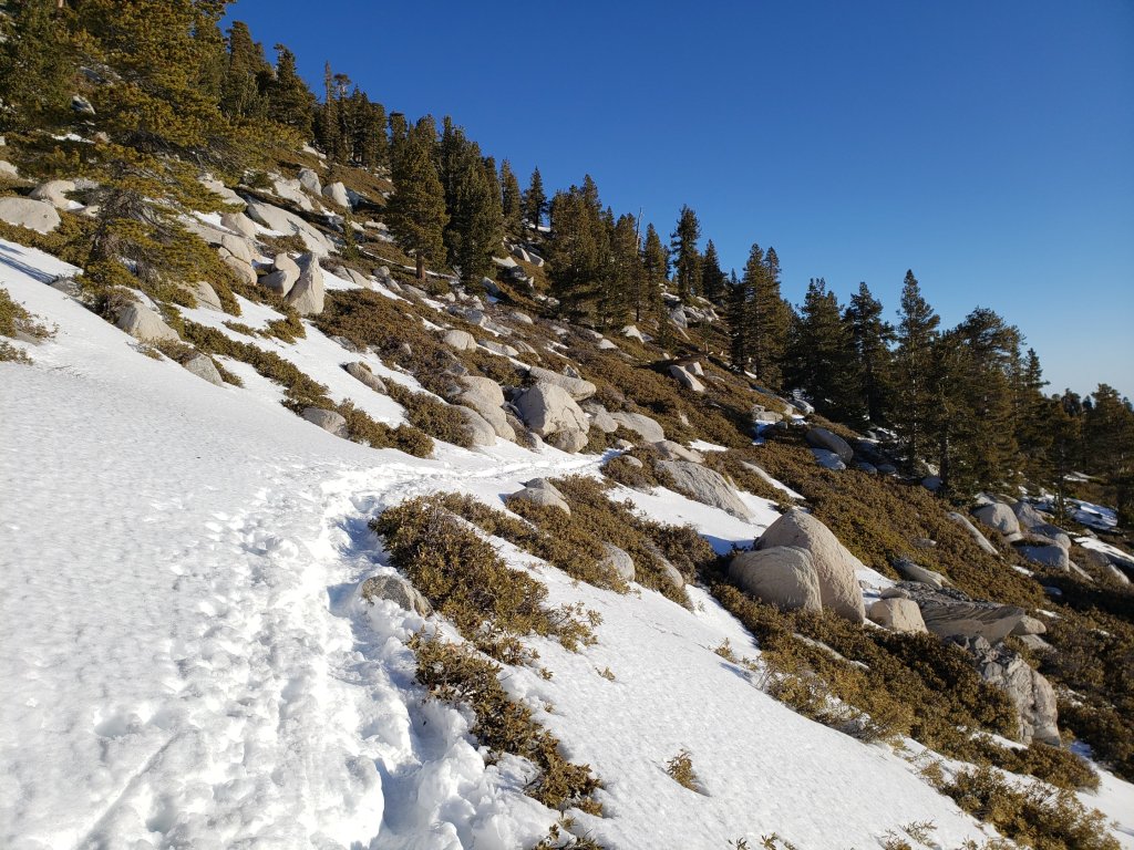
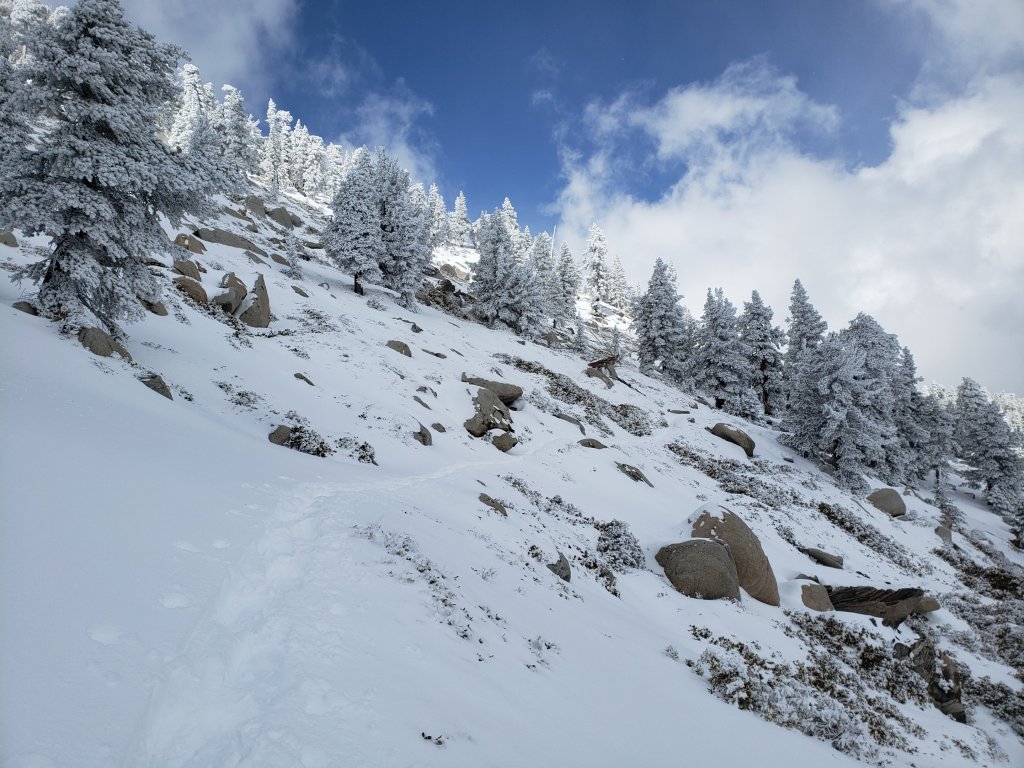
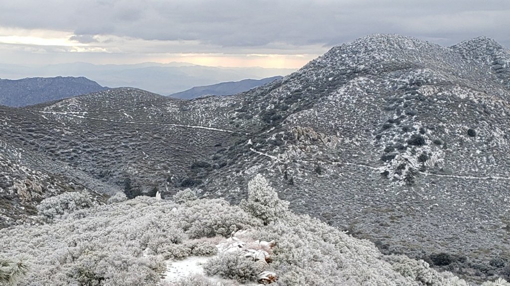
With the obvious exception of the light dusting events of the previous week, snowmelt has been steady at all elevations. Melting will accelerate dramatically over the next week. Sun-exposed slopes in particular are clearing rapidly, with conditions expected to become more reminiscent of a “normal” May or even early June in the first week of April. Spikes are recommended on all well-traveled trails above about 7500ft (lower in places discussed below), especially in the morning and for descending, as established trails are now compacted by hiker traffic and freeze-thaw cycles. Snowshoes are recommended only for off-trail travel above and around about 9000ft.
Despite temperatures well above seasonal norms at upper elevations, hikers should nevertheless be prepared for temperatures near freezing in the high country, and potentially below freezing when considering wind chill effects (see below for weather data recorded recently at San Jacinto Peak).
The USFS gate at Humber Park reopened on 19th March when the area was also plowed.
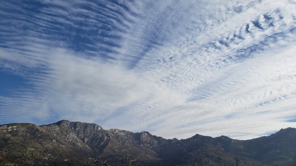
WEATHER Temperatures are forecast to remain well above seasonal until about Tuesday 6th April, when slight cooling is expected to near average temperatures. There is no significant precipitation in the forecast.
At San Jacinto Peak (10,810ft/3295m) on Thursday 1st April 2021 at 0850 the air temperature was 41.9°F (5°C), with a windchill temperature of 34.3°F (1°C), 16% relative humidity, and a steady (and rare) due South wind sustained at 7 mph gusting to 11.9 mph.
At the Peak on Sunday 28th March 2021 at 0815 the air temperature was 36.1°F (2°C), with a windchill temperature of 28.8°F (-2°C), 26% relative humidity, and a light SE wind sustained at 4 mph gusting to 8.0 mph.
At the Peak on Monday 22nd March 2021 at 0950 the air temperature was 25.5°F (-4°C), with a windchill temperature of 7.2°F (-14°C), 39% relative humidity, and a frigid NW wind sustained at 12 mph gusting to 23.8 mph.
TRAIL CONDITIONS
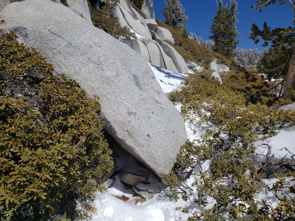
All trails above about 8600ft remain largely or completely snow-covered. Areas below 7500ft are largely clear of snow, with the exception of north-facing slopes (down to about 6500ft). Areas between those elevations are clearing of snow. Rapid clearing at all elevations, especially on sun-exposed slopes, will accelerate this week.
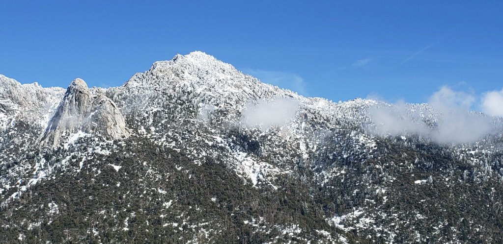
Tahquitz Peak trail from Chinquapin Flat/PCT Mile 178 has no steps to follow through the angled icy snow. These slopes are notoriously treacherous. Currently crampons (or at least spikes) used in conjunction with an ice axe are strongly recommended. Do not attempt to use snowshoes due to the angle of the icy snow.
Devil’s Slide Trail is rapidly clearing of snow to 7600′ with a few extended icy snow patches remaining. Snow is widespread but increasingly patchy above that elevation to Saddle Junction. The trail is hard and icy and spikes are useful.
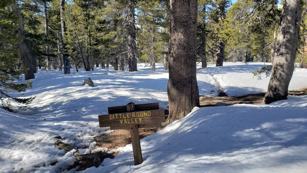
Deer Springs Trail is essentially clear of snow up to Strawberry Junction and largely clear to about 8600ft. Snow is virtually continuous from there to San Jacinto Peak, with an excellent track to follow. Above Little Round Valley the track through the snow does not follow the trail route to San Jacinto Peak, and is steep and direct. Spikes are recommended, especially for descending, as snow is icy and compacted.
South Ridge Trail [updated 30th March] is clear to Old Lookout Flat at 7600′, with just a couple of tiny icy patches low down. Snow cover is a patchy 40% on the traverse at 7600-7800ft. The 18 switchbacks up to Tahquitz Peak are largely clear, but snow cover is almost continuous on those closest to the Peak. Spikes are useful close to Tahquitz Peak especially for descending. South Ridge Road (open) is clear of snow and ice.
Marion Mountain Trail has extensive, icy, snow cover to the PCT/Deer Springs Trail junction. The trail is largely clear to about 6800ft, but thereafter cover is roughly 50% below 7500ft and again above 8500ft. Icy snow is nearly continuous between those elevations. Spikes are strongly recommended throughout.
Fuller Ridge Trail has tracks to follow through the icy snow. They do not accurately follow the PCT route in several places.
Seven Pines Trail has had no visible hiker traffic this winter, nor since the most recent snowfall, with no tracks or trail to follow. Indeed this trail has been hiked very little since November 2018. Extremely cautious navigation is recommended for those who are not very familiar with hiking this trail. The Forest Service closure of Dark Canyon Road continues, and there is no vehicular access to Seven Pines trailhead.
The Ernie Maxwell Trail is essentially clear of ice and snow, with a few icy snow patches near Humber Park. Spikes are not required.
There is a clear but lightly-traveled track up from Round Valley to Wellman Divide, which does not closely follow the established trail route for much of its length.
Skyline Trail is clear of snow to about 7200ft, thereafter snow is generally shallow and increasingly patchy to Grubb’s Notch (8600ft). There is a well-worn but icy track to follow, spikes are recommended.
Current snow cover on the PCT is minimal from Miles 151 (Highway 74) to about 165, and increasingly patchy, but nevertheless very challenging in places, between Miles 165 and about 175 (Red Tahquitz). Snow is then more-or-less continuous between Miles 175-178. Snow cover is steadily becoming patchy between Miles 178 to 183.5, with the exception of the notoriously stubborn half mile just south of Annie’s Junction at about Mile 181. From Mile 183.5 to 191, snow is largely continuous, although some exposed sections of Fuller Ridge (e.g., parts of Miles 186.5-188.5) are thinning rapidly.
Black Mountain Road (closed to vehicles 1.7 miles from Hwy 243) is clear of snow for 5.0 miles to the Boulder Basin turning. The 3.0 miles to Fuller Ridge campground averages about 10% snow cover, with some lengthy soft snow sections increasing in frequency closer to Fuller Ridge [surveyed 2nd April 2021].
Spitler Peak Trail is clear of snow. Spikes are not required.
Cedar Spring Trail is clear of snow from Morris Ranch Road to the PCT, with some small patches remaining on the east side of the PCT down to the spring itself.
May Valley Road, a major component of the PCT Mile 168.5 alternate route, is clear of snow.
SNOW DEPTHS measured on 1st April 2021 (San Jacinto Peak and Little Round Valley) or 28th March 2021. Note that average depth is given first, followed in parentheses by the depth recorded on 16th March after the last significant storms on 10th-15th March. Due to past drifting, and variable melting due to differential sun exposure, depths now vary greatly, especially in trails. Altitudes are approximate.
San Jacinto Peak (10810ft): 14 inches (38 inches on 16th March)
Little Round Valley (9800ft): 10 inches (29 inches on 16th March)
Wellman Divide (9700ft): 4 inches (19 inches on 16th March)
Annie’s Junction (9070ft): 18 inches (24 inches on 16th March)
Strawberry Junction (8100ft): <1 inch (8 inches on 16th March)
Saddle Junction/approx. PCT Mile 179.9 (8070ft): 5 inches (17 inches on 16th March)
Devil’s Slide Trail at Humber Park (6550ft): <1 inch (12 inches on 16th March)
Idyllwild (at 5550ft): 0 inches (6 inches on 16th March)
PACIFIC CREST TRAIL
Following a general discussion, this information is organized roughly south to north (all Mile numbers are approximate). The main Report (above) is updated at least weekly or during/after any storm.
Spikes are currently recommended between about Miles 165 and 191, and they are essential if you attempt Miles 169-178 and 185-190 at least. Currently, an ice axe could be very useful in these areas in conjunction with your spikes, but only if you know how to use it. Challenging sections of angled icy snow requiring this equipment exist north of Apache Peak (Mile 169.5), so if you are not comfortable with the snow conditions in that area, use the Spitler Peak Trail alternate. Please always practice safe decision-making based on your own comfort level (not that of your hiking partners), experience, ability, available equipment, time of day (which can greatly affect traction on snow and ice), and current snow and weather conditions.
This has been a well-below average snow year for the San Jacinto high country (but, oddly, above average snowfall for mid elevations, 4000-6000ft). Given accelerating climate change here, depending on your start date there may be relatively little snow and ice by the time you reach the San Jacinto mountains. Nevertheless even small, isolated sections of icy snow can be very perilous. Details of current snow/ice conditions will be clear from updates to the Trail Report over coming weeks.
Coming off at Mile 168.5 (the well-signed Spitler Peak Trail alternate) may be a good option for many this nobo season. In addition to snow/ice issues ahead, there are nearly 60 trees down across the Trail between Miles 169-177, plus the rock slide at Mile 172.5. Spitler Peak Trail itself clears of snow (as is now the case) long before the PCT north of that point.
The detailed video report for PCT Miles 169-179 from 1st March is again accurate to current conditions. Although there will be significant melting over the next week or so, challenging conditions will persist around Apache Peak (and in the 7-8 miles immediately north) for the foreseeable future. Please exercise very cautious decision-making in this area.
The short snow slope on the NE side of Apache Peak (Mile 169.5) that has proved challenging over the years is currently snow-covered. This area was resurveyed on 29th March as discussed in this short video. Snow is hard and icy in the early mornings, but with reasonable steps to follow. Spikes, ideally in combination with an ice axe, and knowledge of how to use this equipment, are currently recommended. Every individual should make their own assessment of whether to cross based on their comfort level on angled snow, their experience, available equipment, time of day, and current snow conditions. If in any doubt whatsoever, turn around and take the very well signed Spitler Peak Trail alternate option at Mile 168.5.
PCT hikers – thanks for taking the time to read this. The San Jacinto Trail Report depends entirely on small private donations to cover its direct costs. With a busy winter overlapping with a complex PCT season, every contribution, no matter how small, is truly valuable. If you have found the Report useful, please consider visiting the Donate page. Thank you, and safe hiking.
The Pacific Crest Trail remains open at the rockslide north of Antsell Rock (Mile 172.5). Reports that the assisting rope around the rockslide is “in tatters” are inaccurate. However the rope is not in new condition, and if you choose to use it, you do so completely at your own risk. USFS has told the Trail Report that responsibility for removing the rockslide is currently with the PCTA, and that there are currently no plans to close this section of the PCT for removal work before summer 2021 at the earliest. The latest video report (recorded on 1st March 2021, starts at minute 9.05) may be useful for deciding whether to hike around the rockslide.
It is possible to regain the PCT from Idyllwild via Devil’s Slide Trail at Saddle Junction (about Mile 179) then hike on through to Mile 190.5 (Fuller Ridge campground). Currently this would involve significant snow travel, but nothing challenging, as snow is relatively shallow and melting steadily, including Fuller Ridge Trail (Miles 185.5-190.5). Do not attempt to regain the PCT via South Ridge Trail as the slope on the north side of Tahquitz Peak is currently ice-covered and is notoriously treacherous.
PCT hikers are reminded that overnight stays are not permitted at or near San Jacinto Peak, including in the historic shelter. Mt. San Jacinto State Park regulations permit overnight stays only in established campgrounds (when open). Strawberry Junction is a good option for thru-hikers.