UPDATE Friday 2nd January 2026: it continued to drizzle up to 9000 ft until early this morning. San Jacinto Peak added two inches of snow, but it is embedded in a thick ice layer of freezing rain.
I recorded a video report from the Peak early this morning (linked here) discussing the weather and current conditions.
Spikes are strongly recommended everywhere above about 9000 ft due to heavy icing of all surfaces at this time.
Rainfall was prodigious, with about 5.4 inches at Wellman’s Cienega (9300 ft) in the past 48 hours.
UPDATE Thursday 1st January 2026 at 1745: steady rain overnight and almost all day is finally slowing (almost to a stop at mid elevations). Idyllwild (at 5550 ft) received 1.47 inches in the 24 hours up to 0700 this morning, and another 1.37 inches in the subsequent ten hours, for an impressive storm total of 2.84 inches. Long Valley (8500 ft) recorded 1.63 inches in the 24 hours to midnight last night, with an additional 0.45 inch today. The freeze level remained above 10,000 ft all morning, finally dropping this afternoon closer to 9000 ft (but after the bulk of the precipitation had passed).
UPDATE Wednesday 31st December 2025: I spent most of the day in the high country, as my morning hike turned into substantial involvement in a hiker rescue from San Jacinto Peak. The good news is that all has ended well, but this update was of course delayed. Rain started this morning at 0700, but did not turn heavy at mid elevations until 1500. Above 9000 ft, the rain was heavy for much of the day, with Wellman’s Cienega recording 0.4 inch in just four hours from 0900-1300. Rain in Idyllwild totaled 0.83 inch from 0700-1900 today. The system is very mild, as expected, with rain as high as San Jacinto Peak this morning before turning to intermittent snow and sleet at about 1115, but only above 10,500 ft. Trails that had snow and/or ice remaining from last week (or even November) have fast become an ugly mix of softening snow, watery ice, and, increasingly, slush. Fully waterproof gear, including footwear, is critical for the next 36 hours, in addition to gear for genuine winter conditions. Rain is forecast to persist all night until late tomorrow afternoon, at least to 10,000 ft, with just a few inches of snow expected above that elevation.
UPDATE Tuesday 30th December 2025: an extremely mild winter storm arrives tomorrow morning, bringing steady rain all day on Wednesday and Thursday (totaling about two inches at Idyllwild elevation). The forecast freeze level is remarkably high, not dropping below 10,000 ft, above which 6-8 inches of snow are tentatively forecast, with perhaps a dusting down to 9000 ft. After a hiatus on Friday 2nd January, most of the first half of January remains unsettled, with precipitation possible on many days, and a more typical freeze level – especially in the second week of the month – perhaps eventually bringing snow down to mid elevations.
UPDATE Monday 29th December 2025: in a 180° change in the weather – literally, in terms of the wind direction – strong Santa Ana winds are impacting the mountains today. I recorded a north-easterly wind gust of 43.8 mph at Tahquitz Peak early this morning, but more impressive was the sustained speed at 30 mph, with the wind seemingly strengthening further after we left the peak. Although the direction remains the same, the wind speeds are forecast to drop substantially tomorrow, Tuesday 30th, with rain forecast for the following day.
—————————————-
This update summarizes conditions following the fifth storm system of winter 2025/26 – a major atmospheric river across most of California – that recently impacted the San Jacinto mountains on 23rd-26th December. This update is intentionally brief as (a) very limited snowfall has resulted in generally benign trail conditions, and (b) another very warm storm system starting 31st December expected to bring widespread rain to at least 10,000 ft elevation and lasting into the first few days of January will change conditions significantly once again.
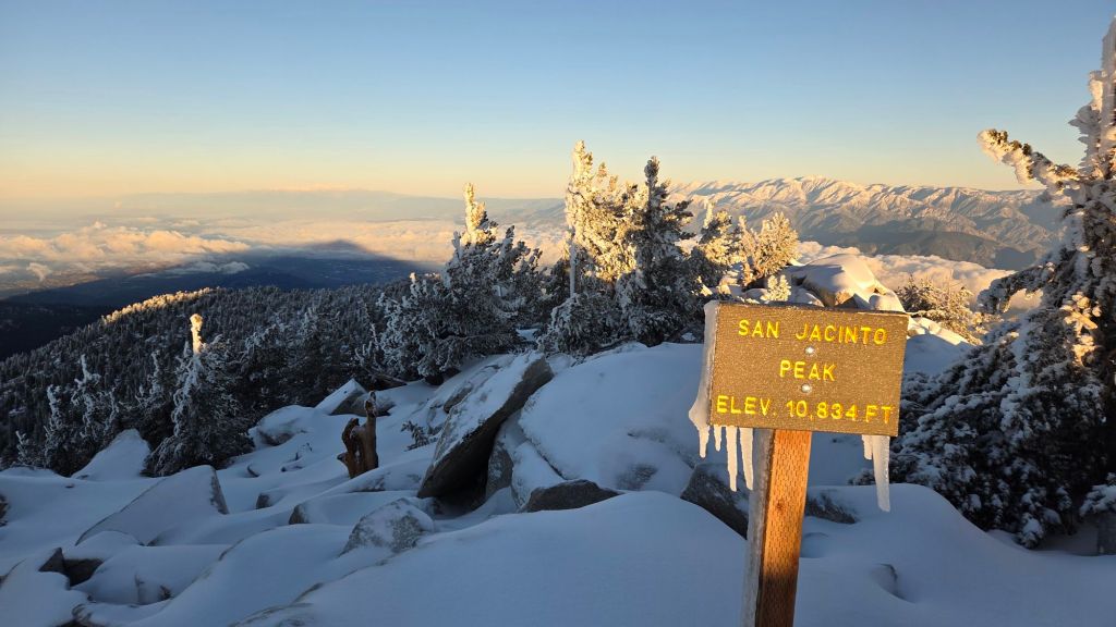
Despite reports of dramatic weather only a short distance to our west, the latest storm greatly underperformed forecasts in the San Jacinto mountains. Across three different days of precipitation, total snow accumulation at San Jacinto Peak was 7.5 inches, with 2.01 inches of rain in Idyllwild (at 5550 ft).
Other than at the end of the storm system on 26th, the bulk of the storm was very mild, and rather than adding snow, rainfall as high as 10,000 ft actually contributed to removing much of the already rather limited snow that remained from November storms. When the freeze level finally dropped, even snowfall on 26th was generally less than 0.5 inch fell below 8500ft, with only an inch to 9900 ft, so impacts on the trails have been very limited.
I recorded a short video discussion from San Jacinto Peak on the morning of Saturday 27th December, giving a feel for the snow conditions underfoot at the highest elevations (linked here). I maintained day-by-day postings on the progress of the multiday storm system available here.
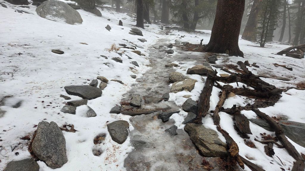
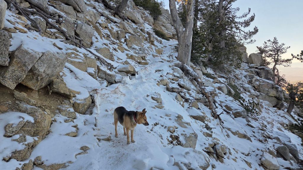
Details are given below under Trail Conditions, but carrying spikes remains advisable everywhere above about 9000 ft, and they can be useful down to 8000 ft in places. Sections of ice and icy snow that remained from November are now largely obscured under thin fresh snow cover, making them especially treacherous. This is especially true on the Peak Trail between 9700-10,100 ft, and on upper Deer Springs Trail (9000-10,500 ft). Spikes tend to be especially helpful for descending, even when they do not seem necessary for ascending.
Snow depths are not currently suitable for snowshoes, except perhaps for off-trail travel around the highest peaks (>10,000 ft), but even then only for the next couple of days as melting is expected to be steady with rising temperatures this week.
Snow depths measured at various locations on the trail system are given towards the end of this posting. Note however that snow depth itself is rarely indicative of the difficulty (or ease) of hiking a particular track or trail. For example a firm, well-compacted track across snow feet deep is often much easier hiking than traversing across just a few inches depth of angled virgin icy snow.
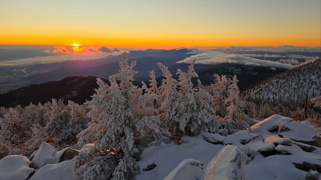
High country temperatures are forecast to remain near or above seasonal for the first ten days of January 2026. Nevertheless, hikers should be prepared for temperatures near or below freezing in the high country (>9800 ft elevation) and at times well below freezing when considering wind chill effects. See the Weather section below for my recent observations from San Jacinto Peak.
The conditions forecast for 31st December-4th January are similar to those on 15th November which resulted in multiple significant hypothermia cases in the San Jacinto high country, and with which I was heavily involved as I alluded in a prior report linked here. Hikers – most notably those from the Tramway where such conditions are less anticipated – may be ascending through rain, before encountering snowfall, stronger winds, and frigid windchills at the highest elevations. Being fully prepared for the challenging combination of both winter conditions and wet weather will be critical (at a minimum, having fully wind- and waterproof clothing, plus multiple dry layers, hats, and gloves stored in a truly waterproof pack system, is very strongly advised). A clear recognition of when turning around is the safest option in such conditions is also invaluable.
Daily survey hikes by the Trail Report year-round in the San Jacinto mountains include multiple routes to the highest peaks including San Jacinto Peak typically at least twice per week (but almost daily during winter storm weather), Tahquitz Peak and area at least once per week, plus a wide variety of other trails on intervening days.
WEATHER
Temperatures rise steadily in the last few days of December, with widespread melting of the very thin snow expected. They will remain somewhat above seasonal in the first week of January, especially at upper elevations, even as a new storm system arrives.
The first five days of January 2026 are forecast to be very unsettled, especially at mid elevations. About two inches of rain are expected at Idyllwild elevation (5000-6000 ft) between the afternoon of Wednesday 31st December and Monday 5th January, heaviest on 31st December and 1st January. The system is expected to be even warmer than that of 23rd-24th December, with freeze levels consistently near or even above 10,000 ft. Snowfall around the highest peaks is tentatively forecast to be several inches spread across the five days, mostly falling on 31st and 1st, with little more than a dusting expected down to 8000 ft, and only roughly 1-3 inches in between, following significant rainfall to 10,500 ft or higher.
At San Jacinto Peak (10,811ft/3295m) on Saturday 27th December 2025 at 0730 the air temperature was 15.2°F (-9°C), with a windchill temperature of -7.4°F (-22°C), 100% relative humidity, and a bitter NW wind sustained at 20 mph gusting to 28.2 mph.
At the Peak on Friday 26th November 2025 at 1330 the air temperature was 28.4°F (-2°C), with a windchill temperature of 13.4°F (-10°C), 98% relative humidity, and a surprisingly gentle SW wind sustained at 5 mph gusting to 6.5 mph.
At the Peak on Thursday 25th December 2025 at 0645 the air temperature was 20.6°F (-6°C), with a windchill temperature of -0.2°F (-18°C), 98% relative humidity, and a sharp due West wind sustained at 15 mph gusting to 27.0 mph.
At the Peak on Wednesday 24th November 2025 at 1045 the air temperature was 32.3°F (0°C), with a windchill temperature of 15.6°F (-9°C), 96% relative humidity, and a harsh SSW wind sustained at 20 mph gusting to 28.9 mph.
TRAIL CONDITIONS
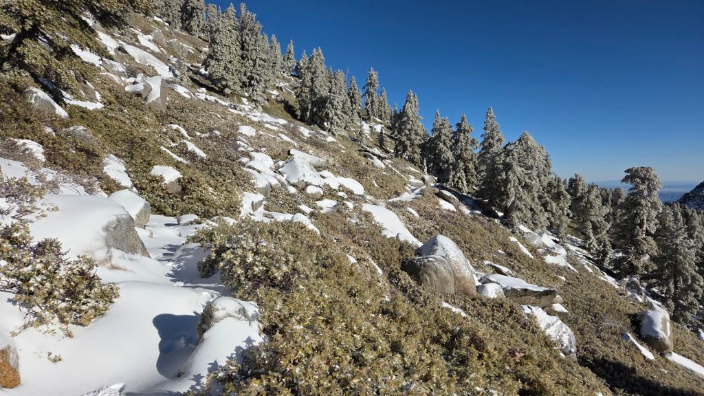
Trails below about 9,900 ft (east side) or 9000 ft (west side) have such a thin covering of snow that they are functionally snow-free, or will largely clear of snow within the next day or two. With sunny days forecast on 28th-31st December in the high country, melting will be rapid, especially on sun-exposed slopes.
Spikes can be useful in places above about 8000 ft, but especially above 9000 ft, depending upon personal preference and comfort level hiking on icy snow. Snow on established trails from storms in November has become densely compacted by hiker traffic, has undergone many freeze-thaw cycles, and has recently been rained upon. Spikes are especially useful for descending heavily traveled high elevation trails (e.g., Peak and upper Deer Springs trails), and also the north side of Tahquitz Peak, which remained largely unmelted from November storms.
Snow depths are generally unsuitable for snowshoeing everywhere due to limited snow depths and compaction/ice.
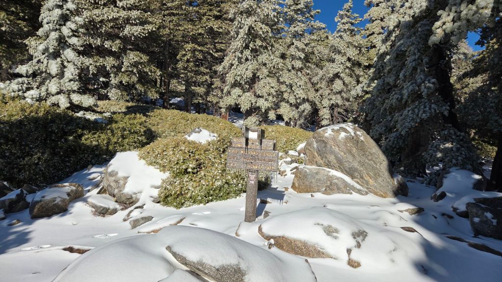
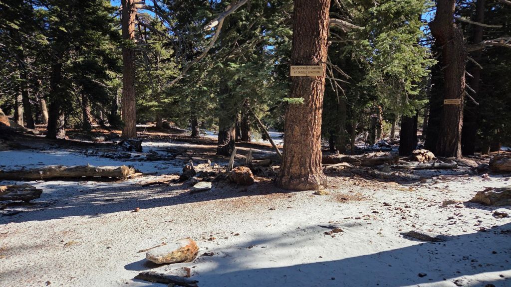
Devil’s Slide Trail is clear of snow, but is very icy in places close to Saddle Junction in the mornings.
The section of South Ridge Trail from Chinquapin Flat to Tahquitz Peak [updated 29th December] currently has a well-traveled, uneven track to follow through increasingly patchy angled icy snow. A very thin covering of fresh snow partially obscures the persistent compacted icy snow remaining from November. These icy slopes on the north side of Tahquitz Peak are notoriously treacherous. Currently spikes are recommended; they are not essential for hikers most experienced with icy snow travel, but conversely this route will not feel safe for some hikers.
South Ridge Trail [updated 29th December] is functionally clear of snow, but has a few small but tricky ice patches above 8500 ft. There is a patchy dusting of 0.25 inch of snow admixed with ice around Tahquitz Peak. Most hikers may find spikes useful
As of Saturday 27th, there was a lightly-traveled track to follow through very shallow and rapidly melting snow on the Strawberry Trail (PCT Miles 180.8-183).
There are well-traveled and compacted tracks on Round Valley Trail through Long and Round valleys to Wellman Divide.
The PCT north from Saddle Junction, continuing onto the Wellman Trail, has a well-traveled track through very light snow cover to Wellman Divide [updated Saturday 27th]. Melting has been rapid on the most sun-exposed section immediately north of Saddle Junction (“Angel’s Glide”) with some lengthy snow-free sections already appearing.
The Peak Trail has a well-traveled track through generally thin continuous snow cover that accurately follows the trail route to the Summit Junction with Deer Springs Trail, and then onward up to San Jacinto Peak.
Upper Deer Springs Trail does not have a track to follow through continuous snow above Little Round Valley as of Saturday 27th. The existing tracks will have been completely obscured by fresh snow, which although shallow, was heavily drifted by strong accompanying winds. Spikes are strongly recommended for this route.
Fuller Ridge Trail [updated Saturday 27th] has a lightly traveled but accurate track to follow through very thin snow cover along its entire length (PCT Miles 185.5-190.5).
SNOW DEPTHS
Snow depths measured on 27th December 2025 are as follows. Current total depth is the first number given, followed (in parentheses) by details of the snowfall in the storm of 23rd-26th December. Altitudes and PCT mileages are approximate.
San Jacinto Peak (10811 ft): 10 inches, drifted deeper in places, notably on East Ridge (0.5 inch added 23rd, 3.5 inches on 24th, 3.5 inches on 26th December)
Wellman Divide (9700 ft): 1 inch (1 inch on 26th December)
Annie’s Junction/PCT Mile 180.8 (9020 ft): 1 inch (1 inches on 26th December)
Long Valley (8500 ft): 1 inch (on 26th December)
Saddle Junction/approx. PCT Mile 179 (8070 ft): <0.25 inch (on 26th December)
Devil’s Slide Trail at Humber Park (6500 ft): 0 inch
Idyllwild (at 5550 ft): 0 inch snow, 1.99 inches rain 23rd-26th December.
The San Jacinto Trail Report celebrates ten years of operation in 2026. It is read by over 30,000 people each year, and will pass one million views in 2026. The Report has helped thousands of hikers, and saved multiple lives, both directly and indirectly. Since the Report became established online, snow/ice rescues in the San Jacinto Mountains have dropped 82%, also saving Riverside County tens, if not hundreds, of thousands of dollars. While all time is volunteered, the Report uses small private donations to help cover operating costs. Donations keep the Report available to all, free from advertising or paywalls, and independent from agencies. If you have found this Report useful, please consider using this link to the Donate page. Thank you very much for your support.

Hi Jon,
I’m in the process of closing my PayPal account through which my monthly support payments to you are processed. Do you have another/better option I can use for that purpose?
Mary
LikeLike