A special thank you to Steve Holldber, owner of Idyllwild Heating and Cooling, for hosting our successful fundraising sale on Saturday 28th May. Many thanks to Anne for tasty treats (visitors commented that they had never seen “free” baked goods and coffee at a yard sale before!), to Florian for publicizing the event on social media, and to the many neighbors and friends, new and old, who came by to say hello and support us.
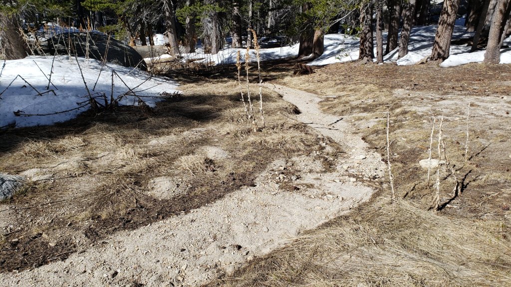
The trail system has been clear of snow for a few weeks and spikes have not been required on the trails since April. Current conditions for individual trails are discussed in detail below where known.
In addition to ascending San Jacinto Peak by different routes on average every three days, we have surveyed large segments of the PCT, its side trails, and a few Forest roads. Trails surveyed in recent days have included Deer Springs, Fuller Ridge, Seven Pines, Marion Mountain, Spitler Peak, and South Ridge, among others.
Due to the exceptionally dry state of the mountain already, there is a brief summary of water conditions where known at the foot of this Report. A short video report (available here) was issued on 10th May giving a visual overview of water conditions in the high country. Air quality and visibility down in the lowlands, especially the Coachella Valley, has been poor all year, likely due to the lack of rainfall combined with windier than average conditions.
National Weather Service San Diego issued this very informative video on 29th May. Some of the data presented are remarkable, if generally very discouraging.
Full fire restrictions were introduced on Thursday 26th May on Forest Service lands, as described in detail here. Campfires on all USFS lands in the San Jacinto mountains (including in fire rings at campgrounds and yellow post sites) are prohibited for the remainder of the year.
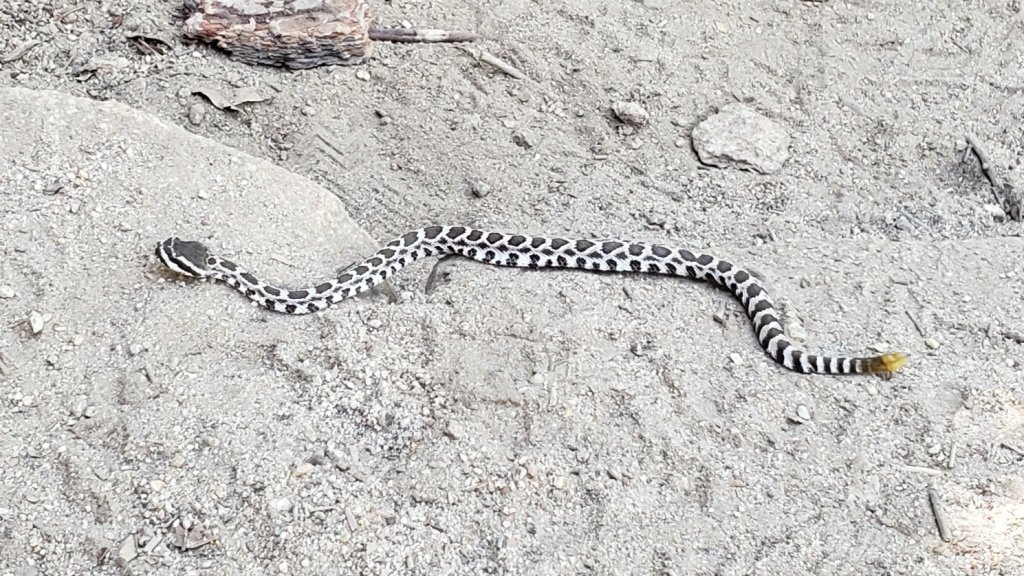
Be rattlesnake aware. Southern Pacific Rattlesnakes (Crotalus helleri) have already been seen on the trail system up to at least 8800 ft elevation (near Tahquitz Peak). As usual, the lower two-thirds of Devil’s Slide Trail seems to be a particular hotspot (e.g., see photos in previous Report).
Black Mountain Road (4S01) reopened on 11th May. South Ridge Road was partially graded in mid April, smoothing the worst sections. Santa Rosa Road (7S02) reopened on 7th April. Dark Canyon Road (5S02) remains in “winter closure”.
Forest Service seasonal campgrounds reopened on Thursday 26th May (Boulder Basin, Marion Mountain, Fern Basin). Note the full fire restrictions described above. The State Park Stone Creek Campground reopened for the season on 6th May.

WEATHER
Following a couple of pleasantly cool days this weekend, temperatures are generally forecast to be above, or well above, seasonal for 1st-7th June, coolest next weekend (3rd-5th June). Overnight low temperatures in particular may average 5-15°F above seasonal at mid elevations. Preliminary forecasts suggest temperatures will be far above seasonal, more reminiscent of August than early June, about starting 8th June. There is no precipitation in the forecasts.
Short-, medium-, and long-term weather projections are summarized in the latest NWS San Diego video (available here), along with very informative data regarding the past couple of years of weather and fire seasons.
At San Jacinto Peak (10,810ft/3295m) on Monday 30th May 2022 at 0710 the air temperature was 39.5°F (4°C), with a windchill temperature of 27.3°F (-3°C), 18% relative humidity, and a brisk WNW wind sustained at 12 mph gusting to 20.5 mph.
At the Peak on Friday 27th May 2022 at 0740 the air temperature was 51.5°F (11°C), with a windchill temperature of 44.3°F (7°C), 23% relative humidity, and a gentle SW wind sustained at 6 mph gusting to 9.9 mph.
TRAIL CONDITIONS
The trail system, including the entire PCT throughout the San Jacinto mountains, has been clear of snow for several weeks.
Due to greatly reduced maintenance work by the agencies and PCTA during the coronavirus pandemic, many trails have accumulated treefall hazards since late 2019, passable with care by hikers but not for stock. Although reported promptly, most hazards were not removed in 2021. With storms this season being accompanied by strong winds and heavy ice loads, hikers should expect to encounter many new and additional hazards, especially in vulnerable burn areas (e.g., Willow Creek Trail, PCT Miles 170-177).
Although some treefall hazards from Red Tahquitz to Antsell Rock (PCT Miles 172.5-175) were cleared in June 2021 prior to the rockslide removal work, the situation has badly deteriorated since. In my most recent survey I counted at least 72 treefall hazards between PCT Miles 170-175. At least a third of these are major hazards that require scrambling over or around.
A significant new treefall hazard that fell across Devil’s Slide Trail over Memorial Day weekend about two miles up from Humber Park was immediately reported to the Forest Service.
The trail route on the East Ridge of San Jacinto Peak is now functionally clear of snow.
Marion Mountain Trail has one huge new treefall hazard across the trail exactly at the State Park/Forest Service boundary.
Deer Springs Trail is now clear of snow. Three new trees came down in late 2021 on the PCT/Deer Springs Trail just south of its junction with Marion Mountain Trail, but they are readily passable for hikers (but not for stock).
The middle section of South Ridge Trail (between May Valley Road and the top of South Ridge Road) has several trees down which are significant obstructions.
Willow Creek Trail has more than 40 downed trees between Skunk Cabbage Junction and Hidden Divide, 30 of these on the Forest Service section.
Spitler Peak Trail is currently in its most hiker-friendly condition since the 2013 Mountain Fire. Forty downed trees, most from an ice storm in late December 2021, plus dozens of additional trunks and branches in the trail, were removed by the Trail Report from this trail in early 2022.
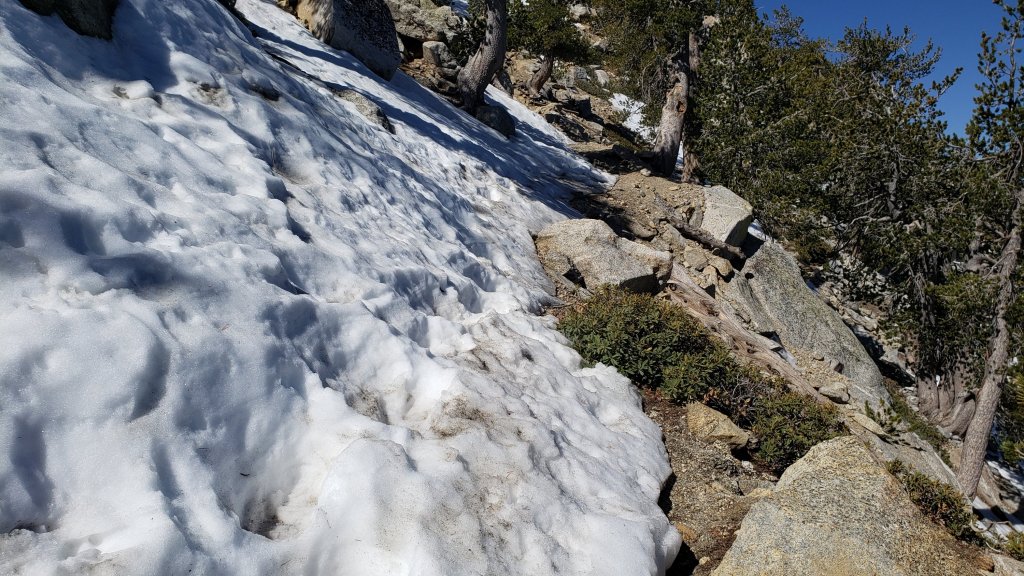
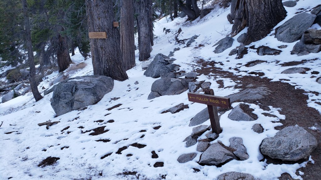
Fuller Ridge Trail has 14 treefall hazards (May 2022 survey) obstructing the trail, but all are readily passable by agile hikers. Eleven of these are in the 1.5 mile section closest to Fuller Ridge Campground (approx PCT Miles 189-190.5).
The Caramba Trail from near Reeds Meadow through Laws Camp and on to Caramba, and the Cedar Trail from Willow Creek Trail to Laws, are optimistically described by the Forest Service as “not maintained”. In reality both trails no longer exist and are so heavily overgrown I advise hikers do not attempt to follow them. An informal use trail to Laws is much more direct and avoids all of the very challenging bushwhacking of the unmaintained trails (some local hikers dubbed it the “King Trail” when I established the route in 2019). It leaves the Willow Creek Trail exactly 1.0 mile from Saddle Junction (0.46 mile from the Skunk Cabbage turning), descending largely on established deer trails for 1.2 miles, meeting Willow Creek just upstream from the old Laws Camp. From Laws east to Caramba the route of the original Caramba Trail has been well-cairned by myself and others and can largely be followed with very careful route-finding. My February 2022 survey counted 97 trees down on this 2.1 miles of trail. It is especially obscure 0.1-0.3 mile east of the Willow Creek crossing, becoming clearer near Caramba. Cautious navigation is advised throughout the area.
Seven Pines Trail has had very limited hiker traffic since November 2018, largely because Dark Canyon Road was closed from February 2019 to early October 2021, and again since December 2021. The Trail Report has “adopted” Seven Pines Trail as a priority for maintenance work as the trail has had a disproportionate number of lost hiker rescues in recent years. Between November 2021 and May 2022, 61 downed trees have been removed and almost the entire trail has been thoroughly trimmed and cleared. Despite this very considerable effort, Seven Pines remains a genuine wilderness trail and is nothing like the relatively wide, bare routes of, for example, Devil’s Slide or Marion Mountain trails. Cautious navigation remains required for those who do not have substantial experience of hiking this trail.

WATER CONDITIONS
On Monday 23rd May, the flow rate at Wellman’s Cienega had dropped by a remarkable 50% since the previous week, although it is largely unchanged in the week since. While I expect sufficient water to continue to trickle here for another couple of months at least, this gives an idea of the poor state of water resources on the mountain this year, and the rate at which they can change.
This is not a comprehensive review of the status of all mountain water sources. In the high country there are still patches of snow available for melting, and several less well-known minor springs are flowing. Sadly however – given that it’s still only May – I have already been getting many questions regarding water availability on the mountain. I have checked all of these water sources personally in recent days.
This video gives an overview of major water sources in the high country as of 10th May.
Water sources currently flowing include: Wellman’s Cienega (flowing weakly on 30th May), Round Valley faucet (flowing well on 30th May), North Fork of the San Jacinto River (both where it crosses Deer Springs Trail and on Fuller Ridge Trail at PCT Mile 186), Deer Springs (PCT Mile 185.4, very weak flow), Willow Creek crossing on Willow Creek Trail, Tahquitz Creek (PCT Mile 177 and also Little Tahquitz Meadow), Skunk Cabbage Meadow creek, Strawberry Cienega (very weak), Apache Spring (weak), Cedar Spring, Live Oak Spring, Antsell Rock Creek (at the Spitler Peak trailhead), Spitler Creek (on Spitler Peak Trail, very weak flow).
Water sources known to be dry: Tahquitz Valley pipe, Penrod Canyon (approx. PCT Mile 154), Little Round Valley creek (isolated pools only and almost dry on 27th May).
Thank you for taking the time to read this. While all time and labor is volunteered, the San Jacinto Trail Report depends on your small private donations to cover our costs. Your contribution keeps the Report available to all, free from advertising or paywalls, and independent from agencies. If you have found this Report useful, please use this link to the Donate page. Zelle, Venmo, and PayPal are all options. Thank you so much for your support.