We have hiked to San Jacinto Peak six of the last nine days, including today, affording a check of snow and trail conditions on most major routes around the mountain. South Ridge and the Tahquitz Peak area were hiked on 25th, and the PCT on the Desert Divide on 26th.
Temperatures far above historic averages – it was an astonishing 47°F (9°C) in Idyllwild at dawn yesterday – have meant that compacted icy snow below 8000′ (e.g., Devil’s Slide Trail) is slick in places. Unseasonably warm temperatures make the snow soft by mid morning at all elevations, the only positive being that postholing renders microspikes of limited use. The light snow that fell on 22nd February was almost completely gone within two days. Intense melting this week rapidly reduced snow depths to their lowest of the winter at all elevations.
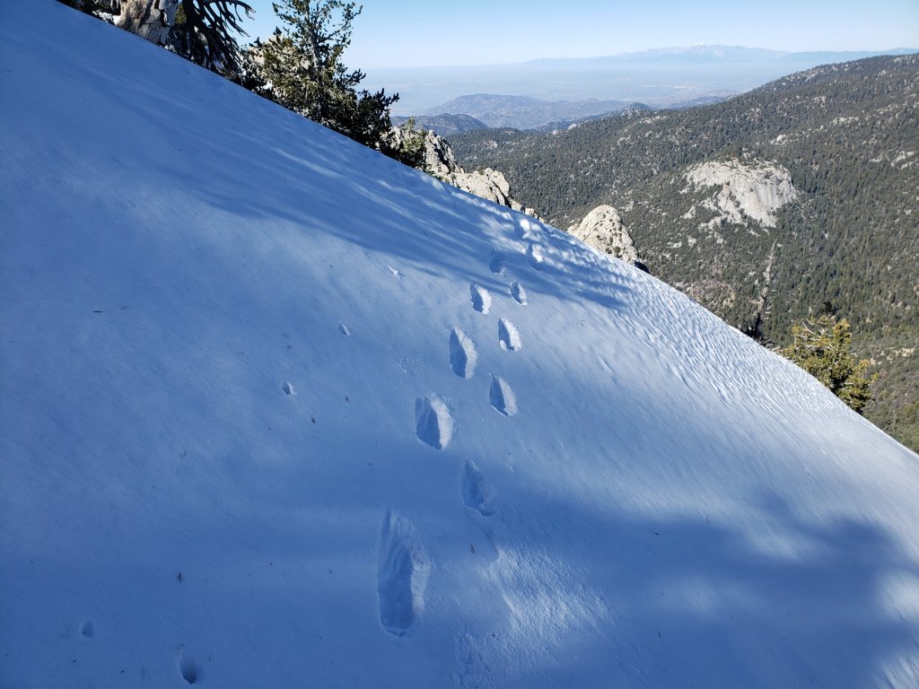
Snow depths measured today are listed at the foot of this posting. Very strong Santa Ana winds in the high country yesterday caused spindrift to obscure parts of even heavily traveled trails. Cautious navigation is recommended everywhere.
Microspikes remain useful in some areas (see below) for hikers who are less comfortable on snow and ice, on compacted well-traveled trails, in particular for descending. Hikers with suitable footwear (plus hiking poles as preferred) will largely not need any additional traction, depending on temperature as discussed above. Shallow snow depths largely preclude any use for snowshoes now, even in areas off-trail above about 9500′ elevation.
Despite warm conditions on most days, hikers should be prepared for temperatures near or below freezing in the high country, and potentially well below freezing when considering windchill effects, especially on 1st-2nd March (see below for weather recorded recently at San Jacinto Peak).
Note that the USFS gate at Humber Park reopened on 5th February.
WEATHER Above average temperatures this week will continue until Friday 29th. A minor storm system is forecast to impact the San Jacinto mountains over the weekend (1st-2nd March) with the possibility of light precipitation including a couple of inches of snow in the high country. However temperatures will recover to well-above-seasonal immediately after the storm, so impacts to the trails will likely be limited to a day or two at most.
At San Jacinto Peak (10,810ft/3295m) today, Thursday 27th February 2020, at 0840 the air temperature was 32.4°F (0°C), with a windchill of 18.7°F (-8°C), 30% relative humidity, and a persistent NE wind sustained at 17 mph gusting to 21.0 mph.
At the Peak on Monday 24th February 2020, at 0945 the air temperature was 31.6°F (0°C), with a windchill of 21.9°F (-6°C), 54% relative humidity, and a light due North wind sustained at 4 mph gusting to 8.6 mph.
PACIFIC CREST TRAIL
The Pacific Crest Trail remains open at the rockslide just north of Antsell Rock (Mile 172.5). USFS has told the Trail Report that there are currently no plans to close this section of the PCT during spring 2020. The video report (available here) can be useful for deciding whether to try to hike around the rockslide or take an alternate route.
Microspikes may be useful on some of the PCT for patchy snow travel between approximately Miles 168 and 191, depending upon your comfort level on icy snow. Most thru hikers using poles will probably find spikes unnecessary however. See below for conditions on some specifc sections of the PCT and the many side trails.
Current snow cover on the PCT is very limited between Miles 165 and about 175 (Red Tahquitz), mainly confined to certain north-facing slopes e.g., Spitler Peak (Mile 168) and Apache Peak (Mile 169.5). Snow is then largely continuous between Miles 175-179 (to near Saddle Junction). The Trail is then largely clear to about Mile 184, except for a stubborn section of 0.5 mile approaching Annie’s Junction (Mile 180.8) which is always among the last areas to clear every spring. Most of Miles 184-191 is snow-covered, although exposed sections of Fuller Ridge (e.g., Miles 186.5-188.5) are clearing rapidly. North from about Mile 191 to Snow Creek is clear.
PCT hikers are reminded that overnight stays are not permitted at or near San Jacinto Peak, including in the historic shelter. Mt. San Jacinto State Park regulations permit overnight stays only in established campgrounds. Options for thru-hikers are Strawberry Junction and Little Round Valley.
Currently I am not updating the water situation in the San Jacinto mountains as the main springs and creeks are all flowing adequately. This may change soon as extremely low precipitation so far in 2020 is already causing flow rates far below average.
TRAIL CONDITIONS
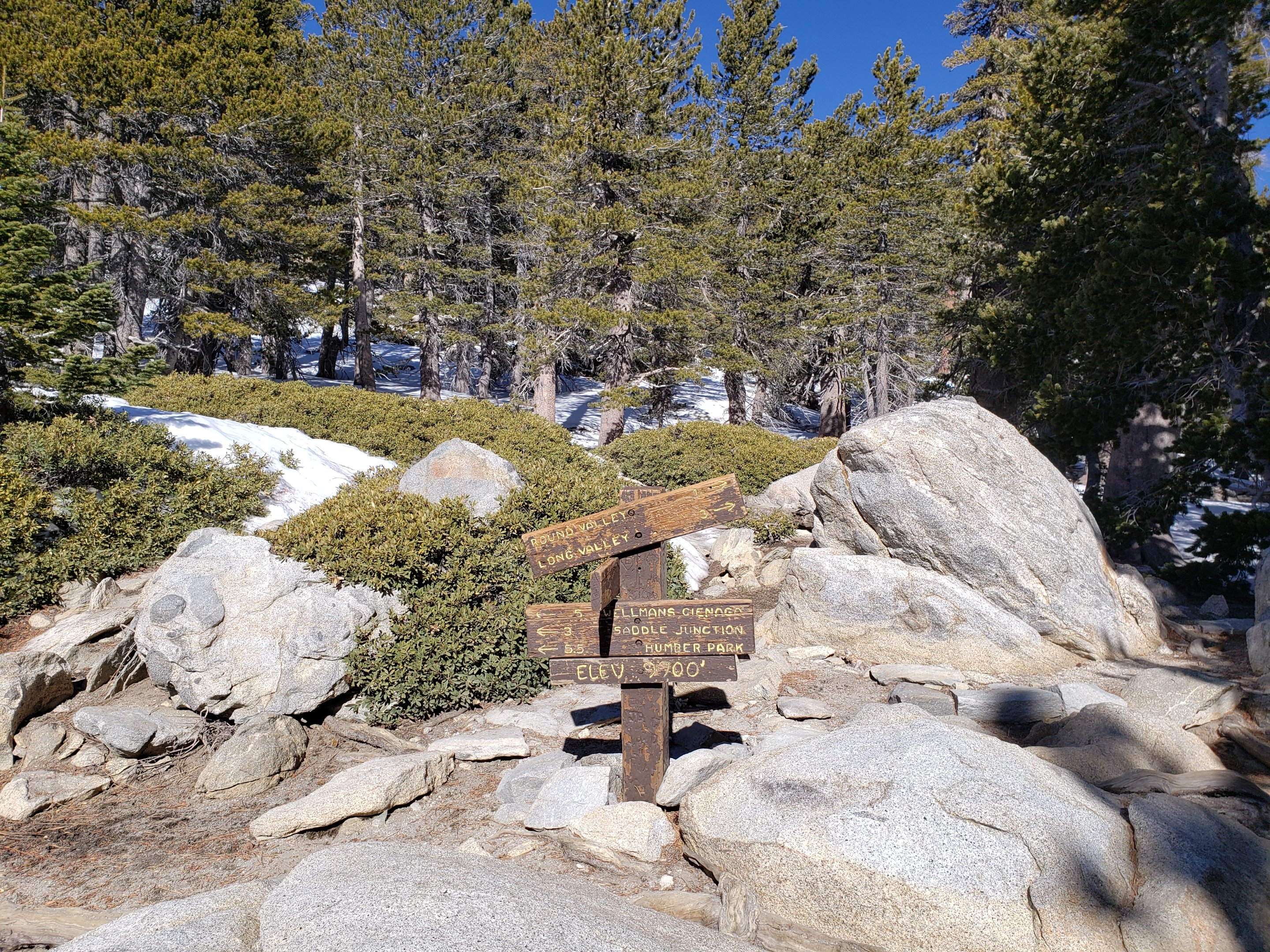
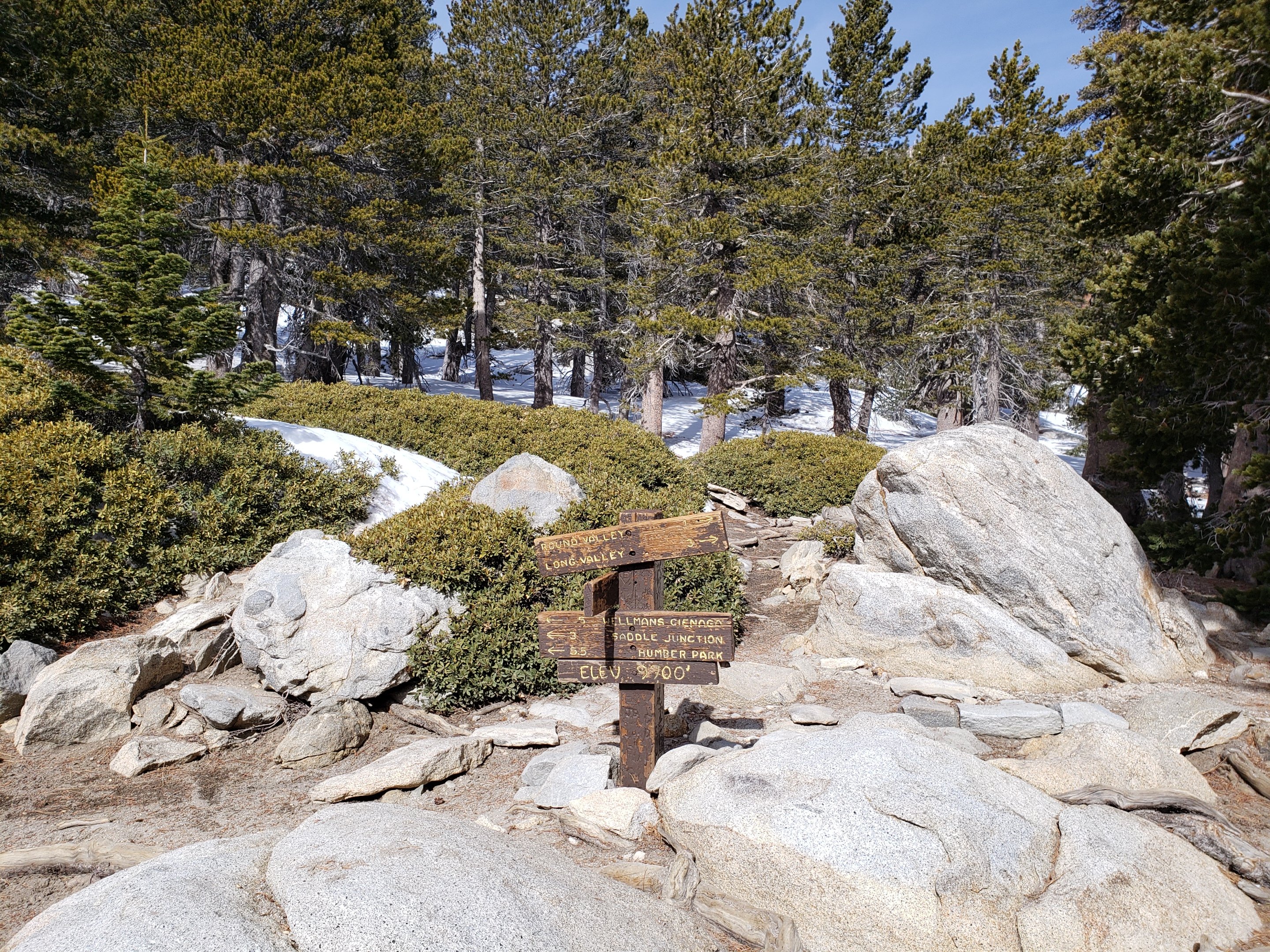
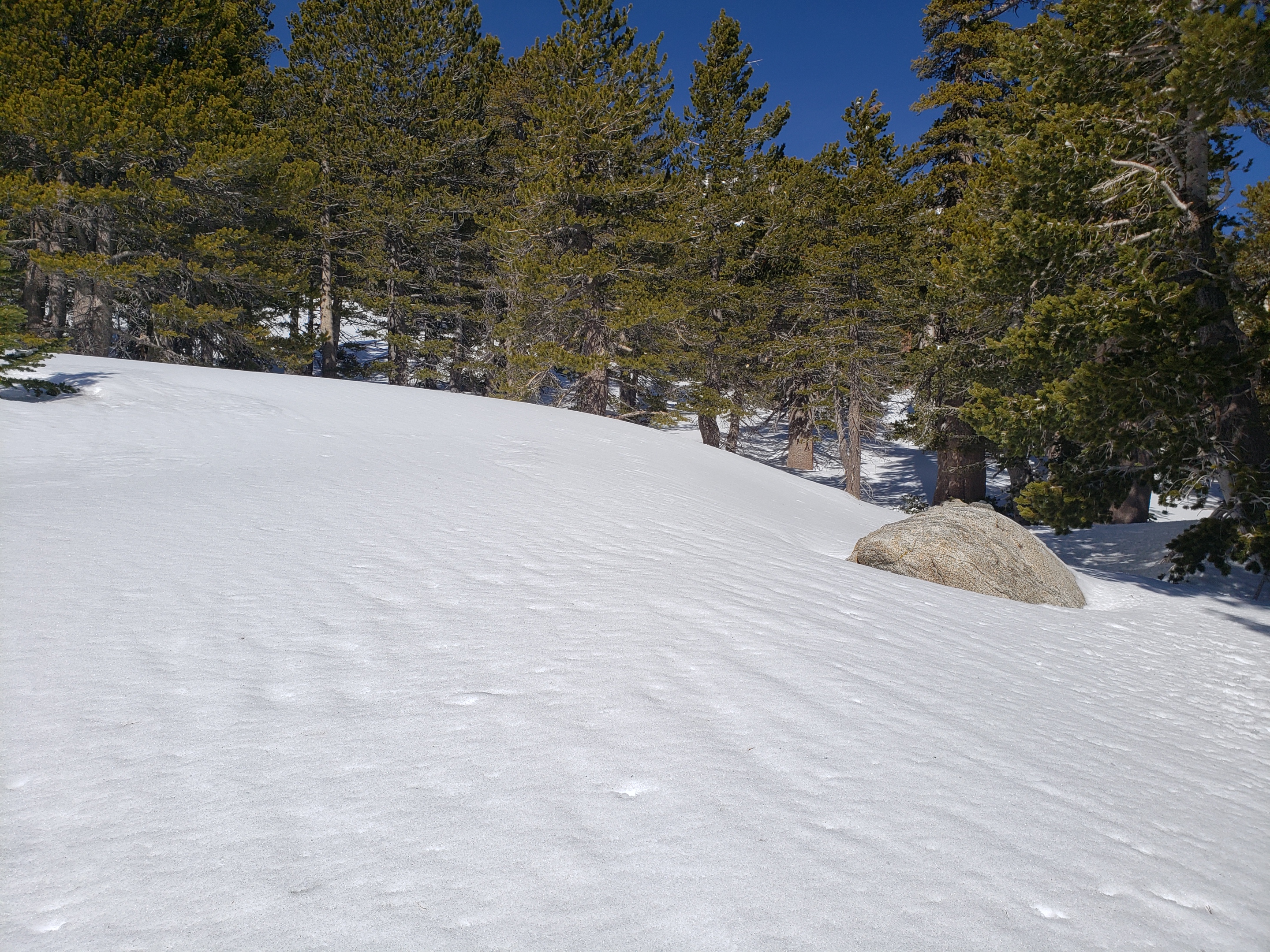
All trails above about 9000′ remain largely snow-covered, with depth depending on elevation (see below) but sun exposed slopes are clearing rapidly (e.g., around Wellman’s Cienega). Some sections of trails above about 7700′ have limited icy snow cover.
Deer Springs Trail is largely clear of snow to Strawberry Junction with just a few patches close to the junction (microspikes not required). The PCT section from here to Fuller Ridge is largely clear of snow to about 8700′ elevation (just south of the Marion Mountain Trail junction), then there is extensive snow cover thereafter, with a well-traveled, consolidated track to follow. A track above 9000′ to Little Round Valley is consolidated, but be advised that it does not follow the established trail in places. Above Little Round Valley there is a direct (i.e. steep) track to follow to San Jacinto Peak. Microspikes can be useful for descending.
Fuller Ridge Trail (PCT Miles 185.5-190.5) has been clearing quickly, especially on sun-exposed slopes, mainly Miles 186.5-188.5. There are tracks to follow through the snow.
Marion Mountain Trail has been traveled and has a consolidated track to follow. Microspikes are useful, but not required, for descending the uppermost 0.5 mile. Note the road to Marion Mountain trailhead has been open all winter and is clear of snow.
Round Valley Trail from the Tram through to Wellman Divide has been well-traveled and a good track through the snow is easy to follow, onward to San Jacinto Peak.
Devil’s Slide Trail has limited icy snow cover in patches, mainly in the 0.5 mile nearest to Saddle Junction. Due to snow and ice compaction caused by hiker traffic, microspikes are helpful in some areas above 7700′, especially for descending, but are not required.
Ernie Maxwell Trail is virtually clear of snow, with just a few tiny patches, mainly near Humber Park.
The notoriously treacherous Tahquitz Peak trail from Chinquapin Flat/PCT Mile 178 is clearing surprisingly quickly, the snow drifts are softening (on warm days), and crampons are no longer required. There is a good set of tracks to follow. Microspikes are strongly recommended, in conjunction with an ice axe (if you know how to use it). In the morning, overnight wind conditions and the freeze-thaw cycle can partially obscure the existing steps through the angled icy snow for 0.1-0.2 mile.
South Ridge Trail is almost clear to Old Lookout Flat at 7600′, but with some remnant short, thin snow patches. Snow cover is fairly patchy (<20%) higher up, and the small patches are easily hiked. Microspikes are not required. South Ridge Road is clear of ice.
Seven Pines Trail has had no hiker traffic so far this winter, with no tracks or trail to follow. Indeed this trail has only been hiked a handful of times since November 2018. Extremely cautious navigation is recommended for those who are not very familiar with hiking this trail. The Forest Service closure of Dark Canyon Road continues, and there is no vehicular access to Seven Pines trailhead.
SNOW DEPTHS measured on 27th February 2020. Note that average depth is given, drifts can be much deeper in places. Altitudes are approximate.
San Jacinto Peak (10810′): 11″ (was 47″ on 27th December 2019)
Wellman Divide (9700′): 1″ (was 27″ on 27th December 2019)
Annie’s Junction (9070′): 7″ (was 25″ on 27th December 2019)
Long Valley (8600′): 1″Strawberry Junction (8100′): 0″
Saddle Junction (8070′): 1″ (was 19″ on 27th December 2019)
Devil’s Slide trailhead at Humber Park (6550′): 0″ (was 11″ on 27th December 2019)
 San Jacinto Trail Report: available for everyone, funded by readers. While thousands of hours of labor are volunteered, the Report depends on small private donations to cover its direct costs (e.g., gear, gas, web space). With a busy PCT season underway, every contribution is invaluable, and your donation helps subsidise the thousands of thru-hikers who also use the Report. If you have found this Report useful, please consider visiting the Donate page. Thank you.