Record heat for March – essentially midsummer weather – has resulted in dramatic snowmelt in the past two weeks. Consequently I have been updating trail conditions daily to the greatest extent possible. I have never seen snow clear as rapidly in these mountains as in the past fortnight, in any month, even May or June, let alone in (initially) mid March. The March air temperature record for San Jacinto Peak has been broken four times, most recently by an almost incomprehensible 15.6 degrees of Fahrenheit compared to the pre-2026 record. Indeed the temperature recorded on 24th March 2026 (61.1°F) exceeded the known Peak record highs for April, May, and June as well. Sadly it is an overused word, but what we are currently witnessing is genuinely unprecedented.
Intense high pressure over the region will result in further remarkable heat until about 31st March, albeit slightly cooler this week than last. Daily and monthly temperature records were widely shattered throughout Southern California (and indeed the American West) throughout 17th-23rd March, with the temperatures for 19th and 20th in particular comparable the seasonal averages for July and August, which was beyond astonishing for mid March.
Obviously melting of what pitifully little snow remains has been dramatic, and the extent of snow remaining on high country trails declines daily. The San Jacinto mountains will be in the unprecedented state of being functionally snow-free by the end of March. There is a possibility for minor precipitation in the first week of April, although forecast volumes will have no significant impact on the worrisome water and fire situations.
Carrying spikes remains a useful option above about 9700 ft for some hikers, but they are generally not required on the trail system at this time. Spikes are no longer required for PCT hikers who remain on the PCT, but they remain useful for thru hikers who use alternates involving San Jacinto Peak, especially those hikers with minimal experience of snow hiking.
Snow depths are no longer given in this posting. This does not mean there is no snow in the high country, simply that snow is both generally localized to the highest elevations, and that it is rarely more than a few inches deep anywhere, especially on the established trails. As discussed elsewhere, melting – which has been exceptionally rapid for more than a week – will continue over the next week, so listing nominal snow depths that change daily serves little purpose.
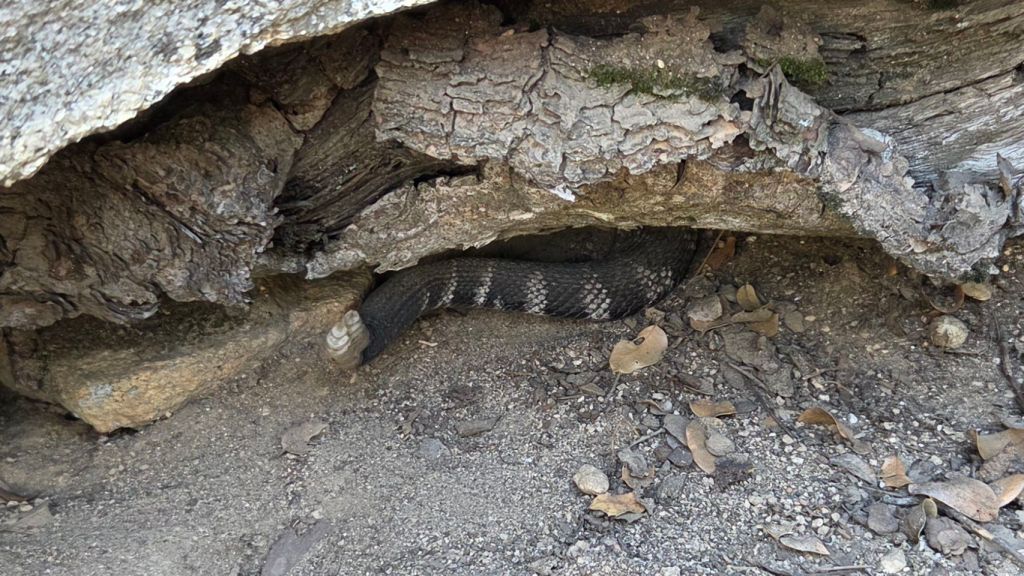
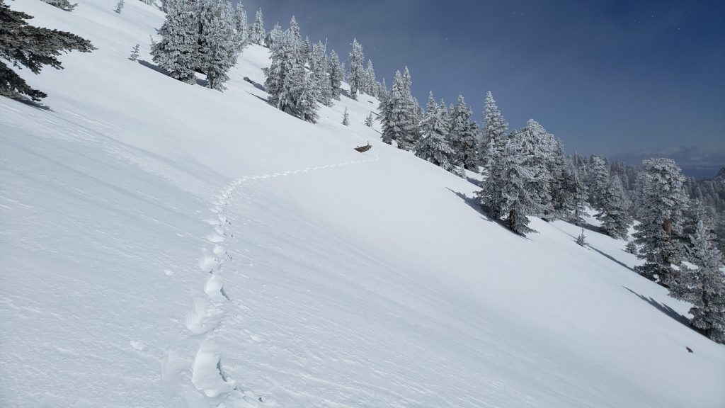
Be rattlesnake aware. It is astounding to have to include this paragraph so early in the year, but there have been reliable sightings at 6000 ft on the Ernie Maxwell Trail starting on 19th March, and on Devil’s Slide Trail at least to 7200 ft since 24th March (photo below). Above about 5000 ft elevation, the venom of Southern Pacific Rattlesnakes (Crotalus [oreganus] helleri) in the San Jacinto mountains is predominantly neurotoxic, almost always fatal for dogs and sometimes for humans (see my detailed article linked here for further information describing our dogs’ survival after a July 2020 neurotoxic bite). Devil’s Slide Trail, lower Deer Springs and lower Marion Mountain trails, Suicide Rock, near Strawberry Cienega, and trails around Tahquitz Peak are frequent higher elevation locations for sightings, but rattlesnakes have been recorded up to 9350 ft (the latter in midsummer).
The gate 1.7 miles up from Highway 243 on Black Mountain Road (4S01) remains closed. Following superficial grading late in 2025 the road is in better condition than last summer, but remains far rougher than in June 2020, the last time it was thoroughly graded.
Daily survey hikes by the Trail Report year-round in the San Jacinto mountains include multiple routes to the highest peaks including San Jacinto Peak typically 2-3 times per week (but almost daily during winter storm weather), Tahquitz Peak and area at least once per week, plus a wide variety of other trails on intervening days.
WEATHER
The past six weeks or so, in common with the past six months, have seen a roller-coaster ride of temperatures and associated weather. Three snow storms in very quick succession impacted the region across four days on 16th-19th February, as described in detail in a prior Report (linked here).
Temperatures rose dramatically immediately after the passage of the last storm system, and were far above seasonal throughout the last week of February, before then cooling closer to seasonal in the first nine days of March. The latter was associated with the brief passage of a minor low pressure system on 6th-8th March, with accompanying strong winds and cold temperatures in the high country.
Temperatures rose yet again starting 11th March, briefly stabilized above seasonal on 12th-15th, then rose even further, to near or even above midsummer averages, on 16th-22nd. A new all-time March record high for San Jacinto Peak was set last week on Friday 13th, but was shattered again on both 18th and 19th (see data below).
The high pressure system persists over Southern California until at least 30th March, consequently with no precipitation in the forecasts before the end of the month. Forecast models remain unclear what may happen when a weak low pressure trough passes through the region around 31st March-7th April, with perhaps only a modest probability of minor precipitation at these latitudes.
NWS/NOAA data confirm that the four month period November-February this winter was the hottest for those four months combined on record for Riverside County (131 years of data). The same period was the second hottest all-time for the entire state of California, only behind November 2014-February 2015.
At San Jacinto Peak (10,810 ft/3295 m) on Tuesday 24th March 2026 at 0900 the air temperature was 61.1°F (16°C), with a “windchill” temperature of 58.5°F (15°C), 31% relative humidity, and a barely discernable SSE breeze sustained at 1 mph gusting to 4.0 mph. The air temperature again broke the all-time record high for the Peak in March, set multiple times in the previous ten days, now by more than 15 degrees Fahrenheit compared to the pre-2026 record.
At San Jacinto Peak (10,810 ft/3295 m) on Thursday 19th March 2026 at 0850 the air temperature was 59.6°F (15°C), with a “windchill” temperature of 57.4°F (14°C), 10% relative humidity, and a very light SSE wind sustained at 2 mph gusting to 4.6 mph.
At the Peak on Wednesday 18th March 2026 at 0900 the air temperature was 54.7°F (12°C), with a “windchill” temperature of 49.1°F (10°C), 16% relative humidity, and a steady ESE wind sustained at 7 mph gusting to 10.1 mph.
At the Peak on Friday 13th March 2026 at 0920 the air temperature was 47.3°F (8°C), with a “windchill” temperature of 40.8°F (5°C), 12% relative humidity, and a light NNW wind sustained at 6 mph gusting to 10.0 mph. This air temperature set a new all-time record high (briefly) for the Peak in March – by two degrees of Fahrenheit – a record that itself has been shattered three times in the next ten days.
TRAIL CONDITIONS
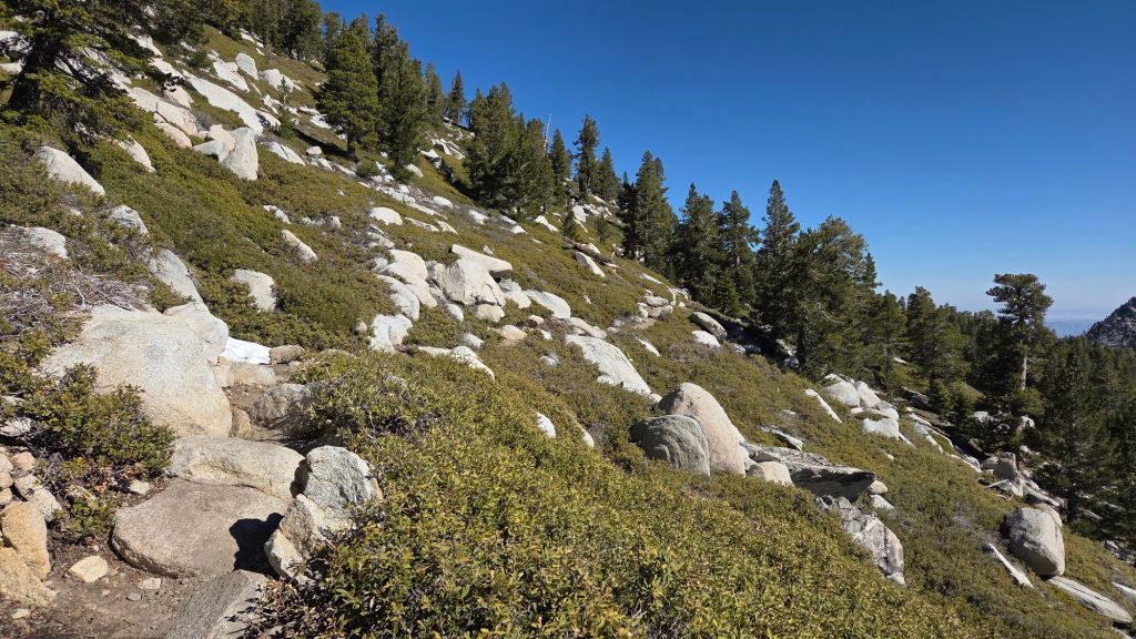
Trails above about 9700 ft remain about 10% snow-covered. Routes below 9000 ft are now largely functionally clear of snow. With temperatures forecast to remain hot (for March) until 30th, snow even at the highest elevations will not refreeze overnight, and melting will continue be fast and widespread, changing trail conditions daily.
Some hikers may find that carrying spikes remains useful above about 9700 ft even as snow softens and melts dramatically, as established trails are nonetheless somewhat consolidated by hiker traffic and weeks of freeze-thaw cycles.
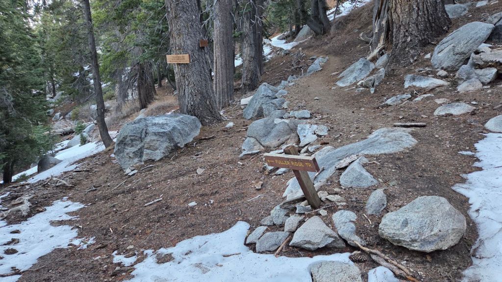
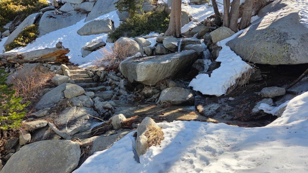
The Pacific Crest Trail is now functionally clear of snow to about Mile 175 (Red Tahquitz). Snow cover is 40% between Miles 175-177. Snow cover is very patchy and averages just 10% between Miles 177 to 178.5, then it is clear to Mile 180.5, but about 20% just south of Annie’s Junction to about Mile 180.8. Miles 181-185 are clear. Snow cover averages 10% from Mile 185 to 185.5, although spikes are not required on the well-traveled snow track. The Fuller Ridge Trail section (Miles 185.5 to 191.5) has cleared of snow extremely rapidly this week and now averages only 10% snow cover. Stubborn sections remain around the crossing of the North Fork of the San Jacinto River (Mile 186, photo below), and on the northerly forested slopes (notably Miles 187.5-187.8 and 188.5-189). North of Mile 189, the trail is functionally clear of snow.
Carrying spikes is no longer required for PCT hikers in the San Jacinto mountains at this time, although some hikers may find that spikes continue to be useful if they (a) take any alternate routes off the PCT to San Jacinto Peak, and/or (b) have very limited experience of hiking on patchy icy snow.
The 0.4 mile section of South Ridge Trail from Chinquapin Flat to Tahquitz Peak [most recently surveyed 27th March] is now functionally clear of icy snow. Spikes are no longer required.
Devil’s Slide Trail is clear of snow.
Wellman Trail [surveyed 24th March] is functionally clear of snow averaging just 10% snow cover, which is confined to the forested 0.3 mile immediately north of Annie’s Junction. Spikes are not required.
The Peak Trail [surveyed 24th March] is largely clear of snow, with only about 10% snow cover remaining, almost entirely confined to the forested section around 10,000 ft elevation. Even there, most hikers will find that spikes are no longer required. Immediately around San Jacinto Peak patchy snow cover persists in drifts, but it is now possible to avoid almost all snow by rock-hopping. Some hikers may find spikes useful.
The East Ridge Trail route [surveyed 24th March] has a barely discernable posthole track through 90% snow cover from near the Miller switchback (10,400 ft) to San Jacinto Peak. Drifted snow here is still up to two feet deep in places, and is locally very soft, even early in the morning.
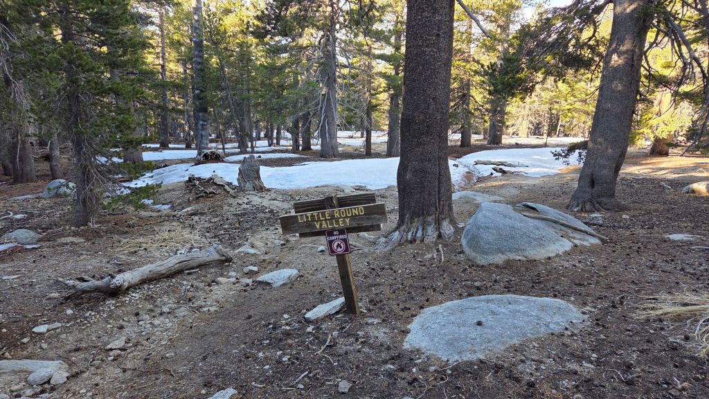
Deer Springs Trail [surveyed seven times in March, most recently on 24th] is now, remarkably, functionally clear to Little Round Valley. The dozen tiny snow patches in the trail above 9000 ft do not pose significant hazards. Little Round Valley is clearing remarkably rapidly, with average snow cover only 10%, a mix of extensive cleared areas interspersed with patchy drifts several inches deep. Above Little Round Valley snow cover also averages only 10%, and the trail route is now almost entirely visible, although some cautious navigation is required where drifts cover switchbacks. Spikes are no longer required on Deer Springs Trail, although some hikers may continue to find them useful for descending parts of the upper trail.
Marion Mountain Trail [surveyed 24th March] is clear of snow.
Seven Pines Trail [surveyed 24th March] is functionally clear of snow, with just 10% cover on the uppermost 0.5 mile of trail. There is a lightly traveled posthole track through the upper snow patches.
South Ridge Trail to Tahquitz Peak [surveyed 27th March] is clear of snow to Tahquitz Peak. Four new blowdowns that came down on this trail in the mid February storms have already been removed by the Trail Report.
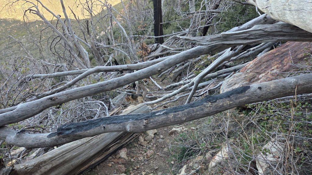
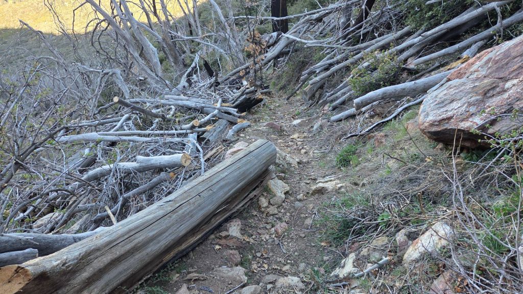
Spitler Peak Trail [surveyed 15th, 23rd, and 26th March] was sadly decimated by more than 60 new blowdowns in strong winds that accompanied the mid February storms. In four days of work since late February, the Trail Report has cut almost all of these, bringing to 235 the number of trees we have removed from this trail in the past seven years (example photos below). Four large burned cedars remain obstructing the trail just above the main creek crossing (between 3.2-3.7 miles up from the trailhead) although most hikers will find they are passable with care.
The San Jacinto Trail Report celebrates ten years of operation in 2026. It is read by over 30,000 people each year, and will pass one million views in 2026. The Report has helped thousands of hikers, and saved multiple lives, both directly and indirectly. Since the Report became established online, snow/ice rescues in the San Jacinto Mountains have dropped 82%, also saving Riverside County tens, if not hundreds, of thousands of dollars. While all time is volunteered, the Report uses small private donations to help cover operating costs. Donations keep the Report available to all, free from advertising or paywalls, and independent from agencies. If you have found this Report useful, please consider using this link to the Donate page. Thank you for your support.