Temperatures were so high in the last eight days of February – with daily and monthly records being set throughout Southern California – that they remained above freezing overnight at even the highest mountain elevations. This resulted in snowmelt at an unprecedented rate, even more striking given that it was in the genuinely winter month of February, with Idyllwild losing 12 inches of snow in four days, sun-exposed locations above 9000 ft losing up to 20-22 inches in a week, and San Jacinto Peak also losing about 15 inches in just seven days.
Thankfully, temperatures cooled to near seasonal from Monday 2nd March, and are forecast to fluctuate either side of seasonal for most of the first two weeks of the month, which should be most noticeable in the high country. This should have two significant effects. First, snowmelt rates will slow markedly, and trail conditions may not change dramatically over the next week or more. Secondly, compacted snow tracks established in the high country will remain firm, at least until late morning, allowing for much easier hiking (with spikes now optimal for traction rather than snowshoes).
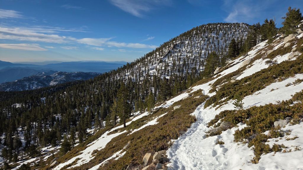
For example, snow was comfortably firm enough for barebooting all the way from Devil’s Slide Trail to San Jacinto Peak early in the morning on Monday 2nd and Thursday 5th, although on 2nd anywhere I stepped off the compacted posthole tracks I promptly sank ankle deep into surrounding snow. Snow remained firm until about 0930 on 2nd, by which time I was well down Deer Springs Trail and snow was so shallow and patchy that even spikes were no longer needed. This weekend will be colder, so hiking conditions should be even easier (with appropriate traction as needed), in stark contrast to the slop and snowshoes of much of last week.
Spikes are recommended for most trails above about 7600 ft for the foreseeable future as established tracks have now become consolidated by hiker traffic and will continue to undergo significant freeze-thaw cycles this week. Snow depths are currently suitable for snowshoeing only off-trail above about 9500 ft, possibly lower as snow softens by late morning on the warmest days and on the most sun-exposed slopes.
Snow depths measured at various locations on the trail system are given towards the end of this posting. Note however that snow depth itself is rarely indicative of the difficulty (or ease) of hiking a particular track or trail. For example a firm, well-compacted track across snow several feet deep may be much easier hiking than traversing across just a few inches depth of angled virgin icy snow.
The USFS gate at Humber Park reopened on 1st March. The gate 1.7 miles up from Highway 243 on Black Mountain Road (4S01) remains closed. Following superficial grading late in 2025 the road is in better condition than last summer, but remains far rougher than in June 2020, the last time it was thoroughly graded. South Ridge Road (5S11) reopened on 3rd March and is clear of snow.
Daily survey hikes by the Trail Report year-round in the San Jacinto mountains include multiple routes to the highest peaks including San Jacinto Peak typically 2-3 times per week (but almost daily during winter storm weather), Tahquitz Peak and area at least once per week, plus a wide variety of other trails on intervening days.
WEATHER
Three snow storms in very quick succession impacted the region across four days on 16th-19th February, with the consequent snowfalls described in detail in a prior Report (linked here). Temperatures rose dramatically starting immediately after the passage of the last storm system, and were far above seasonal throughout the last week of February, as discussed above.
Temperatures are forecast to cool closer to seasonal in the first ten days of March, but with high pressure generally remaining in the region and mild, sunny days, steady snowmelt will continue, albeit at a slower rate than in late February. Forecasts indicate the brief passage of a minor low pressure system on 6th-8th March, with accompanying strong winds and cold temperatures in the high country.
At San Jacinto Peak (10,810 ft/3295 m) on Saturday 7th March 2026 at 0820 the air temperature was 10.6°F (-12°C), with a windchill temperature of -14.8°F (-26°C), 71% relative humidity, and a frigid NNE wind sustained at 16 mph gusting to 30.0 mph. Both the air and windchill temperatures were the lowest recorded at the Peak (so far) in winter 2025/26.
At the Peak on Thursday 5th March 2026 at 0840 the air temperature was 31.9°F (0°C), with a windchill temperature of 17.8°F (-7°C), 16% relative humidity, and a variable NW wind sustained at 7 mph gusting to 16.0 mph.
At the Peak on Monday 2nd March 2026 at 0810 the air temperature was 30.9°F (-1°C), with a windchill temperature of 13.3°F (-10°C), 38% relative humidity, and a stiff due West wind sustained at 16 mph gusting to 29.4 mph.
TRAIL CONDITIONS
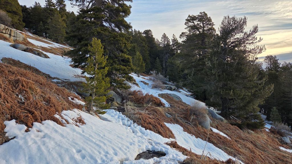
Trails above about 9500 ft are completely snow-covered, and most have significant snow cover above 7600 ft, but routes below 7600 ft are now generally clear of snow (details for specific trails below, where known).
With high country temperatures near (or even below) freezing for most or all of the next two weeks, spikes are recommended for the foreseeable future everywhere above 7600 ft as snow generally firms up, especially overnight and in the mornings, along with localized icing, and as established trails have become increasingly consolidated by hiker traffic and undergo freeze-thaw cycles.
Crampons remain an option above about 9500 ft for the next week at least, especially in the morning when snow remains firm, but they are certainly not required anywhere on trail, and may result in significant postholing during off-trail travel.
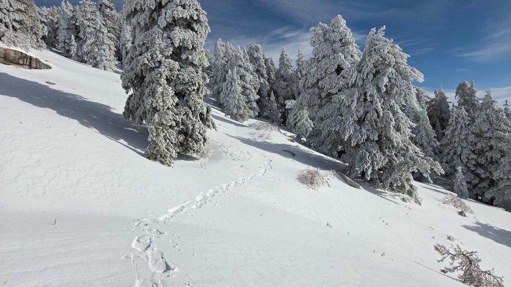
Snowshoes are no longer recommended for travel on the established trail system, as tracks are now generally compacted, icy and uneven. However snowshoes would be invaluable for off-trail travel (e.g., to high peaks other than San Jac) as snow above 9000 ft away from the compacted tracks remains soft, especially after mid morning.
In prior winters I have mentioned the challenges of hard, icy snow underfoot and the value of using spikes especially for descending and traversing. Snow at all elevations will become increasingly firm and icy following multiple freeze-thaw cycles, and I cannot overemphasize the importance of having both appropriate equipment and the right skill set for the terrain. The latter includes interpreting the snow/ice conditions, understanding your physical and mental abilities, and conservative decision making. These concerns may steadily increase over the next couple of weeks with temperatures fluctuating either side of freezing, seasonally stronger insolation, and locally variable snowmelt.
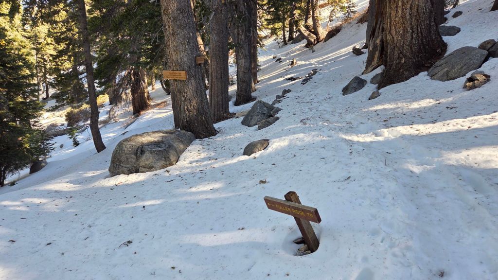
Current snow cover on the PCT is minimal from Miles 151 (Highway 74) to about 175 (Red Tahquitz), largely confined to thin patches on the east slope of Spitler Peak (Mile 168) and the northerly aspects of Apache Peak (Mile 169.5). Snow cover is 90% between Miles 175-177. Snow cover is thin and averages 80% between Miles 177 to 179, then only 10% to Mile 180.5, but almost 100% just south of Annie’s Junction at about Mile 180.8. There are no tracks here where the PCT turns sharply to the west. Miles 181-183 average 20% snow cover. Snow cover is continuous from Mile 184 to 185.5, although spikes are not essential. There are no tracks at this time on the Fuller Ridge Trail section (Miles 185.5 to 191.5), although snow is thin and will be increasingly patchy on the sun-exposed parts of that trail. Stubborn sections will remain around the crossing of the North Fork of the San Jacinto River (Mile 186), and on the northerly slopes (approx. Miles 187.5-187.8 and 188.6-190.4). North of Mile 191, the trail is functionally clear of snow. Carrying spikes is recommended for PCT hikers throughout the San Jacinto mountains at this time.
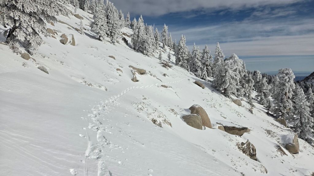
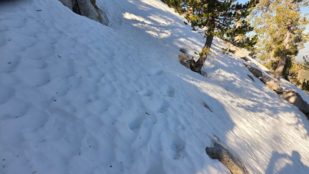
The 0.4 mile section of South Ridge Trail from Chinquapin Flat to Tahquitz Peak [surveyed 3rd March] currently has only a very lightly-traveled single posthole track to follow through steeply angled icy snow (photo below). These icy slopes on the north side of Tahquitz Peak are notoriously treacherous. Currently spikes (or preferably crampons) with an ice axe, and the requisite physical and mental skills to use this equipment in high angle terrain, are strongly recommended, but even then this section of trail will not be comfortable for most hikers until it starts to soften late next week.
Ernie Maxwell Trail [surveyed 2nd March] is now functionally clear of snow (thank you to Anne and Anabel for that report).
Devil’s Slide Trail [surveyed 5th March] is already clear of snow to 7600 ft. From there to Saddle Junction snow cover averages only 20%. Spikes are useful, at least for descending, but they are not required for early morning ascending when the snow is firm, nor for hikers who are especially proficient on patchy icy snow.
Wellman Trail [surveyed 5th March] has a moderately-traveled and very uneven posthole track through about 60% snow cover.
The Peak Trail [surveyed 5th March] has been well-traveled, although in places around 10,000 ft the most heavily traveled track does not accurately follow the trail route. There is a well-compacted posthole and snowshoe route from Wellman Divide to about 10,000 ft through almost continuous snow, but with a few bare patches starting to appear. Above 10,000 ft, snow cover is continuous, and the track becomes more uneven. Most traffic has followed the uppermost traverse of the Peak Trail to Summit Junction (meeting Deer Springs Trail). Multiple tracks around the Peak all ultimately reach the top, although none manage to accurately follow the established trail route.
A lightly-traveled, but now unfortunately lumpy posthole track broadly follows the East Ridge Trail route from near the Miller switchback (10,400 ft) to San Jacinto Peak, and is, as always, an excellent alternative to the upper Peak Trail.
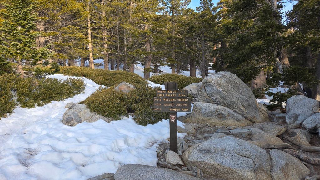
The Round Valley Trail [surveyed 5th March] has a rapidly thinning 40% snow cover to Round Valley, and thereafter a well-traveled posthole track through 90% snow cover to Wellman Divide.
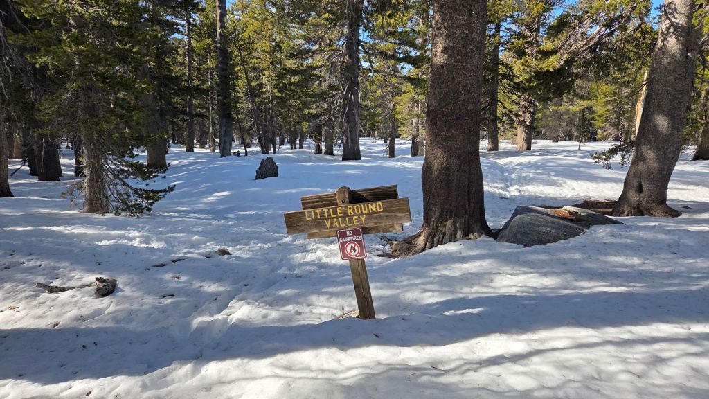
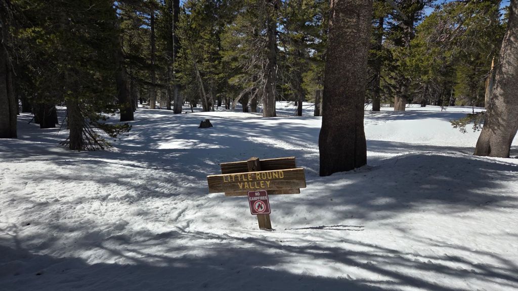
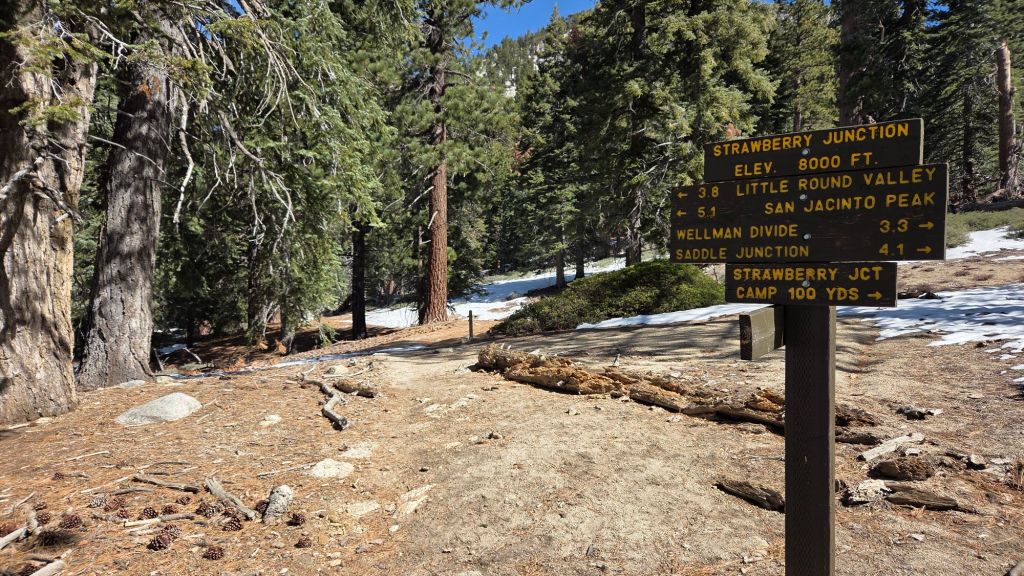
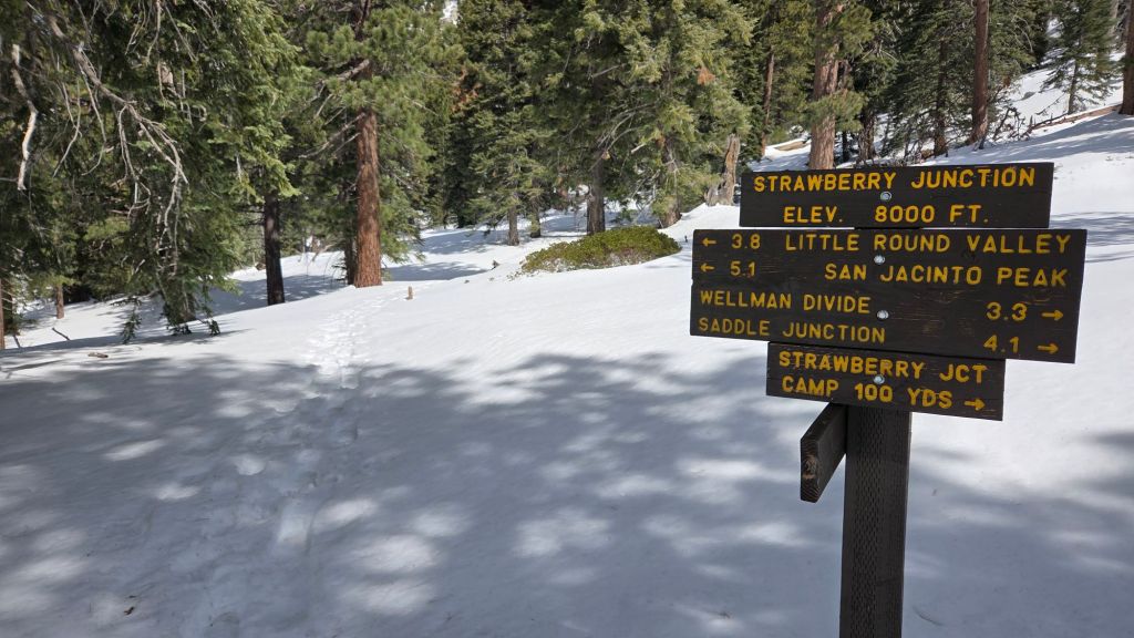
Deer Springs Trail [surveyed 2nd, 6th, and 7th March] is functionally clear of snow to Strawberry Junction, with just a handful of tiny snow patches increasing in frequency closest to the junction. Snow cover then averages 30% until about 8500 ft (less than one mile south of the junction with Marion Mountain Trail, but is only 1-3 inches deep in most places. Thereafter, snow cover on the trail is functionally continuous to San Jacinto Peak, although a handful of bare patches are starting to emerge in the most sun-exposed sections, even as high as 10,400 ft. The somewhat uneven posthole track is largely accurate to the trail route as far as Little Round Valley (LRV). The most heavily-traveled track through LRV vaguely approximates to the trail route, but then at least four tracks ascend from LRV, none of which follow the true trail route for any significant distance, and all of which climb steeply through icy snow toward the Peak, as is traditional in winter.
Marion Mountain Trail [surveyed 7th March] is functionally clear of snow to about 7600 ft, and thereafter has a very well-defined track through largely continuous icy snow to its junction with Deer Springs Trail, that generally follows the true trail route. There is one lengthy sun-exposed section at 8200-8400 ft that is now snow-free. Spikes are valuable, at least for descending the uppermost trail.
As of 7th March there were no tracks through the discontinuous snow on Seven Pines Trail or Fuller Ridge Trail (PCT Miles 185.5-190.5).
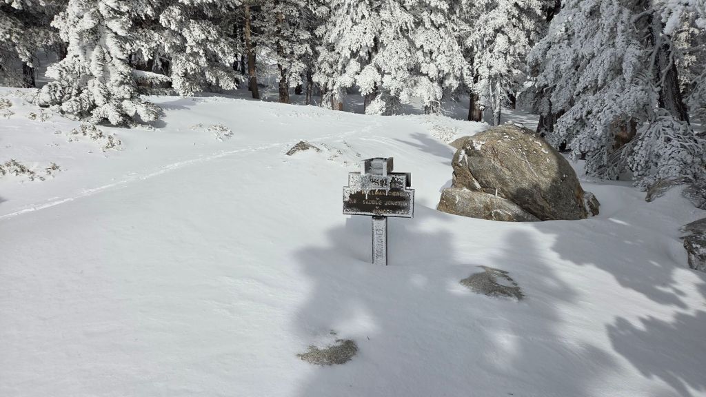
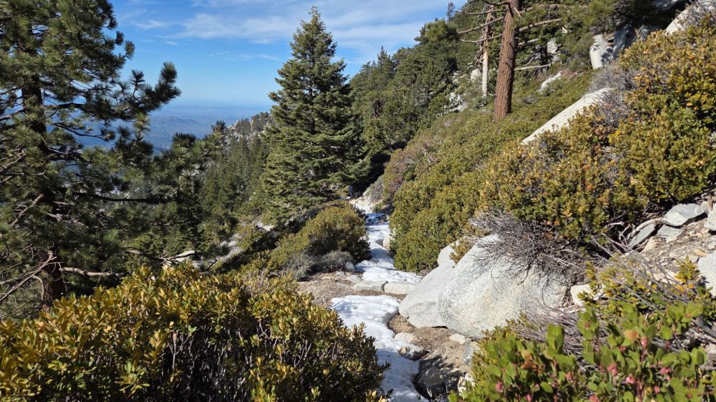
Strawberry Trail (PCT Miles 181-183) [surveyed 6th March] averages 20% snow cover (example photo below).
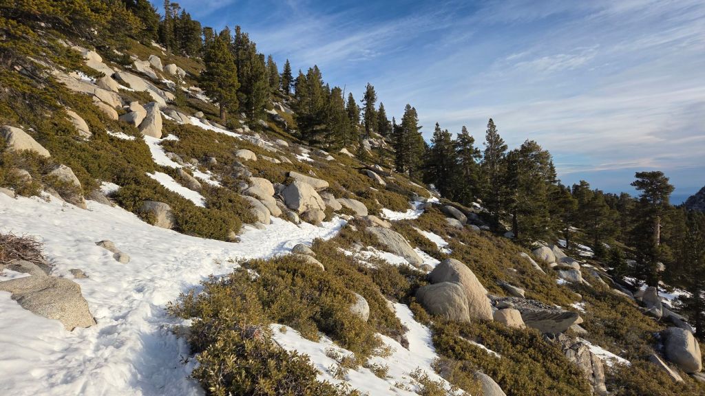
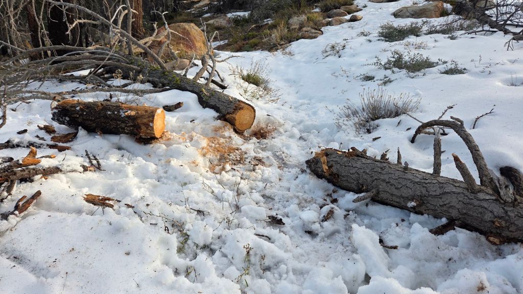
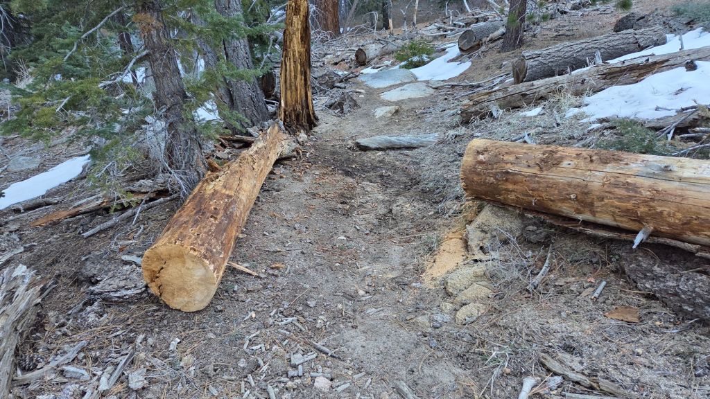
South Ridge Trail to Tahquitz Peak [surveyed 3rd March] is almost completely clear of snow to Old Lookout Flat (7600 ft). Thereafter there is 10% coverage of small snow patches on the traverse to 7900 ft, increasing to 30% on the lower switchbacks, and then to 60% in the upper switchbacks closest to Tahquitz Peak. Snow is firm and icy in the early mornings, starting to soften and become “greasy” by about 0900. Most hikers will find spikes useful in the upper switchbacks but they are not essential for those most experienced on such terrain. Four new blowdowns that came down on this trail in the mid February storms have already been removed by the Trail Report (photo below).
Spitler Peak Trail [surveyed 27th February] is functionally clear of snow, with a few tiny patches of soft, thin snow remaining in the upper third of the trail. The Trail Report cleared another nine trees from the lower four miles of the trail, bringing to 183 the number of trees removed from this trail in recent years. Unfortunately the trail suffered major blowdowns in the most recent storm sequence and four large burned cedars are seriously obstructing the trail between 3.2-4.0 miles up from the trailhead. Several additional small trees remain uncut closer to the PCT.
Skyline Trail reopened on 4th March. Although it is largely clear of icy snow, some hikers will find spikes useful above 7200 ft (the “Traverse”).
SNOW DEPTHS
Snow depths measured on 2nd March 2026 (unless indicated otherwise) are as follows. Current total depth is the principal number given, followed (in parentheses) by the greatest snow depth of this winter to date, following the storms of mid February. Altitudes and PCT mileages are approximate.
San Jacinto Peak (10810 ft): 9 inches (was 26 inches on 20th February), drifted two feet deep in places, notably on east and north sides, especially East Ridge.
Little Round Valley (9750 ft): 8 inches (was 23 inches on 23rd February), ranging from 0-20 inches in places
Wellman Divide (9700 ft): 6 inches (was 20 inches on 20th February)
Annie’s Junction/PCT Mile 181 (9020 ft): 7 inches (was 27 inches on 20th February)
Tahquitz Peak (8836 ft): 0 inch (was 23 inches on 21st February) immediately around the fire lookout, but 3-15 inches on adjacent trails [measured 3rd March]
Long Valley (8500 ft): 1 inch (was 14 inches on 20th February)
Strawberry Junction/PCT Mile 183 (8100 ft): 0 inch (was 15 inches on 23rd February)
Saddle Junction/PCT Mile 179 (8070 ft): 2 inches (was 22 inches on 20th February)
Suicide Rock/Deer Springs trails junction (7000 ft): 0 inch (was 8 inches on 23rd February)
South Ridge Trail trailhead at top of South Ridge Road (6500 ft): 0 inch (was 16 inches on 21st February)
Devil’s Slide Trail trailhead at Humber Park (6500 ft): 0 inch (was 17 inches on 20th February)
Idyllwild (at 5550 ft): 0 inch (was 12.5 inches on 20th February)
The San Jacinto Trail Report celebrates ten years of operation in 2026. It is read by over 30,000 people each year, and will pass one million views in 2026. The Report has helped thousands of hikers, and saved multiple lives, both directly and indirectly. Since the Report became established online, snow/ice rescues in the San Jacinto Mountains have dropped 82%, also saving Riverside County tens, if not hundreds, of thousands of dollars. While all time is volunteered, the Report uses small private donations to help cover operating costs. Donations keep the Report available to all, free from advertising or paywalls, and independent from agencies. If you have found this Report useful, please consider using this link to the Donate page. Thank you for your support.