The sixth storm system of winter 2025/26 to impact the San Jacinto mountains was impressive for both its rain generation, and for its remarkably high freeze level. This combination brought heavy rain – which froze above about 9300 ft – all the way to San Jacinto Peak, but (sadly) minimal fresh snow.
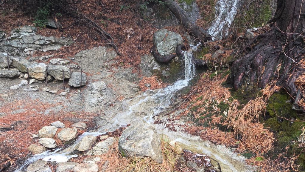
Rainfall began around 0700 on 31st December at both mid and upper elevations, continuing with remarkable persistence until the morning of 2nd January (0500 in Idyllwild, 0700 at 9000 ft). Across the roughly 48 hour period, Idyllwild (at 5550 ft) received 2.98 inches of rain, with Wellman’s Cienega (9300 ft) recording a prodigious 5.2 inches.
Snowfall immediately around San Jacinto Peak was a mere two inches, heavily admixed with freezing rain, sleet, and remnant snow from November and December storms, with just one inch at 10,500 ft, and a dusting as low as 9900 ft.
I recorded a rather lengthy video report from San Jacinto Peak in superb conditions at 0830 on Friday 2nd January (linked here, discussion of trail/ice conditions between minutes 4-5). Icy snow is essentially continuous above 9800 ft, and was so hard and icy that conditions are optimal for spikes. This will change rapidly on sun-exposed areas during the day, but the upper elevations will refreeze overnight, getting icy again every morning. Crampons could be used above about 10,000 ft, but are frankly more than is needed at this time. Snow depth and condition are unsuitable for snowshoes.
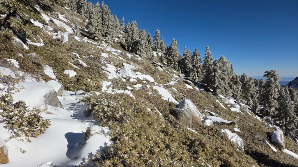
Contrary to normal winter reporting, snow depths are not given at the foot of this posting. Rain has largely eliminated all snow from trails below 9800 ft (with the notable exception of uppermost Deer Springs Trail and the north side of Tahquitz Peak). Generally, trails below that elevation are largely or completely clear of snow (but may retain some ice). Snow depth above 10,000 ft is currently 2-5 inches, with deeper drifts in places.
High country temperatures are forecast to be generally around seasonal into mid January. Consequently, hikers must be prepared for air temperatures below freezing above 10,000 ft elevation and well below freezing when considering wind chill effects. See the Weather section below for my recent observations from San Jacinto Peak.
The conditions forecast for 3rd-4th January may be similar to those earlier this winter which resulted in multiple significant hypothermia cases in the San Jacinto high country. Hikers – most notably those from the Tramway where such conditions are less anticipated – may be ascending through rain, before encountering snowfall, stronger winds, and frigid windchills at the highest elevations. Being fully prepared for the challenging combination of both winter conditions and wet weather can be critical (at a minimum, having fully wind- and waterproof clothing, plus multiple dry layers, hats, and gloves stored in a truly waterproof pack system, is very strongly advised). A clear recognition of when turning around is the safest option in such conditions is also invaluable.
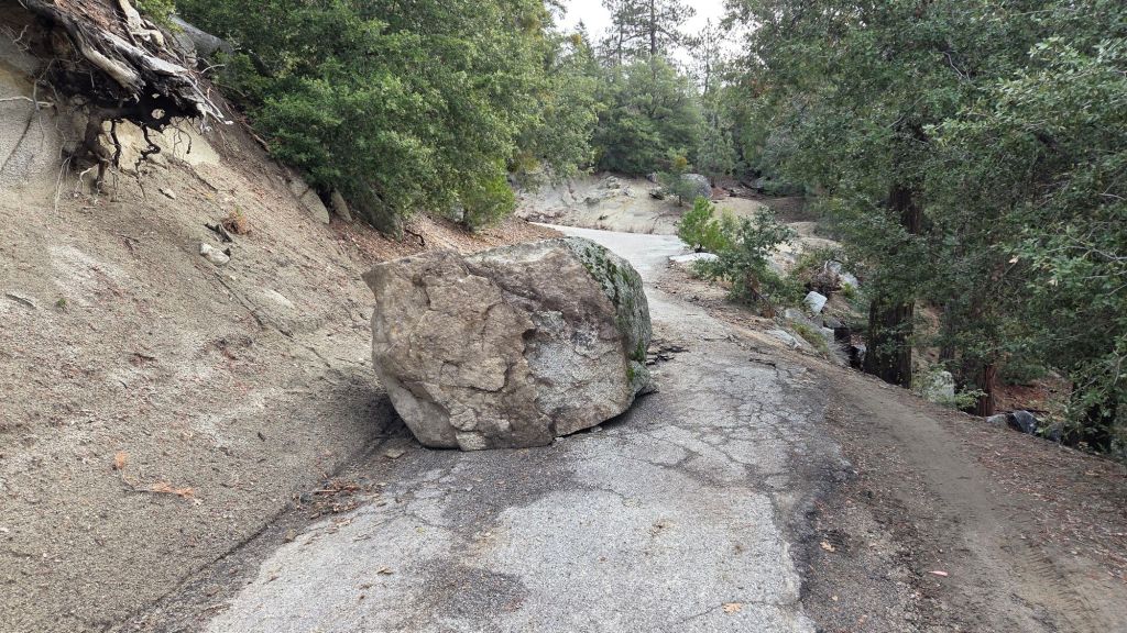
South Ridge Road (5S11) closed on Saturday 3rd January having been partially blocked by a boulder about 0.5 mile up following recent heavy rains (photo below).
Daily survey hikes by the Trail Report year-round in the San Jacinto mountains include multiple routes to the highest peaks including San Jacinto Peak typically at least twice per week (but even more frequently during winter storm weather), Tahquitz Peak and area at least once per week, plus a wide variety of other trails on intervening days.
WEATHER
Conditions remain very unsettled, especially at mid elevations, until at least 8th January. Consequently, temperatures remain generally below seasonal, especially at mid elevations, until next weekend.
Light rain is forecast from late on Saturday 3rd to early on Monday 5th January. This system will be colder than most recent ones, with a freeze level near 8000 ft, but with little precipitation forecast (<1 inch rain at mid elevations, 1-2 inches of snow >9000 ft), the impacts will be limited.
The “blocking” high pressure area returns to Southern California later this week, with temperatures moving back above seasonal the following week, with, predictably, no further precipitation in the forecasts thereafter.
At San Jacinto Peak (10,811ft/3295m) on Friday 2nd January 2026 at 0830 the air temperature was 32.4°F (0°C), with a windchill temperature of 18.7°F (-7°C), 34% relative humidity, and a cool due West wind sustained at 11 mph gusting to 17.0 mph.
At the Peak on Wednesday 31st December 2025 at 1100 the air temperature was 33.8°F (1°C),with a windchill temperature of 17.1°F (-8°C), 79% relative humidity, and a sharp SSE wind sustained at 22 mph gusting to 30.8 mph.
At the Peak on Saturday 27th December 2025 at 0730 the air temperature was 15.2°F (-9°C), with a windchill temperature of -7.4°F (-22°C), 100% relative humidity, and a bitter NW wind sustained at 20 mph gusting to 28.2 mph.

TRAIL CONDITIONS
Trails below about 9,800 ft (east side) or 9500 ft (west side) are generally snow-free, but may be icy to lower elevations in early to mid mornings.
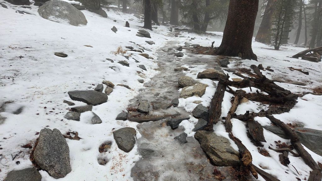
Carrying spikes remains advisable everywhere above about 9000 ft. Sections of ice and icy snow that remained from November are now largely obscured under very thin fresh snow cover (>9900 ft), or ice from frozen rain, making them especially treacherous. This is especially true on the Peak Trail above 10,100 ft, and on upper Deer Springs Trail (>9500 ft). Spikes tend to be especially helpful for descending, even when they do not seem necessary for ascending.
Snow depths are generally unsuitable for snowshoeing everywhere due to limited snow depths and compaction/ice.
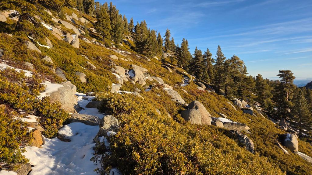
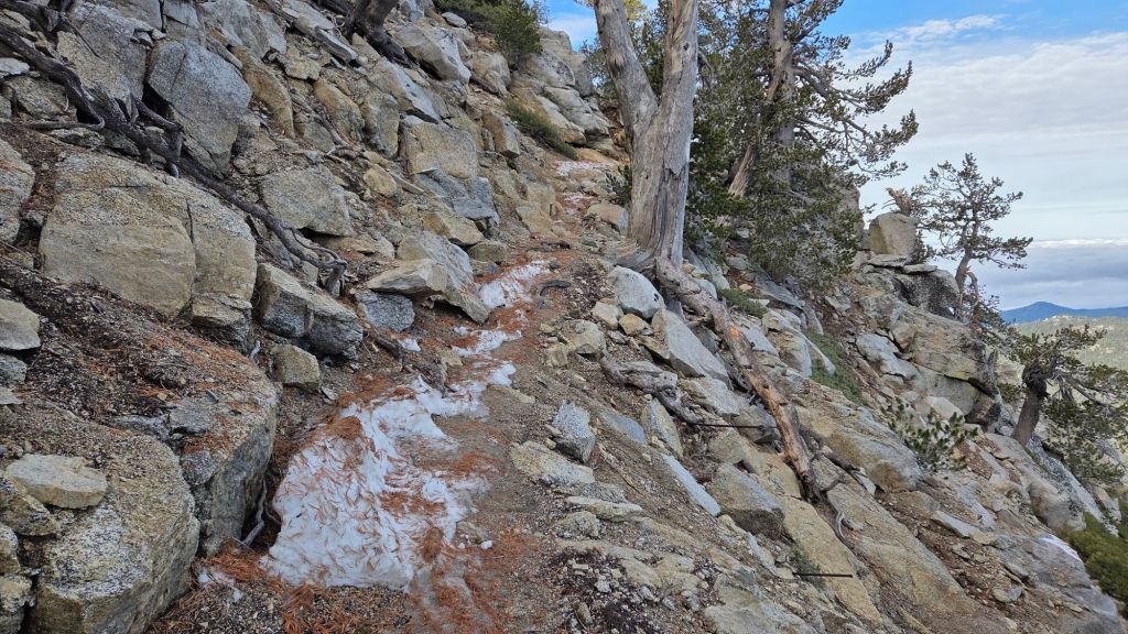
Remarkably, the section of South Ridge Trail from Chinquapin Flat to Tahquitz Peak [updated 3rd January] is largely clear of icy snow, having been melted by rainfall in recent days (photo below). Some hikers may find spikes useful for short sections.
South Ridge Trail [updated 3rd January] south of the peak is clear of snow and ice to Tahquitz Peak.
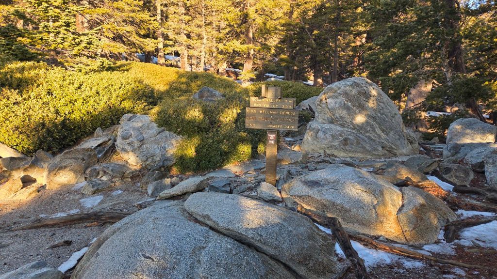
The Wellman Trail is almost entirely clear of icy snow, other than a handful of patches in the sheltered areas at its southern end.
The Peak Trail has an obvious track through very thin continuous snow cover that accurately follows the trail route to the Summit Junction with Deer Springs Trail, and then onward up to San Jacinto Peak. The snow is extremely icy in mornings and in areas that are not sun-exposed. Spikes recommended.
Upper Deer Springs Trail does not have a track to follow through continuous icy snow above Little Round Valley as of Friday 2nd. The existing tracks have been largely obscured by a mixture of melting, rain, and icy fresh snow. Spikes are strongly recommended for this route.
The San Jacinto Trail Report celebrates ten years of operation this year. It is now read by over 30,000 people per year, and will pass one million views in 2026. The Report has helped thousands of hikers and saved multiple lives, both directly and indirectly. Since the Report became established online, snow/ice rescues in the San Jacinto Mountains have declined 82%, saving Riverside County tens, if not hundreds, of thousands of dollars. While all time is volunteered, the Report uses small private donations to help cover operating costs. Donations keep the Report available to all, free from advertising or paywalls, and independent from agencies. If you have found this Report useful, please consider using this link to the Donate page. Thank you very much for your support.