Three minor snow storms impacted the San Jacinto mountains in nine days in mid November, as discussed in detail in the previous Report (linked here). Since then, a week of above seasonal temperatures has led to relatively rapid melting (for the time of year). Although this week is cooling to about seasonal, further dry, warm, weather is expected to return and persist into mid December, with currently no significant additional precipitation in the forecasts.
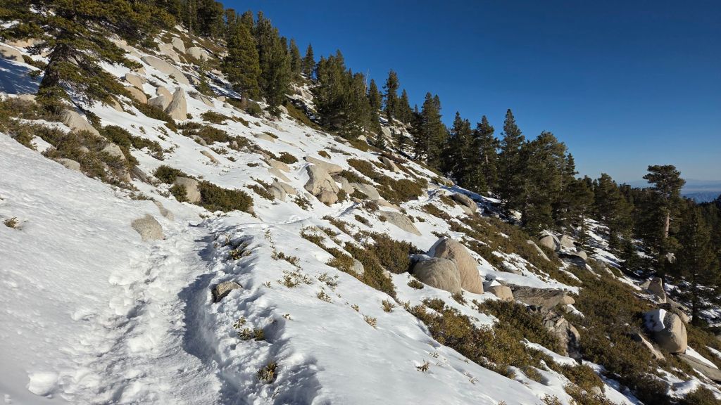
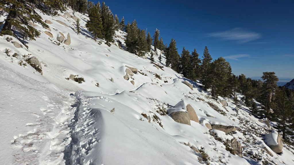
Details are given below under Trail Conditions, but spikes remain valuable in many areas above about 8000 ft, although experienced hikers may find they are no longer essential on established trails even well above that elevation. Despite rapid melting, treacherous icy patches persist as low as 7700 ft, notably on Devil’s Slide and Marion Mountain trails. Spikes tend to be especially helpful for descending, even when they are unnecessary for ascending. Snow depths are locally suitable for snowshoes above about 9500 ft, but generally only off-trail. They are no longer useful on established trails which are now heavily compacted (and hence ideal for spikes) such as Round Valley Trail, Peak Trail, Wellman Trail, and the posthole route on upper Deer Springs Trail.
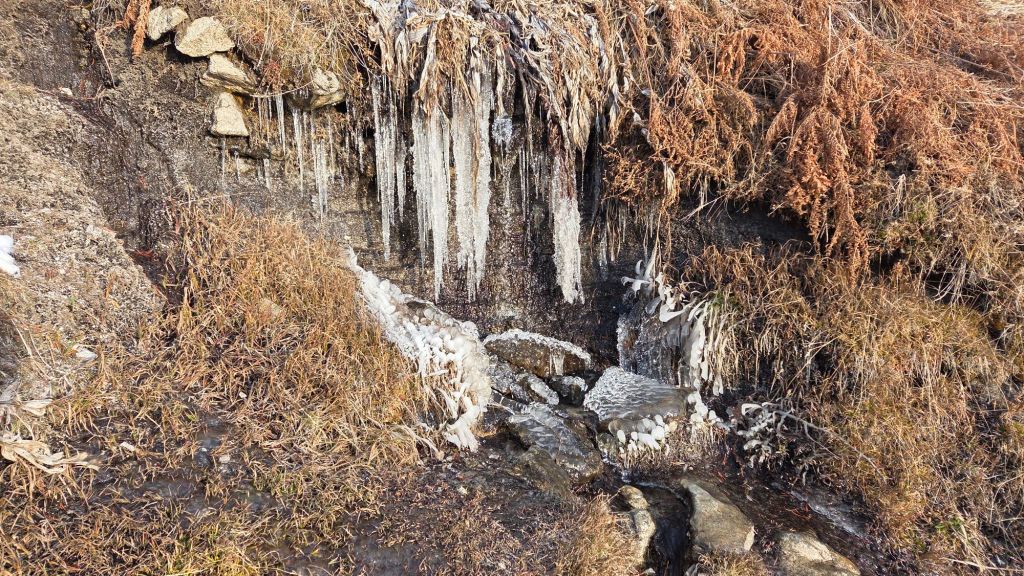
Snow depths measured at various locations on the trail system are given towards the end of this posting. Note however that snow depth itself is rarely indicative of the difficulty (or ease) of hiking a particular track or trail. For example a firm, well-compacted track across snow feet deep is often much easier hiking than traversing across just a few inches depth of, for example, angled virgin icy snow. Conversely, just a one inch covering of icy snow at mid-elevations (where there have been many freeze-thaw cycles) can be the most treacherous surface to hike.
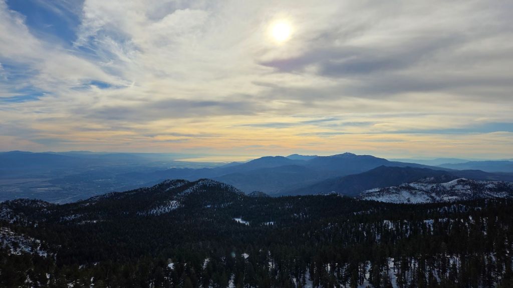
Temperatures are forecast to be generally above seasonal into mid December. Nevertheless, hikers should be prepared for temperatures near or below freezing above 10,000 ft elevation, and at times well below freezing when considering wind chill effects, the latter in particular during the passage of a cold front to the north on 3rd-4th December. See the Weather section below for my recent observations from San Jacinto Peak.
Be bear aware. Although generally rarely reported, at least six individually identifiable Black Bears have been observed in the San Jacinto mountains since 2017 (I have personally encountered at least one annually for the past seven years). A full-sized adult bear with a right ear tag has been seen in multiple locations from Willow Creek to Fern Valley since August (see my video from a trail cam on 14th September available here, and images from Fern Valley in late August in a prior Report linked here). A smaller, second individual has been reliably reported at least twice, most recently in late September in lower Fern Valley. My brief videos from Devil’s Slide Trail in September 2021 (linked here) and one walking past our house in 2018 (linked here) show two further individuals. There have been no reports of negative interactions with humans in the high country, at or near campsites, or on trails, but bear-safe storage of food when camping is recommended.
Daily survey hikes by the Trail Report year-round in the San Jacinto mountains include multiple routes to the highest peaks including San Jacinto Peak typically at least twice per week (much more frequently during stormy weather and in winter), Tahquitz Peak and area at least once per week, plus a wide variety of other trails on intervening days.

WEATHER
Temperatures were well above seasonal in the last week of November, and following a few seasonal days on 1st-4th, will again be well above average starting Friday 5th, then potentially far above average on 8th-12th December. During the latter period, temperatures will be especially mild in the high country (more akin to early April than early December), and melting of snow is expected to be steady throughout, and rapid on sun-exposed slopes.
The second, third, and fourth storm systems of winter 2025/26 all impacted the San Jacinto mountains in quick succession, on 14th-16th, 17th-18th, and 20th-22nd November, respectively. All three storms were relatively mild, with high freeze levels and very limited snow below 7000 ft. The storm sequence and precipitation outcomes were described in detail in the previous Report (linked here).
All three storms underperformed their snow forecasts, but given the climate change crisis, any snow on the ground prior to December should probably be considered something of a bonus. Indeed, at 18.5 inches total snowfall at San Jacinto Peak by the end of November 2025, this winter is second only to 2019/20 in the past eight years for the most snowfall before 1st December (some may remember the spectacular Thanksgiving storm of 2019 that produced almost three feet of snow in three days in late November that year).
At San Jacinto Peak (10,811ft/3295m) on Thursday 4th December 2025 at 0840 the air temperature was 24.5°F (-4°C), with a windchill temperature of 8.2°F (-13°C), 13% relative humidity, and an exceptionally steady NE wind sustained at 15 mph gusting to 17.7 mph.
At the Peak on Monday 1st December 2025 at 0840 the air temperature was 30.6°F (-1°C), with a windchill temperature of 22.8°F (-5°C), 44% relative humidity, and a light NNE wind sustained at 2 mph gusting to 5.8 mph.
At the Peak on Saturday 29th November 2025 at 0755 the air temperature was 36.1°F (2°C), with a windchill temperature of 24.4°F (-4°C), 31% relative humidity, and a benign WNW wind sustained at 6 mph gusting to 11.2 mph.
At the Peak on Thursday 27th November 2025 at 0850 the air temperature was 41.6°F (5°C), with a windchill temperature of 35.2°F (2°C), 18% relative humidity, and a steady SE wind sustained at 6 mph gusting to 7.9 mph.
TRAIL CONDITIONS
All trails above about 8500 ft are largely – or above about 9500 ft completely – snow-covered. With above seasonal temperatures since 24th, melting has been unusually rapid, especially on sun-exposed slopes.
Spikes can be useful above about 8000 ft, locally somewhat lower, as established trails have become consolidated by hiker traffic and undergone freeze-thaw cycles. They are especially useful for descending heavily traveled tracks where the snow has become compacted and icy (e.g., Devil’s Slide, Wellman, Peak, Round Valley, and uppermost Deer Springs trails).
Snow depths are locally suitable for snowshoeing above 9500 ft, but only off-trail or when breaking trail on routes that have so far been largely untraveled. Snow depths are dropping steadily, and snowshoes will be of very limited use by the second week of December.
Devil’s Slide Trail [updated 4th December] is functionally clear of icy snow to about 7700 ft. Above that elevation, there is a heavily compacted and icy track to follow through increasingly patchy thin snow (average ice cover now only 30% to Saddle Junction). Some hikers will find that traction devices are helpful on the upper trail, especially for descending.
There is a well-traveled, compacted track on the PCT south from Saddle Junction to Chinquapin Flat/PCT Mile 178 [updated 4th December]. The track is somewhat less well traveled and requires some minor postholing about 0.3 mile from Chinquapin Flat.
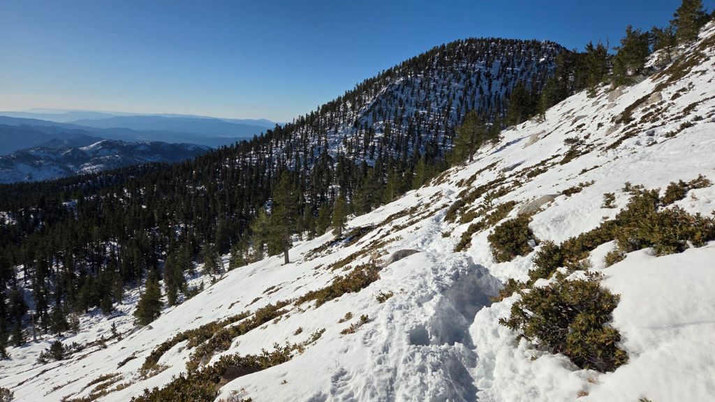
The section of South Ridge Trail from Chinquapin Flat to Tahquitz Peak [updated 6th December] now has a well-traveled track to follow through the angled icy snow, with significant compaction over the holiday weekend in late November, plus minor melting. Some of the track remains covered by fallen ice. These icy slopes on the north side of Tahquitz Peak are notoriously treacherous. Spikes are recommended for most hikers, but even then the route will not be comfortable for all (photo below).
South Ridge Trail south of Tahquitz Peak [updated 6th December] is functionally clear of snow to 8500 ft (switchback 9) with just a couple of tiny icy patches below that elevation. Thereafter icy snow cover averages about 40% to Tahquitz Peak, but it is diminishing rapidly with coverage having halved in the past four days. Some hikers will find spikes useful for descending the upper trail.
As of Sunday 30th November, there is a simple posthole track to follow through shallow and rapidly melting snow on the Strawberry Trail (PCT Miles 180.8-183). The bulk of this trail is very sun-exposed and snow cover averages only 30% on this trail.
Willow Creek Trail [updated 1st December] has a lightly traveled track to follow through shallow and patchy snow, at least to Skunk Cabbage Meadow.
There are well-traveled and compacted tracks on Round Valley Trail through Long and Round valleys to Wellman Divide, and on the “Sid Davis” route, the latter emerging at the Peak Trail near 10,000 ft [updated 4th December].
The PCT north from Saddle Junction, continuing onto the Wellman Trail, has a well-traveled and increasingly compacted track through light snow cover to Wellman Divide [updated 1st December]. Melting has been rapid on the most sun-exposed section immediately north of Saddle Junction (“Angel’s Glide”) with some lengthy snow-free sections already appearing, and the first mile north of Saddle Junction now averages only 50% snow cover.
The Peak Trail [updated 4th December] has a well-traveled, compacted, posthole track through continuous snow cover that accurately follows the trail route to near Miller Peak at 10,400 ft. Thereafter there is a split in hiker traffic – as is traditional in winter – with two equally prominent tracks, one taking the East Ridge on a somewhat meandering route to San Jacinto Peak, and the Peak Trail itself above 10,400 ft now having a defined compacted track to follow. Trails just below San Jacinto Peak proper are starting to consolidate into less of a shambolic maze of alternate routes, but there has been some infilling with spindrift in strong winds on 3rd-4th December, reducing the visibility of some tracks, notably that on the East Ridge.
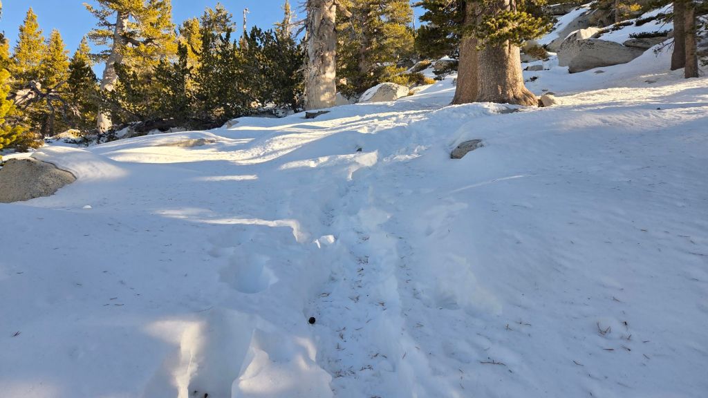
Deer Springs Trail [updated 4th December] is clear of snow to Strawberry Junction. Above Strawberry Junction snow cover has rapidly thinned and is increasingly patchy to 8500 ft (about 0.5 miles south of the Marion Mountain Trail junction). Although snow cover is functionally continuous thereafter all the way to San Jacinto Peak, small bare patches are starting to appear even as high as 9650 ft. There is only a moderately traveled posthole track between Strawberry Junction and the top of Marion Mountain Trail (approx. PCT Miles 183-185), but the snow is thin and easy underfoot. After the Marion junction, the track is well-traveled and compacted to Little Round Valley, almost entirely following the trail route accurately (spikes useful for descending). Above Little Round Valley there are multiple posthole track options, none of which consistently follow the actual trail route, most of which ascend steeply, some of which are more heavily traveled than others, but all of which seem to ultimately make their way up towards the Peak (example photo below).
Marion Mountain Trail [updated 4th December] is completely clear of snow to 7600 ft, roughly midway to the junction with the PCT/Deer Springs Trail. In the upper half of the trail snow cover averages 60%, with extensive bare patches in the most sun-exposed areas, but also some lengthy and very icy sections too. Spikes are very useful, especially for descending.
Seven Pines Trail [updated 4th December] has no tracks to follow through the snow on its upper section.
Fuller Ridge Trail [updated 4th December] has a lightly traveled but accurate posthole track to follow through light snow cover along its entire length (PCT Miles 185.5-190.5). Sun-exposed areas (notably Miles 187.5-188.5) and those closest to Black Mountain Road (Mile 190 north) are now largely clear of snow.
Black Mountain Trail (2E35)[updated 3rd December 2025] is functionally clear of snow, with just a few tiny icy snow patches near the top. Four medium-sized treefall hazards include three within 0.1 mile of one another about 1.5 miles up from the trailhead, plus another just below the top of the trail, but all have easy workarounds. The climbers trail section that continues from the top of the trail to the fire lookout still has about 40% icy snow cover, as does the uppermost access road to the tower.

SNOW DEPTHS
Snow depths measured on 1st December 2025 are as follows. Current total depth is the first number given, followed (in parentheses) by the total measured on 24th November following the most recent storms. Altitudes and PCT mileages are approximate.
San Jacinto Peak (10811 ft): 11-12 inches (17 inches on 24th November)
Wellman Divide (9700 ft): 5 inches (was 11 inches on 24th)
Annie’s Junction/PCT Mile 180.8 (9020 ft): 10 inches (was 12 inches on 24th)
Long Valley (8500 ft): 3-4 inches (was 8 inches on 24th)
Saddle Junction/approx. PCT Mile 179 (8070 ft): 3-4 inches (was 8 inches on 24th)
Devil’s Slide Trail at Humber Park (6550 ft): 0 inch by 24th November.
While all time and labor is volunteered, the San Jacinto Trail Report uses small private donations to help cover operating costs. Your contribution keeps the Report available to all, free from advertising or paywalls, and independent from agencies. If you have found this Report useful, please consider using this link to the Donate page. Thank you very much for your support.