UPDATE Saturday 22nd November 2025 at 1150: as seems to be more frequent in recent years, the rotational movement of yesterday’s storm system has brought it back around, this time coming in from easterly directions. Consequently the east side of the range has received modest snowfall this morning, with about four inches in Long Valley (for a total depth of about eight inches). The highest elevations remained above the cloud for much of the morning. The easterly winds have been strong and very gusty, resulting in extensive drifting, and unfortunately the (at least partial) removal of tracks broken yesterday. We broke trail up South Ridge this morning to Tahquitz Peak, from where I recorded a short video report (linked here). The snow level remained high at about 7000 ft, with just light drizzle in Idyllwild, and total accumulation at Tahquitz is a modest 4-6 inches, but this is obscured by severe drifting everywhere above about 8000 ft. Further fresh snow is possible this afternoon.
UPDATE Friday 21st November 2025: in the biggest weather forecasting error in the past decade in these mountains, the storm overnight – our third in eight days – that was widely forecast to produce 10-25 inches of snow around the highest peaks instead resulted in only three inches at San Jacinto Peak, with one inch at both Saddle Junction and Long Valley, and barely a dusting below 7000 ft. It was however a gorgeous morning in the high country, as seen in a short video report I recorded from San Jacinto Peak early today (linked here). As of this morning, well-defined, accurate tracks are in place on Devil’s Slide Trail, north from there via the Wellman and Peak trails to San Jacinto Peak, and also on the Round Valley Trail from Long Valley to Wellman Divide (broken above 9000 ft with snowshoes by myself and Kyle Eubanks). Spikes are useful everywhere above about 8000 ft, potentially lower in places. While we both used snowshoes this morning above about 9000 ft, they will not be required even above that elevation on traveled tracks (they would however be useful on upper Deer Springs Trail, which does not have a freshly broken track as of Friday morning).

————————————–
This is a summary of conditions following the second and third storm systems of winter 2025/26 that impacted the San Jacinto mountains on 14th-16th and 17th-18th November, respectively. I recorded a video report from San Jacinto Peak on the morning on Tuesday 18th (linked here) which gives a feel for current conditions in the high country.
This Report is intentionally brief as the next storm system, the third in a week, arrives late on Thursday 20th with precipitation expected to last into Saturday 22nd November. That storm will again be relatively cool, similar to the storm on 17th-18th, with a freeze level dropping to near 6000 ft, and potentially two feet of snow forecast above 10,000 ft elevation. Consequently snow and trail conditions are expected to change markedly again by Saturday 22nd, although the changes should be limited to upper elevations, with predominantly rain expected below about 6500 ft.
Both of the recent storms were ultimately less impactful than forecasts had suggested, partly due to the difficulty of predicting the exact paths of complex rotating “atmospheric rivers”, and partly because the first storm was so mild that the very high freeze level significantly restricted the quantity of snowfall (it rained all the way up to San Jacinto Peak for the first 20 hours of the storm throughout 14th November). It is interesting to speculate that if the front of that earlier storm system had been just a couple of degrees colder, with a freeze level consequently hundreds of feet lower overnight on Friday 14th, the snow depth around the highest peaks could easily have been double what we ultimately experienced.
Further details are given below under Trail Conditions, but in summary, carrying spikes is now recommended everywhere above about 7500 ft. Snow depths are currently marginal anywhere for snowshoes, although they could be used above about 9500 ft on untraveled trails. That advice is expected to change by Saturday 22nd with significant additional fresh snowfall.
Details of snow depths measured at various locations on the trail system are given towards the end of this posting. Note however that snow depth itself is rarely indicative of the difficulty (or ease) of hiking a particular track or trail. For example a firm, well-compacted track across snow several feet deep is often much easier hiking than traversing across just a few inches depth of angled virgin icy snow.
Below seasonal temperatures followed the passage of the storm system on Tuesday 18th November and will persist until Sunday 23rd. Hikers must be prepared for temperatures well below freezing at higher elevations, and far below freezing when considering wind chill effects. See the Weather section below for my recent observations from San Jacinto Peak.
Be bear aware. Although generally rarely reported, at least six individually identifiable Black Bears have been observed in the San Jacinto mountains since 2017 (I have personally encountered at least one annually for the past seven years). A full-sized adult bear with a right ear tag has been seen in multiple locations from Willow Creek to Fern Valley since August (see my video from a trail cam on 14th September available here, and images from Fern Valley in late August in a prior Report linked here). A smaller, second individual has been reliably reported at least twice, most recently in late September in lower Fern Valley. My brief videos from Devil’s Slide Trail in September 2021 (linked here) and one walking past our house in 2018 (linked here) show two further individuals. There have been no reports of negative interactions with humans in the high country, at or near campsites, or on trails, but bear-safe storage of food when camping is recommended.
Daily survey hikes by the Trail Report year-round in the San Jacinto mountains include multiple routes to the highest peaks including San Jacinto Peak typically at least twice per week (more frequently during stormy weather), Tahquitz Peak and area at least once per week, plus a wide variety of other trails on intervening days.

WEATHER
The second storm system of the season (and the first since 14th October) impacted the region on 14th-16th November. The “atmospheric river” system was extremely warm for the season, with a freeze level initially above 11,000 ft and rain throughout the highest peaks for the first day of the storm, before turning to snow early on Saturday 15th. Even then, the snow level remained high throughout the storm, with little more than a dusting below 7000 ft. Inevitably this limited snow at all elevations, with seven inches at San Jacinto Peak, down to three inches at Saddle Junction (8100 ft). Accumulated rainfall was impressive at mid elevations, with 2.70 inches in Idyllwild (at 5550 ft).
The system on 17th-18th was palpably colder, with a freeze level dropping to 6000 ft. However this rapid cooling happened largely after the passage of the main precipitation, so snowfall at mid elevations was extremely limited, with just one inch at Humber Park (6500 ft)(which lasted only hours before melting) and barely a dusting below that. Fresh snowfall in the high country was more limited than the prior storm (four inches at San Jacinto Peak), but more uniformly distributed across all elevations above 8000 ft (2-4 inches throughout). Rainfall in Idyllwild was 0.51 inch.
The third system in a week, due on 20th-21st, is expected to be similar in temperature to the storm of 17th-18th. with a freeze level near 6000 ft. About one inch of rain is forecast for Idyllwild. Although snow forecasts have varied widely in recent days, at least 10-12 inches, possibly much more, is now expected above 10,000 ft.
Starting Sunday 23rd November, temperatures are tentatively forecast to rise rapidly to above seasonal, especially at upper elevations. This is expected to result in rapid snowmelt at all elevations, and of course consequent steady changes in trail conditions.
The first (very minor) winter storm of the season impacted the region on Tuesday 14th October 2025, as described in detail in a prior Report (linked here).
At San Jacinto Peak (10,811ft/3295m) on Tuesday 18th November 2025 at 0650 the air temperature was 15.9°F (-9°C), with a windchill temperature of -3.7°F (-20°C), 38% relative humidity, and a sharp SSW wind sustained at 14 mph gusting to 20.7 mph.
At the Peak on Monday 17th November 2025 at 1420 the air temperature was 25.0°F (-4°C), with a windchill temperature of 16.0°F (-9°C), 66% relative humidity, and a frigid SW wind sustained at 14 mph gusting to 26 mph.
At the Peak on Friday 14th November 2025 at 1610 the air temperature was 36.0°F (2°C), with a windchill temperature of 23.5°F (-4°C), 100% relative humidity, and a steady due South wind sustained at 14 mph gusting to 17.4 mph.
TRAIL CONDITIONS
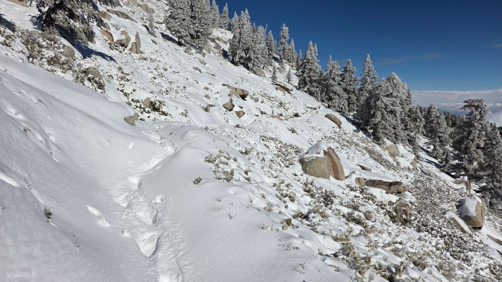
All trails above about 7500 ft are largely or completely snow-covered. By the afternoon of 18th, melting was already well underway below 9000 ft. The powder on 18th was so light and fine that drifting in the trails has been dramatic above 9000 ft, which is not reflected in the snow depths given below. Trails above 10,000 ft have snow up to 25 inches deep in the trail routes in places.
Spikes are potentially useful everywhere above about 7500 ft, lower in places, especially as established trails become consolidated by hiker traffic and undergo freeze-thaw cycles. They are especially useful for descending trails when they become icy and compacted (e.g. Devil’s Slide and lower Deer Springs trails). Snow depths are suitable for snowshoeing above 10,000 ft, but this elevation is expected to drop significantly after 22nd November.
Ernie Maxwell Trail is completely clear of snow.
Devil’s Slide Trail has a well-traveled track to follow through largely continuous thin icy snow above 7000 ft.
Deer Springs Trail is largely clear of snow to the Suicide Rock junction with just a few patches close to the junction (spikes not required). Above Strawberry Junction snow cover is continuous, but at this time there is no track to follow to Little Round Valley or beyond to San Jacinto Peak.
SNOW DEPTHS
Snow depths measured on 18th November 2025 are as follows. Current total depth is the first number given, followed (in parentheses) by the snowfall in the storm of 14th-16th November and then the snowfall in the storm of 17th-18th November). Altitudes and PCT mileages are approximate.
San Jacinto Peak (10811 ft): 11 inches (7 inches by 16th November/4 inches added by 18th November)
Wellman Divide (9700 ft): 7 inches (4 inches/3 inches)
Annie’s Junction/PCT Mile 180.8 (9020 ft): 6 inches (3 inches/3 inches)
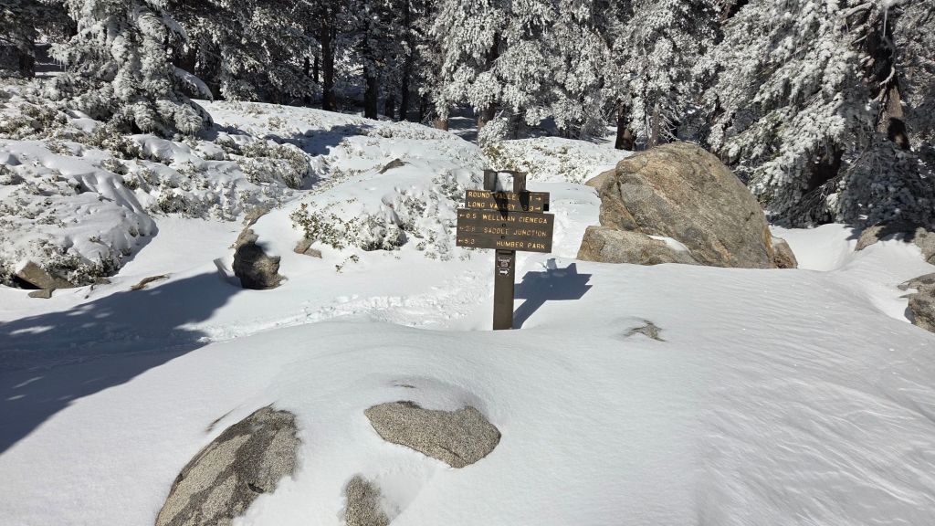
Saddle Junction/approx. PCT Mile 179 (8070 ft): 5 inches (3 inches/2 inches)
Devil’s Slide Trail at Humber Park (6550 ft): 1 inch on 18th, already completely melted later that day
Idyllwild (village center at 5400 ft): 0 inches
While all time and labor is volunteered, the San Jacinto Trail Report uses small private donations to help cover operating costs. Your contribution keeps the Report available to all, free from advertising or paywalls, and independent from agencies. If you have found this Report useful, please consider using this link to the Donate page. Thank you very much for your support.