Minor storm systems on 26th April (1-2 inches of snow) and again on 4th May (2-4 inches) both produced light snow falls in the high country. However, above average temperatures immediately following the storms, combined with a seasonally potent sun, led to very rapid melting and in both cases trails had largely cleared within 1-2 days.
Hot temperatures forecast for the remainder of this week will rapidly melt much of the old icy snow (from storms in March). Spikes are no longer required anywhere, although some hikers may find them useful in places, as described under Trail Conditions. The Pacific Crest Trail has heavily-traveled tracks in the very limited areas – described below – where snow remains on the trail in the San Jacinto mountains.
Water flows in most perennial sources are low – in some cases, very low – for early May. Currently at 73.1 inches, total accumulated snowfall for this winter at San Jacinto Peak could be, by an inch or two, the lowest on record (the three driest winters have all been in the past five years, and each is between 73-76 inches). In the past decade average annual snowfall at the Peak has been 110.5 inches (in the latter half of last century it was approximately 180 inches).
Dark Canyon Road (4S02), the access road to the Seven Pines trailhead, is expected to be closed for the year for staffing/budget reasons (the trail and road remain open for hikers however).
Survey hikes by the Trail Report every single day throughout the year in the San Jacinto mountains include varied routes to the high peaks including San Jacinto Peak typically 2-3 times per week (more frequently during storms), Tahquitz Peak and area 1-2 times per week, plus a wide variety of other trails on intervening days.

WEATHER
Very minor storm systems have impacted the San Jacinto mountains twice in the past ten days, the first on Saturday 26th April. Very fine snow started as low as Idyllwild late that morning and continued on/off into the evening. Most areas at elevations ranging from Humber Park (6500 ft) to San Jacinto Peak (10,810 ft) accumulated only about one inch, but depth at Saddle Junction (8100 ft) was 1.5 inch, with about two inches accumulating in sheltered areas between 8500-9500 ft. In Idyllwild, about 0.4 inch of rain earlier in the day turned to snow in the evening, accumulating to a patchy 0.5 inch.
The system on 4th May was more significant than forecast, with two inches of snow above 9000 ft, three inches at 10,000 ft, and nearly four inches at San Jacinto Peak. Although there was a dusting down to 7000 ft, snow accumulation was negligible below 9000 ft. Idyllwild recorded 0.18 inch of rain.
Temperatures rise yet again to above seasonal by Wednesday 7th May. On 9th-10th temperatures will more closely resemble summer, with both highs and lows as much as 10-20°F above seasonal for early May, notably at mid (rather than upper) elevations. Temperatures drop back to pleasantly cool and seasonal for the first half of May during the following week, on 12th-15th at least.
At San Jacinto Peak (10,810ft/3295m) on Tuesday 6th May 2025 at 0825 the air temperature was 36.3°F (2°C), with a windchill temperature of 25.2°F (-4°C), 80% relative humidity, and a variable WNW wind sustained at 2 mph gusting to 9.6 mph.
At the Peak on Monday 5th May 2025 at 0920 the air temperature was 27.8°F (-3°C), with a windchill temperature of 15.1°F (-10°C), 100% relative humidity, and a fresh due North wind sustained at 5 mph gusting to 12.0 mph.
At the Peak on Sunday 4th May 2025 at 0825 the air temperature was 29.1°F (-2°C), with a windchill temperature of 18.7°F (-8°C), 78% relative humidity, and a light due East wind sustained at 3 mph gusting to 8.5 mph.
TRAIL CONDITIONS
Snowmelt has been steady in the past day or so, both of the limited fresh snow and old remaining snow from March, and will accelerate markedly in the warm weather this week. Everywhere above about 9000 ft carrying spikes can be useful depending on personal preference and experience, but most hikers are now finding spikes unnecessary.
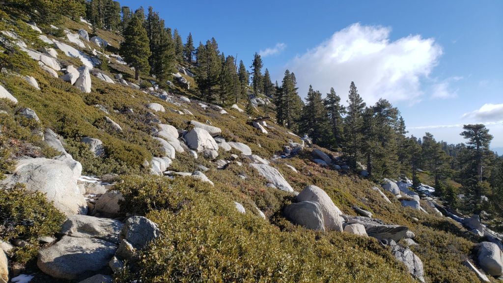
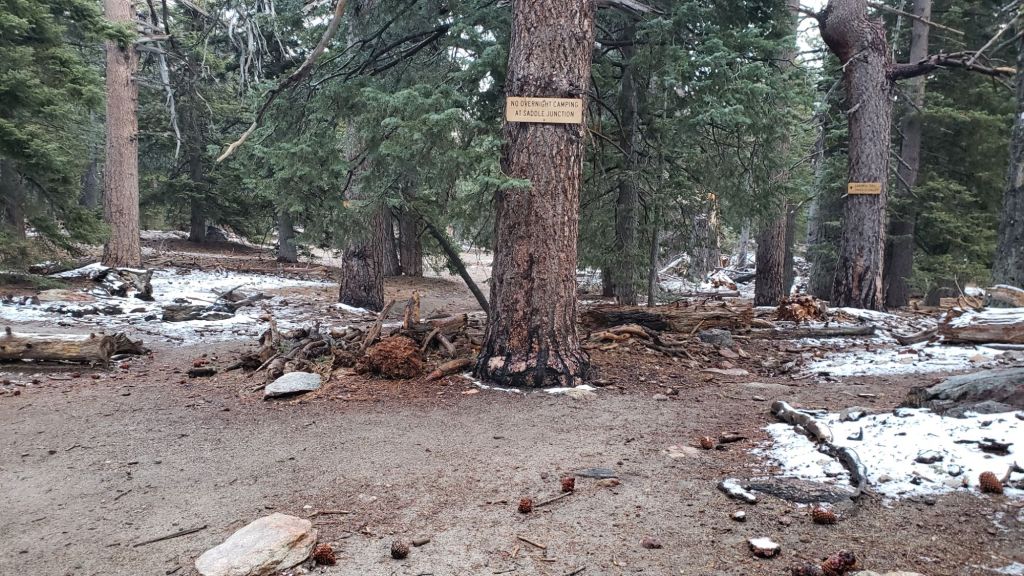
The Pacific Crest Trail is now largely clear of snow through the San Jacinto mountains, with the exception of a few areas described below. Miles 151 (Highway 74) to about Mile 175 are clear. Snow cover from Miles 175 (Red Tahquitz) to 177.7 (Chinquapin Flat) is about 30% with a very well-worn track. Snow cover is minimal between Miles 177.7 to Saddle Junction (about Mile 179). The south-facing slope of Miles 179-180 is clear, while from Mile 180 (elevation 8900 ft) to about Mile 181 just past Annie’s Junction snow cover has dropped dramatically in recent days to just 25%. Miles 181-184.5 are sun-exposed and clear. Snow cover increases around Mile 185 in the sheltered area near the Deer Springs crossing, but again there is a well-traveled boot track. Fuller Ridge (Miles 185.5-191) now averages just 20% snow cover, with Miles 186-186.5 and 187.5-188.3 in particular being sun-exposed and snow-free. Some hikers may find spikes are useful in places throughout this section, but they are not required as the track is well-defined with good steps where it goes through snow patches. The trail is clear of snow from Mile 191 northwards.
Although the situation improved somewhat in 2024, treefall hazards remain a significant problem along parts of the Pacific Crest Trail, most notably between Antsell Rock and South Peak. About 60 trees are down across the trail between PCT Miles 170.5-174, with 37 of these, including several serious obstructions that make for slow-going, between Miles 172.5-174 (around and immediately south of South Peak). A further nine smaller obstructions are down from Miles 168.5-170.5 (Spitler Peak Trail to Zen Center Trail). Significant sections of Miles 168.5-175 are also badly overgrown with brush and are in urgent need of major trimming work. Further logging and trimming work is scheduled in this area in May and early June this year.
Devil’s Slide Trail is clear of snow.
The Wellman Trail is now almost snow-free, with just 20% snow cover confined to the forested 0.3 mile section immediately north of Annie’s Junction. Wellman’s Cienega is unfrozen but flowing relatively poorly for so early in the year.
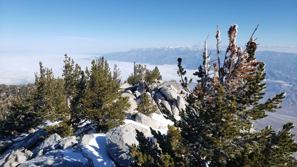
The Peak Trail averages only 10% snow cover, almost all of which is in the north-facing and sheltered section at 9900-10,100 ft (always slow to clear in spring). Rocks around San Jacinto Peak are largely clear of snow and it is possible to ascend the Peak without stepping on snow patches.
The East Ridge Trail route to San Jacinto Peak starting at 10,400 ft near Miller Peak had cleared rapidly to only 40% snow cover prior to the snowfall on 4th. It will likely to return to <50% snow cover during the course of this week. The old trail is visible and can followed in places.
South Ridge Trail is clear of snow to Tahquitz Peak. South Ridge Road is lumpy but readily passable in any moderate clearance vehicle.
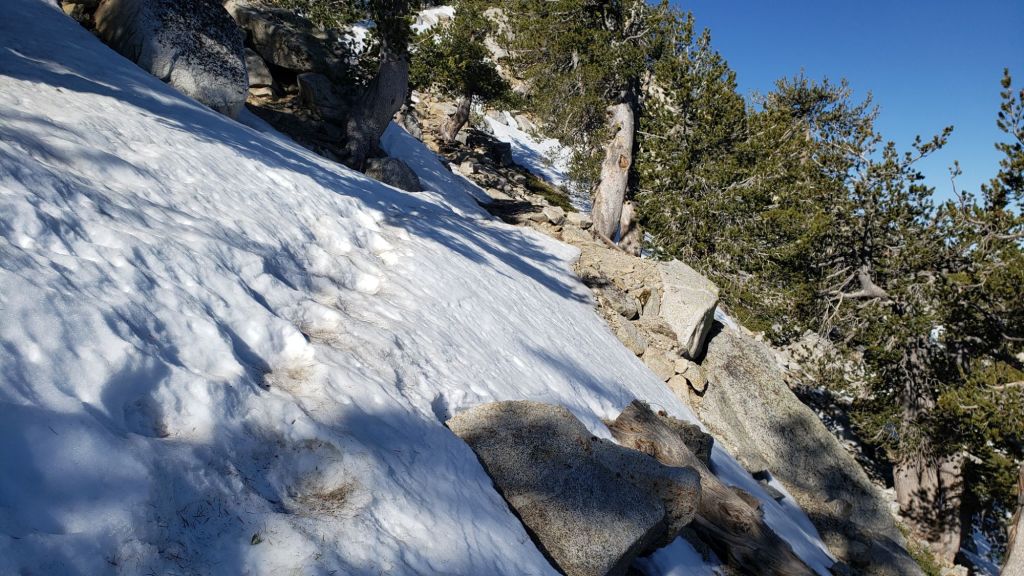
The 0.4 mile section of South Ridge Trail between Chinquapin Flat/PCT Mile 177 and Tahquitz Peak is now largely clear of snow and has a reliable boot track to follow through the few remaining tiny snow patches (example photo above). Most hikers are finding spikes are no longer required on this trail.
Marion Mountain Trail is functionally clear of snow, with just a couple of limited patches of old icy snow remaining at the PCT junction.
Deer Springs Trail will be almost entirely clear of snow up to 9200 ft (above the Fuller Ridge Trail junction) by the weekend, and largely clear of snow to Little Round Valley. A few limited areas of extended icy snow patches remain, notably in the most sheltered areas either side of the Deer Springs crossing and again in the drainage of the North Fork of the San Jacinto River. Nevertheless the well-traveled track is easy to follow to Little Round Valley. In Little Round Valley, snow cover averages only 50%, most continuous in the central, most forested section. Above Little Round Valley the trail has only 20% snow cover, but can be tricky to follow, with large icy snow drifts in a few key places around switchbacks. Spikes remain useful at least for descending parts of upper Deer Springs Trail.
Spitler Peak Trail is clear of snow. Storms in February-March brought down another 34 trees across this trail. All but one were removed in late March, bringing to 162 the total number of trees removed by the Trail Report from this route in the past six years. A very large burned cedar remains which can be a little tricky to pass, next to the first crossing of Spitler Creek (3.2 miles up from the trailhead, 1.6 miles down from the PCT).
Seven Pines Trail is functionally clear of snow to 8200 ft, with about 30% cover of old snow drifts from there to the PCT/Deer Springs Trail. Seventeen downed trees were removed in April 2025, and significant progress made on removal of accumulated winter debris in the trail up to about 8000 ft (example photo below). The Trail Report “adopted” Seven Pines as a priority for maintenance work years ago due to a disproportionate number of lost hiker rescues in the previous decade, with neither State Park nor Forest Service having shown significant interest in maintaining the route for many years. Since 2019 we have removed 92 downed trees and the trail is generally trimmed and cleared at least annually. About six trees remain to be cut above the current snow line to restore the original trail route, plus one very large recently downed tree lower down. Although our work has largely restored this trail, note that Seven Pines remains a genuine wilderness trail unlike the wider, bare, obvious routes of, for example, Devil’s Slide or Marion Mountain trails. Cautious navigation remains invaluable for those without considerable experience of hiking this trail. Also note the trail becomes most obscure in its uppermost mile – especially at present due to snow drifts – i.e. closest to the Deer Springs Trail/PCT junction.
The Caramba Trail from near Reeds Meadow through Laws Camp and on to Caramba, and the Cedar Trail from Willow Creek Trail to Laws, are euphemistically (and potentially dangerously) described by the Forest Service as “not maintained”. In reality both trails have been abandoned and no longer exist. They are so heavily overgrown, largely with dense whitethorn which obscures dozens of downed trees, that hikers should not attempt to follow them (regardless of how much you may trust an app). An informal use trail to Laws is much more direct, generally well maintained, and avoids the bushwhacking of the unmaintained trails (some local Idyllwild hikers dubbed it the “King Trail” when I established the route in 2019). It leaves Willow Creek Trail exactly 1.0 mile from Saddle Junction, 0.46 mile from the Skunk Cabbage turning (trailhead at N 33.7796, W 116.6590). The route descends largely following established deer trails for 1.2 miles, meeting Willow Creek about 0.2 mile upstream from the site of the historic Laws Camp (the remains of which were destroyed by the 2013 Mountain Fire and subsequent flood and treefall damage). One huge tree fell in late 2024 across the King Trail about midway down and requires a minor scramble underneath (that tree will not be cut soon), while another fell in January 2025 close to the bottom of the trail that is relatively easy to cross over. Another five recently downed trees were either removed or worked around in January 2025, when the trail was thoroughly trimmed and cleared. From Laws east to Caramba the original Caramba Trail has been cairned by myself and others and can largely be followed with careful route-finding. My February 2025 survey counted about 120 trees down on this 2.1 miles of trail. It is extremely obscure for the first 0.5 mile east of the Willow Creek crossing, becoming more obvious (but still subtle) as it descends towards Caramba. Very cautious navigation is advised throughout the area.
In late 2024 Willow Creek Trail was nearing its 2020 condition, the last time the original trail route was fully cleared and passable. Four new trees came down on the Forest Service section in January, two of which are large and tricky for hikers to pass. In addition to trees being cut in 2024, whitethorn trimming was largely completed, mainly by volunteers, on the Forest Service side in late summer. On the State Park side localized trimming of the worst patches was undertaken in 2024, and the minor treefall hazards new in 2023/24 were removed, leaving just two major long term downed trees (both easy to pass for hikers).
The Zen Center Trail continues its serious deterioration that started following the 2013 Mountain Fire, with a combination of vigorous regrowth and treefall hazards further obscuring the route with each passing season. The lower and upper thirds of this trail are partially cairned and not too bad for those who are very familiar with the former route, but even the experienced find navigating the central section tricky. Long trousers, scrambling gloves, and a genuine enjoyment of bush-whacking are all strongly recommended.
While all time and labor is volunteered, the San Jacinto Trail Report uses small donations to help cover modest operating costs. Your contribution keeps the Report available to all, free from advertising or paywalls, and independent from agencies. If you have found this Report useful, please consider using this link to the Donate page. Thank you very much for your support.