UPDATE Friday 28th February 2025: I recorded a video report from San Jacinto Peak early this morning (linked here), giving a feel for current conditions and discussing the significant weather change on the way. Below seasonal temperatures are expected for the next two weeks, with three snow storms in quick succession expected on 2nd-3rd, 5th-6th, and 10th-11th March. Even limited snowfall in the first of these storms will be enough to complicate conditions underfoot in the high country by obscuring the thin icy snow above about 9000 ft elevation (lower in places) that persists from mid February.

Despite the moderate storm mid month, Southern California continues to experience one of the the driest winters since records began in 1850. Worse still, this is easily the driest winter in history for the San Jacinto mountains high country, where total snowfall at San Jacinto Peak since September 2024 has been a paltry 25 inches. That number will need to more than double in the next couple of months even to match the lowest snow total in recorded history (57.75 inches in winter 2021/22). The air temperature at San Jacinto Peak on Monday 24th (40.8°F/5°C) was the hottest ever recorded there in the month of February.
The first – and so far only – notable storm of this winter, between Wednesday 12th and Friday 14th February, accounted for 70% of this winter’s snowfall to date and was described in detail in the previous report (linked here). There is an increasing possibility of a minor storm on 2nd-3rd March, with 1-5 inches of snow forecast for the high country, and a mix of light snow and rain for mid elevations.
This report is the first of the season to include a dedicated Pacific Crest Trail section (below, between Weather and Trail Conditions) for the benefit of northbound PCT hikers. Additional information elsewhere in the report is however also of use to PCT hikers.
Trails below about 7600 ft are now generally clear of snow, with snow on trails up to 9000 ft on sun-exposed slopes becoming increasingly patchy (details under Trail Conditions below).
Carrying spikes is recommended throughout the trail system above about 7500 ft. While they are not required, depending upon your expertise and comfort level hiking on shallow, variable, icy snow – with snow condition itself depending on time of day and sun exposure – spikes continue to be widely useful as established tracks undergo freeze-thaw cycles and are consolidated by hiker traffic. Typically spikes tend to be much more valuable for descending trails than for ascending.
Snowshoes are no longer helpful on the established trail system, which is too compacted for their use. Hikers venturing well off-trail may find that they remain valuable in some areas above about 9000 ft.
Hikers should be prepared for temperatures near or below freezing in the high country, and well below freezing when considering wind chill effects, from 28th February into the first week of March (see below for my recent weather observations from San Jacinto Peak).
Survey hikes by the Trail Report every single day throughout the year in the San Jacinto mountains include varied routes to the high peaks including San Jacinto Peak typically 2-3 times per week (more frequently during storms), Tahquitz Peak and area 1-2 times per week, plus a wide variety of other trails on intervening days.
Details of snow depths measured at various locations on the trail system are given at the foot of this posting. Note however that snow depth itself is very rarely indicative of the difficulty (or ease) of hiking a particular track or trail. For example a firm, well-compacted track across deeper snow is often much easier hiking than a poorly defined track across just a few inches depth of angled icy snow.
The USFS gate at Humber Park reopened on 18th February after a brief closure. Even when closed there are nine legal parking spaces immediately below the gate. South Ridge Road remains open and is readily passable, albeit somewhat lumpy in places. Dark Canyon Road (4S02), the access road to the Seven Pines trailhead, is closed due to seasonal conditions.
WEATHER
Since the passage of the storm more than a week ago, temperatures have been largely above seasonal. Temperatures are forecast to be far above average for February from 23rd-27th, with snow softening and melting everywhere.
A rapid cooling will result in temperatures below average from 28th February throughout the first week of March, as minor systems pass through on 2nd-3rd and again 5th-6th March. From 27th February onwards, most days will be partly or mostly cloudy.
Forecasts are currently indicating possibilities for light precipitation on 1st-6th March, most likely on 3rd, with 1-3 inches of snow possible at the highest elevations. The system will be cold enough to produce a dusting of snow as low as 4000 ft.
At San Jacinto Peak (10,810ft/3295m) on Friday 28th February 2025 at 0800 the air temperature was 27.8°F (-2°C), with a windchill temperature of 11.3°F (-13°C), 41% relative humidity, and a bitter SE wind sustained at 17 mph gusting to 23.9 mph.
At the Peak on Monday 24th February 2025 at 0810 the air temperature was 40.8°F (5°C), with a windchill temperature of 30.6°F (-1°C), 55% relative humidity, and a very light NW wind sustained at 3 mph gusting to 7.5 mph.
At the Peak on Thursday 20th February 2025 at 0820 the air temperature was 35.6°F (2°C), with a windchill temperature of 23.2°F (-5°C), 17% relative humidity, and a steady NNW wind sustained at 10 mph gusting to 18.3 mph.

PACIFIC CREST TRAIL
The trail is largely clear of snow from Miles 151 (Highway 74) to about Mile 175. Some thin patchy snow remains on north-facing and sheltered slopes. A patchy 1-2 inches of snow on the north-east side of Apache Peak (Miles 169.5) poses no significant problems. Treefall hazards are a problem on parts of this section but none are insurmountable, as described in more detail under Trail Conditions.
Snow cover is continuous from Miles 175 (Red Tahquitz) to 177.7 (Chinquapin Flat), with a lightly-traveled boot track through very limited consequential terrain. Many hikers may find spikes useful on this section.
PCT hikers attempting to use South Ridge Trail from the PCT at Chinquapin Flat (roughly Mile 177.7) to Idyllwild via Tahquitz Peak – even though this looks temptingly simple on apps and maps – should note that there is only a rough track with limited steps to follow through a section of steeply angled (and notoriously treacherous) ice slopes.
Snow cover is thin and starting to become patchy and averages 90% between Miles 177.7 to Saddle Junction (about Mile 179). The south-facing slope of Miles 179-180 is 50% clear, but from Mile 180 (elevation 8900 ft) to about Mile 181 just past Annie’s Junction snow cover is continuous. Miles 181-183 are sun-exposed and clearing of snow, and snow cover then becomes largely continuous from Mile 183.5. Spikes can be useful on the snowy parts of this section, but are not required at this time for hikers experienced with snow travel.
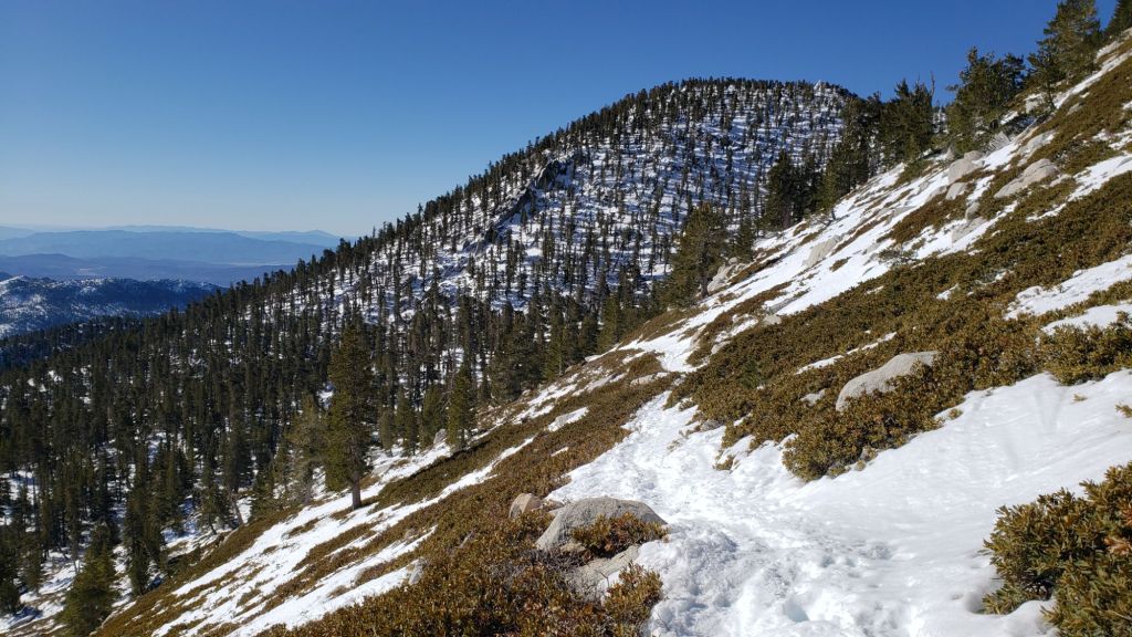
There is a boot track through an average of 90% moderate snow cover on the PCT along Fuller Ridge (Miles 185.5-191), steadily clearing on the most sun-exposed areas. The track does not accurately follow the PCT route in some places and passes through some challenging terrain, especially in Miles 185.5-187. At this time continuing north on Fuller Ridge requires the skills and comfort level to hike on angled terrain with some moderate exposure, and spikes are recommended.
In recent years a myth has periodically circulated on PCT social media that going up and over San Jacinto Peak somehow avoids Fuller Ridge. This is erroneous and potentially dangerous. Whether you remain on the PCT northbound (going around at lower elevation via Strawberry Junction, Mile 183) or leave the PCT at Annie’s Junction (Mile 180.8) to go up to San Jacinto Peak and then down the west side to reconnect to the PCT at about Mile 185.5, you still have to hike Fuller Ridge (Miles 185.5-190.5). It is possible to do the former route more safely by leaving the PCT at Strawberry Junction and descending Deer Springs Trail, which is largely clear of snow below Strawberry Junction, back into Idyllwild.
A well established alternate from Idyllwild – avoiding Fuller Ridge – is to connect back to the PCT at about Mile 191 using Black Mountain Road. Black Mountain Road is clear of snow for the lower five miles, and then has increasingly patchy 20% snow cover for the upper three miles to the PCT but following the road through the snow patches is obvious. Mile 192 northward to Interstate 10 is functionally clear of snow.
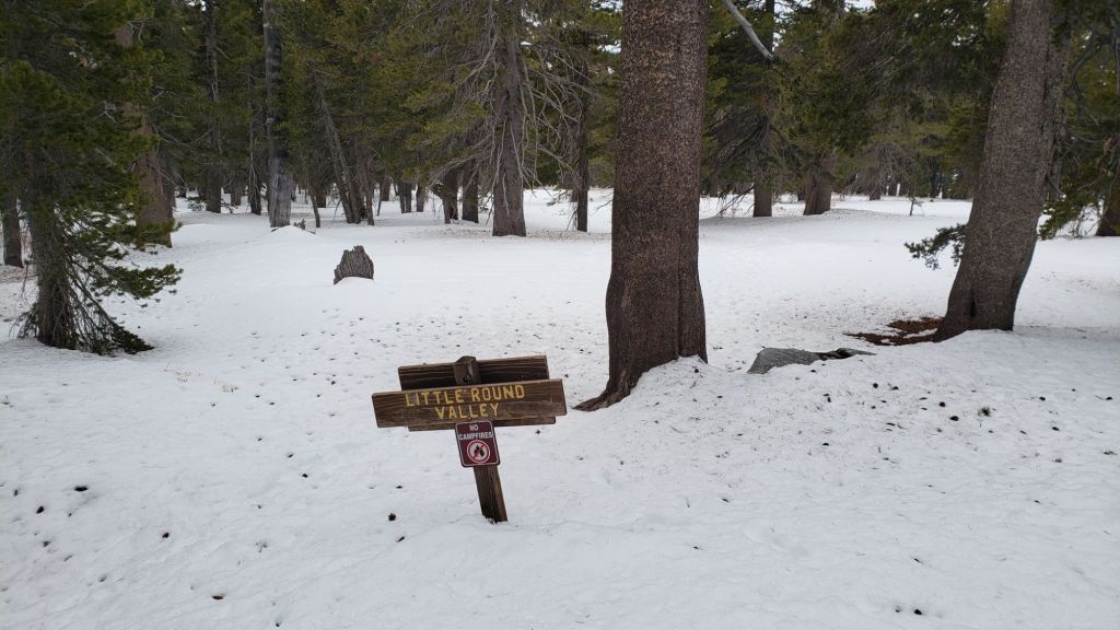
PCT hikers are asked to respect that overnight stays are not permitted at or near San Jacinto Peak, including in the historic shelter, to minimize impacts to a sensitive subalpine environment. Officially Mt. San Jacinto State Park permits overnight stays only in established campgrounds (Little Round Valley and Strawberry Junction are good options for thru-hikers).
While all time and labor is volunteered, the San Jacinto Trail Report uses small private donations to help cover operating costs. Your contribution keeps the Report available to all, free from advertising or paywalls, and independent from agencies. If you have found this Report useful, please consider using this link to the Donate page. Thank you very much for your support.

TRAIL CONDITIONS
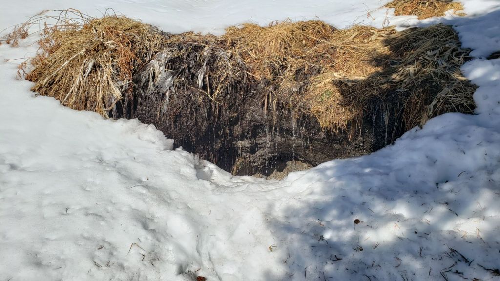
Trails are covered with thin patchy snow above about 7500 ft, and light-to-moderate depth snow above about 8500 ft. Melting is steadily underway at all elevations, and clear patches are already appearing as high as 9000 ft in places. Due to unusually mild temperatures at all elevations this week, snow is softening as early as mid morning, and significant postholing is possible by late morning.
Everywhere above about 7500 ft carrying spikes is recommended as established trails become consolidated by hiker traffic and as they undergo freeze-thaw cycles. This elevation will continue to rise over the next few days as sun-exposed trails continue to melt. As always, spikes tend to be especially useful for descending, even when they are not necessarily required for ascending. For example I have yet to need spikes to ascend to San Jacinto Peak since recent snowfall, but have used them to descend down to 8900 ft on Deer Springs Trail.
Devil’s Slide Trail is now clear of snow to about 7600 ft. From there to Saddle Junction there is about 40% cover of thin and increasingly patchy icy snow to Saddle Junction. Some hikers will find spikes useful in this upper section, especially for descending.
There is a moderately traveled posthole track south on the PCT from Saddle Junction (Mile 179) to about Mile 177 (Chinquapin Flat), that is then very lightly-traveled onward to Tahquitz Peak.
From Saddle Junction northbound a well-traveled track continues to San Jacinto Peak via Annie’s Junction (PCT Mile 180.8) and Wellman Divide, via the Wellman, Peak, and East Ridge trails.
There is now a continuous posthole track on the Peak Trail. However the most-consolidated posthole tracks turn up to the Peak near Miller Peak via the East Ridge Trail route, and although there are various meandering options ascending the ridge, they all merge near the Peak.
Also on the tram side, there is a well-traveled posthole track from Long Valley through Round Valley to Wellman Divide. Earlier tracks coming directly up from the tram via Tamarack Valley (the “Sid Davis” route) that were put in immediately after the storm last week are no longer passable due to melting.
Deer Springs Trail is clear of snow to the Suicide Rock trail junction. The trail remains clear of snow to 7500 ft, with then about 10% thin snow cover nearer Strawberry Junction (8050 ft). Thereafter snow cover is largely continuous to San Jacinto Peak, albeit thin and starting to become patchy especially below 8600 ft. The track is relatively lightly-traveled but easy to follow to the junction with Marion Mountain Trail. Above that point the well-traveled track largely follows the true trail route to Little Round Valley. Above Little Round Valley, there is a mess of meandering posthole tracks that all head upslope toward San Jacinto Peak, with none of them consistently or accurately following the trail route (as is typical in winter with adequate snow depth on this slope), before coalescing near Summit Junction (10,500 ft).
On the section of Deer Springs Trail between Strawberry Junction and the top of Marion Mountain Trail (roughly PCT Miles 183-185) six significant treefall hazards remain, mostly from high winds in January. Three more came down in a concentrated area just north of the top of Seven Pines Trail (near Mile 185.2). About ten further trees on the upper trail (above Fuller Ridge) have been down and reported repeatedly for more than a decade but with no action from the State Park. Two significant obstructions are down across the trail between the Suicide Rock Trail junction and Strawberry Junction.
Marion Mountain Trail is clear of snow to 7600 ft. For a brief transition 0.1 mile above that elevation, icy snow cover is about 50%, before quickly becoming 90% up to the PCT/Deer Springs Trail. There is a good boot track to follow throughout. While spikes are not essential on the ascent, most hikers will find them invaluable for the descent. Several large tree limbs and four medium-sized trees came down across the trail in recent weeks, with one on the Forest Service section and three in the State Park, all of which are relatively easy to pass over for hikers.
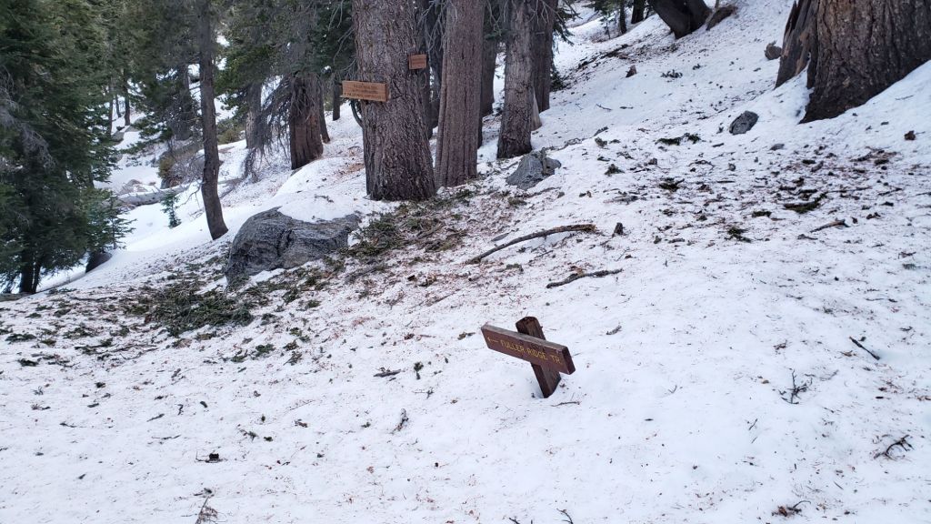
South Ridge Trail [updated 28th] is now largely clear of snow until the uppermost switchbacks close to the peak. In the uppermost switchbacks (>8500 ft, switchback 12) icy snow cover averages 60%, and some hikers will find spikes useful, especially for descending. Five treefall hazards that came down in the trail earlier this year have already been removed by the Trail Report, and the most extensive trail trimming program on South Ridge in more than a decade has continued throughout this winter.
Tahquitz Peak trail from Chinquapin Flat/PCT Mile 177 has a challenging and very lightly traveled posthole track to follow through the steeply angled icy snow (photo in previous Report linked here). These slopes comprise some of the most consequential terrain in winter in these mountains, and this route is not recommended for most hikers at this time. Spikes (or even crampons) are strongly recommended, with at least hiking poles or preferably an ice axe (assuming adequate knowledge of how to use it).
Although the situation has improved somewhat in recent months, treefall hazards remain a significant problem along parts of the Pacific Crest Trail, most notably between Antsell Rock and South Peak. Some 56 trees are down across the trail between PCT Miles 170.5-174, with 37 of these, including several serious obstructions that make for slow-going, between Miles 172.5-174 (around and immediately south of South Peak). A further nine smaller obstructions are down from Miles 168.5-170.5 (Spitler Peak Trail to Zen Center Trail). Significant sections of Miles 168.5-175 are also badly overgrown with brush and are in urgent need of major trimming work (surveyed January 2025).
On the Fuller Ridge Trail section of the PCT there are 12 trees down on the State Park section of the trail (Miles 185.5-189, which have not been maintained by that agency for many years). Several of these pose quite significant hazards for hikers. On the Forest Service section (Miles 189.3-190.5) five significant treefall hazards were removed by USFS late in 2024. Snow cover on Fuller Ridge Trail averages only 50%, but is very localized with sun-exposed sections completely clear and shaded sections still with 1-2 inches depth of snow in the trail.
Trees down on the Strawberry Trail section of the PCT (Annie’s Junction to Strawberry Junction, Miles 180.8-183) have remained uncut by the Forest Service for nearly a decade. About six hazards on this section are thankfully all relatively easy for hikers to negotiate.
The Trail Report heavily trimmed the formerly overgrown Wellman Trail (Annie’s Junction to Wellman Divide) from September 2024-January 2025.
In February 2025 the Trail Report cleared Spitler Peak Trail of the six trees that came down in Santa Ana winds in January (bringing to 129 the total number of trees removed by the Report from this trail in recent years). We also removed most of the whitethorn from the central portion of the trail in December 2024. While more brush trimming work is always required, in general the trail is currently in its best condition since at least mid 2023. Spitler Creek continues to flow gently at its various crossings in the upper switchbacks, and Antsell Rock Creek starting flowing gently again late last year.
The Trail Report removed the only two new small trees down across Fobes Trail earlier in February. The trail is otherwise largely clear, with only a few minor branch hazards mainly along the lower trail.
The Caramba Trail from near Reeds Meadow through Laws Camp and on to Caramba, and the Cedar Trail from Willow Creek Trail to Laws, are euphemistically (and potentially dangerously) described by the Forest Service as “not maintained”. In reality both trails have been abandoned and no longer exist. They are so heavily overgrown, largely with dense whitethorn, which obscures dozens of downed trees, that hikers should not attempt to follow them (regardless of how much you may trust an app). An informal use trail to Laws is much more direct, well maintained, and avoids the bushwhacking of the unmaintained trails (some local Idyllwild hikers dubbed it the “King Trail” when I established the route in 2019). It leaves Willow Creek Trail exactly 1.0 mile from Saddle Junction, 0.46 mile from the Skunk Cabbage turning (trailhead at N 33.7796, W 116.6590). The route descends largely following established deer trails for 1.2 miles, meeting Willow Creek about 0.2 mile upstream from the site of the historic Laws Camp (the remains of which were destroyed by the 2013 Mountain Fire and subsequent flood and treefall damage). One huge tree fell in late 2024 across the King Trail about midway down and requires a minor scramble underneath (that tree will not be cut soon), while another fell in January 2025 close to the bottom of the trail that is relatively easy to cross over. Another five recently downed trees were either removed or worked around in January 2025, when the trail was thoroughly trimmed and cleared. From Laws east to Caramba the route of the original Caramba Trail has been cairned by myself and others and can largely be followed with careful route-finding. My February 2025 survey counted about 120 trees down on this 2.1 miles of trail. It is extremely obscure for the first 0.5 mile east of the Willow Creek crossing, becoming more obvious (but still subtle) as it descends towards Caramba. Very cautious navigation is advised throughout the area.
In late 2024 Willow Creek Trail was nearing its 2020 condition, the last time the original trail route was fully cleared and passable. Four new trees came down on the Forest Service section in January, two of which are large and tricky for hikers to pass. In addition to trees being cut in 2024, whitethorn trimming was largely completed, mainly by volunteers, on the Forest Service side in late summer. On the State Park side localized trimming of the worst patches was undertaken in 2024, and the minor treefall hazards new in 2023/24 were removed, leaving just two major long term downed trees (both easy to pass for hikers).
The Trail Report “adopted” Seven Pines Trail as a priority for maintenance work as the trail had a disproportionate number of lost hiker rescues in the past decade, and both State Park and Forest Service have shown no interest in maintaining the route for years. Since 2020 we have removed 75 downed trees and the trail is trimmed and cleared multiple times annually. As of late 2024 the trail is – by its low standards – relatively clear of treefall hazards, with three down across the trail in its upper section, all easily passable for hikers. A further half-a-dozen downed trees close to the PCT junction would need to be removed to fully restore the original route of the trail. Although the condition of the trail is greatly improved, Seven Pines remains a genuine wilderness trail unlike the wider, bare, obvious routes of, for example, Devil’s Slide or Marion Mountain trails. Cautious navigation remains essential for those without considerable experience of hiking this trail. Be aware in particular that Seven Pines Trail becomes most obscure in the mile closest to its junction with Deer Springs Trail/PCT.
The Zen Center Trail continues its serious deterioration that started following the 2013 Mountain Fire, with a combination of vigorous regrowth and treefall hazards further obscuring the route with each passing season. The lower and upper thirds of this trail are partially cairned and not too bad for those who are very familiar with the former route, but even the experienced find navigating the central section tricky. Long trousers, scrambling gloves, and an enjoyment of bush-whacking are all strongly recommended.
SNOW DEPTHS
Measured on 24th February 2025 (20th February for Deer Springs Trail locations). Note that average depth is given; due to strong winds accompanying the storm system there was extensive drifting, especially in the trails. Altitudes and PCT Miles are approximate. Also note that – remarkably for February – none of these locations had any snow remaining from prior storms (i.e. everything recorded here was from the latest, mid February, storm).
San Jacinto Peak (10810 ft): 11 inches (was 17.5 inches on 14th February, drifted areas ranging from 7-24 inches)
Little Round Valley (9750 ft): 16 inches (drifted to 24 inches in places)
Wellman Divide (9700 ft): 6 inches (was 17 inches on 14th February, heavily drifted in places)
Annie’s Junction/approx. PCT Mile 180.8 (9020 ft): 13 inches (was 16-17 inches on 14th February)
Fuller Ridge Trail junction with Deer Springs Trail/approx. PCT Mile 185.5 (8800 ft): 12 inches
Saddle Junction/approx. PCT Mile 179 (8070 ft): 1-2 inches (was 3.5 inches on 14th February)
Strawberry Junction/approx. PCT Mile 183.1 (8050 ft): 1-2 inches (patchy 0-4 inches)
Devil’s Slide Trail at Humber Park (6550 ft): 0 inches (was 2-3 inches on 14th February)
Idyllwild (at 5550 ft): 0 inches (0.25 inch of snow on 12th February, and 5.3 inches of rain 12th-14th February)
While all time and labor is volunteered, the San Jacinto Trail Report uses small private donations to help cover operating costs. Your contribution keeps the Report available to all, free from advertising or paywalls, and independent from agencies. If you have found this Report useful, please consider using this link to the Donate page. Thank you very much for your support.