UPDATED Thursday 20th February: I hiked to San Jacinto Peak today for the fourth time in the past week, ascending via the Wellman and Peak trails, descending Deer Springs Trail, and have updated the Trail Conditions section below accordingly. I summarized my observations from Sunday 16th in a video report from the far-too-warm-for-February Peak (linked here). On 17th we hiked both north and south sides of Tahquitz Peak. High country tracks are generally firm and reliable underfoot in the early morning, but become soft by late morning, with a much greater likelihood of postholing by and after noon.
————————————-
This is a summary of conditions following the seventh, but by far most substantial, snow storm of winter 2024/25, with the majority of the snow falling between the afternoon of Thursday 13th and the morning of Friday 14th February.
Exactly six years on from the (in)famous Valentine’s Day flood of 2019 – when eight inches of rain in less than a day destroyed several mountain roads, some for months – heavy rain was also a feature of this storm, with Idyllwild recording 5.3 inches (and nearly four inches in one 24 hour period).
This complex storm sequence had multiple phases as discussed under Weather below. The practical consequence was a strikingly high snow level, with moderate snow above about 8500 ft, and surprisingly shallow snow lower down. I have never recorded such a discrepancy in snow depths between Saddle Junction (8100 ft, with just three inches by the afternoon of 14th) and Annie’s Junction (9020 ft, nearly 18 inches).
Final storm totals included 17-18 inches at San Jacinto Peak, similar amounts at Wellman Divide and Annie’s Junction (due to the complexities of the timing of the snowfall), just 10-11 inches at Long Valley, and three inches or fewer from Saddle Junction (8100 ft) down to about 6500 ft.
I recorded a short video report from San Jacinto Peak in the snow just after 0900 on Friday 14th (linked here).
Most trails have now been traveled and most are no longer obscured by significant snowfall, due to hiker traffic and with rapid melting continuing. Nevertheless cautious navigation is recommended everywhere. Snow depths measured on 14th are listed at the foot of this posting, but note that due to very strong winds accompanying the storm there was extreme drifting, and snow is often deeper in the trails.
Until about 18th, conditions were unusually good for snowshoeing above about 9000 ft on most of the mountain, and as low as 8000 ft on the eastern side (where less impacted by rainfall). Rarely have I encountered such a densely formed snowpack in fresh powder, and I was gliding across the surface of the snow on 14th. With compaction from freeze/thaw cycles, conditions are now better for spikes.
Everywhere above about 7000 ft it is recommended to carry spikes for the foreseeable future as established trails have become consolidated by hiker traffic and as they undergo freeze-thaw cycles. This elevation will rise further over the next week as sun-exposed trails rapidly melt.
Sadly – but unsurprisingly given the trend this winter – temperatures abruptly rise to above seasonal on Saturday 15th February, and remain warm for days, possibly even for the remainder of the month. Consequently melting will be rapid at all elevations, especially on sun-exposed slopes. Only those traditional locations that are especially sheltered – for example the north face of Tahquitz Peak, either side of Annie’s Junction (PCT Mile 180.8), in and below Little Round Valley – may continue to hold deep snow for the next several weeks.
The USFS gate at Humber Park reopened on 18th February after a brief closure. Even when closed there are nine legal parking spaces immediately below the gate. If there is a “Road Closed” sign lower down, it is also possible to park along Forest Drive. South Ridge Road remains open and is readily passable, albeit somewhat lumpy in places. Dark Canyon Road (4S02), the access road to the Seven Pines trailhead, is closed due to seasonal conditions.

WEATHER
Temperatures are forecast to abruptly rise above seasonal averages this weekend and remain elevated for the remainder of February, especially on 23rd-27th. By Sunday 23rd record high temperatures for the month of February are possible around the highest peaks. Most days are forecast to be clear and sunny until the turn of the month. Obviously these factors will combine to cause rapid snow melt and deteriorate hiking conditions markedly.
The three day storm on 12th-14th was complex with three distinct phases. The first cold phase on the morning of Wednesday 12th included snow dusting down to just below 5000 ft but minimal depth, with only 0.25 inch in Idyllwild and 0.5 inch at Tahquitz Peak (8836 ft). Upper elevations and especially the eastern side of the mountains received no measurable snow at that time.
As temperatures warmed on 12th and into 13th, the shallow snow at mid elevations melted, producing slush on the trails below 9000 ft. Rainfall then dominated as the snow level rose – briefly as high as San Jacinto Peak – before stabilizing around 8500 ft.
From the evening of 12th to the early hours of 14th, rainfall dominated below about 8500 ft, with snowfall above that elevation, and the greatest intensity of both overnight on 13th.
The final third phase was another cooling as the system departed, with the snow level dropping to 6000 ft early on 14th. Precipitation became more inconsistent throughout 14th, finally ending in the early afternoon.
At San Jacinto Peak (10,810ft/3295m) on Thursday 20th February 2025 at 0820 the air temperature was 35.6°F (2°C), with a windchill temperature of 23.2°F (-5°C), 17% relative humidity, and a steady NNW wind sustained at 10 mph gusting to 18.3 mph.
At the Peak on Sunday 16th February 2025 at 0915 the air temperature was 36.4°F (2°C), with a windchill temperature of 30.1°F (-1°C), 45% relative humidity, and a very light WNW wind sustained at 3 mph gusting to 5.8 mph.
At the Peak on Friday 14th February 2025 at 0915 the air temperature was 20.4°F (-6°C), with a windchill temperature of -1.3°F (-19°C), 100% relative humidity, and a bitter WNW wind sustained at 17 mph gusting to 26.7 mph.

TRAIL CONDITIONS
Trails are snow-covered with thin snow above about 7500 ft, and moderate depth snow above about 8500 ft. Melting is underway at all elevations, and clear sections are already appearing below 7500 ft, e.g., lower Devil’s Slide Trail, South Ridge Trail, and lower Deer Springs Trail.
Until about 18th least, beware of large volumes of ice falling from trees over trails, especially from 8000-10,000 ft. Although this happens to some extent following every storm, due to the large volume and high elevation of freezing rain associated with this latest storm, the ice fall risk is unusually noteworthy at present.
Everywhere above about 7500 ft carrying spikes is strongly recommended for the foreseeable future [updated 20th February] as established trails become consolidated by hiker traffic and as they undergo freeze-thaw cycles. This elevation will rise over the next few days as sun-exposed trails continue to melt. As always, spikes tend to be especially useful for descending, even when they are not necessarily required for ascending. Early on the morning of 20th I did not need spikes at all to ascend the Wellman and Peak trails to San Jacinto Peak, on an excellent firm snow track, but used them to descend down to 8900 ft on Deer Springs Trail. By about 1030, snow was becoming soft below Strawberry Junction (but was thankfully already very shallow).
Conditions remain suitable for snowshoeing above about 9000 ft on most of the mountain. Snowshoes may actually become increasingly useful over the next week to minimize postholing as snow softens by late morning, especially on sun-exposed slopes.
Devil’s Slide Trail [20th February] is now functionally clear of snow to about 7500 ft. Hikers are unlikely to require spikes below that elevation. From there to Saddle Junction there is a well-consolidated track to follow through thin, icy snow to Saddle Junction. Spikes are useful in this upper section, especially for descending.
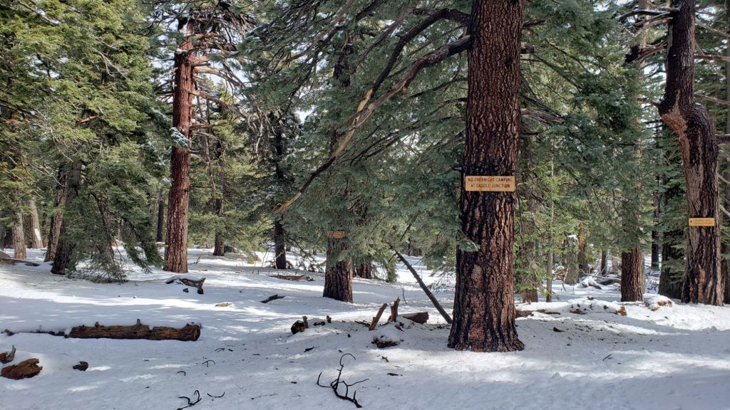
There is a lightly traveled posthole track south on the PCT from Saddle Junction (Mile 179) to about Mile 177 (Chinquapin Flat).
From Saddle Junction northbound [20th February] a well-traveled track continues to San Jacinto Peak via Annie’s Junction (PCT Mile 180.8) and Wellman Divide, via the Wellman, Peak, and East Ridge trails.
Tracks on the Peak Trail end near Miller Peak, where they are joined by tracks coming up from the tram via Tamarack Valley. These all continue up to the Peak via the East Ridge Trail route [20th February], and although there are various options ascending the ridge, they all end up at the Peak.
Also on the tram side, there is a well-traveled posthole track from Long Valley through Round Valley to Wellman Divide.
Deer Springs Trail [20th February] is clear of snow to the Suicide Rock trail junction. The trail remains largely clear of snow to 7500 ft, with then about 50% thin snow cover to Strawberry Junction. Thereafter snow cover is continuous to San Jacinto Peak, albeit very thin below 8600 ft. The track is relatively lightly-traveled but easy to follow to the junction with Marion Mountain Trail. Above that point the well-traveled track is relatively easy to follow, and largely follows the true trail route, to Little Round Valley. Above Little Round Valley, there is only a scattering of posthole tracks that all meander upslope to San Jacinto Peak, with none of them approximating to the trail route (as is traditional in with adequate snow depth on this slope).
South Ridge Trail [22nd February] has a posthole track to Tahquitz Peak fire lookout. The trail is clear of snow to Old Lookout Flat (at 7600 ft). Snow cover averages 50% beyond that. In the uppermost switchbacks (>8500 ft, switchback 12) snow cover is continuous, uneven (due to icefall) and most hikers will find spikes are useful, especially for descending.
Tahquitz Peak trail from Chinquapin Flat/PCT Mile 177 has a challenging and very lightly traveled posthole track to follow through the steeply angled icy snow (photo below). These slopes comprise some of the most consequential terrain in winter in these mountains, and this route is not recommended for most hikers at this time. Spikes (or even crampons) are strongly recommended, with at least hiking poles or preferably an ice axe (assuming adequate knowledge of how to use it).

SNOW DEPTHS
Measured on 14th February 2025. Note that average depth is given; due to strong winds accompanying the storm system there is extensive drifting, especially in the trails. Altitudes and PCT Miles are approximate. Also note that – remarkably for February – none of these locations had any snow remaining from prior storms (i.e. everything recorded here was from this latest storm).
San Jacinto Peak (10810 ft): 18 inches (drifted areas ranging from 7-24 inches)
Wellman Divide (9700 ft): 17 inches, heavily drifted in places.
Annie’s Junction/approx. PCT Mile 180.8 (9020 ft): 15-18 inches
Saddle Junction/approx. PCT Mile 179 (8070 ft): 3 inches
Devil’s Slide Trail at Humber Park (6550 ft): 2 inches (largely slushy, melting already underway)
Idyllwild (at 5550 ft): 0 inches of snow. The 0.25 inch on 12th melted very rapidly. An impressive 4.69 inches of rain since the 12th included 3.72 inches in the 24 hour period starting 0700 on 13th.
While all time and labor is volunteered, the San Jacinto Trail Report uses small private donations to help cover operating costs. Your contribution keeps the Report available to all, free from advertising or paywalls, and independent from agencies. If you have found this Report useful, please consider using this link to the Donate page. Thank you very much for your support.