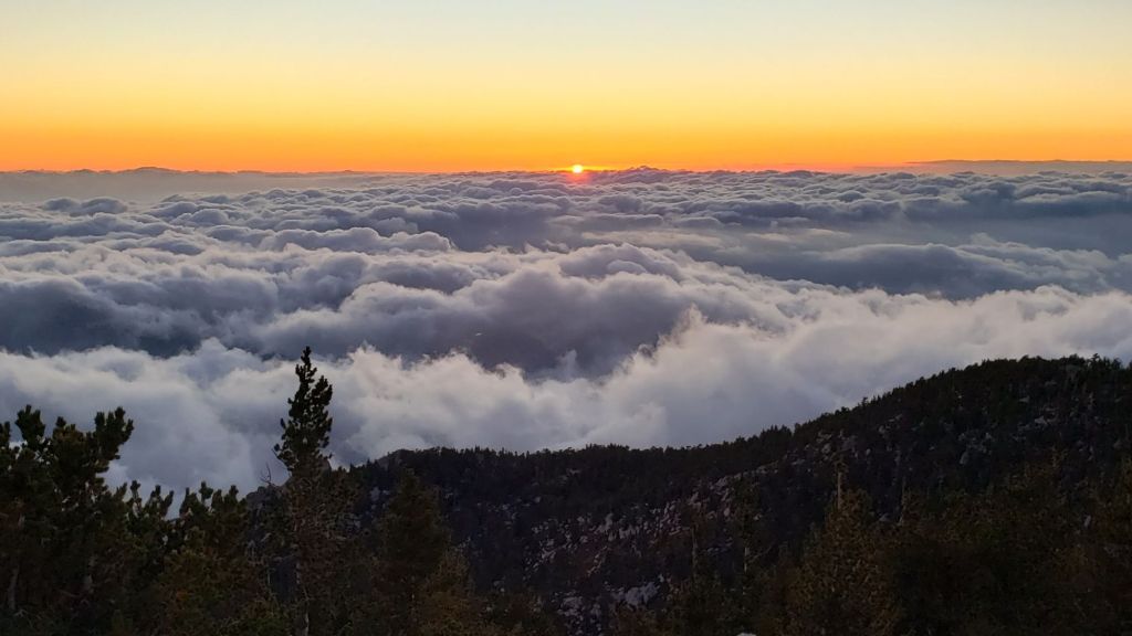
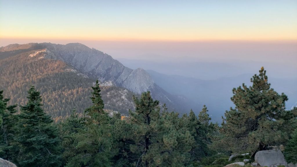
UPDATE Friday 20th September 2024: a cold thunderstorm system moving over the San Jacinto mountains from (unusually) the north-east produced rain, intense hail, and the earliest ever recorded September snow this afternoon! I hiked swiftly up to the high country and recorded a short video from San Jacinto Peak while enjoying being lightly snowed upon (link to video here). The typically localized nature of such storms meant that Idyllwild (at 5550 ft) recorded 0.37 inch of rain, but there was only 0.11 inch at Saddle Junction (8100 ft). Fine, micro grain snow started falling on me at 9800 ft just above Wellman’s Divide and lasted for less than an hour. It only settled significantly on accumulated patches of hail that had fallen a couple of hours earlier, and was melting rapidly by late afternoon.
————————————–
The three major fires burning elsewhere in Southern California – the Airport Fire in the Santa Ana range, the Bridge Fire in the San Gabriels, and the Line Fire in the San Bernardino Mountains – have thankfully all slowed considerably in growth, and smoke pollution across the region is slowly declining. Ultimately the three fires have combined to burn more than 110,000 acres.
Air quality and visibility down in the lowlands, especially the Coachella Valley, had already been generally poor all summer due to the record heat and lack of precipitation, only exacerbated by smoke from recent fires. Air quality has markedly improved in the San Jacinto mountains, following an increase in wind speed, after especially smoky days on 10th and 13th (photos below from the latter). Hiking in the area remains inadvisable for those sensitive to poor air quality.
Thankfully, temperatures fell below seasonal starting Wednesday 11th September, and are forecast to cool even further in a significant cold spell on 16th-20th. A relatively weak but cold system passing to our north will produce temperatures more typical of early winter, including air temperatures near freezing and windchill temperatures well below freezing in the high country on Monday 16th to Friday 20th. There is the possibility of light precipitation on Friday 20th (oddly, especially for the time of year, coming from the north-east).
With a failed monsoon season in most of Southern California, fire risk remains severe everywhere. A comprehensive fire ban is in place on Forest Service lands throughout the San Jacinto Ranger District (link to USFS order here) and in all Idyllwild campgrounds. Campfires are of course always prohibited throughout both the State Park and National Forest wilderness areas.
Survey hikes by the Trail Report every day year-round in the San Jacinto mountains include varied and circuitous routes to San Jacinto Peak multiple times per week (64 ascents this summer since 1st July), plus many other trails on intervening days.
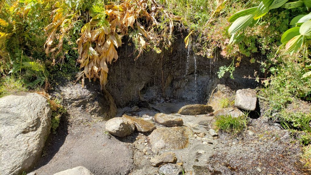
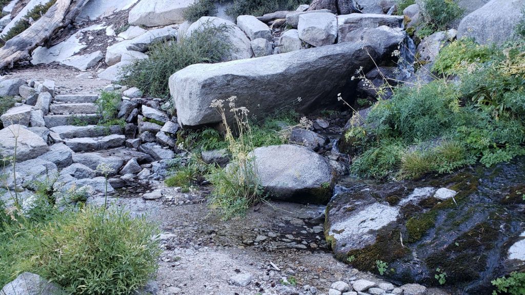
Major springs, creeks, and pipes largely continue to flow adequately at this time (example photos below). However flow rates continue to drop steadily at all elevations and ephemeral water sources are now dry. The Round Valley faucet continued to flow well as of 19th September. In the Tahquitz area meadows, the minor creek in Skunk Cabbage Meadow continues to flow, but the ephemeral creek in Tahquitz Valley is now dry. Tahquitz Creek is flowing steadily at the northern end of Little Tahquitz Meadow, and near its source where it crosses the PCT at Mile 177. Two tiny springs at Strawberry Cienega continue to trickle. Hidden Lake was c.35% full in mid September (by surface area, not volume). Stone Creek is no longer flowing where it crosses Deer Springs Trail at about PCT Mile 183.6, and has dried completely downstream of that point.
The Palm Springs Aerial Tramway closed on Monday 9th September 2024 for annual maintenance, with a tentative reopening date of Monday 7th October.
WEATHER
Temperatures were well above seasonal for the first nine days of September, but then fell below seasonal starting Wednesday 11th September, and are forecast to cool even further in a brief but significant cold snap on 16th-20th. A weak but cold system passing to our north will produce temperatures more typical of November, including air temperatures near freezing and windchill temperatures below freezing above 10,000 ft elevation on Monday 16th to Friday 20th. Thereafter temperatures are expected to rise rapidly yet again starting Sunday 22nd to above seasonal for the remainder of September.
At San Jacinto Peak (3295m/10,810ft) on Friday 20th September 2024 at 1425 the air temperature was 32.2°F (0°C), with a windchill temperature of 20.8°F (-7°C), 95% relative humidity, and a steady NE wind sustained at 9 mph gusting to 12.7 mph.
At the Peak on Thursday 19th September 2024 at 0640 the air temperature was 39.1°F (4°C), with a windchill temperature of 28.7°F (-2°C), 37% relative humidity, and a brisk SW wind sustained at 8 mph gusting to 13.8 mph.
At the Peak on Wednesday 18th September 2024 at 1230 the air temperature was 49.5°F (10°C), with a windchill temperature of 43.6°F (6°C), 42% relative humidity, and a light SW wind sustained at 3 mph gusting to 5.2 mph.
At the Peak on Tuesday 17th September 2024 at 1615 the air temperature was 48.9°F (9°C), with a windchill temperature of 39.6°F (4°C), 31% relative humidity, and a cool WNW wind sustained at 4 mph gusting to 7.8 mph.
At the Peak on Monday 16th September 2024 at 1100 the air temperature was 35.7°F (2°C), with a windchill temperature of 20.3°F (-7°C), 38% relative humidity, and a frigid WSW wind sustained at 15 mph gusting to 23.3 mph.
TRAIL CONDITIONS
Treefall hazards remain a major problem along parts of the Pacific Crest Trail, most notably between Antsell Rock and Red Tahquitz, with 132 recorded in my recent 2024 surveys between Miles 170.5-175.5. The disinterest of Forest Service and PCTA in maintaining this section of a world-famous trail for the past five years is simply unconscionable. Concentrations of large downed trees make for especially slow-going around Miles 170.5-172 (east side of Antsell Rock) and Miles 174-175 (south and east sides of Red Tahquitz). A further 15 smaller trees are down from Miles 168.5-170.5 (Spitler Peak Trail to Zen Center Trail).
About 12 treefall hazards on Deer Springs Trail include 8-9 in the upper trail that have been down and reported repeatedly for years but with no action from the State Park. All but one of the treefall hazards down between Strawberry Junction and the top of Marion Mountain Trail (roughly PCT Miles 183-185) were removed by the Trail Report in late June (example photos in an earlier Report linked here).
On Willow Creek Trail notable treefall hazards on the Forest Service section were finally cut by 13th August. Several trees remain uncut to fully restore the trail route to its 2020 condition, but it seems unlikely that they will ever be cut. Whitethorn along the trail is starting to grow back rapidly, and is becoming a problem on both the Forest Service and State Park sections (photo in previous Report linked here). Forest Service made progress on trail trimming on 26th-27th August and 9th September. Treefall hazards currently on the State Park side include two large ones remaining from last year, plus three small new ones, but none pose major problems for hikers, and there is optimism that some may be removed later in September.
The 34 treefall hazards that came down across Spitler Peak Trail during ice storms in February 2024 were almost all cleared by the Trail Report on 14th June. The couple of minor stepover branches that remain pose no problem for hikers. This work brings to 120+ the total number of trees removed by the Report from this trail in the past three years. Note that currently the upper trail in particular is heavily overgrown with lush seasonal vegetation.
The Caramba Trail from near Reeds Meadow through Laws Camp and on to Caramba, and the Cedar Trail from Willow Creek Trail to Laws, are euphemistically described by the Forest Service as “not maintained”. In reality both trails have been abandoned and functionally no longer exist. They are so heavily overgrown with dense whitethorn, which obscures dozens of downed trees, that I strongly advise hikers do not attempt to follow them (regardless of how much you may trust an app). An informal use trail to Laws is much more direct, maintained, and avoids the challenging bushwhacking of the unmaintained trails (local Idyllwild hikers dubbed it the “King Trail” when I established the route in 2019). It leaves Willow Creek Trail exactly 1.0 mile from Saddle Junction, 0.46 mile from the Skunk Cabbage turning (trailhead at N 33.7796, W 116.6590). The route descends largely following established deer trails for 1.2 miles, meeting Willow Creek about 0.2 mile upstream from the site of the historic Laws Camp (the remains of which were destroyed by the 2013 Mountain Fire and subsequent flood and treefall damage). Eleven trees down on the King Trail were removed in June-July 2023. The tread of the trail received some damage from Tropical Storm Hilary last year. From Laws east to Caramba the route of the original Caramba Trail has been well-cairned by myself and others and can largely be followed with very careful route-finding. My 2023 survey counted about 110 trees down on this 2.1 miles of trail. It is especially obscure for the first 0.3 mile east of the Willow Creek crossing, becoming more obvious (but still subtle) as it descends towards Caramba. Very cautious navigation is advised throughout the area.
The Trail Report “adopted” Seven Pines Trail as a priority for maintenance work as the trail had a disproportionate number of lost hiker rescues in the past decade, and both State Park and Forest Service have shown no interest in maintaining the route for years. Since 2020 we have removed 75 downed trees and the trail is thoroughly trimmed and cleared multiple times annually. As of July 2024 the trail is largely clear of treefall hazards, with three down across the trail in its upper section, all easily passable for hikers. A further half-a-dozen downed trees close to the PCT junction would need to be removed to fully restore the original route of the trail. Although the condition of the trail is hugely improved, Seven Pines remains a genuine wilderness trail unlike the wider, bare, obvious routes of, for example, Devil’s Slide or Marion Mountain trails. Cautious navigation remains essential for those without considerable experience of hiking this trail. Be aware in particular that Seven Pines Trail becomes most obscure in the mile closest to its junction with Deer Springs Trail/PCT.
The Zen Center Trail continues its deterioration that started following the 2013 Mountain Fire, with a combination of vigorous regrowth and treefall hazards further obscuring the route with each passing season. The lower and upper parts of this trail are partially cairned and not too bad for those who are very familiar with the former route, but even the experienced find navigating the central section tricky. Long trousers, scrambling gloves, and an enjoyment of bush-whacking are all strongly recommended.

While all time and labor is volunteered, the San Jacinto Trail Report uses small private donations to help cover operating costs. Your contribution keeps the Report available to all, free from advertising or paywalls, and independent from agencies. If you have found this Report useful, please consider using this link to the Donate page. Thank you very much for your support.