Cooler, seasonal, temperatures on 17th-19th June rapidly transitioned to hot summer temperatures from 21st. Very hot temperatures are forecast for 2nd-8th July, dangerously coinciding with the extended holiday weekend. Overnight low temperatures in particular will be far above seasonal into the second week of July at least. Hikers should be prepared for unseasonably hot weather in the high country, with temperatures above seasonal at all times of day and at all mountain elevations. Give considerable extra thought to start times, route choice, clothing, sun protection, and hydration requirements.
We are already in fire season. Fires – thankfully so far all relatively small – are starting almost daily in the surrounding lowlands of interior Southern California. The first to impact the fringe of the San Jacinto mountains was the Tuscany Fire on 17th June on BLM land on the south side of Chino Canyon (near the Tramway road, north-west Palm Springs), contained at 126 acres.
Survey hikes every day in the San Jacinto mountains include varied routes to San Jacinto Peak multiple times per week (most recently on 21st, 24th, and twice on 28th June) plus many other trails on intervening days. I fully surveyed the northern Desert Divide and associated side trails (PCT Miles 170.5-179) on 18th June.
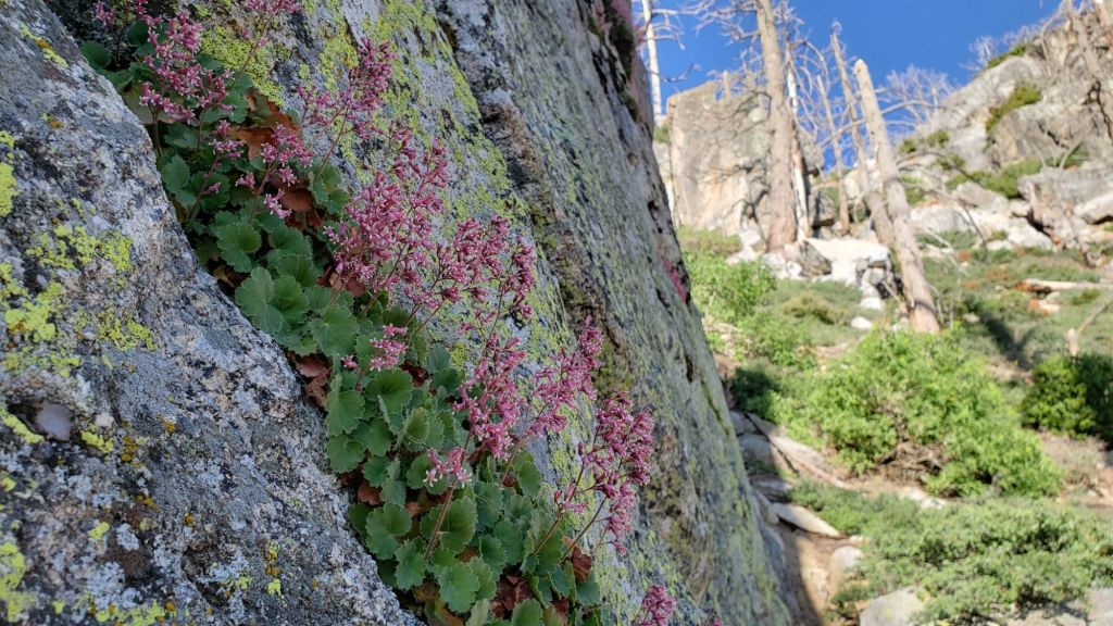
All major springs, creeks, and pipes are flowing well at this time (example photos below). However flow rates are dropping steadily at upper elevations, many ephemeral water sources are dry, and grassy meadows below 7000 ft are already largely dry. A long, hot, dry summer is forecast.
Campgrounds, forest roads, and fire lookouts all opened in time for the Memorial Day weekend, as described in detail in the previous Report (available here).
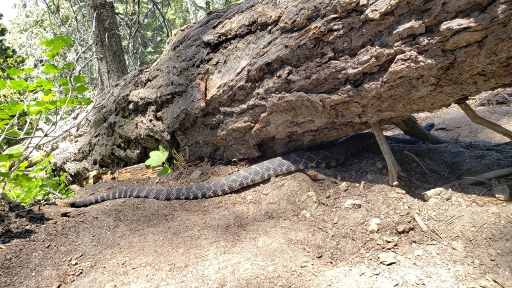
Be rattlesnake aware. Southern Pacific Rattlesnakes (Crotalus helleri) have been seen on the trail system up to at least 8800 ft elevation already, and may be seen as high as 9300 ft this month. The volume of sightings suggest abundant snake populations this year in the San Jacinto mountains.
Be bear aware. Although rarely reported, up to three Black Bears have been in the San Jacinto mountains since 2017, where I have seen at least one annually for the past six years, most recently on upper Marion Mountain Trail on 14th September 2023. I found fresh prints in snow on 12th February this year at 9000 ft near PCT Mile 180.5 (photo here). Brief videos from Devil’s Slide Trail in September 2021 (available here) and at home in Idyllwild in 2018 (linked here) show two different individuals. There have been no reports of negative interactions with humans at or near campsites.
WEATHER
Temperatures above average for June are forecast starting 21st and continuing to the end of the month. Forecast temperatures suggest the first two weeks of July will be hot, and well above average for that month on 1st-8th at least. As is increasingly the case with a heating climate in the San Jacinto mountains, overnight low temperatures in particular will be well above seasonal in late June and into July. There is currently no significant new precipitation in the forecasts.
This video forecast from NWS San Diego (linked here) details the forthcoming heat dome, and the current projections for July and the remainder of the summer. Below average precipitation and above average temperatures are predicted, with vegetation moisture content (a key indicator of fire risk) already below average in much of interior Southern California.
At San Jacinto Peak (3295m/10,810ft) on Friday 28th June 2024 at 0715 the air temperature was 52.4°F (11°C), with a windchill temperature of 42.8°F (6°C), 11% relative humidity, and a pleasantly fresh WSW wind sustained at 14 mph gusting to 22.7 mph.
At the Peak on Monday 24th June 2024 at 0800 the air temperature was 56.2°F (13°C), with a “windchill” temperature of 50.8°F (10°C), 76% relative humidity, and a light ESE wind sustained at 5 mph gusting to 10.6 mph.
TRAIL CONDITIONS
Snow was gone from the high country trails by mid June.
Trail maintenance has made progress this month, although ultimately less than hoped. An American Conservation Experience (and PCTA-supported) crew worked on Miles 162-165 (south from Fobes Saddle, trimmed plus 17 trees cut), and Miles 177-179 (Tahquitz Creek to Saddle Junction, nine trees cut and tread improved). In mid June several smaller trees were removed from Willow Creek Trail and six trees were cleared from the Little Tahquitz Valley Trail by Forest Service. The Trail Report cleared several trees from the PCT section north of Saddle Junction (Miles 179-181) on 10th June, more than 30 trees from Spitler Peak Trail on 14th, and half-a-dozen more from Deer Springs Trail on 27th.
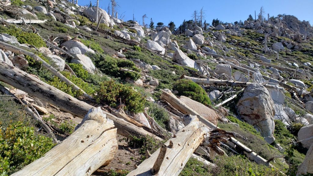
Deer Springs Trail is clear of snow. About 12 treefall hazards on the trail include 8-9 in the upper trail that have been down and reported repeatedly for years but with no action from the State Park. All but one of the treefall hazards down between Strawberry Junction and the top of Marion Mountain Trail (roughly PCT Miles 183-185) were removed by the Trail Report in late June (example photos below).
The Trail Report cleared this winter’s accumulated treefall hazards from South Ridge Trail in April and has also undertaken extensive trail trimming in the first half of this year.
The 34 treefall hazards that came down across Spitler Peak Trail during ice storms in February 2024 were almost all cleared by the Trail Report on 14th June. The couple of minor stepover branches that remain pose no problem for hikers. This work brings to 120+ the total number of trees removed by the Report from this trail in the past three years. Currently the upper trail in particular is heavily overgrown with lush seasonal vegetation.
Willow Creek Trail is in much more hiker-friendly than this time last year. Several of the smaller trees on the Forest Service section were cut in June. Whitethorn along the trail has not (yet) grown back significantly, other than a couple of minor areas near Hidden Divide in the State Park section. Remaining treefall hazards on the trail include three on the Forest Service section and five on the State Park side (two large ones from last year, plus three small new ones). Unfortunately two of the remaining trees on the Forest Service section are huge (four-plus feet diameter) and some hikers will find them challenging to cross (see photo in previous Report linked here).
The Caramba Trail from near Reeds Meadow through Laws Camp and on to Caramba, and the Cedar Trail from Willow Creek Trail to Laws, are euphemistically described by the Forest Service as “not maintained”. In reality both trails have been abandoned and functionally no longer exist. They are so heavily overgrown with dense whitethorn, which obscures dozens of downed trees, that I strongly advise hikers do not attempt to follow them (regardless of how much you may trust an app). An informal use trail to Laws is much more direct, maintained, and avoids the challenging bushwhacking of the unmaintained trails (local Idyllwild hikers dubbed it the “King Trail” when I established the route in 2019). It leaves Willow Creek Trail exactly 1.0 mile from Saddle Junction, 0.46 mile from the Skunk Cabbage turning (trailhead at N 33.7796, W 116.6590). The route descends largely following established deer trails for 1.2 miles, meeting Willow Creek about 0.2 mile upstream from the site of the historic Laws Camp (the remains of which were destroyed by the 2013 Mountain Fire and subsequent flood and treefall damage). Eleven trees down on the King Trail were removed in June-July 2023. The tread of the trail received some damage from Tropical Storm Hilary last year. From Laws east to Caramba the route of the original Caramba Trail has been well-cairned by myself and others and can largely be followed with very careful route-finding. My 2023 survey counted about 110 trees down on this 2.1 miles of trail. It is especially obscure for the first 0.3 mile east of the Willow Creek crossing, becoming more obvious (but still subtle) as it descends towards Caramba. Very cautious navigation is advised throughout the area.
Seven Pines Trail is largely (by its formerly low standards) clear of treefall hazards, with about ten down across the trail, most in the central mile, but they are easily passable for hikers. Be advised that the trail in general becomes more obscure in the mile closest to its junction with the PCT. The Trail Report has “adopted” Seven Pines Trail as a priority for maintenance work as the trail has had a disproportionate number of lost hiker rescues in the past decade. Since November 2021, 70 downed trees have been removed and the trail is thoroughly trimmed and cleared regularly (but not yet in 2024). Nevertheless Seven Pines remains a genuine wilderness trail unlike the relatively wide, bare, and obvious routes of, for example, Devil’s Slide or Marion Mountain trails. Cautious navigation remains essential for those without considerable experience of hiking this trail.
Treefall hazards remain a major problem along parts of the Pacific Crest Trail, most notably between Antsell Rock and Red Tahquitz, with 132 recorded in my June 2024 survey between Miles 170.5-175.5. The disinterest of Forest Service and PCTA in maintaining this section of trail for the past five years is unconscionable. A further 15 smaller trees are down from Miles 168.5-170.5 (Spitler Peak Trail to Zen Center Trail). Concentrations of large downed trees make for especially slow-going around Miles 170.5-172 (east side of Antsell Rock) and Miles 174-175 (south and east sides of Red Tahquitz).
The Zen Center Trail continues to deteriorate since the 2013 Mountain Fire, with a combination of vigorous regrowth and treefall hazards further obscuring the route with each passing season. The lower and upper parts of this trail are partially cairned and not too bad for those who are very familiar with the route, but even the experienced find navigating the central section tricky. Long trousers and scrambling gloves are strongly recommended.
While all time and labor is volunteered, the San Jacinto Trail Report uses small private donations to help cover operating costs. Your contribution keeps the Report available to all, free from advertising or paywalls, and independent from agencies. If you have found this Report useful, please consider using this link to the Donate page. Thank you very much for your support.


