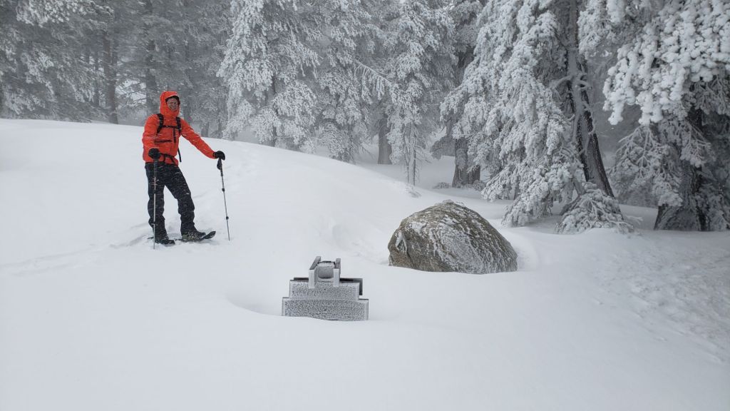
UPDATED 5th April 2024: light snow in the early hours added up to 0.75 inch in Idyllwild. Our morning hike of Devil’s Slide Trail through the snow found 1.5 inches of fresh powder at Saddle Junction (now likely increased to 2-3 inches). Long Valley (8500 ft) added about two inches this morning. Idyllwild had reached 2.5 inches of snow by noon when it abruptly stopped and brightened up. While more snow is possible, it looks likely that total snowfall will be below most forecasts at all elevations. Pre-existing tracks, and their underlying ice, have nevertheless been at least partly obscured, and cautious navigation is required.
UPDATED 4th April 2024: the storm coming in this evening is forecast to be relatively minor and brief – just over 24 hours duration – but will be unusually cold, especially for April. Snow expectations are broadly similar everywhere above 5000 ft, with 3-5 inches possible in Idyllwild and 6-7 inches forecast around the highest peaks. A dusting of snow as low as 3500 ft elevation is possible.
—————————
The 24th storm system of winter 2023/24 started in the early hours of Saturday 30th March and continued until the morning of Monday 1st April. As with so many of this winter’s storms, the bulk of the energy of this system passed tantalizingly close to the San Jacinto mountains but largely just to our west. Consequently the snowfall on Saturday 30th March – 11 inches at San Jacinto Peak – ended up significantly under the 15-20 inches forecast for that day for the high country. Conversely, the snowfall in Idyllwild (5.5 inches on 30th at 5550 ft) accurately matched forecasts.
As has been the case so often in this fascinating winter, two phases characterized this storm. The first, from early morning to late afternoon of 30th, produced moderate powder everywhere above 4000 ft, ranging from 11 inches at San Jacinto Peak (10,810 ft), to 8.5 inches at Saddle Junction (8100 ft), and an impressive 5 inches in Idyllwild (at 5550 ft). With the system coming up from the south-west, as is often the case the eastern side of the mountain experienced a “rain shadow” effect, with only 5 inches in Long Valley (8500 ft) and 8 inches in Round Valley (9100 ft) over a comparable time period.
The second phase on Sunday 31st March ultimately produced limited settled snow, but was periodically spectacular, with intense snow of large, wet flakes at times throughout the day throughout Strawberry Valley (where Idyllwild is located). Had temperatures been a little colder, many inches would have settled, but I estimated an accumulation of about 2.5 inches in town. An additional four inches fell at San Jacinto Peak, for a storm total of 15 inches, ranging down to 3.5 inches at Humber Park (storm total of 10 inches).
At all elevations, but especially above 7000 ft, the impacts of the storm were very significant on the tracks and trails due to very strong and gusty winds completely erasing pre-existing tracks. Near blizzard conditions dominated for much of Saturday 30th above 9500 ft, as both Kyle Eubanks and I witnessed firsthand, with our tracks eliminated within minutes of passing through an area.
On Monday 1st April I broke trail – through delightfully foggy conditions – to San Jacinto Peak via Devil’s Slide, PCT, Wellman, Peak, and East Ridge trails to assess the snowfall and impact to the trails. The mountain remained largely in thick cloud all morning, with very light snow still falling until late morning, but patchy sun and blue skies by the afternoon started very rapid melting.
I discussed the current conditions, principally for PCT hikers, in a short video report recorded at Annie’s Junction (9050 ft, approx. PCT Mile 180.8) at the tail end of the intense storm in the late afternoon of Saturday 30th (linked here). I recorded a further short report at San Jacinto Peak mid morning on Monday 1st April, summarizing the conditions I found on my early morning ascent (video linked here).
Survey hikes every day in the San Jacinto mountains include different routes to San Jacinto Peak multiple times per week (most recently on 24th, 25th, 29th, 30th March, and 1st April), Tahquitz Peak and area at least once per week (most recently on 23rd and 28th March), Apache Peak area regularly during PCT season, plus a wide variety of other trails on intervening days.
Snowshoes are very useful everywhere above about 8000 ft elevation (locally lower). This elevation may rise rapidly to 9000 ft on sun-exposed trails with melting expected this week. They become less useful as tracks become compacted and increasingly suited to spikes and/or crampons. However, snowshoes will continue to be invaluable for any off-trail travel above about 8000 ft for the next month at least.
Tracks remain very icy in places under the fresh powder. For the next 1-2 weeks – until thawing is expected to be partly underway – spikes at a minimum (preferably crampons in some areas) are recommended everywhere above 7500 ft. Crampons are required on the north side of Tahquitz Peak and strongly recommended on Fuller Ridge, as discussed below, and may become increasingly useful everywhere in the high country throughout early April (at least).
Details of snow depths measured at various locations on the trail system are given at the foot of this posting. Note however that snow depth itself is very rarely indicative of the difficulty (or ease) of hiking a particular track or trail. For example a well-traveled and defined track across deep snow is often much easier hiking than a lightly traveled track across just a few inches of angled icy snow.
PCT hikers in particular should note that many high country trails pose greater risks in 2024 – due to underlying ice from prior rain-on-snow – than they did at the same time in 2023 when snow depths were generally double (locally even quadruple) those of this year.
Despite warmer temperatures on days between storms, hikers should generally be prepared for temperatures below freezing at higher elevations, and often well below freezing when considering wind chill effects. See Weather section below for some of my recent observations from San Jacinto Peak. The next storm, expected on 4th-5th April, is forecast to be brief but also unusually cold for April.
Black Mountain Road is closed to vehicle traffic due to winter conditions at the gate 1.7 miles up from Highway 243. The road will quickly clear of snow as far as the turning to Boulder Basin five miles from the highway. Snow cover on the road will remain largely continuous from there for the next three miles to the PCT crossing/Fuller Ridge campground into late March.
Humber Park closed again on 30th March. Even when closed there are nine legal parking spaces just below the gate (Adventure Pass or equivalent still required). South Ridge Road remains closed due to winter conditions. Dark Canyon Road has been closed almost continuously for the past five years.
WEATHER
Temperatures quickly warm to about seasonal for 2nd-3rd April, with sunny days forecast, so melting may be very rapid everywhere below 7500 ft and on sun-exposed slopes at higher elevations. The next storm system is expected starting the evening of Thursday 4th April continuing until the early hours of Saturday 6th. The system is forecast to be very cold, unusually so for April, with freeze levels possibly as low as 4000 ft and hence snow (rather than rain) throughout the San Jacinto mountains. Forecast precipitation amounts include 8-12 inches of snow in the high country above 10,000 ft, 3-5 inches at mid elevations (e.g., Idyllwild), and a dusting possibly as low as 3500 ft. At this time, temperatures are tentatively forecast to rise significantly again from 9th April onwards.
At San Jacinto Peak (3295m/10,810ft) on Monday 1st April 2024 at 0955 the air temperature was 18.1°F (-8°C), with a windchill temperature of -1.3°F (-19°C), 100% relative humidity, and a variable NNE wind sustained at 9 mph gusting to 19.5 mph.
At the Peak on Friday 29th March 2024 at 1840 the air temperature was 20.3°F (-7°C), with a windchill temperature of -1.8°F (-19°C), 51% relative humidity, and a bitter SW wind sustained at 20 mph gusting to 31.3 mph.
At the Peak on Monday 25th March 2024 at 0955 the air temperature was 16.3°F (-9°C), with a windchill temperature of -2.6°F (-19°C), 61% relative humidity, and a fresh WNW wind sustained at 11 mph gusting to 19.1 mph.
TRAIL CONDITIONS
There was largely continuous snow cover on all trails above about 5500 ft on the morning of 1st April, but with rapid melting it is already becoming increasingly patchy to 7000 ft on the most sun-exposed slopes. Under the fresh powder, the remaining deeper old snow is locally firm and icy. Icy snow requires considerably more caution plus specialist equipment (and different physical and mental skillsets) than soft, postholing snow. Snow quality will deteriorate rapidly this week with a warming trend and locally rapid melting at all elevations, before hardening again during a brief but very cold storm on 4th-6th April.
Only a few major tracks are known to have been broken through the snow at this time including Devil’s Slide Trail, onward via the PCT, Wellman, Peak, and East Ridge trails to San Jacinto Peak, and the Round Valley Trail from Long Valley through to Wellman Divide.
Carrying spikes is strongly recommended everywhere above about 7000 ft. Icy compacted snow – once the trails become well-traveled – will be largely ideal for spikes, although as discussed above crampons are an excellent option until next week at least, especially in some locations above about 7700 ft. Crampons are essential if attempting Fuller Ridge and the north side of Tahquitz Peak (discussed below).
Snowshoes can be valuable everywhere above about 7500 ft elevation at present. On warm days (most likely 2nd-3rd April and from 9th April onwards) and later in the day on sunny slopes they will become increasingly helpful. They will quickly become less useful for on-trail travel below 9000 ft as the established tracks become well compacted. Snowshoes are recommended for any significant off-trail travel away from the defined tracks in the high country throughout April.
Despite limited snow this season and being readily passable with the appropriate skills and equipment for angled icy snow (currently crampons plus ice axe recommended), the State Park closed the uppermost section of Skyline Trail in their jurisdiction (above about 5600 ft) starting 21st February due to perceived unsafe conditions.
Devil’s Slide Trail is already thinning of snow below 7000 ft – and becoming very slushy – but is otherwise snow-covered above that elevation. It will largely clear of snow up to 6800 ft in the next two days, with patchy clearing to 7500 ft, and a few bare patches appearing as high as 8000 ft. The track is already very well-defined. Note that at about 7700-7900 ft there are very icy conditions around switchbacks 6-8 (and I saw clear sign of a significant hiker fall of about 25 ft at switchback six from 31st March). Spikes are ideal for this trail, although they are not essential. The Trail Report undertook extensive trail maintenance work in February to remove many damaged tree limbs in and over the trail resulting from an early February ice storm.
The Peak Trail snowshoe track that I broke on 1st April fairly accurately follows the true trail route. However near Miller Peak at about 10,400 ft the track ascends directly up the East Ridge route, rather than following the Peak Trail switchback, as is traditional in winter conditions.
The 0.4 mile section of South Ridge Trail between Chinquapin Flat/PCT MIle 177 and Tahquitz Peak has no track to follow at this time [surveyed multiple times in late March] through several feet of heavily drifted and angled ice and icy snow. This ice slope is notoriously treacherous. Neither snowshoes nor spikes are helpful at this time, due to the angled slope and structure of the snow, respectively. Crampons with an ice axe are essential on this section at this time, along with the necessary skills and experience to use that equipment in icy, angled terrain with considerable exposure.
Spitler Peak Trail suffered badly during ice storms in early February, and I found 34 new treefall hazards down during my surveys in late February, almost all in the upper half. Most are relatively small and readily passable, but a few are larger, and the combined effect is to make for a slower and scrappier hike.
PACIFIC CREST TRAIL
Snow cover on the PCT [updated 3rd April] has already largely melted from Miles 151 (Highway 74) to about 163. Underlying snow is then thin, with old snow largely confined to north- and east-facing slopes, until about Mile 174. Note that many of these patches are icy and require considerable caution, especially when obscured by overlying new snow. See comments below regarding specific conditions around Apache Peak (Mile 169.5). Snow cover is then functionally continuous between Miles 174-193. There are currently no reliable tracks to follow on Fuller Ridge (Miles 185.5-191) and traversing this section requires crampons, an ice axe, and appropriate snow skills.
At this time, nobo hikers should consider taking alternates at either Fobes Trail (Mile 166) or Spitler Peak Trail (Mile 168.5) to avoid the worst of the icy snow slopes from Miles 169-177, and the 100+ downed treefall hazards in the same section. This situation will continue to change over the coming days and weeks with a mix of rapid warming and melting either side of a cold storm in early April.
It is recommended that hikers wanting to avoid Fuller Ridge until the ice conditions improve (now unlikely until mid April) use the Black Mountain Road alternate. Black Mountain Road is open to hikers but not to vehicle traffic at this time. Spikes can be useful (but not essential) on the upper three miles of Black Mountain Road.
A small but significant icy snow slope remains on the north-east side of Apache Peak. Spikes at a minimum, but preferably crampons, plus an ice axe, and crucially the skills and experience to use this equipment on angled icy snow, are required to traverse this section using the PCT route. At this time the best option for nobo hikers is to go up and over the saddle between the double peaks of Apache to avoid this traverse, but note that there are some additional icy chutes and slopes in the next few miles, especially at present around Red Tahquitz (Miles 174-175.5), some of which have proven to be equally problematic in past seasons. Alternates at Miles 166 and 168.5 are recommended as mentioned above.
PCT hikers should not attempt to use South Ridge Trail from the PCT at Chinquapin Flat (roughly Mile 177.7) to Idyllwild via Tahquitz Peak, even though this looks temptingly simple on apps and maps. There are no steps to follow through a lengthy section of steeply angled (and notoriously treacherous) ice slopes. Crampons, always with an ice axe, and expert knowledge of how to use this equipment on high angle terrain, are critical. Even in low-to-moderate snow years like 2024 these slopes always take many weeks longer to clear of ice than adjacent areas, and they will remain challenging into late April this year, possibly May.
Although just outside the region covered by the Trail Report (and my area of expertise) I understand that northbound hikers are experiencing significant problems due to storm damaged trail in the Mission Creek area of roughly Miles 225-250. More details are available at this link.

While all time and labor is volunteered, the San Jacinto Trail Report uses small private donations to help cover operating costs. Every year seems to have its unique challenges, and it is already clear that 2024 will be no exception. Your contribution keeps the Report available to all, free from advertising or paywalls, and independent from agencies. If you have found this Report useful, please consider using this link to the Donate page. Thank you very much for your support.
SNOW DEPTHS measured on 1st April 2024 are as follows. The first number gives current average total depth, which also accounts for rapid melting between recent storms. The number in parentheses gives new snow recorded in the storm on 30th-31st March, while the number in brackets is the greatest depth at that location this winter (where known). Note that averages are given; due to strong winds during and after most storms there has been considerable drifting, plus often very uneven melting during warm interludes. Altitudes and PCT mileages are approximate.
San Jacinto Peak (10810 ft): 60 inches (15 inches new snow 30th-31st March)[60 inches on 1st April]
Wellman Divide (9700 ft): 40 inches (12 inches new 30th-31st March) [41-43 inches on 8th February]
Annie’s Junction/approx. PCT Mile 181.8 (9070 ft): 55 inches (11 inches new on 30th-31st March)[55 inches on 1st April]
Long Valley (8400 ft): 8-14 inches, very uneven melting (9 inches new 30th-31st March)[24 inches on 8th February]
Saddle Junction/PCT Mile 179.9 (8070 ft): 32 inches (12 inches new on 30th-31st March)[32 inches on 1st April]
Devil’s Slide Trail at Humber Park (6550 ft): 4-8 inches, already rapidly melting (10 inches new on 30th-31st March)[15 inches on 8th February]
Idyllwild (at 5550 ft): 0-2 inches, already rapidly melting (8 inches new on 30th-31st March)[9 inches on 8th February]
Mountain Center (4400 ft): 0-1 inch, largely melted (4 inches new on 30th-31st March struggled to accumulate)[3 inches on 9th February and 25th March]