[Information specific to the Pacific Crest Trail is included at the foot of this Report. However much of the main Report is also applicable to PCT hikers.]
The past two days were a pleasant reminder of what April should feel like, with light precipitation at all elevations on/off on Monday 26th, followed by further brief precipitation on the afternoon of Tuesday 27th. Snowfall was minimal on both days, with about 0.5 inch at San Jacinto Peak on 26th (described in this short video), and about the same on 27th. By the time we descended the east slope from the high country late morning on 26th, some of what had settled below 10,000ft had already melted. On 27th snow dusted patchily down to about 6300ft on the west slope of the mountain, but struggled to settle below 9000ft on the eastern side. Total rainfall in Idyllwild across the two days was 0.3 inch. Although the high country had a dusting of about an inch of fresh snow, temperatures well above seasonal starting Thursday 29th April will cause very rapid melting, and will also accelerate melting of what little snow remains from earlier in the winter.
Daily hikes have continued to survey many of the major trails in the high country, including San Jacinto Peak most recently on 26th and 28th April, plus the PCT throughout the San Jacinto mountains and some of its side trails.
April 2021 will likely be the driest for that month in recorded history in the San Jacinto high country, and among the warmest and driest recorded in Idyllwild. Drying of ephemeral creeks and springs has continued steadily, and water conditions in the high country are already worryingly reminiscent of the extremely dry years of 2015 and 2016.
Carrying spikes will remain useful for some hikers on some traveled trails, mainly above about 8700ft, but is no longer required depending on individual comfort level on patchy compacted or soft snow.
WEATHER Temperatures rise rapidly starting 28th April to well above seasonal averages, and largely stay atypically warm throughout the first week of May. Temperatures at all elevations on 30th April and 1st May are forecast to be more typical of midsummer.
At San Jacinto Peak (10,810ft/3295m) on Wednesday 28th April 2021 at 0840 the air temperature was 27.3°F (-3°C), with a windchill temperature of 13.9°F (-10°C), 61% relative humidity, and a gusty due North wind sustained at 8 mph gusting to 12.5 mph.
At the Peak on Monday 26th April 2021 at 0855 the air temperature was 20.1°F (-7°C), with a windchill temperature of 2.8°F (-17°C), 99% relative humidity, and a bitter due West wind sustained at 11 mph gusting to 16.4 mph.
TRAIL CONDITIONS
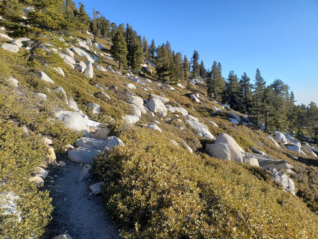
Once the light dusting of fresh snow has melted, trails on the east and south flanks of the high country will be completely or largely clear of snow to San Jacinto Peak. Trails on the west side are clear to near 8700ft, with snow cover increasingly patchy from there to San Jacinto Peak. There are some exceptions discussed below. See “Pacific Crest Trail” below for details of that trail.
Tahquitz Peak trail from Chinquapin Flat/PCT Mile 178 [updated 30th April] no longer requires spikes between the PCT and Tahquitz Peak, depending on your comfort level hiking on angled icy snow. Hiking poles are useful. There are good steps to follow through the small remaining patches for which some hikers will be more comfortable using spikes.
Devil’s Slide Trail is clear of snow to Saddle Junction.
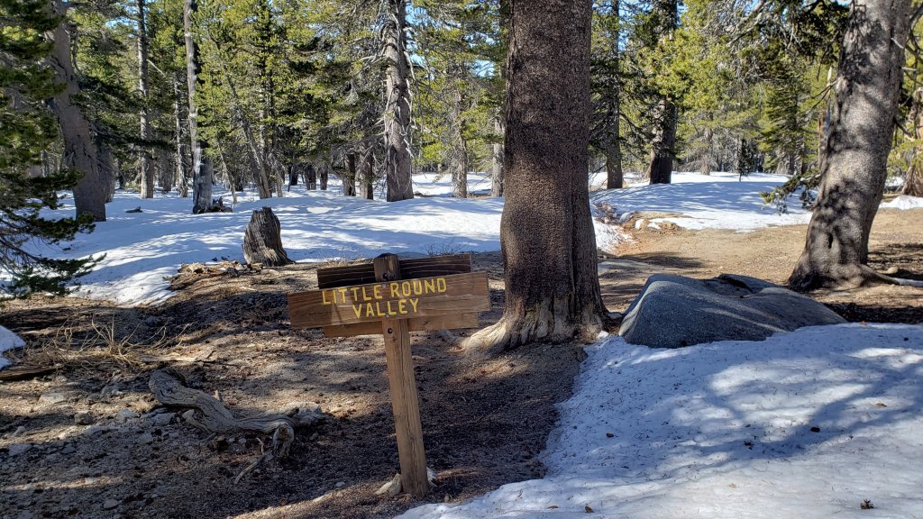
Deer Springs Trail is clear of snow past Strawberry Junction to about 8650ft, near its junction with Marion Mountain Trail. Snow is increasingly patchy from there to Little Round Valley, averaging only about 10% cover, but with several extended icy snow sections. Snow cover is 70% through Little Round Valley. Above Little Round Valley to San Jacinto Peak the trail has cleared very rapidly and is easy to follow, averaging only 10% snow cover. Some hikers will find spikes useful, especially for descending.
South Ridge Trail is clear to Tahquitz Peak. South Ridge Road is open.
Black Mountain Road reopened on 23rd April. There is patchy snow that may be challenging for vehicles (but not for hikers) beyond Farview Point.
Wellman Trail (from Annie’s Junction to Wellman Divide) is largely clear of snow, except for nearly continuous snow for about 0.3 mile immediately north of Annie’s Junction.
The Peak Trail (Wellman Divide to San Jacinto Peak) is clear of snow except for the 0.2 mile patch between 9900-10,100ft, where snow cover is about 60% and some hikers may find spikes useful.
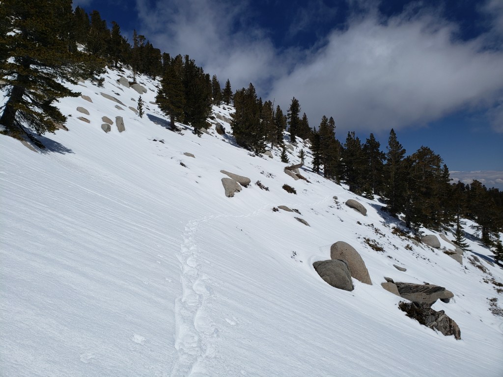
The East Ridge Trail on the east flank of San Jacinto Peak remains about 60% snow-covered. There is an ugly posthole track to follow, but it can be easier to hike across the top of the compacted icy snow (at least in the early morning and on cold days).
Marion Mountain Trail is clear of snow to the PCT.
Fuller Ridge Trail has snow along about 30% of its 5.0 miles length. Stubborn sections in particular remain around the crossing of the North Fork of the San Jacinto River (Mile 186), and on the northerly slopes of Fuller Ridge (approx. Miles 187.5-187.8 and 188.6-190.4).
Seven Pines Trail has had no visible hiker traffic this winter, with no tracks to follow where small snow patches remain. Indeed this trail has been hiked very little since November 2018. Very cautious navigation is recommended for those who are not completely familiar with hiking this trail. The Forest Service closure of Dark Canyon Road continues, and there is no vehicular access to Seven Pines trailhead.
The Round Valley Trail to Wellman Divide has about 30% patchy snow cover. Long Valley is clear of snow.
Skyline Trail is virtually clear of snow. Spikes are no longer required.
Snow cover on the PCT: The PCT is clear of snow from Miles 151 (Highway 74) to about 175 (Red Tahquitz). A few small snow patches remain between Miles 175-177. Miles 177 to 185 are almost clear of snow with the exception of the notoriously stubborn 0.5 mile just south of Annie’s Junction at about Mile 180.8. Snow cover is about 60% from Mile 184 to 185.5, although spikes are not required. From Mile 185.5 to 191, snow is increasingly patchy. Stubborn sections remain around the crossing of the North Fork of the San Jacinto River (Mile 186), and on the northerly slopes of Fuller Ridge Trail (approx. Miles 187.5-187.8 and 188.6-190.4). Miles 191-207 are clear of snow.
Additional trails completely clear of snow include: all Garner Valley trails, Ernie Maxwell Trail, Spitler Peak Trail, Cedar Spring Trail, and May Valley Road.
SNOW DEPTHS measured on 26th April 2021. Note that average depth is given first, followed in parentheses by the depth recorded on 16th March after the last significant storms on 10th-15th March. Due to past drifting, and variable melting due to differential sun exposure, depths now vary greatly even in small areas. Altitudes are approximate.
San Jacinto Peak (10810ft): 0-2 inches (38 inches on 16th March)
Little Round Valley (9800ft): 0-6 inches (29 inches on 16th March)
Wellman Divide (9700ft): 0 inches (19 inches on 16th March)
Annie’s Junction (9070ft): 0-2 inches (24 inches on 16th March)
Deer Springs Trail at Seven Pines Trail junction/approx. PCT Mile 184.9 (8700ft): 0-2 inches (14 inches on 16th March)
Strawberry Junction/approx. PCT Mile 183.1 (8100ft): 0 inch (8 inches on 16th March)
Saddle Junction/approx. PCT Mile 179.9 (8070ft): 0 inch (17 inches on 16th March)
Devil’s Slide Trail at Humber Park (6550ft): 0 inch (12 inches on 16th March)
PACIFIC CREST TRAIL
All Mile numbers are approximate. The main Report (above) is updated at least weekly or during/after any storm and contains significant additional information relevant to PCT hikers.
PCT hikers are reminded that overnight stays are not permitted at or near San Jacinto Peak, including in the historic shelter. This is especially critical during the coronavirus pandemic as it is impossible to adequately clean and sterilize the shelter. Mt. San Jacinto State Park regulations permit overnight stays only in established campgrounds. Strawberry Junction (approx. Mile 183) is a good option for thru-hikers.
This has been a far below average snow year for the San Jacinto high country. Given accelerating climate change here, depending on your start date there may be relatively little snow and ice by the time you reach the San Jacinto mountains. Nevertheless even small, isolated sections of icy snow can be perilous. Details of current snow/ice conditions will be clear from updates to the Trail Report over coming weeks.
Spikes remain useful for those hikers less comfortable hiking on snow for parts of the Trail between about Miles 165 and 191, although at this time most individuals hiking with poles will find spikes unnecessary. Please always practice safe decision-making based on your own comfort level (not that of your hiking partners), experience, ability, available equipment, time of day (which can greatly affect traction on snow and ice), and current snow and weather conditions.
The PCT through the Snow Fire closure area (approx. Miles 191-207) reopened on Saturday 3rd April. Only the tread of the Trail has reopened, USFS is not permitting camping along the 16+ mile section.
PCT hikers – thanks for taking the time to read this. The San Jacinto Trail Report depends entirely on small private donations to cover its direct costs. With a busy winter overlapping with a complex PCT season, every contribution, no matter how small, is truly valuable. If you have found the Report useful, please consider visiting the Donate page. Thank you, and safe hiking.
We undertook a thorough survey of the Fuller Ridge section (Miles 185.5-191) of the PCT on 6th April 2021, discussed in detail in this video. Considerable additional melting has occurred since then. Spikes are not required for hikers comfortable with travel across moderate patches of snow.
We surveyed the PCT section from Spitler Peak Trail to Saddle Junction (approx. Miles 168.5-179.5) on 9th April, as described in this video. Spikes are no longer required around Apache Peak, or elsewhere on this section, although some hikers might find spikes useful for increasingly patchy snow travel on Miles 175-178.
Coming off at Mile 168.5 (the well-signed Spitler Peak Trail alternate) may still be a good option for some this nobo season. In addition to any possible snow/ice issues ahead, there are nearly 60 trees down across the Trail between Miles 169-177, plus the rock slide at Mile 172.5. Spitler Peak Trail itself clears of snow (as is now the case) long before the PCT north of that point. The short snow slope on the NE side of Apache Peak (Mile 169.5) that has proved challenging over the years is now clear of snow, with good steps to follow. Spikes are no longer required, although hiking poles and caution are always useful.
The Pacific Crest Trail remains open at the rockslide north of Antsell Rock (Mile 172.5). Reports that the assisting rope around the rockslide is “in tatters” are completely misleading. However the rope is not in new condition, and if you choose to use it, you do so completely at your own risk. USFS has told the Trail Report that responsibility for removing the rockslide is currently with the PCTA, and that there are currently no plans to close this section of the PCT for removal work before summer 2021 at the earliest. This video report (recorded on 1st March 2021, starts at minute 9.05) may be useful for deciding whether to hike around the rockslide.
If you take an alternate further south, it is possible to regain the PCT from Idyllwild via Devil’s Slide Trail at Saddle Junction (about Mile 179). Do not attempt to regain the PCT via South Ridge Trail as the slope on the north side of Tahquitz Peak remains partly ice-covered and is notoriously treacherous.